- Home
- Travel Packages
- Top Destination
-
Travel Attraction
By Category
Top Attraction

- Travel Agents
- Car Rentals
- Hotels

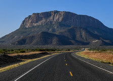
Lagdera Plains is a wide and remote landscape located in Garissa County, in the northeastern region of Kenya. The area is part of the arid and semi-arid lands (ASALs) that stretch across much of northern Kenya. Characterized by vast open plains, sparse vegetation, and a rugged terrain, the Lagdera Plains offer a raw, untouched environment that reflects the natural beauty and resilience of Kenya’s dryland ecosystems. Despite being less known on the tourist map, Lagdera Plains holds ecological significance and is home to several nomadic communities, rare wildlife species, and dryland vegetation. It presents an off-the-beaten-path experience for those who seek adventure and a glimpse into pastoralist lifestyles in one of Kenya’s most culturally rich and least disturbed environments. How to Reach Lagdera Plains, Garissa Lagdera Plains can be accessed from Garissa town, which is the main urban center in the region. Garissa is approximately 350 kilometers northeast of Nairobi. The journey from Nairobi to Garissa is mostly done by road, taking around 6 to 8 hours depending on traffic and road conditions. Public buses and private vehicles frequently travel the Nairobi–Garissa route. Once in Garissa, reaching Lagdera Plains requires a four-wheel-drive vehicle due to the rough and unpaved roads. Local guides or tour companies familiar with northeastern Kenya are highly recommended for safety and navigation. The nearest airstrip is in Garissa town, which is served by small charter planes from Nairobi and other major cities. Weather in Lagdera Plains, Garissa Lagdera Plains lies in an arid climate zone. The weather is predominantly hot and dry throughout the year, with temperatures frequently exceeding 35°C (95°F) during the daytime. Rainfall is scarce and erratic, mostly occurring between March to May and October to December. Due to its semi-desert conditions, visitors are advised to prepare for extreme heat, especially in the afternoon, and dust-laden winds. Early mornings and evenings are relatively cooler and more pleasant for exploration. Timings for Visit There are no official operating hours for Lagdera Plains since it is an open natural region rather than a fenced national park. However, the best time to visit is during the cooler months between June and September or immediately after the rainy seasons when the landscape is dotted with sparse greenery. It is highly advisable to travel during daylight hours for safety and visibility, as road infrastructure is limited and mobile network coverage can be unreliable in remote sections. Why Famous for Lagdera Plains, Garissa? Lagdera Plains is famous for its raw natural beauty, cultural richness, and importance in Kenya’s dryland ecology. It is a habitat for rare desert-adapted wildlife such as the gerenuk, lesser kudu, dik-dik, and various bird species. The region also holds cultural importance due to its Somali-influenced nomadic pastoralist communities who have preserved their traditions for generations. The area is also known for being part of the wider ecosystem that supports wildlife migration corridors and contributes to ecological balance in northeastern Kenya. For researchers and ecotourists, Lagdera Plains is a place of exploration and understanding of human-wildlife coexistence in arid zones. Entry and Visit Details There is no formal gate or entrance fee to visit Lagdera Plains as it is not a designated national park. However, due to its remote nature and potential security considerations, it is advisable to coordinate your visit with local authorities or community elders. Visitors are encouraged to hire a local guide or travel in groups. Carrying sufficient water, food, fuel, and spare vehicle parts is essential for a safe journey. Visitors should also inform someone of their travel plans before entering remote areas. History and Cultural Significance Lagdera region has a long history rooted in pastoralism and nomadic lifestyles. The Somali community, which predominantly inhabits this region, has for centuries moved with their livestock in search of pasture and water across the plains. The cultural practices, language, and attire reflect a strong Somali influence mixed with indigenous Kenyan traditions. While not much is documented about ancient architecture in Lagdera Plains, traditional huts (manyattas), livestock enclosures, and community gathering places serve as the primary forms of traditional rural architecture. These reflect the adaptability and ingenuity of communities living in arid climates. Things to Do in Lagdera Plains, Garissa While the area does not offer conventional tourism infrastructure, it is ideal for: Bird watching – Look out for arid-zone birds like the Somali ostrich, hornbills, and bustards. Wildlife spotting – Sightings of antelope species, jackals, and desert-adapted mammals. Cultural visits – Meet local communities and learn about nomadic life, camel herding, and traditional customs. Nature walks – With a guide, explore the semi-arid landscape, seasonal rivers (lugga), and desert flora. Photography – Capture vast horizons, sunrises, and the dramatic arid landscape. Interesting Facts about Lagdera Plains, Garissa Lagdera is one of the sub-counties of Garissa County and holds cultural and ecological value. The area is often used for camel caravans, a traditional mode of transport and trade in the region. Lagdera Plains support resilient acacia trees and desert shrubs, which are key for grazing animals. Nomadic communities in the area follow seasonal migration patterns that have remained unchanged for generations. Tips for Visiting Lagdera Plains, Garissa Travel with a local guide or through a tour operator experienced in northeastern Kenya. Carry enough water, snacks, fuel, and basic medical supplies. Wear light, breathable clothing, a hat, and sunglasses to protect from the sun. Be culturally respectful – dress modestly and seek permission before photographing locals. Ensure your vehicle is in excellent condition and preferably a 4x4. Check with local authorities regarding safety and security updates before your trip.
Explore More
Mount Marsabit is a majestic extinct volcano located in the arid northern region of Kenya, in Marsabit County. Rising to an elevation of approximately 1,700 meters above sea level, this lush, green mountain is a dramatic contrast to the surrounding dry lowlands. Covered by dense cloud forest, Mount Marsabit is the heart of Marsabit National Park and home to a wide range of wildlife, crater lakes, and historical legends. It serves as a vital water catchment area and offers a peaceful natural retreat filled with stunning landscapes and rich biodiversity. How to Reach Mount Marsabit, Marsabit Mount Marsabit is easily accessible via several travel options: By Road: From Nairobi, the mountain can be reached via the A2 Highway that runs through Isiolo and Archers Post, covering a distance of about 560 km. The journey takes approximately 10–12 hours by vehicle. A 4WD vehicle is recommended due to the rough roads in and around Marsabit. By Air: Marsabit town has a small airstrip that accommodates chartered and scheduled flights from Nairobi’s Wilson Airport. From Marsabit town, the base of Mount Marsabit is just a short drive away. Local Transport: Visitors can take local taxis or hire guides from Marsabit town to reach hiking trails and scenic spots around the mountain. Weather at Mount Marsabit Despite being located in an otherwise dry region, Mount Marsabit’s weather is cool and often misty due to its forested nature: Temperature: Daytime temperatures range between 18°C to 26°C, while nights are cooler at around 10°C to 15°C. Rainfall: The area receives significant rainfall during the long rains (March–May) and short rains (October–December). Best Time to Visit: The dry months from June to September and January to February are ideal for hiking, wildlife viewing, and photography. Timing and Operating Hours Mount Marsabit is part of the Marsabit National Park ecosystem and follows the standard timing of the Kenya Wildlife Service (KWS): Opening Hours: 6:00 AM to 6:00 PM daily, including weekends and holidays. Hiking Hours: Early morning hikes (6:30 AM to 10:30 AM) and late afternoon (3:30 PM to 5:30 PM) are recommended due to cooler temperatures and better wildlife activity. Why Famous for Mount Marsabit, Marsabit? Mount Marsabit is famous for several unique reasons: Its stunning cloud forest provides a green oasis in the otherwise barren north of Kenya. It is home to Lake Paradise, a crater lake surrounded by thick vegetation and frequented by elephants and birds. The mountain is historically linked to famous wildlife conservation stories, including Ahmed the Elephant, one of Kenya’s most protected animals. It has attracted explorers and documentarians like Martin and Osa Johnson who filmed African wildlife here in the early 20th century. Entry and Visit Details about Mount Marsabit, Marsabit Since Mount Marsabit lies within the boundaries of Marsabit National Park, entry is governed by KWS regulations: Entry Fees: Kenyan Citizens: KES 300 (adults), KES 215 (children) Residents: KES 1,030 (adults), KES 515 (children) Non-Residents: USD 52 (adults), USD 35 (children) Payment: Visitors must pay via M-PESA or online through the eCitizen platform. Accommodation: Marsabit Lodge is the primary accommodation within the park. Camping sites and lodges are also available in the town. Guides: Guided tours and nature walks are available from local guides and KWS rangers stationed in the park. History and Architecture Mount Marsabit has historical and ecological importance: The mountain was formed millions of years ago through volcanic activity and has multiple craters, including those housing lakes such as Lake Paradise and Lake Sokorte Guda. The Marsabit Lodge, established during colonial times, is a rustic accommodation facility located near the edge of Lake Paradise. Ahmed the Elephant, known for his huge tusks, roamed Mount Marsabit’s forests and was declared a national treasure under President Jomo Kenyatta’s protection. The mountain's forests were a vital source of water for the local communities and still serve as a catchment for Marsabit town today. Things to Do at Mount Marsabit Visitors can enjoy several activities around Mount Marsabit, including: Hiking and Nature Walks: Explore trails through the misty forest, climb to viewpoints, and experience the unique highland ecosystem. Bird Watching: The forest is home to over 500 bird species such as hornbills, turacos, and raptors. Wildlife Viewing: Spot elephants, buffaloes, warthogs, leopards, bushbucks, and hyenas. Photography: Ideal for landscape, wildlife, and cultural photography due to dramatic scenery and vibrant biodiversity. Crater Lake Exploration: Visit Lake Paradise and other smaller crater lakes for their tranquility and wildlife. Facts about Mount Marsabit Mount Marsabit rises to approximately 1,707 meters above sea level. The mountain contains three major crater lakes and several seasonal water bodies. It’s one of the few cloud forests in Kenya’s northern frontier, offering a rare ecosystem. Ahmed the Elephant, once protected by armed guards, lived on this mountain. The Marsabit forest is home to both tropical and savannah flora and fauna species. Tips about Mount Marsabit, Marsabit Start hikes early in the day to avoid midday heat and increase chances of seeing animals. Always carry drinking water, sunscreen, and insect repellent. Hire a local guide for safer navigation and to learn about local culture and ecology. Respect wildlife and do not feed or approach wild animals. Carry a rain jacket as the weather can shift quickly due to the mountain’s microclimate. Ensure your vehicle is well-fueled and in good condition before traveling into the park.
Explore More
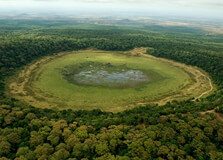
The Dub Goba Crater is a hidden geological gem located in Marsabit County, northern Kenya. Nestled in the Marsabit Forest Reserve, the crater is part of the ancient volcanic landscape that dominates this region. Though less popular than the nearby Gof Sokorte Guda or Lake Paradise, Dub Goba Crater offers equally breathtaking views, lush vegetation, and a sense of mystery and solitude. Surrounded by dense forest and steep walls, this volcanic caldera remains a quiet retreat for adventurous travelers, nature lovers, and researchers interested in geology and biodiversity. How to Reach Dub Goba Crater, Marsabit Dub Goba Crater is located within the Marsabit National Reserve, approximately 6–10 kilometers from Marsabit town center. While not signposted like more popular attractions, it is accessible by foot or 4x4 vehicle with guidance from locals or park authorities. By Road: From Nairobi, the main route to Marsabit is via Isiolo and Merille, covering around 540 km. The road is paved up to Marsabit town, taking about 8–10 hours by car or bus. Once in Marsabit, you can access the crater through the Marsabit Forest area with a guide and suitable off-road vehicle. By Air: Marsabit has a small airstrip with charter flights available from Wilson Airport in Nairobi. From the airstrip, you can hire a local vehicle or arrange a tour. On Foot or Bike: For those staying nearby, guided hiking or biking to the crater is possible through forest trails. Ensure you go with someone who knows the area well due to the thick vegetation and wildlife. Weather at Dub Goba Crater The crater lies within the highland forest area of Marsabit, which gives it a unique microclimate compared to the arid surroundings. Temperature: Average daytime temperatures range between 18°C to 28°C. Nights can be cool, especially due to forest cover. Rainfall: The area receives rainfall twice a year—between March to May and October to December. These rains keep the crater and forest lush and green. Best Time to Visit: June to September and January to early March are the driest and most accessible months. Timings for Visiting As part of the Marsabit Forest Reserve, the Dub Goba Crater can be visited during daylight hours. Most visitors go between 7:00 AM and 5:00 PM. Opening Hours: Daily, 6:00 AM to 6:00 PM (recommended timing for safe exploration) Tour Duration: A visit can take between 2 to 4 hours, including hiking and sightseeing. Why Famous for Dub Goba Crater, Marsabit? Dub Goba Crater is known for its scenic beauty, geological importance, and biodiversity. Its steep sides, lush green floor, and tranquil atmosphere make it ideal for nature photography and eco-tourism. The crater is part of the extinct volcanic system that shaped Marsabit Mountain. Surrounding forest areas are home to elephants, buffaloes, leopards, baboons, and numerous bird species. The crater floor often holds a small seasonal lake or wetland during the rainy season, attracting animals and birds. It is a peaceful, off-the-beaten-path destination for explorers looking to avoid crowds. Entry and Visit Details Since Dub Goba lies within the protected Marsabit Forest, visitors are advised to enter through official routes and inform Kenya Wildlife Service (KWS) personnel before exploring. Entry Fee: Entry to Marsabit National Reserve is typically KES 300 for citizens, KES 600 for residents, and USD 25 for non-residents. This fee covers the general forest and crater areas. Permits: No special permit is needed for Dub Goba, but check with KWS at Marsabit gate for local access rules. Guides: Hiring a local guide is highly recommended for safe navigation and to learn about the flora, fauna, and culture. Facilities: There are no facilities at the crater. Carry water, food, and safety gear. Basic accommodation is available in Marsabit town. History and Architecture Dub Goba Crater is an ancient volcanic feature formed thousands of years ago during Marsabit Mountain’s last eruptions. While it doesn't have man-made architecture, the natural structure of the crater is a geological marvel. The name "Dub Goba" is derived from local Cushitic or Rendille language and refers to the circular nature of the crater. The walls of the crater are steep and densely forested, making it a rare combination of geological and ecological diversity in northern Kenya. Things to Do in Dub Goba Crater Hiking: Trek through forest trails to reach the rim and descend safely to the crater floor. Bird Watching: Spot hornbills, eagles, sunbirds, and other rare forest birds. Photography: Capture the stunning greenery, crater walls, and wildlife in their natural habitat. Nature Observation: Observe elephants, baboons, and other animals during early mornings or evenings. Eco-tourism: Learn about forest conservation and local indigenous practices from guides or researchers. Facts about Dub Goba Crater It is one of several volcanic craters on Marsabit Mountain, including the better-known Lake Paradise. Dub Goba Crater lies at an altitude of over 1,300 meters above sea level. The crater is rarely visited, making it ideal for travelers seeking solitude and untouched nature. The ecosystem includes montane forest species and endemic plants not found in the surrounding arid areas. Dub Goba is a potential site for eco-research and sustainable tourism development. Tips about Dub Goba Crater, Marsabit Wear sturdy hiking shoes and lightweight long clothing to protect against thorns and insects. Bring your own drinking water, snacks, binoculars, and first-aid kit. Hire a guide or join a group to avoid getting lost in the forest. Respect wildlife and avoid making loud noises or feeding animals. Visit during dry seasons for easier access and better visibility of the crater floor. Check in at the KWS gate for safety information and maps before entering the forest.
Explore More
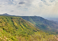
Loita Hills is a rugged and scenic highland area located in the southern part of Narok County, Kenya, near the border with Tanzania. These remote and culturally rich hills are covered in indigenous forests, highland plateaus, and sacred landscapes. Loita Hills is often referred to as the "Forest of the Lost Child" by the Maasai people, who have long protected this land as a spiritual and ancestral home. Loita Hills is not only a place of breathtaking natural beauty but also one of deep cultural significance. The hills are home to the Loita Maasai, a sub-group of the Maasai people who still maintain traditional ways of life, untouched by modern urbanization. With limited development and fewer tourists compared to other parts of Kenya, Loita Hills offers a peaceful and authentic wilderness experience ideal for hiking, cultural immersion, and eco-tourism. How to Reach Loita Hills, Narok Loita Hills is located in a remote area, and reaching it can be a bit of an adventure. However, the journey is worth it for those seeking solitude, culture, and connection with nature. By Road: From Nairobi, the drive to Loita Hills takes around 6 to 8 hours. The route typically goes through Narok town, then south toward Naroosura or Olorte. A 4x4 vehicle is essential, especially during the rainy season, as roads can become muddy and rough. By Air: The nearest airstrip is at the nearby Maasai Mara or private airstrips like Ol Seki or Siana. From there, road transport can be arranged to Loita Hills. Flying reduces travel time but requires coordination with local guides for the final leg of the journey. With a Tour Operator: Many specialized eco-tourism companies and cultural safari operators offer guided expeditions to Loita Hills, complete with transport, guides, and camping gear. Weather at Loita Hills Loita Hills enjoys a cooler and wetter climate compared to the lowland plains. The elevation and forest cover contribute to a moderate and pleasant weather pattern. Dry Season (June to October): Ideal for hiking and outdoor activities, with clear skies and pleasant temperatures. Short Rains (November to December): The forest comes alive with greenery and bird activity, though trails may become slippery. Long Rains (March to May): The wettest season. Hiking becomes more challenging due to mud, but the scenery is lush and vibrant. Temperatures: Daytime temperatures range between 18°C to 26°C, while nights can be chilly, dropping to around 10°C. Timings Loita Hills is open for visitation year-round, although the experience varies by season. Open Hours: There are no official gates or hours, as the area is not a fenced reserve. Visits are usually planned as multi-day hikes or guided treks. Best Time to Visit: June to October for hiking and cultural experiences. Avoid heavy rainy months unless well-prepared for wet conditions. Why Famous for Loita Hills, Narok? Loita Hills is known for its untouched natural beauty, ancient indigenous forests, and deep Maasai cultural heritage. Maasai Culture: The Loita Maasai have preserved their customs, spirituality, and land stewardship for generations. Hiking and Trekking: Multi-day treks through the forest and hills offer unmatched immersion in nature and local life. Sacred Forests: The Loita Forest is considered sacred and contains old growth indigenous trees and medicinal plants. Birdlife and Biodiversity: A haven for birdwatchers and nature lovers, the forest is home to many endemic and rare species. Seclusion: With fewer tourists, Loita Hills offers tranquility and solitude for eco-travelers and adventurers. Entry and Visit Details about Loita Hills, Narok There are no formal entry gates or ticketing systems for Loita Hills, as it is not a gazetted national park. However, visits should be arranged with local community guides or through eco-tour operators. Permits: No official permits required, but community entry fees may apply depending on the area visited. Guides: It is highly recommended to hire local guides for safety, navigation, and cultural interpretation. Accommodation: Options include guided camping experiences, eco-lodges, and homestays in Maasai villages. Tour Packages: Many packages include trekking, cultural activities, meals, and gear. History and Architecture Loita Hills has been home to the Loita Maasai for centuries. Unlike other Maasai communities who have gradually modernized or lost lands to development, the Loita people have fiercely protected their forests and way of life. They believe the forest is sacred and that spirits dwell among the trees and hills. There are no major architectural structures in the hills themselves, but traditional Maasai manyattas (homesteads) can be visited. These homes are built with natural materials such as cow dung, sticks, and thatch, representing a deep connection with the land. The architecture here is more spiritual than structural — the forest itself is a living monument. Things to Do at Loita Hills Hiking and Trekking: Take on multi-day guided hikes through the hills, valleys, and forests, camping under the stars. Cultural Tours: Visit Maasai villages, learn about traditional healing, beadwork, dances, and rites of passage. Bird Watching: Spot hornbills, turacos, sunbirds, and other species in the forest canopy. Forest Meditation: Experience spiritual silence and deep nature immersion in sacred groves. Photography: Capture stunning views, indigenous forest, traditional Maasai life, and unique wildlife. Volunteer or Learn: Join conservation projects or educational visits that promote sustainable development and cultural exchange. Facts about Loita Hills Loita Hills stretches over 200 square kilometers and reaches elevations over 2,300 meters. Home to one of Kenya’s last remaining indigenous forests, protected by community-based efforts. Known locally as Entim Enaimina Enkiyio, which means "Forest of the Lost Child." Loita Maasai have resisted outside influence and continue to live in harmony with their environment. The area has few tourists, offering a raw and authentic experience unlike mainstream safari destinations. Tips about Loita Hills, Narok Go with a trusted guide or tour operator familiar with the terrain and local customs. Pack lightweight but warm clothing—temperatures can drop at night. Wear sturdy hiking boots and carry waterproof gear if visiting during the rainy season. Bring drinking water, insect repellent, and a basic first aid kit. Respect local culture—always ask before taking photos and follow your guide's advice. Prepare for a digital detox as most areas have little or no cell network coverage. Leave no trace—Loita Hills is pristine, and visitors should help keep it that way.
Explore More