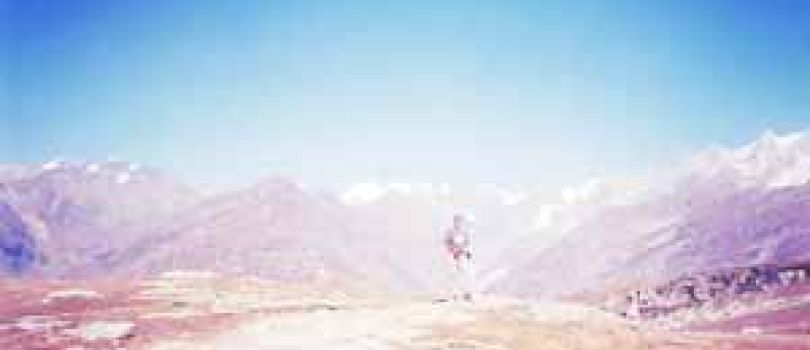
Trekking around the Pin Parvati Valley is actually gaining the most spectacular trek from the lush green valley that involves the changing landscape with snow clad mountain peaks, pristine lakes and beautiful meadows with abundance of Blue flowers “Meconopsis” all around. On the way to this high end trekking destination, the trekkers can also achieve the high altitude Maltalai Lake and the famous Pin Parvati Pass. Definitely, trekking at Pin Parvati Pass will bring the trekkers, a sense of achievement at crossing the 5000m+ Himalayan pass and contrasting landscapes of valleys on either side of the pass. The trekkers can enjoy the beautiful campsites on the either side of the scintillating meadows and can get benefited from the sightseeing of the mountain beauty of the virgin landscape of the Spiti region. Alongside trekking, rafting across the Spiti region is the next best idea to appreciate the nature in its grand original form. An additional advantage for the spiritual or the religious trekkers will be visiting the famous monasteries all around the area to catch hold the Buddhist culture all around the vicinity. Nature’s delights can be seen at its complete innovated form when the trekkers will discover the famous Chandar Tal which is one of the most beautiful lakes in the world to look into the ancient Buddhist culture from close proximity.27-1031-05
Take an overnight bus from Delhi and reach Manali the previous day. Pick up will be arranged from Manali at 6.00 am. The Rohtang and Kunzum passes are known for their notoriously bad traffic jams, making it all the more necessary to leave by 6.00 am. Drive out of Manali, and towards Batal via Rohtang pass on the Manali-Leh Highway. The road is not too good and is bumpy all through. From Gramphu, take a diversion towards the Gramphu – Batal – Kaza road. From Batal the route winds through the real Spiti Valley. Quaint little villages, tucked away in the mountains and arid mountains dotted with green and yellow patches of peas and barley fields. The route from here is straight out of a picture postcard. You will be camping along the Spiti river in Kaza. The acclimatization process starts today.
Activities : Camping , Hill Stations & Valleys
Altitude: 12,467 ft
Activities : Camping , Hill Stations & Valleys
From Kaza, drive down to Mudh village which is at a lower altitude. The drive will take you about 2 hours and covers a distance of 49km. Once you reach Mudh village start trekking to Tiya. You will reach Tiya in 2-3 hours. Mudh is a picture-postcard worthy village with whitewashed houses, peas and barley terraced fields. You can find guest houses here to accommodate trekkers trekking in Pin Valley. Pin Valley is known as snow leopard and ibex country. However, chances of spotting these animals on your trek remain elusive. It is important to start for Mudh from Kaza early as streams gets swollen later in the day, making it difficult to cross. Mudh is the last village you will see on this trek until Kheerganga on the second last day. This is also the only day of luxurious trekking – a very gradually ascending walk on scree and shale surrounded by barren yet colourful mountains typical of Spiti. The trails are well-defined with minimal chances of getting lost. You will be trekking along the Pin River through the day, moving upstream. The trekking trail is at a higher level than the river, so it won’t be possible for you to fill water anywhere. However, to set up camp at Tiya, descend to the river bed. You will have limited level ground that is suitable for putting up tents. Across the river is Mangrungse – which is a campsite on Pin Bhaba trek.
Activities : Hill Stations & Valleys , Trekking
A long day for trekking with beautiful views of Spiti Valley. An early start is important to ford the multiple glacial streams today- which will leave your feet numb. A couple of these tiny streams are also drinkable. Starting on the left bank of the Pin river, the first section is an undulating walk on loose, sedimentary rocks. After this section, you descend to the river, cross it and ascend up the other side. There are a couple of tricky sections – narrow scree-laden ledges over the river that need navigating. After you’ve trekked some distance, the Pin Glacier becomes visible high up, in the distance. Shia is a shepherds’ campsite with barely enough space for camping. You have to find space among the rocks and shale to set up camp. This is also a landslide prone area, so you have to be careful.
Activities : Camping , Hill Stations & Valleys , Trekking
Start your day by crossing the Pin river. You will have to remove your shoes. However, this is not easy to cross barefoot as there are a lot of stones and pebbles on the river bed. If the flow is strong and not manageable, you will have to go 2 km ahead and cross it over the glacier. The ascent to Pin Base Camp will leave you breathless. It is a steep ascent of 1,700 ft. There is also a tricky section that comes midway in the ascent- a stream crossing. This stream comes from Pin glacier (we will camp close to its glacial line) and the volume of the water is high. With the stream flowing on an incline, special care has to be taken while crossing it. The flow of the water is such that you can be swept down to the valley below. The team will have to be roped up for this section. Pin Base camp is a bare, rocky moonland below the Pin glacier and 1,000 ft below the Pass. The camp is also quite windy with views of rugged mountains all around – the setting is almost like Bhagwabasa campsite on Roopkund. These are very different mountains from the ones you see in Uttarakhand or the lower Himachal.
Activities : Hill Stations & Valleys
Depending on the weather, an early start for the Pass is crucial. The Pass should not be traversed after noon as the weather always deteriorates in the second half of the day. The ascent to the Pass is tough, mainly because of the of the altitude – the glacier section is on a gradual incline. There are no crevasses to worry about on Pin side of the pass. The older and originally considered Pass can be seen to the left of the ridge. The Pass used nowadays is at a higher plane, above the one at the left. The world changes at Pin Parvati Pass! The bird’s eye view of both Pin valley and Parvati Valley is one of those grand views that stay with you. It is a very pretty panorama of both the valleys with unnamed peaks populating your view. You can see Parvati South Ridge, Snow Peak, Ridge Peak, Pyramid Peak, Kullu Makalu and Bara Shigri. You might even spot Kinner Kailash and Shrikhand Mahadev, if you know what to look for. The prayer flags fluttering- on your left- adds to the atmosphere at the Pass. Enjoy the view of lofty peaks from Kinnaur, Kullu and Spiti. You can also spot the Mantalai camp, far below, from the pass. The descent to Parvati glacier is brutal – it is sharp and crevasse-ridden. The snow hides these crevasses so you have to be extremely careful. Ensure the team follows the guides’ instructions as he finds the path through the glacier, and descend in a single file. The glacier tapers off and becomes wetter and muddier, transforming into a scree laden plateau. Parvati Base Camp is similar to Pin Base Camp. The weather gets very cold here and the wind chill factor is high. It is a much better option to do a longer trek to Mantalai and have a rest day. The descent to Mantalai is steep and strewn with boulders which makes it a painful affair. Depending on the season, the trail can have snow. From here, you will see breathtaking views of the Parvati valley. You will also see many endangered species of plants and flowers, especially “Losars” and the “Brahmakamals”. Following the shepherds’ trail, you will cross at least 2-3 mountain slopes before you reach Mantalai. At Mantalai, you will have to cross the ice-cold river barefoot and then proceed ahead along the river. Mantalai, said to be the source of Parvati river is not a conventional lake. The boundary of the lake is ill-defined and the area surrounding it is a marsh. The first signs of vegetation start from here – you might even find shepherds and a Baba living in a rock shelter. You will be able to see Pyramid Peak from its base to top and another unnamed peak on the other side. It is by far, the most beautiful and unique campsite you have come across on this trek.
Activities : Hill Stations & Valleys
Rest day at Mantalai Lake
Activities : Hill Stations & Valleys

This day consists of a scenic 9 km downhill hike all the way to the famous meadows of Odi Thach. Walk ahead, along the right side of the river bank, up to a moraine-filled ridge. Once you reach the top of the ridge, you get a view of the point from where Parvati river is gushing down. You have to climb down a series of huge scattered boulders after which it levels out to a valley walk. This is an easier day compared to others as most of it is in a valley section. Follow the trail on the right side of the valley till you reach a large ridge breached from the right side from where the River Parvati rushes down towards Mantalai. After traversing the first of the series of ridges, you officially exit the Mantalai region. The route towards Odi Thach swirls towards the left side of the valley and it becomes easily the prettiest day of the trek. The flowers near Odi Thach give you slopes which are completely decked in red, blue and purple colours. It really hits you, coming from the barrenness of Spiti valley. Every 100 metres after these slopes, you will feel like camping. The swamp land – with a very peaceful Parvati river which branches out to streams – culminates into a plateau and then goes through boulders till you reach level meadow – Odi Thach. A little ahead of Odi Thach is Jwari Thach where we camp.
Activities : Camping , Hill Stations & Valleys
A difficult day like this one would surprise you at this stage after the trek to Odi Thach. It starts out gradually over the meadows and goes lower into the valley to the Parvati river through boulder -strewn fields and streams. You will see a series of waterfalls on your right side and Parvati river flows on your left. Notice Mt Kullu Eiger in front of you to your left along with some un-named peaks and glaciers surrounding the valley. Then you descend down to Pandu Pul which is a natural natural bridge over the river formed by large, misshapen boulders. This rock section can be tricky and slippery so be careful. During rains, one can rope the entire team for safety. You will have to climb down another rock jammed on top of a tributary of Parvati the same way before you head to out to an open valley with waist high shrubs to wade through. You will have to keep your eyes glued to the terrain as you will be walking on narrow ledges over the river. The pulley that takes you to Thakur Kuan is broken so you will have to stay on the same side of the river. This trail, however, gets tricky as it is overhanging the swollen Parvati river in many places. You cannot afford to make a mistake here. If the weather is not friendly, crossing this section will become dangerous. Once the tricky patch gets over, which is the only mountainous patch for today, you will enter forest a full of rhododendrons and pine trees. Tunda Bhuj campsite is a bowl on the mountain surrounded by cliff faces, higher up from the river. There are a series of waterfalls on these beautiful cliff faces and descending into mist. The lush greenery feels luminescent after the moonlands of Spiti. Pin Parvati is an experience that grows better after each campsite – with a layers of greenery adding on and following the various moods of the Parvati river.
Activities : Hill Stations & Valleys
Today’s trek to Kheerganga is a steady descent to the gorge below where Parvati River is coming down at your right side. The trail will take you through many pasture lands, inside silver birch trees. You will also notice a series of lovely waterfalls on the huge mountain walls at the right side of the trail. These waterfalls, as they cascade down jagged mountain faces dissipate as mist. It is quite a sight. Start your day by crossing the bridge over a tributary of Parvati river. An abandoned hut can be located on the left side of the trail. The trail will swirl downhill, out of the expanses of Parvati Valley to an open pasture land. The first forest section – reminiscent of pine forests on Roopkund trail will be steep. Watch your step as it can get slippery with all the mud. After 30 minutes, you enter pastures again – full of knee high bushes and boulders. On your right, you will see local shepherds living in their tents. You can buy fresh buffalo milk from there at a reasonable rate.
Activities : Hill Stations & Valleys
Trek for 7 km from Kheerganga to Barshaini. You will reach Barshaini around 11am. The trek ends at Barshaini. Indiahikes will arrange for transportation from Barshaini to Kullu. The cost of which will be additional and is to be paid to the drivers directly. It takes roughly 3 hours to reach Kullu. You can take the afternoon bus from Kullu to Delhi the same day. The trail enters a thick forest cover as you start the trek for Kheerganga. This region experiences lot of rainfall so expect the trail to be filled with excess mud on a rainy day. Since this is going to be a steep descent, remain alert as the trail can get slippery at times. It becomes a level walk after 40 minutes. Since Kheerganga is a popular trail, you will find dhabas on your way down. There will be a couple of streams running down the mountain on your right. They can be used for filling up your water bottles if needed. You will cross a makeshift bridge over River Parvati one last time today – and Parvati is a gushing, angry force now from the serenity it exuded from its source, Mantalai. Parvati River is quite the moody companion from Mantalai. Just 5 minutes ahead of the makeshift bridge is Rudranag. It is a small piece of land considered sacred, and has a temple dedicated Lord Shiva right next to it. There is a small waterfall next to it. The trail from here has its share of uphill and downhill walks and is manageable. About 30-45 minutes into the hike with Parvati river gushing below on your left side, you enter Nakthan Village. From Nakthan, the descent is steep – however, the trail is well laid, going through villages and lovely apple orchards down to an open meadow called Swagani Maidan. With a motor-able road all the way to Barshaini, very few travelers trek the old 12 km, 6 hour hike from Manikaran to Pulga which is said to be a scenic trail going beside the right bank of Parvati river, passing some small villages like Uchich village. Pulga has a Forest rest house build of pure teak wood where one
Activities : Hill Stations & Valleys
Buffer day may/may not be used. It is recommended to book tickets keeping this in mind. In case the buffer day is used, charges for one additional day will have to be paid on the trek. This documentation is based on the experience of Amitava Chakraborty‘s trek to Pin Parvati Pass
Activities : Hill Stations & Valleys
Buffer day may/may not be used. It is recommended to book tickets keeping this in mind. In case the buffer day is used, charges for one additional day will have to be paid on the trek.
Activities : Hill Stations & Valleys
Buffer day may/may not be used. It is recommended to book tickets keeping this in mind. In case the buffer day is used, charges for one additional day will have to be paid on the trek.
Activities : Hill Stations & Valleys
Buffer day may/may not be used. It is recommended to book tickets keeping this in mind. In case the buffer day is used, charges for one additional day will have to be paid on the trek.
Activities : Hill Stations & Valleys
Buffer day may/may not be used. It is recommended to book tickets keeping this in mind. In case the buffer day is used, charges for one additional day will have to be paid on the trek. This documentation is based on the experience of Amitava Chakraborty‘s trek to Pin Parvati Pass
Activities : Hill Stations & Valleys
* Some Advance Percentage of total booking amount
* Airfare/Transport fare to be paid full at one time in advance.
* Upon cancellation, refund will be made after deducting the Retention Amount.
* Retention Amount varies as per the number of days left before your package start date.
Pretty Planet Travels is a Diversified Tour Operators in India and We have Tie-ups Across all Over Oversees. Pretty Planet Travels is One of the Leading and Experienced Tour and Travel Company Having Its Head-quarters At Dharamsala, Himachal Pradesh. Know more..


New Delhi - Bikaner - Jaisalmer - Jodhpur - Ranakpur - Jaipur - Agra - Mandawa - Ti..
16 Days / 15 Nights

Shimla,Kinnaur,Manali,Amritsar Romantic Package
Shimla - Kinnaur - Manali - Amritsar - Kullu - Sangla
16 Days / 15 Nights

Bikaner - Jodhpur - Jaisalmer - Mount Abu - Chittorgarh - Pushkar - Ajmer - Jaipur ..
16 Days / 15 Nights

Mumbai - Goa City - Belgaum - Bagalkot - Badami - Hassan - Mysore - Bangalore - Hos..
16 Days / 15 Nights

Golden Triangle with Yoga Meditation Tour
New Delhi - Agra - Jaipur - Rishikesh - Haridwar
16 Days / 15 Nights


Antananarivo - Antsirabe - Morondava - Fianarantsoa - Ambalavao - Ihosy - Miandriva..
16 Days / 15 Nights

Himachal Pradesh Tour Package 10 Night - 11 Days
Dalhousie - Khajjiar - Kufri - Manali - Shimla - Dharamshala - Amritsar - Mcleodgan..
11 Days / 10 Nights

10Night Himachal Pradesh Tour Ex - Shimla
Dalhousie - Khajjiar - Kufri - Manali - Shimla - Dharamshala - Amritsar - Mcleodgan..
11 Days / 10 Nights


9 Night - 10 Days Himachal Pradesh Tour Package - 2
Dalhousie - Khajjiar - Kufri - Kullu - Manali - Shimla - Dharamshala - Amritsar - M..
10 Days / 9 Nights

8 Night 9 Days Gujarat Tour Package - 2
Bhuj - Vadodara (Baroda) - Dwarka - Gir Somnath - Diu - Narmada
9 Days / 8 Nights

Gujarat Tour Package 8 Night - 9 Days
Ahmedabad - Bhuj - Rajkot - Dwarka - Gir Somnath - Diu
9 Days / 8 Nights


Shimla - Manali – Chandigarh Tour
New Delhi - Shimla - Manali - Chandigarh City - Kullu
7 Days / 6 Nights


