
- Home
- Travel Packages
- Top Destination
-
Travel Attraction
By Category
Top Attraction

- Travel Agents
- Car Rentals
- Hotels
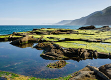
About Royal National Park The Royal National Park is a protected national park located in New South Wales, Australia. It is situated just 29 kilometers south of Sydney and covers an area of 151 square kilometers. Established in 1879, it is the second oldest national park in the world, showcasing stunning natural landscapes and diverse flora and fauna. Location and Geographical Overview The Royal National Park is located along the coast of New South Wales, stretching from the coastline to the southern outskirts of Sydney. The park features rugged cliffs, pristine beaches, lush rainforest, and picturesque waterfalls, offering visitors a wide range of natural attractions to explore. Open and Closing Time The Royal National Park is open daily from sunrise to sunset. It is important to check the park's official website or contact the park office for the most up-to-date information on opening hours. Entry Fee There is an entry fee to access the Royal National Park. Visitors can purchase daily passes or annual passes for individual entry or vehicle entry. Prices may vary depending on the type of pass and the age of the visitor. Species-Flora/Fauna Availability The Royal National Park is home to a diverse range of flora and fauna. Visitors can expect to see various species of plants, birds, mammals, reptiles, and marine life throughout the park. Endangered species such as the green and golden bell frog and the eastern bristlebird can also be found in the park. Activities Performed Visitors to the Royal National Park can enjoy a wide range of recreational activities, including bushwalking, picnicking, camping, swimming, fishing, birdwatching, and whale watching during the migration season. The park also offers opportunities for cycling, kayaking, and snorkeling in designated areas. Jeep Safari Charges Jeep safari tours are available for visitors who wish to explore the park in a guided four-wheel-drive experience. Prices for jeep safari tours may vary depending on the duration and itinerary of the tour. Age Criterion and Entry Fee Entry fees for the Royal National Park may vary based on the age of the visitor. Children under a certain age may enter the park for free, while adults and seniors may be charged a nominal fee for entry. It is recommended to check the park's official website for specific age criteria and entry fees. Senior Citizen Facilities The Royal National Park offers special facilities for senior citizens, including accessible walking tracks, picnic areas, and visitor centers. Seniors may also be eligible for discounts on entry fees and tours within the park. Best Time to Visit The best time to visit the Royal National Park is during the spring and autumn months when the weather is mild, and the park is in full bloom. Visitors can enjoy a pleasant climate, vibrant flora, and fauna, and fewer crowds during these seasons. Nearby Places to Visit There are several nearby attractions to explore while visiting the Royal National Park, including the stunning beaches of Cronulla, the historic town of Bundeena, and the popular hiking trails of the Illawarra Escarpment. Visitors can also take a short drive to the Royal Botanic Gardens in Sydney for more natural beauty. Vehicle Parking Facility The Royal National Park offers designated parking areas for visitors near popular attractions and walking trails. Parking fees may apply, so it is important to check the park's official website for information on parking locations and pricing. Rules and Regulations Visitors to the Royal National Park are required to abide by certain rules and regulations to help preserve the park's natural environment. Some common rules include staying on designated trails, keeping pets on a leash, disposing of rubbish properly, and respecting wildlife and cultural heritage sites. How to Reach and Related Information The Royal National Park is easily accessible by car, public transportation, or tour operators from Sydney. Visitors can drive to the park via the Princes Highway or take a train to various stations near the park entrance. For additional information on entry fees, guided tours, camping reservations, and park events, visitors can contact the Royal National Park office or visit the park's official website. Conclusion The Royal National Park is a natural paradise just a short drive from Sydney, offering visitors a peaceful retreat and a chance to reconnect with nature. With its diverse landscapes, abundant wildlife, and range of outdoor activities, the park is a must-visit destination for nature lovers and outdoor enthusiasts. Whether you are looking to relax on a secluded beach, hike through a rainforest, or spot native wildlife, the Royal National Park has something for everyone to enjoy.
Explore More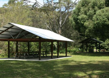
About Lane Cove National Park Lane Cove National Park is a stunning natural oasis located in Sydney, Australia. It covers an area of approximately 1,580 acres and is known for its lush greenery, diverse wildlife, and picturesque waterways. The park offers visitors a peaceful escape from the hustle and bustle of city life, making it a popular destination for nature lovers, hikers, and outdoor enthusiasts. Location and Geographical Overview Lane Cove National Park is situated in the northern suburbs of Sydney, just 10 kilometers from the city center. It is bordered by the Lane Cove River and is surrounded by residential areas such as Lane Cove, Ryde, and Chatswood. The park features a combination of bushland, wetlands, and mangroves, providing a habitat for a wide variety of plant and animal species. Opening and Closing Time The park is open to the public every day from sunrise to sunset. The exact opening and closing times may vary depending on the season, so it is recommended to check the official website or contact the park authorities for up-to-date information. Entry Fee Entry to Lane Cove National Park is free for all visitors, making it an affordable and accessible destination for everyone to enjoy. Species-Flora/Fauna Availability The park is home to a diverse range of plant and animal species, including eucalypt forests, mangroves, and wetland habitats. Visitors may encounter native birds, possums, wallabies, and even the occasional echidna or koala while exploring the park's walking trails and picnic areas. Activities Performed Visitors to Lane Cove National Park can enjoy a variety of activities, including bushwalking, birdwatching, picnicking, fishing, and canoeing. The park also has designated barbecue areas and playgrounds for families to relax and unwind in a natural setting. Jeep Safari Charges There are no jeep safari services available in Lane Cove National Park. However, visitors can explore the park's scenic beauty on foot or by bicycle along the network of walking trails and cycle paths. Age Criterion and Entry Fee There are no specific age criteria for entry to Lane Cove National Park, as it is open to visitors of all ages. As mentioned earlier, entry to the park is free for everyone, regardless of age. Senior Citizen Facilities Senior citizens visiting Lane Cove National Park can take advantage of the park's accessible facilities, including wheelchair-friendly walking tracks, picnic areas, and amenities. The serene environment of the park also provides a peaceful retreat for older visitors to relax and enjoy nature. Best Time to Visit The best time to visit Lane Cove National Park is during the spring and autumn months when the weather is mild, and the park is in full bloom. The colorful wildflowers, abundant birdlife, and pleasant temperatures make these seasons ideal for outdoor activities and sightseeing. Nearby Places to Visit Located in close proximity to Lane Cove National Park are several other attractions worth exploring, such as the Lane Cove River, Lane Cove Village, and the Riverside Walkway. Visitors can also venture further afield to discover nearby parks, reserves, and cultural landmarks in the surrounding area. Vehicle Parking Facility Lane Cove National Park offers ample parking facilities for visitors arriving by car. There are designated parking areas located at various entry points to the park, making it convenient for guests to access the walking trails, picnic areas, and other attractions within the park. Rules and Regulations While visiting Lane Cove National Park, visitors are kindly reminded to adhere to the park's rules and regulations to help preserve its natural beauty and protect its flora and fauna. Some guidelines to keep in mind include staying on designated tracks, disposing of rubbish properly, respecting wildlife, and observing fire restrictions. How to Reach and Other Related Information Lane Cove National Park is easily accessible by car, public transport, or bicycle. Visitors can reach the park via major roads such as Epping Road, Lane Cove Road, and Lady Game Drive. There are also bus services that stop near the park entrance, providing convenient transportation options for those without a vehicle. For more information about Lane Cove National Park, including maps, walking trails, events, and facilities, visitors can visit the official website or contact the park office directly. Whether you're looking for a peaceful retreat in nature, a fun day out with the family, or a place to unwind and recharge, Lane Cove National Park offers something for everyone to enjoy.
Explore More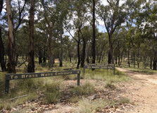
Abercrombie River National Park
About Abercrombie River National Park Abercrombie River National Park is a picturesque and biodiverse park located near Sydney, Australia. The park is known for its stunning landscapes, diverse flora and fauna, and a wide range of outdoor activities for visitors to enjoy. Covering an area of approximately 46,000 hectares, the park offers a peaceful retreat from the hustle and bustle of city life. Location and Geographical Overview The Abercrombie River National Park is located in the southern tablelands of New South Wales, approximately 200 kilometers west of Sydney. The park is characterized by its rugged terrain, deep gorges, and the beautiful Abercrombie River that flows through it. Visitors can explore the park's diverse landscapes, from open woodlands to dense forests and rocky cliffs. Open and Closing Time The park is open to visitors from sunrise to sunset daily. It is recommended to check the official website for any updates on opening and closing times before planning your visit. Entry Fee There is no entry fee to visit Abercrombie River National Park, making it an affordable destination for nature lovers and outdoor enthusiasts. Species-Flora/Fauna Availability The park is home to a wide variety of plant and animal species, including kangaroos, wallabies, wombats, and a diverse range of birdlife. Visitors can also find unique flora such as eucalyptus trees, wildflowers, and native grasses throughout the park. Activities Performed Visitors to Abercrombie River National Park can enjoy a range of activities, including bushwalking, birdwatching, picnicking, camping, fishing, and swimming in the river. The park also offers opportunities for photography, nature study, and wildlife spotting. Jeep Safari Charges For those interested in exploring the park by jeep safari, there may be additional charges. It is recommended to check with park authorities for the latest information on jeep safari tours and pricing. Age Criterion and Entry Fee There is no specific age criterion for entry into the park. Entry is free for visitors of all ages, making it a family-friendly destination for a day out in nature. Senior Citizen Facilities Senior citizens are welcome to explore Abercrombie River National Park and enjoy the facilities available. The park offers accessible trails, picnic areas, and camping grounds for older visitors to relax and immerse themselves in nature. Best Time to Visit The best time to visit Abercrombie River National Park is during the spring and autumn months when the weather is mild and the park is alive with blooming flowers and vibrant foliage. However, the park is open year-round and each season offers its own unique beauty and opportunities for outdoor activities. Nearby Places to Visit There are several nearby attractions to explore while visiting Abercrombie River National Park. Some popular destinations include Jenolan Caves, Kanangra-Boyd National Park, and the town of Oberon, known for its historic buildings and quaint charm. Vehicle Parking Facility There are designated parking areas available for visitors at Abercrombie River National Park. It is recommended to follow parking guidelines and park responsibly to ensure a safe and enjoyable experience for all visitors. Rules and Regulations Visitors are required to follow certain rules and regulations while in the park to protect the natural environment and ensure the safety of all visitors. Some common rules include staying on designated trails, disposing of waste properly, respecting wildlife, and following any specific guidelines provided by park authorities. How to Reach and Other Related Information Abercrombie River National Park is accessible by car from Sydney, with a travel time of approximately 3-4 hours depending on traffic. Visitors can also reach the park by public transport or organized tours. It is recommended to check the official park website for the latest information on directions, facilities, and any updates before planning your visit. Overall, Abercrombie River National Park is a stunning natural oasis that offers a wide range of activities for visitors to enjoy. Whether you're looking for a peaceful retreat in nature, an adventurous hike, or a fun day out with family and friends, the park has something for everyone. Plan your visit to this beautiful park and experience the beauty and serenity of the Australian wilderness.
Explore More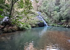
About Cascade National Park Cascade National Park is a picturesque nature reserve located in Sydney, Australia. Spanning over a vast area of lush greenery and mesmerizing landscapes, the park is a popular destination for nature lovers, adventurers, and wildlife enthusiasts. It offers visitors a unique opportunity to immerse themselves in the beauty of the Australian wilderness and experience the diverse flora and fauna that call the park home. Location and Geographical Overview Cascade National Park is situated on the outskirts of Sydney, approximately 50 kilometers from the city center. The park is nestled in the heart of the Cascade Mountain Range, which is known for its rugged terrain, dense forests, and cascading waterfalls. The diverse topography of the park includes towering cliffs, winding rivers, and expansive meadows, making it a haven for outdoor activities and exploration. Opening and Closing Time The park is open to visitors all year round, from sunrise to sunset. However, it is advisable to check the official website or contact the park authorities for the most up-to-date information on opening and closing times, as they may vary depending on the season and weather conditions. Entry Fee There is no entry fee to access Cascade National Park, making it an affordable and accessible destination for all visitors. However, certain activities within the park may have associated charges, such as guided tours, jeep safaris, and camping facilities. Species-Flora/Fauna Availability Cascade National Park is home to a diverse range of flora and fauna, including native plants, animals, and bird species. The park's rich biodiversity offers visitors a chance to observe unique wildlife in their natural habitat, such as kangaroos, wallabies, koalas, and various bird species. The lush vegetation of the park features a variety of eucalyptus trees, wildflowers, and ferns, creating a vibrant and colorful ecosystem. Activities Performed Visitors to Cascade National Park can engage in a wide range of activities to suit their interests and preferences. Popular activities within the park include hiking, bird watching, picnicking, photography, and nature walks. The park also offers camping facilities, guided tours, and jeep safaris for those seeking a more immersive outdoor experience. Additionally, visitors can enjoy adventurous activities such as rock climbing, abseiling, and mountain biking in designated areas of the park. Jeep Safari Charges For visitors looking to explore the park in a unique and exciting way, jeep safaris are available at an additional cost. The charges for jeep safaris vary depending on the duration of the tour, the number of participants, and the specific route chosen. It is recommended to book jeep safaris in advance to ensure availability and secure a spot for this thrilling adventure. Age Criterion and Entry Fee Visitors of all ages are welcome to visit Cascade National Park and enjoy its natural beauty and recreational activities. The entry fee for adults and children is free of charge, making it a family-friendly destination for outdoor excursions. Seniors citizens may be eligible for discounted rates or special promotions, so it is advisable to inquire with the park authorities for more details. Senior Citizen Facilities Cascade National Park strives to provide a comfortable and inclusive environment for senior citizens to enjoy their visit to the park. Special facilities and amenities may be available for elderly visitors, such as designated rest areas, accessible trails, and discounted rates on certain activities. The park staff are trained to assist senior citizens and ensure their safety and well-being during their time in the park. Best Time to Visit The best time to visit Cascade National Park is during the spring and autumn months when the weather is mild and pleasant, and the flora and fauna are at their most vibrant. The park is also popular in the summer months for outdoor activities such as swimming, camping, and picnicking. It is advisable to avoid visiting the park during extreme weather conditions, such as heavy rain or high temperatures, to ensure a safe and enjoyable experience. Nearby Places to Visit Located in the vicinity of Cascade National Park are several other attractions and points of interest that visitors can explore. Nearby places to visit include scenic lookout points, historic sites, local markets, and charming villages. Visitors can also embark on day trips to nearby natural wonders, such as waterfalls, caves, and national parks, to make the most of their stay in the region. Vehicle Parking Facility For the convenience of visitors arriving by car, Cascade National Park offers ample parking facilities near the entrance and various trailheads. Parking is typically free of charge, and designated areas are available for both regular vehicles and RVs. Visitors are advised to follow the parking regulations and guidelines provided by the park authorities to ensure a smooth and hassle-free experience. Rules and Regulations While visiting Cascade National Park, visitors are expected to adhere to certain rules and regulations to ensure the safety of themselves, other visitors, and the environment. Some common rules include staying on designated trails, disposing of litter responsibly, respecting wildlife and vegetation, and following any specific guidelines for certain activities, such as camping or fishing. It is important for visitors to be mindful of their impact on the park and to help preserve its natural beauty for future generations to enjoy. How to Reach and Other Related Information Cascade National Park is easily accessible from Sydney by car, bus, or organized tours. The park can be reached via the Pacific Highway and is well signposted from the main roads. Public transportation options are also available for visitors without private vehicles, including bus services that stop near the park entrance. For more information on how to reach Cascade National Park and to plan your visit, it is recommended to visit the official park website or contact the park office for assistance.
Explore More
About Cunnawarra National Park Cunnawarra National Park is a picturesque natural reserve located near Sydney, Australia. The park covers an area of approximately 400 hectares and is known for its diverse flora and fauna, stunning landscapes, and a range of recreational activities for visitors to enjoy. Location and Geographical Overview The Cunnawarra National Park is situated just 50 kilometers north of Sydney in the Hawkesbury region. The park is easily accessible by road, making it a popular destination for day trips and weekend getaways. Open and Closing Time The park is open to visitors from 8:00 am to 6:00 pm daily. However, it is recommended to check the official website or contact the park authorities for any changes in the opening and closing times. Entry Fee There is no entry fee to access Cunnawarra National Park, making it an affordable and accessible destination for nature lovers of all ages. Species - Flora/Fauna Availability The park is home to a wide variety of plant and animal species, including native trees like eucalyptus and acacia, as well as kangaroos, wallabies, and various bird species. Visitors have the opportunity to observe and appreciate the unique biodiversity of the area. Activities Performed Visitors to Cunnawarra National Park can enjoy a range of outdoor activities, such as bushwalking, birdwatching, picnicking, and photography. The park also offers designated areas for camping and BBQ facilities for a perfect day out in nature. Jeep Safari Charges For those looking for a more adventurous experience, jeep safari tours are available at an additional cost. The charges may vary depending on the duration and type of safari chosen, so it is recommended to inquire with the park authorities for more information. Age Criterion and Entry Fee There is no specific age criterion for entry to the park. Visitors of all ages are welcome to explore Cunnawarra National Park free of charge. Senior Citizen Facilities Cunnawarra National Park is equipped with facilities to cater to senior citizens, including accessible walking trails, seating areas, and restroom facilities. The park staff are also available to assist elderly visitors as needed. Best Time to Visit The best time to visit Cunnawarra National Park is during the spring and autumn seasons when the weather is mild, and the flora and fauna are at their most vibrant. However, the park is open year-round, so visitors can plan their trip according to their preferences. Nearby Places to Visit There are several attractions near Cunnawarra National Park that visitors can explore, including historic villages, vineyards, and scenic lookouts. Some popular nearby places to visit include Kurrajong Heights, Colo River, and Wheeny Creek. Vehicle Parking Facility There is ample parking available at Cunnawarra National Park for visitors traveling by car. The parking area is well-maintained and conveniently located near the park entrance, making it easy for visitors to access the facilities. Rules and Regulations While visiting Cunnawarra National Park, it is important to follow the rules and regulations set out by the park authorities to preserve the natural environment and ensure the safety of visitors. Some common rules include staying on designated trails, disposing of waste properly, and respecting wildlife. How to Reach and Other Related Information Cunnawarra National Park is easily accessible by car, with well-marked roads leading to the park entrance. Visitors can also opt for public transportation or guided tours that include transportation to and from the park. For more information on how to reach the park and any related inquiries, visitors can contact the park authorities or visit the official website.
Explore More
About Coolah Tops National Park Coolah Tops National Park is a stunning natural reserve located in New South Wales, Australia. It covers an area of 20,000 hectares and is known for its diverse flora and fauna, breathtaking landscapes, and a range of outdoor activities for visitors to enjoy. The park is a popular destination for nature lovers, hikers, and wildlife enthusiasts looking to explore the beauty of the Australian bushland. Location and Geographical Overview Coolah Tops National Park is situated in the Central West region of New South Wales, approximately 300 kilometers northwest of Sydney. The park is located near the town of Coolah, and its landscape is characterized by rugged mountains, deep gorges, lush forests, and pristine waterfalls. The elevation of the park ranges from 500 to 1,400 meters above sea level, offering visitors stunning panoramic views of the surrounding countryside. Opening and Closing Time The park is open all year round, from sunrise to sunset. Visitors are advised to check the official website for any changes to the opening and closing times due to weather conditions or special events. Entry Fee There is no entry fee to visit Coolah Tops National Park, making it an affordable and accessible destination for all visitors. Species-Flora/Fauna Availability Coolah Tops National Park is home to a diverse range of plant and animal species. The park's flora includes eucalypt forests, rainforest pockets, and wildflowers, while its fauna includes kangaroos, wallabies, koalas, and a variety of bird species. Visitors can explore the park's ecosystems through its network of walking trails and lookout points. Activities Performed Some of the activities that visitors can enjoy at Coolah Tops National Park include bushwalking, birdwatching, picnicking, camping, and photography. The park also offers opportunities for fishing, mountain biking, and horse riding, making it a versatile destination for outdoor enthusiasts of all ages. Jeep Safari Charges For visitors interested in going on a jeep safari in Coolah Tops National Park, there are guided tours available with varying charges depending on the duration and services included. It is recommended to book in advance to secure a spot on the safari and inquire about pricing. Age Criterion and Entry Fee Entry to Coolah Tops National Park is free for all visitors, regardless of age or gender. Children must be accompanied by an adult at all times, and there are no specific age restrictions for entry. Senior Citizen Facilities For senior citizens visiting Coolah Tops National Park, there are facilities available such as accessible walking trails, picnic areas, and designated parking spaces. The park staff are also trained to assist senior visitors with any special requirements they may have during their visit. Best Time to Visit The best time to visit Coolah Tops National Park is during the cooler months of autumn and spring when the weather is mild, and the flora is in full bloom. These seasons offer comfortable temperatures for outdoor activities and provide the best opportunities for wildlife spotting and nature photography. Nearby Places to Visit There are several nearby attractions to Coolah Tops National Park that visitors can explore during their trip. Some of these include the Coolah Tops Lookout, Pagan's Flat campground, Box Creek Falls, and the historic Coolah township. These places offer unique experiences and opportunities to learn more about the region's natural and cultural heritage. Vehicle Parking Facility There are designated parking areas available throughout Coolah Tops National Park for visitors traveling by car or camper van. These parking facilities are conveniently located near the park's main attractions and trailheads, making it easy for visitors to access the park's amenities and start their outdoor adventures. Rules and Regulations Visitors to Coolah Tops National Park are required to follow a set of rules and regulations to ensure the safety of themselves, other visitors, and the park's natural environment. Some of these rules include staying on designated trails, respecting wildlife, disposing of waste properly, and following fire safety guidelines. It is important for visitors to be mindful of their impact on the park and to contribute to its conservation efforts. How to Reach and Other Related Information Coolah Tops National Park can be reached by car from Sydney via the M1 and Golden Highway, with a driving time of approximately 4 hours. Visitors can also access the park by public transportation, including buses and trains, with connections available to the nearby town of Coolah. For more information on how to reach the park, accommodation options, guided tours, and upcoming events, visitors can visit the official website or contact the park's visitor center for assistance.
Explore More
About Dooragan National Park Dooragan National Park, located in New South Wales, Australia, is a stunning natural reserve known for its diverse flora and fauna, breathtaking views, and a range of outdoor activities for visitors to enjoy. The park is home to the iconic North Brother Mountain, which offers panoramic views of the surrounding area. Location and Geographical Overview Dooragan National Park is situated in the Mid North Coast region of New South Wales, approximately 372 kilometers north of Sydney. The park covers an area of approximately 784 hectares and is characterized by rugged cliffs, lush forests, and pristine beaches. Opening and Closing Time The park is open to visitors from dawn to dusk, seven days a week. It is important to note that the park may be closed during periods of high fire danger or for maintenance purposes, so it is advisable to check the park's official website for any updates before planning your visit. Entry Fee Entry to Dooragan National Park is free for all visitors, making it an affordable and accessible destination for nature lovers and outdoor enthusiasts. Species-Flora/Fauna Availability Dooragan National Park is home to a diverse range of plant and animal species, including iconic Australian wildlife such as kangaroos, wallabies, and koalas. The park also boasts a variety of native trees, flowers, and bird species, making it a paradise for nature lovers and wildlife enthusiasts. Activities Performed Visitors to Dooragan National Park can enjoy a range of outdoor activities, including bushwalking, birdwatching, picnicking, and camping. The park also offers stunning lookouts and walking trails that provide opportunities to immerse oneself in the beauty of the natural surroundings. Jeep Safari Charges Jeep safari tours are not available in Dooragan National Park at this time. However, visitors can explore the park by foot or bicycle to truly experience the beauty and serenity of the natural environment. Age Criterion and Entry Fee Entry to Dooragan National Park is free for visitors of all ages, including children, adults, and senior citizens. There are no age restrictions for entry, allowing individuals of all ages to enjoy the park's natural beauty and recreational activities. Senior Citizen Facilities Dooragan National Park provides facilities to cater to the needs of senior citizens, including accessible walking trails, picnic areas, and restroom facilities. The park is designed to be inclusive and welcoming to visitors of all ages and abilities. Best Time to Visit The best time to visit Dooragan National Park is during the cooler months of the year, from March to November, when the weather is mild and the park is less crowded. Spring and autumn are particularly beautiful times to visit, as the park comes alive with vibrant colors and blooming flowers. Nearby Places to Visit Located in close proximity to Dooragan National Park are a number of other popular attractions, including Crowdy Bay National Park, Googik Heritage Trail, and Laurieton Lookout. Visitors can explore these nearby destinations to further immerse themselves in the natural beauty of the region. Vehicle Parking Facility Dooragan National Park offers ample parking facilities for visitors, with designated parking areas located near the park entrance and popular walking trails. Parking is free of charge, making it convenient for visitors to access the park and explore its attractions. Rules and Regulations Visitors to Dooragan National Park are required to adhere to certain rules and regulations to ensure the safety of themselves and the park's natural environment. Some common rules include staying on designated trails, disposing of rubbish responsibly, and respecting wildlife and other visitors. How to Reach and Other Related Information Dooragan National Park is easily accessible by car from Sydney, with a driving time of approximately 4.5 hours. Visitors can take the Pacific Highway and follow signs to the park entrance. Public transportation options are also available, including bus services and guided tours. For more information on visiting Dooragan National Park, including current opening hours, trail maps, and upcoming events, visitors can visit the park's official website or contact the park ranger station for assistance. Whether you're looking to explore the natural beauty of the Australian wilderness, spot native wildlife, or simply relax in a tranquil setting, Dooragan National Park offers something for everyone to enjoy. Plan your visit today and experience the magic of this stunning natural reserve.
Explore More
Gardens of Stone National Park
About Gardens of Stone National Park Gardens of Stone National Park is a stunning natural reserve located in the Greater Blue Mountains area, just a few hours' drive from Sydney. It is renowned for its unique rock formations, dramatic cliffs, and diverse flora and fauna. The park offers visitors a chance to explore the Australian wilderness and experience the beauty of the Australian bushland. Location and Geographical Overview The Gardens of Stone National Park is situated in the Central Tablelands region of New South Wales, approximately 140 kilometers northwest of Sydney. The park covers an area of over 15,000 hectares and is characterized by its sandstone pagodas, canyons, and wildflowers. Opening and Closing Time The park is open to visitors every day from sunrise to sunset. It is important to note that camping is not permitted in the Gardens of Stone National Park, so visitors must plan their visit accordingly. Entry Fee There is no entry fee to visit the Gardens of Stone National Park, making it an affordable destination for nature lovers and outdoor enthusiasts. Species-Flora/Fauna Availability The park is home to a diverse range of plant and animal species, including kangaroos, wallabies, eagles, and numerous species of native birds. The park's vegetation includes eucalypt forests, heathlands, and woodlands, providing habitat for a variety of wildlife. Activities Performed Visitors to the Gardens of Stone National Park can enjoy a range of activities, including bushwalking, birdwatching, photography, and rock climbing. The park's rugged terrain and breathtaking scenery make it a popular destination for outdoor enthusiasts and adventure seekers. Jeep Safari Charges For those looking to explore the park in style, jeep safari tours are available for an additional fee. These tours provide visitors with a unique perspective of the park's landscape and allow them to access areas that are not accessible by foot. Age Criterion and Entry Fee There are no age restrictions for visiting the Gardens of Stone National Park, and entry is free for all visitors regardless of age. Senior Citizen Facilities The park offers facilities for senior citizens, including accessible walking trails and picnic areas. Visitors are encouraged to contact the park's visitor center for more information on specific facilities for senior citizens. Best Time to Visit The best time to visit the Gardens of Stone National Park is during the spring and autumn months when the weather is mild and the wildflowers are in bloom. These seasons offer the perfect conditions for exploring the park and enjoying its natural beauty. Nearby Places to Visit There are several other attractions in the Greater Blue Mountains area that are worth visiting during your trip to the Gardens of Stone National Park, including the Three Sisters rock formation, the Jenolan Caves, and the Blue Mountains Botanic Garden. Vehicle Parking Facility There are parking facilities available at the entrance to the Gardens of Stone National Park for visitors who wish to drive to the park. It is important to follow all parking regulations and guidelines to ensure a safe and enjoyable visit. Rules and Regulations Visitors to the Gardens of Stone National Park are required to follow certain rules and regulations to protect the park's natural environment and wildlife. These rules include staying on designated walking trails, not feeding the wildlife, and disposing of rubbish responsibly. How to Reach and Other Related Information The Gardens of Stone National Park can be reached by car from Sydney in approximately two to three hours. Visitors can also take public transportation to Lithgow and then arrange for a shuttle or taxi to the park. For more information on how to reach the park and other related details, visitors are encouraged to contact the park's visitor center.
Explore More
About Kanangra Boyd National Park Kanangra Boyd National Park is a stunning wilderness area located in the Central Tablelands of New South Wales, Australia. The park covers an area of approximately 69,000 hectares and is known for its rugged beauty, deep gorges, waterfalls, and panoramic views. Location and Geographical Overview The national park is situated about 180 kilometers west of Sydney and can be accessed via Oberon or Jenolan Caves. It is part of the Greater Blue Mountains World Heritage Area and is characterized by sandstone cliffs, eucalypt forests, and diverse flora and fauna. Opening and Closing Time The park is open to visitors all year round, but specific opening and closing times may vary. It is recommended to check the official website for updated information. Entry Fee There is no entry fee to visit Kanangra Boyd National Park, making it an accessible destination for nature lovers and outdoor enthusiasts. Species-Flora/Fauna Availability The national park is home to a wide variety of plant and animal species, including rare and endangered species. Visitors may encounter kangaroos, wallabies, echidnas, and a diverse range of birdlife while exploring the park. Activities Performed Visitors to Kanangra Boyd National Park can enjoy a range of outdoor activities, including bushwalking, camping, birdwatching, photography, and picnicking. The park offers numerous walking trails of varying difficulties, catering to both casual strollers and experienced hikers. Jeep Safari Charges Jeep safaris may be available in the national park, but specific charges and details should be obtained from the relevant tour operators or visitor centers. Age Criterion and Entry Fee Entry to Kanangra Boyd National Park is generally free for all visitors, regardless of age or gender. However, certain activities within the park may have age restrictions or require adult supervision for children. Senior Citizen Facilities The national park may offer facilities and services tailored to senior citizens, such as accessible trails, rest areas, and information centers. It is advisable to inquire about specific amenities when planning a visit. Best Time to Visit The best time to visit Kanangra Boyd National Park is during the cooler months of autumn and spring when the weather is mild, and the landscapes are vibrant with colors. Avoid visiting during extreme weather conditions or bushfire season. Nearby Places to Visit While exploring Kanangra Boyd National Park, visitors can also check out nearby attractions such as Jenolan Caves, Kanangra Walls, and the historic town of Oberon. These destinations offer additional natural and cultural experiences for a comprehensive trip. Vehicle Parking Facility The national park provides designated parking areas for visitors, including day-use areas, campgrounds, and trailheads. It is essential to follow parking regulations and guidelines to ensure a safe and enjoyable visit for all. Rules and Regulations When visiting Kanangra Boyd National Park, visitors are expected to abide by certain rules and regulations to protect the environment and ensure the safety of all park users. Some common guidelines include staying on designated trails, carrying out all rubbish, and respecting wildlife. How to Reach and Other Related Information Kanangra Boyd National Park can be reached by car from Sydney via the Great Western Highway and the Abercrombie Road. Public transportation options may be limited, so it is recommended to have a private vehicle for easier access to the park. Additional information, including maps, facilities, and accommodation options, can be obtained from the official website or visitor centers. Plan your visit to Kanangra Boyd National Park and immerse yourself in the natural beauty and tranquility of this pristine wilderness area in the heart of New South Wales.
Explore More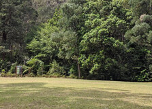
About Macquarie Pass National Park Macquarie Pass National Park is a stunning natural reserve located in New South Wales, Australia. Situated approximately 90 kilometers south of Sydney, the park offers visitors a chance to explore lush rainforests, cascading waterfalls, and breathtaking wildlife. It is a popular destination for nature lovers, hikers, and outdoor enthusiasts looking to immerse themselves in the beauty of the Australian wilderness. Location and Geographical Overview The Macquarie Pass National Park is located in the Illawarra region of New South Wales, just a short drive from the town of Robertson. The park is known for its dramatic landscape, which includes steep cliffs, deep gorges, and dense forest cover. The Macquarie River flows through the park, adding to its natural beauty and providing a habitat for a variety of plant and animal species. Open and Closing Time The park is open to visitors every day of the week from sunrise to sunset. It is important to note that the park may be closed during extreme weather conditions or for maintenance purposes, so it is advisable to check the official website for any updates on opening and closing times. Entry Fee Entry to Macquarie Pass National Park is free for all visitors, making it an affordable and accessible destination for those looking to enjoy the great outdoors. Species-Flora/Fauna Availability The park is home to a diverse range of plant and animal species, including rare and endangered species that are unique to the area. Visitors can expect to see native birds, wallabies, and a variety of reptiles while exploring the park's hiking trails and scenic lookouts. The lush rainforest vegetation adds to the park's biodiversity, with a mix of eucalyptus trees, ferns, and wildflowers dotting the landscape. Activities Performed Visitors to Macquarie Pass National Park can enjoy a range of activities, including hiking, birdwatching, picnicking, and photography. The park's well-maintained trails offer opportunities for both leisurely strolls and more challenging hikes, with options for all fitness levels. The park's picnic areas provide a perfect spot to relax and enjoy a meal surrounded by nature. Jeep Safari Charges Jeep safari tours are not currently offered within Macquarie Pass National Park. However, visitors can explore the park's scenic beauty by foot or by car along the designated roads and trails. Age Criterion and Entry Fee There is no specific age criterion for entry to Macquarie Pass National Park, and visitors of all ages are welcome to explore the park free of charge. Senior Citizen Facilities The park offers facilities for senior citizens, including accessible walking trails, picnic areas, and restrooms. Visitors with mobility issues can still enjoy the park's natural beauty thanks to these accessible amenities. Best Time to Visit The best time to visit Macquarie Pass National Park is during the spring and autumn months when the weather is mild, and the park's flora and fauna are in full bloom. The cool temperatures and clear skies during these seasons make for ideal hiking and exploring conditions. Nearby Places to Visit While visiting Macquarie Pass National Park, visitors can explore nearby attractions such as Robertson, a charming town known for its historic buildings and local shops. The Illawarra Fly Treetop Walk is also a popular destination, offering visitors a unique perspective of the surrounding rainforest from a series of elevated walkways. Vehicle Parking Facility Macquarie Pass National Park offers parking facilities for visitors, with designated parking areas near the park's entrance and trailheads. It is important to follow any signage or instructions regarding parking to ensure the safety and flow of traffic within the park. Rules and Regulations Visitors to Macquarie Pass National Park are advised to follow a few rules and regulations to ensure the protection of the park's natural environment. These include staying on designated trails, refraining from littering, respecting wildlife, and following any posted guidelines or restrictions. By upholding these rules, visitors can help preserve the park for future generations to enjoy. How to Reach and Other Related Information Macquarie Pass National Park can be reached by car from Sydney via the Hume Highway and Illawarra Highway. Public transportation options are limited, so driving is the most convenient way to access the park. Visitors should check the official park website for updated information on access, facilities, and any temporary closures or restrictions before planning their visit.
Explore More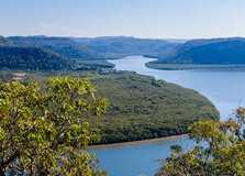
About Marramarra National Park Marramarra National Park is a stunning natural reserve located in Sydney, Australia. It covers an area of approximately 11,221 hectares and is known for its diverse flora and fauna, as well as its breathtaking landscapes. The park offers visitors the opportunity to escape the hustle and bustle of the city and immerse themselves in nature. Location and Geographical Overview Marramarra National Park is situated in the northern outskirts of Sydney, approximately 50 kilometers from the city center. The park is characterized by rugged sandstone cliffs, serene rivers, lush forests, and diverse wildlife. It is a popular destination for nature lovers, hikers, and outdoor enthusiasts. Opening and Closing Time The park is open to visitors from sunrise to sunset every day of the week. Entry Fee There is no entry fee to access Marramarra National Park, making it an affordable destination for a day out in nature. Species-Flora/Fauna Availability Marramarra National Park is home to a wide variety of plant and animal species. The park boasts diverse flora including eucalyptus forests, mangroves, and wildflowers. Visitors may also spot native wildlife such as wallabies, echidnas, and a variety of bird species. Activities Performed Visitors to Marramarra National Park can engage in a range of activities including bushwalking, birdwatching, fishing, camping, and picnicking. The park offers several walking trails of varying lengths and difficulty levels, catering to hikers of all abilities. Jeep Safari Charges There are no official jeep safari tours offered within Marramarra National Park. However, visitors are welcome to explore the park's dirt roads and tracks in their own 4WD vehicles. Age Criterion and Entry Fee There are no specific age restrictions for entry into Marramarra National Park. Children under a certain age may enter for free, while adults may be required to pay a small fee for camping or other activities within the park. Please check with park authorities for current entry fees. Senior Citizen Facilities Marramarra National Park offers facilities to cater to senior citizens, including accessible walking trails, picnic areas, and camping grounds. The park is a peaceful and relaxing environment that is suitable for visitors of all ages. Best Time to Visit The best time to visit Marramarra National Park is during the spring and autumn months when the weather is mild and the flora is in bloom. These seasons offer ideal conditions for hiking, camping, and wildlife spotting. Nearby Places to Visit There are several attractions near Marramarra National Park that visitors may wish to explore, including Berowra Waters, Ku-ring-gai Chase National Park, and the Hawkesbury River. These destinations offer additional opportunities for outdoor recreation and sightseeing. Vehicle Parking Facility Marramarra National Park provides designated parking areas for visitors near popular trailheads, picnic areas, and camping grounds. Please ensure that your vehicle is parked in a designated spot and that all valuables are secure before leaving your car unattended. Rules and Regulations Visitors to Marramarra National Park are expected to follow certain rules and regulations to help protect the park's natural environment and wildlife. These may include staying on designated trails, disposing of rubbish properly, and respecting wildlife and other visitors. Camping permits may be required for overnight stays. How to Reach and Other Related Information Marramarra National Park can be reached by car from Sydney via the M1 motorway and various local roads. Public transportation options may also be available. For more information on how to reach the park, current conditions, and other related details, visitors are encouraged to contact the park authorities or visit the official website.
Explore More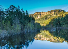
About Nattai National Park Nattai National Park is a stunning natural reserve located in the Southern Highlands of New South Wales, approximately 150 kilometers southwest of Sydney. Established in 2001, the park spans over 60,000 hectares and is renowned for its diverse ecosystems, rugged landscapes, and rich biodiversity. From lush rainforests to towering sandstone cliffs, Nattai National Park offers visitors a truly immersive experience in nature. Location and Geographical Overview The park is situated within the Sydney Basin bioregion, encompassing parts of the Greater Blue Mountains World Heritage Area. It is characterized by deep gorges, pristine rivers, and an array of native vegetation, making it a haven for wildlife. Nattai National Park is easily accessible by car, with several entry points along the edge of the park. Open and Closing Time Nattai National Park is open to visitors from sunrise to sunset, seven days a week. However, it is advisable to check the park's official website or contact the local ranger station for any updates or changes in operating hours. Entry Fee Entry to Nattai National Park is free for all visitors, making it an affordable destination for nature enthusiasts and families looking to explore the great outdoors. Species-Flora/Fauna Availability The park is home to a diverse range of plant and animal species, including rare and endangered ones. Visitors may encounter native flora such as eucalyptus forests, rainforest ferns, and wildflowers, as well as wildlife like wallabies, echidnas, and various bird species. The park's rich biodiversity makes it a prime spot for nature lovers and photographers. Activities Performed Visitors to Nattai National Park can engage in a variety of activities, including bushwalking, birdwatching, camping, picnicking, and swimming in the pristine waterways. The park also offers opportunities for mountain biking, horse riding, and fishing, catering to outdoor enthusiasts of all ages and interests. Jeep Safari Charges Jeep safari tours are not currently available in Nattai National Park. However, visitors are encouraged to explore the park's vast landscape on foot or by car to fully appreciate its natural beauty and tranquility. Age Criterion and Entry Fee There are no specific age criteria for entry to Nattai National Park, as visitors of all ages are welcome to enjoy the park's facilities and attractions. All entry fees are waived, making it an accessible destination for families and individuals alike. Senior Citizen Facilities Nattai National Park offers facilities and amenities that cater to senior citizens, including accessible walking trails, picnic areas with shaded seating, and restroom facilities. The park's serene environment and gentle terrain make it an ideal destination for elderly visitors looking to connect with nature. Best Time to Visit The best time to visit Nattai National Park is during the cooler months of autumn and spring, when the weather is mild and the vegetation is lush. These seasons offer ideal conditions for bushwalking, birdwatching, and enjoying the park's natural beauty without the extreme heat of summer or the cold of winter. Nearby Places to Visit There are several attractions and points of interest near Nattai National Park, including Wombeyan Caves, Fitzroy Falls, and the town of Mittagong. These sites offer additional opportunities for exploration, adventure, and cultural experiences, complementing a visit to the park. Vehicle Parking Facility Nattai National Park provides designated parking areas at various entry points within the park, allowing visitors to safely and conveniently park their vehicles before embarking on their outdoor adventures. Parking is free of charge, and visitors are encouraged to adhere to all signage and regulations to ensure a positive experience for everyone. Rules and Regulations While visiting Nattai National Park, visitors are expected to adhere to certain rules and regulations to ensure the conservation of the park's natural resources and the safety of all guests. These may include staying on marked trails, disposing of litter properly, respecting wildlife, and following any posted guidelines or restrictions. By being mindful of these rules, visitors can help preserve the park for future generations to enjoy. How to Reach and Other Related Information Nattai National Park is easily accessible by car from Sydney, with several entry points located along the edges of the park. Visitors can also reach the park by public transportation, such as bus or train, followed by a short drive or hike to the park entrance. For more information on directions, facilities, and current conditions, visitors are encouraged to visit the park's official website or contact the local ranger station for assistance. Overall, Nattai National Park offers a serene and picturesque setting for outdoor enthusiasts, nature lovers, and families seeking adventure and relaxation amidst the beauty of the Australian wilderness. With its diverse ecosystems, abundant wildlife, and range of activities, the park provides a truly immersive experience in nature that is sure to leave a lasting impression on all who visit. Whether exploring the bushland trails, picnicking by the river, or simply taking in the sights and sounds of the natural world, Nattai National Park is a must-visit destination for anyone looking to reconnect with the great outdoors.
Explore MoreMelbourne To Gold Coast Road Trip 14 Nights - 15 Days
15 Days/ 14 Night
Sydney - Melbourne - Canberra - Gold Coast
AUSTRALIA 6N 7D ITINERARY SYDNEY & MELBOURNE
7 Days/ 6 Night
Sydney
Coastal Bliss 3 Nights - 4 Days Tour
4 Days/ 3 Night
Cairns
Best Of Hobart - Art - Heritage - Coastline 3 Nights - 4 Days Tour
4 Days/ 3 Night
Hobart
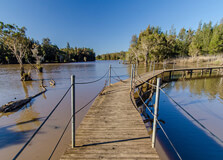
About Scheyville National Park Scheyville National Park is a beautiful natural reserve located in Sydney, Australia. It is known for its diverse flora and fauna, as well as its historical significance. The park covers an area of approximately 920 hectares and offers visitors a peaceful escape from the hustle and bustle of city life. Location and Geographical Overview Scheyville National Park is situated in the north-western part of Sydney, approximately 50 kilometers from the city center. The park is bordered by the Hawkesbury River to the north and the Pitt Town Nature Reserve to the south. The landscape of the park is characterized by open woodland, wetlands, and grasslands, providing a habitat for a wide variety of plant and animal species. Opening and Closing Time The park is open to visitors from sunrise to sunset, seven days a week. Visitors are advised to check the official website or contact the park office for any changes in operating hours. Entry Fee Entry to Scheyville National Park is free for all visitors, making it an affordable and accessible destination for nature lovers and outdoor enthusiasts. Species-Flora/Fauna Availability The park is home to a diverse range of plant and animal species, including kangaroos, wallabies, echidnas, and a variety of bird species. Visitors can also see native trees such as eucalyptus, banksia, and casuarina, as well as wildflowers during the spring season. Activities Performed Visitors to Scheyville National Park can enjoy a range of activities, including bushwalking, bird watching, picnicking, and photography. The park also has designated areas for camping, fishing, and cycling, providing something for everyone to enjoy. Jeep Safari Charges There are various tour operators that offer jeep safari experiences in Scheyville National Park. The charges for these tours may vary depending on the duration and inclusions, so visitors are encouraged to book in advance and check with the respective operators for pricing information. Age Criterion for Male, Female, Children, and Entry Fee There is no specific age criterion for entry to Scheyville National Park. Visitors of all ages are welcome to explore the park free of charge. Senior Citizen Facilities Scheyville National Park offers facilities for senior citizens, including accessible walking trails, picnic areas with seating, and restrooms with disabled access. Visitors can also request assistance from park staff if needed. Best Time to Visit The best time to visit Scheyville National Park is during the spring months of September to November when the wildflowers are in bloom and the weather is mild. The park is also beautiful in the autumn months of March to May when the foliage changes color, providing a stunning backdrop for outdoor activities. Nearby Places to Visit There are several other attractions near Scheyville National Park that visitors can explore, including Cattai National Park, Pitt Town Nature Reserve, and the historic town of Windsor. These places offer additional opportunities for outdoor activities, as well as cultural and historical experiences. Vehicle Parking Facility Scheyville National Park has designated parking areas for visitors, including car parks near the main entrance and picnic areas. Parking is free of charge, but visitors are encouraged to arrive early, especially on weekends and public holidays, to secure a spot. Rules and Regulations Visitors to Scheyville National Park are required to abide by certain rules and regulations to ensure the safety and preservation of the park. Some common guidelines include staying on designated tracks, disposing of rubbish properly, and respecting wildlife and other park users. Pets are not allowed in the park, except for certified assistance animals. How to Reach and Other Related Information Scheyville National Park is easily accessible by car, located approximately an hour's drive from Sydney CBD. Visitors can also take public transport to reach the park, with bus services available to the nearby town of Pitt Town. For more information on how to get to the park and current conditions, visitors can check the official website or contact the park office.
Explore More
About Sydney Harbour National Park Sydney Harbour National Park is a stunning natural reserve located in Sydney, Australia. It covers 392 hectares of land and consists of several islands, headlands, and foreshores along the Sydney Harbour. The park is a popular destination for tourists and locals alike, offering breathtaking views of the iconic Sydney Opera House and Harbour Bridge. Location and Geographical Overview The Sydney Harbour National Park is situated on the shores of Sydney Harbour, just a short distance from the city center. The park encompasses several key areas, including Bradleys Head, Nielsen Park, and Shark Island. It is easily accessible by car, public transport, or by ferry. Open and Closing Time The Sydney Harbour National Park is open daily from sunrise to sunset. It is recommended to check the park's website for any updates on opening hours before planning your visit. Entry Fee There is no entry fee to access the Sydney Harbour National Park, making it a great option for budget-conscious travelers looking to explore the natural beauty of Sydney. Species-Flora/Fauna Availability The park is home to a diverse range of flora and fauna, including native plants such as eucalyptus trees, banksias, and grevilleas. Birdwatchers will also enjoy spotting various bird species, such as kookaburras, lorikeets, and seabirds along the coastline. Activities Performed Visitors to Sydney Harbour National Park can enjoy a variety of recreational activities, including bushwalking, picnicking, swimming, snorkeling, and wildlife spotting. The park also offers guided tours and educational programs for those looking to learn more about the area's natural heritage. Jeep Safari Charges Unfortunately, jeep safaris are not permitted within Sydney Harbour National Park. However, visitors can explore the park on foot, by bike, or by joining a guided tour to discover the beauty of the area. Age Criterion and Entry Fee There are no specific age criteria for visiting Sydney Harbour National Park. Entry is free for all visitors, regardless of age or gender. Senior Citizen Facilities Senior citizens are welcome to visit Sydney Harbour National Park and can enjoy the same facilities and activities as other visitors. The park offers accessible walking tracks and picnic areas for those with mobility issues. Best Time to Visit The best time to visit Sydney Harbour National Park is during the spring and autumn months when the weather is mild and the park is in full bloom. Summer can be quite hot, so it's best to visit early in the morning or late in the afternoon to avoid the heat. Nearby Places to Visit There are several attractions near Sydney Harbour National Park that are worth exploring, including Taronga Zoo, Balmoral Beach, and the historic Quarantine Station. Visitors can also take a ferry ride to popular spots like Manly Beach or Watsons Bay for more sightseeing opportunities. Vehicle Parking Facility There are limited parking facilities available at various entry points of Sydney Harbour National Park. Visitors are encouraged to carpool or use public transport when possible to reduce congestion and minimize their environmental impact. Rules and Regulations Visitors to Sydney Harbour National Park are expected to follow the park's rules and regulations to help preserve its natural beauty. This includes staying on designated walking tracks, disposing of rubbish properly, and respecting the wildlife and vegetation in the area. How to Reach and Other Related Information Sydney Harbour National Park is easily accessible by car, public transport, or by ferry. Visitors can drive to various entry points of the park or take a bus from Sydney CBD. Ferries also operate to locations such as Taronga Zoo and Watsons Bay, providing a scenic way to reach the park. For more information on visiting Sydney Harbour National Park, including guided tours, events, and park updates, visitors can check the official website or contact the park's visitor center for assistance.
Explore More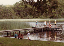
About Thirlmere Lakes National Park Thirlmere Lakes National Park is a beautiful natural reserve located in Sydney, Australia. It is known for its stunning freshwater lakes, diverse flora and fauna, and peaceful surroundings. The park covers an area of approximately 6,500 hectares and is a popular destination for nature lovers, hikers, and birdwatchers. Location and Geographical Overview Thirlmere Lakes National Park is situated in the Southern Highlands region of New South Wales, approximately 90 kilometers southwest of Sydney. The park is characterized by a series of five large and shallow lakes, which are believed to have formed over 15,000 years ago during the last Ice Age. Open and Closing Time The park is open to visitors from sunrise to sunset, seven days a week. It is recommended to check the official website or contact the park ranger for any updates on opening and closing times. Entry Fee Entry to Thirlmere Lakes National Park is free of charge for all visitors. Species-Flora/Fauna Availability The park is home to a rich variety of flora and fauna, including eucalypt forests, wetlands, and grasslands. Visitors can spot a range of bird species such as black swans, ducks, and honeyeaters, as well as kangaroos, wallabies, and echidnas. Activities Performed Some of the popular activities at Thirlmere Lakes National Park include hiking, birdwatching, picnicking, and camping. The park offers several well-marked walking trails that cater to all fitness levels, providing opportunities to explore the diverse landscapes and wildlife. Jeep Safari Charges There are no designated jeep safari tours or charges at Thirlmere Lakes National Park. However, visitors are welcome to explore the park in their own 4WD vehicles along designated tracks and trails. Age Criterion and Entry Fee Entry to the park is free for visitors of all ages, including males, females, and children. There are no specific age criteria for entry. Senior Citizen Facilities Thirlmere Lakes National Park provides facilities for senior citizens, including accessible walking trails, picnic areas, and restroom facilities. Visitors are advised to check with the park management for any additional senior-friendly amenities or services. Best Time to Visit The best time to visit Thirlmere Lakes National Park is during the cooler months of the year, from March to November, when the weather is mild and comfortable for outdoor activities. Spring and autumn are particularly beautiful seasons, with blooming wildflowers and vibrant foliage. Nearby Places to Visit There are several attractions and points of interest near Thirlmere Lakes National Park, including the historic town of Thirlmere, the NSW Rail Museum, and the picturesque village of Buxton. Visitors can also explore the scenic Wollondilly River and nearby national parks like Morton and Nattai. Vehicle Parking Facility The park offers designated parking areas for vehicles at the main entrance and trailheads. Visitors are advised to follow the parking regulations and avoid parking in undesignated areas to ensure the safety and convenience of all park visitors. Rules and Regulations Visitors to Thirlmere Lakes National Park are required to adhere to the following rules and regulations: - Stay on designated trails and respect all signage and park rules. - Do not feed or disturb the wildlife. - Carry out all trash and waste to help preserve the park's natural beauty. - Camp only in designated camping areas and obtain necessary permits. - Keep pets on a leash at all times and clean up after them. - Observe fire restrictions and be mindful of fire hazards. - Respect the privacy and property of other visitors and residents in the area. - Follow all COVID-19 safety guidelines and social distancing measures. How to Reach and Other Related Information Thirlmere Lakes National Park is accessible by car via the Hume Highway and the Picton Road, with signposted entrances and parking areas. The nearest town is Thirlmere, which offers accommodation, dining options, and visitor information. Visitors can also reach the park by train to Thirlmere station and then continue by local transport or on foot. For more information on visiting Thirlmere Lakes National Park, including updated park hours, special events, and guided tours, visitors can visit the official website or contact the park office directly. Whether you're looking to immerse yourself in nature, enjoy outdoor activities, or simply relax in a serene environment, Thirlmere Lakes National Park offers a rewarding experience for all visitors.
Explore More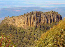
About Mt Kaputar National Park Located in New South Wales, Australia, Mt Kaputar National Park is known for its spectacular landscapes, unique flora and fauna, and diverse range of activities for visitors to enjoy. The park is home to the iconic Mt Kaputar, an ancient volcanic peak that offers breathtaking views of the surrounding countryside. Location and Geographical Overview Mt Kaputar National Park is situated near the town of Narrabri, approximately 500 kilometers northwest of Sydney. The park covers an area of over 42,000 hectares and features a variety of ecosystems, including dry eucalypt forests, subtropical rainforests, and towering granite cliffs. Open and Closing Time The park is open to visitors daily from sunrise to sunset. It is recommended to check the official website for any updates on opening hours before planning your visit. Entry Fee There is no entry fee to visit Mt Kaputar National Park, making it an affordable and accessible destination for nature lovers of all ages. Species-Flora/Fauna Availability The park is home to a diverse range of plant and animal species, including koalas, wallabies, echidnas, and a variety of bird species. Visitors can explore the park's many walking trails to spot native flora and fauna in their natural habitat. Activities Performed Visitors to Mt Kaputar National Park can enjoy a variety of activities, including bushwalking, birdwatching, camping, picnicking, and star-gazing. The park also offers guided tours and educational programs for visitors of all ages. Jeep Safari Charges Jeep safari tours are available at Mt Kaputar National Park for an additional fee. Prices may vary depending on the duration and type of safari tour chosen. Age Criterion and Entry Fee Entry to Mt Kaputar National Park is free for visitors of all ages, making it a great destination for families and travelers of all ages to explore and enjoy. Senior Citizen Facilities Senior citizens can enjoy a range of facilities at Mt Kaputar National Park, including accessible walking trails, picnic areas, and visitor centers with information about the park's history and wildlife. Best Time to Visit The best time to visit Mt Kaputar National Park is during the cooler months of the year, from April to October, when the weather is mild and the park's flora and fauna are at their best. Avoid visiting during the summer months, as temperatures can be high and bushfires are a common risk. Nearby Places to Visit While visiting Mt Kaputar National Park, be sure to explore the nearby town of Narrabri, known for its agricultural heritage, local markets, and charming cafes. Other nearby attractions include Sawn Rocks, an impressive rock formation, and Pilliga Forest, a rugged wilderness area to explore. Vehicle Parking Facility Parking facilities are available at Mt Kaputar National Park for visitors arriving by car. Please be sure to follow park regulations and guidelines when parking your vehicle to ensure the safety and enjoyment of all visitors. Rules and Regulations When visiting Mt Kaputar National Park, it is important to follow the park's rules and regulations to protect the environment and wildlife. This includes staying on designated trails, not feeding wildlife, and taking all rubbish with you when you leave. Please respect the natural beauty of the park and leave only footprints behind. How to Reach and Other Related Information Mt Kaputar National Park can be reached by car from Sydney, approximately a 6-hour drive. Alternatively, visitors can take a bus or train to Narrabri and then arrange local transport to the park. For more information on how to reach the park and other related information, please visit the official Mt Kaputar National Park website. By following the guidelines and information provided, visitors to Mt Kaputar National Park can enjoy a memorable and enriching experience exploring the natural wonders of this unique destination.
Explore More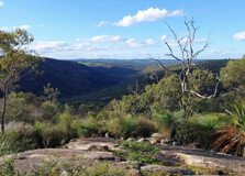
About Avon Valley National Park Avon Valley National Park is a stunning natural wonder located in the picturesque Avon Valley, just a short drive from Perth, Western Australia. This national park is known for its diverse range of flora and fauna, stunning landscapes, and recreational activities, making it a popular destination for nature lovers, outdoor enthusiasts, and families alike. The park covers an area of approximately 4,800 hectares and is home to a variety of plant and animal species. Location and Geographical Overview Avon Valley National Park is situated around 80 kilometers northeast of Perth, making it an easily accessible destination for both locals and tourists. The park is nestled within the Avon Valley, characterized by rolling hills, lush forests, and the meandering Avon River. The diverse landscape of the park provides a habitat for a wide range of flora and fauna, including kangaroos, emus, and a variety of bird species. Opening and Closing Time The Avon Valley National Park is open to visitors from 8:30 AM to 5:00 PM daily, providing ample time to explore and enjoy the natural beauty of the park. It's recommended to check the park's official website or contact the visitor center for any updates or changes in the opening and closing times. Entry Fee There is no entry fee to visit Avon Valley National Park, making it an affordable and accessible destination for all visitors. However, certain activities within the park may have additional charges, such as guided tours or jeep safaris. Species-Flora/Fauna Availability Avon Valley National Park is home to a diverse range of plant and animal species, making it a paradise for nature enthusiasts and wildlife lovers. Visitors can expect to see kangaroos, emus, wallabies, and a variety of bird species while exploring the park. The park is also known for its unique flora, including wildflowers, eucalyptus trees, and native shrubs. Activities Performed There are plenty of activities to enjoy in Avon Valley National Park, catering to visitors of all ages and interests. Popular activities include bushwalking, birdwatching, picnicking, camping, and nature photography. The park also offers opportunities for fishing, canoeing, and swimming in the Avon River. Jeep Safari Charges For visitors looking to explore the park in a unique way, guided jeep safaris are available for an additional fee. The safari charges may vary depending on the duration of the tour and the number of participants. It's recommended to book in advance to secure a spot on the jeep safari and experience the beauty of the park from a different perspective. Age Criterion for Male, Female, Children and their Entry Fee Avon Valley National Park welcomes visitors of all ages, with no specific age criteria for entry. Children under a certain age may enter the park for free, while discounted rates may be available for students and senior citizens. It's advisable to inquire about entry fees and special rates for different age groups when planning a visit to the park. Senior Citizen Facilities Avon Valley National Park offers facilities and amenities to cater to the needs of senior citizens, ensuring a comfortable and enjoyable visit for all visitors. Accessibility features, such as designated parking spaces, wheelchair ramps, and accessible trails, are available throughout the park. Rest areas and picnic shelters provide opportunities for seniors to relax and take in the beauty of the surroundings. Best Time to Visit The best time to visit Avon Valley National Park is during the spring months of September to November when the wildflowers are in full bloom, creating a vibrant and colorful landscape. The mild weather during spring makes it ideal for outdoor activities such as bushwalking and picnicking. Summer months (December to February) also offer pleasant weather for exploring the park and enjoying water-based activities in the Avon River. Nearby Places to Visit While exploring Avon Valley National Park, visitors can also discover nearby attractions and points of interest. The historic town of Toodyay, known for its charming heritage buildings and quaint shops, is just a short drive away from the park. Other nearby attractions include the Noble Falls and the Bilya Koort Boodja Cultural Centre, offering insights into the local Aboriginal history and culture. Vehicle Parking Facility Avon Valley National Park provides designated parking areas for visitors, ensuring a convenient and hassle-free experience. Parking facilities are available near the park entrance, picnic areas, and trailheads, allowing visitors to easily access the various attractions and amenities within the park. It's recommended to follow signage and park regulations when parking your vehicle to help maintain the natural beauty of the park. Rules and Regulations When visiting Avon Valley National Park, visitors are required to adhere to certain rules and regulations to ensure the safety of themselves, other visitors, and the park's environment. Some common rules include staying on designated trails, disposing of litter properly, and respecting wildlife and plant life. It's important to familiarize yourself with the park's rules and regulations before embarking on your visit to help preserve the beauty of this natural treasure. How to Reach and Other Related Information Avon Valley National Park is easily accessible by car from Perth, with a drive of approximately 1.5 to 2 hours depending on traffic and weather conditions. Visitors can take Great Eastern Highway out of Perth and follow the signs to Northam, then continue on to the park entrance. Public transportation options, such as buses or trains, may also be available for those without access to a vehicle. It's recommended to check the park's official website or contact the visitor center for detailed directions, maps, and additional information before planning your visit.
Explore More
About Black Mountain National Park Black Mountain National Park is a stunning natural reserve located just a short drive away from the bustling city of Brisbane, Australia. The park covers an area of approximately 6,000 hectares and is known for its rugged terrain, dense rainforest, and unique rock formations. Location and Geographical Overview The national park is located in the coastal region of Queensland, around 25 kilometers northwest of Brisbane. It is easily accessible by car and is a popular destination for locals and tourists alike. The park is characterized by its steep, rocky slopes, dense vegetation, and diverse wildlife. Open and Closing Time The Black Mountain National Park is open to visitors every day of the week from sunrise to sunset. It is recommended to check the park's official website for any temporary closures or changes in operating hours. Entry Fee There is no entry fee to access the Black Mountain National Park, making it an affordable and accessible destination for nature lovers of all ages. Species-Flora/Fauna Availability The park is home to a wide variety of plant and animal species, including rare and endangered ones. Visitors can expect to see lush rainforest vegetation, colorful birds, wallabies, and even the occasional koala in their natural habitat. Activities Performed Visitors to Black Mountain National Park can enjoy a range of activities, including bushwalking, birdwatching, picnicking, and photography. The park also has designated camping areas for those who wish to spend the night under the stars. Jeep Safari Charges For those looking to explore the park in style, jeep safari tours are available for an additional fee. These guided tours offer a unique and exciting way to experience the park's rugged terrain and wildlife up close. Age Criterion and Entry Fee Entry into Black Mountain National Park is free for visitors of all ages. There are no specific age criteria or entry fees for male, female, or children, making it a family-friendly destination for everyone to enjoy. Senior Citizen Facilities The park offers special facilities for senior citizens, including designated parking spaces, accessible walking trails, and rest areas. Visitors are encouraged to inquire at the park office for more information on senior-friendly amenities. Best Time to Visit The best time to visit Black Mountain National Park is during the cooler months of the year, from April to September, when the weather is more pleasant for outdoor activities. Visitors should be aware of the summer heat and humidity, which can be intense in this region. Nearby Places to Visit While in the area, visitors can explore other nearby attractions such as Lake Kurwongbah, Samford Village, and the D'Aguilar National Park. These destinations offer additional outdoor recreational opportunities and cultural experiences for those looking to extend their visit. Vehicle Parking Facility Black Mountain National Park provides ample parking spaces for vehicles of all sizes at designated parking lots near the park entrance. Visitors are advised to follow any posted parking regulations and be mindful of other park guests when parking their vehicles. Rules and Regulations Visitors to the park are expected to follow a set of rules and regulations to help preserve the natural environment and ensure the safety of all guests. Some common rules include staying on designated trails, properly disposing of rubbish, and respecting wildlife habitats. How to Reach and Other Related Information Black Mountain National Park is easily accessible by car from Brisbane, with a drive of approximately 30 minutes. Visitors can also reach the park by public transportation, with bus services available to the nearest town of Petrie. For more information on how to reach the park and other related details, visitors can consult the park's official website or contact the park office directly. Overall, Black Mountain National Park offers a peaceful escape into nature, with its stunning landscapes, diverse wildlife, and recreational opportunities for visitors of all ages. Whether you are looking for a leisurely hike, a scenic picnic spot, or a thrilling jeep safari adventure, this park has something for everyone to enjoy.
Explore More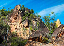
About Auburn River National Park The Auburn River National Park is a hidden gem located near Brisbane, Queensland, Australia. This picturesque park is nestled in the heart of the Burnett Valley and offers visitors a serene escape into nature. The park covers an area of 7,090 hectares and is home to a diverse range of flora and fauna. Location and Geographical Overview The Auburn River National Park is situated approximately 180 kilometers northwest of Brisbane. The park is easily accessible by car and is located near the town of Mundubbera. The park is characterized by rugged sandstone cliffs, dense eucalypt forests, and the tranquil Auburn River. Opening and Closing Time The Auburn River National Park is open to visitors from sunrise to sunset. It is recommended to check the park's official website or contact the park office for the most up-to-date information on opening hours. Entry Fee There is no entry fee to access the Auburn River National Park. Visitors can enjoy the park's natural beauty and amenities free of charge. Species-Flora/Fauna Availability The Auburn River National Park is teeming with a wide variety of plant and animal species. Visitors may encounter native wildlife such as kangaroos, wallabies, koalas, and an array of bird species. The park is also home to diverse flora, including eucalypt forests, acacia woodlands, and native grasses. Activities Performed Visitors to the Auburn River National Park can partake in a range of activities, including bushwalking, birdwatching, picnicking, camping, and fishing. The park offers several well-maintained walking trails that allow visitors to explore the natural beauty of the area. Jeep Safari Charges For those looking to explore the park in a more adventurous way, jeep safari tours are available for a fee. The charges for jeep safari tours may vary depending on the tour operator and the duration of the tour. Age Criterion and Entry Fee There is no specific age criterion for entry to the Auburn River National Park. Visitors of all ages are welcome to enjoy the park free of charge. Senior Citizen Facilities The Auburn River National Park offers facilities to accommodate senior citizens, including accessible walking trails, picnic areas, and restroom facilities. Senior citizens can also avail themselves of discounted rates for jeep safari tours, if available. Best Time to Visit The best time to visit the Auburn River National Park is during the cooler months of the year, from April to September. The weather during this time is pleasant, making it ideal for outdoor activities such as hiking and camping. Nearby Places to Visit For those looking to explore more of the region, there are several nearby attractions worth visiting. These include the town of Mundubbera, Mount Perry, and Cania Gorge National Park. Each of these destinations offers its own unique natural beauty and attractions. Vehicle Parking Facility The Auburn River National Park provides ample parking facilities for visitors. There are designated parking areas near the park entrance, as well as near popular trailheads and picnic areas. Rules and Regulations Visitors to the Auburn River National Park are required to follow certain rules and regulations to help protect the park's natural environment. Some key rules include: staying on designated trails, respecting wildlife and vegetation, disposing of waste properly, and following any posted signs or guidelines. How to Reach and Other Related Information To reach the Auburn River National Park from Brisbane, visitors can take the Bruce Highway north towards the town of Mundubbera. From Mundubbera, follow the signs to the park entrance. It is recommended to have a reliable vehicle as some roads leading to the park may be unpaved or rough. For more information, visitors can contact the park office or visit the official website for updates on park conditions and amenities. Overall, the Auburn River National Park offers visitors a peaceful retreat into nature, with plenty of opportunities to explore, relax, and appreciate the beauty of the Australian landscape.
Explore More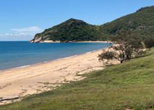
Bowling Green Bay National Park
About Bowling Green Bay National Park Bowling Green Bay National Park is a stunning natural reserve located in the outskirts of Brisbane, Australia. Covering an area of 53,100 hectares, the park is known for its diverse landscapes, including rugged mountains, lush rainforests, and pristine beaches. The park is home to a wide variety of flora and fauna, making it a popular destination for nature enthusiasts and wildlife lovers. Location and Geographical Overview The Bowling Green Bay National Park is situated approximately 45 kilometers south of Townsville, in the Northern Queensland region. The park is bordered by the towns of Alligator Creek to the south and Nome to the north. It is easily accessible by car via the Bruce Highway. Open and Closing Time The park is open to visitors throughout the year, from sunrise to sunset. However, it is recommended to check the official website or contact the park ranger station for the latest information on opening and closing times, as they may vary depending on the season. Entry Fee Entry to Bowling Green Bay National Park is free for all visitors. There are no charges for admission, allowing everyone to enjoy the natural beauty and serenity of the park without any financial burden. Species-Flora/Fauna Availability The park is rich in biodiversity, with a wide range of plant and animal species. Visitors can expect to see various types of birds, reptiles, mammals, and insects, along with diverse vegetation such as eucalypt forests, mangroves, and grasslands. Some of the notable species found in the park include wallabies, koalas, and numerous bird species. Activities Performed Visitors to Bowling Green Bay National Park can engage in a variety of activities, including bushwalking, birdwatching, camping, picnicking, fishing, and swimming. The park offers several walking trails of varying lengths and difficulties, allowing visitors to explore the natural surroundings at their own pace. Jeep Safari Charges For those looking to explore the park in a more adventurous way, jeep safari tours are available for a fee. The charges for jeep safari tours may vary depending on the duration and services included, so it is advisable to inquire with the tour operator or ranger station for more information. Age Criterion and Entry Fee There are no specific age criteria for visitors to enter Bowling Green Bay National Park. However, children under the age of 16 must be accompanied by an adult. As mentioned earlier, entry to the park is free for all visitors, regardless of age or gender. Senior Citizen Facilities The park offers facilities for senior citizens, including wheelchair-accessible trails, designated parking spaces, and rest areas with seating. Senior citizens can enjoy the natural wonders of the park comfortably and safely, with amenities to meet their specific needs. Best Time to Visit The best time to visit Bowling Green Bay National Park is during the cooler months of the year, from May to September. This period offers pleasant weather conditions for outdoor activities such as hiking and camping, with lower chances of rain and humidity. However, the park is open year-round, so visitors can plan their visit according to their preferences. Nearby Places to Visit There are several attractions and points of interest near Bowling Green Bay National Park that visitors can explore. Some popular nearby destinations include Mount Elliot, Cape Cleveland Lighthouse, and Alligator Creek Falls. These sites offer additional opportunities for sightseeing, outdoor adventures, and cultural experiences. Vehicle Parking Facility The park provides designated parking areas for visitors arriving by car. Parking facilities are available near the entrance to the park, as well as at various trailheads and picnic areas. Visitors are reminded to follow the parking regulations and avoid blocking access roads or emergency exits. Rules and Regulations While visiting Bowling Green Bay National Park, visitors are required to adhere to certain rules and regulations to ensure the preservation of the natural environment and the safety of all guests. Some common rules include staying on designated trails, disposing of rubbish properly, and respecting wildlife habitats. It is important to respect the park rules and regulations to help protect this natural treasure for future generations. How to Reach and Other Related Information Travelers can reach Bowling Green Bay National Park by car via the Bruce Highway, which connects the park to major cities and towns in the region. The nearest airport is Townsville Airport, which is located approximately 35 kilometers north of the park. Visitors can also access the park by public transportation, such as buses or organized tours. For more information on visiting Bowling Green Bay National Park, including trail maps, camping reservations, and ranger-led activities, visitors can contact the park authorities or visit the official website. Whether you are a nature lover, adventure enthusiast, or simply seeking a peaceful retreat, Bowling Green Bay National Park offers a memorable experience for all who visit.
Explore More
Kosciuszko National Park is a vast protected area located in the southeastern corner of New South Wales, Australia. Encompassing 6,900 square kilometers, it is renowned for its diverse landscapes, ranging from alpine peaks to dense forests and pristine rivers. The park is home to Mount Kosciuszko, the highest peak in Australia, and Cabramurra, the highest town in the country. Established in 1967, the park offers a myriad of recreational activities year-round, attracting nature enthusiasts, adventure seekers, and those interested in Australia's rich cultural heritage. How to Reach Kosciuszko National Park, Cabramurra To reach Kosciuszko National Park and Cabramurra, travelers can drive from major cities like Sydney or Canberra. From Sydney, the journey takes approximately 5.5 hours, while from Canberra, it's about a 2.5-hour drive. The park is accessible via the Snowy Mountains Highway, with well-maintained roads leading to various entry points. However, during winter months (June to October), some roads may be closed due to snow, so it's essential to check current conditions before traveling. Weather and Timing The weather in Kosciuszko National Park varies significantly with the seasons. Winters are cold and snowy, with temperatures often dropping below freezing and snow covering the mountains from June to September. Summer months (December to February) are milder, with daytime temperatures ranging from 10°C to 25°C, making it ideal for hiking and camping. Visitors are advised to check weather forecasts regularly, as conditions can change rapidly in alpine environments. Why Is Cabramurra Famous? Cabramurra holds historical significance as the highest town in Australia, situated at an elevation of 1,481 meters. Established in 1954 as part of the Snowy Mountains Scheme, the town served as a base for workers involved in the hydro-electric project. The town's unique architecture, designed to withstand heavy snowfall, and its role in Australia's engineering history contribute to its fame. Entry and Visit Details about Kosciuszko National Park Entry to Kosciuszko National Park requires a valid park pass. During winter months (June to October long weekends), the vehicle entry fee is $29 per day. During the rest of the year, the fee is $17 per day. Passes can be purchased at entry stations, NPWS visitor centres, pay machines, or via the Park'nPay app. It's important to note that some roads and trails in the Cabramurra area may close due to weather conditions or park management issues during winter months. History and Architecture The origins of Cabramurra trace back to nearby Kiandra, where skiing began in Australia around 1861. The more reliable snow cover at Selwyn led to the establishment of a portable rope tow in 1966. Over the years, the resort has evolved, with significant developments including the installation of a triple chairlift in 2009. Unfortunately, the resort was heavily impacted by the 2019–2020 bushfires, leading to the loss of many facilities. However, it has since been rebuilt and reopened in 2023, offering modern amenities and improved infrastructure. Things to Do in Kosciuszko National Park Kosciuszko National Park offers a wide range of activities for visitors: Skiing and Snowboarding: The park is home to several ski resorts, including Thredbo, Perisher, and Charlotte Pass, offering excellent slopes for all skill levels. Hiking: The Australian Alps Walking Track crosses almost the length of the park, providing stunning views and diverse landscapes. Camping: Numerous campgrounds are available, such as Sawpit Creek, offering facilities for tents and caravans. Fishing: The park's rivers and lakes are stocked with trout, and seasonal fishing is allowed with a permit. Wildlife Watching: The park is home to diverse wildlife, including the endangered southern corroboree frog, which is the focus of conservation efforts. Facts and Tips about Kosciuszko National Park Interesting Facts: The park encompasses 6,900 square kilometers, making it one of the largest national parks in New South Wales. Mount Kosciuszko, the highest peak in Australia, is located within the park. The Snowy River, Murray River, Murrumbidgee River, and Gungarlin River all originate in the park. On 7 November 2008, the park was added to the Australian National Heritage List as part of the Australian Alps National Parks and Reserves. Travel Tips: Always check road conditions before traveling, as weather can change rapidly in alpine areas. Ensure your vehicle is equipped with snow chains during winter months, as required by park regulations. Dress in layers and wear waterproof clothing to stay comfortable in cold and wet conditions. Stay hydrated and take regular breaks to prevent fatigue, especially when engaging in snow activities. Respect all safety signs and instructions provided by park staff to ensure a safe experience.
Explore More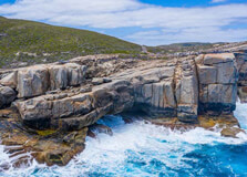
Torndirrup National Park, located just 25 kilometers southeast of Albany, Western Australia, is a breathtaking natural attraction that showcases the rugged beauty of the region’s coastline. With its stunning cliffs, spectacular ocean views, diverse ecosystems, and remarkable geological formations, the park is a haven for nature lovers, outdoor enthusiasts, and those seeking to experience the region's raw beauty. From towering granite peaks to lush coastal heathland, Torndirrup National Park is a must-visit destination when exploring Albany. How to Reach Torndirrup National Park, Albany Torndirrup National Park is easily accessible from the town of Albany, just a short drive away. To get to the park, head south from Albany’s city center on the Lower King Road, and follow the signs to the park. The drive takes around 30 minutes, offering a scenic route with beautiful views of the surrounding landscape. The park is located along the southern coast of Western Australia, where the Great Southern Ocean meets the rugged landforms of the Torndirrup Peninsula. If you are traveling from Perth, Albany is approximately a 4-5 hour drive (around 400 kilometers) via the Albany Highway. Visitors can also take a bus or hire a car to explore the area, or even bike along the scenic routes that lead to the park. If arriving by air, Albany Airport (ALH) is just 30 minutes away by car from the park. Weather and Best Time to Visit Torndirrup National Park experiences a temperate climate with warm, dry summers and mild, wet winters. The best time to visit the park is during the spring and summer months (from September to April), when the weather is warmer, and the days are sunny and pleasant, perfect for exploring the outdoor landscapes and enjoying coastal walks. Average temperatures during summer range from 17°C to 25°C, and rainfall is minimal. In autumn and winter (from May to August), the weather can be cooler and wetter, but the park is still accessible. If you prefer fewer crowds and cooler temperatures, this is also a good time to visit. Always check the weather forecast before your visit to ensure the best experience and to prepare for any changes in conditions. Timing and Entry Details Torndirrup National Park is open year-round, providing visitors with ample opportunity to explore its natural beauty. There is no entrance fee to access the park, as it is a public natural reserve. However, some specific attractions within the park, such as the visitor center or the interpretive displays at various lookouts, may have individual operating hours. Most of the park’s scenic spots, including the famous natural formations like The Gap and Natural Bridge, are accessible throughout the day. The park’s walking trails, including those leading to the iconic viewing platforms, are open from dawn until dusk, giving visitors plenty of time to explore. As there are no gates or specific opening hours for general park access, visitors can enjoy the park at their own convenience, although it’s always a good idea to arrive during daylight hours for safety and to fully appreciate the views. Why Torndirrup National Park is Famous Torndirrup National Park is famous for its dramatic and awe-inspiring coastal scenery, featuring iconic natural landmarks that draw visitors from all over the world. Some of the key highlights include the famous Gap and Natural Bridge, two stunning rock formations that have been carved over millions of years by the relentless forces of wind and water. These spectacular geological features offer panoramic views of the Southern Ocean and are among the most photographed sites in Albany. The park also features diverse ecosystems, from coastal heathlands to granite peaks, providing an ideal environment for wildlife and plant enthusiasts. With its unique blend of history, natural beauty, and outdoor adventure opportunities, Torndirrup National Park is a top destination for those visiting Albany. History and Architecture of Torndirrup National Park Torndirrup National Park is rich in both cultural and geological history. The park is named after the local Aboriginal word “Torndirrup,” which means “the place where the rocks meet the sea,” perfectly describing the striking coastal features found in the park. The area has long been significant to the local Noongar people, who have deep cultural connections to the land. The park contains remnants of the region's Indigenous heritage, including sacred sites and traditional routes used by the Noongar people. In terms of architecture, the park does not feature traditional buildings or man-made structures but instead showcases natural rock formations and landscapes. One of the key architectural elements is the purpose-built viewing platform at The Gap, designed to give visitors a safe and unobstructed view of the ocean below. Similarly, the Natural Bridge has an engineered pathway and viewing platform that allows visitors to observe this impressive formation without disturbing the environment. Things to Do at Torndirrup National Park Torndirrup National Park offers a wide range of activities for visitors, from scenic drives and walks to wildlife watching and photography. Some of the best things to do in the park include: Explore The Gap: One of the park’s most popular attractions, The Gap is a deep chasm that plunges into the Southern Ocean. Visitors can stand on the viewing platform and marvel at the sheer drop, feeling the power of the ocean below. Visit the Natural Bridge: A stunning rock formation that has been carved by the elements, the Natural Bridge is a unique natural wonder. The nearby boardwalk offers great views and photo opportunities. Take a Scenic Drive: The park is accessible by car, and a scenic drive along the coastal route offers breathtaking views of the ocean and surrounding landscape. There are several viewpoints along the way where you can stop and take in the beauty of the area. Hike the Trails: There are several walking trails in the park, offering varying levels of difficulty. Whether you prefer short coastal walks or longer hikes through the park's unique landscapes, there’s a trail for every fitness level. Wildlife Watching: Torndirrup National Park is home to a wide range of wildlife, including kangaroos, emus, and numerous bird species. It is also a great spot for whale watching during migration season (June to October). Photography: The park’s dramatic coastal landscapes, fascinating rock formations, and abundant wildlife make it a photographer’s paradise. Be sure to bring a camera to capture the stunning views. Facts About Torndirrup National Park Here are some interesting facts about Torndirrup National Park: The park covers an area of approximately 16,000 hectares. Torndirrup National Park is known for its stunning granite rock formations that have been shaped over millions of years by erosion from the ocean. The Gap and Natural Bridge are some of the most famous geological landmarks in Western Australia. The park is located within the Great Southern Region of Western Australia, a popular area for nature-based tourism. In addition to its natural beauty, Torndirrup National Park is a great place for fishing, boating, and picnicking. Tips for Visiting Torndirrup National Park To make the most of your visit to Torndirrup National Park, here are a few tips: Wear Comfortable Footwear: The park has several walking trails and rocky terrain, so be sure to wear sturdy, comfortable shoes suitable for hiking and exploring. Bring Water and Snacks: While there are some picnic areas in the park, it’s always a good idea to bring your own water and snacks to stay refreshed during your visit. Check the Weather: The weather along the coast can change quickly, so it’s important to check the forecast before heading out, especially if you're planning to hike or engage in outdoor activities. Respect the Environment: Torndirrup National Park is a protected natural area, so be sure to follow Leave No Trace principles to preserve the park’s beauty and wildlife. Bring a Camera: Don’t forget to bring a camera to capture the stunning coastal views, wildlife, and unique geological features of the park. Conclusion Torndirrup National Park is one of the most scenic and historically significant natural attractions in Albany, Western Australia. With its dramatic landscapes, iconic geological formations, and diverse ecosystems, the park offers a range of activities and stunning views for visitors of all ages. Whether you're hiking along the coastal trails, photographing the impressive rock formations, or simply relaxing and enjoying the serene atmosphere, Torndirrup National Park is a must-visit destination for anyone exploring Albany and the Great Southern Region of Western Australia.
Explore More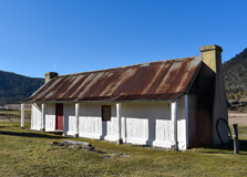
Namadgi National Park is a stunning natural reserve located near Canberra, offering breathtaking landscapes, rich Aboriginal heritage, and diverse wildlife. The park covers nearly half of the Australian Capital Territory and is a paradise for nature lovers and outdoor enthusiasts. How to Reach Namadgi National Park, Canberra By Car: A 40-minute drive from Canberra city center via the Boboyan Road or Naas Road. By Bus: No direct public transport, but tours and private transfers are available. By Bicycle: Suitable for experienced cyclists looking for an adventurous route. Weather in Namadgi National Park The park experiences seasonal variations: Summer (December-February): Warm days, cool nights, 10-30°C (50-86°F). Autumn (March-May): Mild temperatures, 5-20°C (41-68°F). Winter (June-August): Cold with occasional snow in higher areas, -2 to 12°C (28-54°F). Spring (September-November): Blooming wildflowers, 5-22°C (41-72°F). Timings of Namadgi National Park Open year-round, but visitor center hours vary. The Namadgi Visitor Centre is open daily from 9 AM to 4 PM (closed on Christmas Day). Why is Namadgi National Park Famous? The park is known for its rich Aboriginal rock art sites, hiking trails, stunning granite formations, and diverse ecosystems. It is also home to many native Australian animals, including kangaroos, wombats, and echidnas. Entry and Visit Details Entry Fees: Free entry, but camping fees apply. Facilities: Visitor center, picnic areas, campsites, and marked trails. History and Architecture The park has been an important site for Aboriginal people for thousands of years. The rock shelters and rock art sites, such as those at Yankee Hat, provide insight into the rich cultural history of the Ngunnawal people. European settlers later used the land for grazing and forestry before it was designated a national park. Things to Do Hiking: Explore trails like Booroomba Rocks, Gibraltar Peak, and Yankee Hat Rock Art Walk. Wildlife Watching: Spot kangaroos, wallabies, and various bird species. Camping: Stay overnight at designated campgrounds for an immersive experience. Rock Climbing: Popular climbing areas include Booroomba Rocks. Photography: Capture breathtaking landscapes and wildlife. Facts about Namadgi National Park, Canberra Occupies nearly 46% of the Australian Capital Territory. Home to over 400 species of native plants and animals. Contains Aboriginal rock art dating back thousands of years. Recognized as part of the Australian Alps National Parks system. Tips for Visiting Check weather conditions before visiting, as temperatures can vary. Carry sufficient water and food, as there are limited facilities. Wear sturdy footwear for hiking and outdoor activities. Respect Aboriginal sites and avoid touching rock art. Follow Leave No Trace principles to protect the environment.
Explore More
Freycinet National Park is one of Tasmania’s most stunning natural attractions, featuring dramatic pink granite mountains, white sandy beaches, and crystal-clear waters. It is home to the famous Wineglass Bay and offers visitors a range of outdoor experiences, from hiking to wildlife spotting. How to Reach Freycinet National Park, Tasmania By Car: The park is approximately a 2.5-hour drive from Hobart and Launceston via the Tasman Highway. By Bus: Shuttle services operate from Hobart and Launceston to the park. By Air: The nearest airports are in Hobart and Launceston, with car rentals available for further travel. Weather in Freycinet National Park The park experiences a mild coastal climate: Summer (December-February): Warm and dry, 10-24°C (50-75°F). Autumn (March-May): Cool and pleasant, 6-20°C (43-68°F). Winter (June-August): Mild but chilly at night, 3-15°C (37-59°F). Spring (September-November): Fresh and blooming, 6-21°C (43-70°F). Timings of Freycinet National Park, Tasmania The park is open year-round, 24 hours a day. Visitor centers typically operate from 9 AM to 5 PM. Why is Freycinet National Park, Tasmania Famous? Freycinet National Park is best known for its stunning landscapes, particularly Wineglass Bay, one of the world’s most beautiful beaches. It is also a haven for native wildlife and offers excellent hiking, kayaking, and birdwatching opportunities. Entry and Visit Details Entry Fees: A National Parks Pass is required, available for daily or extended visits. Public Access: The park is accessible via car, with various walking tracks and guided tours available. History and Landscape Established in 1916, Freycinet National Park is Tasmania’s oldest national park. The park features rugged pink granite peaks, coastal heathlands, and abundant marine life. Aboriginal heritage is also present in the park, with ancient shell middens and rock art found in several locations. Things to Do Wineglass Bay Lookout: Hike to this world-famous viewpoint for breathtaking views. Hiking: Explore trails such as the Hazards Beach Circuit and Mount Amos climb. Kayaking: Paddle along the coastline to enjoy the stunning scenery from the water. Wildlife Spotting: See wallabies, echidnas, and diverse bird species. Camping: Stay overnight at designated camping areas within the park. Facts about Freycinet National Park, Tasmania Named after French navigator Louis de Freycinet. Home to the iconic Wineglass Bay, frequently ranked among the world’s top beaches. The pink granite mountains, known as The Hazards, change colors at different times of the day. Tips for Visiting Wear comfortable hiking shoes if planning to explore trails. Carry plenty of water and sun protection, especially in summer. Check weather conditions before visiting for the best experience. Book accommodations in advance, especially during peak seasons.
Explore MoreNew Zealand - Australia 16 Nights 17 Days Tour
17 Days/ 16 Night
Sydney - Melbourne - Auckland - Christchurch - Rotorua - Queenstown - Gold Coast
Best Of Melbourne - Culture - Coffee - Coast 3 Nights - 4 Days Tour
4 Days/ 3 Night
Melbourne
Australian Getaway With Tangalooma Island 10 Nights - 11 Days Tour
11 Days/ 10 Night
Sydney - Melbourne - Gold Coast
Majestic Australia 11 Nights - 12 Days Tour
12 Days/ 11 Night
Sydney - Cairns - Melbourne - Gold Coast
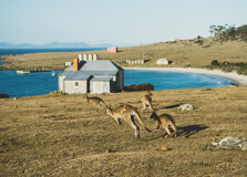
Maria Island National Park is a stunning natural reserve located off the east coast of Tasmania. Known for its breathtaking landscapes, rich history, and diverse wildlife, the island is a haven for nature lovers and adventure seekers. How to Reach Maria Island National Park, Tasmania By Car: Drive to Triabunna, about 1.5 hours from Hobart, where you can take the ferry. By Ferry: A ferry service operates from Triabunna to Maria Island, with regular departures. By Foot/Bike: Once on the island, explore by walking or cycling as no vehicles are allowed. Weather in Maria Island Maria Island has a temperate maritime climate: Summer (December-February): 12-25°C (54-77°F), warm and dry. Autumn (March-May): 8-20°C (46-68°F), mild and pleasant. Winter (June-August): 3-14°C (37-57°F), cool with occasional rainfall. Spring (September-November): 6-19°C (43-66°F), fresh and blooming. Timings of Maria Island National Park Maria Island is open year-round, but ferry schedules vary seasonally. It is best to check ferry availability in advance. Why is Maria Island National Park, Tasmania Famous? The park is famous for its pristine landscapes, rich wildlife including wombats and Tasmanian devils, historic ruins, and scenic hiking trails like the Painted Cliffs and Bishop and Clerk walk. Entry and Visit Details Entry Fees: National park fees apply, and ferry tickets need to be purchased separately. Facilities: Campsites, basic accommodation, and visitor information available. History and Architecture Maria Island was used as a convict settlement in the 1820s and later became a farming area before being designated a national park. The Darlington Probation Station, a UNESCO World Heritage site, is a key historical attraction. Things to Do Hike to Bishop and Clerk: A challenging trail with stunning views. Visit the Painted Cliffs: Marvel at the unique sandstone formations. Spot Wildlife: Look for wombats, kangaroos, and rare bird species. Explore Darlington: Discover convict-era ruins and learn about the island's past. Go Snorkeling or Kayaking: Experience the island’s marine life. Facts about Maria Island National Park, Tasmania The island has no cars, making it a peaceful retreat. It was declared a national park in 1972. Home to one of Tasmania’s largest wombat populations. Tips for Visiting Bring sufficient food and water as there are no shops on the island. Wear sturdy hiking shoes for exploring trails. Book ferry tickets in advance, especially during peak seasons. Carry a camera to capture the stunning scenery and wildlife.
Explore More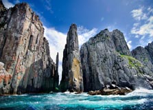
Tasman National Park is a spectacular natural reserve located on the Tasman Peninsula in Tasmania. Known for its dramatic coastal scenery, towering sea cliffs, and abundant wildlife, the park is a paradise for nature lovers, hikers, and adventure seekers. How to Reach Tasman National Park, Tasmania By Car: The park is about a 90-minute drive from Hobart via the Arthur Highway. By Bus: Public transport options are limited, but some tour operators provide day trips from Hobart. By Boat: Several boat tours operate along the coastline, offering spectacular views of the park’s cliffs and marine wildlife. Weather in Tasman National Park Tasman National Park has a temperate maritime climate: Summer (December-February): 12-24°C (54-75°F), warm and dry. Autumn (March-May): 8-20°C (46-68°F), mild and pleasant. Winter (June-August): 4-13°C (39-55°F), cool with frequent rain. Spring (September-November): 7-18°C (45-64°F), fresh and blooming. Timings of Tasman National Park The park is open year-round, with access available at all times. However, guided tours and boat cruises have specific schedules. Why is Tasman National Park, Tasmania Famous? The park is renowned for its breathtaking sea cliffs, rock formations such as the Tasman Arch and the Blowhole, as well as its diverse wildlife, including seals, dolphins, and seabirds. It is also a popular destination for hiking and coastal adventures. Entry and Visit Details Entry Fees: A valid national park pass is required. Facilities: Picnic areas, walking trails, and visitor information points are available. History and Architecture The Tasman Peninsula has a rich Indigenous and European history. It was once home to the Pydairrerme people and later became a significant site during Tasmania’s convict era, with Port Arthur Historic Site nearby. Things to Do Explore the Three Capes Track: A multi-day hiking experience with stunning views. Visit the Tasman Arch and Devil’s Kitchen: Impressive natural rock formations. Take a Boat Tour: See the park’s dramatic cliffs and marine wildlife. Spot Wildlife: Keep an eye out for seals, dolphins, and rare bird species. Enjoy Photography: Capture the rugged coastline and towering cliffs. Facts about Tasman National Park, Tasmania Home to some of the tallest sea cliffs in the Southern Hemisphere. Declared a national park in 1999. Contains significant Aboriginal cultural sites. Tips for Visiting Wear sturdy hiking shoes for exploring trails. Check weather conditions before visiting, as coastal winds can be strong. Bring binoculars for spotting wildlife and birdwatching. Carry sufficient food and water, as services are limited in some areas.
Explore More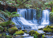
Mount Field National Park is one of Tasmania’s oldest and most diverse national parks, offering stunning landscapes, cascading waterfalls, and rich wildlife. It is a paradise for nature lovers and outdoor enthusiasts. How to Reach Mount Field National Park, Tasmania By Car: The park is approximately a 1.5-hour drive from Hobart via the Lyell Highway. By Bus: Some tour operators offer day trips from Hobart. Weather in Mount Field National Park The park has a cool temperate climate with seasonal variations: Summer (December-February): 10-24°C (50-75°F), mild and pleasant. Autumn (March-May): 6-18°C (43-64°F), cool with colorful foliage. Winter (June-August): 0-10°C (32-50°F), often snowy, especially at higher altitudes. Spring (September-November): 5-16°C (41-61°F), fresh and green. Timings of Mount Field National Park The park is open year-round, but visitor facilities operate at different times. The Visitor Centre is open daily. Why is Mount Field National Park, Tasmania Famous? It is famous for its breathtaking waterfalls like Russell Falls, diverse ecosystems, alpine landscapes, and rich wildlife, including platypuses and wombats. Entry and Visit Details Entry Fees: A valid national park pass is required. Facilities: Visitor Centre, picnic areas, walking trails, and restrooms are available. History and Architecture Declared a national park in 1916, Mount Field has a rich history of conservation. The park's landscapes have been shaped by glacial activity, and it contains unique alpine flora. Things to Do Visit Russell Falls: One of Tasmania’s most iconic waterfalls. Hike the Tarn Shelf: A breathtaking alpine walk. See Lake Dobson: A scenic lake surrounded by ancient rainforest. Spot Wildlife: Wombats, pademelons, and echidnas are common. Photography: Capture the stunning landscapes and waterfalls. Facts about Mount Field National Park, Tasmania Home to some of Tasmania’s tallest trees, the swamp gums. Part of the Tasmanian Wilderness World Heritage Area. The park’s higher elevations often experience snowfall in winter. Tips for Visiting Wear warm clothing, as weather can change quickly. Check for road closures in winter due to snow. Bring a camera to capture the stunning scenery. Carry food and water, as options inside the park are limited.
Explore More
Karijini National Park is one of Western Australia's most stunning natural attractions, located in the heart of the Pilbara region. Renowned for its breathtaking gorges, waterfalls, and rugged red landscapes, Karijini covers over 6,000 square kilometers, making it the second-largest national park in Western Australia. The park offers a unique blend of natural beauty, adventure, and Aboriginal cultural heritage, drawing visitors from across Australia and around the world. How to Reach Karijini National Park, Pilbara Karijini National Park is located approximately 1,400 kilometers north of Perth. The closest town is Tom Price, which is about 80 kilometers away. Visitors can reach the park via several methods: By Car: The most common way to reach Karijini is by driving. It is accessible by sealed and unsealed roads, so a 4WD vehicle is recommended for exploring the park's interior roads. By Air: The nearest airport is Paraburdoo Airport (around 100 km away), with regular flights from Perth. Car rentals are available at the airport for the drive to the park. By Tour: There are guided tour packages available from major cities or towns like Exmouth, Broome, and Perth that include transportation and accommodations. Weather in Karijini National Park Karijini experiences a semi-arid climate with hot summers and mild winters. The best time to visit is during the cooler months from April to September when daytime temperatures range between 20°C and 30°C (68°F to 86°F). Summer (December to February) can be extremely hot, with temperatures soaring above 40°C (104°F), and there may be occasional thunderstorms or cyclones. Visitors should always check weather conditions before traveling, as roads can become impassable during rain. Timing of Visit Karijini National Park is open year-round. However, visitor facilities like the Karijini Visitor Centre typically operate between 9:00 AM and 4:00 PM daily. Some areas may be closed temporarily due to weather or maintenance, so it’s advisable to check the official website or local notices for the latest information. Why is Karijini National Park Famous in Pilbara? Karijini is famous for its dramatic landscapes, ancient geological formations, and crystal-clear pools. The park’s gorges, such as Hancock Gorge, Weano Gorge, and Dales Gorge, offer breathtaking views and challenging hikes. Pilbara’s rugged terrain and red earth give the park its distinctive and photogenic look, making it a favorite among photographers and adventure travelers. Additionally, the park is a spiritual place for the Banyjima, Kurrama, and Innawonga Aboriginal people, adding a rich cultural element to its significance. Entry and Visit Details Visitors must pay a park entry fee, which goes toward maintenance and conservation efforts. As of the latest update: Private vehicle (up to 12 passengers): AUD $15 per day Concession holders: AUD $8 per day Park passes are available for extended visits or multiple parks Camping is allowed in designated campgrounds such as Dales Campground and the Eco Retreat. These may require bookings and have fees associated with overnight stays. History and Natural Architecture The natural architecture of Karijini is millions of years in the making. Its deep gorges, plateaus, and waterfalls have been carved over two billion years by erosion and weathering. The iron-rich rocks give the land its vibrant red color, and some of the oldest rocks on Earth can be found here. The park also holds cultural significance for the Aboriginal communities who have lived in the area for tens of thousands of years. Sacred sites, rock art, and traditional stories connect the people deeply to the land. Things to Do in Karijini National Park There are plenty of exciting and relaxing activities in Karijini: Hiking: Explore gorges like Hancock, Weano, and Kalamina. Some hikes lead to hidden pools and waterfalls. Swimming: Refresh yourself in natural pools such as Fern Pool and Circular Pool. Camping: Enjoy stargazing at night from campgrounds within the park. Photography: Capture stunning landscapes, especially at sunrise and sunset. Wildlife Watching: Spot kangaroos, echidnas, goannas, and various bird species. Visit the Karijini Visitor Centre: Learn about geology, flora, fauna, and Indigenous culture. Facts and Tips about Karijini National Park, Pilbara Interesting Facts: Karijini is over 2 billion years old geologically. The park was formerly known as Hamersley Range National Park. It is one of the best places in Australia to see banded iron formations. The park is home to unique plant species adapted to the arid climate. Travel Tips: Bring plenty of water and food, as facilities are limited. Wear sturdy shoes for hiking and be cautious on slippery rocks. Mobile reception is limited, so download maps beforehand. Respect the natural environment and Indigenous cultural sites. Check road and weather conditions in advance, especially during the wet season. Whether you're a seasoned adventurer or a nature lover, Karijini National Park offers a raw and unforgettable outback experience in the heart of Pilbara. Its majestic gorges, vibrant flora and fauna, and deep cultural roots make it a must-visit destination in Western Australia.
Explore More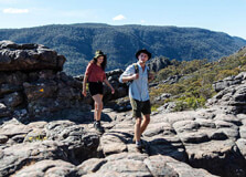
Grampians National Park, located in the western part of Victoria, Australia, is one of the state’s most spectacular natural attractions. Known for its striking sandstone mountain ranges, dramatic cliffs, rich Aboriginal heritage, and diverse flora and fauna, the park offers something for every kind of traveler. Locally referred to as “The Grampians” and known as “Gariwerd” to the traditional owners, the park covers over 167,000 hectares and is a top destination for hiking, camping, and wildlife watching. The park is also home to a wide array of native wildlife such as kangaroos, emus, echidnas, and a vibrant bird population. With waterfalls, panoramic lookouts, and ancient rock art sites, Grampians National Park is both a natural and cultural treasure. How to Reach Grampians National Park, Victoria, Australia Grampians National Park is accessible by road and is located approximately 260 kilometers northwest of Melbourne. Here are the main options for reaching the park: By Car: Driving is the most convenient way to reach the Grampians. From Melbourne, take the Western Freeway toward Ballarat and continue on to Ararat and Halls Gap, the main tourist village inside the park. The journey takes about 3 hours. By Bus: V/Line operates buses to Ararat, and from there, you can take a connecting service to Halls Gap. Services may be limited, so check schedules in advance. By Tour: Several tour companies offer guided day trips and multi-day tours to the Grampians from Melbourne, often including stops at major lookouts and Aboriginal sites. Weather and Best Time to Visit The Grampians experience a temperate climate, which means the park can be visited year-round. However, each season offers a different experience: Spring (September to November): This is one of the best times to visit, with wildflowers blooming and mild temperatures. It’s also a great time for hiking. Summer (December to February): Temperatures can rise above 30°C. Some trails may be closed due to fire danger, so check local warnings. Autumn (March to May): Cooler temperatures and fewer crowds make this a great time for outdoor activities and photography. Winter (June to August): Cold and occasionally wet, but the misty mountain views can be magical. Ideal for cozy cabin stays and quieter hikes. Why is Grampians National Park Famous? Grampians National Park is famous for several reasons that make it a unique and attractive destination in Victoria: Stunning Landscapes: The park features rugged mountain peaks, dramatic escarpments, and deep valleys. Aboriginal Rock Art: Home to some of the most significant Aboriginal rock art sites in southeastern Australia. Hiking Trails: Popular for its extensive walking tracks, including day hikes and multi-day treks. Waterfalls and Lookouts: Highlights include MacKenzie Falls and The Pinnacle Lookout. Flora and Fauna: The park is a biodiversity hotspot with hundreds of native plant species and plenty of native animals. Entry and Visit Details Entry to Grampians National Park is free for day visitors. However, fees may apply for camping, guided tours, and parking in some areas. Visitors should stop by the Brambuk the National Park and Cultural Centre in Halls Gap to get maps, information, and learn about the park’s cultural significance. Facilities in the park include walking trails, picnic areas, campgrounds, and public toilets. Visitors are encouraged to bring water, food, and supplies, especially if planning extended hikes. History and Architecture Grampians National Park has a rich history that dates back tens of thousands of years. The area has been home to Aboriginal communities for at least 20,000 years, and the rock art found in caves and on cliffs tells stories of Dreamtime and daily life. Architecturally, the park does not contain man-made structures in the traditional sense but is instead “sculpted” by nature. Towering sandstone cliffs, narrow gorges, and rock overhangs serve as natural monuments. The rock art sites, such as Bunjil’s Shelter and Ngamadjidj Shelter, are among the most culturally important in Victoria. Things to Do in Grampians National Park Hiking: Explore trails like The Pinnacle, Mount William, and Wonderland Loop. Visit Waterfalls: MacKenzie Falls, Silverband Falls, and Fish Falls are must-sees. Aboriginal Culture: Learn about local Indigenous history at Brambuk Cultural Centre and explore ancient rock art sites. Wildlife Watching: Spot kangaroos, wallabies, and emus roaming freely. Photography: Capture sunrise or sunset at Reeds and Boroka Lookouts. Rock Climbing: The Grampians are a top destination for climbers from around the world. Camping and Stargazing: Enjoy the night sky in one of the many scenic campsites. Facts and Travel Tips The Grampians were added to the Australian National Heritage List in 2006. “Gariwerd” is the traditional Aboriginal name for the park and is widely used alongside “Grampians.” Bring plenty of water, especially on long hikes, as supplies are limited within the park. Weather can change quickly; dress in layers and wear sturdy footwear. Mobile phone reception can be patchy; download maps in advance. Look out for wildlife on roads, especially at dawn and dusk. Respect all cultural sites—do not touch rock art or remove any natural materials. Conclusion Grampians National Park is a gem of Victoria and a must-visit for anyone interested in nature, culture, and adventure. Whether you're hiking through rugged terrain, learning about one of the world's oldest living cultures, or simply enjoying the views from a lookout, the Grampians promise an enriching and unforgettable experience. A visit here offers a perfect blend of natural wonder and cultural depth, making it one of the top destinations in Australia.
Explore More
Wilson’s Promontory National Park
Wilson’s Promontory National Park, also known as "The Prom," is one of Victoria’s most beloved natural treasures. Located at the southernmost tip of the Australian mainland, it offers some of the country’s most beautiful landscapes, from pristine beaches to dense forests and rugged mountains. With an area of over 50,000 hectares, Wilson’s Promontory provides an idyllic escape for outdoor enthusiasts, nature lovers, and families looking to explore one of the most diverse ecosystems in Australia. How to Reach Wilson’s Promontory National Park, Victoria, Australia Reaching Wilson’s Promontory is relatively straightforward, though it does require some planning due to its remote location. By Car: The most common way to reach Wilson’s Promontory is by car. From Melbourne, it is about a 2.5 to 3-hour drive (around 200 kilometers) southeast via the South Gippsland Highway (A440) and then the Wilsons Promontory Road. The roads are well-maintained, and signage is clear for visitors traveling to the park. By Bus: Public transport options to the park are limited, but buses operate from Melbourne to nearby towns such as Foster and Fish Creek. From there, visitors can catch a local taxi or use a tour service to reach the park entrance. By Air: The closest airport to Wilson’s Promontory is the Melbourne International Airport. From the airport, travelers can drive or use public transport to reach the park. Alternatively, you can fly to smaller regional airports in the Gippsland area, but a car rental is required for further travel. Weather in Wilson’s Promontory National Park Wilson’s Promontory enjoys a temperate climate with four distinct seasons, making it a year-round destination for outdoor activities. Summers (December to February) are mild, with temperatures ranging from 14°C to 25°C (57°F to 77°F), ideal for hiking, beach outings, and swimming. Winters (June to August) are cool, with temperatures ranging from 6°C to 14°C (43°F to 57°F), and it is common for temperatures to dip below 5°C (41°F) overnight. Rain is common year-round, with the wettest months being in late autumn and winter. Given its coastal location, visitors should be prepared for occasional windy conditions, especially along the coast. It’s always a good idea to check the weather forecast before visiting and pack accordingly. Why Wilson’s Promontory National Park is Famous Wilson’s Promontory is famous for its stunning natural beauty and its status as one of Victoria’s most important national parks. The park is a haven for wildlife, offering a chance to see native Australian species in their natural habitats, including kangaroos, wombats, koalas, and a wide variety of bird species. The park is also renowned for its breathtaking beaches, such as Squeaky Beach, which is famous for its white sand that makes a squeaking sound when walked on. Another key feature of Wilson’s Promontory is its diverse landscapes. The park contains everything from dense forests and eucalypt woodlands to sandy beaches, rocky outcrops, and rugged hills. It’s a haven for outdoor activities such as hiking, camping, wildlife watching, and photography. The park is also a popular destination for marine activities such as snorkelling and diving, with a rich underwater ecosystem. Entry and Visit Details About Wilson’s Promontory National Park Wilson’s Promontory National Park is open every day of the year, though access to certain areas may be restricted during extreme weather events or fire danger periods. The park is managed by Parks Victoria, and visitors are required to pay an entry fee to access the park. The standard entry fee for a vehicle is around $17 per day (subject to change), and this fee grants access to the park’s attractions, roads, and hiking trails. For those wishing to camp, Wilson’s Promontory offers several camping areas, including Tidal River, which is the most popular campground. Tidal River is well-equipped with facilities such as showers, toilets, and BBQ areas, making it an excellent base for exploring the park. Bookings for campsites are highly recommended, especially during peak seasons (summer and school holidays), as the park can get busy. The visitor centre at Tidal River provides maps, brochures, and helpful information about the park. It is also a great place to learn about the park's flora and fauna through exhibits and displays. The centre is open daily from 9:00 AM to 5:00 PM. History and Architecture of Wilson’s Promontory National Park Wilson’s Promontory has a rich history that dates back to the Indigenous people of the area. The traditional owners of the land are the Boonwurrung people, who have lived in the region for thousands of years. The land was used for fishing, hunting, and gathering, with coastal areas being particularly important to their way of life. Evidence of Indigenous heritage can still be found in the form of shell middens, rock art, and other cultural sites in and around the park. European settlers arrived in the area in the early 19th century, and by the mid-1800s, European farming settlements were established on the peninsula. The area was eventually gazetted as a national park in 1898, making it one of the oldest national parks in Victoria. Over the years, the park has been protected and preserved, and it remains one of the best examples of Australia’s diverse ecosystems and natural beauty. While Wilson’s Promontory is not known for traditional architecture, the visitor centre and various facilities in the park are designed to blend seamlessly into the environment. Buildings use natural materials, and the architecture is kept minimalistic to ensure the park’s natural beauty remains the focal point. Things to Do in Wilson’s Promontory National Park Wilson’s Promontory offers a wide variety of activities for visitors of all ages and interests. Here are some of the top things to do: Hiking: The park is home to numerous walking trails, ranging from easy strolls to more challenging hikes. Popular hikes include the Mount Oberon Summit Track, which offers panoramic views of the park, and the Tidal River Circuit, a shorter walk that takes you through stunning coastal scenery. Beach Visits: Enjoy the pristine beaches such as Squeaky Beach, Picnic Bay, and Whisky Bay, where you can swim, sunbathe, or explore rock pools. These beaches are also great for photography, with their white sand and clear waters. Wildlife Watching: Wilson’s Promontory is home to an abundance of wildlife. Keep an eye out for kangaroos, wombats, koalas, emus, and a wide variety of bird species. The park is also a haven for marine life, making it a great spot for snorkeling and diving. Camping: Tidal River is the most popular campsite in the park, offering facilities such as powered and unpowered sites, as well as cabins. The campground is located in a beautiful natural setting, making it the perfect place to relax and unwind. Photography: With its stunning landscapes, wildlife, and coastal beauty, Wilson’s Promontory is a photographer’s paradise. Early morning and late afternoon light provide the best opportunities for capturing the park’s natural splendor. Facts About Wilson’s Promontory National Park Wilson’s Promontory is often referred to as the "Prom" by locals and is the southernmost point of mainland Australia. The park covers over 50,000 hectares and includes 130 kilometers of coastline. It is home to over 1,000 species of plants and around 20 species of mammals, including rare and endangered species such as the eastern barred bandicoot. The park’s marine life includes dolphins, seals, and a variety of fish species, making it popular for snorkeling and diving. The area has a rich cultural history, with evidence of Indigenous habitation dating back thousands of years. Tips for Visiting Wilson’s Promontory National Park Prepare for the Weather: The weather can change quickly, especially near the coast. Be sure to pack layers, sunscreen, a hat, and a rain jacket. Book Campsites in Advance: During peak times, such as holidays or summer, campsites can fill up quickly. Book in advance to ensure you have a spot. Respect Wildlife: Keep a safe distance from wildlife, and do not feed animals. It’s important to respect the natural habitats of the animals in the park. Stay on Marked Trails: To preserve the park’s ecosystems, always stay on designated trails and follow park guidelines. Bring Cash: Some areas of the park may not accept card payments, so it’s a good idea to bring cash for park entry or other small purchases.
Explore More