- Packages
- Destination
-
Travel Attraction
By Category
Top Attraction
- Agents
- Car Rentals
- Hotels
Machame Gate To Machame Camp
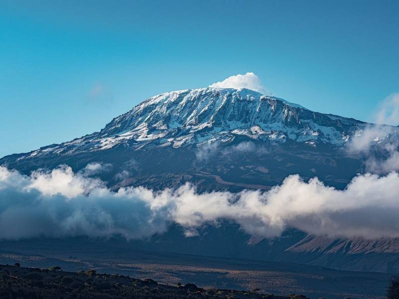
Machame Gate to Machame Camp The journey begins with a drive from Moshi or Arusha to the Machame Gate: After registering with the park service and meeting the climb crew and porters, the trek starts on the edge of the rain forest. The path leads hikers through the dense rain forest on a winding trail up a ridge. The environment features moss and lichen on branches, tree ferns, and various blooming flowers [2]. Birds, colobus monkeys, blue monkeys, and other forest creatures may be seen and heard. The day's hike concludes at Machame Camp
Elevation: Approximately 5,380 ft (1,830 m) to 9,350-10,000 ft (3,000 m)
Hiking Time: 5-7 hours
Distance: Approximately 10-11 km (6-7 miles)
Habitat: Rain Forest.
Activities : Adventure
Accommodation : machame camp [ 1 Star ]
Mt Kilimanjaro
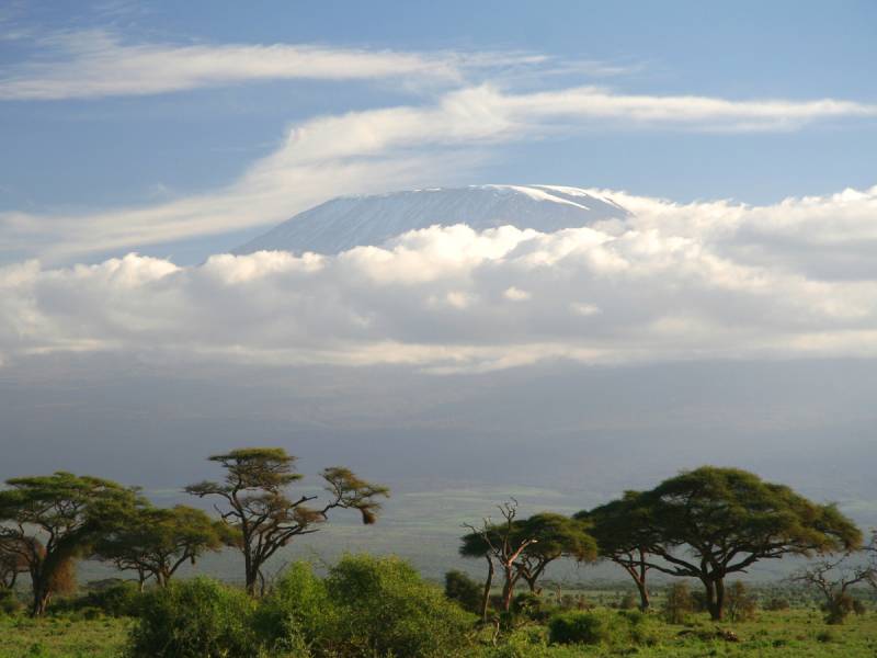
Leaving the glades of the rain forest: the trail continues on an ascending path along a steep, rocky ridge onto heather-clad moorland, known as the heath zone As vegetation becomes more sparse, plants like helichrysum and lobelia are visible Various geological features, including lava tubes and glacial valleys, can be observed] After a picnic lunch, the route continues up a rocky ridge onto the Shira Plateau By now, the Western Breach with its glaciers may be visible. The day ends at Shira Camp (sometimes referred to as Shira 2 Camp)
Elevation: Approximately 9,350-10,000 ft (3,000 m) to 12,300-12,500 ft (3,800 m)
Hiking Time: 4-6 hours
Distance: Approximately 5-8 km (3-5 miles)
Habitat: Heath/Moorland.
Activities : Adventure
Accommodation : shira camp [ 1 Star ]
Mt Kilimanjaro
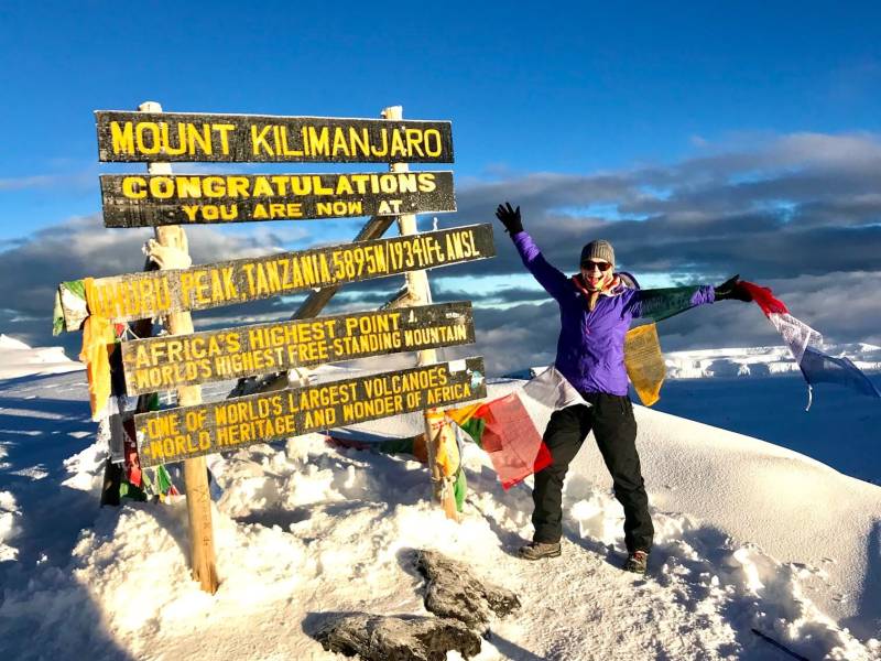
Today is a "walk-high, sleep-low" day, beneficial for acclimatization. The route ascends into the alpine desert towards the main peak of Kibo, where the western glaciers become clearly visible. Hikers continue east up a ridge and then head southeast towards the Lava Tower, a 300 ft tall volcanic rock formation. Lunch is typically taken near Lava Tower. After reaching the highest point of the day near Lava Tower, the trail descends to Barranco Camp. The descent passes through the unique 'Garden of the Senecios' (giant groundsel) and giant lobelias. The Barranco Valley is noted as one of the prettiest areas of the trail.
Elevation: Starts around 12,500 ft (3,800 m), ascends to approximately 14,800-15,223 ft (4,500-4,640 m) at Lava Tower, and descends to approximately 12,800-13,044 ft (3,900 m) at Barranco Camp.
Hiking Time: 6-9 hours. The ascent to Lava Tower is approximately 4-5 hours, and the descent to Barranco Camp is approximately 2-3 hours
Distance: Approximately 10 km (6-7 miles) Source 1 splits this into 7 km (4 miles) to Lava Tower and 3 km (2 miles) to Barranco Camp
Habitat: Alpine Desert.
Activities : Adventure
Accommodation : barranko [ 1 Star ]
Barranco Camp To Karanga camp
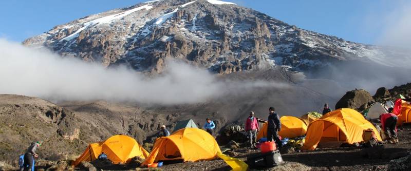
Day 4 – Barranco Camp to Karanga Camp: The day begins by descending into a ravine to the base of the Great Barranco Wall. Hikers then climb the non-technical but steep, nearly 900 ft cliff, often using all four limbs. From the top of the Barranco Wall, the path crosses a series of hills and valleys, passing below the famous Breach Wall. The trail descends sharply into Karanga Valley, followed by one more steep climb up to reach Karanga Camp. This is a relatively shorter day, strategically planned for acclimatization Sunsets here can be spectacular with views of the southern glacial valleys and ice fields
Elevation: Approximately 12,800-13,044 ft (3,900 m) to 13,000-13,300 ft (4,055 m)
Hiking Time: 4-5 hours
Distance: Approximately 5 km (3 miles)
Habitat: Alpine Desert.
Activities : Adventure
Karanga Camp To Barafu Camp
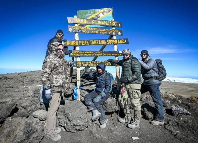
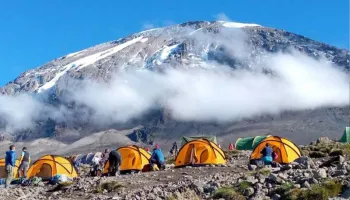
Leaving Karanga, the trail ascends to Barafu Camp (also referred to as Barafu Hut or Upper Barafu Camp). The route hits the junction which connects with the Mweka Trail and continues up a rocky section. At this point, the Southern Circuit is completed, offering views of the summit from many different angles. Barafu Camp is situated in a desolate alpine desert, sometimes experiencing strong winds. In the evenings, splendid views of Mawenzi Peak are common. Camp is made here, and hikers rest and have an early dinner to prepare for the summit day
Elevation: Approximately 13,000-13,300 ft (4,055 m) to 15,288-15,800 ft (4,815 m)
Hiking Time: 4-6 hours
Distance: Approximately 4-5 km (2-3 miles)
Habitat: Alpine Desert/High Desert Plateau.
Activities : Adventure
Accommodation : barafu camp [ 1 Star ]
Barafu camp To uhuru Peak to Mweka Camp/millennium Camp
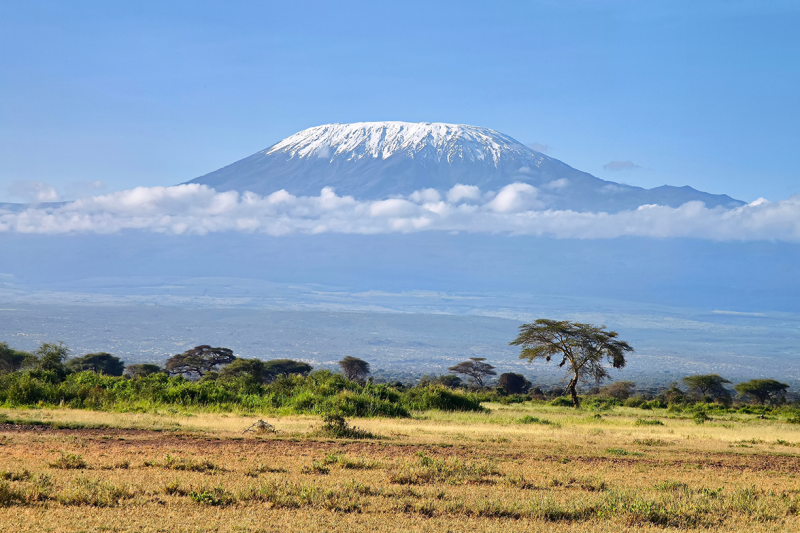
The summit push begins very early in the morning, typically around midnight. This is the most mentally and physically challenging portion of the trek. The wind and cold at this elevation and time of day can be extreme. Hikers ascend in the darkness for several hours, taking frequent but short breaks. Near Stella Point (approximately 18,652-18,900 ft), the sun begins to rise over Mawenzi Peak, offering a magnificent view]. Ascending via Stella Point leads to the final section to Uhuru Peak, the highest point on Mount Kilimanjaro and the continent of Africa (approximately 19,341-19,344 ft / 5,896 m). After a short celebration at the summit, the descent begins. The trail is very rocky and can be hard on the knees. Hikers descend back to Barafu Camp for lunch and a short rest] before continuing down to the last camp on the mountain, either Mweka Camp (approximately 10,000-10,065 ft) or Millennium Camp (approximately 12,250 ft / 3,733 m) Mweka Camp is situated in the upper forest, where mist or rain can be expected in the late afternoon
Elevation: Starts around 15,288-15,800 ft (4,815 m), ascends to 19,341-19,344 ft (5,896 m), and descends to approximately 10,000-12,250 ft (3,050-3,733 m)
Hiking Time: Ascent to summit is approximately 6-8 hours. Descent from summit to Mweka/Millennium Camp is approximately 6.5-9 hours (including stop at Barafu) Total time for the day can be 11-17 hours.
Distance: Ascent to summit is approximately 5-7 km (3-6 miles) Descent from summit to Mweka Camp is approximately 12 km (7 miles). Descent from Barafu Camp to Millennium Camp is approximately 5.6 km (3.5 miles).
Habitat: Arctic (summit), Rain Forest (lower descent).
Activities : Adventure
Accommodation : mweka camp [ 1 Star ]
Mweka Camp/Millennium Camp To Mweka Gate
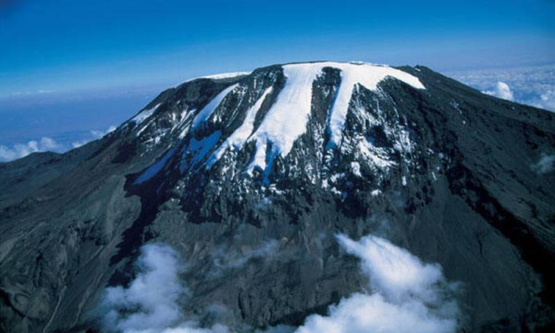
On the final day, the descent continues through the montane forest or thickest jungle encountered yet. The environment becomes primordial with large fern trees The trail can be wet and muddy at lower elevations The trek concludes at Mweka Gate where summit certificates are collected A vehicle meets the group at Mweka Village or Mweka Gate to drive back to the hotel in Moshi or Arusha
Elevation: Approximately 10,000-12,250 ft (3,050-3,733 m) to 5,380-5,580 ft (1,800 m)
Hiking Time: 3-5 hours
Distance: Approximately 10-13.5 km (6-8.4 miles)
Habitat: Rain Forest/Montane Forest.
Activities : Adventure
| No of pax | Age Limit | Price per pax (Rs) |
|---|---|---|
| Adult | Above 12 years | $ 1650 / Adult( With Tax ) |
| City | Hotel Name | Star Rating |
|---|---|---|
| mt kilimanjaro | machame camp | |
| mt kilimanjaro | shira camp | |
| mt kilimanjaro | barranko | |
| mt kiilimanjaro | barafu camp | |
| mt kiimanjaro | mweka camp |
* 20% Advance Percentage of total booking amount
* Airfare/Transport fare to be paid full at one time in advance.
* Upon cancellation, refund will be made after deducting the Retention Amount.
* Retention Amount varies as per the number of days left before your package start date.
* Refund will be made within 15 working days from the date of receipt of the cancellation.
ASILI EXPLORER is the best safari tour company in Africa specializing in African safari planning Tanzania safari holidays and Tanzania budget Safari tours. Explore our safari styles namely Basic, Mid-range, Luxury, and Luxury Plus.Asili Explorer wil Know more..
6Night 7 Days The Best of Africas Big Five Safari
Arusha - Tarangire National Park - L.Manyara National Park - Ngorongoro Crater - Se..
7 Days / 6 Nights

Srinagar - Anantnag - Jammu - Baramulla
7 Days / 6 Nights

Amritsar Chandigarh Delhi Agra Family Package
New Delhi - Agra - Vrindavan - Mathura - Amritsar
7 Days / 6 Nights
11 Days 10 Nights Ultimate Kilimanjaro & Safari Adventure
Ngorongoro - Moshi - Arusha
11 Days / 10 Nights

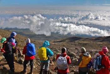
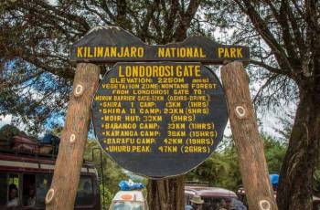
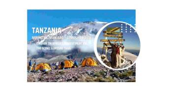
Summit Dreams - Mount Kilimanjaro - Lemosho Route 8N - 9D Tour
Moshi - Kilimanjaro
9 Days / 8 Nights
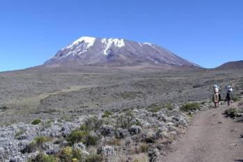
21 Days Kilimanjaro Climbing - Safari And Zanzibar Excursion Tour
Zanzibar - Arusha - Moshi - Kilimanjaro - Ngorongoro - Manyara
21 Days / 20 Nights
