
- Home
- Travel Packages
- Top Destination
-
Travel Attraction
By Category
Top Attraction
- Travel Agents
- Car Rentals
- Hotels

Times Square is a prime commercial intersection that establishes itself at the juncture of 42nd Street, Seventh Avenue and Broadway intersect. It is the busiest square of New York and has also won several acclaims such as ‘The Great White Way’, ‘The Crossroads of the World’, and ‘The Center of the Universe’. Times Square lures thirty nine million visitors each year. The triangle that lies in the north of Times Square is called the Duffy Square, which was named after Chaplain Francis P. Duffy in year 1937. Along with the memorial of Chaplain Francis P. Duffy, there is also a figurine of George M. Cohan that can be located in Times Square. There is also a TKTS in Times Square where one can buy discounted tickets for various shows. On the eve of New Year, armada of people gather here to welcome and witness the first moments of the New Year. There is a ball hinged on the top of the One Times Square building. This ball is swooped down as part of New Year’s celebrations. The practice started in 1907 and has manifested itself as a tradition in Time Square. Prior to 1907, the New Years’ celebrations at Times Square involved fireworks, which was later stopped by the authorities. The New Year’s celebrations of 1999 also made news worldwide when two million people reached Times Square to whoop and clasp. Times Square building was also an important place for New Yorkians during Second World War. Many huddled here for a one minute silence and due to restrictions imposed on the lowering of the ball, the church bells were pealed instead. In 2008, LED ball was introduced to Times Square and now intersection has become a favourite spot for many to celebrate Halloween and Valentine’s Day every year.
Explore More
The Lincoln Memorial was built to pay tribute to Abraham Lincoln, the adulated and celebrated 16th President of U.S. The memorial is situated at Washington, D.C. Henry Bacon was the lead architect of the memorial. The memorial resembles the Greek Doric temple. Apart from the sculpture of Abraham Lincoln, the building also exhibits two of the inspiring speeches of the President, The Gettysburg Address and Second Inaugural Address. The building has been cleaved into 3 big chambers and there are also rows of classically ordered columns. The chambers also have President’s famous speeches engraved on the northern and southern areas of these beautiful chambers. The peripheries of the engraved speeches are decorated by a rectangular column containing the wreaths, fasces, etc. The building is brimming with various symbolisms. There are 36 columns that display the states that were present in the union when the President departed the world leaving its beloved citizens in a state of sorrow. The murals representing Law, Freedom, Immortality, Fraternity, Liberty, Unity, and Charity are depicted on the north and south walls. The ceilings are embellished with the leaves of oak and laurel tree. An intuitive light system has also been incorporated into the building that keeps the memorial replete with enough light. The lights are controlled from a separate room where the custodians increase and decrease the amount of the light according to the amount of natural light that is sprinkling from the outside.
Explore More
The Stratosphere Tower in Las Vegas, now known as The STRAT Hotel, Casino & SkyPod, is one of the most iconic landmarks in the city. Standing at 1,149 feet (350 meters), it is the tallest observation tower in the United States. The tower offers breathtaking views of the Las Vegas Strip and the surrounding desert, thrilling rides, fine dining, and an unforgettable experience for visitors. How to Reach Stratosphere Tower, Las Vegas The Stratosphere Tower is located at 2000 S Las Vegas Blvd, Las Vegas, NV 89104. Here’s how you can get there: By Car: The STRAT offers free parking for guests, with valet services available for convenience. By Bus: The RTC (Regional Transportation Commission) Deuce and SDX buses have stops near The STRAT, making it easy to reach. By Taxi/Rideshare: Uber, Lyft, and taxis are widely available in Las Vegas and can drop you off right at the entrance. On Foot: The STRAT is located at the northern end of the Strip, and while it is walkable from some nearby locations, it is best to use transportation. Weather in Las Vegas Las Vegas has a desert climate with hot summers and mild winters. The best time to visit is during the spring (March to May) and fall (September to November) when temperatures are pleasant. Summer temperatures can exceed 100°F (38°C), while winters are cool, averaging around 50°F (10°C). Timings of Stratosphere Tower, Las Vegas The observation deck is open daily from 10:00 AM to 1:00 AM on weekdays and until 2:00 AM on weekends. However, ride schedules and restaurant hours may vary, so checking the official website before visiting is recommended. Why is the Stratosphere Tower Famous? The Stratosphere Tower is famous for its breathtaking panoramic views of Las Vegas, thrilling rides at extreme heights, and luxurious dining experiences. It is one of the best spots in the city to watch the sunset and the sparkling lights of the Strip at night. Entry and Visit Details General admission to the observation deck costs around $20-$30 per person, with discounts for Nevada residents, military personnel, and seniors. Ride tickets are available separately or in combo packages, and special event tickets, such as VIP rooftop experiences, can be purchased online. History and Architecture The Stratosphere Tower opened in 1996 as part of the Stratosphere Hotel. Designed by architect Ned Baldwin, the tower is built to withstand strong desert winds and earthquakes. Its sleek, modern structure includes an indoor and outdoor observation deck, thrill rides, and dining options. The tower remains one of the most recognizable structures in Las Vegas. Things to Do at the Stratosphere Tower Observation Deck: Enjoy stunning 360-degree views of the city from the indoor and outdoor decks. Thrill Rides: Experience adrenaline-pumping rides like Big Shot, X-Scream, and Insanity, all perched at extreme heights. SkyJump Las Vegas: Try the world’s highest controlled freefall jump from the tower. Top of the World Restaurant: Dine at the revolving restaurant offering fine cuisine with an unbeatable view. Bars and Lounges: Relax with a drink at 108 Drinks or the Sky Lounge, both offering fantastic views. Interesting Facts About the Stratosphere Tower The Stratosphere Tower is the tallest freestanding observation tower in the U.S. The Big Shot ride catapults riders 160 feet into the air at 45 mph. The Top of the World restaurant completes a full rotation every 80 minutes. SkyJump holds the Guinness World Record for the highest commercial decelerator descent. Tips for Visiting the Stratosphere Tower Visit during sunset or nighttime for the best views. Book ride tickets in advance to avoid long waits. If you’re scared of heights, start with the indoor observation deck before stepping outside. Dress appropriately as it can be windy at the top. Check for online discounts and combo deals to save on admission and rides.
Explore More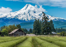
Mount Hood, Oregon’s tallest peak, stands as an iconic symbol of the Pacific Northwest. At 11,240 feet (3,426 meters), it’s not only the highest point in Oregon but also one of the most active volcanoes in the Cascade Range. Whether you're seeking adventure, serenity, or breathtaking views, Mount Hood offers a wide range of experiences throughout the year. From hiking in the summer to skiing in the winter, this majestic mountain attracts outdoor enthusiasts from around the world. How to Reach Mount Hood, Oregon Located just about 50 miles east of Portland, Oregon, Mount Hood is easily accessible by car and offers several routes depending on your starting point. By Car: The most common way to reach Mount Hood is by car from Portland. The easiest route is to take US Route 26 east, which will take you through the scenic town of Sandy before winding up to the mountain’s base. The drive takes approximately 1-1.5 hours depending on weather and traffic conditions. Visitors coming from Seattle or other parts of Washington can take Interstate 5 south to Portland, and then take US 26 east to Mount Hood. Public Transportation: If you’re relying on public transportation, you can take a Greyhound or Amtrak bus to Portland. From there, you can use the Mt. Hood Express Bus, which connects the city with Mount Hood’s recreational areas. Alternatively, consider booking a shuttle service or renting a car. Weather at Mount Hood The weather at Mount Hood varies greatly depending on the season and elevation. The mountain experiences four distinct seasons, each offering its own unique experiences for visitors. Winter (December to February): Mount Hood is a popular ski destination during the winter months. Average temperatures on the mountain range from 25°F to 40°F (-4°C to 4°C). Heavy snowfall is common, and the surrounding area can see up to 500 inches of snow annually, especially in the higher elevations. Spring (March to May): Spring sees milder temperatures with daytime highs ranging from 50°F to 70°F (10°C to 21°C) at lower elevations, but it can still be quite chilly at higher elevations. Snow can still fall at the summit, providing skiing and snowboarding opportunities during early spring. As the season progresses, the mountain becomes lush and green, making it a great time for hiking. Summer (June to August): Summer is the best time to explore Mount Hood for hiking, mountain biking, and camping. Daytime highs at the base can reach 70°F to 90°F (21°C to 32°C), but temperatures drop quickly in the evenings. The summit remains cool year-round, with temperatures rarely exceeding 60°F (15°C) at the peak. This is also the time when the wildflowers bloom, and the mountain is covered in vibrant colors. Fall (September to November): Fall brings cooler temperatures ranging from 45°F to 65°F (7°C to 18°C). The changing foliage creates a picturesque backdrop for hiking and outdoor photography. By November, snowfall begins to accumulate, signaling the start of the ski season. Why Mount Hood is Famous for Oregon Mount Hood is one of the most recognized landmarks in Oregon and a focal point of the state’s natural beauty. It’s particularly famous for its year-round skiing opportunities, but it offers much more than that. The mountain is an outdoor paradise for hikers, campers, climbers, and photographers. Historic Significance: The mountain was named after Lord Samuel Hood, a British Admiral, by British Captain George Vancouver in 1792. It has been a vital part of the history and culture of the Native American tribes that once inhabited the area, including the Wasco, Klickitat, and Yakama tribes. Mount Hood is also known for being part of the **Cascade Volcanoes**, which are one of the most active volcanic regions in the world. Outdoor Adventure: Besides skiing and snowboarding, Mount Hood is famous for its hiking trails, mountain biking, fishing, and kayaking. The mountain is surrounded by dense forests and stunning alpine lakes, offering outdoor enthusiasts endless opportunities to explore its diverse landscape. Entry and Visit Details about Mount Hood There is no general entrance fee for visiting Mount Hood itself, as it is part of the Mount Hood National Forest. However, there are some specific areas and activities that charge for entry or usage. Ski Resorts: Mount Hood is home to several ski resorts, including **Timberline Lodge**, **Mount Hood Meadows**, and **Skibowl**. These resorts charge lift ticket fees and may require reservations for skiing and snowboarding activities during the peak winter season. Prices vary depending on the resort, time of season, and the type of activity. Campgrounds: There are many campgrounds located within Mount Hood National Forest, such as **Trillium Lake Campground** and **Lost Lake Campground**, with fees ranging from $10 to $30 per night for a campsite. Visitor Centers: The **Mount Hood Visitor Center** located in Government Camp is a great starting point for visitors. It provides maps, information, and details about hiking trails, ski conditions, and other recreational opportunities in the area. Additionally, **Timberline Lodge** is an excellent place to learn about the history of Mount Hood and relax with stunning views. History and Architecture of Mount Hood Mount Hood has been a prominent feature of Oregon’s landscape for centuries. Its first known ascent was in 1854 by a group of settlers. Today, the mountain is not only a place of natural beauty but also a historical landmark. Timberline Lodge: One of the most famous architectural landmarks on Mount Hood is **Timberline Lodge**, a historic building completed in 1937 as part of the New Deal’s Public Works Administration. The lodge was designed in the rustic architectural style, with logs, stonework, and large windows that offer breathtaking views of the surrounding mountain landscape. It served as the backdrop for the movie *The Shining* in 1980, adding to its fame. Things to Do in Mount Hood, Oregon Mount Hood offers an array of outdoor activities and attractions for visitors of all ages and skill levels. Here are some of the best things to do: Skiing and Snowboarding: Mount Hood is one of the best places in the United States for skiing and snowboarding. Resorts like **Timberline Lodge** and **Mount Hood Meadows** offer skiing opportunities from late fall to early spring. Hiking and Trails: There are numerous hiking trails around Mount Hood, including the **Timberline Trail**, **Ramona Falls Trail**, and **Tamanawas Falls Trail**. These hikes provide fantastic views, waterfalls, and opportunities to explore the lush forest. Climbing: Mount Hood is a popular destination for climbers. The mountain offers challenging routes for experienced mountaineers, with the summit being a coveted prize. Fishing and Boating: The lakes around Mount Hood, including **Trillium Lake** and **Lost Lake**, are great spots for fishing, kayaking, and canoeing. The lakes provide a serene setting for a day of relaxation. Wildlife Viewing: The area around Mount Hood is home to a variety of wildlife, including deer, elk, black bears, and numerous bird species. Wildlife watching is a popular activity in the summer and fall months. Facts about Mount Hood Mount Hood is an active stratovolcano and is the highest peak in Oregon. The mountain is one of the most climbed peaks in North America, with over 10,000 climbers attempting to summit each year. The snow-capped peak is visible from Portland on clear days, making it a prominent landmark for the city. Timberline Lodge is the highest elevation hotel in Oregon, located at 6,000 feet. Tips for Visiting Mount Hood Check weather conditions before your visit, especially during the winter, as storms can affect the roads and visibility. Wear layers, as temperatures can fluctuate dramatically, especially at higher elevations.
Explore More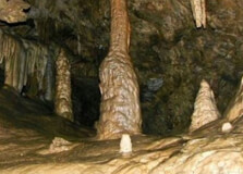
Oregon Caves National Monument
Oregon Caves National Monument and Preserve is a stunning natural attraction located in the Siskiyou Mountains of southwestern Oregon. Known for its marble caves, lush forests, and rich biodiversity, this hidden gem is managed by the National Park Service. The site not only features spectacular underground passages but also scenic hiking trails and historic architecture. It’s an ideal destination for anyone interested in geology, nature, and adventure. How to Reach Oregon Caves National Monument, Oregon Oregon Caves is located about 20 miles southeast of Cave Junction in Josephine County. The closest major city is Grants Pass, around 50 miles away. The most convenient way to reach the monument is by car. From Cave Junction, take Oregon Highway 46 (also known as Caves Highway) and follow the signs. The road is narrow and winding, so drive carefully, especially in winter or wet conditions. There is no public transportation to the caves, so renting a car is the best option if you’re flying into the area. The nearest airport is Rogue Valley International-Medford Airport (MFR), which is about 75 miles from the monument. Weather at Oregon Caves National Monument The weather at Oregon Caves varies greatly by season due to its mountainous location. Summers (June to September) are generally warm and dry, with daytime temperatures ranging from 70°F to 85°F (21°C to 29°C). This is the best time to visit the caves and surrounding trails. Winters (December to February) can be cold and snowy, with temperatures often dropping below freezing. The road to the caves may be closed during heavy snow or icy conditions. Spring and fall are mild but can be rainy, so visitors should dress in layers and bring waterproof gear. Inside the caves, the temperature remains a constant 44°F (7°C) year-round, so a jacket is recommended no matter when you visit. Timings of Oregon Caves National Monument The monument is open year-round, but cave tours are typically offered from late spring through early fall (May to October), depending on weather and road conditions. The visitor center is usually open daily from 9:00 AM to 5:00 PM during the season. Cave tours require a guide and are offered several times a day. Tour times vary, so it's a good idea to check the official National Park Service website for updated schedules and availability. Why is Oregon Caves National Monument Famous in Oregon? Oregon Caves is famous for its rare marble cave system. Unlike many limestone caves, these caves are formed in marble, a metamorphic rock, which is relatively rare in the United States. The complex cave network features stunning formations like stalactites, stalagmites, and flowstone. The monument is also known for its rich biological diversity and its historic chateau, which is a National Historic Landmark. The unique geology, combined with its remote and scenic setting, makes Oregon Caves one of Oregon’s most fascinating and lesser-known natural wonders. Entry and Visit Details Entrance to the monument grounds is free. However, guided cave tours require a ticket. As of the most recent information, adult tickets cost around $10–$15, with reduced prices for children and seniors. Tickets can be purchased online or at the visitor center, but availability may be limited during peak season, so advance booking is recommended. The park has limited amenities, including a visitor center, restrooms, picnic areas, and the historic Oregon Caves Chateau (when open). There are also hiking trails around the monument, offering scenic views of the forest and mountains. History and Architecture of Oregon Caves National Monument The caves were discovered in 1874 by Elijah Davidson while he was hunting. Fascinated by the underground world, early explorers soon realized the scientific and aesthetic value of the caves. In 1909, President William Howard Taft designated it a National Monument. One of the most iconic architectural features is the Oregon Caves Chateau, built in 1934. The lodge is an excellent example of “National Park rustic” architecture, designed to blend in with the surrounding environment. Constructed using native materials like wood and stone, the six-story building is nestled into the hillside and offers lodging, dining, and historical exhibits. Things to Do at Oregon Caves National Monument There are plenty of activities for visitors at Oregon Caves: Cave Tours: Guided tours take you through a half-mile of underground passages. Tours vary in length and difficulty, including family tours and adventure caving for more experienced explorers. Hiking: The park offers several hiking trails, including the Cliff Nature Trail and Big Tree Trail, where you can see one of the largest Douglas fir trees in Oregon. Wildlife Watching: The surrounding preserve is home to black bears, bobcats, deer, and over 50 species of birds. Photography: The scenic forest, cave formations, and historic chateau provide great photo opportunities. Visitor Center: Learn about the geology, ecology, and history of the caves through exhibits and ranger programs. Interesting Facts about Oregon Caves National Monument Here are some fascinating facts: The caves are made of marble, not limestone, which is quite rare in the U.S. Oregon Caves was one of the first National Monuments created to protect a cave system. The cave system is over 500,000 years old. The Oregon Caves Chateau is considered one of the finest examples of rustic park architecture in the country. Fossils of ancient animals have been found in the caves, including jaguars and grizzly bears. Tips for Visiting Oregon Caves National Monument To make the most of your trip, consider the following tips: Dress in layers and bring a jacket – the caves are cold even in summer. Wear sturdy, non-slip shoes suitable for walking on wet surfaces inside the cave. Arrive early or book cave tour tickets in advance to ensure availability. Check road and weather conditions before visiting, especially in winter. No food, drinks, or pets are allowed inside the caves. Be respectful of cave formations – don’t touch them, as oils from hands can cause damage.
Explore More
The Palace of Fine Arts in San Francisco is one of the city's most iconic landmarks, known for its classical Roman-inspired architecture and serene beauty. Originally constructed for the 1915 Panama-Pacific Exposition, the Palace of Fine Arts was designed to showcase fine arts and serve as a monumental symbol of the exposition. Today, it stands as a beloved architectural wonder, drawing visitors from around the world to admire its grandeur, explore its surroundings, and enjoy a peaceful retreat in the heart of San Francisco. How to Reach Palace of Fine Arts, San Francisco The Palace of Fine Arts is located in the Marina District of San Francisco, making it accessible by car, public transit, and walking. Here’s how to get there: By Car: The Palace of Fine Arts is easily reachable by car from anywhere in San Francisco. It is located just off of Marina Boulevard and has a parking lot nearby. Street parking is available, but it can be limited during peak times, especially on weekends. It is recommended to arrive early to secure a parking spot. By Public Transportation: If you're using public transportation, the Muni bus lines #30 and #49 provide direct routes to the Palace of Fine Arts. Additionally, the #22 bus stops within walking distance. The city’s Muni system is a great way to navigate San Francisco, and a combination of buses or even the San Francisco Bay Area’s Metro can take you to the museum. You can check routes via the Muni website or Google Maps for real-time updates. By Bicycle or Walking: San Francisco has an extensive network of bike lanes, and the Palace of Fine Arts is easily accessible by bike. You can enjoy the views of the Golden Gate Bridge and surrounding areas as you make your way to the palace. If you prefer walking, it’s a pleasant stroll from the Crissy Field area or the Golden Gate Bridge Visitor Center, both of which offer spectacular views of the city and bay. Weather at Palace of Fine Arts, San Francisco San Francisco is known for its cool, foggy, and mild weather throughout the year. The Palace of Fine Arts, located near the bay, can often experience fog in the summer months, which brings cooler temperatures. The average temperature typically ranges from 55°F (13°C) in winter to 65°F (18°C) in summer. While the weather is generally mild, it can feel chillier near the waterfront, so it is advisable to bring a light jacket or sweater, especially in the morning and evening. Timing and Hours of Operation The Palace of Fine Arts is open to the public every day, and the grounds are free to access. Visitors can walk around the beautiful rotunda, admire the stunning architecture, and take photographs at any time of the day. However, the indoor spaces, including the Exploratorium (a science museum), have specific operating hours. Typically, the Exploratorium is open from 10:00 AM to 5:00 PM, Tuesday to Sunday, with occasional extended hours for special events. It’s a good idea to check the official website or local resources for up-to-date information on events or closures. For instance, if you plan on visiting during major holidays or special events, the area may be busier than usual, so it’s a good idea to plan accordingly. Why Famous for Palace of Fine Arts, San Francisco? The Palace of Fine Arts is famous for its incredible architectural design and rich history. Originally created as a temporary structure for the 1915 Panama-Pacific Exposition, it was one of the few buildings to survive after the event, thanks to its enduring beauty and architectural significance. The design was conceived by architect Bernard Maybeck, and it features a grand rotunda surrounded by Corinthian columns, a lagoon, and a lovely garden area. The Palace of Fine Arts remains a major cultural symbol in San Francisco and is often associated with elegance and romance. Many people visit to take in the beautiful surroundings, host weddings or photo shoots, or simply relax near the water. Over time, the palace has evolved into a location for cultural events, art exhibitions, and educational purposes, making it a cultural hub in the city. Entry and Visit Details about Palace of Fine Arts, San Francisco Visiting the Palace of Fine Arts is free, as the park and outdoor areas are open to the public. Visitors can stroll around the stunning lagoon, enjoy the architecture, and take in the beautiful landscape without any charge. The gardens surrounding the Palace of Fine Arts are also free to explore. If you plan to visit the Exploratorium, which is housed nearby in part of the Palace of Fine Arts complex, you will need to purchase a ticket. Entry for adults is typically around $30, with discounts available for children, seniors, and students. The Exploratorium is an interactive science museum that offers fun and educational exhibits, making it a great destination for families, kids, and science enthusiasts. Be sure to check for special discounts or promotions when planning your visit. History and Architecture of Palace of Fine Arts The Palace of Fine Arts was originally constructed in 1915 for the Panama-Pacific Exposition, a world’s fair held to celebrate the opening of the Panama Canal. The exposition showcased advancements in culture, art, science, and technology, and the Palace of Fine Arts was one of the most impressive structures created for the event. The building was intended to represent the “palace” of art, housing paintings and sculptures from all over the world. The original structure was made from plaster and lath, which wasn’t intended to last, but the beauty of the design inspired San Francisco to preserve it. The building was reconstructed in the 1960s with more durable materials such as steel and concrete. The resulting architecture blends Classical and Beaux-Arts styles, featuring an immense rotunda and graceful arches surrounded by lush landscaping. The 1,000-foot lagoon surrounding the building is another iconic feature that adds to its beauty and serenity. Things to Do at the Palace of Fine Arts There are numerous activities to enjoy at the Palace of Fine Arts, including: Explore the Grounds: Stroll through the gardens and around the lagoon, where you can relax and enjoy the view of the palace and surrounding nature. Take Photos: The palace’s grand architecture and picturesque lagoon make it one of the most photographed landmarks in San Francisco. Visit the Exploratorium: The Exploratorium is an interactive museum filled with fun and educational exhibits for children and adults alike. It's a great way to spend an afternoon learning and experimenting with science and art. Attend Events: Throughout the year, the Palace of Fine Arts hosts various cultural events, including art exhibitions, theater performances, and community gatherings. Check out the schedule of events to see if anything interests you during your visit. Relax by the Lagoon: The tranquil waters of the lagoon are perfect for a relaxing break or a peaceful walk, especially on a clear day. Fun Facts and Tips about Palace of Fine Arts, San Francisco The Palace of Fine Arts is one of the few surviving structures from the 1915 Panama-Pacific Exposition, making it a piece of history that represents a significant event in San Francisco’s past. It is a popular spot for weddings and other photo shoots due to its picturesque architecture and natural beauty. The lagoon is home to many ducks and swans, which add to the charm and serenity of the location. It’s a great spot to enjoy a picnic or just take a leisurely walk while soaking in the views of the Golden Gate Bridge and the Bay Area. For those interested in art and culture, the museum exhibitions at the Exploratorium are frequently updated, offering new and interesting exhibits all year long.
Explore More
Pittsburgh, Pennsylvania, is a city known for its transformation from a steel powerhouse to a modern hub of innovation, education, and culture. Located in the western part of the state, Pittsburgh is nestled at the confluence of the Allegheny, Monongahela, and Ohio Rivers. With a rich history in steel manufacturing, Pittsburgh has evolved into a vibrant city that blends its industrial past with cutting-edge technology and arts. It is often called the “Steel City” or the “City of Bridges” because of its 446 bridges. How to Reach Pittsburgh, Pennsylvania Pittsburgh is easily accessible by air, train, bus, and car, making it convenient for travelers from across the country and around the world. By Air: Pittsburgh International Airport (PIT) is the primary airport serving the city. Located about 20 minutes from downtown, the airport offers numerous flights to major U.S. cities and international destinations. It is well-connected with ground transportation options including taxis, ride-sharing services, and the Port Authority bus system. By Train: Amtrak operates a train station in Pittsburgh, with connections to major cities such as Chicago, Washington D.C., and New York. The Amtrak station is centrally located, making it easy to explore the city from there. By Bus: Greyhound and Megabus offer services to Pittsburgh, with most buses arriving at the Greyhound terminal or the Megabus stop in the downtown area. By Car: Pittsburgh is accessible by several major highways, including I-76 (Pennsylvania Turnpike), I-79, and I-376. The city is approximately 5 hours from Philadelphia and about 3 hours from Cleveland, Ohio. Weather in Pittsburgh, Pennsylvania Pittsburgh experiences a humid continental climate, which means it has distinct seasons with cold winters and warm, humid summers. Summer: Summers in Pittsburgh are warm and humid, with temperatures typically ranging from the mid-70s to the mid-80s °F (24-30°C). It is an ideal time to explore the city’s parks, rivers, and outdoor festivals. Fall: Fall in Pittsburgh brings cooler temperatures, with the foliage in the area offering beautiful colors. The temperature ranges from the low 50s to mid-70s °F (10-24°C), making it a perfect time for outdoor activities. Winter: Winters can be cold, with temperatures often dipping below freezing. Snow is common in Pittsburgh, and while the city doesn’t usually experience severe winter storms, it’s best to be prepared for snow showers and icy conditions. Average temperatures range from the mid-20s to mid-30s °F (-4 to 1°C). Spring: Spring in Pittsburgh is mild, with temperatures ranging from the mid-40s to mid-60s °F (7-18°C). This season is perfect for those looking to enjoy the city’s botanical gardens, parks, and riversides in pleasant weather. Timing to Visit Pittsburgh, Pennsylvania The best time to visit Pittsburgh is in the spring and fall when the weather is mild and comfortable, and the city’s outdoor spaces are in full bloom or offering vibrant autumn colors. Summer is also a great time to visit for outdoor activities, but it can be humid. Winter can be harsh, but it offers opportunities for those who enjoy snow sports and winter activities. Why Pittsburgh is Famous in Pennsylvania Pittsburgh is famous for its rich history in the steel industry, which played a pivotal role in the city’s development. During the 20th century, Pittsburgh was one of the largest steel-producing cities in the world, earning it the nickname “Steel City.” Today, Pittsburgh is renowned for its medical and technological industries, with world-class institutions such as the University of Pittsburgh Medical Center (UPMC) and Carnegie Mellon University leading the way in research and innovation. The city is also known for its thriving arts scene, iconic sports teams, and vibrant cultural attractions. Pittsburgh’s rich architectural heritage, beautiful parks, and numerous bridges also make it a unique city worth exploring. Entry and Visit Details About Pittsburgh, Pennsylvania Pittsburgh is a city that welcomes visitors with a variety of attractions, making it easy to explore both its historic and modern aspects. Many of the city’s famous landmarks, like the Duquesne Incline, PNC Park, and the Andy Warhol Museum, are open to the public and attract tourists year-round. Many attractions in Pittsburgh offer free admission on certain days, such as the Carnegie Museums of Art and Natural History. Visitors should also take advantage of Pittsburgh’s convenient public transportation system, which includes buses, light rail, and the Duquesne Incline, a historic funicular that provides stunning views of the city. It’s important to check the opening hours and any special events or closures before visiting, as some museums or attractions may have seasonal hours or require advance reservations for tours. History and Architecture of Pittsburgh, Pennsylvania Pittsburgh’s history is deeply tied to the steel industry, which shaped its economy and character for much of the 20th century. The city’s industrial past is still evident in the architecture of neighborhoods like the Strip District and Lawrenceville, where old warehouses have been converted into trendy lofts and shops. Architecturally, Pittsburgh boasts a mix of modern skyscrapers, historic buildings, and beautiful bridges. Notable structures include the PPG Place (a collection of glass skyscrapers), the Heinz Memorial Chapel, and the Gothic-style Allegheny County Courthouse. Pittsburgh’s skyline is often considered one of the most distinctive in the country, thanks to its confluence of rivers and the many bridges that span them. Things to Do in Pittsburgh, Pennsylvania Pittsburgh is packed with a wide variety of activities that appeal to all kinds of visitors. Here are some of the top things to do in the city: Visit the Carnegie Museum of Natural History: One of the country’s best natural history museums, with incredible dinosaur exhibits and rare gems. Explore the Andy Warhol Museum: A tribute to Pittsburgh-born pop artist Andy Warhol, this museum showcases his iconic works and collections of modern art. Ride the Duquesne Incline: Take a ride on this historic funicular for panoramic views of the Pittsburgh skyline and rivers. Catch a Game: Pittsburgh is home to passionate sports fans. Watch the Pittsburgh Steelers (NFL), Penguins (NHL), or Pirates (MLB) in action at their respective stadiums. Stroll Through Point State Park: This park offers beautiful views of the three rivers and is perfect for a walk, picnic, or a scenic boat ride. Visit PNC Park: A beautiful ballpark for watching baseball, with one of the best views in all of Major League Baseball. Facts About Pittsburgh, Pennsylvania Pittsburgh is home to 446 bridges, more than any other city in the world. The city was once known as the "Steel City" due to its prominence in steel production, but today, it is a center for technology, healthcare, and education. Pittsburgh is the birthplace of the Big Mac, which was created by McDonald's franchisee Jim Delligatti in 1967. The city is known for its highly ranked universities, including Carnegie Mellon University and the University of Pittsburgh. Tips for Visiting Pittsburgh, Pennsylvania To make the most of your trip to Pittsburgh, consider these helpful tips: Wear comfortable shoes: Pittsburgh is a city with lots of hills and bridges, so prepare for walking and exploring on foot. Use public transportation: Pittsburgh has an excellent public transit system, including buses, the T (light rail), and the Incline. It’s a great way to get around the city. Plan for the weather: Be prepared for all types of weather, especially if you visit during the winter months, when snow is common. Explore neighborhoods: Beyond downtown, neighborhoods like Squirrel Hill, Shadyside, and the Strip District offer great food, shopping, and cultural experiences.
Explore More
The Pocono Mountains, also known as the Poconos, is a beautiful and scenic mountain range located in northeastern Pennsylvania. Known for its year-round outdoor activities and stunning natural beauty, the Poconos has long been a popular destination for travelers seeking relaxation, adventure, and a connection with nature. Whether you're looking for winter sports, hiking, fishing, or a peaceful retreat, the Pocono Mountains offers something for everyone. How to Reach Pocono Mountains, Pennsylvania The Pocono Mountains are easily accessible by car, bus, or air travel, making it a convenient getaway for visitors from all over the country. By Car: The Poconos are located about 90 miles north of Philadelphia and approximately 75 miles west of New York City. Major highways such as Interstate 80 and Interstate 476 connect the region to both metropolitan areas. From Philadelphia, the drive to the Poconos takes around 1.5 to 2 hours, while from New York City, it takes about 2 to 2.5 hours by car. By Air: The nearest major airport to the Pocono Mountains is the Wilkes-Barre/Scranton International Airport (AVP), located about 45 minutes from the region. Another option is the Lehigh Valley International Airport (ABE), which is about an hour's drive from the Poconos. Visitors can rent a car or take a shuttle from these airports to the Poconos. By Bus: Several bus services, including Greyhound and Martz Trailways, offer transportation to various towns and attractions in the Pocono Mountains. Bus stations in nearby cities like Philadelphia and New York City connect to the Poconos for those relying on public transportation. Weather in Pocono Mountains, Pennsylvania The weather in the Pocono Mountains varies depending on the season, offering a diverse experience for visitors year-round. Winter: Winter in the Pocono Mountains is cold, with temperatures ranging from the 20s to 30s °F (-6 to 4°C). This is the peak season for skiing and snowboarding, as the mountains receive substantial snowfall, creating ideal conditions for winter sports. Spring: Spring brings milder temperatures, with daytime highs ranging from 40°F to 60°F (4 to 16°C). The season is marked by blooming flowers, wildlife, and outdoor activities such as hiking and fishing in the region's lakes and streams. Summer: Summers in the Pocono Mountains are warm and pleasant, with temperatures typically ranging from the mid-70s to mid-80s °F (24-29°C). It's the perfect time for outdoor adventures, such as hiking, mountain biking, zip-lining, and water sports at the area's lakes and rivers. Fall: Fall in the Pocono Mountains is a favorite time for visitors due to the stunning foliage. Temperatures range from 50°F to 70°F (10 to 21°C), and the vibrant autumn colors make it a fantastic time for scenic drives and hiking through the forests. Timing to Visit Pocono Mountains, Pennsylvania The Pocono Mountains are a year-round destination, but the best time to visit depends on the activities you are interested in. Winter is the best time for skiing, snowboarding, and other snow-related activities. Spring and summer offer great weather for hiking, fishing, and enjoying outdoor festivals. Fall is perfect for leaf-peeping and scenic drives through the colorful forests. While each season brings its own charm, the Pocono Mountains are particularly famous for their winter sports during the colder months, attracting skiers and snowboarders from across the country. Why Pocono Mountains Are Famous The Pocono Mountains are famous for being a year-round recreational destination. The region is renowned for its outdoor sports and natural beauty, with over 2,400 square miles of forests, lakes, and mountains. Here are some key reasons why the Poconos are so famous: Skiing and Snowboarding: The Pocono Mountains are home to several ski resorts, including Camelback Resort and Blue Mountain Resort, making it a popular destination for winter sports enthusiasts. Scenic Beauty: The Poconos are known for their breathtaking landscapes, including lush forests, sparkling lakes, and picturesque waterfalls, making it a perfect destination for nature lovers and photographers. Outdoor Activities: From hiking and mountain biking to fishing, kayaking, and zip-lining, the region offers endless opportunities for outdoor adventures. Romantic Getaways: The Pocono Mountains have long been a favorite romantic destination, with cozy cabins, resorts, and spas that offer an idyllic setting for couples. Entry and Visit Details About Pocono Mountains, Pennsylvania Most of the attractions in the Pocono Mountains, such as state parks, ski resorts, and lakes, are free to visit. However, certain activities such as skiing, zip-lining, and entry to indoor water parks or other attractions may have a fee. Some of the popular resorts and attractions in the area include: Camelback Resort: A year-round resort offering skiing, snowboarding, snow tubing in winter, and water parks and zip-lining in the warmer months. Blue Mountain Resort: Known for its steep slopes and excellent skiing conditions during the winter months, as well as hiking and mountain biking during the summer. Hickory Run State Park: This park is famous for its Boulder Field, a National Natural Landmark, and its numerous trails, lakes, and picnic areas. The Pocono Mountains Visitors Bureau: A great place to get maps, brochures, and information about the region’s attractions, restaurants, and events. History and Architecture of Pocono Mountains, Pennsylvania The Pocono Mountains have a rich history dating back to the Native American tribes that first inhabited the region, including the Lenape tribe. The area’s natural beauty attracted early European settlers, who established small communities throughout the mountains. The region became popular as a resort destination in the 19th and 20th centuries, with wealthy individuals from New York and Philadelphia building vacation homes in the area. Today, the region’s architecture includes a mix of traditional log cabins, Victorian-style cottages, and modern resort developments. The Pocono Mountains’ resorts and lodges continue to offer a nostalgic and cozy retreat for visitors, combining rustic charm with modern amenities. Things to Do in Pocono Mountains, Pennsylvania Whether you're an adventure seeker, nature lover, or someone looking to relax, the Pocono Mountains offers a wide range of activities: Skiing and Snowboarding: The region boasts several ski resorts, including Camelback and Blue Mountain, with runs suitable for all skill levels. Hiking and Mountain Biking: With hundreds of miles of trails, the Pocono Mountains is a paradise for hikers and mountain bikers. Popular trails include the Appalachian Trail and those in the Delaware Water Gap National Recreation Area. Water Sports: Enjoy kayaking, boating, and fishing on the region’s many lakes and rivers, including Lake Wallenpaupack, the largest in the area. Visit Waterparks: Great Wolf Lodge and Kalahari Resorts are popular indoor waterparks, perfect for families looking to have fun year-round. Spas and Wellness: The Pocono Mountains are home to several luxurious spas, perfect for those seeking relaxation and pampering. Facts About Pocono Mountains, Pennsylvania The Pocono Mountains cover more than 2,400 square miles and are home to over 150 lakes. The region receives more than 50 inches of snow each year, making it a top destination for winter sports. The Poconos were once a popular honeymoon destination, with the area’s resorts offering romantic retreats. The Pocono Mountains are home to the Delaware Water Gap, a National Recreation Area that attracts visitors for its scenic beauty and outdoor activities. Tips for Visiting Pocono Mountains, Pennsylvania Plan your trip according to the season: Whether you’re interested in skiing in the winter or hiking in the summer, make sure to time your visit for the activities you enjoy most. Dress for the weather: Be sure to pack appropriate clothing for outdoor activities, especially in winter when temperatures can be very cold. Book accommodations early: The Pocono Mountains are a popular vacation destination, so it’s wise to book your accommodations in advance, especially during peak seasons like winter and fall. Check local events: There are many local festivals, live performances, and events throughout the year, so check the schedule before your visit to see if anything interests you.
Explore More
The Space Needle, an iconic symbol of Seattle, Washington, is a must-see landmark for anyone visiting the Pacific Northwest. Standing at 605 feet tall, the Space Needle offers stunning views of Seattle and its surrounding areas, including the Puget Sound, Mount Rainier, and the Olympic Mountains. Originally built for the 1962 World's Fair, it has since become one of the most recognized structures in the United States. Known for its futuristic design, the Space Needle is both a tourist attraction and an architectural marvel, drawing millions of visitors each year. How to Reach Space Needle, Seattle Located in the heart of Seattle, the Space Needle is easily accessible from most areas of the city. Here are a few ways you can reach this iconic landmark: By Car: If you're driving to the Space Needle, it is located at 400 Broad Street, Seattle, WA 98109. There are parking garages nearby, including the Space Needle's own parking garage, as well as street parking options, though these can fill up quickly, especially during peak tourist seasons. By Public Transportation: Seattle's public transportation system, including buses and the Link Light Rail, provides convenient access to the Space Needle. The nearest Light Rail station is the Westlake Station, which is about a 15-minute walk from the Space Needle. Additionally, several bus routes stop near the Space Needle, making it easy to get there from almost any part of the city. By Walking: If you're staying nearby, walking to the Space Needle is a pleasant option. It is located within the Seattle Center, which is a short distance from popular neighborhoods like Belltown and Lower Queen Anne. Weather at Space Needle, Seattle Seattle has a temperate maritime climate, meaning the weather can be unpredictable, especially during the cooler months. Here’s what you can expect when planning your visit: Winter (December to February): The winter months in Seattle are cold and rainy, with temperatures ranging from 35°F to 45°F (2°C to 7°C). While it rarely snows, it’s important to bring a warm jacket and an umbrella. The winter months can provide unique views of the city with misty skies, but the view from the Space Needle may sometimes be limited due to clouds or fog. Summer (June to September): Summer in Seattle is mild, with temperatures averaging between 60°F to 75°F (16°C to 24°C). These months tend to be the most popular for tourists, offering clear skies and great visibility. It's an excellent time to visit, as the Space Needle’s observation deck offers spectacular panoramic views of the city and its surrounding areas. Spring and Fall (March to May and October to November): Both spring and fall are pleasant times to visit, with mild temperatures ranging from 50°F to 70°F (10°C to 21°C). These seasons offer a good balance of moderate weather and fewer crowds compared to summer, making it an ideal time to explore Seattle and the Space Needle. Timing and Hours of Operation The Space Needle is open every day, but its hours of operation can vary depending on the season and special events. As of recent years, the typical hours are: Monday to Thursday: 10:00 AM to 8:00 PM Friday to Sunday: 9:00 AM to 10:00 PM However, it is recommended to check the official website or call ahead before your visit to confirm the exact operating hours, especially if there are any special events or maintenance schedules. Why Famous for Space Needle, Seattle? The Space Needle is famous for being the centerpiece of Seattle's skyline and a symbol of the city's innovation and growth. It was built for the 1962 World’s Fair and was designed to embody the future of space-age technology. The structure was once the tallest building in the Pacific Northwest and remains one of the most recognizable landmarks in the world. The Space Needle is also known for its rotating glass floor and the observation deck at the top, where visitors can take in panoramic views of Seattle, the surrounding islands, and even Mount Rainier, a snow-capped peak towering over the city. In addition to the observation deck, the Space Needle hosts several dining experiences, including the SkyCity Restaurant, which revolves around the tower, offering ever-changing views as you dine. Entry and Visit Details about Space Needle, Seattle Visiting the Space Needle is an unforgettable experience, and there are various options to make the most of your visit: Admission: Tickets for the Space Needle are typically sold online, and it’s recommended to book in advance to avoid long lines. As of now, adult tickets range from $30 to $40, depending on the time of year and whether you opt for additional packages (such as skip-the-line access or combination tickets with other attractions like the Chihuly Garden and Glass). Family-Friendly: The Space Needle is an excellent spot for families. The observation deck offers kid-friendly interactive exhibits, and the view is equally thrilling for both adults and children. Special Events: The Space Needle hosts special events throughout the year, such as New Year’s Eve celebrations and viewing parties for major sporting events. During these events, the observation deck is a prime location to enjoy the festivities from above. History and Architecture of Space Needle The Space Needle was designed by architect John Graham and structural engineer William Browning. Its unique design was inspired by the space-age optimism of the 1960s, making it an embodiment of the future. Standing at 605 feet, the Space Needle was built in just over a year, completing its construction in December 1961. Upon completion, it became the tallest building west of the Mississippi River and remained the tallest structure in the Pacific Northwest until the completion of the Columbia Center in Seattle in 1985. The architectural design is a mix of futuristic and functional elements. The tower’s thin, tapering structure and saucer-shaped top reflect a modern aesthetic, while its height and slender form make it an engineering marvel. The observation deck, which sits at a height of 520 feet, provides unobstructed views of the surrounding areas, and the glass floor allows visitors to look straight down at the ground below. Things to Do at Space Needle, Seattle Observation Deck: The main highlight is the observation deck, where you can take in breathtaking 360-degree views of the Seattle skyline, the Puget Sound, and the Olympic and Cascade Mountain ranges. Glass Floor: One of the most exciting features of the Space Needle is the glass floor, which allows visitors to look down and see the ground beneath them from over 500 feet in the air. SkyCity Restaurant: For a unique dining experience, visit the rotating SkyCity Restaurant, where you can enjoy delicious meals while taking in the ever-changing views. Interactive Exhibits: Inside the Space Needle, there are interactive exhibits that educate visitors about the structure's history, its engineering feats, and Seattle’s growth. Gift Shop: Before leaving, don’t forget to stop by the gift shop to purchase souvenirs, including Space Needle-themed items and memorabilia. Fun Facts and Tips about Space Needle, Seattle The Space Needle was originally designed as a temporary structure for the 1962 World’s Fair but became so popular that it was made a permanent part of Seattle’s skyline. The Space Needle’s observation deck sits 520 feet above ground, and on clear days, visitors can see up to 80 miles away, offering spectacular views of the city and beyond. Make sure to check the weather forecast before visiting, as visibility can be limited on rainy or cloudy days, reducing the overall experience of panoramic views. If you're visiting in the summer, consider getting there early to avoid crowds. The Space Needle is a popular tourist spot, and it can get very busy, especially in peak hours. Consider purchasing a combination ticket to visit nearby attractions like the Chihuly Garden and Glass for a full Seattle experience.
Explore More
Mount Vernon is one of the most historically significant landmarks in the United States. Located in Fairfax County, Virginia, along the banks of the Potomac River, Mount Vernon was the home of George Washington, the first President of the United States. The estate is now a beautifully preserved museum and historical site that attracts visitors from all over the world. It offers a glimpse into 18th-century plantation life and the personal and political life of one of America’s Founding Fathers. How to Reach Mount Vernon, Virginia Mount Vernon is located about 15 miles south of Washington, D.C., and is easily accessible by car, public transportation, or bike. If you're driving, take the George Washington Memorial Parkway, which offers scenic views of the Potomac River and leads directly to the estate. Public transportation is also an option. From the Huntington Metro Station (Yellow Line), take Fairfax Connector Bus Route 101, which stops at the Mount Vernon entrance. Some tour companies in D.C. also offer day trips to Mount Vernon. Biking is popular as well, with the Mount Vernon Trail providing a safe and scenic route from Alexandria. Weather in Mount Vernon, Virginia Mount Vernon experiences a four-season climate. Spring (March to May) and fall (September to November) are the most pleasant times to visit, with mild temperatures and blooming gardens or colorful foliage. Summer (June to August) can be hot and humid, with temperatures in the 80s and 90s °F. Winter (December to February) is colder, with occasional snowfall and average temperatures between 30°F and 45°F. Most of the estate is outdoors, so it’s wise to check the weather forecast and dress appropriately for the season. Comfortable walking shoes are also recommended. Timing and Opening Hours Mount Vernon is open every day of the year, including holidays. The typical hours of operation are from 9:00 AM to 5:00 PM, with extended hours during the peak season (April through October). The last admission is usually one hour before closing. The estate includes indoor and outdoor exhibits, so plan to spend at least 3 to 4 hours to fully enjoy the experience. Arriving early in the day is recommended, especially during weekends or holidays. Why Mount Vernon is Famous in Virginia Mount Vernon is famous for being the long-time home of George Washington, a central figure in American history. Washington lived here for more than 40 years, managing the estate, leading the Continental Army, and later serving as the nation’s first president. The site is more than just a historic home; it's a symbol of American heritage and leadership. The beautifully preserved mansion, gardens, and working farm illustrate life in the 18th century and the values that Washington held dear. Entry and Visit Details Admission tickets can be purchased online or at the gate. Prices vary by season and type of tour, but general admission typically includes access to the mansion, gardens, museum, and outbuildings. Adults (12+): $28 Youth (6–11): $15 Children under 6: Free Discounts are available for seniors, military, and groups Premium experiences such as National Treasure tours (based on the movie filmed there), special lectures, and boat cruises on the Potomac are available at additional cost. History and Architecture Mount Vernon began as a modest farmhouse and was expanded by George Washington into a grand estate. The mansion showcases Palladian-style architecture with colonial influences. It consists of 21 rooms, including elegant parlors, bedrooms, a study, and the famous “New Room,” which reflects Washington’s taste and sophistication. The estate originally spanned more than 8,000 acres and was operated as a plantation using enslaved labor. Today, about 500 acres are preserved for public education and reflection. Washington and his wife, Martha, are buried in a tomb on the grounds, which visitors can see. Things to Do at Mount Vernon Mount Vernon offers a variety of attractions and educational experiences for all ages: Tour the Mansion: Step into George Washington’s home and see rooms furnished with original and period-accurate pieces. Visit the Museum and Education Center: Learn about Washington’s life, leadership, and legacy through interactive exhibits and films. Explore the Gardens: Stroll through beautifully maintained gardens designed by Washington himself, including a fruit garden and greenhouse. Walk the Pioneer Farm: See demonstrations of 18th-century farming techniques, visit historic barns, and meet heritage breed animals. See Washington’s Tomb: Pay respects at the final resting place of George and Martha Washington. Enjoy Scenic Views: Take in panoramic views of the Potomac River from the mansion’s back porch and walking trails. Interesting Facts About Mount Vernon - Mount Vernon was originally known as Little Hunting Creek Plantation. - George Washington inherited the estate from his brother Lawrence. - The mansion was expanded over 45 years using timber and materials from the property. - More than 300 enslaved people lived and worked at Mount Vernon during Washington’s time. - Mount Vernon was saved from decline in the 1850s by the Mount Vernon Ladies’ Association—the first national preservation group in the U.S. - The estate receives over one million visitors each year. Tips for Visiting Mount Vernon - Purchase tickets online in advance to avoid lines, especially during peak tourist seasons. - Wear comfortable walking shoes and bring sunscreen or a raincoat depending on the weather. - Arrive early to take advantage of guided tours and scheduled programs. - Photography is allowed in most outdoor areas but restricted inside the mansion. - Don’t miss the museum and education center—it’s included in the ticket and packed with fascinating information. - Bring water and snacks, or dine at the Mount Vernon Inn Restaurant or the food court. - Allow at least 3–4 hours for your visit to enjoy all aspects of the estate.
Explore More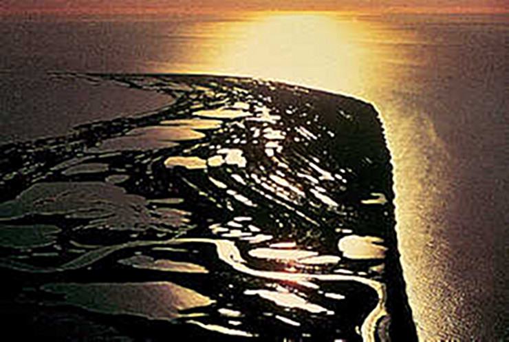
Cape Krusenstern National Monument
Cape Krusenstern National Monument is an archaeological site that is also an archetype of Arctic coastline that disperses at the Chukchi Sea. The monument is situated alongside the succession of other beach ridges. This also stands as solid evidence that the coastline was being used even before the period when events in the history were recorded in written. Many birds migrate from different parts of the world to this monument throughout the year. Tourists can take flight from Anchorage/ Fairbanks and travel to Nome/ Kotzebue. The various commercial airlines provide charted and scheduled flights to certain park spots and also to the villages. One can take ride of the small planes that fly over the monument area and from where one can have the beauteous view of the ridges. These planes can be hired from Kotzebue. In summers the visitors can also get access to motorized and non-motorized boats and in winters one can also drive the snowmachines and take ride of the dog sleds. Summers are good for taking a walking trip to the monument, though airlines continue to provide their regular services. While hiking on the hills, one can also get the picturesque glimpses of the tundra landforms. One can even view the Chukchi Sea from the hills. Many enthusiasts prefer Kayaking but most of the time tourists abstain from it due to the chilly westerly winds that even blow in summers. The monument is open for the visitors throughout the year. The climate of the place is characterized by snow, cold wind, sheer white ice, and extreme temperatures. The months from October to April are the chilliest. The place is notorious for witnessing freezing temperatures at any time of the year.
Explore More