
- Home
- Travel Packages
- Top Destination
-
Travel Attraction
By Category
Top Attraction

- Travel Agents
- Car Rentals
- Hotels
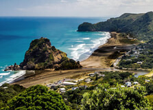
Piha Beach is one of the most iconic and beautiful beaches in New Zealand, located on the west coast of Auckland, about 40 kilometers from the city center. Known for its rugged beauty, wild surf, and stunning black sand, Piha Beach is a popular destination for both locals and tourists. Whether you are looking for a relaxing day by the sea, an adventurous surf session, or a chance to explore the natural beauty of the area, Piha Beach offers something for everyone. It is also a great place to enjoy a variety of outdoor activities, from hiking to beachcombing. How to Reach Piha Beach, Auckland Piha Beach is easily accessible by car from Auckland. The drive takes around 45 minutes, and you can follow State Highway 16 west from Auckland city center, then turn onto Piha Road, which will lead you directly to the beach. The road leading to Piha is narrow and winding, but the journey is scenic, offering beautiful views of the lush landscape and nearby hills. The drive is straightforward, and the road is generally well-maintained, though it can be a bit tricky for those not used to driving on winding roads. If you prefer public transportation, there are bus services that run from central Auckland to Piha Beach, although they are less frequent than private transport. The nearest bus station is in New Lynn, where you can catch a bus to Piha. However, using a car is the most convenient way to visit Piha Beach, especially if you want to explore the area at your own pace. Weather at Piha Beach, Auckland The weather at Piha Beach is typically mild, with warm summers and cooler winters. Being located on the west coast of Auckland, the area can be quite windy, particularly in the cooler months. Summer (December to February) temperatures range between 18°C to 25°C (64°F to 77°F), making it a perfect time to enjoy the beach and outdoor activities. Winter temperatures (June to August) are generally mild, ranging from 10°C to 15°C (50°F to 59°F), although it can feel colder due to the wind. Piha Beach also tends to experience a fair amount of rainfall throughout the year, especially in the winter months. It’s a good idea to check the weather forecast before visiting, as heavy rain can make outdoor activities less enjoyable. Despite the rain, the beach is stunning year-round, and the surrounding lush greenery thrives in the wetter climate, making it an excellent spot for nature lovers. Timing for Visiting Piha Beach, Auckland Piha Beach is a popular destination throughout the year, but the best time to visit is during the summer months when the weather is warm and dry. The beach can get quite busy during weekends and public holidays, so it’s advisable to visit early in the day to avoid crowds. The area is open to visitors 24 hours a day, but the best time to enjoy the beach and surrounding area is from early morning to late afternoon when the sun is at its best for outdoor activities like swimming, surfing, and hiking. It’s important to note that Piha Beach can be dangerous for swimming and surfing, particularly if you are unfamiliar with the surf conditions. Always check the surf report and heed the lifeguard warnings if you plan to swim or surf. It’s best to avoid swimming during rough weather conditions, as the currents can be strong. Why Famous for Piha Beach, Auckland? Piha Beach is famous for its dramatic beauty, which includes its wide expanse of black sand, the towering Lion Rock, and the powerful surf that attracts surfers from all over the world. The beach is surrounded by stunning native forests and rugged cliffs, making it a perfect spot for nature lovers and outdoor enthusiasts. The beach is particularly well-known for its surf, as it has some of the best waves on the west coast of New Zealand. The strong waves make it a popular location for both beginner and experienced surfers. Piha is home to one of the oldest surf lifesaving clubs in New Zealand, the Piha Surf Lifesaving Club, which has been keeping beachgoers safe for many years. Another reason Piha Beach is famous is its striking landscape. The iconic Lion Rock, a large rock formation located in the middle of the beach, is one of the most photographed landmarks in Auckland. The rock holds historical significance for the Māori people, and visitors can climb to the top for spectacular panoramic views of the beach and surrounding area. Entry and Visit Details about Piha Beach, Auckland There are no entry fees for Piha Beach, as it is a public area. Visitors are welcome to come and enjoy the beach and surrounding parkland. The area is open to the public year-round, and it’s a popular spot for locals, especially during weekends and summer holidays. The beach is easily accessible, and there are ample parking facilities available near the beach and along Piha Road. During the busier times of the year, parking can fill up quickly, so it’s a good idea to arrive early to secure a spot. If you’re planning to hike around the area, there are several walking tracks that lead through the surrounding native bush. Some of these tracks provide excellent views of the beach and Lion Rock, while others take you to more secluded spots for a peaceful escape in nature. History and Architecture at Piha Beach Piha Beach has a rich history, both culturally and geographically. The area was originally settled by Māori people, and the land surrounding the beach was used for various purposes, including fishing and gathering resources from the surrounding forest. The Māori name for Piha, “Te Piha,” refers to the area’s narrow inlet or stream that runs through the area. Piha Beach became a popular holiday destination for Aucklanders in the early 20th century, and the beach has since become an iconic location for tourists from around the world. The Piha Surf Lifesaving Club, which was established in 1934, is one of the oldest and most respected surf lifesaving clubs in New Zealand. The club continues to play a significant role in ensuring the safety of beachgoers, particularly when the surf is rough. In terms of architecture, Piha is known for its minimalistic, nature-integrated buildings that blend in with the rugged landscape. The area has a laid-back, rustic vibe, with simple beach houses and cottages dotting the coastline. The emphasis is on nature and preserving the area’s natural beauty, which adds to the charm of the location. Things to Do at Piha Beach, Auckland Piha Beach offers a variety of activities for visitors to enjoy, from relaxing on the beach to exploring the surrounding nature. Some of the top things to do include: Surfing: Piha is renowned for its surf and attracts surfers from around the world. Whether you're a beginner or an experienced surfer, Piha’s waves offer something for everyone. Surf lessons are also available for those who want to learn. Hiking: There are several walking tracks around Piha Beach, including the popular Lion Rock track, which offers stunning views of the beach and the surrounding coastline. Beachcombing: The black sand of Piha Beach is perfect for a relaxing stroll, and you can often find interesting shells and other natural treasures along the shoreline. Picnicking: Piha Beach has a large grassy area near the beach that is perfect for a family picnic. There are also picnic tables available, making it a great spot for a relaxing day out. Photography: The dramatic scenery, from the powerful surf to the towering Lion Rock, makes Piha a fantastic destination for photography enthusiasts. Facts About Piha Beach, Auckland Piha Beach is known for its black sand, which is a result of volcanic activity in the area. The beach is famous for its powerful surf, making it a popular destination for surfers. Lion Rock, one of Auckland’s most famous landmarks, sits in the middle of Piha Beach and offers panoramic views of the area. Piha is located on the west coast of Auckland, about 40 kilometers from the city center. It is a popular spot for outdoor activities like hiking, surfing, and photography. Tips for Visiting Piha Beach, Auckland Always check the surf report before swimming or surfing, as the currents can be strong and dangerous. Bring sunscreen, water, and appropriate footwear, especially if you plan to hike or spend the day on the beach. Arrive early during peak times (especially weekends) to secure parking and avoid crowds. Respect the natural environment and follow all safety signs and guidelines. Keep an eye on the weather, as Piha can be quite windy, especially in winter.
Explore More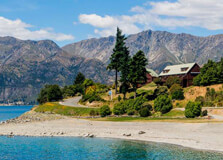
Lake Hawea is a stunning glacier-fed lake located in the Otago region of New Zealand's South Island. Known for its deep blue waters, peaceful surroundings, and breathtaking mountain backdrop, the lake is a paradise for nature lovers and outdoor enthusiasts. Just 15 kilometers north of Wanaka, Lake Hawea offers a quieter and less commercialized alternative to more well-known tourist areas. Whether you're interested in hiking, fishing, camping, or simply relaxing by the water, Lake Hawea is a perfect getaway. How to Reach Lake Hawea, Otago Lake Hawea is easily accessible by road. The nearest town is Wanaka, only about a 15–20-minute drive away. If you're coming from Queenstown, it takes about 1 hour and 45 minutes by car via State Highway 6 and Cardrona Valley Road. From Christchurch, it’s a scenic 5.5 to 6-hour drive through the Southern Alps. The most convenient way to reach Lake Hawea is by renting a car, especially since public transport is limited in the region. If you prefer, you can also take a bus to Wanaka and then hire a taxi or local shuttle to Lake Hawea. The route is incredibly scenic, offering views of lakes, rivers, and mountains. Weather in Lake Hawea, Otago Lake Hawea enjoys a continental climate with four distinct seasons. Summers (December to February) are warm and dry, with temperatures ranging from 20°C to 30°C, making it perfect for swimming, boating, and other outdoor activities. Autumn (March to May) is cooler and ideal for hiking and photography, thanks to the golden colors of the trees. Winters (June to August) can be cold, with temperatures sometimes falling below freezing, especially at night. Snow often covers the nearby mountains, creating a picturesque landscape. Spring (September to November) brings fresh greenery and blooming flowers. Overall, Lake Hawea is a year-round destination, but summer is the most popular time to visit. Timings to Visit Lake Hawea, Otago There are no fixed opening or closing times for visiting Lake Hawea, as it is a natural attraction. Visitors can come at any time of the day or year. However, the best time to enjoy outdoor activities like hiking, fishing, and swimming is during daylight hours, generally between 7:00 AM and 8:00 PM in summer. If you are camping or staying overnight, there are several holiday parks and camping grounds around the lake that operate year-round. Always check for any seasonal closures, especially in winter when snow may impact road access. Why Famous for Lake Hawea, Otago? Lake Hawea is famous for its pristine natural beauty, outdoor recreation opportunities, and peaceful environment. It’s less crowded than nearby Lake Wanaka, making it ideal for those seeking solitude and connection with nature. The lake is popular for fishing, with trout and salmon being the most common catches. Water sports like kayaking, paddleboarding, and boating are also enjoyed here. The lake is surrounded by mountains, offering great trails and panoramic views, especially from the Hawea Lookout and Isthmus Peak Track. The unspoiled environment and clean air make Lake Hawea a favorite spot for both tourists and locals. Entry and Visit Details about Lake Hawea, Otago There is no entry fee to visit Lake Hawea. The lake is open to the public and accessible from multiple points, including beaches, picnic spots, and trails. Parking is available near the main lakefront area and at most walking tracks and lookout points. Several accommodation options are available nearby, including campgrounds, motels, and holiday homes. Lake Hawea Holiday Park is one of the most popular places to stay, located right on the lake’s edge. It offers campsites, cabins, and direct lake access. History and Architecture of Lake Hawea, Otago The name "Hawea" comes from a Māori tribe that once occupied the area. The lake was an important source of food and travel for early Māori communities, who used it for fishing and gathering resources. European settlers arrived in the mid-1800s, bringing sheep farming and agriculture to the region. While the area around Lake Hawea does not feature elaborate historical architecture, it is rich in heritage and local history. The nearby town of Hawea has a few early settler buildings, and old farms still operate in the region. The focus here is more on natural than architectural beauty. Things to Do in Lake Hawea, Otago - Fishing: Lake Hawea is excellent for trout and salmon fishing. You can fish from the shore or on a boat. - Hiking and Biking: Popular trails include Isthmus Peak, Breast Hill Track, and the Hawea River Trail. - Swimming and Water Sports: In summer, the lake is perfect for swimming, paddleboarding, and kayaking. - Camping: Lake Hawea has several scenic campgrounds where you can stay overnight surrounded by nature. - Scenic Drives and Lookouts: Drive around the lake and stop at various lookouts to take in the incredible views. - Boating: You can bring your own boat or rent one to explore the lake from a different angle. - Relaxing by the Shore: Sometimes, the best thing to do is simply enjoy the peace, listen to the birds, and admire the views. Facts and Tips about Lake Hawea, Otago - Lake Hawea is 35 kilometers long and more than 400 meters deep in some places. - It is one of the highest major lakes in New Zealand, sitting at 348 meters above sea level. - The lake was raised by 20 meters in 1958 for hydroelectric storage purposes. - Bring insect repellent, especially in summer when sandflies are common near the water. - Always check weather and track conditions before hiking in the surrounding mountains. - If you enjoy stargazing, Lake Hawea has very little light pollution. - Local cafés and stores are available in Hawea township for basic supplies and food. - Dogs are allowed in some areas but must be kept under control—always follow posted signs.
Explore More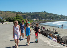
Sumner Beach is one of Christchurch’s most beautiful coastal attractions, offering golden sands, clear waters, and stunning coastal views. It is a popular destination for swimming, surfing, and leisurely walks along the shoreline. How to Reach Sumner Beach, Christchurch Sumner Beach is located about 10 kilometers southeast of Christchurch city center. By Car: A 20-minute drive via Main Road or Ferry Road. By Public Transport: Bus services, including the Purple Line, provide easy access from the city center. By Bicycle: A scenic cycle route follows the coastline, offering a great biking experience. Weather and Best Time to Visit Sumner Beach has a mild oceanic climate with warm summers and cool winters. The best time to visit is during the summer months (December to February) when temperatures are ideal for beach activities. Timings Sumner Beach is accessible 24/7, making it perfect for sunrise or sunset strolls. However, facilities such as cafes and shops operate during standard business hours. Why is Sumner Beach Famous? Sumner Beach is known for: Its stunning natural beauty, with soft golden sand and clear blue waters. Being a favorite spot for surfers, swimmers, and kayakers. The iconic Cave Rock, a unique volcanic formation that visitors can explore. A relaxed coastal town atmosphere with charming cafes and restaurants nearby. Entry and Visit Details Entry to Sumner Beach is free, making it a great budget-friendly destination. Parking is available along the esplanade. History and Architecture Sumner Beach has a rich history dating back to early Māori settlements. European settlers later developed the area into a seaside retreat. The nearby town of Sumner features charming coastal architecture, with historic buildings and modern cafes. Things to Do at Sumner Beach Swimming and Surfing: Enjoy the waves or relax in the sun. Cave Rock Exploration: Climb and explore this famous rock formation. Coastal Walks: Take a scenic stroll along the beach or to nearby Scarborough Hill. Dining: Visit the cafes and restaurants along the esplanade. Photography: Capture the stunning scenery, especially at sunrise and sunset. Interesting Facts About Sumner Beach Cave Rock was formed from volcanic activity millions of years ago. Sumner was one of the first European settlements in the Canterbury region. The beach is named after John Bird Sumner, a former Archbishop of Canterbury. Tips for Visiting Sumner Beach Visit early in the morning or late afternoon to avoid crowds. Bring sunscreen and a hat, as the sun can be strong. Check tide times before exploring Cave Rock. Try the local seafood at nearby restaurants.
Explore More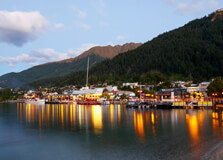
Lake Wakatipu is a stunning alpine lake located in Queenstown, New Zealand. It is the third-largest lake in the country and is known for its crystal-clear waters, breathtaking mountain views, and unique rhythmic rising and falling water levels. How to Reach Lake Wakatipu, Queenstown Lake Wakatipu is easily accessible from Queenstown: By Car: The lake is just a few minutes' drive from Queenstown’s town center. By Walking: Many parts of the lake are accessible by walking trails from Queenstown. By Boat: Cruise services operate on the lake, offering scenic transport options. Weather and Best Time to Visit The weather around Lake Wakatipu varies by season: Summer (December - February): Warm and sunny, perfect for swimming and boating. Autumn (March - May): Cool and colorful with beautiful foliage. Winter (June - August): Cold, with snow-capped mountains providing a stunning backdrop. Spring (September - November): Pleasant temperatures and blooming flowers. Timing of Lake Wakatipu The lake is open to visitors year-round, with no restrictions on visiting hours. Why is Lake Wakatipu Famous? Lake Wakatipu is famous for several reasons: Unique Tidal Effect: The lake has a natural 25-minute seiche (standing wave) causing the water level to rise and fall. Stunning Scenery: Surrounded by mountains like The Remarkables. Adventure Activities: Offers various water sports and hiking opportunities. Film Location: Featured in movies like The Lord of the Rings. Entry and Visit Details Lake Wakatipu is free to visit, but some activities like cruises and kayaking may require fees. History and Architecture The lake was formed by glacial movements thousands of years ago. It holds cultural significance in Māori mythology, with legends about its formation. Things to Do at Lake Wakatipu Boat Cruises: Explore the lake with scenic boat tours. Kayaking and Paddleboarding: Enjoy water sports in the calm waters. Fishing: A popular spot for trout fishing. Hiking and Biking: Trails like the Queenstown Trail offer breathtaking views. Interesting Facts About Lake Wakatipu Lake Wakatipu is New Zealand’s longest lake at 80 km in length. Its depth reaches up to 380 meters. According to Māori legend, the lake was created by a giant sleeping demon. Tips for Visiting Lake Wakatipu Dress in layers, as the weather can change quickly. Book cruises and activities in advance during peak seasons. Respect nature and avoid littering around the lake.
Explore More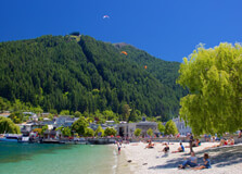
Main Town Beach in Queenstown is a picturesque lakeside spot located along the shores of Lake Wakatipu. It is famous for its stunning views of the surrounding mountains, crystal-clear waters, and lively atmosphere. The beach is a favorite among both locals and tourists for relaxation, water activities, and breathtaking sunsets. How to Reach Main Town Beach, Queenstown The beach is centrally located in Queenstown, making it easily accessible by various means: By Foot: If you're staying in the town center, the beach is just a short walk away. By Car: Parking is available nearby, but it can get crowded during peak hours. By Public Transport: Local buses operate in Queenstown and have stops near the beach. Weather and Best Time to Visit The weather at Main Town Beach varies throughout the year: Summer (December - February): Warm temperatures, perfect for swimming and sunbathing. Autumn (March - May): Cooler but still pleasant for lakeside walks and photography. Winter (June - August): Cold, but the snow-capped mountains create a stunning backdrop. Spring (September - November): Mild temperatures, ideal for outdoor activities. Timing of Main Town Beach The beach is open 24/7, but the best times to visit are early morning for a peaceful atmosphere or evening for a spectacular sunset. Why is Main Town Beach Famous? Main Town Beach is known for: Scenic Beauty: Stunning views of Lake Wakatipu and The Remarkables mountain range. Vibrant Atmosphere: Popular among visitors for picnics, relaxation, and live performances. Water Activities: Ideal for swimming, kayaking, and paddleboarding. Entry and Visit Details There is no entry fee for Main Town Beach, making it an accessible and budget-friendly attraction. History and Architecture The beach has been a natural part of Queenstown’s landscape for centuries. It has become a central point for the community, blending modern amenities with natural beauty. Things to Do at Main Town Beach Swimming and Sunbathing: Enjoy the refreshing waters and relax on the shore. Paddleboarding and Kayaking: Rent equipment and explore the lake. Picnicking: Bring food and enjoy an outdoor meal with a view. Photography: Capture stunning landscapes and sunsets. Interesting Facts About Main Town Beach The beach offers one of the best sunset views in Queenstown. It is a popular spot for local events and performances. Tips for Visiting Main Town Beach Arrive early to secure a good spot, especially during peak season. Bring sunscreen and a hat in summer. Check the weather forecast before planning water activities.
Explore More
Tunnel Beach is one of the most beautiful and unique natural wonders located just a short drive from the city center of Dunedin, on the South Island of New Zealand. Known for its stunning coastal views, fascinating history, and tranquil atmosphere, Tunnel Beach is a must-visit destination for nature lovers, photographers, and anyone seeking a peaceful escape. This picturesque beach, with its carved tunnel leading to the shore, offers visitors a unique experience in the heart of New Zealand's Otago region. How to Reach Tunnel Beach, Dunedin Getting to Tunnel Beach from Dunedin is relatively easy. From the city center, it takes about a 15-minute drive by car. To reach the beach, head west from the city, following the signs to Tunnel Beach Road. The road leads you to a small parking area near the entrance to the beach. From the parking lot, there is a 20-minute walk down a steep path to the beach. It is important to wear comfortable shoes, as the trail can be slippery and rugged in some parts. Weather at Tunnel Beach, Dunedin The weather at Tunnel Beach is typical of the southern New Zealand coast. Dunedin's climate is oceanic, with cool winters and mild summers. The summer months (December to February) offer the warmest temperatures, usually ranging from 15°C to 20°C (59°F to 68°F), making it an ideal time for a visit. However, the weather can change rapidly, so it’s always a good idea to check the forecast before your visit. During the winter months (June to August), the temperatures can drop to around 5°C to 10°C (41°F to 50°F), and the area may experience occasional rain or strong winds, so dressing in layers is recommended. Timing and Why Tunnel Beach, Dunedin is Famous Tunnel Beach is famous for several reasons. First, the beach features a stunning natural tunnel carved through the rock, which visitors can walk through to access the beach. This tunnel, believed to have been carved in the 1870s by the owner of the nearby property, is a unique and visually striking feature that makes the beach stand out among others in the region. The beach is also known for its dramatic sea cliffs, rock formations, and crystal-clear waters. The beach is not just known for its beauty, but also for its quiet and secluded atmosphere. Due to the relatively short and steep path leading down to the beach, many people do not visit, making it a peaceful retreat for those who do make the trek. It’s the perfect spot for a quiet picnic, photography, or simply soaking in the natural surroundings. Entry and Visit Details about Tunnel Beach, Dunedin There is no entry fee to visit Tunnel Beach, making it an affordable destination for all travelers. The beach is open year-round, but visitors should be cautious when walking down the steep trail, particularly during rainy or wet conditions. Since it is a natural area, it is recommended to respect the environment and stay on the marked paths. While there is a car park at the top, the path leading down is only accessible by foot. Therefore, visitors should be prepared for a moderate walk both ways, which takes around 40 minutes in total. History and Architecture of Tunnel Beach, Dunedin The history of Tunnel Beach is closely linked to the development of the surrounding land. The tunnel itself was carved by hand in the 1870s by a wealthy landowner, John Cargill, who wanted to create a private pathway to the beach for his family. The tunnel was painstakingly carved out of the sandstone cliffs using basic tools, and its construction likely took several years. The reason for this tunnel was to allow the Cargill family access to the beach without having to traverse the steep cliffs above. Interestingly, there are several theories about the tunnel's purpose. Some believe it was a way to provide privacy for the family, while others think it may have been a symbol of the family's wealth and status. The tunnel itself is a simple yet functional design, carved straight through the rock, with only one entrance and exit. The tunnel remains intact to this day and continues to be one of the main draws for visitors to Tunnel Beach. Things to Do at Tunnel Beach, Dunedin Tunnel Beach offers several activities for visitors to enjoy. The primary attraction is, of course, the beach itself, with its crystal-clear waters and stunning views of the surrounding coastline. Whether you’re looking to take a dip, have a picnic, or simply relax, Tunnel Beach offers a tranquil environment. The cliffs surrounding the beach are perfect for photography, providing some of the best natural shots of the South Island's rugged coastline. For hikers and outdoor enthusiasts, the walk down to the beach is a highlight. The trail is surrounded by native vegetation, providing a beautiful natural setting, with the opportunity to spot wildlife along the way. The walk down to the beach can be a bit challenging, but the reward of reaching the sandy shore is worth it. Additionally, for history buffs, learning about the fascinating history of the tunnel and the Cargill family can add an interesting dimension to your visit. The surrounding area also offers excellent spots for birdwatching, with seabirds commonly spotted along the coastline. Interesting Facts about Tunnel Beach, Dunedin The tunnel is about 10 meters long and was carved entirely by hand without modern machinery. The beach was once a private retreat for the wealthy Cargill family, and the tunnel was built for their exclusive use. Tunnel Beach is often less crowded than other beaches in the Dunedin area, making it an ideal place for a peaceful getaway. The beach is surrounded by striking rock formations, with unique sea stacks and cliffs that make it a great spot for photographers. In recent years, Tunnel Beach has become more popular as a tourist destination, but it still retains much of its charm due to its remote location. Tips for Visiting Tunnel Beach, Dunedin Wear sturdy footwear: The path down to Tunnel Beach can be steep and slippery, so make sure to wear comfortable, non-slip shoes. Check the weather: The weather in Dunedin can change quickly, so be sure to check the forecast before heading out. Bring plenty of water: The hike down can be challenging, especially on warm days, so it's a good idea to bring water and snacks. Respect the environment: Tunnel Beach is a natural area, so remember to take all rubbish with you and avoid disturbing the wildlife. Take your time: Enjoy the journey down to the beach and take in the scenic views. There’s no rush to get to the bottom!
Explore More
St. Clair Beach is one of the most well-known and loved beaches in Dunedin, located on the southern coast of New Zealand’s South Island. The beach is renowned for its scenic beauty, vibrant atmosphere, and excellent facilities, making it a popular destination for both locals and tourists alike. Whether you're visiting for a relaxing day by the ocean, a surf session, or a walk along the coastline, St. Clair Beach offers something for everyone. With its sandy shore, rolling waves, and proximity to Dunedin city, it's a perfect place to enjoy the natural beauty of the region. How to Reach St. Clair Beach, Dunedin Getting to St. Clair Beach from Dunedin city center is relatively simple, as it is just a short 10-minute drive away. The beach is located to the south of the city, accessible via the main road, Victoria Road, which leads directly to the beach. If you're driving, there is ample parking available near the beach, including parking areas along the Esplanade. There are also several parking lots available, making it convenient for visitors to find a spot. For those who prefer public transportation, there are bus routes that connect Dunedin's city center to St. Clair Beach. Bus services run regularly, and it’s an affordable and easy way to get to the beach. Visitors can check local bus schedules to plan their trip. Additionally, cycling is an option for those staying nearby or in the city, as Dunedin is known for being a bike-friendly city, and there are paths leading to the beach. Weather at St. Clair Beach, Dunedin St. Clair Beach enjoys a temperate maritime climate typical of the Dunedin area. The weather is often unpredictable, with frequent changes in conditions, so visitors should be prepared for varying temperatures and occasional rain. The summer months (December to February) tend to be warmer, with temperatures ranging from 12°C to 20°C (54°F to 68°F). During this time, the beach is popular with swimmers, surfers, and families looking to enjoy a sunny day by the sea. Winter (June to August) temperatures in Dunedin can drop to between 5°C and 10°C (41°F and 50°F), and it is not uncommon to experience rain or strong winds, so it's advisable to dress warmly if you're visiting during this season. Despite the cooler temperatures, the beach remains a pleasant place to visit during winter, especially for those who enjoy the more tranquil atmosphere that comes with fewer crowds. Why St. Clair Beach, Dunedin is Famous St. Clair Beach is famous for its beautiful setting, recreational opportunities, and relaxed atmosphere. It is best known for being a prime spot for surfers, as the beach faces directly into the Tasman Sea and offers good surf breaks, making it a popular destination for surfing enthusiasts of all levels. It has earned a reputation as one of New Zealand's top surf beaches, with consistent waves and a long sandy shoreline perfect for catching waves. In addition to surfing, St. Clair Beach is also famous for its long, wide, sandy beach, which is ideal for a leisurely walk or sunbathing. The scenic views from the beach, including the iconic St. Clair Surf Life Saving Club, and the nearby cliffs, make it a perfect spot to enjoy the outdoors. The St. Clair area also has a vibrant cafe culture, with many cafes and restaurants overlooking the beach, offering great food and beverages with a view of the ocean. Entry and Visit Details about St. Clair Beach, Dunedin There are no entry fees for visiting St. Clair Beach, as it is a public beach. The beach is open to the public year-round, and visitors can come and enjoy the area at any time. Facilities at the beach are free to use, including public restrooms, picnic areas, and a skate park nearby. The beach is accessible 24/7, making it a great place for early morning walks or late-night stargazing. While visiting the beach itself is free, some activities, such as surfing or joining organized surf lessons, may come with a fee. You can rent surfboards and other equipment from local shops or surf schools in the St. Clair area. There are also several cafes, shops, and restaurants nearby where you can enjoy a meal or a coffee after spending time at the beach. History and Architecture of St. Clair Beach, Dunedin St. Clair Beach has a rich history, with its development dating back to the early 19th century. It was originally a prominent location for the city’s early settlers, and over time, it became a well-known leisure spot for Dunedin locals. The area around the beach developed in the late 1800s, with several buildings, including the St. Clair Surf Life Saving Club, which still stands today, playing an important role in the area's development as a popular beach destination. Architecturally, the St. Clair area is known for its historic buildings, including early 20th-century beachside cottages and the traditional surf life-saving club, which was first established in 1911. The architecture of the buildings along the Esplanade reflects the beach's long-standing popularity as a seaside resort, with many buildings retaining their classic charm and offering a glimpse into the region's history. Things to Do at St. Clair Beach, Dunedin St. Clair Beach offers a variety of activities and attractions for visitors to enjoy, whether you're seeking relaxation or adventure. Here are some of the best things to do at the beach: Surfing: As one of Dunedin's top surf beaches, St. Clair Beach is perfect for both beginners and experienced surfers. You can either bring your own surfboard or rent equipment from nearby surf shops and surf schools. Swimming: The beach is a popular spot for swimming, particularly in the summer months when the weather is warmer. The surf life-saving club is active in keeping the area safe for swimmers. Walking and Beachcombing: The long, wide stretch of sand is perfect for beach walks. You can explore the coastline, search for seashells, or simply enjoy the stunning views of the Tasman Sea and the Otago Peninsula. Café and Dining: There are several cafes and restaurants near the beach where you can enjoy fresh seafood, coffee, and other refreshments while enjoying beautiful views of the ocean. Skateboarding: The nearby St. Clair Skate Park is popular among locals and visitors, offering a space for skateboarders and scooter riders to practice their skills. Take a Scenic Walk: You can explore the nearby St. Clair Esplanade and take in the views from the cliffs that overlook the beach. The area is perfect for a leisurely walk or bike ride. Interesting Facts about St. Clair Beach, Dunedin St. Clair Beach is known for its excellent surf breaks, making it one of the top surfing destinations in New Zealand. The beach was historically a popular recreational area in Dunedin, dating back to the 19th century when it was a fashionable seaside resort. St. Clair Beach is also home to the St. Clair Surf Life Saving Club, which was established in 1911 and continues to play a key role in keeping the beach safe for swimmers and surfers. The beach offers some of the most spectacular views of the Otago Peninsula and the rugged coastline, making it a favorite spot for photographers and nature lovers. Tips for Visiting St. Clair Beach, Dunedin Bring Sunscreen: The sun can be strong, especially in summer, so make sure to pack sunscreen to protect your skin while enjoying the beach. Check the Surf Conditions: If you're planning to surf, check the surf conditions before you go. Local surf shops and websites provide up-to-date surf reports. Respect the Surf Life Saving Club: The club is there to keep everyone safe, so always pay attention to safety signs and follow their advice while swimming or surfing. Visit During Low Tide: To experience the best beach conditions, consider visiting during low tide, as the beach will be wider and more accessible. Take Photos: The views of the beach and coastline are breathtaking, so don’t forget your camera or smartphone to capture the beauty of St. Clair Beach.
Explore More
Taiaroa Head is a remarkable and iconic headland located on the Otago Peninsula, near Dunedin, New Zealand. Known for its stunning natural beauty, diverse wildlife, and historical significance, Taiaroa Head is a must-visit destination for nature lovers, history enthusiasts, and travelers seeking breathtaking views. This unique location offers a fascinating blend of history, wildlife, and scenery, making it one of Dunedin's most popular tourist attractions. How to Reach Taiaroa Head, Dunedin Taiaroa Head is situated about a 40-minute drive from Dunedin city center, making it an easily accessible destination for visitors traveling by car. To reach Taiaroa Head, head out of Dunedin and follow the Otago Peninsula route. The road takes you along the beautiful coastline, providing incredible views of the harbor and the surrounding landscape. Once you pass through Portobello village, follow the signs to Taiaroa Head. The drive itself is scenic and picturesque, offering travelers the chance to enjoy the stunning natural surroundings. If you don't have access to a car, you can also join a guided tour from Dunedin city. Many local tour companies offer packages that include visits to Taiaroa Head, often combining it with other nearby attractions such as Larnach Castle or the Royal Albatross Centre. Weather at Taiaroa Head, Dunedin The weather at Taiaroa Head is typical of the temperate maritime climate of Dunedin and the Otago Peninsula. Summer (December to February) tends to be mild, with average temperatures ranging from 12°C to 20°C (54°F to 68°F). This is the best time to visit if you wish to enjoy pleasant weather for walking and outdoor activities. Autumn (March to May) and spring (September to November) are also good times to visit, as the weather remains relatively mild, though cooler temperatures and occasional rain showers can occur. Winter (June to August) brings colder conditions, with temperatures ranging from 5°C to 10°C (41°F to 50°F), and it's the wettest season in the region. However, Taiaroa Head remains an interesting site to visit during winter, with fewer crowds and a peaceful atmosphere. Be sure to bring warm layers and a waterproof jacket if you plan to visit during the colder months, as the weather can change quickly. Why Taiaroa Head, Dunedin is Famous Taiaroa Head is famous for its remarkable wildlife, stunning coastal views, and historical significance. The headland is home to one of the world's rarest seabirds, the northern royal albatross (Diomedea sanfordi), which nests on the cliffs of Taiaroa Head at the Royal Albatross Centre. The albatross colony here is the only known mainland breeding site for these majestic birds in the world, making Taiaroa Head a significant location for birdwatching and conservation. In addition to the royal albatross, Taiaroa Head is a site of great historical importance. The headland is home to the historic Taiaroa Head Fortress, a 19th-century military defense system built to protect the entrance to Otago Harbour from potential attack. The fortress is a significant part of New Zealand's military history and offers visitors the chance to explore its well-preserved tunnels and fortifications, providing a fascinating insight into the country's colonial past. Entry and Visit Details about Taiaroa Head, Dunedin Entry to Taiaroa Head is generally free, though specific attractions, such as the Royal Albatross Centre and the Taiaroa Head Fortress, may charge an entrance fee. It is important to check the official websites for current opening hours and fees before planning your visit, as they may vary depending on the season and special events. The Royal Albatross Centre offers guided tours and a chance to observe the northern royal albatross up close. The best time to visit is during the albatross breeding season, which typically runs from September to March. During this period, visitors can witness the dramatic courtship displays, nesting behavior, and chick-rearing activities of the albatrosses. The center also provides educational displays and information about the conservation efforts in place to protect the albatross population. For those interested in the area's military history, the Taiaroa Head Fortress is open to the public, offering guided tours of the underground tunnels, gun emplacements, and other historical features. The fortress was built in the 1880s as part of New Zealand's defense strategy during the colonial era, and it remains an important landmark of New Zealand’s military heritage. History and Architecture of Taiaroa Head, Dunedin The history of Taiaroa Head is rich and diverse. The area was originally inhabited by Māori people, who called it "Te Pae o Aoraki," meaning "the ridge of Aoraki," and used the headland as a lookout and for fishing. Later, European settlers arrived in the region, and the headland became a key site for defense and communication. In the 1880s, during the period of British colonial rule, the New Zealand government built the Taiaroa Head Fortress as part of the country’s defense system. The fortress was constructed to protect the entrance to Otago Harbour from possible naval threats, particularly after concerns about potential Russian expansion in the Pacific region. The fortress features large coastal guns, underground tunnels, and several other fortifications designed to defend the area. Today, visitors can explore the well-preserved military structures and learn about New Zealand's defense history. The Royal Albatross Centre, which opened in 1989, is situated on the headland and plays a key role in the conservation of the northern royal albatross. The centre provides educational displays and guided tours to help visitors learn about the albatross breeding program and the efforts to preserve this endangered species. Things to Do at Taiaroa Head, Dunedin There are several exciting activities to enjoy during your visit to Taiaroa Head: Royal Albatross Viewing: One of the top attractions at Taiaroa Head is the opportunity to observe the northern royal albatross. Guided tours at the Royal Albatross Centre allow visitors to view the albatross up close, particularly during the breeding season when the birds are nesting. Explore the Taiaroa Head Fortress: Discover the history of New Zealand's military defenses by exploring the Taiaroa Head Fortress. Guided tours provide insight into the fortifications, tunnels, and the strategic importance of the site. Scenic Walks: Taiaroa Head offers stunning panoramic views of the Otago Peninsula and Otago Harbour. Take a walk around the headland to enjoy these views and observe other wildlife, such as seals and seabirds. Photography: The dramatic cliffs, coastal views, and fascinating wildlife make Taiaroa Head a great destination for photography. Capture the beauty of the albatross, the fortress, and the surrounding landscape. Interesting Facts about Taiaroa Head, Dunedin Taiaroa Head is home to the only mainland breeding colony of the northern royal albatross in the world. The Taiaroa Head Fortress was built in the 1880s and is a well-preserved example of New Zealand’s colonial military architecture. The headland is named after the Māori word "Taiaroa," meaning "the head of the sea," reflecting its importance as a natural landmark. In addition to albatrosses, Taiaroa Head is also home to other wildlife, including sea lions, seals, and a wide variety of seabirds. In 1989, the Royal Albatross Centre was established to help protect and conserve the endangered albatross population, making it a significant site for bird conservation. Tips for Visiting Taiaroa Head, Dunedin Plan Ahead: Be sure to check the opening times of the Royal Albatross Centre and Taiaroa Head Fortress, as they may vary depending on the season. Bring Binoculars: If you're planning to watch the albatross or other wildlife, binoculars will enhance your experience and allow for better views. Dress for the Weather: The weather on Taiaroa Head can change quickly, so it's advisable to bring layers and wear sturdy shoes, especially if you plan to explore the fortifications or go on a walk around the headland. Respect Wildlife: Taiaroa Head is home to sensitive wildlife, so it's important to respect the albatross and other animals. Follow the guidelines provided by the Royal Albatross Centre to ensure minimal disturbance to the creatures. Take Your Time: Taiaroa Head is a peaceful and beautiful location, so take your time to explore, enjoy the views, and learn about the fascinating history and wildlife of the area.
Explore More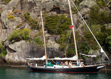
The Mine Bay Maori Rock Carvings, located on the shores of Lake Taupo in the North Island of New Zealand, are one of the most significant and impressive examples of Maori art in the country. Carved into the cliff faces of Mine Bay, these intricate and powerful carvings tell the story of New Zealand’s rich Maori heritage. The carvings were created by local Maori artists in the late 20th century and have become one of the most popular tourist attractions in Taupo. Offering a unique blend of cultural history, artistic beauty, and natural surroundings, the Mine Bay Maori Rock Carvings are a must-see for visitors to the area. How to Reach Mine Bay Maori Rock Carvings, Taupo The Mine Bay Maori Rock Carvings are located on the eastern shore of Lake Taupo, about 20 minutes by boat from the Taupo town center. The carvings themselves are only accessible by water, making boat tours the primary way to reach the site. There are several options for getting to the carvings, including: Boat Tours: Numerous local tour operators offer boat trips to Mine Bay, providing informative commentary about the carvings and the surrounding landscape. Some of the boat tours also include stops at other nearby attractions, such as the geothermal hot springs. Kayak or Stand-Up Paddleboard: For those looking for a more adventurous experience, you can hire a kayak or stand-up paddleboard and paddle your way out to the carvings. This is a fantastic way to enjoy the serene beauty of Lake Taupo and get a closer look at the carvings. Private Boat: If you have access to your own boat, you can also reach the site by water. However, it is important to be aware of the local regulations and ensure that you are respecting the natural environment. While there is no direct land access to the carvings, the scenic boat trip to Mine Bay offers beautiful views of Lake Taupo and its surroundings, making the journey itself an enjoyable part of the experience. Weather at Mine Bay Maori Rock Carvings, Taupo The weather around Taupo can vary depending on the season, so it's important to consider the climate when planning your visit. Taupo has a temperate climate with four distinct seasons. During the summer months (December to February), the weather is warm and ideal for outdoor activities, with temperatures ranging from 20°C to 25°C (68°F to 77°F). This is the peak tourist season and the best time to take a boat tour to the carvings. Autumn (March to May) and spring (September to November) are also pleasant, with mild temperatures and fewer crowds. These seasons are ideal for visitors who want to enjoy the natural beauty of the area while avoiding the summer rush. Winter (June to August) can be cold, with temperatures dropping to around 5°C (41°F) during the day, and occasional frost in the mornings. While the weather can be cooler, the winter months offer a peaceful and less crowded experience, although it may be chilly for boat trips. Why Mine Bay Maori Rock Carvings, Taupo is Famous Mine Bay Maori Rock Carvings are famous for their stunning beauty, intricate detail, and the cultural significance they represent. The carvings were created in the 1970s by a team of Maori artists, led by local carver Matahi Whakataka-Brightwell. The carvings depict a range of important figures from Maori mythology and history, with the most notable image being the large portrait of Ngatoroirangi, the Maori high priest who played a central role in the settlement of the Taupo region. What makes these carvings particularly special is their location. Carved into the cliffs along the shoreline of Lake Taupo, the art is not only a testament to the skill of the artists but also to the connection between the Maori people and the land. The carvings are set against the stunning backdrop of the lake and surrounding mountains, making them a unique and visually spectacular cultural site. Entry and Visit Details about Mine Bay Maori Rock Carvings, Taupo Visiting the Mine Bay Maori Rock Carvings is a relatively easy process, but it requires taking a boat or other watercraft, as the carvings are not accessible by land. There are no entrance fees to view the carvings from the water, but you will need to pay for the boat tour or other watercraft rentals. Prices for boat tours can vary depending on the operator and the length of the tour. Generally, a boat tour will cost around NZD 50-80 per person, with some tours offering additional stops and activities along the way. The best time to visit is during the summer months, when the weather is warm and the lake is calm. However, visitors can enjoy the carvings year-round, and many boat operators run tours throughout the year. Be sure to check with the local tour operators for specific schedules and availability, as weather conditions may impact the availability of tours, particularly in winter. History and Architecture of Mine Bay Maori Rock Carvings The history of the Mine Bay Maori Rock Carvings is closely tied to the cultural heritage of the local Maori people, particularly the Ngati Tuwharetoa iwi (tribe), who have lived in the Taupo region for centuries. The carvings were created in the 1970s, with the aim of preserving and showcasing the Maori heritage of the area for future generations. Matahi Whakataka-Brightwell, a local Maori artist, led the project, and his work was inspired by traditional Maori carving techniques. The central figure of the carvings is Ngatoroirangi, the legendary priest who is said to have brought fire to the Taupo region. Other carvings depict important Maori figures, such as Tama-te-Kapua and the symbols that represent the spiritual connection between the people and the land. The carvings themselves are incredibly detailed, with intricate lines and patterns that are characteristic of traditional Maori art. Things to Do at Mine Bay Maori Rock Carvings, Taupo Aside from visiting the carvings, there are several other activities that visitors can enjoy around Lake Taupo and the surrounding area: Boat Tours: As mentioned, boat tours are the primary way to reach the Mine Bay Maori Rock Carvings. These tours typically last about 1 to 2 hours, and many operators offer additional sightseeing along the way, such as stopping at the geothermal hot springs at the lake's edge. Kayaking and Paddleboarding: For those seeking an adventure, kayaking or stand-up paddleboarding offers a more intimate experience of Lake Taupo and the Maori carvings. Paddle out to the carvings for a unique perspective and the opportunity to enjoy the natural beauty of the lake up close. Fishing: Lake Taupo is a popular spot for fishing, particularly for trout. If you enjoy fishing, you can try your luck on the lake, either from a boat or the shore. Geothermal Hot Springs: After visiting the carvings, relax in the nearby geothermal hot springs, which are located along the lake's shore. These natural thermal pools offer a soothing experience amidst stunning surroundings. Hiking: The Taupo region is home to several scenic walking and hiking trails, including those around the lake. Hiking to a lookout point can offer fantastic views of the lake and surrounding mountains. Interesting Facts about Mine Bay Maori Rock Carvings The carvings were created in the 1970s, making them relatively modern compared to other traditional Maori rock art. The main carving depicts Ngatoroirangi, a high priest who played a significant role in the mythological history of the Taupo region. The carvings are carved into the volcanic rock that makes up the cliffs along the eastern shore of Lake Taupo. The carvings are only accessible by water, adding to their exclusivity and charm. Lake Taupo is the largest lake in New Zealand, and the views from the carvings are some of the best in the area. Tips for Visiting Mine Bay Maori Rock Carvings Book in Advance: As the boat tours are popular, especially in peak tourist seasons, it's a good idea to book your tour in advance to secure your spot. Wear Comfortable Clothing: If you're taking a boat tour, wear comfortable clothing and bring a jacket, as it can get cool on the water. Respect the Carvings: While viewing the carvings from the water, it is important to respect the cultural significance of the site. Keep noise levels low and follow any guidelines provided by the tour operators. Consider Other Activities: There are many other attractions around Lake Taupo, so plan a day trip to explore the region fully.
Explore More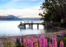
Kinloch Beach is a stunning lakeside destination located on the northern shores of Lake Taupo in New Zealand. Known for its crystal-clear waters, golden sands, and breathtaking views of the surrounding mountains, Kinloch Beach is a peaceful retreat perfect for swimming, picnicking, and water sports. The beach is a favorite among locals and tourists looking for a relaxing escape from the busier parts of Taupo. How to Reach Kinloch Beach, Taupo Kinloch Beach is located about 20 km northwest of Taupo town and is easily accessible by various means: By Car: A 20-minute drive from Taupo via State Highway 1 and Kinloch Road will take you directly to the beach. Parking is available near the lakefront. By Bike: The W2K (Whakaipo to Kinloch) cycle trail provides a scenic biking route to the beach. By Boat: Kinloch Beach has a marina where visitors can dock their boats if arriving via Lake Taupo. Weather in Kinloch Beach The weather at Kinloch Beach varies throughout the year: Summer (December to February): Warm temperatures ranging from 20°C to 28°C, perfect for swimming and sunbathing. Autumn (March to May): Mild weather with beautiful autumn colors. Winter (June to August): Cooler temperatures between 5°C and 15°C, ideal for peaceful walks along the lake. Spring (September to November): Moderate temperatures and blooming landscapes. Timings of Kinloch Beach Kinloch Beach is open to visitors 24/7. However, daytime visits are recommended for safety and to make the most of the scenic beauty and activities available. Why is Kinloch Beach Famous? Kinloch Beach is famous for its tranquil atmosphere, scenic landscapes, and outdoor adventure opportunities. The beach is known for its safe swimming conditions, making it a family-friendly destination. Additionally, it serves as a gateway to some of the best hiking and biking trails in the region, such as the Great Lake Trail. Entry and Visit Details Kinloch Beach is a public beach and free to visit. Facilities available for visitors include: Public restrooms and changing facilities. BBQ and picnic areas along the lakefront. A marina for boat docking. Playgrounds and open spaces for children. History and Background Kinloch Beach and its surrounding area have a rich history, originally inhabited by the Māori people who lived along the shores of Lake Taupo. The modern settlement of Kinloch was developed as a lakeside retreat, attracting holidaymakers and adventure seekers. Over the years, it has grown into a popular destination while maintaining its peaceful, unspoiled charm. Things to Do at Kinloch Beach Swimming and Sunbathing: Enjoy the clean, clear waters and relax on the sandy shore. Boating and Fishing: The marina allows easy access to Lake Taupo for fishing and sailing. Kayaking and Paddleboarding: Rent a kayak or paddleboard to explore the scenic shoreline. Hiking and Biking: Access the Great Lake Trail and other nearby tracks for stunning nature views. Photography: Capture the breathtaking landscapes of the lake and mountains. Picnicking: Enjoy a meal with family and friends in designated picnic areas. Interesting Facts About Kinloch Beach Kinloch means “Head of the Lake” in Scottish Gaelic. The beach is one of the few sandy shorelines on Lake Taupo. It is a popular stop for cyclists on the Great Lake Trail. The Kinloch Marina provides access to some of the best fishing spots on Lake Taupo. Tips for Visiting Kinloch Beach Bring sunscreen and a hat, as the sun can be strong, especially in summer. Pack a picnic or BBQ supplies for a lakeside meal. Wear comfortable shoes if planning to explore hiking or biking trails. Check weather conditions before engaging in water activities. Respect the environment by disposing of trash properly and keeping the beach clean. Kinloch Beach is a must-visit destination for nature lovers and adventure seekers. Whether you want to relax by the lake, explore scenic trails, or enjoy water sports, this hidden gem in Taupo offers an unforgettable experience.
Explore More