
- Home
- Travel Packages
- Top Destination
-
Travel Attraction
By Category
Top Attraction
- Travel Agents
- Car Rentals
- Hotels
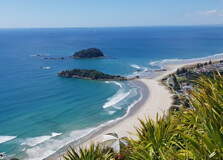
Mount Maunganui (Māori: Mauao) is a vibrant coastal suburb and iconic landmark in Tauranga, Bay of Plenty, New Zealand. The distinct 232 m dormant volcanic cone sits at the end of a tombolo, with both ocean and harbour beaches on either side :contentReference[oaicite:1]{index=1}. Known simply as "The Mount," it offers a perfect mix of natural beauty, adventure, and relaxed beach-town culture. How to Reach Mount Maunganui, Bay Of Plenty By Car: Just a 10-minute drive from Tauranga via the Harbour Bridge via the Bay Link, or around 1 hour from Rotorua and ~2¾ hours from Auckland :contentReference[oaicite:2]{index=2}. By Bus: Regional and local buses run from Tauranga to Mount Main Street, with frequent MyRide services. By Air: Fly into Tauranga Airport (just south of Mount), then take a taxi or shuttle for the 5-minute ride. Weather at Mount Maunganui The region enjoys a pleasant, temperate climate. Summers (Dec–Feb) are warm and sunny (25–30 °C), ideal for the beach and outdoor activities :contentReference[oaicite:3]{index=3}. Winters (Jun–Aug) are mild (10–18 °C), but rainfall increases. Autumn and spring are mild and less crowded, making them ideal for exploring. Timings of Mount Maunganui As a suburb and outdoor destination, Mount Maunganui is open 24/7. Specific attractions have their own hours: Mount Hot Pools: Daily, typically 8:00–20:00. Beach Patrols: Lifeguards on main ocean beach seasonally (Nov–Mar). Harbour and walking tracks: Always open. Why Mount Maunganui is Famous - Two beautiful beaches: Surf Beach on the ocean side; calm Pilot Bay on harbour side, both within walking distance :contentReference[oaicite:4]{index=4}. - Mauao summit: The extinct volcanic cone with hiking trails offering panoramic 360° views of plains, sea, and Tauranga :contentReference[oaicite:5]{index=5}. - Ocean pools: The famed Mount Hot Pools feature hot saltwater baths—perfect after a hike or surf :contentReference[oaicite:6]{index=6}. - Community & events: Hosts beach events, triathlons, markets, and the Northern Regional Surf Championships :contentReference[oaicite:7]{index=7}. Entry and Visit Details - Free access: The summit walk, beaches, harbour-side walks, and island tracks are free. - Parking: Paid street and zone parking along Main Beach; early arrival is recommended during summer. - Hot Pools admission: Approx. NZD 14 per person; passes available on-site :contentReference[oaicite:8]{index=8}. - Safety: Swim between flags on patrolled ocean beach; watch for harbor boat traffic at Pilot Bay. History & Geography of Mauao Mauao is a rhyolite lava dome formed around 2.35 Ma ago—as a result, Mount Maunganui was born. It holds deep cultural significance to local iwi, Ngāi Te Rangi, Ngāti Ranginui and Ngāti Pūkenga, who co-manage its summit with the Tauranga City Council :contentReference[oaicite:9]{index=9}. Legend tells of a nameless mountain that, spurned in love, was dragged to the sea by patupaiarehe (supernatural beings), earning the name "Mauao" meaning “caught by the dawn sun” :contentReference[oaicite:10]{index=10}. The Waka landing—used by Māori for centuries—tells the story of early settlement and spiritual importance. Architecture & Urban Design Mount Maunganui’s beachfront area features a relaxed, sun-soaked streetscape with low-rise boutique shops, cafés, surf stores, and eateries lining The Strand. Pilot Bay’s wharf is a community hub with a mix of heritage buildings and seaside facilities :contentReference[oaicite:11]{index=11}. Notable modern sites include the Bay Oval cricket stadium and Tauranga Airport terminal near the Mount suburb :contentReference[oaicite:12]{index=12}. Things to Do at Mount Maunganui - Hike Mauao summit: Easy–moderate trails (30–40 min) with breathtaking views :contentReference[oaicite:13]{index=13}. - Base walk: Scenic 3.5 km loop around the hill—ideal for walking and jogging :contentReference[oaicite:14]{index=14}. - Surf & swim: Surfboards to rent; lessons available. Swim in calm Pilot Bay or on surf beach :contentReference[oaicite:15]{index=15}. - Hot Pools: Saltwater pools ranging 31–39 °C, plus spa jets and family-friendly zones :contentReference[oaicite:16]{index=16}. - Moturiki Island: Walk accessible at low tide, enjoy birdwatching, and view blowhole :contentReference[oaicite:17]{index=17}. - Cycle & stroll: Beachfront paths are shared by bikes and walkers :contentReference[oaicite:18]{index=18}. - Stand-up paddleboarding: Lessons and rentals available—calm harbour waters suit beginners :contentReference[oaicite:19]{index=19}. - Boat cruises: Dolphin, fishing, and scenic cruises depart from Pilot Bay :contentReference[oaicite:20]{index=20}. - Art & nightlife: Browse beachside galleries, street murals; enjoy bars and summer markets :contentReference[oaicite:21]{index=21}. - Attend events: Northern Surf Champs, triathlons, concert series, farmers’ markets. Interesting Facts - Mauao experienced a tragic ship accident in 1950 when the "Ranui" ferry sank off its base—memorial plaque exists :contentReference[oaicite:22]{index=22}. - The ocean beach has been ranked New Zealand’s #1 beach by TripAdvisor and recognized globally :contentReference[oaicite:23]{index=23}. - Bay Oval opened in 2007 and hosted its first Test match in 2019; capacity ~10,000 :contentReference[oaicite:24]{index=24}. - The Mount is a surf mecca and triathlon hotspot, with international championships held regularly :contentReference[oaicite:25]{index=25}. - Moturiki was once a Marineland aquarium (1950s–1980s), now a wildlife refuge :contentReference[oaicite:26]{index=26}. Tips for Visiting Mount Maunganui Start the summit hike early—sunrise is spectacular, and the route can get busy :contentReference[oaicite:27]{index=27}. Bring water, sunscreen, and layers—weather can change on summit. Arrive early for parking or use Tauranga bus or cycle to avoid summer crowds :contentReference[oaicite:28]{index=28}. Book Hot Pools online during high season to secure your spot :contentReference[oaicite:29]{index=29}. Stay between flags on patrolled surf beach and follow lifeguard guidance. Don’t miss local ice-cream (Sea People, Mount Made, Copenhagen Cones) :contentReference[oaicite:30]{index=30}. Explore street art & galleries along The Strand; consider guided walking tours of Māori legend sites. Try paddleboarding or kayak around Pilot Bay or Moturiki island—sunset tours are magical :contentReference[oaicite:31]{index=31}. Time your visit to coincide with community events and markets—Little Big Markets, artisan nights).
Explore More
The Auckland Art Gallery Toi o Tāmaki is one of New Zealand's premier art institutions, located in the heart of Auckland's central business district. As the largest public art gallery in New Zealand, it houses an impressive collection of national and international art, ranging from traditional Maori works to contemporary masterpieces. Whether you're an art lover or simply looking to explore Auckland’s cultural scene, the Auckland Art Gallery offers a vibrant space to appreciate the creative diversity of the country. With stunning architecture, rotating exhibitions, and a strong commitment to showcasing both New Zealand’s heritage and modern artistic expression, it is a must-see for anyone visiting Auckland. How to Reach Auckland Art Gallery, Auckland The Auckland Art Gallery is located at 36 Kitchener Street, near the central business district of Auckland. It's easily accessible by a variety of transport options. Public transport options are plentiful, with many buses stopping nearby. The gallery is also a short walk from the Auckland Train Station, which connects commuters from various parts of the city. If you're traveling by car, there are parking facilities close to the gallery, including a paid car park beneath the Auckland Civic Theatre. Additionally, the gallery is close to the popular Queen Street, making it an easy walk from many central Auckland locations. You can also take a taxi or use ride-sharing services like Uber for more convenience. Weather Auckland has a temperate maritime climate, characterized by mild temperatures throughout the year. Summer months (December to February) are warm, with temperatures typically ranging from 20°C to 25°C (68°F to 77°F), while winter (June to August) brings cooler conditions with temperatures ranging from 8°C to 15°C (46°F to 59°F). The city experiences moderate rainfall throughout the year, so it’s a good idea to carry an umbrella or light jacket if you’re visiting during the wetter months. Regardless of the weather, the Auckland Art Gallery is an indoor experience, so you can enjoy the exhibitions and collections in comfort, rain or shine. Timing The Auckland Art Gallery is open daily from 10:00 AM to 5:00 PM. During public holidays or peak tourist seasons, the gallery may extend its hours or have special events. The gallery is closed on Christmas Day but remains open on other major holidays. It’s advisable to check the gallery's official website for any changes to operating hours or special holiday events before planning your visit. For visitors wishing to avoid crowds, it’s often best to visit on weekdays or early in the morning. Why Famous for Auckland Art Gallery, Auckland? The Auckland Art Gallery is renowned for its extensive collection of both historical and contemporary art. It is particularly famous for its representation of New Zealand’s art history, including significant works from the colonial period, early New Zealand modernism, and Maori and Pacific Island art. The gallery's permanent collection showcases masterpieces from some of New Zealand's most renowned artists, including works by Charles Frederick Goldie, Frances Hodgkins, and Colin McCahon. Additionally, the gallery is known for hosting world-class temporary exhibitions, bringing in international artists and traveling exhibitions. The combination of New Zealand heritage art and global contemporary art makes the gallery a vibrant, ever-changing space. The architecture of the building itself is also a major attraction. The Auckland Art Gallery was expanded and renovated in 2011, and the design blends heritage and modern elements seamlessly. The gallery’s award-winning design includes a beautiful glass roof that allows natural light to flood the space, enhancing the experience for visitors. Entry and Visit Details about Auckland Art Gallery, Auckland Entry to the Auckland Art Gallery is free for all New Zealand residents, which is a significant draw for locals. International visitors will need to purchase an entry ticket, which typically costs around NZD 20 for adults. There are often discounted prices for seniors, students, and children. The gallery also offers special promotions and free entry on certain days or for specific exhibitions, so it's a good idea to check the gallery's website or social media pages for any upcoming offers or changes in pricing. Group discounts are available for schools or large tours, and the gallery is well-equipped for visitors with accessibility needs, including wheelchair access throughout the building. History and Architecture The Auckland Art Gallery was first opened in 1888 and has since become a key cultural institution in New Zealand. Originally designed by architect Sir George Grey, the building has undergone multiple expansions and renovations over the years. The most significant renovation took place in 2011 when the gallery was redesigned by architects from the firm Mee + O’Connell and constructed by the public architecture practice, providing a more modern and functional space. The renovation preserved the heritage aspects of the original building while adding contemporary design features, like the distinctive glass canopy that now crowns the gallery, allowing natural light to flood the central atrium. The gallery’s architecture beautifully combines old and new, with the original building's neoclassical style complementing the modern addition, creating a harmonious space that suits its vast range of collections. The unique layout and thoughtful design make the museum an architectural gem in the heart of Auckland. The museum is also located within the Auckland Domain, a large public park that provides lovely green spaces and great views of the surrounding area, offering visitors a scenic backdrop for their museum experience. Things to Do at Auckland Art Gallery, Auckland There is no shortage of things to do when visiting the Auckland Art Gallery, whether you’re interested in exploring the extensive art collections, engaging with special exhibitions, or enjoying the architectural beauty of the building itself. Some of the highlights include: Explore the Permanent Collection: The gallery’s permanent collection includes works by significant New Zealand artists, such as Charles Goldie, and a wide range of international artists. The collection covers a variety of genres, including landscape painting, contemporary art, and traditional Maori art. Attend Special Exhibitions: The gallery regularly hosts special exhibitions showcasing both international and New Zealand-based artists. These exhibitions often feature cutting-edge contemporary art, photography, sculpture, and installations, making each visit a new experience. Participate in Events and Workshops: The Auckland Art Gallery frequently hosts artist talks, workshops, and other educational events for visitors of all ages. This is a great way to engage more deeply with the artwork and learn from experts in the field. Enjoy the Outdoor Sculpture Collection: The gallery is home to a large collection of sculptures located in the surrounding Auckland Domain, offering a pleasant outdoor experience as you explore the gallery’s extensive grounds. Relax at the Café: After exploring the gallery, take a break at the gallery’s café, which offers a range of delicious food and drinks with views over the park. Facts About Auckland Art Gallery, Auckland The Auckland Art Gallery Toi o Tāmaki is the largest public art gallery in New Zealand. It houses over 15,000 works of art, including an impressive collection of New Zealand and Pacific art, as well as international art from Europe, Asia, and the Americas. The gallery’s building is a blend of neoclassical and contemporary architecture, with an iconic glass canopy that allows natural light to fill the space. It regularly hosts special exhibitions that bring international artists to New Zealand, making it a key venue for contemporary art in the region. The Auckland Art Gallery is an award-winning architectural space, having received numerous design awards for its renovation and expansion. Tips for Visiting Auckland Art Gallery, Auckland Wear comfortable shoes, as the gallery is spacious, and you’ll want to explore the various floors and exhibitions. Check out the gallery’s website before your visit for information about any special exhibitions or events happening during your stay. If you’re traveling with children, look for family-friendly workshops or activities offered by the gallery. Consider taking a guided tour to gain deeper insights into the art and architecture of the gallery. Take time to relax in the museum’s café, which is a great place to take a break and reflect on what you’ve seen. Visit the Auckland Domain park for a leisurely stroll before or after your visit, as it provides a peaceful and scenic environment.
Explore More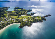
Waiheke Island, located just 35 minutes by ferry from downtown Auckland, is a beautiful escape from the city. Known for its picturesque beaches, rolling vineyards, and laid-back atmosphere, Waiheke is one of New Zealand’s most popular island getaways. Visitors are drawn to the island’s stunning natural beauty, its thriving wine industry, and a range of outdoor activities that make it an ideal destination for day trips or extended stays. Whether you're interested in exploring the island’s wineries, relaxing on its pristine beaches, or hiking its scenic trails, Waiheke Island has something to offer everyone. How to Reach Waiheke Island, Auckland Waiheke Island is easily accessible from Auckland city center, and the most common way to get there is by ferry. The ferry departs regularly from the Auckland Ferry Terminal, located at the end of Quay Street. The ferry ride takes approximately 35 minutes and offers stunning views of the Auckland skyline and surrounding waters, making the journey itself a memorable part of the trip. There are also a number of ferry services to Waiheke, operated by Fullers360 and Explore Waiheke, offering frequent sailings throughout the day. If you prefer a more private or unique experience, you can also reach the island by private boat, seaplane, or helicopter, although these options are more expensive than the ferry service. Once you arrive on Waiheke Island, public transport, taxis, or rental vehicles such as cars, scooters, or bicycles are available for further exploration. Weather The climate on Waiheke Island is relatively mild, with temperatures remaining comfortable year-round. The island enjoys a temperate maritime climate, which means warm summers and cool winters. Summer temperatures (December to February) generally range from 20°C to 25°C (68°F to 77°F), making it perfect for outdoor activities like hiking, beach outings, and vineyard tours. Winter (June to August) temperatures typically range from 8°C to 15°C (46°F to 59°F), which is mild compared to other parts of New Zealand, though it can be a bit cooler and rainier. Waiheke Island is generally drier than Auckland, which makes it a fantastic destination for outdoor adventures. However, it is still advisable to carry a light jacket or umbrella, as the weather can change suddenly. For the best experience, summer and spring (September to November) are considered ideal times to visit when the island is in full bloom with beautiful flowers and lush landscapes. Timing Waiheke Island is a year-round destination, but the best time to visit largely depends on what kind of experience you are seeking. The peak tourist season runs from December to February, coinciding with the summer holidays in New Zealand. During this period, the island is more crowded, and many events and festivals take place. If you're planning to visit during these months, it's advisable to book accommodations and ferry tickets in advance. For a quieter and more relaxed experience, consider visiting in the shoulder seasons of spring (September to November) or autumn (March to May). These months offer pleasant weather without the summer crowds. Winter (June to August) is the least popular time to visit, as the weather can be cooler and rainier, but the island is still charming for those who enjoy a more tranquil environment. Why Famous for Waiheke Island, Auckland? Waiheke Island is famous for its breathtaking landscapes, world-class wineries, and artistic vibe. It is known as the “Island of Wine” because of its thriving wine industry, with more than 30 wineries scattered across its rolling hills. The island’s Mediterranean climate makes it an ideal location for growing grapes, and many of its wines have gained international acclaim. Wine tours are one of the most popular activities on the island, with visitors flocking to its vineyards to enjoy tastings and scenic views. Aside from its wineries, Waiheke Island is famous for its stunning beaches, such as Oneroa Beach, Palm Beach, and Onetangi Beach, which are perfect for swimming, sunbathing, and water sports. The island also has a strong arts community, with numerous galleries and craft shops showcasing local artwork, jewelry, and pottery. Additionally, Waiheke’s rugged landscape, featuring hills, forests, and coastal cliffs, offers ample opportunities for hiking, cycling, and nature walks, making it a haven for outdoor enthusiasts. Entry and Visit Details about Waiheke Island, Auckland There are no entry fees for Waiheke Island itself, but you will need to purchase a ferry ticket to get there. The cost of ferry tickets varies depending on the time of day, the ferry company, and whether you are traveling with a vehicle. A standard adult return ferry ticket costs around NZD 40 to 45, and a one-way ticket is typically around NZD 20 to 25. Prices for children and seniors are discounted, and some ferry companies also offer family passes or group discounts. Be sure to check ferry schedules and prices in advance to plan your visit accordingly. Once on the island, you can explore at your own pace. If you plan to visit wineries or join a guided tour, booking in advance is recommended. Many vineyards offer tours that include wine tastings and educational talks about the wine-making process. You can also take a hop-on-hop-off bus tour, which will take you to the island’s key attractions, including its top beaches and wineries. If you’re planning on renting a vehicle, car rentals, scooters, and bicycles are available at the ferry terminal or other locations on the island. History and Architecture Waiheke Island has a rich history that dates back to the early Polynesian settlers and later European colonization. The first Maori people arrived on the island in the 14th century, and evidence of their settlement can still be seen in archaeological sites scattered across the island. Early Maori settlers fished, farmed, and built villages on Waiheke, and their influence is still felt in the island's culture today. After European settlers arrived in the 19th century, Waiheke became an important location for agriculture, particularly for sheep farming and later grape growing. Over time, the island’s population grew, and it became known as a popular holiday destination for Aucklanders. Today, Waiheke Island has a mix of modern architecture and historical buildings, many of which are designed to blend in with the island’s natural environment. There are some beautiful historical sites, such as the old churches, including the St. Peter’s Church in Oneroa, and a number of charming old cottages. The island’s architecture is a reflection of its relaxed and rustic vibe, with many buildings using local materials like wood and stone to complement the surrounding landscapes. Things to Do at Waiheke Island, Auckland Waiheke Island offers an abundance of activities for visitors, making it a great destination for outdoor adventures, relaxation, and cultural exploration. Some of the most popular things to do on the island include: Wine Tasting Tours: Waiheke is famous for its vineyards, and taking a wine tour is a must-do activity. There are many vineyards offering wine tastings and tours, where you can learn about the wine-making process while enjoying scenic views of the island. Beach Hopping: The island has several beautiful beaches, including Oneroa Beach, Onetangi Beach, and Palm Beach, which are perfect for swimming, kayaking, or simply relaxing on the sand. Hiking and Nature Walks: Waiheke Island offers numerous hiking trails that take you through its native forests and along coastal cliffs, providing stunning views of the surrounding ocean and islands. Cultural Exploration: The island is home to several art galleries, craft shops, and cultural events that showcase local artists and artisans. Be sure to visit the Waiheke Community Art Gallery or check out the annual Waiheke Island International Jazz Festival. Water Sports: Waiheke is a great spot for kayaking, paddleboarding, and sailing, and there are rental services available at many of the beaches. Cycling: Rent a bike and explore the island at your own pace. Many bike trails connect the vineyards, beaches, and other attractions on the island. Facts About Waiheke Island, Auckland Waiheke Island is the third-largest island in the Hauraki Gulf, covering 92 square kilometers (35 square miles). The island is home to over 30 vineyards, making it one of New Zealand’s most renowned wine-producing regions. Waiheke Island has a population of around 9,000 people, but this number increases significantly during the summer months. The island is known for its excellent hiking trails, beautiful beaches, and vibrant arts scene. The island has a wide range of accommodations, from luxury resorts to more budget-friendly options like holiday parks and Airbnb rentals. Tips for Visiting Waiheke Island, Auckland Book your ferry tickets in advance, especially during peak tourist seasons. If you plan to visit several vineyards, consider taking a guided wine tour to avoid worrying about transport or drinking and driving. Wear comfortable shoes, as there are many walking trails and hilly areas to explore. Don’t forget to bring sunscreen, a hat, and plenty of water, especially if you’re visiting during the summer months. Consider renting a bike or scooter to get around the island easily, as it’s a great way to explore at your own pace.
Explore More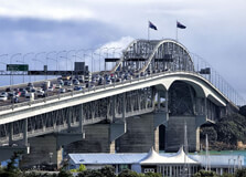
The Auckland Harbour Bridge is one of Auckland's most iconic landmarks and an essential part of the city's transportation infrastructure. Spanning across the Waitematā Harbour, it connects the Auckland Central Business District (CBD) with the North Shore. Not only does it provide vital road access, but it also offers stunning views of the harbor, the city skyline, and the surrounding landscapes. Whether you're commuting or simply exploring the area, the Auckland Harbour Bridge remains a must-see for visitors to Auckland. How to Reach Auckland Harbour Bridge, Auckland The Auckland Harbour Bridge is centrally located, making it easy to access from various parts of the city. If you're traveling by car, it is easily reachable via the Northern Motorway (State Highway 1), which directly leads to the bridge. The bridge itself is located just a short drive from Auckland's city center, about 2 kilometers to the north of the CBD. If you're using public transport, the closest bus stops are located near the bridge, and you can catch a bus from Auckland's CBD that heads towards the North Shore. The Auckland ferry terminal is another nearby option, as ferries often depart from the downtown area to the North Shore, where you can access the bridge by foot or bus. For those looking to walk or cycle, the bridge can also be accessed via the Auckland waterfront, and pedestrian paths run along certain sections. However, if you’re looking for a more immersive experience, many visitors opt for organized walking or cycling tours that provide a closer look at the bridge and surrounding area. Weather at Auckland Harbour Bridge, Auckland The weather in Auckland is generally mild throughout the year, with temperatures rarely reaching extremes. Summers (December to February) are warm, with average highs between 20°C and 25°C (68°F to 77°F), making it an ideal time to enjoy outdoor activities around the bridge, such as walking or sightseeing. The area is often breezy, offering a cool, refreshing atmosphere, particularly when standing on or near the bridge. During winter (June to August), temperatures in Auckland drop to an average range of 8°C to 15°C (46°F to 59°F), but the climate remains relatively temperate. Rain is common in Auckland, especially during the colder months, so it's a good idea to check the weather forecast before planning a visit to the bridge. The breezes near the harbor can make it feel a bit colder, so bringing a light jacket is recommended for winter visits. Timing for Visiting Auckland Harbour Bridge, Auckland The Auckland Harbour Bridge is open for visitors to enjoy year-round. However, the best time to visit is during the daylight hours when you can fully appreciate the panoramic views of the city, the harbor, and the nearby islands. Early mornings and late afternoons are particularly popular times, as these hours offer quieter conditions and opportunities for stunning photographs, especially during the golden hour before sunset. If you're interested in experiencing the bridge at its most iconic, consider visiting on a sunny day. The views from the bridge, especially of the Waitematā Harbour, are especially beautiful under clear skies. For those who enjoy events or thrill-seeking experiences, the bridge often hosts special events such as the Auckland Harbour Bridge Climb and the annual "Bridge to Bridge" fun run. Why Famous for Auckland Harbour Bridge, Auckland? The Auckland Harbour Bridge is famous for several reasons. It is one of the most recognized symbols of the city, offering a striking visual connection between Auckland's central business district and the North Shore. The bridge spans over the Waitematā Harbour, one of the busiest harbors in New Zealand, and its architectural design represents a blend of engineering excellence and aesthetic appeal. Built in 1959, the bridge has become a crucial piece of infrastructure, facilitating the movement of thousands of vehicles daily. Over the years, the bridge has also been involved in several significant engineering projects, including its major expansion in the 1960s to accommodate increasing traffic demand. In addition to its practical significance, the Auckland Harbour Bridge is also known for its breathtaking views and has become a popular tourist attraction. Visitors can enjoy sweeping vistas of the harbor, Rangitoto Island, the Auckland skyline, and the Hauraki Gulf. It also offers a great vantage point for watching ships, yachts, and ferries move across the water. Entry and Visit Details about Auckland Harbour Bridge, Auckland The Auckland Harbour Bridge itself is not a traditional tourist attraction with an entry fee. However, there are several ways to engage with the bridge that offer a more immersive experience. One popular option is the Auckland Harbour Bridge Climb, where visitors can ascend to the top of the bridge and enjoy an unparalleled 360-degree view of the city and surrounding landscapes. This experience is run by a professional team and includes safety equipment and expert guides, making it a thrilling and safe activity for all ages. For those who are interested in exploring the area surrounding the bridge, the nearby waterfront area has plenty of walking and cycling paths, as well as cafes and shops. You can easily access these areas for a more relaxed experience without any additional charges. History and Architecture of Auckland Harbour Bridge The Auckland Harbour Bridge was designed by the renowned New Zealand engineering firm, Freeman Fox & Partners, and built in the 1950s. The project was a significant engineering feat at the time, with the bridge being constructed using a cantilever design. At its completion in 1959, the bridge was considered one of the largest infrastructure projects in the country. The bridge originally had four lanes, but due to growing traffic volumes, an expansion project in the 1960s added more lanes, and it was later reinforced with a steel deck. The design is a remarkable blend of modernism and industrial strength, with the distinctive truss-like structure making the bridge instantly recognizable. Over time, the bridge has undergone several updates to maintain its structural integrity, but it has retained its original design, which remains a testament to mid-20th century engineering. Things to Do at Auckland Harbour Bridge, Auckland There are plenty of things to do around the Auckland Harbour Bridge, both on the bridge itself and in the surrounding area: Auckland Harbour Bridge Climb: One of the most popular activities, where you can climb to the top of the bridge for an incredible view of Auckland. This adventure is available for both tourists and locals and offers a thrilling experience for all ages. Walking and Cycling: The area surrounding the bridge is equipped with pedestrian and cyclist paths, so you can enjoy a leisurely walk or bike ride across the harbor while taking in the views of the bridge and the city. Scenic Views: Whether you're on the bridge itself or exploring the nearby waterfront, the views of the Waitematā Harbour, Rangitoto Island, and the Auckland skyline are incredible. Be sure to bring a camera! Harbour Cruises: You can also take a harbor cruise to get a different perspective of the Auckland Harbour Bridge. Many tours depart from nearby Viaduct Harbour or the Auckland Ferry Terminal. Picnic and Relaxation: The surrounding waterfront area has plenty of green spaces for picnics or just relaxing. There are also various cafes where you can enjoy a meal while watching the bustling harbor activities. Facts About Auckland Harbour Bridge, Auckland The Auckland Harbour Bridge was completed in 1959, making it over 60 years old. It is 1,020 meters long (3,350 feet) and spans across the Waitematā Harbour. The bridge initially had four lanes, but today it accommodates up to eight lanes of traffic. More than 150,000 vehicles cross the bridge daily, making it one of New Zealand's busiest bridges. The Auckland Harbour Bridge was the first major bridge in New Zealand to be built using pre-stressed concrete. Tips for Visiting Auckland Harbour Bridge, Auckland Wear comfortable shoes if you're planning to climb or walk around the area, especially if you plan to explore the waterfront or the bridge itself. If you're planning to do the bridge climb, book your tickets in advance, as spots can fill up quickly, especially during peak seasons. Bring a camera to capture the stunning views of the harbor and the city skyline. If you're visiting in the cooler months, be prepared for breezes and dress warmly, as it can be windy on the bridge. For a more relaxed experience, consider visiting the nearby parks and cafes to enjoy the scenic views of the bridge and harbor.
Explore More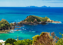
The Tutukaka Coast, located in the Whangarei District of Northland, New Zealand, is one of the most beautiful and serene coastal destinations in the country. Known for its pristine beaches, stunning marine life, and the famous Poor Knights Islands, this coast is a paradise for nature lovers, adventure seekers, and anyone looking for a peaceful retreat in New Zealand's North Island. With its unique blend of rugged coastline, crystal-clear waters, and lush forest, the Tutukaka Coast offers a variety of experiences for travelers to enjoy. How to Reach Tutukaka Coast, Whangarei The Tutukaka Coast is approximately 30 kilometers northeast of Whangarei, the largest city in Northland. To get there, visitors can take a scenic drive along State Highway 1, heading out of Whangarei towards the coast. The drive takes about 30 minutes and offers breathtaking views of the countryside, making it an enjoyable journey in itself. If you’re coming from Auckland, the Tutukaka Coast is about a 2.5-hour drive, making it a great option for a weekend getaway or day trip from the city. There are no direct public transportation services to the Tutukaka Coast from Whangarei, so renting a car or taking a private taxi is the best option. Once you reach the coast, local buses and taxis are available for short distances. Weather and Best Time to Visit Tutukaka Coast, Whangarei The weather on the Tutukaka Coast is temperate, with mild winters and warm, sunny summers. Summer, from December to February, is the peak tourist season, with pleasant temperatures averaging around 22°C (72°F) to 25°C (77°F). This is the ideal time to enjoy the coast's beautiful beaches, go snorkeling or diving, or take boat tours to the nearby Poor Knights Islands. Autumn (March to May) and spring (September to November) are also great times to visit, as the weather is still warm and there are fewer tourists. These seasons offer a more peaceful and relaxing atmosphere, with the added bonus of beautiful spring blossoms or autumn foliage along the coastal walks. Winters (June to August) are cooler, with temperatures ranging between 10°C (50°F) and 15°C (59°F). While the coast is less crowded during this time, it’s still a great place to visit for those who enjoy a quieter and more tranquil experience, especially for walking and enjoying the natural scenery. Why Famous for Tutukaka Coast, Whangarei? Tutukaka Coast is famous for its unspoiled natural beauty and its world-class diving and snorkeling sites, particularly the Poor Knights Islands Marine Reserve. These islands are a major draw for divers from around the world, known for their rich biodiversity and crystal-clear waters. The Poor Knights Islands are often listed as one of the top 10 diving destinations in the world, thanks to their dramatic underwater landscapes, marine life, and visibility. Beyond the marine life, the Tutukaka Coast is famous for its stunning beaches, which include Matapouri Bay, Ngunguru, and the iconic Whale Bay. These beaches are perfect for swimming, relaxing, and beachcombing, and the surrounding coastline offers numerous walking tracks and picnic spots with panoramic views of the ocean. The region is also known for its Māori heritage, with several historical sites that offer insights into the area's indigenous culture and history. The coast is dotted with small villages and communities, giving visitors a sense of New Zealand's slower pace of life. Entry and Visit Details About Tutukaka Coast, Whangarei There is no entry fee to visit the Tutukaka Coast itself. The beaches, walking tracks, and scenic views are free for the public to enjoy. However, if you wish to take part in activities such as diving, snorkeling, or boat tours to the Poor Knights Islands, there are fees associated with these experiences. Popular companies such as the Poor Knights Islands Dive and Snorkel operate tours to the islands, and there are also various accommodation options in the Tutukaka region, including holiday parks, motels, and boutique lodges. It’s recommended to book your tours and accommodation in advance, especially during the busy summer season. History and Architecture of Tutukaka Coast, Whangarei The history of the Tutukaka Coast is rich in Māori heritage, with early Māori settlers using the coastal areas for fishing, agriculture, and trade. The name "Tutukaka" is derived from the Māori language, where "tutu" refers to a native plant, and "kaka" means a type of parrot, often associated with the coastal region's wildlife. Historically, the area was also used by European settlers for timber and flax production, and there are still remnants of early European settlement in the region. Today, the coast’s small villages and towns, such as Tutukaka and Ngunguru, retain a rustic charm with wooden cottages, small fishing boats, and scenic harbors that showcase the area’s maritime heritage. Things to Do in Tutukaka Coast, Whangarei There’s no shortage of activities to enjoy at the Tutukaka Coast. Some of the top things to do include: Snorkeling and Diving: The Poor Knights Islands are one of the world’s top dive sites, with crystal-clear waters, marine life, and dramatic underwater landscapes. Whether you’re an experienced diver or a beginner, you can explore the rich marine biodiversity of the region. Boat Tours: If you’re not a diver, you can take a boat tour to the Poor Knights Islands to witness the breathtaking scenery, wildlife, and underwater life from the comfort of a glass-bottomed boat or on a scenic cruise. Beach Hopping: Explore the pristine beaches of the Tutukaka Coast, such as Matapouri Bay, Ngunguru Beach, and Whale Bay. These beaches are ideal for swimming, sunbathing, and relaxing. Coastal Walks: The Tutukaka Coast is home to several scenic walking tracks, including the Tutukaka Headland Walk and the Matapouri Bay Coastal Walk, offering stunning views of the coastline and access to secluded beaches. Fishing: The area is a popular spot for fishing enthusiasts, with plenty of opportunities for both freshwater and saltwater fishing. Whether from the shore or on a boat, fishing is a favorite pastime in the region. Explore the Local Villages: Spend time in the charming towns of Tutukaka and Ngunguru, where you can find local eateries, art galleries, and shops selling handcrafted goods and souvenirs. Interesting Facts About Tutukaka Coast, Whangarei The Poor Knights Islands are home to a unique underwater ecosystem that includes a wide range of species, including kelp forests, nudibranchs, and schools of tropical fish. Tutukaka is often referred to as the gateway to the Poor Knights Islands, attracting divers and snorkelers from around the world. The Tutukaka Coast is a popular spot for kayaking and paddleboarding, with calm bays and sheltered coves that are ideal for water sports. Matapouri Bay is one of the region’s most photographed beaches, known for its white sand and crystal-clear waters. The region is a haven for birdwatching, with native species such as the New Zealand Kaka and the North Island Kaka spotted in the surrounding forests. Tips for Visiting Tutukaka Coast, Whangarei Book Early: If you plan to visit during the peak summer months, it’s best to book your accommodations and tours in advance, as the area can get busy. Bring Sun Protection: The sun can be intense in the region, especially in the summer. Be sure to bring sunscreen, hats, and sunglasses to protect yourself from UV rays. Respect the Environment: The Tutukaka Coast is a protected marine environment, so be sure to follow the Leave No Trace principles when visiting beaches and natural areas. Take a Camera: The views along the coast are absolutely stunning, so make sure to bring a camera to capture the beauty of the area. Be Prepared for the Weather: Even in summer, the weather can be unpredictable, so bring layers, rain gear, and comfortable walking shoes for coastal exploration. In conclusion, the Tutukaka Coast is a stunning destination that offers something for everyone, from world-class diving to tranquil beach walks and cultural experiences. Whether you're seeking adventure or relaxation, the Tutukaka Coast is a perfect getaway for nature lovers and those looking to explore the breathtaking beauty of New Zealand’s Northland region.
Explore More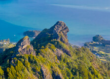
Mt. Parihaka, located in the heart of Whangarei, Northland, New Zealand, is one of the region’s most iconic natural landmarks. Rising to a height of 241 meters, this dormant volcanic cone offers panoramic views of the surrounding area, making it a popular spot for hiking, sightseeing, and photography. Known for its rich cultural history and stunning landscapes, Mt. Parihaka is a must-visit for nature lovers and adventure seekers. How to Reach Mt. Parihaka, Whangarei Mt. Parihaka is situated just a few kilometers from the center of Whangarei, making it easily accessible for both locals and tourists. The most convenient way to reach the mountain is by car, as there are designated parking areas near the base of the mountain. If you're coming from the Whangarei city center, simply head south on the State Highway 1 and follow the signs to the mountain. The drive takes approximately 10 minutes. If you're relying on public transport, buses and taxis are available from Whangarei's central business district, though it may require a bit of walking once you arrive at the base of the mountain. Alternatively, the scenic route from Whangarei’s CBD to Mt. Parihaka makes for an enjoyable walk, offering glimpses of the surrounding natural beauty. Weather and Best Time to Visit Mt. Parihaka, Whangarei The weather at Mt. Parihaka is typically mild, with temperate conditions year-round. Summers (December to February) are warm, with temperatures ranging between 20°C (68°F) to 25°C (77°F), making it ideal for outdoor activities like hiking and sightseeing. The mountain offers a pleasant environment during these months, with clear skies and lush greenery. Autumn (March to May) and spring (September to November) are also great times to visit. The temperatures are moderate, and the area is less crowded compared to the peak summer season. Spring brings vibrant blossoms to the region, while autumn offers stunning foliage, perfect for nature walks and photography. Winters (June to August) are cooler, with temperatures ranging from 10°C (50°F) to 15°C (59°F). While it may be chilly, the views from the top are still breathtaking, and the crowds are minimal, providing a peaceful experience for visitors who prefer a quieter visit. Why Famous for Mt. Parihaka, Whangarei? Mt. Parihaka is famous for both its natural beauty and cultural significance. As one of the tallest volcanic cones in Whangarei, it offers panoramic views of the town, the harbour, and surrounding landscapes, including the Hen and Chicken Islands to the northeast. From the summit, visitors can take in the stunning vistas of the Kaipara Harbour, the rural farmland of Northland, and the city itself, making it a prime location for photography and sightseeing. Additionally, Mt. Parihaka holds great cultural and historical importance to the Māori people. The mountain was once a fortified pā site, used by the Māori as a place of defense and strategic lookout. It was also an important settlement site in pre-European times. Today, Mt. Parihaka is regarded as a symbol of Whangarei’s heritage, and visitors can explore the mountain’s rich Māori history through guided tours or by reading informational signs along the trail. Entry and Visit Details About Mt. Parihaka, Whangarei There is no formal entry fee to visit Mt. Parihaka. The mountain and its surrounding park are open to the public year-round, and the walking tracks are free to access. Visitors can enjoy the trails at their own pace, whether they are hiking to the summit or simply exploring the lower slopes. The walking tracks to the summit of Mt. Parihaka are well-maintained, and there are several routes to choose from, ranging from easy to moderate in difficulty. The hike typically takes around 30 to 45 minutes one way, depending on the chosen path and the pace of the walker. For those who prefer a shorter visit, it is also possible to explore the base of the mountain and enjoy the views from lower vantage points. History and Architecture of Mt. Parihaka, Whangarei Mt. Parihaka is steeped in Māori history. The mountain was once used as a fortified pā site by the Māori, and its elevated position made it an ideal location for a defensive settlement. The Māori people used the site for lookout purposes, watching for invaders from the surrounding areas, and it was heavily fortified with terraces and earthworks. Evidence of these historic structures can still be seen today along the walking trails. In the 19th century, after the arrival of European settlers, Mt. Parihaka continued to hold strategic significance for both Māori and Pākehā (European settlers). The site was involved in the land disputes that took place in Northland during the 19th century, adding to its complex historical significance. In terms of architecture, there are no major buildings on the mountain itself, but the remnants of Māori fortifications can still be seen as archaeological features. The focus of the mountain is its natural beauty and the cultural heritage that it represents. Things to Do in Mt. Parihaka, Whangarei Mt. Parihaka offers a variety of activities for visitors, including hiking, sightseeing, and cultural exploration. Some of the top things to do at Mt. Parihaka include: Hiking: The main activity at Mt. Parihaka is hiking. There are multiple trails that wind their way up the mountain, offering varying levels of difficulty. The trails are well-marked, and the summit provides stunning 360-degree views of Whangarei and the surrounding areas. Photography: The views from the summit are incredible, making it a perfect location for photography. Whether it’s capturing the sprawling cityscape or the lush greenery surrounding the mountain, there are ample opportunities to take photos. Cultural Exploration: As a historic Māori site, Mt. Parihaka provides an opportunity to learn about the rich Māori heritage of the area. You can read interpretative signs along the walking trails to learn about the mountain’s cultural significance or book a guided tour for a more in-depth experience. Picnicking: The base of the mountain offers ample space for picnicking, and there are several parks in the area where you can relax and enjoy the natural surroundings after your hike. Birdwatching: Mt. Parihaka is home to a variety of bird species, including native New Zealand birds such as the Tūī and the Kaka. The area is a great spot for birdwatching, particularly in the early morning or late afternoon when the birds are most active. Interesting Facts About Mt. Parihaka, Whangarei Mt. Parihaka is one of the 10 volcanic cones located in and around the Whangarei region, all of which are remnants of ancient volcanic activity. The Māori name "Parihaka" is derived from the words "pari," meaning hill, and "haka," meaning to dance or perform a ritual. The name reflects the cultural importance of the mountain to the Māori people. The summit of Mt. Parihaka offers one of the best panoramic views in Whangarei, with sights of the city, the Whangarei Harbour, and the surrounding farmland. In 2011, a large-scale restoration project began at the base of the mountain to enhance the visitor experience, including the creation of new walking tracks and better facilities. Mt. Parihaka is also known for its biodiversity, with a wide range of plant species, including native New Zealand trees and shrubs, making it a haven for nature enthusiasts. Tips for Visiting Mt. Parihaka, Whangarei Wear Comfortable Shoes: The hiking tracks can be steep and uneven, so it’s essential to wear comfortable, sturdy shoes that are suitable for walking on rough terrain. Bring Water: It’s important to stay hydrated, especially if you plan to hike to the summit. Bring a bottle of water with you to ensure you stay refreshed along the way. Check the Weather: Before heading up the mountain, check the weather forecast. While the mountain is open year-round, it’s best to hike when the weather is clear, as the views from the summit are the highlight of the visit. Respect the Environment: Be sure to stay on marked trails and avoid disturbing the natural habitat of the plants and animals in the area. This will help preserve the mountain for future generations to enjoy. Take Your Time: Whether you’re hiking to the summit or simply enjoying the views, take your time to fully experience the beauty and history of Mt. Parihaka. In conclusion, Mt. Parihaka offers a perfect mix of nature, history, and adventure. Whether you're a local or a tourist, the hike to the summit, the cultural insights, and the stunning views make Mt. Parihaka an essential part of any visit to Whangarei. So, lace up your shoes, pack some water, and enjoy everything this incredible mountain has to offer!
Explore More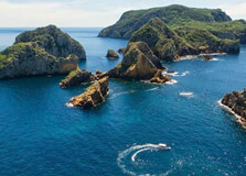
Poor Knights Islands Marine Reserve
The Poor Knights Islands Marine Reserve, located off the coast of Whangarei, New Zealand, is one of the most spectacular underwater ecosystems in the world. Renowned for its rich marine life and vibrant underwater environments, the reserve offers a unique experience for nature enthusiasts and divers alike. The islands are an integral part of New Zealand's marine conservation efforts and have been designated as a marine reserve to protect the area's biodiversity. Whether you're looking to explore the underwater world, hike on the islands, or simply enjoy the beauty of the surroundings, Poor Knights Islands offers a wealth of opportunities for visitors. How to Reach Poor Knights Islands Marine Reserve, Whangarei To reach Poor Knights Islands, you must travel from the mainland of Whangarei to the islands by boat. The islands are located about 23 kilometers (14 miles) northeast of Whangarei, which is roughly a 45-minute boat ride from the nearest port. There are several tour operators in Whangarei who offer daily boat trips to the islands, including dive tours, snorkeling trips, and sightseeing cruises. Most trips depart from the Tutukaka Harbour, which is around a 25-minute drive from Whangarei's city center. If you're planning on visiting, it's essential to book a tour in advance, especially during the peak tourist season (December to February). The boat ride to the islands can be rough, so it's advisable to check the weather and sea conditions before you go. The tours generally include transport, safety equipment, and guides to help you explore the area safely and make the most of your visit. Weather and Best Time to Visit Poor Knights Islands Marine Reserve The weather at Poor Knights Islands is generally temperate, with mild temperatures year-round. Summers (December to February) are warm, with temperatures ranging from 20°C to 25°C (68°F to 77°F). This is the best time to visit for clear skies and warm seas, making it perfect for snorkeling and diving. However, be prepared for occasional rain showers and wind, as coastal weather in New Zealand can be unpredictable. Autumn (March to May) offers cooler temperatures (15°C to 20°C or 59°F to 68°F), and the waters are still warm, making it a great time for diving. Winter (June to August) is cooler, with temperatures dropping to around 10°C (50°F), and the water temperature drops as well, which may make diving less comfortable. Spring (September to November) sees temperatures warming up again, with pleasant weather for outdoor activities. Why Famous for Poor Knights Islands Marine Reserve, Whangarei? The Poor Knights Islands are famous for their unparalleled marine biodiversity and unique underwater features. The marine reserve is renowned for its crystal-clear waters, dramatic underwater cliffs, and abundant marine life, making it one of the world’s top diving and snorkeling destinations. The islands are home to a variety of marine species, including large schools of fish, kelp forests, manta rays, and even the occasional dolphin or whale sighting. The reserve is also famous for its underwater caves and tunnels, which attract divers and snorkelers from around the globe. These caves, combined with the rich marine ecosystem, make Poor Knights Islands an ideal location for both beginner and experienced divers. The region's isolation and strict conservation measures have preserved its marine environment, ensuring that it remains a pristine and protected site. Entry and Visit Details About Poor Knights Islands Marine Reserve As the Poor Knights Islands are a protected marine reserve, access to certain areas of the islands may be restricted to minimize human impact on the environment. Entry to the reserve is typically done through organized tours, and visitors must follow the guidelines set by the tour operators and conservation authorities. Visitors must ensure they are participating in a legally approved tour, as unauthorized visits to the islands are not permitted. While the marine reserve is primarily known for its underwater attractions, the islands also offer opportunities for hiking and wildlife viewing. There are walking tracks on the islands where visitors can enjoy panoramic views of the surrounding ocean and rugged landscapes. The islands are home to various bird species, and it’s possible to spot native seabirds such as gannets, shearwaters, and little blue penguins. History and Architecture of Poor Knights Islands Marine Reserve The Poor Knights Islands have a long history of human interaction, dating back to early Māori settlements. The Māori people named the islands "Rangi-nui-a-Whiro," meaning "the great sky of Whiro," and used the islands for fishing, gathering resources, and as navigational landmarks. European explorers later arrived in the area, and the islands were used for various purposes, including as a resource base for the fishing industry. The islands' significance as a natural habitat led to the establishment of the Poor Knights Islands Marine Reserve in 1981. The reserve was created to protect the area’s unique marine life, preserve its ecological balance, and maintain its status as an important marine research area. Today, the reserve is managed by the Department of Conservation (DOC) in collaboration with local iwi (Māori tribes) to ensure its ongoing protection. Things to Do at Poor Knights Islands Marine Reserve There is no shortage of activities to enjoy at the Poor Knights Islands Marine Reserve. Whether you’re an adventurer or simply looking to relax, there’s something for everyone. Snorkeling and Diving: The Poor Knights Islands are famous for their diving and snorkeling opportunities. The crystal-clear waters, rich marine life, and underwater caves make this one of the best places in New Zealand for underwater exploration. There are various dive sites suitable for all levels of experience, from shallow reefs to deep-water adventures. Boat Tours: If you're not into diving or snorkeling, boat tours are a great way to see the islands from the water. These tours provide opportunities to learn about the history and ecology of the reserve while enjoying the stunning coastal scenery. Wildlife Watching: The Poor Knights Islands are home to a wide variety of seabirds, including gannets, petrels, and shearwaters. Whale watching and dolphin spotting are also popular activities in the area, especially during the migration seasons. Hiking: Visitors can explore the islands on foot via designated walking tracks that offer fantastic views of the surrounding area. These hikes provide an opportunity to learn more about the islands' flora and fauna while enjoying the tranquility of the environment. Interesting Facts About Poor Knights Islands Marine Reserve The Poor Knights Islands are considered one of the best dive sites in the world, attracting divers from around the globe. The marine reserve covers an area of 2,400 hectares (5,930 acres), and it is one of the largest marine reserves in New Zealand. It is home to a variety of marine species, including large schools of fish, giant kelp forests, and rare species such as the endangered Cook's petrel. The underwater caves and tunnels of the islands are a major draw for divers, as they are teeming with marine life. The Poor Knights Islands are a popular location for marine research, with scientists regularly conducting studies on the marine ecosystem and conservation efforts. Tips for Visiting Poor Knights Islands Marine Reserve Book in Advance: Due to the popularity of the Poor Knights Islands, especially during peak tourist seasons, it’s important to book your tours in advance to secure a spot. Bring Your Own Gear: While some tours offer rental equipment, it’s a good idea to bring your own snorkeling or diving gear if you prefer it for comfort or hygiene reasons. Wear Suitable Clothing: If you’re hiking on the islands, make sure to wear sturdy footwear and bring sun protection such as hats, sunscreen, and sunglasses. Respect the Environment: As Poor Knights Islands is a marine reserve, it’s essential to follow the guidelines provided by tour operators and respect the area’s conservation rules to minimize your environmental impact. In conclusion, Poor Knights Islands Marine Reserve is an exceptional destination for anyone interested in marine life, diving, and nature. Its pristine waters, diverse wildlife, and unique geological features make it a must-visit location in New Zealand. Whether you're an adventurer or a nature lover, a visit to the Poor Knights Islands is sure to be a memorable experience.
Explore More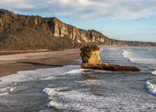
Punakaiki is a small village located on the rugged West Coast of New Zealand's South Island. Known for its striking natural beauty, this tranquil destination is a haven for nature lovers, offering incredible views, unique geological formations, and plenty of outdoor activities. The village is most famous for its stunning Pancake Rocks and blowholes, which attract visitors from all around the world. With a combination of beautiful beaches, lush rainforests, and dramatic cliffs, Punakaiki is a must-visit spot for anyone traveling along the West Coast. How to Reach Punakaiki, West Coast Punakaiki is conveniently located along State Highway 6, approximately halfway between Westport and Greymouth on the South Island's West Coast. The village is easily accessible by car, and visitors traveling from either direction can enjoy the scenic journey through native forests and coastal landscapes. If you're coming from Christchurch, Punakaiki is around a 3-hour drive north, and if you're traveling from Greymouth, it will take about 40 minutes to reach the village. The drive itself is part of the adventure, as the road offers stunning views of the rugged coastline, dense forests, and the Southern Alps in the background. For those using public transportation, there are bus services between major cities such as Christchurch and Greymouth. From Greymouth, visitors can hire a car or take a shuttle to reach Punakaiki. Weather and Best Time to Visit Punakaiki Punakaiki has a temperate maritime climate, which means it experiences mild weather throughout the year, with relatively moderate temperatures and regular rainfall. Due to its coastal location, Punakaiki is prone to heavy rainfall, especially during the winter months (June to August). However, this also means that the lush rainforest and dramatic coastline are always green and vibrant. The best time to visit Punakaiki is during the summer months (December to February) when the weather is warmer, and rainfall is less frequent. This is the peak tourist season, with clear skies and pleasant temperatures, making it ideal for outdoor activities such as hiking and sightseeing. Autumn (March to May) also offers pleasant weather, with fewer tourists and the changing colors of the leaves in the surrounding forests. If you prefer a more tranquil experience, visiting during the winter months allows you to enjoy Punakaiki’s beauty in solitude, although you should be prepared for cooler temperatures and higher chances of rain. Why Punakaiki is Famous Punakaiki is most famous for its Pancake Rocks and Blowholes, a geological wonder that draws thousands of visitors every year. The Pancake Rocks are unique limestone formations that resemble stacked pancakes, created by thousands of years of erosion and pressure from the surrounding sea. These fascinating rock formations are located in the Punakaiki Coastal Reserve, a short walk from the village. Additionally, the nearby blowholes create an incredible natural spectacle when sea water is forced through cracks in the rocks during high tide or stormy weather. The sight and sound of water gushing out of the blowholes with force is a mesmerizing experience for visitors. Aside from its natural wonders, Punakaiki is also famous for its pristine beaches, dense rainforests, and the relaxed, laid-back vibe of the village. It’s a perfect destination for those seeking peace and tranquility, away from the crowds and bustle of more popular tourist destinations. Entry and Visit Details About Punakaiki Entry to Punakaiki itself is free, and visitors can explore the village, its beaches, and surrounding landscapes without any charges. However, the main attraction, the Pancake Rocks and Blowholes, is located in the Punakaiki Coastal Reserve. There is a small entry fee to access the reserve, which helps with maintenance and conservation efforts. The reserve features well-marked walking trails that take you through the area, providing excellent views of the Pancake Rocks and the blowholes. Visitors can explore the Punakaiki Coastal Reserve at any time, though it’s recommended to visit during daylight hours. There are parking facilities available near the reserve, and the walking trails are accessible to people of all fitness levels. The area is well-maintained, with informative signage to educate visitors about the unique geology and history of the site. History and Architecture of Punakaiki Punakaiki has a rich history that dates back to the early Māori settlers. The Māori people used the surrounding forests and waterways for food, shelter, and tools, and the region was significant for its natural resources. European settlers arrived in the area in the mid-19th century, with the establishment of small settlements focused on mining, agriculture, and timber production. While Punakaiki’s main attractions are natural, the village itself has some charming, traditional architecture that reflects its historical past. Many of the buildings in the area are designed in the style of small New Zealand coastal towns, with simple wooden structures that blend well with the surrounding landscape. Things to Do in Punakaiki Punakaiki offers a wide range of activities for outdoor enthusiasts, nature lovers, and those simply looking to relax in a beautiful environment. Some popular things to do include: Visit Pancake Rocks and Blowholes: Explore the unique limestone formations and watch as the blowholes erupt during high tide. Hiking: Take a walk along the Truman Track, a short but scenic hike through native forest that leads to a beautiful beach with dramatic cliffs. Beach Walks: Enjoy the beautiful Punakaiki Beach, perfect for a relaxing walk or a peaceful moment by the ocean. Kayaking: The nearby Pororari River offers opportunities for kayaking or canoeing, allowing visitors to explore the surrounding rainforest from the water. Wildlife Watching: The area is home to various bird species, including the New Zealand rock wren and the rare white-flippered penguin. Birdwatching is a popular activity for nature lovers. Interesting Facts About Punakaiki Punakaiki’s Pancake Rocks are formed from limestone that has been subjected to both marine and geological forces over millions of years. The blowholes at Punakaiki are most active during high tide and when storms occur, making it a popular spot to visit during these conditions. The Punakaiki Coastal Reserve is part of the Paparoa National Park, which covers over 30,000 hectares of coastal wilderness, rainforests, and limestone formations. Punakaiki is home to several small accommodation options, including motels, lodges, and campsites, making it a great place for a quiet retreat or an overnight stop on a West Coast road trip. Tips for Visiting Punakaiki Check the Tide Times: To witness the blowholes in action, plan your visit around high tide times. Check tide schedules for the best chance to see the spectacle. Bring Waterproof Clothing: Punakaiki is known for its rain, so it’s a good idea to bring waterproof jackets and shoes, especially if you plan to hike or walk along the beach. Respect the Environment: The West Coast is a fragile ecosystem, so always stay on marked tracks and avoid disturbing wildlife. Wear Comfortable Shoes: Whether you’re hiking the Truman Track or walking along the beach, comfortable footwear is essential for exploring Punakaiki’s natural beauty. Stay for Sunset: Punakaiki offers incredible sunsets over the ocean, so don’t miss the chance to enjoy the breathtaking views in the evening. In conclusion, Punakaiki is a remarkable destination on New Zealand’s West Coast. With its awe-inspiring natural features like the Pancake Rocks and Blowholes, combined with its accessible walking tracks, tranquil beaches, and unique history, Punakaiki offers something for everyone. Whether you're exploring the dramatic coastline, hiking through lush rainforests, or simply enjoying the peaceful village atmosphere, Punakaiki promises a memorable and enriching experience.
Explore More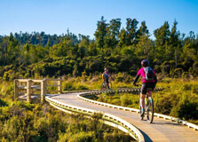
The West Coast Wilderness Trail is one of New Zealand's most exciting cycling and walking trails, offering a remarkable experience through the stunning landscapes of the West Coast. This 139-kilometer trail showcases the incredible beauty of the region, from lush rainforests to dramatic coastlines, and historical gold-mining towns to untouched wilderness areas. It’s an incredible adventure for outdoor enthusiasts, providing a chance to immerse oneself in the natural world while discovering the rich cultural history of the area. How to Reach West Coast Wilderness Trail, West Coast The West Coast Wilderness Trail starts in the town of Greymouth and stretches all the way to Ross, passing through a range of landscapes. To reach the trail, travelers typically fly into Christchurch or Wellington, and then take a bus or drive to Greymouth. The town is easily accessible by car and bus from both cities, with Greymouth being around 3.5 hours’ drive from Christchurch and about 4.5 hours’ drive from Wellington. If you are already on the West Coast, you can also catch a local bus or take the scenic TranzAlpine train that travels from Christchurch to Greymouth, providing stunning views along the way. Once in Greymouth, you can easily access the trail’s starting point and rent bikes from local operators if needed. Weather and Best Time to Visit the West Coast Wilderness Trail The weather on the West Coast can be unpredictable, with frequent rain and changing conditions. It’s a temperate rainforest environment, meaning it tends to have mild temperatures year-round. The trail is best experienced during the warmer months from November to April when the weather is generally more favorable for outdoor activities. This period also offers longer daylight hours, making it ideal for biking or walking. During the winter months (May to October), temperatures can drop, and while it’s possible to still enjoy the trail, rain is more common, and parts of the trail might be slippery. Regardless of the time of year, visitors should come prepared for rain, wear appropriate clothing, and be ready for quickly changing weather conditions. Why Famous for West Coast Wilderness Trail, West Coast? The West Coast Wilderness Trail is famous for its diverse landscapes and historical significance. The trail winds through lush rainforests, wetlands, and rugged coastlines, with stunning views of the Southern Alps and the Tasman Sea. What sets this trail apart is its combination of natural beauty and cultural heritage. The route is not only a treat for nature lovers but also for history buffs, as it takes travelers through historic gold mining towns like Ross, and gives insight into the region’s rich Māori and European heritage. Aside from the scenic beauty and historical sites, the West Coast Wilderness Trail is also renowned for being suitable for people of all fitness levels. Whether you're an avid cyclist, a casual walker, or simply enjoy taking in the views, the trail provides plenty of options to suit all abilities. The trail is well-maintained and has been designed to be accessible for both experienced and novice riders, which makes it an attractive destination for visitors from around the world. Entry and Visit Details About West Coast Wilderness Trail, West Coast The West Coast Wilderness Trail is open year-round and is free to access. The trail can be completed by walking or cycling, and you can choose to do the entire trail or break it up into sections, depending on your time and energy levels. Some sections are suitable for day trips, while others are designed for multi-day adventures. If you plan to cycle the trail, there are bike rental companies in Greymouth and Hokitika where you can rent a bike for the duration of your trip. There are also guided tours available, which are a great option for those who would like to learn more about the area and its history. For those walking, it’s recommended to do so in sections, with a comfortable pace. Various accommodation options are available along the trail, ranging from campsites and backpacker lodges to hotels and B&Bs in nearby towns. History and Architecture of West Coast Wilderness Trail The history of the West Coast Wilderness Trail is closely tied to the region's gold rush era, which began in the 1860s. The trail passes through several gold mining towns, including Ross, which was once a thriving center of gold mining. Today, these towns offer a glimpse into New Zealand's gold rush history and are home to preserved buildings and sites that tell the story of this important time in the region's development. The trail itself was built on old logging and rail routes, and its development as a recreational trail began in the early 2000s, aimed at boosting tourism and promoting the region’s stunning natural landscapes. The route is largely constructed with care to preserve the natural environment, and the architecture along the trail is predominantly rustic and in keeping with the region’s historical character. Things to Do Along the West Coast Wilderness Trail There are many things to see and do along the West Coast Wilderness Trail, making it an exciting and enriching experience for visitors: Cycling: The West Coast Wilderness Trail is one of New Zealand’s best long-distance cycling routes, offering a chance to ride through scenic forests, wetlands, and historical gold mining towns. Walking: For those who prefer a slower pace, walking the trail offers plenty of opportunities to immerse yourself in nature, with peaceful walks through lush rainforests and along beautiful riverbanks. Gold Mining History: Stop by Ross to explore the remnants of the gold mining era. The Ross Goldfields Heritage Park is a great place to learn about the history of gold mining in the area. Birdwatching: The trail passes through wetlands and coastal areas, making it a great place for birdwatching. Look out for native birds such as the Fantail, Grey Warbler, and the endangered South Island Kaka. Historic Sites: Take time to visit the many historic sites along the trail, including old mining tunnels, train stations, and relics of the early settlers. Interesting Facts About West Coast Wilderness Trail The trail spans 139 kilometers, from Greymouth to Ross, and can be completed over 3 to 4 days, depending on your pace and chosen route. It passes through the rugged West Coast rainforests, which are part of the Te Wahipounamu World Heritage Area, a UNESCO World Heritage Site. Although the West Coast Wilderness Trail is most famous for cycling, it is also a fantastic walking trail for those who want to take their time and enjoy the landscape at a leisurely pace. Ross, the southern terminus of the trail, is known as the site of New Zealand’s last gold rush, and it still holds the title for the richest gold discovery in New Zealand’s history. The trail is designed to be family-friendly, with a range of difficulty levels. You can either ride the entire trail or choose sections of the trail based on your interests and energy levels. Tips for Visiting West Coast Wilderness Trail Be prepared for weather changes: The West Coast is known for its unpredictable weather. Always carry a raincoat, sturdy shoes, and warm layers to stay comfortable in any conditions. Plan your accommodation: Book your accommodation ahead of time, especially if you’re visiting during peak tourist season. There are a variety of options, including motels, hotels, and camping grounds along the trail. Take your time: The West Coast Wilderness Trail offers plenty of opportunities for exploration and photo-taking. Don’t rush through it – enjoy the journey and soak in the natural beauty around you. Bring a camera: With stunning views of rainforests, rivers, mountains, and wildlife, you’ll want to capture the beauty of the trail. Make sure your camera or phone is charged! Check trail conditions: Before you start your journey, check the trail’s website or ask for advice on current conditions, especially in winter months when some sections might be wet or slippery. In conclusion, the West Coast Wilderness Trail is a must-visit for nature lovers, history buffs, and outdoor adventurers. Whether you’re cycling, walking, or simply soaking in the natural beauty, this trail offers an unforgettable journey through one of New Zealand’s most scenic and culturally rich regions.
Explore More
Shantytown Heritage Park, located on the West Coast of New Zealand's South Island, is a unique and historical attraction that allows visitors to step back in time to experience life during the Gold Rush era. The park is set in a recreated 19th-century mining town, where visitors can explore old buildings, watch demonstrations of traditional crafts, and learn about the region's gold mining history. It’s an excellent destination for families, history buffs, and anyone interested in New Zealand’s pioneering past. How to Reach Shantytown Heritage Park, West Coast Shantytown Heritage Park is located just 10 kilometers south of the town of Greymouth on New Zealand's West Coast. If you’re traveling from the major cities of the South Island, the easiest way to reach the park is by car. From Christchurch, it’s about a 3-hour drive to Greymouth, and from there, a short 10-minute drive to the park. If you're coming from Nelson, the park is about a 4-hour drive away. There are also bus services available from major towns and cities like Christchurch and Nelson to Greymouth, and from there, you can use local transport or a taxi to get to the park. For those flying into the West Coast, the closest airport is in Greymouth, which is serviced by regular flights from Wellington and Christchurch. Weather The West Coast of New Zealand experiences a temperate climate, with mild winters and cool summers. The weather can be quite variable, so it’s essential to come prepared for a range of conditions. Summer temperatures (December to February) typically range from 10°C to 20°C (50°F to 68°F), while winter (June to August) temperatures can dip to around 5°C (41°F). It’s not uncommon for the region to experience rain, especially in the winter months, so visitors should pack appropriately for the weather and be ready for wet conditions. Timing Shantytown Heritage Park is open year-round, though it operates with slightly reduced hours during the off-season (usually from May to September). The park is open daily, with extended hours during the summer months (October to April). It is advisable to check the opening times before planning a visit, especially if you are traveling during the quieter winter months when some activities may be limited. Why Famous for Shantytown Heritage Park, West Coast? Shantytown Heritage Park is famous for being a living history museum that immerses visitors in the Gold Rush era. The park showcases the rich history of the West Coast’s gold mining days, providing an authentic experience of what life was like during the 19th century. The park’s most famous feature is its recreation of a gold mining town, complete with original buildings, shops, and even a working steam train. Visitors can try their hand at gold panning, visit historic buildings, and watch skilled artisans demonstrate traditional crafts like blacksmithing and wood carving. It’s also famous for its unique collection of historic machinery and exhibits that give a vivid picture of the hardships and triumphs of early settlers in the region. For those interested in the history of New Zealand’s West Coast, Shantytown Heritage Park offers an interactive and engaging way to learn about the area’s cultural and industrial past. Entry and Visit Details about Shantytown Heritage Park, West Coast Admission to Shantytown Heritage Park is by ticket, with prices varying depending on age and the activities you wish to engage in. The park is family-friendly and offers discounts for children and seniors. The entry ticket typically covers admission to the park and access to most of its attractions, including historic buildings, exhibits, and the steam train ride. There are also extra activities that may require additional fees, such as gold panning, train rides, and guided tours. Visitors can purchase tickets at the entrance or in advance via the Shantytown Heritage Park website, especially during peak tourist seasons when crowds are larger. It’s also worth noting that the park has various facilities for visitors, including a café, souvenir shop, and picnic areas, making it a great place to spend a few hours or even a whole day with the family. History and Architecture The history of Shantytown Heritage Park dates back to the gold rush days of the late 1800s, when the West Coast of New Zealand was a thriving center for gold mining. The park was created to preserve and celebrate this period of New Zealand’s history, and it features a range of original and replica buildings that transport visitors back in time. These buildings include a hotel, church, school, and general store, all of which have been faithfully restored to reflect the architectural style of the era. One of the park’s key historical features is its collection of antique machinery and tools used in the gold mining process. Visitors can learn about the various mining techniques and technologies employed by early miners, and how these tools shaped the development of the region. The park also has a working steam train that runs along a section of track, adding to the historical atmosphere and offering a unique way to explore the park. Things to Do in Shantytown Heritage Park Shantytown Heritage Park offers a wide variety of activities that can be enjoyed by visitors of all ages. Some of the most popular things to do include: Gold Panning: Try your hand at gold panning in one of the park's gold-rich streams. Visitors can learn how to pan for gold and keep any treasure they find. Ride the Steam Train: Take a ride on the park's historic steam train, which travels along a section of track through the scenic surroundings. Visit Historic Buildings: Explore the various historic buildings that have been carefully restored to reflect the Gold Rush era, including the general store, hotel, and church. Watch Traditional Crafts: Watch demonstrations of traditional skills like blacksmithing, wood carving, and weaving. Interactive Exhibits: Learn about the history of the West Coast’s gold mining industry through informative displays and hands-on exhibits. Facts about Shantytown Heritage Park Shantytown Heritage Park was officially opened in 1971 and has since become one of the West Coast's most popular tourist destinations. The park is home to over 30 historic buildings, many of which are original structures from the Gold Rush era. The working steam train at Shantytown is one of the park's most iconic attractions, providing visitors with a glimpse into the transportation methods of the 19th century. Shantytown Heritage Park is also known for its educational programs, which are popular among schools and tour groups. Tips for Visiting Shantytown Heritage Park Wear comfortable shoes, as there is a lot of walking to do, especially if you plan to explore the entire park. Consider visiting during the off-peak season (autumn or spring) to avoid large crowds and have a more relaxed experience. Don’t forget your camera! The park is full of photo opportunities, from historic buildings to scenic train rides and gold panning activities. Check the weather before your visit, as the region can be rainy, especially in the winter months. Bring a raincoat or umbrella if necessary. Plan some time to visit the café and souvenir shop, where you can grab a snack or purchase unique local products.
Explore More
Rabbiter’s Bay, located in the Nelson region of New Zealand, is a hidden gem that attracts nature lovers and adventure seekers alike. With its breathtaking views, tranquil waters, and rich natural surroundings, Rabbiter’s Bay is a perfect spot for those looking to escape the hustle and bustle of city life. The bay is known for its calm waters, scenic walking trails, and opportunities for various outdoor activities. Whether you are into hiking, bird watching, or simply soaking in the beauty of New Zealand’s coastline, Rabbiter’s Bay has something to offer for every type of traveler. How to Reach Rabbiter's Bay, Nelson Rabbiter’s Bay is located on the outskirts of Nelson, easily accessible by road. From Nelson city, the bay is approximately a 20-25-minute drive. To reach Rabbiter’s Bay, take State Highway 6 (SH6) north from Nelson. Once you pass the outskirts of the city, follow signs for the bay, and you’ll find a well-maintained road leading you right to the entrance of the area. The drive is scenic, with beautiful views of the surrounding countryside and coastline along the way. If you prefer public transportation, there are buses available in Nelson that can take you to the general area. However, due to the location of Rabbiter’s Bay, a private vehicle is recommended for ease of access. For those who enjoy a more active route, there are cycling paths along the coast that provide a wonderful way to reach the bay while enjoying the natural beauty of the region. Weather The weather in Nelson is generally mild and temperate, which makes Rabbiter’s Bay a great destination year-round. Summer (December to February) sees temperatures ranging from 18°C to 25°C (64°F to 77°F), providing ideal conditions for outdoor activities like hiking, swimming, and picnicking by the bay. Autumn and spring (March to May and September to November) offer pleasant temperatures between 12°C and 20°C (54°F to 68°F), with fewer crowds, making it an excellent time to visit for a more peaceful experience. Winter (June to August) in Nelson is also mild, with temperatures usually ranging from 5°C to 15°C (41°F to 59°F), but it can be cooler near the water. Even in winter, Rabbiter’s Bay remains accessible, though visitors may want to check the forecast for any heavy rain or wind before heading out. The weather generally remains favorable, so no matter the season, Rabbiter’s Bay is an appealing destination. Timing Rabbiter’s Bay is a natural site without specific opening or closing times, making it an ideal spot for visitors who prefer to explore at their own pace. Since it is an outdoor location, it is accessible 24/7. However, for those who wish to take part in organized activities or guided tours, it is recommended to check with local operators for their availability and operating hours. If you’re planning to go hiking or bird watching, visiting in the early morning or late afternoon is often the best time to enjoy the calmest and most beautiful moments of the day. Why Famous for Rabbiter's Bay, Nelson? Rabbiter’s Bay is famous for its serenity, beautiful views, and abundant wildlife, making it a popular spot for both locals and tourists seeking tranquility. The bay is a hidden oasis, offering visitors a chance to escape the crowds while being surrounded by nature’s best features. With crystal-clear waters, lush greenery, and dramatic coastal scenery, the area has earned its reputation as a peaceful retreat for those wanting to connect with nature. The bay is also popular among bird watchers, as it provides a habitat for various bird species. Visitors can often spot native birds such as the New Zealand dotterel, black-backed gulls, and even the occasional Australasian harrier. The area’s calm waters and scenic walking paths make it an excellent place for photography, especially at sunset when the bay is bathed in golden light. Entry and Visit Details about Rabbiter's Bay, Nelson There is no entry fee to visit Rabbiter’s Bay, making it a great option for those looking to enjoy nature without spending money. The park and surrounding area are open to the public year-round, and visitors can explore the bay at their own pace. Whether you're planning to spend the day swimming, walking, or simply enjoying a picnic by the water, the bay is accessible without any restrictions. Parking facilities are available at designated areas near the bay, making it convenient for visitors. As the bay is located in a rural area, there are no extensive amenities on-site. It is recommended to bring your own food, water, and any necessary supplies for your visit. Be sure to pack out any trash to help preserve the beauty of the environment. While the area is quiet and peaceful, visitors should always be aware of their surroundings and take precautions when swimming or hiking, especially when walking along the rocky coastline. History and Architecture of Rabbiter's Bay Rabbiter’s Bay is rich in natural history, with the surrounding area once being home to early Māori settlements. The Māori were the first to settle in the region, and their history can still be seen through remnants of their past in the nearby coastal areas. Over the years, European settlers also began to move into the Nelson region, establishing farms and communities that would eventually lead to the development of the modern city of Nelson. While there are no specific historical buildings at Rabbiter’s Bay itself, the area holds significance due to its importance in the local ecology and as a traditional site for the Māori. The architecture in the surrounding Nelson region is a blend of colonial and modern styles, with many historical buildings reflecting the heritage of the area. Things to Do in Rabbiter’s Bay, Nelson Rabbiter’s Bay offers a variety of activities that cater to different interests, including: Swimming and Beach Activities: The calm waters of Rabbiter’s Bay are perfect for a refreshing swim or for simply relaxing by the beach. It’s a great spot for a peaceful day by the water. Hiking: Several walking trails around Rabbiter’s Bay offer stunning views of the coastline and surrounding nature. The trails vary in difficulty, from easy walks to more challenging routes. Bird Watching: Rabbiter’s Bay is home to a variety of bird species, making it a fantastic location for bird watchers. The peaceful environment allows for quiet observation of native New Zealand birds. Photography: With its scenic landscapes, Rabbiter’s Bay is a photographer's dream. Capture the beauty of the bay, especially at sunrise and sunset when the light casts a magical glow over the water. Picnicking: The area is perfect for a family picnic or a quiet day outdoors. Bring your own food and enjoy a meal while taking in the peaceful surroundings. Facts about Rabbiter's Bay, Nelson Rabbiter’s Bay is a popular spot for locals to escape the busy city life and enjoy the outdoors. The bay offers stunning views of the coastline, with rocky outcrops and lush greenery surrounding the area. It’s a prime location for bird watching, especially during the spring and summer months when many species are nesting. There are no entry fees for visiting Rabbiter’s Bay, making it a cost-effective way to enjoy nature in the Nelson region. The bay is ideal for a variety of outdoor activities, including swimming, hiking, and photography. Tips for Visiting Rabbiter's Bay, Nelson Pack for the Outdoors: Bring sunscreen, a hat, comfortable walking shoes, and enough water for your visit, especially if you plan to hike or stay for an extended period. Respect Nature: Ensure that you clean up after yourself and leave no trace of your visit to help preserve the natural beauty of the area. Check the Weather: The weather can change quickly in coastal areas, so it’s best to check the forecast before heading out, particularly if you plan on hiking. Bring a Camera: Rabbiter’s Bay offers picturesque views, so don’t forget to bring a camera to capture the stunning landscape. Plan for a Quiet Visit: As Rabbiter’s Bay is a peaceful location, it's perfect for those who want to unwind and enjoy nature in solitude.
Explore More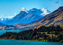
Queenstown, located in the Otago region of New Zealand’s South Island, is one of the country’s most renowned tourist destinations. Known as the “Adventure Capital of the World,” Queenstown is surrounded by breathtaking landscapes, including the Southern Alps, Lake Wakatipu, and nearby valleys. The town is famous for its variety of outdoor activities, vibrant nightlife, stunning views, and world-class restaurants. Whether you’re looking for adrenaline-pumping adventures or serene experiences in nature, Queenstown has something to offer everyone. How to Reach Queenstown, Otago Queenstown is easily accessible, whether you're coming from within New Zealand or internationally. The town is serviced by Queenstown International Airport, which is located about 8 kilometers from the town center. There are direct flights from major cities in New Zealand, such as Auckland, Wellington, and Christchurch, and seasonal flights from Australia as well. If you're traveling from nearby cities, Queenstown is about a 6-hour drive from Christchurch and around a 3.5-hour drive from Dunedin. For those already in the South Island, buses and shuttles run frequently from nearby towns like Wanaka and Te Anau. Self-driving is a popular option for visitors, as it allows for flexibility and scenic routes along the way. Weather Queenstown enjoys a temperate climate, with four distinct seasons. In the summer months (December to February), the temperatures range from 18°C to 25°C (64°F to 77°F), making it ideal for outdoor activities like hiking, biking, and water sports. Winter (June to August) brings cooler temperatures, ranging from -2°C to 8°C (28°F to 46°F), and snow is common, particularly in the nearby ski fields like The Remarkables and Coronet Peak. Autumn (March to May) and spring (September to November) are considered shoulder seasons, with mild temperatures and fewer tourists. These seasons are great for exploring Queenstown without the large crowds, while also enjoying the vibrant colors of autumn or the blooming flowers of spring. It's important to note that Queenstown’s weather can be unpredictable, so it's always best to pack layers and be prepared for sudden changes. Timing Queenstown is open year-round, with different experiences depending on the season. The summer months (December to February) are the busiest, as tourists flock to the town to enjoy activities like hiking, cycling, and lake cruises. Winter (June to August) is also a popular time for visitors who come to ski and snowboard on the nearby slopes. The ski season runs from June to October, attracting many winter sports enthusiasts. Spring and autumn are less crowded, making it an ideal time for those who prefer quieter experiences in nature. These seasons also offer great opportunities for photography, with stunning landscapes and colorful foliage. Regardless of the season, Queenstown has something to offer, with a variety of activities and events happening throughout the year. Why Famous for Queenstown, Otago? Queenstown is renowned for its adventure tourism, offering a wide range of activities for thrill-seekers. Some of the most famous activities include bungee jumping, skydiving, jet boating, and white-water rafting. The town also offers more tranquil activities like scenic cruises on Lake Wakatipu, wine tasting, and hiking in the surrounding mountains. In addition to adventure sports, Queenstown is also known for its stunning natural beauty. With towering mountain ranges, crystal-clear lakes, and alpine forests, the town offers some of the most picturesque landscapes in New Zealand. Queenstown has become a popular destination for those looking for a combination of adventure, nature, and luxury. Queenstown's vibrant culture and lively atmosphere make it a great place to visit for those seeking a mix of relaxation and excitement. The town is also famous for being the filming location of several scenes in Peter Jackson's *The Lord of the Rings* trilogy, adding to its international fame. Entry and Visit Details About Queenstown, Otago There is no entry fee to visit Queenstown itself. However, some attractions and activities may have associated costs. Queenstown is open to the public year-round, and tourists can enjoy the town and its surroundings without the need for a specific visiting time. However, some activities, especially adventure sports and skiing, require bookings in advance, particularly during the peak seasons. Accommodation options range from budget hostels and motels to luxury hotels and resorts. Many visitors stay in or near the town center for easy access to shops, restaurants, and activities. Queenstown also offers a variety of dining options, from casual eateries to fine dining experiences with stunning views of the lake and mountains. History and Architecture of Queenstown, Otago Queenstown’s history dates back to the 1860s when European settlers arrived in the area during the Otago gold rush. The discovery of gold in the nearby Arrow River led to a surge in population, and the town quickly became a bustling settlement. The architecture of Queenstown reflects its gold rush history, with several heritage buildings still standing today, including the historic Queenstown Gardens and the old town center. Throughout the years, Queenstown has transformed from a gold mining town into a thriving tourist destination. Today, the town boasts a mix of modern architecture and historic charm, with many buildings offering stunning views of the lake and surrounding mountains. The town center features a combination of quaint wooden buildings, art galleries, and trendy cafes, while the surrounding areas showcase larger luxury resorts and modern developments. Things to Do in Queenstown, Otago Queenstown is known for its wide variety of activities, catering to both thrill-seekers and those looking for a more relaxed experience. Some of the top things to do in Queenstown include: Bungee Jumping: Queenstown is the birthplace of commercial bungee jumping, and a visit to the famous *Kawarau Bridge* for a jump is a must for thrill-seekers. Skydiving: For those seeking the ultimate adrenaline rush, skydiving over Queenstown offers breathtaking views of the surrounding mountains and lakes. Jet Boating: The Shotover Jet is one of the most famous jet boating experiences in the world, where you can speed through narrow river canyons. Skiing and Snowboarding: In the winter, Queenstown’s nearby ski fields, such as The Remarkables and Coronet Peak, are popular for skiing and snowboarding. Wine Tasting: The nearby Gibbston Valley is famous for its vineyards and wineries, particularly known for producing some of the best Pinot Noir in New Zealand. Lake Wakatipu Cruise: Take a scenic boat ride on Lake Wakatipu, enjoying the stunning views of the surrounding mountains and lush landscapes. Hiking: There are numerous trails around Queenstown, including the Ben Lomond Track, which offers panoramic views of the town and the surrounding area. Facts About Queenstown, Otago Queenstown is located on the shores of Lake Wakatipu, which is New Zealand’s third-largest lake. The town is known as the "Adventure Capital of the World" due to its wide range of adventure tourism activities. Queenstown was once the site of the first commercial bungee jumping operation, established at the Kawarau Bridge in 1988. The town's economy is primarily based on tourism, with outdoor activities, skiing, and luxury travel being the main attractions. Queenstown is a popular destination for international travelers and has been the setting for several Hollywood films, including *The Lord of the Rings* trilogy. Tips for Visiting Queenstown, Otago Book Activities in Advance: Queenstown is a popular destination, especially during the summer and winter months, so it’s advisable to book adventure activities, accommodation, and tours in advance. Dress in Layers: The weather in Queenstown can be unpredictable, so it's important to pack layers, even in the summer. You might experience both warm and cold weather on the same day. Stay Active: Queenstown offers numerous hiking and biking tracks. If you're an outdoor enthusiast, make sure to take advantage of these trails to fully enjoy the natural beauty of the region. Take a Scenic Drive: The drive from Queenstown to Glenorchy along Lake Wakatipu is considered one of the most scenic drives in New Zealand, so make sure to carve out some time to enjoy the views.
Explore MoreNew Zealand - Australia 16 Nights 17 Days Tour
17 Days/ 16 Night
Sydney - Melbourne - Auckland - Christchurch - Rotorua - Queenstown - Gold Coast
SOUTH ISLAND ADVENTURE ( QUEENSTOWN FOCUS ) 5N 6D ITINERARY
6 Days/ 5 Night
Queenstown
NORTH ISLAND CULTURE & GEOTHERMAL ( AUCKLAND / ROTORUA FOCUS )
6 Days/ 5 Night
Queenstown
New Zealand North - South Island 9 Days 8 Nights Tour
9 Days/ 8 Night
Auckland - Christchurch - Rotorua - Queenstown
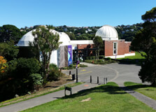
Space Place at Carter Observatory
Located in Wellington, New Zealand, Space Place at Carter Observatory is a must-visit destination for astronomy enthusiasts and anyone curious about the mysteries of the universe. With interactive exhibits, a high-tech planetarium, and fascinating insights into New Zealand's role in space exploration, Space Place offers an educational and entertaining experience for visitors of all ages. How to Reach Space Place at Carter Observatory, Wellington Space Place is situated at 40 Salamanca Road, Kelburn, Wellington. It is easily accessible by various means of transportation: By Cable Car: The Wellington Cable Car is a popular and scenic way to reach Space Place. Take the cable car from Lambton Quay and get off at the Kelburn terminal. A short walk through the Botanic Garden will lead you to Space Place. By Car: If you’re driving, there is limited parking available near the observatory. The nearest parking areas include Salamanca Road and the nearby streets. By Public Transport: Several buses connect the central city with the Kelburn area. The observatory is a short walk from the closest bus stops. Weather and Best Time to Visit Wellington has a temperate maritime climate with mild summers and cool winters. The best time to visit Space Place is on clear nights when the observatory’s telescopes can be used for stargazing. Summer months (December to February) offer pleasant weather, but winter nights (June to August) can also provide crisp, clear skies ideal for astronomy. Timing of Space Place at Carter Observatory Space Place operates on a schedule that varies depending on the season. It is generally open: Tuesday to Sunday: 10:00 AM – 5:30 PM Late Night Sessions: Some evenings offer extended hours for night sky viewing (check the official website for details). Closed: Mondays (except public holidays) Why is Space Place at Carter Observatory Famous? Space Place is renowned for its impressive planetarium shows, interactive science exhibits, and historical significance in New Zealand’s astronomical research. It serves as a gateway to understanding the southern hemisphere’s night sky and the indigenous Māori perspectives on celestial navigation. The observatory has been a center for astronomical study for decades, making it a key attraction in Wellington. Entry and Visit Details The entry fees and visit details are as follows: Adults: Around NZD 14 – 18 Children (4-16 years): Around NZD 9 – 10 Family Pass: Available for discounted rates Concession Rates: Students and seniors may receive discounts It is recommended to book tickets in advance, especially for planetarium shows and guided telescope viewing sessions. History and Architecture Established in 1941, Carter Observatory was named after Charles Rooking Carter, a philanthropist who funded its creation. Over the years, it has been transformed into a modern space education center while retaining its historic charm. The observatory’s architecture blends classic scientific design with contemporary exhibition spaces, making it both a cultural and scientific landmark. Things to Do at Space Place Planetarium Shows: Experience immersive full-dome movies about space, black holes, and celestial wonders. Telescope Viewing: On selected nights, visitors can observe planets and stars through powerful telescopes. Interactive Exhibits: Learn about the solar system, space exploration, and New Zealand’s contributions to astronomy. Walkthrough the Botanic Gardens: Since Space Place is located within Wellington Botanic Garden, visitors can enjoy scenic walks before or after their visit. Interesting Facts Space Place has one of the most advanced digital planetariums in New Zealand. It features a special exhibit on Māori astronomy and traditional celestial navigation. The observatory is over 80 years old and has played a significant role in New Zealand’s space education. The telescope used at Space Place is a Thomas Cooke & Sons 9 ¾-inch refractor, dating back to the 19th century. Tips for Visiting Book planetarium tickets in advance to secure a good seat. Visit on a clear night for the best telescope viewing experience. Wear comfortable clothing, especially during winter when outdoor viewing can be chilly. Allow extra time to explore nearby attractions, such as the Cable Car Museum and the Botanic Gardens.
Explore More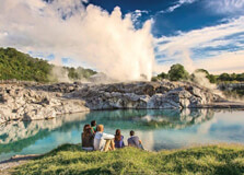
Te Puia is one of the most popular cultural and geothermal attractions in Rotorua, New Zealand. It is home to the famous Pohutu Geyser, bubbling mud pools, and the New Zealand Māori Arts and Crafts Institute. Visitors can explore the rich Māori heritage, witness geothermal wonders, and experience traditional cultural performances, making Te Puia a must-visit destination. How to Reach Te Puia, Rotorua Te Puia is conveniently located in Rotorua and is easily accessible by various means: By Car: Te Puia is about 5 minutes from Rotorua city center. There is ample parking available on-site. By Bus: Several tour buses and public transport options connect Rotorua’s main areas to Te Puia. By Air: Rotorua has a domestic airport with flights from major cities like Auckland and Wellington. Weather and Best Time to Visit Rotorua has a mild climate throughout the year. The best time to visit Te Puia is during the spring and summer months (September to March) when temperatures are warm and the geothermal attractions can be comfortably explored. However, the geothermal activity is visible year-round, making any time a good time to visit. Timing of Te Puia Te Puia is open daily with the following schedule: Opening Hours: 8:30 AM – 5:00 PM Evening Cultural Performances: Available on select nights with dinner packages Visitors are encouraged to check the official website for any changes in timings or special events. Why is Te Puia Famous? Te Puia is famous for its geothermal features, particularly the Pohutu Geyser, which is the largest active geyser in the Southern Hemisphere. It is also renowned for preserving and showcasing Māori culture through traditional carvings, weaving, and performances. The combination of natural wonders and cultural experiences makes it a unique attraction in New Zealand. Entry and Visit Details The entry fees for Te Puia vary depending on the type of experience chosen: General Admission: NZD 50 – 60 for adults Children (5-15 years): NZD 25 – 30 Family Pass: Discounted rates available Guided Tours and Cultural Performances: Available at additional cost It is recommended to book tickets online in advance, especially for cultural performances and guided tours. History and Architecture Te Puia has a rich history deeply connected to the indigenous Māori people. The New Zealand Māori Arts and Crafts Institute, established in 1963, ensures the preservation of traditional Māori skills such as carving and weaving. The architecture of Te Puia incorporates traditional Māori designs, using intricate carvings that tell ancestral stories. Things to Do at Te Puia Visit the Pohutu Geyser: Witness the spectacular eruptions of this famous geyser. Explore the Geothermal Valley: Discover boiling mud pools, steaming vents, and hot springs. Experience Māori Culture: Enjoy traditional performances, storytelling, and cultural workshops. Visit the Kiwi Conservation Center: See New Zealand’s iconic kiwi bird in a specially designed habitat. Enjoy Māori Cuisine: Try authentic hāngī (earth-cooked meal) at Te Puia’s restaurant. Interesting Facts About Te Puia The Pohutu Geyser can erupt up to 30 meters high and erupts several times a day. Te Puia spans over 60 hectares of geothermal valley and cultural heritage land. The Māori Arts and Crafts Institute has trained generations of artists in traditional carving and weaving techniques. The site is managed by the local iwi (tribe), ensuring authentic Māori representation and preservation. Tips for Visiting Wear comfortable walking shoes as the geothermal area has uneven terrain. Bring a camera to capture the stunning geothermal landscapes and cultural performances. Book a guided tour to learn in-depth details about Māori history and the geothermal wonders. Visit early in the day to avoid crowds and enjoy a more immersive experience.
Explore More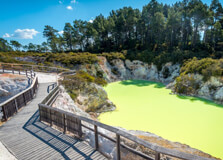
Waiotapu Thermal Wonderland is one of New Zealand’s most spectacular geothermal attractions. Located near Rotorua, this unique landscape features vibrant geothermal pools, steaming vents, bubbling mud pools, and erupting geysers. It is a must-visit destination for nature lovers and those interested in volcanic activity. How to Reach Waiotapu Thermal Wonderland, Rotorua Waiotapu Thermal Wonderland is located about 27 kilometers south of Rotorua and can be accessed in several ways: By Car: The site is about a 30-minute drive from Rotorua via State Highway 5. Free parking is available on-site. By Tour Bus: Many guided tours include Waiotapu in their itineraries from Rotorua or Taupō. By Public Transport: There are limited public transport options, so it is recommended to drive or join a tour. Weather and Best Time to Visit Rotorua experiences a temperate climate with mild summers and cool winters. Waiotapu Thermal Wonderland can be visited year-round, but the best time to explore is during the spring and summer months (September to March) when the weather is warmer and the colors of the geothermal pools appear more vibrant. Timing of Waiotapu Thermal Wonderland Waiotapu Thermal Wonderland operates on the following schedule: Opening Hours: 8:30 AM – 5:00 PM (last admission at 3:45 PM) Lady Knox Geyser Eruption: Daily at 10:15 AM Closed: On Christmas Day It is advisable to arrive early to experience the Lady Knox Geyser eruption and avoid crowds. Why is Waiotapu Thermal Wonderland Famous? Waiotapu is renowned for its stunning geothermal features, including the iconic Champagne Pool, bubbling mud pools, and vibrant mineral deposits. It is considered one of the most colorful geothermal areas in the world, attracting thousands of visitors each year. The site is also known for the daily eruption of the Lady Knox Geyser. Entry and Visit Details The entry fees for Waiotapu Thermal Wonderland are as follows: Adults: NZD 32.50 Children (5-15 years): NZD 11.00 Family Pass: NZD 80.00 (2 adults + 3 children) Guided Tours: Available at additional cost Tickets can be purchased online or at the entrance. Guided tours provide in-depth information about the geothermal features. History and Geothermal Formation The geothermal activity at Waiotapu has been forming for thousands of years due to the volcanic activity beneath the Earth’s surface. The name “Waiotapu” means “Sacred Waters” in Māori, reflecting its cultural and geological significance. The area has been shaped by intense geothermal activity, creating unique formations like sinter terraces, hot springs, and mineral-rich pools. Things to Do at Waiotapu Thermal Wonderland Visit the Champagne Pool: One of the most famous geothermal pools with striking orange and blue hues. Watch the Lady Knox Geyser: Witness the daily eruption of this geyser, reaching up to 20 meters in height. Explore the Bubbling Mud Pools: See natural mud pools in constant motion due to geothermal activity. Walk the Geothermal Trails: Choose from different walking tracks to explore the various geothermal wonders. Photography: Capture the otherworldly landscapes created by mineral deposits and geothermal activity. Interesting Facts About Waiotapu Thermal Wonderland The Champagne Pool gets its name from the constant release of carbon dioxide bubbles, resembling a glass of champagne. The vibrant colors in the pools come from different minerals like sulfur, arsenic, and manganese. The Lady Knox Geyser is named after Lady Constance Knox, the daughter of a former New Zealand governor. Waiotapu covers an area of 18 square kilometers, making it one of the largest geothermal areas in New Zealand. Tips for Visiting Waiotapu Thermal Wonderland Wear comfortable walking shoes as the geothermal area has uneven terrain. Bring a hat, sunscreen, and water if visiting during summer. Arrive early to see the Lady Knox Geyser eruption. Stick to the marked trails to ensure safety around geothermal pools. Carry a camera to capture the stunning natural formations and colors.
Explore More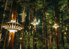
The Redwood Treewalk in Rotorua is one of New Zealand’s most unique eco-tourism experiences. Suspended high among the towering Californian Redwoods, this walk offers breathtaking views of the forest, a peaceful atmosphere, and an opportunity to experience nature in a spectacular way. How to Reach Redwood Treewalk, Rotorua The Redwood Treewalk is located in the Whakarewarewa Forest, just a short distance from Rotorua’s city center. By Car: It takes about 5-10 minutes to drive from Rotorua’s city center. Parking is available near the entrance. By Bike: Rotorua is a bike-friendly city, and cycling to the forest is a great way to explore the area. By Public Transport: Some local bus services operate routes close to the Whakarewarewa Forest. Weather and Best Time to Visit Rotorua experiences a temperate climate with mild temperatures year-round. The best time to visit the Redwood Treewalk is: Spring and Summer (September to March): Pleasant temperatures and vibrant greenery make this a great time to visit. Autumn (April to May): The changing colors of the leaves add to the scenic beauty. Winter (June to August): A unique experience with misty and atmospheric surroundings. Timing of Redwood Treewalk The Redwood Treewalk operates during the following hours: Day Walk: 9:00 AM – 10:30 PM (last entry at 10:00 PM) Night Walk: Begins at dusk and lasts until 10:30 PM Open 7 Days a Week, including public holidays Why is Redwood Treewalk Famous? The Redwood Treewalk is famous for its suspension bridges and platforms that provide a serene and immersive way to experience the beauty of the towering redwoods. It is also known for the enchanting Nightlights Treewalk, featuring glowing lanterns designed by renowned designer David Trubridge. Entry and Visit Details The entry fees for the Redwood Treewalk are: Adults: NZD 39.00 Children (5-15 years): NZD 19.00 Family Pass: NZD 99.00 (2 adults + 2 children) Nightlights Experience: Additional fees apply It is recommended to book tickets online, especially for the Nightlights experience, as it is a popular attraction. History and Architecture The Redwood forest in Rotorua was planted in 1901 as an experimental timber plantation. Over the years, it has become a beloved natural area for locals and tourists alike. The Treewalk was constructed with eco-friendly materials, ensuring minimal impact on the trees while offering a safe and enjoyable experience. Things to Do at Redwood Treewalk Daytime Treewalk: Experience the beauty of the towering trees from 20 meters above the ground. Nightlights Experience: Walk among lantern-lit bridges for a magical and immersive adventure. Explore the Forest Trails: Enjoy various walking and biking tracks around the forest. Photography: Capture breathtaking views of the forest from different heights. Interesting Facts About Redwood Treewalk The walkway consists of 28 suspension bridges and platforms. The tallest redwoods in the forest stand at over 70 meters. The Nightlights Treewalk features over 30 custom-designed lanterns. It is one of the longest tree-based walkways in the world. Tips for Visiting Redwood Treewalk Wear comfortable shoes as the walkway requires some walking. Visit in the evening for the Nightlights experience. Bring a camera to capture the stunning views. Book tickets in advance to secure your preferred time slot.
Explore More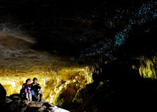
The Waitomo Glowworm Caves are one of New Zealand’s most extraordinary natural attractions, famous for their stunning glowworm displays. These caves are home to thousands of Arachnocampa luminosa, a species of glowworm unique to New Zealand, which illuminate the caves with their bioluminescent glow, creating a magical underground experience. How to Reach Waitomo Glowworm Caves, Rotorua Waitomo Glowworm Caves are located in the Waitomo region, approximately 2.5 hours’ drive from Rotorua. Here are the best ways to get there: By Car: The most convenient way to reach the caves is by car. Follow State Highway 5 towards Tirau, then take State Highway 1 and State Highway 3 to reach Waitomo. By Tour Bus: Several tour companies operate day trips from Rotorua to Waitomo. By Public Transport: Limited bus services are available between Rotorua and Waitomo, so check schedules in advance. Weather and Best Time to Visit Waitomo has a temperate climate, making it a great year-round destination. The caves maintain a cool and consistent temperature of around 12-14°C (54-57°F), regardless of the season. Spring and Summer (September to March): Pleasant weather for exploring the surrounding countryside. Autumn and Winter (April to August): Fewer crowds and a more intimate cave experience. Timing of Waitomo Glowworm Caves The caves are open daily with the following hours: Monday to Sunday: 9:00 AM – 5:00 PM Last Tour: Usually departs at 4:30 PM Special night tours may be available upon request. Why are Waitomo Glowworm Caves Famous? Waitomo Glowworm Caves are famous for their mesmerizing glowworm-lit ceilings, which resemble a starry night sky. The caves also feature stunning limestone formations, underground rivers, and impressive stalactites and stalagmites formed over millions of years. Entry and Visit Details Visitors can explore the caves through guided tours. Ticket prices are: Adults: NZD 55.00 Children (4-14 years): NZD 25.00 Family Pass: NZD 150.00 (2 adults + 2 children) Combination Tours: Options include visits to other nearby caves, such as Ruakuri Cave and Aranui Cave. History and Architecture The caves were first explored by local Māori in the 1800s and later became a major tourist attraction. The stunning rock formations inside the caves have taken thousands of years to develop. The glowworms create their light to attract insects, using bioluminescence in a spectacular natural display. Things to Do at Waitomo Glowworm Caves Glowworm Boat Tour: Drift silently through the caves on a guided boat tour while marveling at the glowworm-lit ceiling. Adventure Caving: For thrill-seekers, activities such as black water rafting, abseiling, and cave tubing are available in nearby caves. Photography: Although photography is not allowed inside the glowworm caves, you can capture stunning shots of the surrounding limestone formations. Walks and Trails: Explore the scenic Waitomo Walkway and discover breathtaking natural landscapes. Interesting Facts About Waitomo Glowworm Caves The caves are over 30 million years old. The glowworms emit light through a chemical reaction in their tails. Over half a million visitors explore the caves each year. The name “Waitomo” means “water passing through a hole” in Māori. Tips for Visiting Waitomo Glowworm Caves Book tickets in advance, especially during peak seasons. Wear comfortable walking shoes, as the caves can be damp. Dress warmly, as the cave temperature is cool year-round. Consider combining your visit with other nearby attractions.
Explore More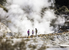
Hell's Gate is one of Rotorua’s most famous geothermal attractions, known for its steaming vents, boiling mud pools, and therapeutic sulfur baths. It is one of the most active geothermal fields in New Zealand and has been used by the Māori people for centuries for healing and relaxation. How to Reach Hell's Gate, Rotorua Hell's Gate is located about 15 minutes from Rotorua’s city center and can be reached by: By Car: Drive east along State Highway 30. Free parking is available on-site. By Shuttle: Hell’s Gate offers a shuttle service from Rotorua, which can be booked in advance. By Public Transport: Local buses operate in Rotorua, but a car or shuttle is the most convenient option. Weather and Best Time to Visit Rotorua has a temperate climate, making Hell’s Gate a great destination year-round. However: Summer (December to February): Warm temperatures make the experience pleasant. Winter (June to August): The hot pools are especially soothing in cooler weather. Timing of Hell's Gate Hell’s Gate is open daily from 10:00 AM to 6:00 PM, with the last entry at 5:00 PM. Why is Hell's Gate Famous? Hell's Gate is famous for its intense geothermal activity, therapeutic mud baths, and sulfur-rich pools. It is the only geothermal park in New Zealand where visitors can bathe in mineral mud, which is believed to have healing properties. Entry and Visit Details Hell’s Gate offers different experiences, including geothermal walks, mud baths, and spa treatments. Prices vary depending on the activities chosen. History and Architecture The area has been used by the Māori for over 700 years for healing and relaxation. The name "Hell's Gate" was given by Irish playwright George Bernard Shaw in the 1900s due to the area's dramatic geothermal features. Things to Do at Hell's Gate Geothermal Walk: Explore boiling mud pools, hot water falls, and steaming fumaroles. Mud Bath Experience: Enjoy a therapeutic mud bath that softens and detoxifies the skin. Sulfur Spa: Relax in mineral-rich hot pools with healing properties. Traditional Māori Carving: Learn about Māori wood carving and create your own souvenir. Interesting Facts About Hell's Gate It contains the Southern Hemisphere’s largest hot-water waterfall. The mud from Hell's Gate is exported worldwide for beauty treatments. Māori warriors traditionally used the hot springs to heal battle wounds. Tips for Visiting Hell's Gate Wear old swimwear for the mud baths, as the sulfur smell can linger. Rinse off thoroughly after using the sulfur pools. Book in advance for the spa and mud bath experiences. Follow safety signs around geothermal areas.
Explore More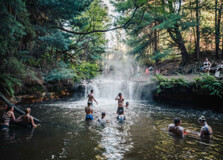
Kerosene Creek is a natural hot spring located near Rotorua, New Zealand. It is a popular geothermal attraction where a warm stream flows through a scenic forest, creating natural hot pools for visitors to enjoy. The creek is completely free to access and offers a unique and relaxing experience in nature. How to Reach Kerosene Creek, Rotorua Kerosene Creek is located about 30 minutes south of Rotorua, off State Highway 5. Visitors can reach the creek by: By Car: Drive along SH5 towards Taupo, turn onto Old Waiotapu Road, and follow the gravel road to the parking area. By Public Transport: There are no direct public transport options, so renting a car or joining a tour is recommended. By Tour: Some local tour companies include Kerosene Creek as part of their geothermal experience packages. Weather and Best Time to Visit Rotorua has a mild climate, making Kerosene Creek a great place to visit throughout the year. However, the best times to visit are: Summer (December to February): The warm weather makes it a great time to enjoy a relaxing soak. Winter (June to August): The contrast of the cool air and warm water creates a soothing experience. Timing of Kerosene Creek Kerosene Creek is open to visitors 24/7, and there is no official entry fee. Why is Kerosene Creek Famous? Kerosene Creek is famous for its natural geothermal waters, which create a warm, relaxing environment amidst a lush forest. It is one of the few places in New Zealand where visitors can bathe in a free, naturally heated stream. Entry and Visit Details There is no charge to visit Kerosene Creek, making it a popular spot for both locals and tourists. However, the area is unmonitored, so visitors should take precautions when visiting. History and Natural Formation Kerosene Creek is a naturally occurring hot spring, heated by geothermal activity beneath the Earth's surface. The stream flows over a small waterfall into a series of pools, allowing visitors to soak in naturally warm waters. Things to Do at Kerosene Creek Soaking in the Hot Pools: Relax in the warm, mineral-rich water. Exploring the Forest: Enjoy a short walk around the surrounding native bushland. Photography: Capture the beauty of the natural hot spring and its serene surroundings. Picnic: Bring some food and have a picnic in the nearby areas. Interesting Facts About Kerosene Creek Kerosene Creek gets its name from the occasional sulfuric smell in the water, similar to kerosene. It is one of the few free hot springs in the Rotorua region. The water temperature varies but generally stays warm due to geothermal heating. It is surrounded by native New Zealand bush, providing a peaceful and natural setting. Tips for Visiting Kerosene Creek Visit early in the morning or late in the afternoon to avoid crowds. Be mindful of personal belongings, as the area is unattended. Wear water shoes as the stream bed can be slippery. Rinse off after your visit to remove any sulfur residue from your skin. Respect the natural environment and take all trash with you.
Explore More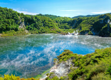
Waimangu Volcanic Valley is a unique geothermal attraction in Rotorua, New Zealand. It is the world's youngest geothermal system, created by the eruption of Mount Tarawera in 1886. The valley features stunning hot springs, steaming lakes, bubbling mud pools, and a diverse range of flora and fauna. How to Reach Waimangu Volcanic Valley, Rotorua Waimangu Volcanic Valley is located about 25 minutes south of Rotorua. Visitors can reach the valley by: By Car: Drive along State Highway 5 towards Taupo, then follow the signs to Waimangu Volcanic Valley. By Public Transport: There are no direct public transport options, so renting a car or booking a guided tour is recommended. By Tour: Several local tour operators offer guided trips to the valley. Weather and Best Time to Visit Rotorua experiences a temperate climate, making Waimangu Volcanic Valley accessible throughout the year. The best seasons to visit are: Summer (December to February): Warm weather and clear skies make for comfortable hiking. Winter (June to August): Cooler temperatures enhance the steam effects from geothermal features. Timing of Waimangu Volcanic Valley The valley is open daily from 8:30 AM to 5:00 PM, with the last admission at 3:00 PM. Why is Waimangu Volcanic Valley Famous? Waimangu Volcanic Valley is famous for its geothermal activity, unique landscape, and rich history. It is home to Frying Pan Lake, one of the world's largest hot water springs, and Inferno Crater, known for its striking blue color. Entry and Visit Details Visitors can choose from self-guided walking tours, boat cruises on Lake Rotomahana, or guided experiences. Entry fees apply, and tickets can be purchased online or at the entrance. History and Geological Formation The valley was formed in 1886 after the massive eruption of Mount Tarawera. The eruption altered the landscape, creating geothermal features and new ecosystems. Today, the valley continues to evolve due to ongoing geothermal activity. Things to Do at Waimangu Volcanic Valley Walking Trails: Explore various hiking trails with scenic views. Boat Cruise: Take a cruise on Lake Rotomahana to see geothermal features from the water. Photography: Capture the stunning geothermal landscapes. Bird Watching: Spot native birds and unique plant life. Interesting Facts About Waimangu Volcanic Valley It is the only geothermal system in the world created by a documented volcanic eruption. Frying Pan Lake is one of the largest hot water springs on Earth. The valley was once home to the famous Pink and White Terraces, which were destroyed in the 1886 eruption. Tips for Visiting Waimangu Volcanic Valley Wear comfortable walking shoes as the trails include some steep sections. Bring water and sun protection, especially in summer. Allow at least 2-3 hours to explore the valley fully. Follow safety guidelines and stay on marked trails.
Explore More
Paradise Valley Springs is a stunning wildlife park and natural spring attraction located near Rotorua, New Zealand. This family-friendly destination offers visitors the chance to see native and exotic animals up close, walk through lush native bush, and experience the fresh spring waters of the region. How to Reach Paradise Valley Springs, Rotorua Paradise Valley Springs is located about 10 km northwest of Rotorua and can be reached by: By Car: Drive along Paradise Valley Road, which is well signposted from Rotorua city center. By Public Transport: There are no direct public transport options, so renting a car or booking a taxi is recommended. By Tour: Some tour operators in Rotorua include Paradise Valley Springs in their itineraries. Weather and Best Time to Visit Rotorua has a temperate climate, making Paradise Valley Springs a great year-round attraction. The best times to visit are: Spring (September to November): Lush greenery and active wildlife. Summer (December to February): Warm weather, ideal for walking and exploring. Autumn (March to May): Cooler temperatures with stunning foliage. Winter (June to August): Fewer crowds and a peaceful environment. Timing of Paradise Valley Springs The park is open daily from 8:00 AM to 5:00 PM, including public holidays. Why is Paradise Valley Springs Famous? Paradise Valley Springs is famous for its incredible wildlife encounters, including a pride of African lions. Visitors can hand-feed animals such as deer, alpacas, and wallabies while also exploring natural freshwater springs. Entry and Visit Details Paradise Valley Springs charges an entry fee, with different rates for adults, children, and families. Visitors can purchase tickets at the entrance or online in advance. History and Features of Paradise Valley Springs Paradise Valley Springs was established as a wildlife park and conservation area. It features well-maintained walking tracks, waterfalls, and viewing platforms for observing the diverse range of animals. Things to Do at Paradise Valley Springs Wildlife Encounters: See lions, trout, and various farm animals up close. Feeding Animals: Hand-feed friendly animals like deer, goats, and wallabies. Walking Trails: Enjoy a scenic walk through native bushland. Spring Water Tasting: Drink pure fresh spring water straight from the source. Photography: Capture stunning photos of wildlife and natural landscapes. Interesting Facts About Paradise Valley Springs It is one of the few places in New Zealand where visitors can see lions up close. The park is home to a trout-filled freshwater stream. Paradise Valley Springs has been a popular attraction for over 40 years. The mineral-rich spring water is known for its purity and great taste. Tips for Visiting Paradise Valley Springs Wear comfortable walking shoes for exploring the park. Bring a camera to capture memorable moments with the animals. Visit during feeding times to see animals in action. Respect the wildlife and follow park guidelines.
Explore More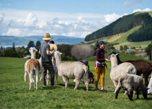
The Agrodome is a world-famous farm experience in Rotorua, New Zealand, offering visitors a unique insight into New Zealand's agricultural heritage. With live sheep shows, interactive farm tours, and hands-on activities, the Agrodome is an exciting attraction for visitors of all ages. How to Reach Agrodome, Rotorua The Agrodome is located about 10 km north of Rotorua and can be reached by: By Car: Drive along State Highway 5, following signs to the Agrodome. Parking is available on-site. By Public Transport: Public buses may not have direct routes, so hiring a car or taking a taxi is recommended. By Tour: Many tour operators in Rotorua include the Agrodome in their packages. Weather and Best Time to Visit Rotorua has a temperate climate, making the Agrodome a great year-round attraction. The best times to visit are: Spring (September to November): Enjoy baby lambs and lush farm landscapes. Summer (December to February): Ideal for outdoor activities and farm tours. Autumn (March to May): Cooler temperatures with stunning scenery. Winter (June to August): A quieter and more relaxed experience. Timing of Agrodome The Agrodome is open daily from 9:00 AM to 5:00 PM, including public holidays. Why is Agrodome Famous? The Agrodome is famous for its world-renowned sheep show, showcasing New Zealand’s rich farming culture. Visitors can witness sheep shearing, sheepdog demonstrations, and even get a chance to hand-feed the animals. Entry and Visit Details The Agrodome charges an entry fee, with different rates for adults, children, and families. Tickets can be purchased at the venue or booked online in advance. History and Features of Agrodome Established over 40 years ago, the Agrodome has become an iconic attraction showcasing New Zealand's agricultural excellence. It features a large working farm, live demonstrations, and an interactive experience with farm animals. Things to Do at Agrodome Sheep Show: Watch an entertaining and educational show featuring 19 sheep breeds. Farm Tour: Ride a tractor through the farm and meet cows, alpacas, and deer. Animal Feeding: Hand-feed sheep, lambs, and other farm animals. Wool Demonstration: Learn about sheep shearing and wool processing. Farm Market: Shop for local honey, wool products, and farm-related souvenirs. Interesting Facts About Agrodome The Agrodome hosts over 200,000 visitors annually. It has been operating for over four decades. The farm spans 350 acres of lush farmland. It showcases over 19 breeds of sheep. Tips for Visiting Agrodome Arrive early to get good seats for the sheep show. Wear comfortable clothing and shoes for the farm tour. Bring a camera to capture fun moments with the animals. Book tickets online to avoid long queues.
Explore More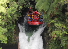
Okere Falls is a stunning natural attraction located near Rotorua, New Zealand. It is known for its beautiful waterfalls, lush greenery, and thrilling white-water rafting opportunities. The falls are part of the Kaituna River and attract adventure seekers and nature lovers alike. How to Reach Okere Falls, Rotorua Okere Falls is about 21 km northeast of Rotorua and can be reached by: By Car: Take State Highway 30 from Rotorua and follow signs to Okere Falls. The drive takes around 20-25 minutes. By Public Transport: Limited public transport options are available, so hiring a car or booking a tour is recommended. By Tour: Many local tour operators include Okere Falls as part of their adventure or sightseeing packages. Weather and Best Time to Visit Rotorua has a mild climate, making Okere Falls an excellent destination throughout the year: Spring (September to November): Enjoy blooming flowers and moderate temperatures. Summer (December to February): Ideal for rafting and outdoor activities. Autumn (March to May): Cooler weather with beautiful fall colors. Winter (June to August): Less crowded, but still accessible for hiking and sightseeing. Timing of Okere Falls Okere Falls is accessible at all times as it is a public natural attraction. However, guided tours and rafting companies operate during specific hours, usually from 9:00 AM to 5:00 PM. Why is Okere Falls Famous? Okere Falls is famous for its breathtaking scenery, rich Māori history, and adventure activities, especially white-water rafting on the Kaituna River, which includes the world's highest commercially rafted waterfall, Tutea Falls. Entry and Visit Details There is no entry fee to visit Okere Falls as it is a public reserve. However, guided rafting tours and adventure activities have associated costs that vary by operator. History and Features of Okere Falls Okere Falls has deep historical and cultural significance. It was once the site of a Māori settlement and features remnants of a historic hydroelectric power station built in the early 1900s. The falls and river continue to be an important place for local iwi (tribes). Things to Do at Okere Falls White-Water Rafting: Experience thrilling rafting on the Kaituna River, including a 7-meter drop over Tutea Falls. Hiking: Walk the Okere Falls Track for stunning views of the river, waterfalls, and historic sites. Swimming: Some calm areas of the river are suitable for swimming. Wildlife Watching: Spot native birds and lush vegetation along the trails. Photography: Capture breathtaking views of the waterfalls and river rapids. Interesting Facts About Okere Falls Okere Falls is home to the world's highest commercially rafted waterfall (7m drop). The area was historically used by Māori for fishing and gathering food. Remnants of a 1901 hydroelectric power station can still be seen near the falls. The falls attract thousands of adventure seekers each year. Tips for Visiting Okere Falls Wear comfortable walking shoes if planning to hike the Okere Falls Track. Book rafting tours in advance, especially during peak seasons. Bring a waterproof camera for capturing adventure activities. Respect the environment and follow safety guidelines near the river.
Explore More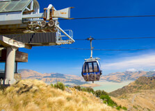
The Christchurch Gondola is one of the city's most famous attractions, offering breathtaking panoramic views of the city, Canterbury Plains, and Lyttelton Harbour. It provides a unique experience, taking visitors on a scenic ride up the Port Hills to the summit station. How to Reach Christchurch Gondola The gondola is located just 15 minutes from Christchurch city center: By Car: Drive to 10 Bridle Path Road, Heathcote Valley. There is free parking available. By Public Transport: Take the Metro Bus route from the city center to Heathcote Valley. By Shuttle: A shuttle service operates from the central city to the gondola base. Weather and Best Time to Visit Christchurch has a temperate climate, making the gondola a great experience year-round: Spring and Summer (September to February): Ideal for clear views and comfortable temperatures. Autumn (March to May): Offers beautiful colors and cool weather. Winter (June to August): Crisp air and the chance to see snow-capped mountains. Timing of Christchurch Gondola The gondola operates daily from: 10:00 AM – 5:00 PM Why is Christchurch Gondola Famous? The Christchurch Gondola is known for its spectacular views, nature walks, and historical exhibits at the summit station. Entry and Visit Details Tickets can be purchased at the base station or online. Prices vary for adults, children, and families. History and Architecture The gondola was opened in 1992 and has since become a major tourist attraction. The summit station includes a time tunnel ride showcasing Canterbury's history. Things to Do at Christchurch Gondola Enjoy Panoramic Views: See the city, mountains, and ocean from the top. Visit the Time Tunnel: An interactive exhibit about Christchurch’s history. Hiking and Walking: Explore scenic trails from the summit. Dining: The summit café offers great food with stunning views. Photography: Capture breathtaking landscapes from various lookout points. Interesting Facts About Christchurch Gondola The gondola ride covers a distance of 862 meters. The summit station sits 445 meters above sea level. It offers a 360-degree view of Christchurch and its surroundings. Tips for Visiting Christchurch Gondola Check the weather forecast for the best visibility. Arrive early to avoid long queues. Wear warm clothing, especially in winter. Bring a camera to capture stunning scenery.
Explore More7D - 6N New Zealand Tour Package
7 Days/ 6 Night
West Coast - Milford Sound - Christchurch - Queenstown - Greymouth
New Zealand - Mountain Magnificence - Adrenaline - Queenstown In 5 Days Tour
5 Days/ 4 Night
Queenstown
New Zealand Adrenaline Rush 10N - 11D Tour
11 Days/ 10 Night
Auckland - Christchurch - Rotorua - Queenstown
7 Nights - 8 Days New Zealand Package
8 Days/ 7 Night
Auckland - Christchurch - Rotorua - Queenstown

International Antarctic Centre
The International Antarctic Centre in Christchurch is a world-renowned attraction that offers visitors an immersive experience into the icy landscapes and fascinating wildlife of Antarctica. Located near Christchurch Airport, this center provides interactive exhibits, thrilling rides, and real-life encounters with Antarctic animals. How to Reach International Antarctic Centre, Christchurch The center is conveniently located near the airport, making it easy to access: By Car: Located at 38 Orchard Road, just a 5-minute drive from Christchurch Airport and about 15 minutes from the city center. Free parking is available on-site. By Public Transport: Bus routes, including the Purple Line, connect the city center to the International Antarctic Centre. By Taxi or Rideshare: Taxis and rideshare services provide quick and easy access to the center. Weather and Best Time to Visit Christchurch has a mild oceanic climate, making the International Antarctic Centre a great destination year-round. Since it is an indoor attraction, visitors can enjoy it in any season. Timing of International Antarctic Centre The center is open daily with the following timings: 9:00 AM – 5:30 PM (last entry at 4:30 PM) Special holiday hours may apply, so checking the official website before visiting is recommended. Why is International Antarctic Centre Famous? The International Antarctic Centre is known for its unique attractions and experiences: Antarctic Storm Experience: Feel the extreme temperatures of an Antarctic storm inside a specially designed room. Hägglund Ride: Experience an exciting ride in an all-terrain Antarctic vehicle. Little Blue Penguins: Observe rescued penguins in a natural habitat setting. 4D Theatre: Enjoy an immersive Antarctic adventure with special effects. Entry and Visit Details Admission prices vary depending on the experience package chosen: Adults: Approximately NZD 49 Children (5-15 years): NZD 29 Family passes and combo tickets with other attractions are available. History and Architecture Opened in 1992, the International Antarctic Centre was designed to educate and entertain visitors about Antarctic exploration and wildlife. The center features modern architecture with interactive displays, multimedia exhibits, and simulated environments. Things to Do at International Antarctic Centre Antarctic Storm Room: Experience the chill of a real Antarctic storm. Penguin Encounter: Watch little blue penguins up close. Hägglund Ride: Take a thrilling ride in an Antarctic transport vehicle. 4D Theatre: Enjoy a dynamic Antarctic adventure movie. Exhibits and Displays: Learn about Antarctic history, wildlife, and research. Interesting Facts About International Antarctic Centre It is one of the few places in the world where visitors can experience an Antarctic storm indoors. The center houses rescued little blue penguins that cannot survive in the wild. Christchurch serves as a major gateway to Antarctica for scientific research missions. Tips for Visiting International Antarctic Centre Wear warm clothing, especially for the Antarctic Storm experience. Visit in the morning to avoid crowds and enjoy all activities at a relaxed pace. Check for combo deals if you plan to visit other Christchurch attractions. Don’t miss the feeding time at the penguin exhibit.
Explore More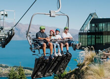
The Skyline Gondola in Queenstown is one of the most famous attractions in New Zealand, offering breathtaking panoramic views of Queenstown, Lake Wakatipu, and the surrounding mountain ranges. This scenic cable car ride takes visitors up to Bob’s Peak, where a variety of exciting activities await. How to Reach Skyline Gondola, Queenstown The Skyline Gondola is conveniently located in the heart of Queenstown: By Car: The base station is located at Brecon Street, Queenstown. Paid parking is available nearby. By Foot: A short 5-10 minute walk from central Queenstown. By Public Transport: Local buses and shuttles provide easy access to the gondola base. Weather and Best Time to Visit Queenstown experiences a mix of weather conditions throughout the year. Summer (December to February) offers clear skies and warm temperatures, while winter (June to August) provides a snowy landscape. The Skyline Gondola operates year-round, making any season a good time to visit. Timing of Skyline Gondola The Skyline Gondola operates daily with the following schedule: Opening hours: 9:00 AM – 9:00 PM Check the official website for seasonal variations and special event closures. Why is Skyline Gondola Famous? The Skyline Gondola is renowned for its stunning views and thrilling activities: Panoramic Views: Enjoy breathtaking views of Queenstown and its surroundings. Adventure Activities: Try the Skyline Luge, mountain biking, and ziplining. Dining with a View: Experience fine dining at the Stratosfare Restaurant and Bar. Stargazing: Participate in guided stargazing tours at night. Entry and Visit Details Admission prices vary based on activities included: Gondola Ride: Approx. NZD 46 for adults, NZD 32 for children. Luge Packages: Additional charges apply based on the number of rides. Combo Tickets: Available for dining and adventure activities. History and Architecture The Skyline Gondola has been a major Queenstown attraction since its establishment in 1967. The gondola system has undergone upgrades to provide a safer and more comfortable ride. The viewing decks and restaurant feature a modern architectural design, enhancing the overall experience. Things to Do at Skyline Gondola Skyline Luge: Ride down winding tracks with stunning views. Mountain Biking: Explore thrilling downhill bike trails. Hiking Trails: Enjoy scenic walks and hikes around Bob’s Peak. Stratosfare Restaurant: Dine with a view at one of Queenstown’s best restaurants. Stargazing: Take part in guided night tours to explore the night sky. Interesting Facts About Skyline Gondola It is the steepest cable car lift in the Southern Hemisphere. The luge track was designed by a former Olympic luger. The viewing deck offers a 220-degree panorama of Queenstown. Tips for Visiting Skyline Gondola Book tickets online in advance to avoid long queues. Visit during sunset for spectacular views. Dress warmly in winter for a comfortable experience. Take a camera to capture the stunning landscapes.
Explore More
Kawarau Bridge is one of the most iconic landmarks in Queenstown, New Zealand. It is widely known as the birthplace of commercial bungy jumping, attracting thrill-seekers from around the world. The bridge spans the stunning Kawarau River and offers breathtaking views of the surrounding landscapes. How to Reach Kawarau Bridge, Queenstown Kawarau Bridge is easily accessible from Queenstown: By Car: The bridge is located about 20 minutes from Queenstown along State Highway 6. Parking is available near the site. By Bus: Several tour operators and shuttle services run from Queenstown to the bridge. By Taxi or Rideshare: Taxis and rideshare services offer a convenient option for visitors. Weather and Best Time to Visit Queenstown has a temperate climate, making Kawarau Bridge a great attraction to visit year-round. Summer (December to February) offers warm temperatures, while winter (June to August) provides a scenic snow-covered backdrop. Timing of Kawarau Bridge The bridge is accessible at all times; however, bungy jumping operates daily: 9:30 AM – 4:30 PM (hours may vary seasonally) It is recommended to check the official website for updated schedules. Why is Kawarau Bridge Famous? Kawarau Bridge is renowned for several reasons: Bungy Jumping: It is the world's first commercial bungy jumping site, operated by AJ Hackett Bungy. Scenic Views: The bridge offers incredible views of the Kawarau River and surrounding mountains. Adventure Tourism: It is a must-visit destination for adrenaline seekers in New Zealand. Entry and Visit Details Visiting the bridge is free, but activities like bungy jumping have costs: Bungy Jumping: Starts from approximately NZD 205 per person. Tandem Bungy: Available for those who want to jump with a partner. Bridge Viewing: Free for visitors who want to watch the jumpers. History and Architecture Built in 1880, Kawarau Bridge was originally part of the main road connecting Queenstown to the Otago Goldfields. The bridge has a distinctive suspension design and has since become a historic and adventure hotspot. Things to Do at Kawarau Bridge Bungy Jumping: Experience an exhilarating 43-meter freefall into the Kawarau River. Ziplining: Enjoy an exciting zip ride across the river. Photography: Capture stunning views of the bridge and river. Spectator Viewing: Watch daring jumpers take the plunge. Interesting Facts About Kawarau Bridge It was the world's first commercial bungy site, opened in 1988. The bridge is 43 meters high, offering a thrilling drop into the river below. AJ Hackett Bungy has operated the site for over 30 years. Tips for Visiting Kawarau Bridge Book bungy jumps in advance to secure your preferred time slot. Wear comfortable clothing and secure loose items before jumping. Even if you're not jumping, the bridge is worth visiting for its scenery and history.
Explore More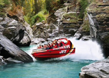
The Shotover River Jet Boat Ride in Queenstown is one of New Zealand’s most thrilling adventure activities. This high-speed jet boat ride takes you through the narrow canyons of the Shotover River, offering adrenaline-pumping twists and turns while showcasing stunning natural scenery. How to Reach Shotover River Jet Boat Ride, Queenstown Reaching the Shotover River Jet Boat Ride is easy, as it is located close to Queenstown’s town center: By Car: Located about 7 km from Queenstown, it takes around 10 minutes to drive to the Shotover Jet base. By Shuttle: The operator provides shuttle services from Queenstown, making it convenient for tourists. By Taxi or Rideshare: A quick and hassle-free way to reach the site. Weather and Best Time to Visit Queenstown experiences four distinct seasons, making the jet boat ride an enjoyable experience all year round: Summer (December - February): Warm and sunny, ideal for water adventures. Autumn (March - May): Mild temperatures with beautiful golden landscapes. Winter (June - August): Chilly but exhilarating, as the surrounding mountains are covered in snow. Spring (September - November): Fresh and vibrant, a perfect time for outdoor fun. Timing of Shotover River Jet Boat Ride The jet boat ride operates daily: Opening hours: 9:00 AM – 6:00 PM Rides run frequently throughout the day. Booking in advance is recommended, especially during peak tourist seasons. Why is Shotover River Jet Boat Ride Famous? The Shotover Jet is world-famous for its thrilling experience and breathtaking scenery: Extreme Speed: Boats travel at speeds of up to 85 km/h. 360-Degree Spins: Skilled drivers perform spectacular spins and maneuvers. Narrow Canyons: The ride navigates through the dramatic Shotover River canyons. Exclusive Access: The only jet boat operator allowed to operate in the Shotover River canyons. Entry and Visit Details Tickets and entry details: Adults: Approximately NZD 159 Children (5-15 years): NZD 89 Family packages and group discounts available. History and Architecture The Shotover Jet began in 1965 and has since become one of New Zealand’s top adventure attractions. The high-powered jet boats are specifically designed to navigate the river’s shallow waters and narrow canyons. Things to Do at Shotover River Jet Boat Ride Jet Boat Ride: Experience the thrill of high-speed spins and narrow canyon runs. Scenic Photography: Capture stunning landscapes and the dramatic Shotover River. Explore Nearby Areas: Visit nearby trails, rivers, and adventure parks. Other Adventure Activities: Try bungee jumping, rafting, or canyon swings in the Queenstown area. Interesting Facts About Shotover River Jet Boat Ride The Shotover Jet has been thrilling visitors for over 50 years. Over 4 million people have experienced the ride since its inception. The ride covers a stretch of 7 km along the Shotover River. Famous personalities, including members of the British royal family, have enjoyed the ride. Tips for Visiting Shotover River Jet Boat Ride Wear warm clothing and sunglasses to protect against wind and water spray. Book tickets online in advance to secure your preferred time slot. Arrive at least 30 minutes before your scheduled ride for check-in and safety briefing. Hold on tightly and enjoy the thrill!
Explore More
Skydiving in Queenstown is one of the most thrilling adventure experiences in New Zealand. Known as the adventure capital of the world, Queenstown offers breathtaking aerial views, making it a perfect destination for skydiving enthusiasts. How to Reach Skydiving in Queenstown Queenstown is well-connected by various modes of transportation: By Air: Queenstown Airport is the nearest airport, with flights from major cities in New Zealand and Australia. By Road: Visitors can drive from other cities such as Christchurch and Dunedin, offering scenic routes. By Bus: Several bus services connect Queenstown with nearby locations. Weather and Best Time to Visit The weather in Queenstown affects the skydiving experience: Summer (December - February): Warm temperatures and clear skies provide ideal conditions. Autumn (March - May): Cooler but still good for skydiving with stunning fall colors. Winter (June - August): Snow-capped mountains offer spectacular views, but weather conditions can be unpredictable. Spring (September - November): Mild temperatures and clear skies make it a great time to skydive. Timing of Skydiving in Queenstown Skydiving is available year-round, but it depends on weather conditions. Most operators run jumps from early morning until the afternoon. Why is Skydiving in Queenstown Famous? Queenstown is a renowned skydiving destination for several reasons: Spectacular Views: Skydivers get breathtaking views of Lake Wakatipu, The Remarkables, and the surrounding landscapes. Different Altitudes: Options range from 9,000 ft to 15,000 ft for different thrill levels. Professional Operators: Highly experienced skydiving companies ensure safety and provide professional guidance. Adrenaline Rush: Free-falling at speeds of up to 200 km/h offers an unforgettable experience. Entry and Visit Details Skydiving operators in Queenstown require prior booking. Prices vary based on the altitude and package selected, usually ranging from NZD 300 to NZD 600. History of Skydiving in Queenstown Queenstown has been a hub for adventure sports for decades. Skydiving gained popularity in the late 20th century as tourists sought thrilling activities. Since then, it has become one of the most iconic experiences in the region. Things to Do Besides Skydiving Bungee Jumping: Experience the famous Kawarau Bridge Bungy. Jet Boating: Enjoy an adrenaline-pumping ride on the Shotover River. Hiking: Explore stunning trails like the Ben Lomond Track. Wine Tasting: Visit the nearby Gibbston Valley for world-class wines. Interesting Facts About Skydiving in Queenstown Queenstown is one of the most popular skydiving destinations in the Southern Hemisphere. Skydivers can reach freefall speeds of up to 200 km/h. The experience offers views of fjords, lakes, and mountains, making it one of the most scenic skydiving locations. Tips for Skydiving in Queenstown Wear comfortable clothing and avoid loose items. Book your slot in advance, especially during peak tourist seasons. Check weather conditions before booking, as skydiving is weather-dependent. Listen carefully to the instructor’s briefing for a safe and enjoyable experience.
Explore More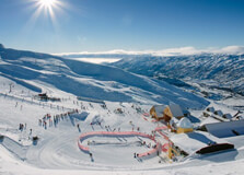
Queenstown is known as New Zealand’s adventure capital, and skiing is one of the top activities that draw visitors from around the world. With breathtaking alpine scenery, world-class ski resorts, and a long ski season, Queenstown offers an unforgettable skiing experience. How to Reach Skiing in Queenstown, Queenstown Queenstown is well connected and easy to reach: By Air: Queenstown Airport receives domestic and international flights. By Road: Accessible via scenic routes from Christchurch, Dunedin, and other cities. By Shuttle: Many ski resorts offer shuttle services from Queenstown. Weather and Best Time to Visit The skiing season in Queenstown runs from June to October: Winter (June - August): Peak ski season with heavy snowfall. Spring (September - October): Softer snow and fewer crowds. Timing of Skiing in Queenstown Most ski resorts operate daily during the ski season from early morning to late afternoon. Why is Skiing in Queenstown Famous? Queenstown is famous for its world-class ski resorts, stunning landscapes, and adventure-filled atmosphere. Entry and Visit Details Visitors can buy ski passes online or at the resort. Costs vary depending on the resort and the duration of stay. History and Development Skiing in Queenstown has a long history, with major ski fields developed over the decades to accommodate international tourists. Things to Do at Queenstown’s Ski Resorts Skiing and Snowboarding: Experience slopes suitable for all levels. Snowshoeing: Explore the snow-covered trails. Heli-Skiing: For those looking for extreme adventure. Interesting Facts About Skiing in Queenstown Queenstown has four major ski fields: Coronet Peak, The Remarkables, Cardrona, and Treble Cone. It’s one of the few places in the world where you can ski with a view of a lake. Tips for Visiting Ski Resorts in Queenstown Book accommodation early during peak season. Dress in warm, waterproof layers. Rent equipment if you don’t have your own.
Explore More