
- Home
- Travel Packages
- Top Destination
-
Travel Attraction
By Category
Top Attraction
- Travel Agents
- Car Rentals
- Hotels
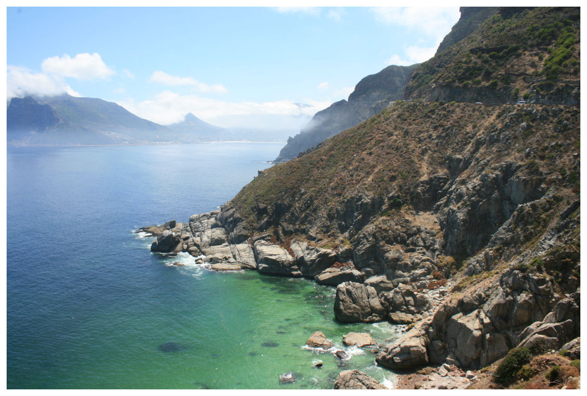
Chapman’s Peak Drive, one of the most scenic coastal drives in the world, is a popular road located along the Cape Peninsula in Cape Town, South Africa. Known for its breathtaking views of the Atlantic Ocean, dramatic cliffs, and surrounding mountain landscapes, this 9-kilometer stretch of road offers a one-of-a-kind experience for drivers and passengers alike. The drive is renowned for its jaw-dropping beauty, making it a must-see for anyone visiting Cape Town. Why Chapman's Peak Drive is Famous Chapman’s Peak Drive is famous for its spectacular scenery and unique construction. The road was carved into the mountainside and offers visitors panoramic views of the ocean, the rugged coastline, and the charming towns below. Opened in 1922, it has since become a popular route for both locals and tourists. The drive is often used for road trips, sightseeing tours, and as a scenic route between Cape Town and the Cape of Good Hope. It also serves as a filming location for many documentaries, advertisements, and travel videos, thanks to its striking natural beauty. How to Reach Chapman's Peak Drive Chapman’s Peak Drive is easily accessible from Cape Town and the surrounding areas. The drive is located just outside of the city, and there are various ways to get there: By Car The most common way to reach Chapman’s Peak Drive is by car. If you're in Cape Town, head south on the M3 highway, and then follow signs to the M64 (the road leading to the start of Chapman’s Peak Drive). The drive offers an excellent opportunity to explore the beautiful coastal scenery as you head toward the charming towns of Hout Bay and Noordhoek. It takes about 30 minutes from Cape Town to reach the start of Chapman’s Peak Drive. By Public Transport Public transport options are limited directly to Chapman's Peak Drive, but you can take a train or bus to Hout Bay, which is a short drive from the start of the drive. From Hout Bay, you can either walk or take a taxi to Chapman’s Peak Drive. However, driving yourself or taking a guided tour is the most convenient way to explore this scenic route. Weather at Chapman's Peak Drive The weather at Chapman’s Peak Drive is largely influenced by the Mediterranean climate of the Cape Peninsula. Summers, which run from November to February, are warm and dry, with average temperatures ranging from 18°C to 25°C (64°F to 77°F). This is the ideal time to visit, as the skies are usually clear and the weather is perfect for enjoying the stunning coastal views. Winter, from June to August, brings cooler temperatures, with averages between 10°C and 18°C (50°F to 64°F). While it’s still relatively mild, this season can be windy and rainy, especially in the later months. Even during winter, Chapman’s Peak Drive remains open, but it's best to check the weather forecast before setting out to ensure a smooth drive. Timing and Opening Hours Chapman’s Peak Drive is open daily, although the road may occasionally close during heavy storms or strong winds. It's essential to check road conditions before you go, as safety is a priority. The best time to visit is during the day when the views are most striking. The drive offers stunning vistas that are best appreciated with good visibility. Since it is a toll road, there is an entrance fee to access the drive, and the toll is collected at the entrance in Hout Bay. Entry and Visit Details The entrance to Chapman’s Peak Drive is located near Hout Bay. The toll fee is typically around R50 to R70 for cars, though the price can vary. The fee helps maintain the road and supports the surrounding environment. Payment is collected at a toll booth near the entrance. If you are traveling with a larger group or on a bus, the fees may vary based on the size of the vehicle. Once you're on the drive, you can stop at various designated viewpoints along the route to take photos, enjoy the view, or simply take in the fresh air. There are also several spots along the way where you can park and explore the natural beauty of the area. For those looking to extend their visit, there are hiking trails near the area, including the famous “Chapman’s Peak Trail” which leads to the top of the mountain. History and Architecture Chapman’s Peak Drive was constructed in the early 20th century and officially opened in 1922. It was built by the government to improve access between Hout Bay and Noordhoek, but it also served as a strategic military route during times of conflict. The road is a feat of engineering, carved into the side of the mountain with winding turns and curves that provide breathtaking views of the ocean below. The road itself is a testament to early civil engineering, with the construction making use of dynamite to clear rock and create the winding route. The project was challenging and risky, but the end result is one of the most beautiful coastal drives in the world. The views from Chapman’s Peak Drive are simply stunning, with dramatic cliffs on one side and sweeping views of the Atlantic Ocean on the other. Things to Do at Chapman’s Peak Drive There are several things to do along Chapman’s Peak Drive, making it more than just a scenic drive: 1. Scenic Viewing Chapman’s Peak Drive is renowned for its stunning vistas. The best way to experience this is by stopping at the various viewpoints along the way. Some of the most popular stops include the overlook at the top of the drive, which offers panoramic views of Hout Bay, Noordhoek Beach, and the Atlantic Ocean. 2. Hiking For those looking for an active adventure, there are numerous hiking trails in and around the area. One of the most popular trails is the Chapman’s Peak Trail, which leads up the side of the mountain and provides spectacular views of the surrounding landscape. It’s a great way to explore the natural beauty of the region up close. 3. Photography Chapman’s Peak Drive is a photographer’s paradise. Whether you're capturing the stunning landscapes, the wildlife, or the architecture of the road itself, you'll find plenty of opportunities for incredible photos. The road offers golden hour light in the early mornings and late afternoons, which makes for some truly magical shots. 4. Relax at Noordhoek Beach At the end of Chapman’s Peak Drive, you’ll find the idyllic Noordhoek Beach, a long stretch of sand that’s perfect for walking, picnicking, or simply relaxing. The beach is a great spot to unwind after your drive and enjoy the beauty of the Cape Peninsula. Facts About Chapman's Peak Drive Chapman’s Peak Drive is 9 kilometers long and connects the towns of Hout Bay and Noordhoek. The road is often referred to as “Chappies” by locals. It’s one of the most photographed roads in the world due to its stunning beauty. The road was constructed in the early 1920s, with significant work done to carve it into the cliffs. It’s considered a dangerous route in certain weather conditions, with strong winds and rockfalls occasionally causing road closures. Tips for Visiting Chapman's Peak Drive Check road conditions: Before setting off, ensure the road is open, especially in winter or during storms. It's best to visit on clear days for the best views. Bring your camera: The views are spectacular and deserve to be captured. Don’t forget to stop at various viewpoints for the perfect photos. Drive safely: The road can be winding and narrow. Make sure to drive carefully, particularly on the sharp bends, and be cautious of cyclists and pedestrians. Wear comfortable shoes: If you plan to hike or walk along the trails, bring comfortable footwear for the terrain. Conclusion Chapman’s Peak Drive is more than just a road – it’s an experience. With its breathtaking views, rich history, and many activities to enjoy, it is one of the highlights of any trip to Cape Town. Whether you're looking to take a scenic drive, go hiking, or simply relax at the beach, Chapman’s Peak offers something for everyone. Don’t miss the opportunity to explore one of the world’s most beautiful coastal routes on your visit to Cape Town.
Explore More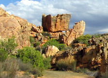
The Cederberg is a rugged and remote mountain range located about 300 kilometers north of Cape Town in the Western Cape province of South Africa. Known for its striking rock formations, ancient San rock art, breathtaking mountain landscapes, and star-filled skies, the Cederberg is a haven for adventurers, nature lovers, and those seeking an escape from city life. This region forms part of the Cederberg Wilderness Area, offering a blend of natural beauty, history, and cultural richness. How to Reach Cederberg, Western Cape Cederberg is not connected by public transport, so the best way to reach it is by road: By Car: From Cape Town, take the N7 highway towards Citrusdal. Depending on your destination in Cederberg (such as Clanwilliam or Algeria Forest Station), the drive takes approximately 3.5 to 4.5 hours. Most lodges or campsites are accessible via gravel roads, so a vehicle with good clearance is recommended. By Tour: Several travel companies offer guided tours from Cape Town to the Cederberg region, including transport, meals, and accommodations. Make sure to refuel and stock up on supplies before entering the wilderness area, as amenities are limited once you’re in the mountains. Weather in Cederberg, Western Cape Cederberg has a semi-arid climate with hot, dry summers and cool winters. Rain is sparse but mostly occurs during the winter months. Summer (Nov–Mar): Hot and dry with daytime temperatures often exceeding 30°C. Best for stargazing and rock climbing but can be intense for hiking during midday. Winter (Jun–Aug): Cooler with temperatures ranging from 5°C to 18°C. Occasional frost at night; ideal for hiking if you prefer mild weather. Best Time to Visit: Spring (Sept–Nov) and autumn (Mar–May) are perfect with moderate temperatures, fewer bugs, and blooming wildflowers in spring. Timings The Cederberg Wilderness Area is open year-round. There are no official entry hours since it's a natural area, but it’s advisable to travel and hike during daylight. Hiking and Trail Access: Recommended between 6:00 AM and 6:00 PM. Accommodation Check-in: Varies by lodge or campsite, usually 2:00 PM to 6:00 PM. Why Famous for Cederberg, Western Cape? Cederberg is famous for several compelling reasons: Rock Formations: Iconic sandstone formations like the Maltese Cross and Wolfberg Arch draw climbers and photographers alike. San Rock Art: Thousands of years old, these paintings provide insight into the spiritual life of the indigenous San people. Rooibos Tea: The region is the exclusive home of the Rooibos plant, used to make South Africa’s famous herbal tea. Stargazing: With almost no light pollution, Cederberg skies are among the clearest in the country, ideal for stargazers and astrophotographers. Biodiversity: The area is home to rare plants, including endangered Clanwilliam Cedar trees and unique fynbos species. Entry and Visit Details about Cederberg, Western Cape Entry Fee: No fee to enter the general area, but certain parts like Algeria Forest Station and CapeNature hiking routes may require a small conservation fee (typically around R50–R70 per adult). Permits: Required for overnight hikes and for access to restricted heritage sites like Truitjieskraal Rock Art. Facilities: Campsites, mountain huts, self-catering lodges, picnic areas, and some basic shops in Clanwilliam and Algeria. Safety: Mobile signal is limited in the region. Always carry a physical map or GPS, and inform someone of your itinerary. History and Architecture The name “Cederberg” comes from the endangered Clanwilliam Cedar tree, once found in abundance in the area. The Cederberg region has a long history, with the oldest known inhabitants being the San people, who left behind an extraordinary legacy of rock art. Some artworks date back over 6,000 years. European settlers arrived in the 18th century, using the land primarily for grazing and farming. Today, remnants of old mission stations, stone houses, and farm buildings reflect colonial-era architecture, often blending stone, thatch, and whitewashed walls. Things to Do in Cederberg, Western Cape Hiking: Popular trails include: Maltese Cross Trail – a short hike to an impressive rock column. Wolfberg Cracks & Arch – challenging but extremely rewarding for fit hikers. Stadsaal Caves – short walk to rock art and sandstone chambers. Rock Climbing: Cederberg is a world-class bouldering and sport-climbing destination. Swimming: Cool off in natural rock pools and clear mountain streams during summer. Visit Wupperthal: A historic Moravian mission village known for handmade leather shoes and cultural heritage. Stargazing: Bring a telescope or enjoy naked-eye views of the Milky Way. Tea Tasting: Visit Rooibos farms in Clanwilliam to learn about tea cultivation and enjoy tastings. Facts about Cederberg, Western Cape The Cederberg Wilderness Area covers over 71,000 hectares of mountainous terrain. There are more than 2,500 known San rock art sites in the region. The Wolfberg Arch is over 15 meters tall and one of the largest natural arches in South Africa. The area has its own unique microclimate supporting rare endemic species. The Cederberg is part of the Cape Floral Kingdom, a UNESCO World Heritage site. Tips about Cederberg, Western Cape Bring all essentials including food, water, sunscreen, and medical supplies, especially for remote trails. Wear good hiking shoes and sun protection at all times. Book accommodation and permits in advance, especially during holidays and spring wildflower season. Respect cultural heritage sites—do not touch or deface rock art. Carry a flashlight or headlamp if hiking close to dusk or camping overnight. Always follow conservation rules to protect this fragile and pristine ecosystem. The Cederberg offers a rare mix of wilderness, culture, and spiritual solitude. Whether you’re chasing a challenging summit, exploring ancient artwork, or simply gazing at the stars in silence, this unique region of the Western Cape provides an unforgettable journey into South Africa’s natural soul.
Explore More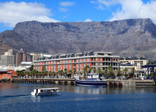
Table Mountain National Park is one of South Africa’s most iconic and scenic protected areas, stretching from Signal Hill in Cape Town to Cape Point at the tip of the Cape Peninsula. It was established to protect the unique biodiversity of the Cape Floral Kingdom and to preserve the rich cultural and natural heritage of the Western Cape. Dominated by the flat-topped Table Mountain, one of the New 7 Wonders of Nature, this park draws millions of visitors every year with its stunning views, rich biodiversity, historic sites, and thrilling outdoor adventures. How to Reach Table Mountain National Park, Western Cape Table Mountain National Park is easily accessible as it lies within and around the city of Cape Town in the Western Cape province. By Air: The nearest airport is Cape Town International Airport (about 20 km from Table Mountain). Flights operate daily from major cities in South Africa and internationally. By Car: Visitors can drive from anywhere in Cape Town using signs for Table Mountain or the Cableway. Parking is available at various points like the Lower Cableway Station and Cape Point. By Public Transport: Taxis, tour buses, and ride-sharing services like Uber are readily available in Cape Town. The MyCiTi bus also services some areas close to the park. Weather at Table Mountain National Park The climate at Table Mountain National Park is Mediterranean, with mild, wet winters and warm, dry summers. However, the weather on the mountain can change rapidly, so visitors are advised to dress in layers and check conditions before visiting. Summer (Nov–Mar): Warm and dry, temperatures range from 20°C to 30°C. Ideal for hiking and sightseeing. Winter (Jun–Aug): Cooler and rainy, temperatures drop to around 10°C to 18°C, with occasional fog or strong winds. The top of the mountain is usually cooler and windier than the city below. Always carry sun protection, a windbreaker, and water regardless of the season. Timings Table Mountain National Park is open year-round, but different sections of the park have their own operating hours. Below are general timings: Table Mountain Aerial Cableway: 08:00 AM to 06:00 PM (last car up at 5:00 PM, down at 6:00 PM; varies seasonally) Cape Point: 06:00 AM to 06:00 PM (Oct to Mar), 07:00 AM to 05:00 PM (Apr to Sept) Silvermine and Boulders Beach: 08:00 AM to 06:00 PM Note: The cableway may close due to adverse weather conditions, especially strong winds or fog. Why Famous for Table Mountain National Park, Western Cape? Table Mountain National Park is world-famous for several reasons: Home to Table Mountain, one of the most recognizable natural landmarks globally and a UNESCO World Heritage Site. Rich in plant biodiversity, including over 2,200 species of flora, many of which are endemic to the region. Offers spectacular panoramic views over Cape Town, the Atlantic Ocean, and the Cape Peninsula. Popular for hiking, paragliding, rock climbing, and bird watching. Includes unique attractions like Cape Point, Boulders Beach with its penguin colony, and Lion’s Head. Entry and Visit Details There are no entry fees for Table Mountain itself unless using the cableway. However, certain sections of the park like Cape Point and Boulders Beach have separate conservation fees: Cableway Round Trip: Approx. R420 for adults, R200 for children Cape Point: R360 for international adults, R90 for South African citizens (discounted with ID) Boulders Beach: R190 for international adults, R45 for South African citizens Visitors can explore several areas without fees, including hiking trails around Devil’s Peak, Signal Hill, and Lion’s Head. Guided tours and adventure activities can be booked via local operators. History and Architecture Table Mountain has been a significant landmark for centuries, first noted by indigenous Khoisan tribes and later by European explorers. The park area holds remnants of Stone Age tools and ancient rock art. The name "Table Mountain" comes from its distinctive flat top. While there are no grand architectural structures in the traditional sense, the Table Mountain Cableway, opened in 1929, is a marvel of engineering. It has been modernized to offer rotating cabins that give visitors a 360° view as they ascend. Cape Point also has a historic lighthouse built in 1859. Things to Do at Table Mountain National Park Visitors can enjoy a wide variety of activities: Ride the Cable Car: Enjoy breathtaking views as you ascend Table Mountain in a rotating cable car. Hiking: Choose from over 350 trails, including Platteklip Gorge, Skeleton Gorge, and Pipe Track. Cape Point: Visit the dramatic cliffs and historic lighthouse at the southern end of the peninsula. Boulders Beach: See the endangered African penguins up close. Picnicking: Silvermine and Kirstenbosch offer great spots for relaxation amidst nature. Photography: Capture sunsets, panoramic views, flora, and wildlife. Adventure Activities: Rock climbing, abseiling, mountain biking, and paragliding. Facts about Table Mountain National Park Table Mountain is over 260 million years old—older than the Himalayas and the Alps. It is part of the Cape Floral Region, the smallest yet richest floral kingdom in the world. The park is home to over 8,000 plant species, including fynbos, proteas, and ericas. It attracts over 4 million visitors annually, making it one of South Africa’s top tourist destinations. The Table Mountain cableway has carried more than 30 million visitors since it opened. Tips for Visiting Table Mountain National Park Check weather forecasts and cableway status before visiting. Arrive early to avoid long queues at the cableway, especially during holidays. Carry water, sunscreen, a hat, and a light jacket. Wear comfortable shoes for hiking or walking. Book tickets for the cable car online to skip the ticket queue. Respect wildlife—do not feed baboons or penguins. Keep a map or GPS handy when hiking as some trails are rugged and remote. Table Mountain National Park is a gem that beautifully combines natural splendor, adventure, biodiversity, and cultural significance. Whether you want to hike up rugged paths, glide up in a cable car, take pictures of penguins, or simply soak in some of the world’s most spectacular views, the park offers something for every type of traveler. It is a must-visit destination when exploring South Africa’s Western Cape.
Explore More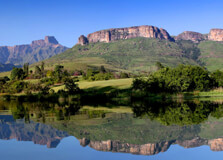
Champagne Castle is a majestic mountain peak located in the Central Drakensberg region of KwaZulu-Natal, South Africa. Standing tall at 3,377 meters (11,079 feet), it is the second-highest peak in the Drakensberg range, after Mafadi. The peak is not just a mountaineering destination but also a scenic and serene escape that attracts nature lovers, hikers, and adventurers from around the world. With its dramatic cliffs, sweeping vistas, and rich flora and fauna, Champagne Castle offers an unforgettable experience for visitors. How to Reach Champagne Castle, KwaZulu-Natal Champagne Castle is located within the uKhahlamba Drakensberg Park, a UNESCO World Heritage Site, near the town of Winterton in KwaZulu-Natal. Here’s how you can get there: By Car from Durban: Drive northwest along the N3 towards Johannesburg. Exit at the Estcourt North or Winterton off-ramp, and follow signs towards the Champagne Valley. The drive takes around 2.5 to 3 hours. By Car from Johannesburg: Take the N3 south towards Durban. Exit at Harrismith, take the R74 via Bergville, and continue to the Champagne Valley. The journey takes about 4.5 to 5 hours. By Air: The closest airport is King Shaka International Airport in Durban. From there, renting a car is the most convenient option to reach the mountain region. Weather at Champagne Castle Champagne Castle has a mountain climate, which varies throughout the year: Summer (November to March): Warm with daytime temperatures between 20°C and 30°C. Afternoon thunderstorms are common, and the landscape is lush and green. Winter (May to August): Cold and dry, especially at higher altitudes. Temperatures range from 5°C to 20°C during the day but can drop below freezing at night. Spring and autumn (April and September-October) offer the best weather for hiking, with mild temperatures and clear skies. Timings to Visit Champagne Castle is accessible year-round, though it is best visited during the drier months from April to September. There are no fixed operating hours for hiking the mountain, but it is advisable to begin early in the morning for safety and to enjoy a full day outdoors. If you’re visiting resorts or using hiking trails within the Champagne Valley, check with local lodges or Ezemvelo KZN Wildlife for specific timings and access rules. Why Famous for Champagne Castle, KwaZulu-Natal? Champagne Castle is renowned for its towering peaks, dramatic natural beauty, and challenging hiking trails. It is a sought-after destination for experienced hikers and climbers, as well as those seeking tranquility in nature. Scenic Beauty: The mountain offers breathtaking views of the Drakensberg escarpment, valleys, and rivers. Biodiversity: Home to unique plant species, birds like the bearded vulture, and mountain wildlife. Adventure: Popular for hiking, rock climbing, and even horse riding in the nearby valleys. Cultural Significance: The surrounding area features San rock art, reflecting the region’s ancient heritage. Entry and Visit Details Access to Champagne Castle is usually through the Monk’s Cowl entrance of the uKhahlamba Drakensberg Park. Entry requires a conservation fee payable at the gate. Adults: Approximately R50 per person Children: Reduced rates available Opening Hours: Typically from 6:00 AM to 6:00 PM Visitors can opt for guided hikes, or self-guided trails. Overnight hikes require prior booking and registration with Ezemvelo KZN Wildlife. Several lodges and campsites are available in the Champagne Valley region. History and Architecture Champagne Castle’s name dates back to a climbing expedition in the early 20th century. Legend has it that two mountaineers carried a bottle of champagne to celebrate summiting Cathkin Peak. Upon reaching the summit, the bottle was accidentally broken, and they named the area "Champagne Castle" in honor of the mishap. While there are no man-made architectural structures on the mountain itself, the surrounding region has charming mountain lodges, rustic chalets, and farmhouses that reflect local Drakensberg architectural styles. Things to Do at Champagne Castle Hiking: Trails range from easy walks to challenging climbs. Notable trails include the hike to Blind Man’s Corner and longer treks up the Champagne Castle massif. Bird Watching: Look out for rare species like the Cape vulture and the Drakensberg rockjumper. Photography: Capture panoramic views of valleys, ridges, and changing cloudscapes. Camping: Designated sites are available for overnight hikers who want to explore the summit. Rock Art Viewing: Nearby caves feature ancient San rock paintings. Horse Riding: Some lodges offer horseback rides through the mountain meadows. Facts about Champagne Castle Champagne Castle is the second-highest peak in South Africa after Mafadi (3,450 m). The mountain is part of the Drakensberg range, a UNESCO World Heritage Site. It is named after an incident involving a broken champagne bottle. The area supports rare flora and is a designated biodiversity hotspot. The peak can only be reached via multi-day hikes and is suitable for experienced hikers. Tips about Champagne Castle, KwaZulu-Natal Check the weather forecast before planning your hike—weather conditions change rapidly at high altitudes. Wear proper hiking boots and layered clothing to adapt to cold or rainy conditions. Carry plenty of water, food, sunscreen, and a basic first aid kit. If camping, book in advance and inform park authorities of your itinerary. Travel with a guide if you are unfamiliar with mountain trekking routes. Start hikes early in the day to ensure a safe return before dusk. Respect wildlife and do not disturb the natural environment.
Explore More