
- Home
- Travel Packages
- Top Destination
-
Travel Attraction
By Category
Top Attraction
- Travel Agents
- Car Rentals
- Hotels

Table Mountain, one of the most iconic landmarks in South Africa, stands proudly over the city of Cape Town. With its flat-topped summit and steep cliffs, it is an instantly recognizable symbol of the city and has earned its place as one of the New7Wonders of Nature. Towering 1,085 meters (3,563 feet) above sea level, Table Mountain offers stunning panoramic views of the city, the surrounding beaches, and the ocean. It is a must-visit destination for tourists and locals alike, offering a unique combination of natural beauty, diverse flora and fauna, and rich history. Why is Table Mountain Famous? Table Mountain is famous for its breathtaking views and unique, flat-topped shape. The mountain has a rich geological history, formed around 600 million years ago during the formation of the Earth’s crust. Its summit, which resembles a large, flat table, has earned the mountain its name. Table Mountain is also known for its incredible biodiversity, being home to a vast number of plant species, some of which are found nowhere else on Earth. Aside from its natural beauty, Table Mountain is deeply ingrained in Cape Town’s history and culture. It serves as a focal point for the city and a prominent feature of the Cape Peninsula, drawing visitors from around the world who come to explore its hiking trails, ride the famous cableway, or simply enjoy the stunning views. It is also one of the world’s most photographed natural landmarks. How to Reach Table Mountain, Cape Town Table Mountain is located in the heart of Cape Town, easily accessible from the city center. Here are a few ways to reach this remarkable landmark: By Car If you are driving, Table Mountain is only a short distance from Cape Town's city center. The mountain is accessible via the Cableway Road, which leads to the lower cableway station. There is parking available at the lower station for visitors who are driving themselves. By Public Transport For those without a car, the MyCiTi bus service offers a convenient route to Table Mountain. The bus stops at the lower cable car station and is an affordable way to travel from the city to the mountain. You can also use taxis or ridesharing services like Uber, which are readily available in Cape Town. By Hiking For the more adventurous traveler, hiking to the summit of Table Mountain is a rewarding experience. There are several popular trails, including Platteklip Gorge, which is the most direct route to the top. Hikers can enjoy breathtaking views while challenging themselves with a steep ascent. However, this hike should only be attempted by those in good physical condition and with proper preparation. Weather at Table Mountain The weather on Table Mountain can be unpredictable, with frequent changes due to its unique location. The mountain is known for its “tablecloth” – a cloud formation that often blankets the summit, giving it the appearance of a tablecloth draped over the mountain. The weather can be quite different from the conditions in Cape Town itself, so visitors should always be prepared for temperature changes, especially in winter. Summers (December to February) are typically warm with temperatures ranging between 15°C to 25°C (59°F to 77°F). Winters (June to August) can be cooler, with temperatures ranging from 7°C to 15°C (45°F to 59°F). Rain is more common in the winter months, so it’s advisable to bring a jacket and be prepared for possible showers. Opening Hours and Timing Table Mountain is open year-round, but the Cableway operates with specific hours: Summer (October to March): 8:00 AM to 9:00 PM Winter (April to September): 8:00 AM to 6:00 PM The mountain's summit can be accessed during these times, but visitors should note that the Cableway may close temporarily due to weather conditions, especially in windy or stormy weather. Entry and Visit Details about Table Mountain To reach the summit of Table Mountain, visitors have two options: hiking or taking the Cableway. The Cableway is the most popular choice, offering a smooth and quick ride to the top. Tickets for the Cableway are available online or at the ticket office at the base of the mountain. Cableway Ticket Prices Adult (return): 360 ZAR Child (return): 180 ZAR Senior (return): 270 ZAR The prices vary for one-way tickets, with discounts available for South African residents. It is advisable to book tickets in advance during the high tourist season to avoid long queues. History and Architecture of Table Mountain Table Mountain has a long history that dates back millions of years. The mountain’s geological formation is attributed to ancient volcanic activity and erosion over time, creating its distinct flat top and steep cliffs. The mountain is made primarily of sandstone, with layers of granite forming the base. In the 19th century, the idea of creating a cableway to the summit was proposed, and in 1929, the first cableway system was built. It was later replaced in 1997 with the modern Table Mountain Aerial Cableway, which features rotating cabins that offer 360-degree views of the surroundings. Things to Do at Table Mountain Table Mountain offers a variety of activities for visitors to enjoy, including: 1. Cableway Ride The most popular activity at Table Mountain is taking the Cableway to the summit. The ride offers stunning views of Cape Town, the harbor, and the surrounding mountains. Visitors can enjoy the panoramic vistas from the top and take in the stunning beauty of the area. 2. Hiking For those who love adventure, hiking to the summit is a must. Popular trails like Platteklip Gorge and Skeleton Gorge offer challenging hikes that reward you with spectacular views of Cape Town from the top. 3. Scenic Views and Photography Table Mountain is one of the best places to take in the spectacular views of Cape Town, the coastline, and the nearby Robben Island. It is a great spot for photographers, with numerous viewpoints providing excellent opportunities to capture breathtaking photos. 4. Flora and Fauna The mountain is home to over 1,470 species of plants, many of which are endemic to the region. Visitors can explore the different ecosystems on the mountain, from fynbos vegetation to forests. It is also home to wildlife such as dassies (rock hyraxes), birds of prey, and various small mammals. Facts About Table Mountain Table Mountain is one of the oldest mountains in the world, estimated to be over 600 million years old. The mountain is a UNESCO World Heritage Site and a key part of the Cape Floristic Region. The “tablecloth” phenomenon occurs when cloud formations cover the summit, creating the iconic image of a table with a cloth over it. There are over 2,200 species of plants on Table Mountain, making it a biodiversity hotspot. Tips for Visiting Table Mountain Arrive Early: To avoid the crowds, try to visit early in the morning, especially during peak tourist seasons. Wear Comfortable Shoes: If you plan to hike, ensure that you wear sturdy footwear as some trails can be quite steep and rocky. Check the Weather: Weather conditions can change quickly on the mountain, so always check the forecast before your visit, especially if you plan to hike. Bring Water and Snacks: Staying hydrated is important, especially if you’re hiking. There are also limited facilities at the summit, so bring snacks if needed. Conclusion Table Mountain is a must-see destination for anyone visiting Cape Town. Whether you prefer to take the Cableway or hike to the summit, the mountain offers spectacular views, incredible biodiversity, and a rich history. It is a place of natural beauty and a central part of Cape Town's identity. A visit to Table Mountain is sure to be a highlight of any trip to South Africa.
Explore More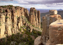
The Valley of Desolation is one of South Africa’s most breathtaking natural wonders, located in the Camdeboo National Park just outside the historic town of Graaff-Reinet in the Eastern Cape. This spectacular geological phenomenon features towering dolerite columns, some rising up to 120 meters above the valley floor, carved over millions of years by volcanic and erosional forces. The panoramic views, stark rock formations, and dramatic landscape make it a must-visit destination for nature lovers, photographers, hikers, and travelers looking for tranquility and awe-inspiring beauty. How to Reach Valley of Desolation, Eastern Cape Valley of Desolation is easily accessible from the town of Graaff-Reinet, which lies about 5 kilometers from the main viewpoint. Graaff-Reinet is located on the N9 national route and is well connected by road to other major towns and cities in the Eastern Cape and beyond. - From Port Elizabeth (Gqeberha): Approx. 260 km (3 to 4-hour drive) - From East London: Approx. 450 km (5 to 6-hour drive) - From Cape Town: Approx. 760 km (8 to 9-hour drive) If you're flying in, the nearest airports are in Port Elizabeth or East London. From there, you can rent a car and drive to Graaff-Reinet. Once in Graaff-Reinet, follow signage to Camdeboo National Park and then to the Valley of Desolation. The park roads are well-maintained, though the last stretch involves a steep climb to the viewpoint. Weather in Valley of Desolation, Eastern Cape The region experiences a semi-arid climate. Summers (October to March) are warm and sometimes hot, with temperatures ranging between 25°C and 35°C. Rainfall is sporadic and mostly occurs in the form of afternoon thunderstorms. Winters (May to August) are cooler, with daytime temperatures averaging 15°C to 22°C and night temperatures sometimes dropping below freezing. The crisp air and clear skies in winter often offer better visibility for photography and hiking. The area is generally dry and sunny year-round, making it suitable for visits in all seasons, though early mornings and late afternoons are ideal for sightseeing due to softer lighting and cooler temperatures. Timing The Valley of Desolation is open daily as part of Camdeboo National Park. The park hours are typically: Summer (October – March): 06:00 AM – 19:00 PM Winter (April – September): 07:00 AM – 18:00 PM It is best to visit during early morning or late afternoon for sunrise or sunset views. The golden light during these times enhances the colors of the rock formations and the landscape below. Why Famous for Valley of Desolation, Eastern Cape? The Valley of Desolation is famous for its towering dolerite columns, breathtaking scenery, and expansive views over the Great Karoo plains. It is a designated national monument and a key feature within Camdeboo National Park. Visitors are often left in awe at the natural beauty and geological scale of the area. The valley’s remote and stark terrain has also earned it a spiritual and almost otherworldly reputation. The vast silence and grandeur of the place have made it popular not only for sightseeing but also for reflection and meditation. Entry and Visit Details about Valley of Desolation, Eastern Cape The Valley of Desolation is located within Camdeboo National Park, managed by South African National Parks (SANParks). Entry fees are required: South African Citizens and Residents: Approx. R60 per adult International Visitors: Approx. R120 per adult Children (age-dependent): Reduced rates available Tickets can be purchased at the gate. Guided tours are not mandatory but are available through local operators for those seeking deeper geological or cultural insights. History and Geology The Valley of Desolation was formed over 100 million years ago through a combination of volcanic activity and erosion. The massive dolerite columns that characterize the valley are the remnants of ancient volcanic intrusions. Over time, the softer surrounding rock eroded, leaving behind these dramatic stone pillars. Culturally, the area was inhabited by Khoisan people and later by Dutch settlers. Today, it stands as a geological marvel and is part of Camdeboo National Park, which was proclaimed in 2005 to protect the unique environment of the region. Things to Do Visitors to the Valley of Desolation can enjoy a wide range of outdoor and cultural activities: Viewpoints: Drive up to the main viewpoint for stunning panoramic views. Hiking: Try the Crag Lizard Trail (1.5 km) for a scenic loop around the cliff tops. Photography: Ideal location for landscape and nature photography. Wildlife Watching: Look out for kudu, springbok, baboons, and over 200 species of birds. Stargazing: With minimal light pollution, the park offers excellent views of the night sky. Visit Graaff-Reinet: Explore museums, galleries, and historic architecture in the nearby town. Facts and Tips about Valley of Desolation, Eastern Cape Interesting Facts: The dolerite columns are over 120 million years old. The valley sits 1,500 meters above sea level. The name "Valley of Desolation" was given due to the barren, haunting appearance of the landscape. The surrounding Camdeboo National Park covers more than 19,000 hectares. Travel Tips: Wear sturdy walking shoes if planning to hike. Bring water, especially during summer, as it can get very hot. Don’t forget sunscreen, sunglasses, and a hat. Check for road and weather conditions in advance, especially during the rainy season. Stay until sunset for the best views and photographs. Visit nearby Graaff-Reinet for accommodations, restaurants, and historical attractions. The Valley of Desolation is a place of solitude, beauty, and awe. Its powerful natural formations, vast landscapes, and quiet atmosphere offer a unique escape into the heart of South Africa’s geological past. Whether you visit for adventure or contemplation, the Valley of Desolation is sure to leave a lasting impression.
Explore More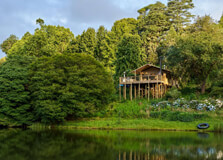
Makapansgat Valley, located near Mokopane in Limpopo province, is one of South Africa’s most historically and archaeologically significant sites. Recognized as part of the UNESCO World Heritage Site under the “Cradle of Humankind,” the valley is famous for its remarkable fossil discoveries, cultural heritage, and early human history. Visitors come to explore ancient caves, learn about early hominins, and admire the breathtaking landscape that has remained largely untouched for millennia. How to Reach Makapansgat Valley, Limpopo Makapansgat Valley lies about 15 kilometers northeast of Mokopane, formerly known as Potgietersrus, in Limpopo Province. By Road: From Johannesburg, the drive is about 3.5 to 4 hours (approximately 250 km) via the N1 highway to Mokopane. From there, a well-marked local road leads to the valley. By Public Transport: Regular buses and minibus taxis are available from major towns to Mokopane. However, a private vehicle or local taxi is needed to reach the valley itself. By Air: The closest airport is Polokwane International Airport, around 60 km away. From there, you can rent a car or arrange a shuttle to Makapansgat. Weather at Makapansgat Valley, Limpopo Limpopo experiences a warm, semi-arid climate. The weather around Makapansgat Valley is generally dry with a mix of hot summers and mild winters. Summer (October to March): Hot temperatures between 28°C and 35°C. Rainstorms are common in the afternoon. Winter (May to August): Dry and cool, with daytime temperatures around 20°C and nights as low as 5°C. The best time to visit is during winter and early spring (May to September) when the weather is pleasant for hiking and exploration. Timings Makapansgat Valley is typically open to visitors during daylight hours. Entry times may vary slightly based on guided tour schedules. Opening Hours: 8:00 AM to 4:00 PM daily (except public holidays) Best Time to Visit: Morning hours for cooler temperatures and better lighting for photography Why Famous for Makapansgat Valley, Limpopo? Makapansgat Valley is world-renowned for its archaeological and paleontological significance. The valley has yielded fossils dating back over 3 million years and includes some of the oldest evidence of human ancestors in southern Africa. It is also famous for the Makapansgat Limeworks and the “Cave of Hearths,” which has signs of early human use of fire. The site bridges prehistory and history, as it also contains records of the 1854 siege during the conflicts between the Voortrekkers and local tribes. Entry and Visit Details about Makapansgat Valley, Limpopo Entry Fee: Around R40 for adults and R20 for children and students (rates may vary) Guided Tours: Recommended and available by prior arrangement, often led by experts in archaeology or history Facilities: Visitor center, basic restrooms, shaded rest areas, and interpretive signage throughout the site Accessibility: Some areas have uneven terrain and steep paths; not all parts are wheelchair-accessible History and Architecture Makapansgat Valley is home to several historic and prehistoric sites that trace back to early hominins. The Limeworks Cave has provided Australopithecus fossils and early tools. The “Cave of Hearths” is considered one of the earliest places where hominins controlled fire, dating back nearly 1 million years. The 19th-century siege of Makapan’s Cave marks a tragic and important historical event, where Voortrekker commandos laid siege to local tribes seeking refuge in the caves, resulting in the deaths of hundreds of people. Stone ruins, burnt timbers, and historical markers reflect this dark chapter of colonial conflict. Things to Do at Makapansgat Valley, Limpopo Explore the Caves: Visit the Limeworks, Historic Cave, and Cave of Hearths to see fossil sites and ancient formations. Take a Guided Tour: Learn about the prehistoric era, fossil findings, and the siege of 1854 from professional guides. Hiking: Enjoy walking trails that wind through the valley, offering scenic views and chances to spot local flora and fauna. Photography: The dramatic cliffs, cave entrances, and untouched landscapes offer excellent photography opportunities. Educational Visits: The site is often visited by universities and researchers. Visitors can see ongoing archaeological work in some seasons. Facts about Makapansgat Valley, Limpopo The valley has been continuously occupied by humans and their ancestors for over 3 million years. The "Makapansgat Pebble," a natural stone resembling a human face, was found in the valley and is one of the earliest examples of symbolic thinking. The valley is part of the Cradle of Humankind World Heritage Site, which also includes the famous Sterkfontein Caves. The 1854 siege is one of the most significant historic confrontations in Limpopo and has been the subject of extensive academic research. The area supports diverse wildlife, including antelope, baboons, and birds, especially in the summer months. Tips about Makapansgat Valley, Limpopo Wear comfortable shoes suitable for hiking and rocky terrain. Bring water, sunscreen, and a hat, especially during summer months. Check in advance for guided tour schedules, which offer a more informative experience. Respect the natural and historical environment—do not remove fossils, stones, or damage cave walls. Combine the visit with a trip to Mokopane Biodiversity Centre or other nearby attractions in Limpopo. Mobile signal may be weak in the valley; download maps or guides beforehand.
Explore More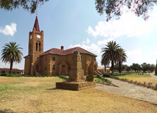
The Vredefort Dome, located in the Free State province of South Africa, is a geological marvel and a UNESCO World Heritage Site. It is the site of the largest and oldest verified impact crater on Earth, created over 2 billion years ago when a massive meteorite struck the planet. Today, the dome forms a part of a stunning landscape filled with hills, ridges, rivers, and rock formations that attract geologists, adventurers, and nature lovers from around the world. The Vredefort Dome offers a unique blend of scientific significance, natural beauty, and cultural heritage. How to Reach Vredefort Dome, Free State The Vredefort Dome is located near the towns of Parys and Vredefort, about 120 km southwest of Johannesburg. By Car: From Johannesburg, take the N1 south, then the R59 toward Parys. It’s a scenic drive of about 1.5 to 2 hours. From Bloemfontein, it’s approximately a 4-hour drive via the N1 and R721. By Bus: While there is no direct public transport to the dome itself, intercity buses can take you to Parys, from where local taxis or tour operators can help you explore the area. By Tour: Several eco-tourism and adventure tour operators in Johannesburg and the Free State offer guided trips to the dome, including geological tours, rafting, and hiking packages. Weather at Vredefort Dome, Free State The region experiences a temperate climate with distinct seasons: Summer (November to March): Warm with afternoon thunderstorms. Average temperatures range between 18°C and 30°C. Winter (June to August): Cool and dry. Temperatures can range between 5°C and 20°C, with colder mornings and evenings. Spring and autumn are considered the best times to visit, offering pleasant temperatures and clear skies, ideal for hiking and sightseeing. Timings The Vredefort Dome is a natural geological site spread across a vast area, accessible at all times. However, specific activities, tours, and information centres have set timings: Visitor Centres: Generally open from 9:00 AM to 4:30 PM (Tuesday to Sunday). Guided Tours: Available by appointment and usually run during daylight hours. Adventure Activities: Operated mostly between 8:00 AM to 5:00 PM, depending on the provider. Why Famous for Vredefort Dome, Free State? The Vredefort Dome is world-renowned for being the oldest and largest known impact structure on Earth. The meteorite that formed the dome is estimated to have been about 10 km in diameter, creating a crater more than 300 km wide at the time of impact. Over time, erosion has left a visible ring-like structure spanning about 90 km. It is also a place of great geological interest, with exposed rocks that provide critical evidence about the early Earth’s crust and impact processes. Scientists from around the globe study the dome to understand planetary evolution. The region is also famous for its outdoor recreational activities, cultural tours, and eco-tourism ventures. Entry and Visit Details about Vredefort Dome, Free State There is no general entrance fee to the Vredefort Dome as a whole, as it spans public and private land. However, guided tours, accommodation, and some attractions within the area may require bookings and fees. Entry Fees: Free access to most natural parts, but museums, guided tours, and private nature reserves may charge R50–R200 depending on the activity. Tour Guides: Hiring a guide is recommended for a deeper understanding of the dome’s geology and history. Facilities: Visitor centres, picnic spots, campsites, self-catering lodges, and restrooms are available in nearby towns like Parys. History and Architecture The Vredefort impact occurred around 2.02 billion years ago. The shock waves from the impact deformed the Earth's crust, creating rings of uplifted rock that are visible today. Unlike most heritage sites, the "architecture" here is purely natural—rock domes, ridges, and valleys shaped by the massive energy release from the impact event. In 2005, the site was declared a UNESCO World Heritage Site for its geological value. There are also remnants of early human settlements in the area, such as San rock art and stone walls from Tswana settlements, blending natural history with human heritage. Things to Do at Vredefort Dome, Free State Geological Tours: Learn about the impact crater, rock formations, and Earth’s history through guided field tours. Hiking & Mountain Biking: Trails wind through valleys and rocky hills, offering panoramic views and birdwatching. White Water Rafting: The Vaal River, which flows through the dome, offers thrilling rafting experiences. Camping & Picnicking: Campgrounds and picnic areas are available, especially near Parys and Vaal de Grace. Cultural Tours: Visit local communities, explore historical stone ruins, or see San rock art. Photography: The scenic beauty of the dome, combined with rare geological features, makes it a photographer’s paradise. Facts about Vredefort Dome, Free State It is the oldest known impact site on Earth, dating back over 2 billion years. The original crater may have been more than 300 km wide, though much of it has eroded over time. The dome is a key geological site, helping scientists understand crater formation and planetary history. UNESCO recognized the Vredefort Dome as a World Heritage Site in 2005. The region also has significant biodiversity and is home to various bird and plant species. Tips about Vredefort Dome, Free State Book a knowledgeable local guide to fully appreciate the scientific and historical significance. Carry plenty of water and wear hiking boots if exploring trails. Check the weather forecast and avoid river activities during or after heavy rains. Respect private land and follow local rules if entering privately owned parts of the dome. Bring a camera, especially during sunrise and sunset, for amazing geological landscapes. Nearby towns like Parys offer charming accommodation and eateries for overnight stays.
Explore More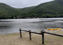
Keurbooms River Nature Reserve
The Keurbooms River Nature Reserve is a peaceful and scenic conservation area located near Plettenberg Bay along South Africa’s iconic Garden Route. Known for its pristine river, lush indigenous forests, and tranquil atmosphere, the reserve offers visitors an escape into nature where they can enjoy boat cruises, hiking, birdwatching, and water activities. It spans approximately 740 hectares and is named after the native “Keurboom” tree (Virgilia oroboides), a tree with lovely pink-purple flowers commonly found in the area. The reserve is managed by CapeNature and is recognized as a protected area of natural beauty and ecological importance. How to Reach Keurbooms River Nature Reserve, Garden Route The reserve is located about 8 kilometers east of Plettenberg Bay in the Western Cape province. By Car: From Plettenberg Bay, take the N2 highway toward Nature’s Valley and look for signage for Keurbooms River. The entrance is well-marked and has parking facilities. By Air: The nearest airport is George Airport, approximately 120 kilometers away. From there, car rental services are available to drive along the N2 eastbound to the reserve. By Public Transport: While public transport is limited, private taxis and shuttle services can be arranged from Plettenberg Bay. Weather at Keurbooms River Nature Reserve, Garden Route The Garden Route enjoys a mild maritime climate throughout the year, making Keurbooms River Nature Reserve a suitable destination in all seasons. Summer (November to March): Warm temperatures between 20°C and 30°C make it ideal for river-based activities like canoeing and swimming. Winter (June to August): Cooler temperatures (10°C to 20°C) with occasional rain, but the forest remains green and picturesque. Spring and Autumn: Mild and pleasant, with spring blossoms and autumn foliage adding beauty to the landscape. Timings and Entry Details Opening Hours: Daily from 7:00 AM to 6:00 PM. Entrance Fee: Adults – R40, Children – R20, Conservation cardholders – Free (rates subject to change). Boat Cruises: Operated from the launch site and generally run between 9:00 AM and 5:00 PM. Booking in advance is recommended during peak seasons. Why Famous for Keurbooms River Nature Reserve, Garden Route? Keurbooms River Nature Reserve is best known for its quiet, unspoiled natural environment and the beauty of the Keurbooms River itself. It attracts nature lovers, photographers, birdwatchers, and kayakers looking for a serene outdoor experience. The reserve is also famous for its ancient indigenous forest, which includes Outeniqua yellowwood trees and an abundance of bird species, such as the Knysna loerie and African fish eagle. It offers a unique opportunity to explore South Africa’s forested riverine ecosystems without large crowds. History and Natural Architecture The name “Keurbooms” originates from the Keurboom tree, once widely used by early settlers for furniture-making due to its hard wood. The area was declared a nature reserve to protect the Keurbooms River ecosystem, which is home to various species of fish, birds, and small mammals. The river is one of the few remaining clean and undisturbed rivers in the region. The reserve has a natural layout, with wooden walkways, simple boat jetties, and eco-friendly picnic spots to maintain harmony with the surrounding environment. There is minimal man-made infrastructure, which adds to its charm and focus on sustainable ecotourism. Things to Do at Keurbooms River Nature Reserve Boat Cruises: A guided boat tour takes you deep into the reserve along the Keurbooms River, with informative commentary on wildlife and plant species. Canoeing and Kayaking: Canoes and kayaks are available for rent, allowing guests to explore the tranquil river at their own pace. Swimming and Relaxation: There are several safe spots along the riverbank for swimming, sunbathing, or simply enjoying a picnic. Birdwatching: The reserve is home to over 90 bird species including the majestic African fish eagle, kingfishers, and herons. Hiking: Short forest trails offer immersive nature walks where you can observe ferns, mushrooms, and towering yellowwood trees. Fishing: Recreational fishing is allowed with a valid permit and is a peaceful activity in the early mornings or evenings. Interesting Facts about Keurbooms River Nature Reserve The river stretches for 85 kilometers and flows into the Indian Ocean near Plettenberg Bay. The reserve is a UNESCO-recognized ecological hotspot due to its biodiversity. Some of the yellowwood trees in the forest are over 600 years old. Keurbooms River is one of the cleanest freshwater rivers along the South African coast. The reserve also forms part of the Garden Route National Park buffer zone. Tips for Visiting Keurbooms River Nature Reserve Bring sunscreen, water, and a hat if visiting in summer, as the sun can be intense even near the river. Wear comfortable shoes suitable for light walking and trail exploration. Binoculars are a great idea for birdwatchers. Bring your own picnic or snacks, as there are limited food services inside the reserve. Arrive early for canoe rentals, as they are limited and first-come, first-served. Respect wildlife and avoid feeding birds or disturbing natural habitats. Keep noise levels low to enjoy the peaceful atmosphere and observe more animals. Keurbooms River Nature Reserve is a hidden treasure on the Garden Route, offering a peaceful and authentic experience of South Africa’s riverine and forest ecosystems. Whether you're paddling through calm waters, observing birds from the shore, or simply enjoying the serene surroundings, this reserve is a paradise for those who cherish nature and solitude. A visit here offers a refreshing contrast to the more commercial attractions of the region and leaves visitors with a deep appreciation of untouched wilderness.
Explore More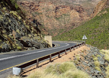
Prince Alfred Pass is one of South Africa's most scenic and historically significant mountain passes. Located in the Western Cape’s Garden Route region, this iconic route links the coastal town of Knysna to the inland town of Uniondale. Spanning about 68 kilometers, the pass winds through the Outeniqua Mountains, offering breathtaking landscapes, untouched nature, and a deep sense of history. Designed by the legendary road engineer Thomas Bain in the 1800s, this route remains a favorite for travelers seeking adventure, photography, and an escape into nature. How to Reach Prince Alfred Pass, Garden Route The Prince Alfred Pass can be accessed from either the coastal town of Knysna or the Karoo town of Uniondale. From Knysna: Drive northeast on the R339 towards Uniondale. The start of the pass is about 20 km from Knysna and is well signposted. From Uniondale: Take the R339 southward. The pass begins shortly after exiting the town and takes travelers through winding mountain paths. By Air: The nearest airport is George Airport, approximately 100 km away. From there, you can rent a car and drive to either Knysna or Uniondale to access the pass. Note: A 4x4 vehicle is not strictly necessary in dry weather, but a high-clearance vehicle is recommended due to gravel roads and occasional rough patches. Weather at Prince Alfred Pass, Garden Route The weather along Prince Alfred Pass varies with elevation and seasons, but generally reflects a temperate climate. Summer (November–March): Warm to hot with occasional rain. Daytime temperatures range from 20°C to 30°C. Winter (June–August): Cooler with chilly nights. Temperatures can range from 5°C in the morning to 20°C by midday. Mountain mists and occasional rain are common. Travelers should always check weather conditions before driving the pass, especially in winter or during heavy rains, as some sections may become slippery or impassable. Timings and Entry Details The Prince Alfred Pass is a public road and is open year-round. There are no official opening or closing times, but it is best to travel during daylight hours. Entry Fee: Free of charge Best Time to Visit: Spring (September–November) and Autumn (March–May) offer the best combination of mild weather and clear views. It is advisable to start your journey early in the day to fully experience the scenic route and stop at various viewpoints and picnic spots along the way. Why Famous for Prince Alfred Pass, Garden Route? Prince Alfred Pass is famous for being one of the most beautiful and historic mountain passes in South Africa. It is the longest pass built by Thomas Bain, a renowned road engineer, and is often considered his masterpiece. The route is famous for its natural beauty, offering views of deep forested gorges, crystal-clear streams, rugged cliffs, and remote farmsteads. Additionally, the pass holds great cultural value, as it connects two vastly different landscapes—the lush Garden Route forests and the semi-arid Little Karoo—making it both a geographical and historical bridge. History and Architecture Prince Alfred Pass was built between 1860 and 1867 by Thomas Bain and a team of convicts. It was named after Prince Alfred, the second son of Queen Victoria, who visited South Africa during that period. The road was carved using manual labor, without modern machinery, making its construction an impressive engineering feat. The pass retains much of its original charm and design, with dry-stone retaining walls, hand-cut curves, and stone culverts still visible today. The architecture is not grand in the traditional sense but stands as a testament to colonial road-building ingenuity and persistence in the face of rugged terrain. Things to Do at Prince Alfred Pass, Garden Route Scenic Drive: Enjoy a peaceful and picturesque drive with numerous stops for panoramic views and photography. Picnicking: Several roadside spots offer great picnic areas surrounded by fynbos and forest vegetation. Birdwatching: The region is rich in birdlife, including raptors, forest birds, and sunbirds. Photography: Capture stunning mountain views, historic bridges, and the unique flora and fauna. Hiking: While there are no formal hiking trails along the pass, several detour roads and footpaths invite exploration. Interesting Facts about Prince Alfred Pass It is the longest of the 24 passes built by Thomas Bain in the Cape Colony. The road still features many of Bain's original stonework and is considered an engineering marvel. The pass has remained largely unchanged since its completion over 150 years ago. Some sections are still so narrow that vehicles must slow down or stop to allow passing. The route offers an exceptional view of the unique transition between lush coastal forests and dry Karoo scrubland. Tips for Visiting Prince Alfred Pass, Garden Route Travel with a full tank of fuel, as there are no fuel stations along the pass. Carry drinking water, snacks, and basic first aid supplies. Ensure your car is in good condition; puncture repair kits are recommended. Avoid driving the pass at night due to its narrow, winding nature and limited lighting. Mobile reception may be limited in some areas, so download offline maps beforehand. Allow at least 2–3 hours to drive the pass leisurely with photo stops and short breaks. Prince Alfred Pass is more than just a road—it's a historical journey through time and terrain. It offers one of the most captivating drives in South Africa, combining natural beauty with engineering brilliance. Whether you’re a history lover, a nature enthusiast, or simply someone seeking a peaceful escape, this pass provides a memorable and enriching experience through the heart of the Garden Route.
Explore More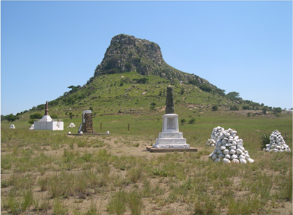
The Isandlwana Hill is situated in the province of KwaZulu-Natal in South Africa. It is the site of the famous battle which took place on January 22, 1879 between a battalion of British troops and Zulu warriors. Isandlwana Hill marks the battle where the native warriors defeated an entire battalion of the British Empire. The place is known for the memorials which mark the graves of the British soldiers who were killed on that day. Isandlwana Hill has a military significance as the underestimation of the British Empire and the superior ambush tactics of the Zulu warriors led to one of the biggest upsets in the history of warfare. It has, in time, attained significance equal to the slaying of Goliath at the hands of David. Isandlwana Hill is one of the most visited tourist sites.
Explore More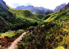
Jonkershoek Nature Reserve is a breathtaking natural haven situated near Stellenbosch in the Western Cape of South Africa. Nestled in a valley surrounded by majestic mountains, the reserve is part of the greater Hottentots-Holland Nature Reserve and is managed by CapeNature. The area is renowned for its rugged beauty, rich biodiversity, and scenic hiking and biking trails that attract nature lovers, adventure seekers, and photographers alike. How to Reach Jonkershoek Nature Reserve, Stellenbosch Jonkershoek Nature Reserve is located approximately 10 kilometers from the center of Stellenbosch, making it very accessible for visitors. By Car: From Cape Town, it takes about 1 hour (50 km) via the N1 or N2 highways to reach Stellenbosch. From Stellenbosch town center, follow Jonkershoek Road to the end where the reserve is clearly signposted. By Public Transport: Stellenbosch is accessible via train or taxi from Cape Town. From there, local taxis or ride-hailing services can be used to reach the reserve. By Tour Services: Several day tour packages from Cape Town and Stellenbosch include Jonkershoek as part of guided nature or wine region itineraries. Weather Jonkershoek experiences a Mediterranean climate with warm, dry summers and cool, wet winters. Summer (November to March): Temperatures range from 20°C to 35°C. Ideal for hiking, biking, and picnicking. Winter (May to August): Cooler with rainfall and temperatures between 5°C and 18°C. Trails may be slippery. Best Time to Visit: Spring (September to November) and early summer offer comfortable temperatures and blooming flora. Timing Operating Hours: Daily from 07:30 AM to 18:00 PM (last entry at 16:00 PM). Closed on: Some public holidays and during severe weather conditions for safety. Recommended Duration: At least 3–5 hours to explore key trails or a full day for more extensive hiking or mountain biking. Why Famous for Jonkershoek Nature Reserve, Stellenbosch? Jonkershoek Nature Reserve is celebrated for its pristine landscapes, diverse ecosystems, and recreational opportunities. Its location in a biosphere reserve and its proximity to Stellenbosch's wine estates make it a favorite among both local and international visitors. Flora and Fauna: The reserve is home to indigenous fynbos, several bird species, baboons, leopards (rarely seen), and antelope. Scenic Trails: Some of the most beautiful hiking trails in the Western Cape, with panoramic views of mountains and waterfalls. Eco-Tourism: A key conservation area in the Cape Floral Region, a UNESCO World Heritage Site. Adventure Sports: Popular with mountain bikers, rock climbers, and trail runners. Entry and Visit Details about Jonkershoek Nature Reserve, Stellenbosch Entry Fee: Approx. R50 per adult and R30 per child (subject to change). Permits: Required for hiking and mountain biking. Available at the entrance. Parking: Ample parking available at the gate and designated spots inside the reserve. Facilities: Basic amenities such as restrooms, picnic areas, and information boards are available. No restaurants inside. History and Architecture While Jonkershoek Nature Reserve itself is primarily a natural area, it holds historical significance as part of the broader Stellenbosch Valley, which was first settled by Europeans in the late 1600s. The name "Jonkershoek" is derived from a Dutch colonial settler who farmed in the valley. There are no traditional buildings or architecture inside the reserve, but old irrigation furrows and historical farm routes hint at the area's agricultural past. The nearby Stellenbosch area offers Cape Dutch-style architecture that complements the visit. Things to Do Hiking: Choose from several trails such as the Tweede Waterval Trail or Panorama Circuit for stunning views. Mountain Biking: Designated routes are available for riders of varying experience levels. Birdwatching: Spot species like the Cape sugarbird, sunbirds, and raptors. Photography: Capture images of waterfalls, mountain peaks, and native plants. Picnicking: Bring a packed meal and enjoy the peaceful surroundings in the designated areas. Facts about Jonkershoek Nature Reserve, Stellenbosch Part of the Cape Winelands Biosphere Reserve and the Cape Floristic Region, a UNESCO World Heritage Site. Over 1,200 plant species grow here, many of them endemic to the region. The Eerste River, which flows through Stellenbosch, originates in the Jonkershoek mountains. It’s a top training location for trail athletes due to its steep ascents and natural terrain. Environmental education programs are often run for local schools and conservation groups. Tips about Jonkershoek Nature Reserve, Stellenbosch Wear Proper Gear: Hiking boots or trail shoes are highly recommended due to rocky terrain. Start Early: Arrive in the morning to make the most of the day and avoid peak sun hours. Bring Water and Snacks: There are no shops inside the reserve. Check Weather Reports: Avoid visiting during heavy rains as trails may become dangerous. Respect Nature: Stay on marked trails and do not disturb wildlife or plants.
Explore More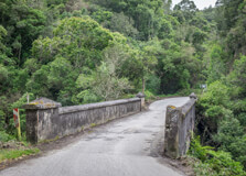
The Seven Passes Drive is a historic and scenic mountain route that connects the towns of George and Knysna along the Garden Route in the Western Cape, South Africa. This 75-kilometre road winds through lush forests, deep river gorges, old bridges, and charming farmlands. It was once the main road between George and Knysna before the construction of the N2 highway. Designed by renowned road engineer Thomas Bain in the 19th century, the drive showcases a unique combination of natural beauty and historical significance, making it a favourite for road trippers, photographers, cyclists, and nature lovers. How to Reach Seven Passes Drive, George The Seven Passes Drive begins in George and ends in Knysna, or vice versa, depending on your starting point. By Car: From George, take the Saasveld Road heading east. Signage for "Seven Passes Road" or “Old Knysna Road” will guide you. The drive includes passes such as Kaaimansgat, Silver River, and Homtini. The route is accessible with a standard vehicle, although some sections are gravel. By Tour: Local tour operators offer guided tours that include historical insights, photography stops, and optional picnic or farm visits. By Bicycle: The route is popular with mountain bikers due to its moderate terrain and scenic views. Weather The Garden Route region, including George and the Seven Passes Drive, enjoys a mild oceanic climate year-round. Summer (Dec–Feb): Warm and sunny, ideal for driving with clear mountain views. Temperatures range from 20°C to 30°C. Autumn (Mar–May): Pleasant weather with fewer tourists and great for scenic photography. Winter (Jun–Aug): Cooler and occasionally rainy, especially in forested areas. Temperatures can drop to 8°C–15°C. Spring (Sep–Nov): Blooming wildflowers and active birdlife make this a colourful season to visit. Timing The Seven Passes Drive is accessible 24/7 as it is a public road. However, daylight hours are recommended for safety and sightseeing. Best Time to Start: Early morning to allow ample time for stops and exploration. Driving Duration: Approximately 2 to 3 hours one way with no stops, but a full day is ideal for exploration. Why Famous for Seven Passes Drive, George? Seven Passes Drive is famous for its engineering history, scenic beauty, and tranquil forest surroundings. It offers an off-the-beaten-path alternative to the N2 with significantly more charm and character. Historic Engineering: Designed in the 1860s by Thomas Bain, it features seven historic mountain passes and several old stone bridges. Natural Beauty: Thick forests, rivers, waterfalls, and dramatic views of the Outeniqua Mountains line the route. Cultural Sites: Old mission stations, churches, and rural villages provide insight into the region’s colonial and indigenous past. Eco-tourism: The route encourages slow, sustainable travel and supports local communities. Entry and Visit Details about Seven Passes Drive, George Entrance Fee: Free of charge. No tolls or permits are required to drive the route. Facilities: Available in nearby towns like George, Karatara, Rheenendal, and Knysna. Picnic spots and cafés can be found along the way. Road Condition: A mix of tarred and gravel road. Drive slowly and carefully, especially after rain. Safety: The road is generally safe, but it’s advised to travel during the day and check weather conditions beforehand. History and Architecture Constructed between 1867 and 1883, the Seven Passes Drive is the work of Thomas Bain, a civil engineer famous for his mountain pass designs throughout South Africa. His work blended engineering brilliance with sensitivity to natural landscapes. The road connects seven original passes: Kaaimansgat, Silwer River, Touw River, Hoogekraal, Karatara, Homtini, and Phantom Pass. Architecturally, the drive features hand-built stone bridges, dry-packed retaining walls, and historic buildings like the Dalene Matthee Memorial and old forestry stations. Each pass has a distinct design tailored to its terrain. Things to Do Scenic Driving: Take your time to enjoy the slow meandering road through forests, rivers, and farmlands. Photography: Numerous lookout points, old bridges, and natural landscapes provide stunning photo opportunities. Picnicking: Pack a basket and enjoy lunch beside one of the rivers or forested clearings. Forest Walks: Stop at Woodville Big Tree or explore indigenous forest trails around Homtini and Karatara. Bird Watching: Over 280 bird species inhabit the surrounding areas, especially near rivers and wetlands. Visit Villages: Stop at Rheenendal and Karatara to explore local crafts, small eateries, and rural charm. Facts about Seven Passes Drive, George The drive covers seven passes over seven different rivers. It was the original road linking George and Knysna before the N2 highway was built in the 1950s. It’s listed as a heritage site due to its historical and architectural value. Renowned South African author Dalene Matthee lived near the Homtini Pass and based several of her books on the area. The road is still used daily by local farmers and residents in addition to tourists. Tips about Seven Passes Drive, George Check Your Vehicle: Ensure your vehicle, especially tyres and brakes, is in good condition before attempting the drive. Pack Essentials: Carry snacks, water, a map, and a fully charged phone as signal may be weak in forested areas. Take Your Time: The road is not meant for speed. Enjoy the views and make plenty of stops. Dress Comfortably: Wear comfortable clothes and shoes if planning to explore on foot or stop for walks. Respect the Environment: Avoid littering and be cautious of wildlife crossing the road.
Explore More