
- Home
- Travel Packages
- Top Destination
-
Travel Attraction
By Category
Top Attraction
- Travel Agents
- Car Rentals
- Hotels
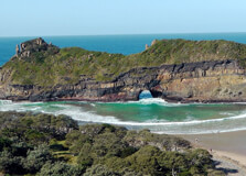
Hole In The Wall is one of South Africa’s most striking natural wonders, located along the Wild Coast of the Eastern Cape near the coastal village of Coffee Bay. This iconic geological formation is essentially a large rock arch carved out of a cliff by the constant pounding of ocean waves. It sits in the Indian Ocean just off the rugged coastline and is surrounded by lush rolling hills and traditional Xhosa villages. The sight is breathtaking, with waves crashing through the opening in the rock and mist rising into the air, creating a dramatic and almost mystical setting. How to Reach Hole In The Wall, Eastern Cape Hole In The Wall is located about 8 kilometers south of Coffee Bay, which is the nearest village. The journey to get there is part of the adventure. The nearest major town is Mthatha, approximately 85 kilometers away. From Mthatha, you can hire a car or take a shuttle service to Coffee Bay. The road to Coffee Bay, while scenic, is narrow and winding in parts, so driving carefully is important. From Coffee Bay, visitors can hike, drive, or arrange local transport to reach Hole In The Wall. The walk is highly recommended for those who enjoy nature, as it offers incredible views of the Wild Coast. Though accessible, the road conditions to Hole In The Wall can be rough, especially after rains, so a high-clearance vehicle or 4x4 is ideal. Weather in Eastern Cape The Eastern Cape’s Wild Coast enjoys a mild, temperate climate. Summers (November to March) are warm and humid with average temperatures ranging from 22°C to 30°C. This is a great time to visit, especially for outdoor activities like hiking, swimming, and beachcombing. Winters (June to August) are cooler and drier, with average temperatures between 12°C and 20°C. While you can still visit during winter, the sea may be colder for swimming. Rainfall is more frequent during summer months, so always check the forecast if you plan to hike. Timing Hole In The Wall is open and accessible 24/7 as it is a natural site. However, for safety and optimal viewing, it is best to visit during daylight hours. Early mornings and late afternoons offer the best lighting for photography and a more peaceful experience. Tides also play a big role in the experience. During high tide, the waves crash directly through the hole, creating a roaring, dramatic effect. During low tide, you can walk closer to the rock formation and explore the surrounding beach and tidal pools. Why Famous for Hole In The Wall, Eastern Cape? Hole In The Wall is famous for its unique and dramatic rock formation, which has become an iconic image of South Africa’s Wild Coast. It’s not just a geological marvel — it holds deep cultural and spiritual significance for the local Xhosa people. According to local legend, the hole was formed when sea people created an opening in the cliff to allow a young man to be united with his love. The site is also popular among photographers, hikers, and nature lovers. The raw natural beauty, combined with rich cultural stories and tranquil surroundings, makes it a must-visit location for travelers to the Eastern Cape. Entry and Visit Details about Hole In The Wall, Eastern Cape There is no entry fee to visit Hole In The Wall, making it a wonderful budget-friendly destination. The site is freely accessible to the public, and visitors can explore the area on their own or hire local guides for an enriched experience. Several local guesthouses and lodges in Coffee Bay and near the Hole In The Wall area offer guided tours, hikes, and cultural storytelling. These often include round-trip transportation, picnic setups, and history sessions about the site. History and Geology Hole In The Wall was formed over thousands of years by the relentless action of waves eroding the rock face. The arch stands at the mouth of the Mpako River where it meets the sea. Over time, the force of the ocean carved out the iconic opening in the cliff, which now appears as a massive hole in a free-standing rock wall in the surf. Geologically, the structure is made up of sedimentary rock that has withstood the erosive forces of nature. Culturally, the site is significant to the Xhosa people, who regard it as a sacred place. The Xhosa name for Hole In The Wall is “esiKhaleni,” meaning “place of sound,” referring to the echoing roar of waves as they pass through the hole. Things to Do There are plenty of things to do in and around Hole In The Wall: Hiking: Multiple scenic trails lead to the site from Coffee Bay, offering incredible views of the coastline. Photography: The rock formation is a stunning subject, especially during sunrise and sunset. Swimming: There are nearby beaches safe for swimming, though care must be taken due to strong currents in certain areas. Picnicking: The grassy areas and beach near the site make for perfect picnic spots. Cultural Tours: Learn Xhosa traditions and hear the stories that surround the Hole In The Wall from local guides. Kayaking and Fishing: Some local tour operators offer kayaking experiences and shore fishing expeditions. Facts and Tips about Hole In The Wall, Eastern Cape Interesting Facts: The hole in the rock is large enough to allow small boats to pass through during high tide. It is one of the most photographed natural landmarks in South Africa. The formation is over 40 meters high and is visible from several kilometers away. There are legends about sea creatures living in the hole that can be heard at night, adding a mystical aura to the site. Travel Tips: Wear comfortable shoes if hiking to the site. Trails may be slippery after rain. Bring water, sunscreen, and a hat, as the sun can be strong, especially in summer. Use local guides – they enhance the experience with stories and ensure you take the safest route. Be cautious near the water during high tide; strong waves can be dangerous. Support local businesses by purchasing handmade crafts and enjoying traditional meals in Coffee Bay. Hole In The Wall is not only a geological masterpiece but also a cultural treasure. With its stunning visuals, rich folklore, and serene surroundings, it offers a truly South African coastal experience. Whether you come for the photos, the hikes, or the legends, Hole In The Wall promises a memorable and soulful journey through the heart of the Eastern Cape.
Explore More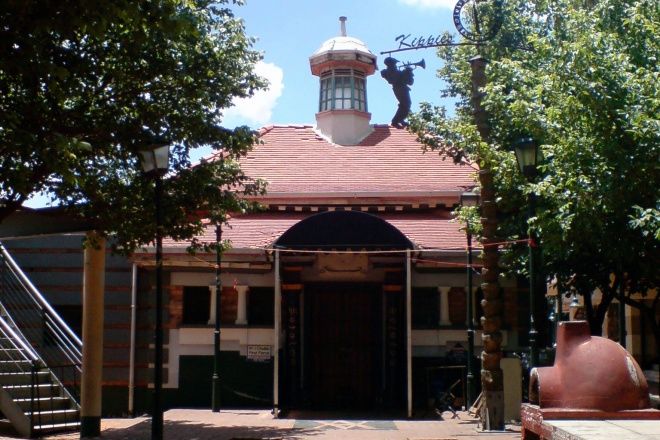
The Newtown Cultural Precinct is situated in Johannesburg, South Africa, and stands as a symbol for the re-inventions and redefinitions which the South African identity has gone through. The precinct is well linked with the nearby towns and is very popular due to the Market Theatre which is a renowned theater. The theater was an important entity during the period of apartheid due to its stress on non-racial theater.
Explore More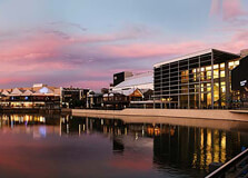
Loch Logan Waterfront is one of the most prominent shopping, entertainment, and recreational hubs in Bloemfontein, the judicial capital of South Africa. Located in the heart of the city, near the Free State Stadium and next to the beautiful Loch Logan lake, this vibrant commercial center is more than just a shopping mall—it's a destination that combines retail, leisure, and culture under one roof. With its scenic location and family-friendly facilities, Loch Logan Waterfront attracts locals and tourists alike. How to Reach Loch Logan Waterfront, Bloemfontein Loch Logan Waterfront is easily accessible by various modes of transportation: By Car: It is located on Henry Street in the city center. Visitors can follow the N1 highway and take the Nelson Mandela Drive exit into the city. The waterfront is well-signposted and has ample parking space. By Public Transport: Minibus taxis and local buses frequently travel to the central business district. Several bus stops are located nearby. By Air: Bram Fischer International Airport is about 10 km from the city center. Taxis, ride-hailing services, or rental cars are available to reach the waterfront. Weather at Loch Logan Waterfront, Bloemfontein Bloemfontein experiences a semi-arid climate, which means warm summers and cool, dry winters. Summer (November to March): Warm to hot with occasional thunderstorms. Temperatures range between 25°C to 35°C. Winter (June to August): Dry and cool with clear skies. Daytime temperatures average 15°C to 20°C, but it can drop below freezing at night. Best Time to Visit: Spring (September–October) and Autumn (April–May) offer mild and pleasant weather for shopping and outdoor leisure. Timing and Entry Details Mall Hours: Monday to Saturday: 9:00 AM – 6:00 PM; Sunday & Public Holidays: 9:00 AM – 2:00 PM. Individual restaurants and cinemas may have extended hours. Entry Fee: Entry is free. However, parking fees may apply depending on the duration of your stay. Accessibility: The facility is wheelchair-accessible and has designated parking bays for people with disabilities. Why Famous for Loch Logan Waterfront, Bloemfontein? Loch Logan Waterfront is famous for being the largest shopping center in central South Africa and for its unique lakeside location. Unlike many typical urban malls, it is built next to a natural body of water, giving it a serene and scenic atmosphere. The waterfront is known for its mix of retail outlets, dining venues, family activities, and cultural exhibitions. It’s also situated near several sports and cultural landmarks, making it a central leisure destination for Bloemfontein residents and tourists. History and Architecture Loch Logan Waterfront was established to modernize Bloemfontein’s shopping experience while integrating the city’s heritage and natural beauty. The development began in the early 1990s, with expansions over the years making it a contemporary landmark. The architecture is modern yet spacious, with a focus on open-air design that integrates seamlessly with Loch Logan lake. Large glass panels and open courtyards allow natural light to flood the space, while walking paths along the water provide a relaxing environment. The integration of retail spaces with nature sets it apart from typical commercial developments. Things to Do at Loch Logan Waterfront Shopping: With over 120 stores, including major national and international brands, visitors can shop for fashion, electronics, groceries, and more. Dining: A variety of restaurants, fast-food outlets, and coffee shops are available, offering both local and international cuisine. Movies: The Ster-Kinekor cinema complex features multiple screens with the latest film releases. Boating and Waterside Walks: Enjoy a walk along the edge of the lake or rent paddle boats during special events and seasons. Events and Exhibitions: Regular markets, cultural shows, and exhibitions are hosted in the central courtyard or lakeside plaza. Kids' Entertainment: Play areas, gaming arcades, and seasonal activities like jumping castles are popular with families. Facts about Loch Logan Waterfront It is named after the man-made Loch Logan lake beside which it is built. The shopping center covers over 80,000 square meters of retail space. It is adjacent to the Free State Stadium, a venue used during the 2010 FIFA World Cup. It is the only waterfront-style shopping center in the Free State province. The lake attracts various birds and small wildlife, adding to the natural charm. Tips for Visiting Loch Logan Waterfront, Bloemfontein Visit during weekdays or early mornings on weekends to avoid crowds, especially during holidays. Carry sun protection if you plan to walk along the lake during summer. Watch out for seasonal markets and food festivals—these are often advertised on local radio or the mall’s website. Security is generally good, but it's wise to keep valuables safe and lock your car when parking. If attending events at the nearby stadium, use the waterfront parking and dine at one of the restaurants before or after the game. Photography is allowed but be mindful of mall policies in retail spaces. Whether you're shopping, strolling by the lake, catching a movie, or enjoying a meal with a view, Loch Logan Waterfront offers a complete urban experience with a scenic twist. It’s an essential stop for travelers to Bloemfontein and a cherished leisure space for locals, blending commerce, culture, and natural beauty.
Explore More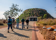
The Cradle of Humankind is one of the most significant archaeological sites in the world, offering a fascinating glimpse into human evolution. Situated just outside Johannesburg, South Africa, this UNESCO World Heritage Site is home to some of the oldest hominid fossils ever discovered. Visitors to the Cradle of Humankind can explore prehistoric caves, learn about the origins of humanity, and witness the discoveries that have shaped our understanding of the past. The site is an essential destination for history buffs, science enthusiasts, and anyone interested in the story of human origins. Why is the Cradle of Humankind Famous? The Cradle of Humankind is renowned for its contribution to the study of human evolution. It is one of the richest sites in the world for hominid fossils, and it has provided key insights into the early stages of human life. The area is famous for the discovery of fossils dating back as far as 4 million years, including the famous "Mrs. Ples" skull, a 2.1 million-year-old Australopithecus skull found at the Sterkfontein Caves. This discovery and many others have solidified the Cradle of Humankind as a central location in the study of human evolution. Notably, the site also houses the fossilized remains of various early human ancestors, including Homo habilis and Australopithecus afarensis. Visitors can learn about the life of early hominids and their development through interactive exhibits, fossil displays, and guided tours. How to Reach the Cradle of Humankind, Johannesburg The Cradle of Humankind is located about 50 kilometers northwest of Johannesburg, making it an easy day trip from the city. The most common ways to reach the site are by car or through organized tours. Visitors can rent a car and drive along the N14 highway, following the signs to the Cradle of Humankind. The journey typically takes around an hour, depending on traffic conditions. For those without a car, several tour companies in Johannesburg offer guided tours to the Cradle of Humankind, which often include stops at other nearby attractions such as the Lion & Safari Park. Public transportation options to the site are limited, so booking a tour or hiring a private vehicle is often the most convenient choice. Weather at the Cradle of Humankind The weather at the Cradle of Humankind is typically characterized by a temperate climate with distinct seasons. Johannesburg, situated on a highveld plateau, experiences warm summers and cooler winters. Summer (November to February) temperatures can range from 20°C to 30°C (68°F to 86°F), with afternoon thunderstorms being common. The summer months are ideal for outdoor activities, as the weather is warm, although visitors should be prepared for the occasional rain shower. Winter (June to August) in the Cradle of Humankind is dry and cooler, with temperatures ranging between 5°C and 20°C (41°F to 68°F). Visitors during this season should pack warm clothing, as mornings and evenings can be quite chilly. Overall, the Cradle of Humankind is a year-round destination, but visitors are advised to check the weather forecast before their trip. Timing and Opening Hours The Cradle of Humankind is generally open every day of the week, with regular visiting hours as follows: Monday to Sunday: 9:00 AM – 5:00 PM It’s important to note that some specific attractions within the Cradle of Humankind, such as the Sterkfontein Caves, may have separate opening hours. It is advisable to confirm specific timings and any special events before visiting. Guided tours of the caves are available throughout the day, but they may be subject to availability, so booking in advance is recommended, particularly during peak tourist seasons. Entry and Visit Details Entry to the Cradle of Humankind is relatively affordable, with fees generally as follows: Adults: Approximately 150 ZAR Children (Ages 6-12): Approximately 75 ZAR Children under 6: Free These fees provide access to the Cradle of Humankind visitor center and its exhibits, but additional costs apply for specific activities like the Sterkfontein Caves tour and the Maropeng Visitor Centre’s boat ride. The fees for the cave tours are typically around 100 ZAR per person. Things to Do at the Cradle of Humankind The Cradle of Humankind offers a variety of attractions and activities for visitors, ranging from historical exhibits to outdoor adventures. Some of the top things to do include: Sterkfontein Caves Tour: This is one of the key highlights of a visit to the Cradle of Humankind. Visitors can take a guided tour of the Sterkfontein Caves, which have yielded some of the most important fossil discoveries related to human evolution. The tour takes visitors underground to see the actual sites where fossils were found and learn about the history of the caves. Maropeng Visitor Centre: The Maropeng Visitor Centre is the main hub for visitors to the Cradle of Humankind. It offers interactive exhibits that explain the story of human evolution, from the earliest hominids to the present day. The center features a range of exhibits, including fossil displays, multimedia presentations, and a boat ride that simulates the journey through time. Cradle of Humankind Nature Reserve: In addition to its historical attractions, the Cradle of Humankind is surrounded by a beautiful nature reserve. The reserve is home to various wildlife, including zebras, antelopes, and other indigenous species. Visitors can enjoy scenic hikes, birdwatching, and even a guided safari experience. Fossil Hunting: Visitors can join fossil-hunting expeditions led by trained guides to learn about the excavation process and try their hand at finding fossils. This is a fun and educational activity for those interested in archaeology and paleontology. Facts About the Cradle of Humankind The Cradle of Humankind spans more than 47,000 hectares and is one of the richest fossil sites in the world. More than 1,000 hominid fossils have been discovered at Sterkfontein alone, contributing to our understanding of human evolution. The site is home to some of the world’s oldest and most complete hominid fossils, including the famous "Mrs. Ples" and "Little Foot." These fossils date back millions of years. In addition to hominid fossils, the area has yielded fossils of ancient animals, such as sabre-toothed cats and giant crocodiles, that once roamed the region. Tips for Visiting the Cradle of Humankind Book Tours in Advance: Guided tours, especially the cave tours, can fill up quickly, especially during peak seasons. It’s recommended to book tickets and tours in advance to avoid disappointment. Wear Comfortable Shoes: The tour of the Sterkfontein Caves involves walking on uneven terrain, so make sure to wear sturdy shoes suitable for the underground environment. Bring Water and Snacks: While there are some facilities on-site, the Cradle of Humankind is in a relatively remote area, so it's a good idea to bring your own water and snacks, especially if you plan to spend a few hours exploring. Prepare for Weather Conditions: Depending on the time of year, the weather can be quite hot or chilly, so it’s advisable to check the forecast and dress appropriately for the day. Allow Plenty of Time: There’s much to see and do, so plan to spend at least half a day exploring the Cradle of Humankind. If you’re interested in both the caves and the exhibits, make sure to allocate sufficient time. Conclusion The Cradle of Humankind is a must-visit destination for anyone interested in the origins of humanity. With its combination of historical significance, natural beauty, and educational exhibits, it offers visitors a unique opportunity to learn about the story of human evolution. From exploring the ancient Sterkfontein Caves to experiencing the cutting-edge Maropeng Visitor Centre, the Cradle of Humankind is a fascinating and enriching experience for people of all ages. Whether you're a history enthusiast, a nature lover, or someone simply curious about our distant ancestors, the Cradle of Humankind is an unforgettable journey through time.
Explore More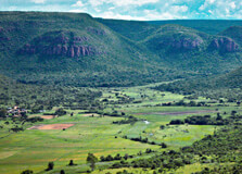
The Waterberg Biosphere Reserve in Vaalwater, Limpopo Province, is a vast and ecologically rich area recognized by UNESCO as a Biosphere Reserve. Spanning over 654,000 hectares, it is one of South Africa’s most pristine and lesser-known wilderness areas. With its unique combination of scenic beauty, archaeological significance, biodiversity, and conservation, the Waterberg region offers a tranquil escape for nature lovers, adventure seekers, and cultural enthusiasts. It is home to a wide variety of flora and fauna, including the Big Five, and is known for its rugged mountains, savannahs, wetlands, and valleys. How to Reach Waterberg Biosphere Reserve, Vaalwater Reaching the Waterberg Biosphere Reserve is relatively easy from major cities in Gauteng: By Road: The most convenient way is to drive from Johannesburg or Pretoria. The journey takes about 2.5 to 3.5 hours (approximately 250 to 300 km). Take the N1 highway north to Modimolle or Bela-Bela, then follow the signs to Vaalwater and the reserve. By Air: Charter flights are available to private airstrips in the region. The closest airport for commercial flights is Polokwane International Airport, located about 2.5 hours from the reserve by road. Transfers: Many lodges and tour operators provide private transfers from Johannesburg and Pretoria, especially for international tourists. Weather The Waterberg region enjoys a moderate climate throughout the year: Summer (October to March): Warm and rainy with temperatures ranging from 20°C to 35°C. Afternoon thunderstorms are common, and the bush is lush and green. Winter (May to August): Dry and cooler with daytime temperatures around 18°C to 24°C and cooler nights around 5°C to 10°C. Ideal for wildlife viewing due to sparse vegetation. The area is malaria-free, making it suitable for family travel year-round. Timing The Waterberg Biosphere Reserve is accessible year-round, with no official entry times since it encompasses various private reserves, parks, and conservation areas. Most private game lodges and activities operate from sunrise to sunset. Game drives usually take place in the early morning and late afternoon. Why Famous for Waterberg Biosphere Reserve, Vaalwater? The Waterberg Biosphere Reserve is famous for being South Africa's first biosphere reserve designated by UNESCO. It’s known for its rich biodiversity, spectacular landscapes, and commitment to sustainable development. The area is home to numerous game reserves, archaeological sites, and rock art paintings left by the San people. It also supports a range of eco-tourism and conservation projects. Its status as a malaria-free destination with Big Five sightings adds to its popularity among safari-goers. Entry and Visit Details about Waterberg Biosphere Reserve, Vaalwater The reserve includes a network of private and public reserves and farms, and visitors access the biosphere via specific lodges or game reserves. There is no single entry gate, and each accommodation or park has its own regulations and facilities. Entry Points: Access is through towns such as Vaalwater, Modimolle, Bela-Bela, or Lephalale depending on your destination within the reserve. Fees: Entrance or conservation fees vary by lodge or park. Most are included in accommodation costs. Guided Activities: Self-drives are allowed in some areas, while others offer guided safaris only. Accommodation: A wide range of options are available — from budget campsites to luxurious eco-lodges. History and Architecture The Waterberg has a rich history dating back thousands of years. Archaeological evidence shows that the region was inhabited by early humans and later by the San people, who left behind remarkable rock art. The reserve's name comes from the Waterberg mountain range, which translates to "water mountain" due to its many rivers and wetlands. Architecturally, lodges in the Waterberg region are designed to blend into the natural environment, with structures made from stone, wood, and thatch. Many buildings incorporate eco-friendly technologies and designs that reflect traditional African style combined with modern luxury. Things to Do Big Five Safaris: Game drives and walking safaris in private reserves such as Welgevonden and Marakele. Hiking and Nature Trails: Explore trails through bushveld, wetlands, and river gorges. Bird Watching: Over 400 species recorded, making it a haven for birders. Cultural Experiences: Visit local villages and learn about traditional Venda and Pedi cultures. Rock Art Tours: Discover ancient San rock art sites hidden in the cliffs and caves. Horseback Safaris: Explore the terrain on guided horseback excursions. Star Gazing: The reserve’s remote location allows for breathtaking views of the night sky. Facts about Waterberg Biosphere Reserve, Vaalwater Declared a UNESCO Biosphere Reserve in 2001. Covers over 654,000 hectares of protected land. Home to more than 5,000 plant species, 50 mammal species, and 400+ bird species. One of the few areas in southern Africa with no malaria. The name "Waterberg" comes from the numerous natural springs and rivers in the area. Tips about Waterberg Biosphere Reserve, Vaalwater Plan in Advance: Book lodges and safari activities early, especially in peak season (June to September). Clothing: Wear neutral tones for game drives. Layers are ideal due to temperature changes. Health & Safety: No malaria risk, but always carry basic medication, sunscreen, and repellent. Photography: Bring extra batteries and memory cards — the views and wildlife are incredible. Respect the Environment: Stay on trails and follow lodge or guide instructions to preserve the ecosystem. Connectivity: Mobile signal may be limited in remote areas. Use the opportunity to unplug.
Explore More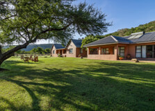
Nestled within the spectacular Waterberg region of Limpopo Province, the Melkrivier 4×4 Trail in Vaalwater offers a rugged and scenic adventure experience for off-road enthusiasts. The trail winds through dramatic mountain landscapes, dense bushveld, and riverbeds, offering an unforgettable challenge for both novice and experienced 4×4 drivers. With its panoramic viewpoints, rich biodiversity, and serene environment, Melkrivier has become a must-visit destination for nature lovers and thrill-seekers alike. The area is known not only for its off-road appeal but also for its untouched wilderness and tranquil atmosphere, making it ideal for an outdoor weekend getaway. How to Reach Melkrivier 4×4 Trail, Vaalwater Melkrivier is situated about 50 km from the town of Vaalwater and is accessible by road: By Car: From Johannesburg or Pretoria, take the N1 highway toward Modimolle (Nylstroom), then drive through Vaalwater via the R33. From Vaalwater, continue west along gravel roads to reach the Melkrivier area. A 4x4 vehicle is highly recommended even for the approach roads, especially during the rainy season. Nearest Airport: Polokwane International Airport is around 3 hours away by road. Private airstrips in the Waterberg region can be used for charter flights. GPS Coordinates: Provided by local tourism offices or trail organizers when booking. It’s advisable to use offline maps as reception may be limited. Weather The Waterberg area, where Melkrivier is located, experiences a pleasant subtropical climate: Summer (October to March): Warm and rainy, with temperatures ranging from 20°C to 35°C. Rain can make trails muddy and more challenging. Winter (May to August): Dry and cool, with daytime temperatures around 15°C to 25°C. Ideal for off-roading and camping. Best Time to Visit: Late winter to early spring (August to October) offers the best conditions for 4x4 activities and wildlife sightings. Timing The Melkrivier 4×4 Trail is generally open year-round, but it’s important to book your trip in advance. Trail access typically starts from 7:00 AM to around 6:00 PM daily. Overnight camping or lodge stays in the area are common and often required due to the remote location. Why Famous for Melkrivier 4×4 Trail, Vaalwater? Melkrivier is renowned for its authentic bushveld experience and challenging yet scenic 4×4 trails. The route includes technical rock sections, steep climbs, river crossings, and dense forest paths, making it one of the most diverse 4×4 tracks in Limpopo. The trail is not only an adrenaline-pumping adventure but also a journey through one of South Africa’s most beautiful wilderness areas. The absence of commercial traffic, low visitor numbers, and rich ecological diversity make it a top destination for off-road and nature lovers alike. Entry and Visit Details about Melkrivier 4×4 Trail, Vaalwater Trail Access: Most 4×4 trails in the Melkrivier area are privately owned and managed. Access is permitted via booking through trail or lodge operators. Entry Fee: Entry fees typically range between R150 to R400 per vehicle, depending on the trail and whether guided assistance is provided. Accommodation: Basic bush campsites, self-catering lodges, and nearby farm stays are available. Some offer access as part of a package. Duration: Trails range from 2-hour circuits to full-day experiences depending on the selected route and weather conditions. Trail Difficulty: Trails vary in difficulty from moderate to advanced. Beginners are advised to travel in groups or with a guide. History and Architecture The name “Melkrivier” translates to “Milk River,” a reference to the river flowing through the area which often appears milky due to sediment during rainy seasons. The Melkrivier valley has long been used for farming and conservation, with a growing reputation for outdoor tourism in recent years. The trail architecture includes hand-built rock sections and bush-cleared paths, carefully integrated into the natural landscape to minimize environmental impact. The surrounding lodges and rest camps often use rustic, eco-friendly designs, blending with the natural bush environment. Things to Do 4×4 Driving: Navigate scenic and technical off-road trails ranging in difficulty. Enjoy rocky ridges, riverbeds, and forest paths. Wildlife Watching: Spot antelope, warthogs, jackals, and even the occasional leopard. Birdlife is abundant, including eagles and kingfishers. Camping: Set up camp at designated sites with basic amenities. Most sites offer braai areas and pit toilets. Hiking: Explore shorter walking routes nearby for a slower pace and a chance to see smaller flora and fauna. Photography: Capture landscapes, wildlife, and dramatic Waterberg cliffs from elevated viewpoints along the trail. Stargazing: The clear rural skies make for excellent stargazing, especially during dry winter nights. Facts about Melkrivier 4×4 Trail, Vaalwater The trail stretches over various terrains and altitudes, reaching heights of 1,400 meters above sea level. Located within the UNESCO-designated Waterberg Biosphere Reserve. Privately managed by farmers and conservationists committed to sustainable land use. Ideal for weekend getaways and part of several self-drive Limpopo adventure routes. Facilities are rustic by design to maintain the wild atmosphere—no loud tourism hubs here. Tips about Melkrivier 4×4 Trail, Vaalwater Use a Proper 4×4: Low-range gears and differential locks are highly recommended for technical sections. Travel in Groups: If possible, travel with another vehicle in case of mechanical issues or recovery needs. Carry Essentials: Include water, food, tire repair kits, fuel, maps, and a first-aid box. Check Trail Conditions: Trails can become impassable after heavy rain. Always confirm trail status before arriving. Respect the Environment: Stick to marked routes, avoid littering, and never disturb wildlife. Book in Advance: Some trails only allow limited vehicles per day to preserve the trail and environment. Bring Binoculars and Cameras: Great for spotting wildlife and capturing the dramatic Waterberg landscape.
Explore More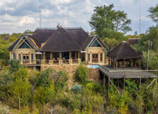
The Limpopo Gateway Gallery is an artistic and cultural treasure located in the picturesque town of Vaalwater, nestled within the Waterberg Biosphere in South Africa’s Limpopo Province. This unique gallery serves as a platform for showcasing regional creativity, heritage, and natural inspiration. It bridges the gap between conservation and community by displaying local art, crafts, photography, and multimedia works that reflect the area's biodiversity, cultural richness, and history. How to Reach Limpopo Gateway Gallery, Vaalwater Getting to the Limpopo Gateway Gallery is relatively simple, especially for travelers already exploring the Waterberg region or coming from Gauteng. By Car: From Johannesburg or Pretoria, take the N1 north to the Modimolle exit. Continue on the R33 through Vaalwater. The gallery is located in or near the central part of the town and is well-signposted. The drive takes approximately 3.5 to 4 hours. By Public Transport: While public transport options are limited, minibus taxis from nearby towns may drop off in Vaalwater. However, having your own transport is highly recommended. By Air: Polokwane International Airport is the nearest major airport, about a 2.5-hour drive from Vaalwater. Private charters can land at local airstrips. Weather The region experiences a warm and temperate climate suitable for year-round visits. Summer (October to March): Hot, often with afternoon thunderstorms. Daytime temperatures range from 25°C to 35°C. Winter (May to August): Dry with cool mornings and evenings and mild afternoons. Temperatures range from 5°C to 24°C. Best Time to Visit: May to October for pleasant weather and fewer chances of rain, making it ideal for walking around and exploring. Timing The Limpopo Gateway Gallery is generally open to the public throughout the week, although exact times may vary. Monday to Saturday: 9:00 AM – 5:00 PM Sunday: 10:00 AM – 2:00 PM Closed on: Public holidays may affect operating hours. It's advisable to call ahead or check online before planning a visit. Why Famous for Limpopo Gateway Gallery, Vaalwater? The gallery has gained recognition for its role in promoting local art and environmental awareness. It is a rare blend of cultural and natural interpretation in a formal exhibition space in a rural setting. Showcases Local Talent: Art from local and regional creators highlights themes such as nature, rural life, wildlife, and identity. Education and Awareness: The gallery often collaborates with schools and NGOs for art workshops and conservation education. Eco-Inspired Installations: Many exhibits are themed around biodiversity, sustainable living, and indigenous traditions. Gateway to the Waterberg Biosphere: It serves as an introductory portal for tourists exploring the surrounding nature reserves and heritage sites. Entry and Visit Details about Limpopo Gateway Gallery, Vaalwater Entry Fees: Most exhibitions are free or require a small donation. Special exhibits or workshops may charge a nominal entry fee. Parking: Free parking is available on site. Accessibility: The gallery is wheelchair accessible and designed to welcome all visitors. Facilities: On-site restrooms, a small coffee station or café, and souvenir/art sales area. History and Architecture The gallery is a relatively recent initiative established as part of broader efforts to promote eco-tourism and cultural development in the Waterberg region. Architecturally, it blends harmoniously with its surroundings, using sustainable materials like reclaimed wood, thatch roofing, and local stone. The building is designed to be energy-efficient and environmentally responsible, with large windows allowing natural light and views of the surrounding bushveld. Inside, flexible gallery spaces can accommodate both permanent and rotating exhibits, community events, and interactive displays. Things to Do View Art Exhibits: Explore a rotating selection of paintings, sculptures, beadwork, and mixed media pieces by emerging and established Limpopo artists. Buy Local Crafts: Support artists by purchasing handmade souvenirs, jewelry, prints, and traditional art. Attend Workshops: The gallery frequently hosts hands-on sessions in painting, pottery, and storytelling for both children and adults. Photography: Take photos of art pieces and outdoor views, especially during special exhibitions or installations. Enjoy Nature Walks: Some gallery grounds feature short paths with indigenous plant signage and sculpture gardens. Facts about Limpopo Gateway Gallery, Vaalwater Located near the entrance to the Waterberg Biosphere Reserve, making it a good first stop before a safari. The gallery is a collaborative project supported by local artists, tourism boards, and conservation organizations. Features a small research and reading corner focusing on Waterberg history, flora, and fauna. Some exhibits are interactive, using video screens or augmented reality to tell conservation stories. The space is often used for local meetings, poetry readings, and cultural events. Tips about Limpopo Gateway Gallery, Vaalwater Visit on a Weekday: Quieter and ideal for in-depth viewing and talking with staff or curators. Ask Questions: Staff are often artists themselves or knowledgeable about the region's art and ecology. Combine with Other Attractions: Include a visit to the gallery before heading to the nearby Welgevonden Game Reserve or Mokolo Dam Nature Reserve. Photography Allowed: You may photograph most artworks unless labeled otherwise; flash may be restricted. Support the Artists: Consider buying art or donating to support art education in local communities.
Explore More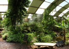
Butterfly World in Stellenbosch is one of the most unique and family-friendly attractions in the Western Cape of South Africa. Located just outside the historic town of Stellenbosch, it offers an immersive experience in a lush tropical environment filled with hundreds of free-flying exotic butterflies from across the globe. More than just a butterfly park, Butterfly World also houses reptiles, birds, spiders, monkeys, and other small animals in spacious enclosures that mimic their natural habitats. This indoor tropical garden is a favorite destination for nature lovers, families with children, and travelers looking for an educational and relaxing outing. How to Reach Butterfly World, Stellenbosch Butterfly World is conveniently situated along the Route 44 between Stellenbosch and Paarl, making it easily accessible by car or public transportation. By Car: From Cape Town, take the N1 towards Paarl and then take the Klapmuts (exit 47) off-ramp. Turn onto R44 towards Stellenbosch. Butterfly World is located on your left-hand side about 500 meters down the road. It is clearly signposted, and ample parking is available. By Public Transport: While direct public transport is limited, tourists can use rideshare services or book a guided tour that includes Butterfly World as a stop. By Air: The nearest airport is Cape Town International Airport, located approximately 45 minutes away by car. Weather Butterfly World is an all-weather attraction because most of its exhibits are indoors within a climate-controlled tropical garden. However, general weather conditions in the Stellenbosch region can still enhance your visit. Summer (Nov – Mar): Warm and dry with temperatures ranging between 25°C and 35°C. Ideal for visiting and exploring the surrounding vineyards and outdoor cafés nearby. Winter (Jun – Aug): Cool and wet, with temperatures from 7°C to 18°C. A good time to enjoy the indoor butterfly sanctuary. Spring & Autumn: Mild weather with pleasant temperatures and blooming flowers, enhancing the tropical feel of Butterfly World. Timing Operating Hours: Open daily from 9:00 AM to 5:00 PM. Last entry at 4:00 PM. Closed On: Only on December 25 (Christmas Day). Ideal Duration: 1.5 to 2 hours to explore all sections at a relaxed pace. Why Famous for Butterfly World, Stellenbosch? Butterfly World is famous for its beautiful, lush tropical enclosure filled with free-flying butterflies from countries such as Costa Rica, the Philippines, and Thailand. The park is also home to a variety of other small animals and offers a hands-on, educational environment where visitors of all ages can learn about biodiversity and conservation. Butterfly Sanctuary: The heart of the park is the large greenhouse with hundreds of colorful butterflies flying freely among exotic plants and flowers. Diverse Species: Beyond butterflies, visitors can see parrots, snakes, marmoset monkeys, tortoises, spiders, and iguanas. Conservation Focus: Butterfly World works to educate the public about animal care, environmental awareness, and the importance of conservation. Interactive Learning: Engaging exhibits make it a great learning experience for children and adults alike. Entry and Visit Details about Butterfly World, Stellenbosch Entry Fee: Adults – ZAR 99, Children (3–17 years) – ZAR 55, Children under 3 – Free. Group discounts are available for schools and tour groups. Tickets: Can be purchased on-site or via the official Butterfly World website. No prior booking is usually necessary for individuals or families. Accessibility: The facility is wheelchair and stroller accessible. Facilities: On-site amenities include clean restrooms, picnic areas, a coffee shop, and a well-stocked souvenir store. History and Architecture Butterfly World was established in 1996 as one of the first facilities in South Africa to offer an enclosed tropical garden specifically for butterflies. The founders aimed to create an educational and environmental attraction for tourists and locals alike. The greenhouse structure was designed to maintain optimal temperature and humidity for tropical species, while being energy-efficient and sustainable. Over time, the facility expanded to include reptiles, birds, and small mammals, making it a miniature zoo and nature reserve for rescued and donated animals. The architectural design emphasizes openness, natural lighting, and plant integration, creating an immersive jungle-like environment inside the greenhouse. Things to Do Walk Through the Tropical Garden: Stroll through the vibrant butterfly sanctuary and marvel at their graceful flight. Explore Animal Zones: Visit sections with reptiles, birds, and monkeys, all kept in enriched and safe enclosures. Educational Exhibits: Learn about the life cycle of butterflies, environmental conservation, and biodiversity. Photography: Capture beautiful moments and close-ups of colorful butterflies and exotic birds. Enjoy the Café: Relax with a cup of coffee or snacks in the on-site café overlooking the surrounding landscape. Souvenir Shopping: Buy handmade gifts, butterfly-themed items, and eco-friendly products at the gift shop. Facts about Butterfly World, Stellenbosch Butterfly World imports butterfly pupae weekly to ensure a constant population of butterflies. All animals at Butterfly World have been rescued, donated, or adopted from facilities that could no longer care for them. The facility uses sustainable practices including water recycling and plant-based pest control inside the greenhouse. The butterflies’ life span is short – typically just 2 to 4 weeks – so visitors may see different species every visit. Butterfly World has won multiple awards for tourism, education, and environmental awareness. Tips about Butterfly World, Stellenbosch Visit Early: Morning visits provide the best lighting and butterfly activity. Wear Bright Colors: Butterflies are often attracted to bright colors, which may enhance your experience. Don’t Touch the Butterflies: Handle them with care if instructed, but generally avoid touching to protect their delicate wings. Stay on Pathways: Respect the environment by staying within designated paths and areas. Combine Your Visit: Pair your trip with nearby attractions such as wine farms, the Giraffe House, or Stellenbosch town center.
Explore More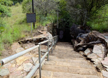
The Sterkfontein Caves are one of South Africa’s most important and fascinating paleoanthropological sites. Located about 40 km northwest of Johannesburg, near Krugersdorp in Gauteng province, these limestone caves are part of the UNESCO-recognized Cradle of Humankind World Heritage Site :contentReference[oaicite:2]{index=2}. Known as the “Strong Spring” caves in Afrikaans, they have preserved an extraordinary fossil record that has reshaped our understanding of human evolution. How to Reach Sterkfontein Caves, Krugersdorp The caves are located on Kromdraai Road, Muldersdrift, about 9.5 km northwest of Krugersdorp :contentReference[oaicite:3]{index=3}. By car, travel via the N14 from Johannesburg, exit onto the R563/Kromdraai Road, then follow signs to the caves. The site offers free parking :contentReference[oaicite:4]{index=4}. Public transport involves taking Gautrain to Krugersdorp and then a taxi or ride-hailing service :contentReference[oaicite:5]{index=5}. Weather at Sterkfontein Caves The region has a subtropical highland climate. Summers feature frequent thunderstorms with average annual precipitation of 650–750 mm, while winters are dry and crisp :contentReference[oaicite:6]{index=6}. Temperatures can range from −12 °C to 39 °C, but inside the caves, the climate stays steady at about 20 °C :contentReference[oaicite:7]{index=7}. Timings of Sterkfontein Caves The caves are open Tuesday through Sunday, from 09:00 to 16:00, with guided tours departing hourly and the last tour at 16:00 :contentReference[oaicite:8]{index=8}. The site is closed on Mondays, Christmas Day, and sometimes New Year’s Eve :contentReference[oaicite:9]{index=9}. Tours last about 60–90 minutes :contentReference[oaicite:10]{index=10}. Why Sterkfontein Caves is Famous Sterkfontein is world-renowned for its rich fossil discoveries. It has yielded remains of Australopithecus africanus (like the skull "Mrs Ples") and an almost complete skeleton known as "Little Foot" :contentReference[oaicite:11]{index=11}. This site alone has produced around 500 hominin fossils, making it one of the richest paleoanthropological reserves globally :contentReference[oaicite:12]{index=12}. These finds solidified the idea of Africa as the cradle of mankind. Entry and Visit Details **Admission fees**: Adults R150; Children (6–18) R125; under 6 free (max two per adult); Pensioners R100; free entry on one’s birthday with ID :contentReference[oaicite:13]{index=13}. Combined tickets with Maropeng are available :contentReference[oaicite:14]{index=14}. Most visitors book online via Webtickets, though onsite purchase is possible :contentReference[oaicite:15]{index=15}. History and Architecture The caves were recognized in the late 19th century by lime miners :contentReference[oaicite:16]{index=16}. Formal excavations began in 1936 under Dr. Robert Broom, who discovered "Mrs Ples." The site has been under continuous exploration since 1968 by the University of the Witwatersrand :contentReference[oaicite:17]{index=17}. Sterkfontein was declared a National Heritage Site in 2004 and a UNESCO World Heritage Site in 2000 :contentReference[oaicite:18]{index=18}. Things to Do at Sterkfontein Caves Guided Cave Tour: Navigate through natural chambers like the Silberberg Grotto, Tuff Chamber, and subterranean lake, while learning about geological formations and ongoing excavations :contentReference[oaicite:19]{index=19}. Museum & Display Centre: Exhibits feature palaeobotany, stalactites, early mammals, and lifelike hominin models illustrated by John Gurche :contentReference[oaicite:20]{index=20}. Timeline Walk: Enjoy outdoor wooden boardwalks overlooking excavation sites and the surrounding Cradle of Humankind scenery :contentReference[oaicite:21]{index=21}. Fossil Prep Lab: Observe paleontologists working on excavated fossils :contentReference[oaicite:22]{index=22}. Restaurant on Site: Post-tour refreshments include local snacks and light meals :contentReference[oaicite:23]{index=23}. Interesting Facts "Mrs Ples" dates back ~2.1 million years, while "Little Foot" is over 3 million years old :contentReference[oaicite:24]{index=24}. Over 500 early hominin fossils have been discovered here :contentReference[oaicite:25]{index=25}. The cave’s internal temperature remains constant at 20 °C :contentReference[oaicite:26]{index=26}. Home to 16 species of bats and wasps like Belonogaster petiolata, plus other wildlife in surrounding grasslands :contentReference[oaicite:27]{index=27}. Declared a UNESCO World Heritage Site in 2000 and a National Heritage Site in 2004 :contentReference[oaicite:28]{index=28}. Tips for Visiting Wear closed-toe, non-slip shoes and comfortable clothes :contentReference[oaicite:29]{index=29}. Bring a torch for better visibility :contentReference[oaicite:30]{index=30}. Reserve in advance, especially during holidays; phone ahead to confirm availability :contentReference[oaicite:31]{index=31}. Avoid if claustrophobic, have asthma or mobility challenges :contentReference[oaicite:32]{index=32}. Leave oversized bags behind; helmets are mandatory :contentReference[oaicite:33]{index=33}. Check weather conditions; tours are suspended during heavy rain due to slippery or flood risks :contentReference[oaicite:34]{index=34}. Combine your visit with Maropeng Visitor Centre for a richer experience :contentReference[oaicite:35]{index=35}. Extend your trip into the Cradle of Humankind: visit Nirox Sculpture Park or take hot air balloon rides :contentReference[oaicite:36]{index=36}.
Explore More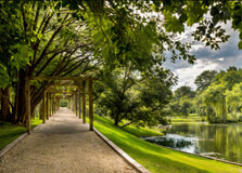
Shepherd’s Fold Stables is a premier equestrian facility nestled in the scenic Elandsdrift Valley near Lanseria, on the outskirts of Krugersdorp in Gauteng, South Africa. With over two decades of experience, this family-run yard offers a magical blend of horse riding lessons, livery services, trail rides, pony camps, and themed parties — all set in an unspoiled rural landscape bordered by the Cradle of Humankind :contentReference[oaicite:1]{index=1}. How to Reach Shepherd’s Fold Stables, Krugersdorp Located at 55 Sunset Drive, Elandsdrift, Lanseria (postcode 1739), Shepherd’s Fold is easily reached by car. From Johannesburg, take the N14 or R28 west towards Krugersdorp, then merge onto the R563/Kromdraai Road and follow signs toward Lanseria and the Cradle of Humankind. The turn-off to Sunset Drive is clearly marked. Ample free parking is available :contentReference[oaicite:2]{index=2}. For those without a car, ride-hailing services like Uber or Bolt can drop visitors directly at the gate. Public transport options are limited; the nearest train station or taxi hub is in Krugersdorp, followed by a short ride-share or taxi connection :contentReference[oaicite:3]{index=3}. Weather at Shepherd’s Fold Stables Krugersdorp experiences a subtropical highland climate with hot, wet summers and cool, dry winters. In summer (November–February), average high temperatures range from 25 °C to 30 °C, with afternoon storms common. Winter days (June–August) are mild, typically between 15 °C and 22 °C, with early mornings dipping below 10 °C. Autumn and spring offer mild, dry weather perfect for riding and exploring. Riders should dress in layers and check weather forecasts before booking trail rides, as heavy rainfall can lead to rescheduling :contentReference[oaicite:4]{index=4}. Timings of Shepherd’s Fold Stables Shepherd’s Fold operates seven days a week, including most public holidays, from 08:00 AM to 05:00 PM :contentReference[oaicite:5]{index=5}. Riding lessons, trail rides, pony parties, and camps should all be booked in advance, and riders are asked to arrive at least 15 minutes early for check-in, tack-up, and safety briefings :contentReference[oaicite:6]{index=6}. Why Shepherd’s Fold Stables is Famous Shepherd’s Fold is celebrated for making equestrian experiences accessible and memorable. Set against dramatic landscapes of the Magaliesberg mountains and Cradle of Humankind, it offers: Professionally guided trail rides ranging from one to two hours A well-equipped riding school offering English-style lessons for ages 3 to 65 Skillfully organized pony camps, pony parties, and social events High-quality livery services, including spacious stabling, ample grazing, and 24-hour horse care :contentReference[oaicite:7]{index=7} The stables are also consistently ranked among the top kids' activities in Krugersdorp and Gauteng, based on both popularity and quality awards :contentReference[oaicite:8]{index=8}. Entry and Visit Details Trail Ride Prices: Pony rides (children
Explore More
The Montebello Design Centre is a vibrant non-profit art, craft, design, and cultural hub nestled at 31 Newlands Avenue in Lansdowne (Newlands), Cape Town. Established in 1993, it occupies beautifully restored Victorian-era stables and farm buildings originally built around 1880 :contentReference[oaicite:1]{index=1}. Surrounded by a canopy of historic trees beneath Devil’s Peak, it brings together over twenty creative studios, workshops, galleries, co‑working spaces, a greenhouse nursery, and a charming café—all unified by its mission to nurture local design, entrepreneurship, and community growth :contentReference[oaicite:2]{index=2}. How to Reach Montebello Design Centre, Lansdowne The centre is easy to reach from central Cape Town. By car, follow M3 or M5 south-east, take the Newlands exit, and proceed along Newlands Avenue until you reach number 31. Ample off‑street parking is available within the premises :contentReference[oaicite:3]{index=3}. For public transport users: disembark at Newlands or Rondebosch train station then walk about 10 minutes to the centre. Alternatively, Board MyCiTi bus or minibus taxis to higher Main Road and hike across Newlands Oval to the site. Ride‑hail options like Uber and Bolt also serve the area. Weather at Montebello Design Centre Cape Town enjoys a Mediterranean climate—hot, dry summers (December to February) with daytime temps between 25–30 °C, and cool, wet winters (June to August) averaging 10–18 °C. The sheltered garden and shaded courtyards of Montebello are perfect for year‑round visits, but the best time to visit is during spring (September–November) and autumn (March–May), when temperatures are mild and outdoor areas are most inviting. Timings of Montebello Design Centre Montebello operates during the following hours: Monday to Friday: 09:00 – 17:00 Saturday: 09:00 – 16:00 Sunday: 09:00 – 15:00 (for The Gardener’s Cottage brunch by booking) Studios, shops, cafés, and nursery follow these hours, while individual galleries may adjust their times slightly. Always check their website ahead of special events like night‑garden evenings or workshops :contentReference[oaicite:4]{index=4}. Why Montebello Design Centre is Famous Montebello is cherished for its unique combination of historic architecture, artistic vibrancy, and eco-conscious cultural programming. It’s famed for: **Heritage spaces**: Victorian stables and greenhouses once used by Ohlsson’s Brewery, restored for craft and creativity :contentReference[oaicite:5]{index=5}. **Creative diversity**: Home to Black‑badge studio initiatives like Montebello Labs—supporting emerging social‑impact designers :contentReference[oaicite:6]{index=6}. **Community events**: Hosts regular workshops like mosaic‑making, monthly in‑season markets, night‑garden festivals and D‑Desk exhibitions :contentReference[oaicite:7]{index=7}. **Hands‑on experiences**: Visitors can take classes in ceramics, printmaking, weaving, beadwork and more :contentReference[oaicite:8]{index=8}. **Eco‑focus**: Its greenhouse nursery promotes indigenous plants and sustainable living, while on‑site café uses fresh produce :contentReference[oaicite:9]{index=9}. Entry and Visit Details Entry is free. Visitors can stroll through galleries, watch artists at work, browse shops, or participate in casual activities without charge :contentReference[oaicite:10]{index=10}. Workshops & events typically cost between R300–R750, depending on duration and materials (e.g., mosaic bird‑feeder session is R750 for 3 hours) :contentReference[oaicite:11]{index=11}. Bookings are required for classes and The Gardener’s Cottage table reservations. Check the website or call (021 685 6445) for dining and event bookings :contentReference[oaicite:12]{index=12}. History and Architecture The site originated as a forested estate noted by Jan van Riebeeck in 1652. In 1696, it became the first brewer’s site in Cape Town. The brick homestead built in 1875 and adjoining stables (c. 1880) are fine examples of Victorian farm architecture :contentReference[oaicite:13]{index=13}. In 1888 brewer Anders Ohlsson acquired the estate, renaming it Montebello. After industrial decline, the property was donated in 1988 by Cecil Michaelis to UCT with the purpose of creating an arts centre. Earnings of the centre are reinvested in community outreach and training :contentReference[oaicite:14]{index=14}. Things to Do at Montebello Design Centre Explore craft studios & galleries: Meet artists working in clay, glass, metal, textiles, sculpture and upcycled materials. Attend workshops: Learn mosaic work, ceramic painting, printmaking, beading, etc. via scheduled sessions :contentReference[oaicite:15]{index=15}. Tree Walk: Self‑guided tour under Camphor trees (planted ~1750), with plaques explaining their botanical and cultural history :contentReference[oaicite:16]{index=16}. Shop local crafts: The Montebello Shop stocks items made on-site, featuring upcycled and alien vegetation furniture :contentReference[oaicite:17]{index=17}. Enjoy refreshments: Relax at The Gardener’s Cottage or Picnic Café & Deli under giant trees :contentReference[oaicite:18]{index=18}. Join events: Night‑garden evenings, live music, markets, exhibitions and collaboration showcases. Co‑working and start‑ups: D‑Desk and Montebello Labs offer co‑working spaces, incubator support and creative mentorship :contentReference[oaicite:19]{index=19}. Interesting Facts The stables date from around 1880 and are among the finest structures of that period in South Africa :contentReference[oaicite:20]{index=20}. Cecil Michaelis, son of Max Michaelis, studied art in Oxford and bequeathed the site to encourage African design :contentReference[oaicite:21]{index=21}. Montebello Labs, launched in 2014, is a 'Black‑Badge' incubator for socially responsive design start‑ups :contentReference[oaicite:22]{index=22}. The 1750‑era Camphor trees were valued for medicinal bark and insect‑repellent properties :contentReference[oaicite:23]{index=23}. Studio spaces include the Ikwezi Art Centre, supporting disadvantaged township artists :contentReference[oaicite:24]{index=24}. Tips for Visiting Montebello Design Centre Plan at least two hours to browse shops, galleries, nurseries, and cafés; longer if attending workshops. Bring a reusable bag or basket—you’ll want to support local artisans. Book workshops and restaurant tables online or via phone to avoid disappointment. Visit during spring when the gardens and trees bloom. Wear comfortable shoes—explore uneven pathways and tree‑lined courtyards. Check online for special events—night‑garden evenings and artisan markets are particularly charming. Perfect venue for family photos, lunch‑dates, educational visits or inspiring creative thinking. Support outreach by purchasing Ikwezi art and other township‑based studio products. Arrive early weekend mornings for a peaceful experience before crowds arrive.
Explore More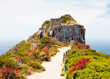
Cape Recife Nature Reserve is a coastal gem located at the southeastern tip of Gqeberha (formerly known as Port Elizabeth), in the Eastern Cape province of South Africa. This 366-hectare protected area boasts scenic ocean views, diverse marine and bird life, peaceful hiking trails, and one of the oldest lighthouses in South Africa. The reserve is a haven for nature lovers, photographers, hikers, birdwatchers, and those who want to experience Gqeberha’s raw coastal beauty. How to Reach Cape Recife Nature Reserve, Gqeberha Cape Recife Nature Reserve is situated around 15 km from Gqeberha’s central business district and approximately 10 km from Chief Dawid Stuurman International Airport. It is easily accessible by car. Visitors can drive south along Marine Drive through the Summerstrand suburb. The entrance to the reserve is clearly marked near the Nelson Mandela University South Campus and SANCCOB seabird rehabilitation center. Public transport to the reserve is limited, so using a private car, Uber, or taxi is recommended. There is ample parking at the entrance to the reserve. Weather The weather at Cape Recife is generally mild and temperate, influenced by its coastal location. Summers (December to March) are warm and breezy, with average daytime temperatures between 22°C and 28°C. Winters (June to August) are cooler but rarely harsh, with temperatures ranging from 10°C to 20°C. Rain can fall throughout the year but tends to peak in spring and autumn. The sea breeze is common, so a light jacket or windbreaker is advisable even during summer months. Timing Cape Recife Nature Reserve is open to the public from 07:00 AM to 17:00 PM daily. The best time to visit is early morning or late afternoon for optimal wildlife and bird viewing, pleasant temperatures, and soft natural light for photography. Why Famous for Cape Recife Nature Reserve, Gqeberha? Cape Recife is famous for its remarkable natural setting and biodiversity. It provides a perfect mix of coastal dunes, rocky shores, sandy beaches, fynbos vegetation, and intertidal pools. It is also renowned for: Birdwatching, especially for waders and seabirds. The historic Cape Recife Lighthouse (built in 1851). The SANCCOB seabird rescue and rehabilitation center nearby. Its location along the popular "Roseate Tern Trail" hiking route. Surfing, snorkeling, and beachcombing opportunities. Entry and Visit Details about Cape Recife Nature Reserve, Gqeberha Entry to Cape Recife Nature Reserve requires a small conservation fee. Tickets can be purchased at the main gate. Visitors must sign in upon entry. The reserve is patrolled and managed for conservation purposes, so all rules must be observed. Guided walks can be arranged through local eco-tourism organizations or at the SANCCOB center. There are no restaurants or shops inside the reserve, so visitors should bring water and snacks. Basic facilities such as parking, signage, and walking paths are available. Always check tide charts if planning coastal exploration. History and Architecture The centerpiece of the reserve is the historic Cape Recife Lighthouse, which was first lit in 1851. The lighthouse, constructed in a classical Victorian style with a cylindrical stone tower painted in black and white bands, still operates today. It was originally built to reduce shipwrecks along the rocky coastline. The name "Cape Recife" comes from the Portuguese word "reef," indicating the hazardous reefs in the area. While there are no large buildings or modern architecture within the reserve, the blend of manmade and natural structures—like wooden boardwalks, information signs, and lookout points—enhance the visitor experience without disturbing the ecosystem. Things to Do 1. Roseate Tern Hiking Trail: A well-known circular walking trail of around 9 km that takes visitors through different ecosystems, offering stunning views and excellent birdwatching. 2. Birdwatching: Spot more than 200 species, including the African oystercatcher, roseate tern, and various migratory waders. 3. Visit the Lighthouse: Marvel at the historic Cape Recife Lighthouse and learn about its maritime significance. 4. Tide Pool Exploration: Discover marine creatures such as starfish, crabs, and sea anemones in the intertidal pools. 5. Photography: Capture breathtaking images of ocean landscapes, wildlife, and sunsets. 6. Visit SANCCOB: Drop by the nearby seabird rescue center to learn about their rehabilitation work and meet rescued penguins. 7. Picnicking and Beachcombing: Enjoy a peaceful walk or picnic by the beach, searching for shells and soaking in the natural beauty. Facts about Cape Recife Nature Reserve, Gqeberha - The reserve protects one of the last remaining dune and fynbos systems along the Eastern Cape coast. - The Cape Recife Lighthouse is one of the oldest working lighthouses in South Africa. - It is part of the greater Nelson Mandela Bay conservation area. - The reserve plays a crucial role in protecting endangered species like the African penguin and roseate tern. - It's one of the few places in South Africa where marine, coastal, and dune ecosystems meet. Tips about Cape Recife Nature Reserve, Gqeberha - Wear sturdy walking shoes: Some trails have sandy or rocky patches. - Bring sunscreen and a hat: There is little shade, and the sun can be strong. - Check tides: Some coastal areas may be inaccessible at high tide. - Respect wildlife: Do not disturb birds or marine animals. - Bring binoculars: Ideal for birdwatching and spotting marine life. - Pack out trash: Help preserve the ecosystem by taking all litter with you. - Stay on marked trails: To protect delicate vegetation and avoid disturbing nesting areas.
Explore MoreLuxury South African Safari
7 Days/ 6 Night
Limpopo - Johannesburg - Kapama
10 Day Youth Leadership Tour Itinerary For South Africa
10 Days/ 9 Night
Cape Town - Johannesburg
30 Days Volunteer Program South Africa Tour
30 Days/ 29 Night
Garden Route - Cape Town - Johannesburg
Special Needs Family Tour - Cape Town
8 Days/ 7 Night
Cape Town
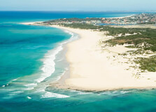
Algoa Bay Cruises in Gqeberha (formerly known as Port Elizabeth) offer one of the most exciting ways to explore South Africa’s Eastern Cape marine life. Algoa Bay is part of the Indian Ocean, stretching along the coast of Gqeberha, and is widely recognized for its biodiversity, pristine waters, and unique marine experiences. From whale watching and dolphin spotting to historical harbor tours and island visits, these cruises provide unforgettable memories for tourists and nature enthusiasts alike. How to Reach Algoa Bay Cruises, Gqeberha Algoa Bay Cruises operate primarily from the Port Elizabeth Harbour, located close to the city center in Gqeberha. Here's how you can reach the starting point: By Car: From Gqeberha’s city center, take Humewood Road or Beach Road to reach the harbor area. There are signboards directing visitors to the cruise departure terminals. By Taxi or Ride-hailing Services: Uber and Bolt are commonly available in Gqeberha, and they can drop you directly at the harbor cruise terminals. By Public Transport: Minibus taxis are an option, but it's safer and more convenient for tourists to use private or hotel-arranged transportation. Weather Gqeberha enjoys a moderate coastal climate, making cruises possible throughout the year. Summer (November to March) brings warm, sunny days ideal for marine excursions, with temperatures ranging from 20°C to 30°C. Winters (June to August) are mild, averaging between 12°C and 22°C. The best time for whale watching is during the southern hemisphere winter and spring months, from July to November, when southern right whales migrate along the coast. Timing Most Algoa Bay Cruises operate between 8:00 AM and 4:00 PM. Some companies offer early morning or sunset cruises, especially for dolphin watching or romantic boat rides. Booking in advance is highly recommended, especially during peak tourist seasons. The duration of cruises ranges from 1.5 to 4 hours depending on the type of cruise selected. Why Famous for Algoa Bay Cruises, Gqeberha? Algoa Bay is renowned as the “Bottlenose Dolphin Capital of the World,” due to the large resident population of these intelligent marine mammals. It is also one of the few locations globally where tourists can see all of the “Marine Big 7” – whales, sharks, dolphins, seals, penguins, orcas, and seabirds. The cruises offer exceptional wildlife photography opportunities and educational insights into the marine ecosystem. The chance to visit St. Croix and Bird Islands, which are home to the largest breeding colony of African penguins, makes the experience even more unique. Entry and Visit Details about Algoa Bay Cruises, Gqeberha Visitors can book Algoa Bay Cruises through local tour operators such as Raggy Charters, AB Marine, or Bay Cruises. Prices vary depending on the type of cruise: Dolphin & Whale Watching Cruise: Approx. R900-R1500 per person Harbor Tour or Sunset Cruise: Approx. R300-R500 per person Private Yacht Charter: Customized rates available Most cruises provide onboard guides, safety gear, light refreshments, and restroom facilities. Visitors should arrive at least 30 minutes before departure for safety briefings and check-in procedures. History and Architecture While Algoa Bay Cruises themselves are modern experiences, the harbor from which they depart holds historical significance. Port Elizabeth Harbour was established in 1820 and played a vital role in maritime trade during the colonial era. Today, the area blends industrial use with recreational activities, maintaining some original port structures and warehouses repurposed into tourist amenities. The architecture of modern cruise vessels is sleek, featuring safety-focused design, open decks for viewing, and enclosed cabins for comfort during windy conditions. Things to Do Whale Watching: See southern right whales and humpbacks during their migration season. Dolphin Encounters: Observe pods of bottlenose dolphins leaping alongside the boats. Penguin Viewing: Visit Bird Island to see endangered African penguins in their natural habitat. Seabird Photography: Capture images of gannets, cormorants, and terns. Sunset Cruises: Relax on evening cruises that showcase Gqeberha’s coastal sunsets. Educational Marine Tours: Learn about marine conservation efforts from experienced guides and biologists. Facts about Algoa Bay Cruises, Gqeberha Algoa Bay is approximately 80 kilometers wide and reaches depths of up to 100 meters. It is the only bay in South Africa to host all seven of the Marine Big 7. The cruises often support marine research and wildlife conservation projects. St. Croix Island hosts over 20,000 African penguins, the largest such colony in the world. Gqeberha is part of the UNESCO-recognized Cape Floristic Region, enhancing both land and marine biodiversity appeal. Tips about Algoa Bay Cruises, Gqeberha Book Early: Especially in whale season (July-November), cruises can fill up fast. Dress Appropriately: Wear layers, including a windbreaker, as ocean breezes can be chilly. Bring a Camera: A zoom lens is great for photographing whales and seabirds. Use Sunscreen: Even cloudy days can cause sunburn when on open water. Motion Sickness Pills: If you're prone to seasickness, take precautions before departure. Check Weather Forecasts: Tours may be postponed or canceled in rough seas. Support Eco-Operators: Choose cruise providers that follow ethical wildlife viewing and eco-friendly practices.
Explore More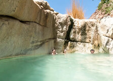
Riemvasmaak Hot Springs, located in the Northern Cape near Upington, is one of South Africa’s most unique and secluded natural wonders. Nestled within a rugged, ancient volcanic valley between towering granite cliffs, the hot springs offer visitors a rare opportunity to relax in thermal pools surrounded by dramatic desert scenery. This area is rich in cultural heritage and natural beauty, making it a hidden gem for nature lovers, photographers, and adventurers. How to Reach Riemvasmaak Hot Springs, Upington Riemvasmaak is approximately 56 kilometers from Augrabies Falls and about 160 kilometers from Upington. To reach the springs, travelers typically drive from Upington via Kakamas and Augrabies. From Augrabies, a gravel road leads to Riemvasmaak village and eventually the hot springs. A 4x4 vehicle is highly recommended, especially during or after rains, as the terrain can become rough and uneven. Guided tours are also available from local operators in Upington or Augrabies. There is no public transport available directly to the springs, so self-drive or private tour is the best option. Weather The region experiences a semi-arid desert climate with extremely hot summers and cool to mild winters. Summer temperatures (October to March) can soar above 40°C (104°F), making early morning or late evening visits more comfortable. Winter months (May to August) are cooler, with daytime temperatures ranging from 18°C to 25°C (64°F to 77°F), which is ideal for enjoying the hot springs without overheating. Rainfall is sparse and mostly occurs in brief showers during the summer. The climate is dry for most of the year. Timing Riemvasmaak Hot Springs are open daily but access is typically restricted to daylight hours. Most visitors go between 7:00 AM and 6:00 PM. Overnight stays are available through campsites and rustic chalets nearby, which must be booked in advance. It is advisable to plan your visit early in the day to avoid the midday heat, especially during summer months. Why Famous for Riemvasmaak Hot Springs, Upington? Riemvasmaak is famous for its natural hot springs located in a spectacular canyon landscape formed by ancient volcanic activity. The springs bubble up from the Earth and collect in rock pools, offering naturally warm, therapeutic waters that are both relaxing and invigorating. What makes Riemvasmaak even more unique is its remote, untouched setting—an oasis in a desert-like environment. The springs are also well known for their cultural history. The Riemvasmaak area was once home to indigenous Nama, Damara, and Xhosa communities who were forcibly removed during apartheid. Today, the land has been returned to the original communities and is managed through community-based tourism initiatives. Entry and Visit Details about Riemvasmaak Hot Springs, Upington Entry fees are charged per person and per vehicle, with rates varying slightly depending on whether you are visiting for the day or staying overnight. Children, adults, and pensioners may have different prices, and it is recommended to check with local tourism offices or the Riemvasmaak Community Tourism Board in advance. Facilities include basic ablution blocks, shaded areas, picnic sites, and braai (barbecue) facilities. There are no shops or restaurants, so visitors should bring their own food, water, and other supplies. Booking is advised for overnight camping or chalet stays. History and Architecture Riemvasmaak has a deep and complex history. The area was originally settled by mixed communities of Nama, Damara, and Xhosa peoples. During the 1970s, these communities were forcibly relocated to make way for military testing grounds under apartheid rule. After the end of apartheid, the land was returned to the original inhabitants through South Africa’s land restitution program, and they have since developed the site as an eco-tourism attraction. The architecture in the area is minimal and blends naturally with the environment. The chalets and campsites are rustic and built with local materials, designed to preserve the natural landscape and minimize environmental impact. The hot springs themselves are natural rock pools with minimal structural interference. Things to Do 1. Soak in the Hot Springs: The main activity is, of course, enjoying the warm mineral-rich waters surrounded by towering cliffs. 2. Hiking: Several trails in the canyon allow visitors to explore the area's geology and landscape. 3. Stargazing: The remote location makes it perfect for observing a clear night sky with minimal light pollution. 4. Birdwatching and Wildlife Spotting: While not a game reserve, the area has interesting desert flora and fauna including eagles, dassies, and lizards. 5. Photography: The landscape offers stunning photo opportunities, especially during sunrise and sunset. 6. Cultural Encounters: Interact with local guides and community members to learn about the area’s history and current development. Facts about Riemvasmaak Hot Springs - The hot springs emerge from volcanic rock and are naturally heated. - The water temperature in the springs averages between 36°C and 40°C (97°F to 104°F). - Riemvasmaak was a military test site until the 1990s. - The site is now part of a successful land restitution and eco-tourism project. - The canyon is over 1.5 billion years old. - Riemvasmaak means “tied-up land” in Afrikaans, referring to the challenging terrain. Tips for Visiting Riemvasmaak Hot Springs, Upington - Use a 4x4 vehicle: The gravel roads can be challenging, particularly in the rainy season. - Bring your own supplies: There are no shops, so carry water, food, and camping essentials. - Book accommodation in advance: Space is limited and in demand during holiday periods. - Travel in groups: It’s safer and more fun to visit with others, especially in remote areas. - Respect the environment: Keep the area clean and avoid damaging natural features. - Check weather conditions: Roads may become impassable during heavy rains. - Charge devices in advance: Electricity may be limited at campsites. - Wear proper footwear: The rocky terrain requires good walking shoes. - Stay hydrated: The dry climate can quickly lead to dehydration.
Explore More
Witsand Nature Reserve, located in the Northern Cape of South Africa near Upington, is one of the most fascinating and lesser-known desert destinations in the country. Famous for its striking white sand dunes that “roar” or “boom” under certain conditions, Witsand offers a unique mix of desert beauty, geological wonder, and tranquil seclusion. Covering over 3,500 hectares, the reserve is a sanctuary for plant and animal life, as well as a destination for adventurers, photographers, and those seeking solitude in nature. How to Reach Witsand Nature Reserve, Upington Witsand Nature Reserve lies approximately 240 kilometers southeast of Upington. The most common route is via the R364 and then the gravel road through Groblershoop. The journey takes about 3 to 4 hours by car depending on road conditions. A portion of the trip is on well-maintained gravel roads, so while a 4x4 is not strictly necessary, a high-clearance vehicle is recommended, especially in rainy seasons. There is no public transport service to the reserve. Travelers typically drive from Upington or include it as part of a road trip through the Northern Cape. Signage is available along the route, but a GPS or detailed map is useful. Weather The reserve experiences a semi-arid climate with hot, dry summers and cool winters. Summer temperatures (November to March) can exceed 40°C (104°F), making early morning and evening the best times to explore. Winter (May to August) brings milder weather, with daytime temperatures averaging 20–25°C (68–77°F) and cooler nights, sometimes dropping below freezing. Rainfall is infrequent and occurs mostly in summer, often as short thunderstorms. The arid environment results in very low humidity and clear skies throughout most of the year. Timing Witsand Nature Reserve is open to visitors daily, from 07:00 AM to 6:00 PM. Overnight guests staying in the reserve’s chalets or campsites have access beyond regular day visitor hours. The visitor center and reception operate during normal business hours and provide information, maps, and keys for accommodations. The best time to visit is between April and September, when temperatures are more moderate and suitable for outdoor exploration. Why Famous for Witsand Nature Reserve, Upington? Witsand is best known for its unique white dunes that produce a low-frequency booming sound when disturbed under specific dry conditions—a rare natural phenomenon known as “singing” or “roaring” dunes. These dunes, formed by quartzite sand, can reach up to 20 meters in height and stretch for kilometers across the reserve. The reserve is also a haven for wildlife, with springbok, gemsbok, porcupines, Cape foxes, and various birds such as kori bustards and sociable weavers. The landscape contrasts red Kalahari dunes with bright white sand, creating a surreal and photogenic setting. Entry and Visit Details about Witsand Nature Reserve, Upington Entry to the reserve requires an admission fee, which varies for adults, children, and pensioners. Fees are typically paid at the entrance gate or visitor center. Overnight accommodation includes self-catering chalets, campsites, and group facilities. It is advisable to book in advance, especially during school holidays or long weekends. Facilities in the reserve include: - Chalets with solar power, kitchenettes, and bathrooms - Braai (barbecue) areas and picnic spots - Campsites with basic ablution blocks - A small kiosk for snacks and firewood History and Architecture The region where Witsand Nature Reserve is located has long been part of the cultural landscape of the indigenous San (Bushmen) people. While there are no major man-made historical structures, the area holds archaeological significance due to the discovery of stone tools and rock engravings nearby. The reserve’s chalets and structures are designed to blend with the environment, featuring neutral earth tones and minimalistic, eco-friendly architecture. Most accommodations run on solar power, reflecting the commitment to sustainable tourism in a sensitive desert ecosystem. Things to Do 1. Explore the Roaring Dunes: Walk on the dunes and, under dry conditions, experience the rumble of the sands—a phenomenon few places in the world offer. 2. Hiking: Several marked trails allow visitors to explore the dunes, red Kalahari sand, and desert vegetation. 3. Birdwatching: Look out for desert species including crimson-breasted shrikes and secretary birds. 4. Wildlife Viewing: Spot small mammals like meerkats, mongoose, and reptiles, especially during morning or dusk. 5. Star Gazing: The night sky is crystal-clear, making it ideal for astronomy and astrophotography. 6. Photography: The contrast of white dunes against a red desert and blue sky offers dramatic landscapes. Facts about Witsand Nature Reserve - The white dunes span about 10 square kilometers in the heart of red Kalahari sands. - The dunes’ “roaring” is caused by sand grains of specific size and dryness rubbing against each other. - Witsand is one of only a few places in the world where singing sand dunes can be experienced. - The reserve is home to over 150 bird species. - Solar power is used to reduce the ecological footprint of accommodation. - Witsand means "white sand" in Afrikaans. Tips for Visiting Witsand Nature Reserve, Upington - Bring enough water and food supplies: The remote location means there are no major shops nearby. - Wear sun protection: Hats, sunscreen, and sunglasses are essential in this intense sun. - Use appropriate footwear: The sand can be hot and coarse, so closed hiking shoes are best. - Travel early in the day: Avoid heat exhaustion by hiking or dune walks during cooler hours. - Pack warm clothing for nights: Even in summer, desert temperatures can drop significantly after dark. - Do not disturb the dunes: Help preserve the phenomenon by minimizing excessive digging or activity on the dunes. - Keep an eye on children: The remote location and wildlife make it essential to supervise kids at all times. - Book early: Accommodation is limited and in demand during peak seasons.
Explore More