
- Home
- Travel Packages
- Top Destination
-
Travel Attraction
By Category
Top Attraction
- Travel Agents
- Car Rentals
- Hotels

Mount Meru, located in the Arusha Region of Tanzania, stands as the country's second-highest peak at 4,562 meters (14,968 feet). This dormant stratovolcano is nestled within the Arusha National Park, offering trekkers a unique blend of challenging climbs and abundant wildlife encounters. Its proximity to Mount Kilimanjaro makes it an excellent acclimatization trek for those planning to summit Africa's highest peak. How to Reach Mount Meru, Arusha Accessing Mount Meru is straightforward from Arusha, approximately 55 kilometers (about 1 hour's drive) away. Visitors can reach the park via the Momella Gate, the primary entry point for climbers. From Arusha, taxis, private vehicles, or guided tours can facilitate the journey. For international travelers, Kilimanjaro International Airport (JRO) serves as the nearest major airport, situated about 60 kilometers from the park. From there, local transportation options are available to reach Arusha and subsequently the park. Weather and Best Time to Visit The climate around Mount Meru varies with altitude. The dry seasons, from June to October and December to February, are considered the best times for trekking. During these months, the trails are less slippery, and visibility is clearer, enhancing the trekking experience. Temperatures range from 15°C to 25°C at lower elevations, with cooler conditions at higher altitudes. The wet season, from March to May and November to early December, brings increased rainfall, which can make trails muddy and challenging for climbers. Timing and Duration of Climb Climbing Mount Meru typically takes 3 to 4 days, depending on the chosen route and acclimatization needs. The most common route is the Momella Route, which offers a scenic ascent through diverse ecosystems. A standard 4-day itinerary includes: Day 1: Trek from Momella Gate to Miriakamba Hut (2,514 meters) through lush rainforest. Day 2: Continue to Saddle Hut (3,570 meters), passing through montane forest and enjoying panoramic views. Day 3: Early morning summit attempt to the peak (4,562 meters), followed by descent back to Miriakamba Hut. Day 4: Return trek to Momella Gate and transfer back to Arusha. This itinerary allows for proper acclimatization, reducing the risk of altitude sickness and enhancing the overall experience. Why Mount Meru is Famous Mount Meru is renowned for several reasons: Scenic Beauty: The mountain offers breathtaking views, including the Ash Cone crater and expansive vistas of the surrounding landscape. Wildlife Encounters: As part of Arusha National Park, trekkers often spot wildlife such as giraffes, buffaloes, zebras, and various bird species along the trail. Acclimatization Opportunity: Its proximity to Mount Kilimanjaro makes it an ideal training ground for climbers preparing for the higher elevations of Kilimanjaro. Cultural Significance: The local Waarusha people regard the mountain as sacred, performing rituals to honor it, which adds a cultural dimension to the trekking experience. Entry and Visit Details To trek Mount Meru, visitors must enter through the Momella Gate of Arusha National Park. A park entry fee is required, and climbers must obtain a trekking permit. It's advisable to book the trek in advance through authorized tour operators, as this ensures proper arrangements and guides. Additionally, hiring an armed ranger is mandatory for safety reasons, as the park is home to various wildlife species. History and Architecture Mount Meru's last eruption occurred between October and December 1910. The mountain's summit was significantly altered around 7,800 years ago due to a massive collapse, forming the current caldera. The Momella Route, the primary trekking path, was established to provide access to the mountain's summit while minimizing environmental impact. The huts along the route, such as Miriakamba and Saddle Huts, offer basic accommodations for trekkers, constructed to blend with the natural surroundings. Things to Do at Mount Meru Trekking: Embark on the ascent to the summit, experiencing diverse ecosystems and panoramic views. Wildlife Viewing: Spot various animals like giraffes, buffaloes, and zebras within Arusha National Park. Bird Watching: Observe over 400 bird species, including flamingos and various waterfowl. Photography: Capture the stunning landscapes, wildlife, and the unique Ash Cone crater. Cultural Exploration: Learn about the local Waarusha people's traditions and their connection to the mountain. Facts and Tips Elevation: Mount Meru stands at 4,562 meters (14,968 feet). Route: The Momella Route is the only trekking route to the summit. Accommodations: Basic hut accommodations are available at Miriakamba and Saddle Huts. Safety: An armed ranger is required for all trekkers for safety against wildlife encounters. Preparation: Proper physical conditioning and acclimatization are essential for a successful climb. Booking: Advance booking through authorized tour operators is recommended. Conclusion Mount Meru offers an exhilarating trekking experience amidst Tanzania's rich natural beauty and cultural heritage. Whether you're seeking adventure, wildlife encounters, or a preparatory climb before tackling Mount Kilimanjaro, Mount Meru provides a rewarding and memorable journey. Proper planning, preparation, and respect for the environment and local cultures will ensure a fulfilling experience on this remarkable mountain.
Explore More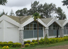
The Arusha Declaration Museum is a historic site located in Arusha, Tanzania. It is dedicated to showcasing Tanzania’s political and cultural history, with a special focus on the Arusha Declaration of 1967. This was a major political statement by Tanzania’s first president, Julius Nyerere, outlining the country's vision of socialism and self-reliance after gaining independence. The museum is a place of national pride and remembrance, giving visitors a chance to learn about Tanzania’s journey through colonialism, independence, and nation-building. How to Reach Arusha Declaration Museum, Arusha The Arusha Declaration Museum is centrally located in Arusha, making it easy to access from many parts of the city. It is situated near the Uhuru Roundabout on Makongoro Road, in the Kaloleni area. If you’re traveling by public transport, you can take a local minibus (called “daladala”) from any part of Arusha to the Central Market, which is nearby. From there, it’s just a 10-15 minute walk to the museum. If you’re coming by taxi or boda boda (motorbike taxi), simply ask the driver to take you to the Arusha Declaration Museum or “Makumbusho ya Azimio la Arusha” in Swahili. Visitors coming from outside the city can arrive via the Arusha Airport, located about 10 km from the city center. Taxis and rental cars are available at the airport. Weather in Arusha Arusha has a pleasant climate throughout the year due to its elevation. It lies at the base of Mount Meru, so temperatures are moderate. The average daytime temperature is around 25°C (77°F), while nights are cooler. There are two rainy seasons: the long rains from March to May and the short rains around November. The best time to visit is during the dry season from June to October or January to February, when the weather is sunny and ideal for sightseeing. Timing and Entry Details The Arusha Declaration Museum is open to visitors from Monday to Saturday, between 9:00 AM and 5:00 PM. It is usually closed on Sundays and public holidays, although this can vary, so it’s good to call ahead. The entry fee is modest—around 10,000 Tanzanian shillings (about 4 to 5 USD). Students and local residents may get discounts if they show valid ID. The museum is accessible for people with disabilities and has basic facilities such as restrooms and nearby cafes or kiosks. Why It’s Famous The museum is famous for preserving and presenting the story behind the Arusha Declaration—a defining moment in Tanzania’s post-independence history. This declaration, made in 1967, laid the foundation for Tanzania’s unique political philosophy of ujamaa (Swahili for "familyhood" or African socialism). Visitors come here to learn about the country's shift from colonial rule to a socialist republic, and to understand the vision of Julius Nyerere, who wanted to build a society based on equality, education, and self-reliance. History and Architecture The building housing the museum was originally a community welfare hall in the Kaloleni area. In 1967, it was the location where the Arusha Declaration was first read. Recognizing its historical importance, the government converted it into a museum and opened it to the public in 1977 to commemorate the 10-year anniversary of the declaration. The architecture is simple yet meaningful. The museum is designed to reflect Tanzanian identity and self-reliance. Inside, you'll find a collection of photographs, writings, historical documents, and exhibits that tell the story of Tanzania’s development. Things to Do at Arusha Declaration Museum There are many interesting things to do and see at the museum: Explore historical exhibits: See documents, newspaper clippings, and original speeches by Julius Nyerere. Join a guided tour: Museum guides can walk you through the exhibits, providing background and context. Visit the monument: Outside the museum stands a monument dedicated to the declaration and its ideals. Watch educational videos: Some rooms show films and documentaries about Tanzania’s independence and political history. Buy souvenirs: The small shop near the entrance sells books, crafts, and other items related to Tanzanian culture. Facts and Tips The museum is one of the few in Tanzania that focuses solely on political history. It is a good place for students and researchers interested in African studies and post-colonial governance. English and Swahili labels are available on most exhibits. Photography may not be allowed inside, so check with staff before taking pictures. There are restaurants and cafes nearby where you can enjoy local Tanzanian food after your visit. Weekday mornings are less crowded, making it easier to explore at your own pace. Conclusion The Arusha Declaration Museum is more than just a museum—it is a symbol of Tanzania’s identity and the values on which the nation was built. It is a place to learn, reflect, and appreciate the efforts of those who shaped the country’s path. Whether you're a local resident, a student of African history, or a curious traveler, the museum offers an educational and inspiring experience in the heart of Arusha.
Explore More
Arusha Cultural Heritage Centre
The Arusha Cultural Heritage Centre is one of Tanzania’s most fascinating and unique destinations. It is located in Arusha, the gateway city to Africa's renowned safari destinations such as the Serengeti and Mount Kilimanjaro. The Centre serves as a bridge to Tanzanian culture, showcasing its rich traditions, history, and diverse heritage. It provides visitors with a comprehensive view of Tanzania's cultural history, art, and craftsmanship, making it a must-visit site for anyone traveling to Arusha. How to Reach Arusha Cultural Heritage Centre, Arusha The Arusha Cultural Heritage Centre is conveniently located just outside the bustling town center of Arusha, about a 10-15 minute drive from the city center. It is easily accessible by taxi, car hire, or even local transport options like buses or dala-dalas (shared minivans). The Centre is situated on the main route that leads to some of the most famous national parks, so tourists traveling by private vehicles often make a stop here to learn about the rich culture and art of Tanzania before embarking on their safari adventures. Weather in Arusha Arusha experiences a pleasant climate, with mild weather throughout the year. The region has two main seasons: a rainy season from March to May and a dry season from June to October. Temperatures typically range from 18°C to 30°C (64°F to 86°F), making it a comfortable destination for year-round visits. Visitors to the Arusha Cultural Heritage Centre will experience moderate temperatures that are perfect for exploring the exhibits and outdoor spaces. Timing of the Arusha Cultural Heritage Centre The Arusha Cultural Heritage Centre is open every day of the week. Its usual operating hours are from 9:00 AM to 6:00 PM. These hours allow enough time for visitors to explore the various exhibits and galleries. It is advisable to plan for at least 2-3 hours to fully appreciate the Centre's extensive collection of art and artifacts. However, the Centre may have special timings or closures during major holidays or public events, so it is recommended to check ahead for any updates. Why is Arusha Cultural Heritage Centre Famous? The Arusha Cultural Heritage Centre is famous for several reasons. First, it offers an impressive display of Tanzanian art, historical artifacts, and cultural pieces, representing different ethnic groups from across the country. It houses a significant collection of traditional and contemporary African art, tribal masks, sculptures, and beadwork that reflect the diversity of Tanzanian culture. Additionally, the Centre is renowned for its jewelry and craft shops, where visitors can purchase authentic, handmade Tanzanian crafts. This includes Maasai beadwork, intricate silver jewelry, and hand-carved wood artifacts. It also has a well-curated gallery that features renowned Tanzanian artists and contemporary works. Entry and Visit Details The entry fee for the Arusha Cultural Heritage Centre is relatively affordable, with different rates for Tanzanian residents and international visitors. The cost typically ranges from $5 to $10 for adults, and children may enjoy discounted entry rates. Special tours and guided visits may incur additional costs, but they offer a more in-depth understanding of the displays and the culture behind them. Visitors are encouraged to take part in the Centre's guided tours, which provide rich insights into the cultural significance of the various items on display. These tours are usually available in English, and the knowledgeable guides can answer questions, offering a deeper understanding of Tanzania's heritage. History and Architecture of the Arusha Cultural Heritage Centre The Arusha Cultural Heritage Centre was established with the goal of preserving and promoting Tanzania's cultural heritage. It was created by the Arusha Cultural Heritage Trust, an organization dedicated to showcasing the arts, crafts, and traditions of the various ethnic groups in Tanzania. The Centre's collection reflects the deep history and cultural richness of the country, offering a window into the past and present of Tanzania. The architecture of the Centre itself is inspired by traditional African designs, blending local and modern influences. The structure is spacious and designed to complement the surrounding landscape, with large windows allowing natural light to illuminate the exhibition halls. Visitors can enjoy both indoor and outdoor spaces, which are beautifully landscaped to create a peaceful and engaging environment. Things to Do at the Arusha Cultural Heritage Centre At the Arusha Cultural Heritage Centre, visitors can engage in several activities that provide both cultural enrichment and relaxation. Some of the activities include: Explore the Galleries: Discover the various art exhibitions that showcase Tanzania's rich cultural history and contemporary art. The Centre is home to many unique pieces of African art and cultural artifacts. Shop for Souvenirs: Purchase authentic Tanzanian crafts, including Maasai beadwork, jewelry, clothing, and hand-carved wood items. The Centre’s craft shop offers a variety of beautiful souvenirs to take home. Take a Guided Tour: Engage in a guided tour to learn more about the history behind the artworks and the different tribes that contribute to Tanzania’s vibrant culture. Relax in the Café: After exploring the exhibits, relax in the Centre’s café, which serves refreshments, snacks, and traditional Tanzanian dishes, giving you a taste of the local cuisine. Facts About the Arusha Cultural Heritage Centre The Centre is home to one of the largest collections of Tanzanian art and cultural artifacts. It features an extensive selection of traditional and contemporary African artwork, tribal masks, and sculptures. The Centre is famous for its Maasai beadwork and jewelry, which is highly regarded for its craftsmanship. The Centre has a dedicated gallery space that showcases the works of prominent Tanzanian artists. It is a popular stop for tourists heading to nearby national parks such as Serengeti and Ngorongoro Crater. Tips for Visiting the Arusha Cultural Heritage Centre Plan your visit during the morning: The Centre can get busier in the afternoon, so arriving early gives you a more peaceful experience. Bring cash: While the Centre accepts card payments, some small purchases, such as souvenirs from local artisans, may require cash. Wear comfortable shoes: The Centre has large grounds, and you’ll want to explore both the indoor galleries and the outdoor spaces. Engage with the staff: The staff is knowledgeable and friendly, and they are happy to answer questions and provide insights into the exhibits. Support local artisans: Purchasing handcrafted items from the Centre helps support local artists and communities.
Explore More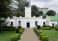
The Old Boma Museum, also known as the German Boma, is a historical site located in Arusha, Tanzania. The museum is situated in a colonial-era building that reflects the region’s past, showcasing various artifacts, cultural displays, and information about Tanzania's natural and cultural heritage. Established as a museum, the Old Boma plays a crucial role in preserving the history of the region and offers a deep dive into Arusha’s rich and diverse history. How to Reach Old Boma Museum, Arusha Reaching the Old Boma Museum in Arusha is relatively straightforward, whether you are traveling by car, taxi, or public transport: By Car: From the city center of Arusha, head southeast towards the main road that connects to Dodoma. The museum is easily accessible by road and well-signposted. It is located just off Boma Road. By Public Transport: Public transport such as shared minibuses, locally known as matatus, can be taken from the Arusha Bus Station. The fare is quite affordable, and the journey will be short, depending on traffic conditions. By Taxi: A taxi ride is another comfortable way to reach the museum. It’s a good option if you want a direct route to the museum. Ensure to confirm the fare with the driver beforehand. Weather in Arusha Arusha enjoys a moderate, temperate climate, characterized by cooler temperatures in the highlands. The weather can be categorized into wet and dry seasons. The wet season occurs from March to May, while the dry season runs from June to October. Temperatures typically range between 15°C (59°F) in the cooler months to 25°C (77°F) in the warmer months. For a pleasant visit to the museum, it’s best to check the forecast before your trip, as the rainy season might limit outdoor activities in the garden. Timing of the Old Boma Museum The museum is open every day to the public. The operating hours are as follows: Monday to Saturday: 9:00 AM – 6:00 PM Sunday: 9:00 AM – 5:00 PM It is advisable to visit in the morning to avoid the afternoon crowds and enjoy the exhibits more leisurely. However, weekends can be busier, so planning a weekday visit might be more comfortable. Why is Old Boma Museum Famous? The Old Boma Museum is renowned for its role in showcasing the history and culture of Arusha and Tanzania. It is famous for several reasons: Colonial History: The building was originally constructed by the Germans in the late 19th century as a military outpost. It later served as a British administrative headquarters after World War I, making it an important historical site in the region. Cultural and Archaeological Exhibits: The museum’s displays focus on the cultural heritage of the region, including ancient artifacts and exhibits on local tribes, colonial history, and natural history. Connection to Tanzanian Evolution: The museum contains information and exhibits related to human evolution, particularly artifacts from archaeological digs in nearby areas such as Olduvai Gorge and Laetoli, which are key sites in the study of human evolution. Entry and Visit Details About Old Boma Museum, Arusha The entry fees for the museum are affordable, making it accessible for both local visitors and international tourists: Tanzanian Residents: 2,000 TZS Non-Residents: $5 USD While the entry fee is modest, guided tours are also available for a more enriched experience. These tours provide deeper insight into the exhibits and the historical significance of the Old Boma building. It’s recommended to hire a local guide if you want a more detailed understanding of the exhibits. History and Architecture The Old Boma Museum is housed in a building that dates back to the German colonial era, constructed between 1899 and 1900. The building was originally used as a military base by the Germans and later served as a British military post after World War I. The architecture of the building reflects its military origins, with a simple, functional design, strong stone walls, and a central courtyard. Over the years, the building has been repurposed for various uses, but today, it stands as a museum, preserving the history of the region. Things to Do at the Old Boma Museum There are several things to enjoy when visiting the Old Boma Museum: Explore the Exhibits: Learn about Tanzania’s colonial history, as well as the indigenous cultures of the region. The museum houses various historical artifacts and cultural displays that provide a glimpse into the past. Enjoy the Botanical Garden: The museum is surrounded by a beautiful garden, which is a serene place to relax and explore native plants and flora. It offers a peaceful escape from the bustle of the city. Photography: The architecture of the Old Boma and its surroundings are picturesque, making it a great spot for photography enthusiasts. Attend Cultural Events: The museum occasionally hosts cultural events and exhibitions. Check for any ongoing events that might coincide with your visit. Facts About the Old Boma Museum The Old Boma was originally a German fort built during the colonial era between 1899 and 1900. After World War I, the building was used by the British colonial administration as a military post and administrative center. The museum houses important archaeological collections, including artifacts from Olduvai Gorge and the Laetoli footprints, which provide significant insights into human evolution. The museum’s architectural style is a reflection of the military function it originally served, featuring sturdy stone walls and a simple, functional design. Tips for Visiting Old Boma Museum, Arusha Wear Comfortable Shoes: The museum grounds and exhibits require walking, so comfortable footwear is recommended. Arrive Early: To avoid the afternoon crowds, try visiting in the early hours when the museum is less crowded. Bring Cash: While entry fees are reasonable, cash is preferred for purchasing tickets and souvenirs. Credit card facilities may not be available. Take a Guided Tour: To fully appreciate the history and significance of the museum, consider hiring a local guide for a more immersive experience. Respect the Environment: As with any historical site, be mindful of the artifacts and exhibits and avoid touching them.
Explore More
Olpopongi Maasai Cultural Village & Museum
Situated approximately 85 kilometers from Arusha in northern Tanzania, the Olpopongi Maasai Cultural Village & Museum offers visitors an authentic and immersive experience into the heart of Maasai culture. Nestled in the semi-arid region between Mount Kilimanjaro, Mount Meru, and Longido, this cultural hub provides a unique opportunity to engage with one of East Africa's most iconic indigenous communities :contentReference[oaicite:1]{index=1}. How to Reach Olpopongi Maasai Cultural Village & Museum, Arusha Reaching Olpopongi Maasai Cultural Village involves a scenic journey from Arusha. Travelers can embark on a day trip or opt for an overnight stay. The journey typically begins with a drive to Boma Ng'ombe, located 23 kilometers west of Moshi. From there, a 27-kilometer sealed road leads to Sanya Juu, after which a poorly signposted track continues 25 kilometers further to Olpopongi :contentReference[oaicite:2]{index=2}. For those preferring guided tours, various tour operators offer packages that include transportation from Arusha or Moshi to the village. Weather Arusha experiences a subtropical highland climate, characterized by mild temperatures and distinct wet and dry seasons. The average annual high temperature hovers around 25°C, with the coolest months being June to October. The long rainy season, known as 'masika,' occurs from March to May, while the short rainy season, or 'vuli,' typically falls between November and December :contentReference[oaicite:3]{index=3}. Visitors planning their trip should consider these climatic patterns to ensure a comfortable experience. Timings Olpopongi Maasai Cultural Village welcomes visitors daily. However, it's advisable to check with the official website or contact the village directly for the most current visiting hours and any special events or closures. Early morning arrivals are recommended to fully experience the day's activities, including cultural tours and traditional ceremonies. Why Famous for Olpopongi Maasai Cultural Village & Museum, Arusha? Olpopongi stands out as Tanzania's first authentic Maasai boma, complete with a museum and overnight facilities. Unlike other cultural centers, Olpopongi offers a genuine glimpse into the Maasai way of life. Visitors can explore traditional Maasai homes, participate in cultural activities such as spear-throwing, learn about natural medicine, and enjoy traditional Maasai meals. The village also serves as an educational center, promoting conservation efforts and community development :contentReference[oaicite:4]{index=4}. Entry and Visit Details about Olpopongi Maasai Cultural Village & Museum, Arusha Entry to Olpopongi Maasai Cultural Village is available through various tour packages. The "Day Tour" includes a cultural day trip to the Maasai village with a welcome drink, a traditional lunch, and a walking safari. The "Overnight Tour" offers a cultural day tour and full board arrangement in a Maasai village, including a traditional lunch, BBQ dinner buffet, breakfast, and a welcome drink :contentReference[oaicite:5]{index=5}. It's essential to make advance bookings, as visits are by appointment only. Contact details and booking information can be found on the official website: www.maasai-village.com. History and Architecture The Maasai people have a rich history as semi-nomadic pastoralists who have inhabited the savannas of East Africa for centuries. Olpopongi Maasai Cultural Village preserves this heritage through its traditional architecture and lifestyle. The bomas (homesteads) are constructed using local materials such as mud, wood, and thatch, reflecting the Maasai's deep connection to their environment. The village also features a museum showcasing Maasai tools, jewelry, and artifacts, providing visitors with insights into the community's history and cultural practices :contentReference[oaicite:6]{index=6}. Things to Do Cultural Tours: Explore the village and learn about Maasai traditions, including their social structure, customs, and daily activities. Traditional Ceremonies: Witness or participate in Maasai dances, songs, and rituals that have been passed down through generations. Walking Safaris: Embark on guided walks through the surrounding landscape to observe local wildlife and learn about the Maasai's relationship with nature. Craft Shopping: Purchase handmade Maasai crafts such as beadwork, jewelry, and clothing, supporting local artisans and the community. Overnight Stay: Experience life as the Maasai do by staying overnight in a traditional boma, complete with authentic meals and accommodations. Facts and Tips about Olpopongi Maasai Cultural Village & Museum, Arusha Authentic Experience: Olpopongi offers one of the most genuine Maasai cultural experiences, allowing visitors to immerse themselves in the community's way of life. Community Support: Proceeds from visits and purchases directly benefit the local Maasai community, contributing to education, healthcare, and infrastructure development. Respect Local Customs: Visitors are encouraged to dress modestly and respectfully, adhering to local customs and traditions. Bring Cash: While some tour packages include meals and activities, it's advisable to carry cash for additional purchases such as crafts or tips for guides. Health Precautions: As with any travel, ensure you have necessary vaccinations and carry any required medications. It's also wise to use insect repellent to protect against mosquito-borne diseases. In conclusion, a visit to Olpopongi Maasai Cultural Village & Museum offers a rare opportunity to experience the rich heritage and traditions of the Maasai people. Whether you're interested in cultural immersion, wildlife observation, or supporting community development, Olpopongi provides a memorable and meaningful experience in the heart of Tanzania.
Explore More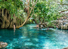
Chemka Hot Springs, also known as Kikuletwa Hot Springs or Maji Moto, is a stunning natural geothermal oasis located in the Kilimanjaro Region of Tanzania. Situated approximately 40 kilometers from the town of Moshi, this hidden gem offers visitors a refreshing and serene escape amidst lush vegetation and crystal-clear waters. Whether you're seeking relaxation, adventure, or a unique cultural experience, Chemka Hot Springs has something to offer every traveler. How to Reach Chemka Hot Springs, Arusha Reaching Chemka Hot Springs from Arusha requires a journey of about 72 kilometers, which typically takes around two hours by car. The route involves driving through rural areas and unpaved roads, so it's advisable to travel in a 4x4 vehicle. While public transportation options are limited, several tour operators in Arusha offer guided trips to the springs, providing transportation and local expertise. Alternatively, visitors can hire a taxi or arrange private transport for a more personalized experience. Weather and Best Time to Visit The climate around Chemka Hot Springs is generally warm and tropical, with temperatures averaging around 27°C (81°F). The area experiences a dry season from June to October, which is considered the best time to visit. During this period, the weather is pleasant, and the roads leading to the springs are more accessible. The rainy season, from March to May, can make the roads muddy and challenging to navigate, so it's advisable to plan your visit during the dry months. Operating Hours and Entry Details Chemka Hot Springs is open year-round, allowing visitors to enjoy its natural beauty at any time. The entrance fee typically ranges between $10 and $20 USD per person, which grants access to the springs and surrounding areas. For a more comprehensive experience, many tour operators offer guided trips that include transportation, meals, and additional activities, with prices ranging from $30 to $50 USD per person. It's recommended to check with local operators for the most current pricing and availability. Why Chemka Hot Springs is Famous Chemka Hot Springs is renowned for its breathtaking beauty and tranquil atmosphere. The springs are nestled in a secluded location, surrounded by palm trees and tropical vegetation, creating a picturesque setting. The water is crystal-clear and maintains a comfortable temperature, making it ideal for swimming and relaxation. Visitors can float in the natural pools, enjoy the refreshing water, and immerse themselves in the serene environment. The unique combination of natural beauty and peaceful ambiance makes Chemka Hot Springs a must-visit destination for travelers seeking an authentic Tanzanian experience. Entry and Visit Details Upon arrival at Chemka Hot Springs, visitors are greeted by a lush oasis that contrasts sharply with the surrounding dry landscape. The springs consist of several interconnected pools, each offering a unique experience. The main pool is the largest and deepest, providing ample space for swimming and relaxation. Smaller pools and channels allow visitors to explore and enjoy the water at their own pace. Changing facilities are available, though they are basic, so it's advisable to bring your own towel and swimwear. Local vendors offer snacks, drinks, and souvenirs, adding to the authentic experience. History and Architecture The name "Chemka," meaning "boiling" in Swahili, refers to the appearance of the water as it emerges from the ground. Historically, the Chagga people considered the site sacred, and it was used for various cultural and spiritual purposes. Over time, the area has evolved into a popular tourist destination, with minimal development to preserve its natural beauty. The architecture around the springs is simple and blends harmoniously with the environment, ensuring that the focus remains on the natural surroundings. Things to Do at Chemka Hot Springs Swimming and Relaxation: The crystal-clear waters of the springs are perfect for swimming and unwinding. Visitors can float in the pools, enjoy the warm water, and relax amidst the natural beauty. Snorkeling: The clear waters offer excellent visibility, making it ideal for snorkeling. Visitors can explore the underwater environment and observe the diverse aquatic life. Photography: The picturesque setting provides numerous opportunities for photography. The contrast between the lush vegetation and clear blue waters creates stunning images. Birdwatching: The surrounding area is home to various bird species, making it a great spot for birdwatching enthusiasts. Picnicking: The tranquil environment is perfect for a picnic. Visitors can enjoy local snacks and meals while surrounded by nature. Interesting Facts About Chemka Hot Springs The water temperature of the springs is approximately 27°C (81°F), providing a comfortable environment for swimming year-round. The springs are fed by underground geothermal sources, resulting in clear, mineral-rich water. Local fish species, such as catfish and red garra, inhabit the springs and contribute to the ecosystem. On clear days, visitors can catch a glimpse of Mount Kilimanjaro from the springs, offering a breathtaking backdrop. Tips for Visiting Chemka Hot Springs Bring Essentials: Pack swimwear, a towel, sunscreen, and a hat to protect yourself from the sun. Wear Comfortable Footwear: The terrain around the springs can be uneven, so sturdy footwear is recommended. Stay Hydrated: Bring water to stay hydrated, especially if you're visiting during the warmer months. Respect Local Customs: Be mindful of local traditions and the natural environment to ensure a positive experience for all visitors. Plan Ahead: Since public transportation options are limited, it's advisable to arrange transportation in advance through a tour operator or local guide. Conclusion Chemka Hot Springs offers a unique and tranquil experience for travelers seeking to connect with nature in Tanzania. Its crystal-clear waters, serene environment, and rich cultural history make it a must-visit destination for those exploring the Kilimanjaro Region. Whether you're looking to relax, adventure, or immerse yourself in local culture, Chemka Hot Springs provides an unforgettable experience amidst the natural beauty of Tanzania.
Explore More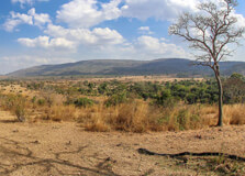
The Monduli Mountains are a breathtaking range located in the Arusha Region of northern Tanzania. These mountains, part of the East African Rift, offer stunning landscapes and a unique opportunity to explore Tanzania's diverse ecosystems. Situated to the west of the famous Mount Kilimanjaro, the Monduli Mountains are a hidden gem for those seeking a more tranquil and off-the-beaten-path adventure. The range is surrounded by forests, savannahs, and grasslands, making it a perfect destination for nature lovers and adventure enthusiasts alike. It is home to a wide variety of wildlife, including birds, monkeys, and indigenous plant species. The area is also rich in cultural heritage, with local communities like the Maasai living in harmony with the land. How to Reach Monduli Mountains, Arusha Getting to the Monduli Mountains from Arusha is relatively straightforward. Arusha, a major city in northern Tanzania, is approximately 50 kilometers away from the Monduli Mountains. The easiest way to reach the mountains is by car or taxi, which takes about 1 to 1.5 hours, depending on traffic conditions. There are also several bus and matatu (shared minibus) services that operate from Arusha to Monduli, though these options may not take you directly to the base of the mountains. If you prefer a more guided experience, many tour operators in Arusha offer day trips and guided tours to the Monduli Mountains. These tours often include transportation, a guide, and the option to explore the surrounding areas. Weather and Best Time to Visit Monduli Mountains The weather in the Monduli Mountains varies depending on the time of year and the altitude. The region enjoys a temperate climate, with cooler temperatures at higher altitudes. The average temperature ranges from 15°C to 25°C (59°F to 77°F), making it pleasant for hiking and outdoor activities. However, during the rainy season, which typically occurs from March to May, the trails can become muddy, and the weather can be unpredictable. The best time to visit Monduli Mountains is during the dry season, from June to October, when the weather is more stable, and hiking conditions are ideal. This is also the peak tourist season in Tanzania, so it’s recommended to book accommodations and tours in advance if you plan to visit during this period. Timing and Entry Details The Monduli Mountains are open to visitors year-round. However, the best time to explore is during daylight hours, with most visitors arriving between 8:00 AM and 4:00 PM. If you plan on hiking or exploring the area, it’s important to note that the mountain trails can be quite challenging, especially during the rainy season. For those interested in guided tours, these typically start in the morning and finish in the late afternoon. Entry fees for the area can vary depending on whether you are visiting as part of a tour or independently. Local authorities or tour operators may charge a small fee to help with the conservation and maintenance of the trails. It's advisable to carry cash for any fees and tips for local guides. Why Monduli Mountains Are Famous The Monduli Mountains are famous for their rugged terrain, rich biodiversity, and cultural significance. The range is a hidden treasure for those looking to escape the crowds of more popular Tanzanian destinations like Mount Kilimanjaro and Serengeti National Park. The mountains offer a peaceful and picturesque environment for trekking, wildlife watching, and cultural exploration. One of the main attractions of the Monduli Mountains is their unique geological formation, which is part of the East African Rift Valley. This makes the mountains an interesting subject for geologists and nature enthusiasts alike. Additionally, the area is culturally significant to the Maasai people, who have lived in the region for centuries and maintain traditional ways of life. The combination of natural beauty and cultural heritage makes the Monduli Mountains a unique destination for travelers. Entry and Visit Details Visiting the Monduli Mountains typically involves hiking or trekking along the various trails that wind through the region. The trails range from easy walks to more strenuous hikes, depending on your level of fitness and the time you have available. The area offers several viewpoints where visitors can enjoy stunning vistas of the surrounding plains, valleys, and distant peaks. The local Maasai community plays an integral role in tourism, with many Maasai guides offering their services to visitors. These guides provide valuable insights into the culture and history of the region, as well as information about the flora and fauna. Visitors may also have the opportunity to interact with the Maasai people and learn about their traditions, such as their pastoral lifestyle and unique way of life. It’s important to wear appropriate footwear and clothing for the hike, as the terrain can be uneven, and some areas are quite steep. If you plan on camping or spending an extended period in the mountains, it’s recommended to bring supplies such as water, food, and a good tent, as facilities are limited. History and Architecture of Monduli Mountains The Monduli Mountains have a long history, both geologically and culturally. The mountains are part of the East African Rift system, which is a tectonic plate boundary that has been forming for millions of years. The geological history of the region is fascinating, with evidence of volcanic activity and tectonic shifts that have shaped the landscape. The area is also historically significant to the Maasai people, who have lived in the region for centuries. The Maasai are known for their distinctive customs, dress, and architecture. Their traditional homes, called "enkangs," are made from mud, grass, and cow dung, and are built in a circular shape. These homes are typically constructed by the women of the community and are designed to be easily dismantled and moved as the Maasai migrate with their herds of cattle. While modern influences have brought changes to the Maasai lifestyle, many still live in traditional ways and welcome visitors to experience their culture. Things to Do in Monduli Mountains Hiking: Hiking is one of the main activities in the Monduli Mountains. There are various trails to explore, offering different levels of difficulty. Hiking through the mountains allows you to enjoy the stunning views and observe local wildlife. Wildlife Watching: The Monduli Mountains are home to a variety of animals, including monkeys, birds, and antelope. Birdwatching is especially popular, with several species of colorful and rare birds to spot. Cultural Tours: Take a cultural tour of the Maasai villages and learn about their traditional way of life, including their customs, dress, and practices. Many Maasai guides are available to take visitors on walking tours of the area. Photography: The panoramic views and vibrant landscapes make the Monduli Mountains an excellent destination for photographers. Capture the beauty of the mountains, the wildlife, and the Maasai culture. Camping: For those seeking a more immersive experience, camping in the Monduli Mountains is an option. Spend the night under the stars and wake up to the sounds of nature. Interesting Facts About Monduli Mountains The Monduli Mountains are part of the East African Rift Valley, a tectonic plate boundary that has shaped the region over millions of years. The Maasai people, who are semi-nomadic herders, have lived in the Monduli Mountains for centuries and continue to maintain traditional customs and lifestyle. The area is home to a rich diversity of wildlife, including various bird species, monkeys, and small mammals. Though less crowded than other Tanzanian destinations, the Monduli Mountains offer a peaceful escape for nature lovers and adventure seekers. Tips for Visiting Monduli Mountains Bring Sturdy Footwear: The hiking trails can be rugged, so it's important to wear appropriate shoes with good grip. Respect Local Culture: The Maasai people have a rich cultural heritage, so it’s important to be respectful of their traditions and customs when visiting their villages. Hire a Guide: A local guide can provide valuable insights into the region’s history, culture, and wildlife, enhancing your visit. Pack Essentials: Ensure you bring enough water, snacks, and any necessary camping gear if you plan to stay overnight. Check Weather Conditions: Be sure to check the weather forecast before hiking, especially during the rainy season, as trails can become slippery. Conclusion The Monduli Mountains offer a perfect blend of natural beauty, cultural richness, and outdoor adventure. Whether you’re hiking through the lush landscapes, learning about the Maasai people, or simply enjoying the peaceful surroundings, a visit to the Monduli Mountains is an unforgettable experience. With its diverse ecosystems, stunning vistas, and the warm hospitality of the Maasai community, the Monduli Mountains are a must-visit destination for anyone traveling to northern Tanzania.
Explore More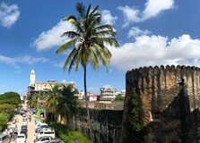
The Old Fort of Zanzibar, also known as the "Ngome Kongwe," is a historic fortress located in Stone Town, Zanzibar. The fort is a significant landmark that stands as a testament to Zanzibar's rich history, particularly its colonial past. Built in the 17th century, it has served various purposes over the years, from a military stronghold to a cultural center. Today, the Old Fort is a popular tourist attraction, offering visitors a glimpse into the island's history and vibrant culture. How to Reach the Old Fort of Zanzibar Reaching the Old Fort of Zanzibar is relatively easy, especially for those staying in or around Stone Town. The fort is located in the heart of Stone Town, a UNESCO World Heritage site. Most visitors either walk to the site or take a short taxi ride from nearby hotels or tourist attractions. If you're coming from Zanzibar International Airport, the distance to Stone Town is approximately 6 km (about 15 minutes by car). Once in Stone Town, the Old Fort is within walking distance of many other historical sites, including the House of Wonders and the Sultan's Palace. Weather Around the Old Fort of Zanzibar Zanzibar experiences a tropical climate, which means it is generally warm and humid throughout the year. The best time to visit the Old Fort of Zanzibar is during the dry season, which runs from June to October. During these months, the weather is relatively cooler, and there is less rainfall, making it ideal for sightseeing. The wet season lasts from March to May, and while it does bring lush greenery to the island, heavy rainfall can make outdoor activities less enjoyable. Temperatures in Zanzibar typically range between 25°C (77°F) and 32°C (90°F), so it is important to dress comfortably when visiting the Old Fort. Timing for Visiting the Old Fort of Zanzibar The Old Fort of Zanzibar is generally open to visitors every day of the week. The visiting hours are typically from 9:00 AM to 6:00 PM. It is advisable to visit the fort early in the day to avoid the heat, especially if you're planning to explore its outdoor areas. Keep in mind that the fort's opening hours can change during public holidays or special events, so it is a good idea to check with local sources or your hotel before planning your visit. Why is the Old Fort of Zanzibar Famous? The Old Fort is famous not only for its architectural beauty but also for its rich history. Built by the Omanis in the late 1600s, the fort was initially constructed to defend Zanzibar from Portuguese invasions. Over time, it became a key military structure, playing a crucial role in the defense of Zanzibar against various colonial powers. Today, the fort is a symbol of the island's resilience and cultural diversity. In addition to its military importance, the Old Fort has also served as a cultural center and performance venue. It is home to several art exhibitions and music festivals, adding to its reputation as a hub for Zanzibar's vibrant arts scene. Entry and Visit Details Visitors to the Old Fort can explore the site for a small entry fee. The entry fee typically ranges from $1 to $2 USD for international visitors, while locals may have a discounted rate. The fee helps to preserve the historical site and support its maintenance. The fort is open to self-guided tours, but for a more in-depth experience, visitors can also opt for guided tours. These tours are usually conducted by knowledgeable local guides who provide fascinating insights into the history and significance of the fort. The fort also hosts cultural events, including traditional dances and music performances, which are often included in the visit. History of the Old Fort of Zanzibar The Old Fort has a rich history that spans several centuries. It was built by the Omanis in the late 1600s after they successfully ousted the Portuguese from Zanzibar. The Omani Sultan Seyyid Said ordered the construction of the fort to protect the island from future attacks. Over the years, the fort's purpose evolved, serving as a military garrison, a prison, and even a place of exile. In the late 19th century, the British took control of Zanzibar, and the fort was used by colonial powers for various administrative purposes. Today, it stands as a reminder of the island's turbulent past and its enduring cultural heritage. Architecture of the Old Fort of Zanzibar The architecture of the Old Fort is a fusion of Arab, Indian, and European influences, reflecting the diverse cultures that have shaped Zanzibar's history. The fort's exterior features massive stone walls designed to withstand attacks, while its interior is a labyrinth of courtyards, passages, and rooms. The structure includes a central courtyard where performances and exhibitions are often held. The fort's thick walls and small, arched windows are characteristic of military architecture, while the decorative elements, including carved doors and intricate stonework, display the artistic influence of Zanzibar's Islamic heritage. Things to Do at the Old Fort of Zanzibar While visiting the Old Fort of Zanzibar, there are several activities to enjoy: Explore the history: Walk through the fort's maze-like interior and learn about its fascinating history through displays and exhibits. Attend cultural events: Depending on the time of year, you may be able to witness live music, traditional dance performances, and art exhibitions. Photography: The architecture of the fort, combined with the beautiful views of Stone Town and the Indian Ocean, makes it a great spot for photography. Visit nearby attractions: The Old Fort is located close to several other important historical sites in Stone Town, such as the House of Wonders and the Slave Market, so you can easily plan a full day of sightseeing. Facts and Tips About the Old Fort of Zanzibar Fact: The Old Fort is one of the oldest structures in Zanzibar, having been in continuous use since its construction in the late 1600s. Tip: Bring water, sunscreen, and a hat, as the weather can get quite hot, especially in the afternoons. Tip: If you're interested in a more personalized experience, hire a local guide who can provide historical context and help you discover hidden gems within the fort. Fact: The fort's role in Zanzibar's defense against colonial powers is an important chapter in the island's history, and many of its architectural elements reflect this military heritage. Tip: The fort is a popular spot for sunset views, offering a peaceful place to relax after a day of exploration. Conclusion The Old Fort of Zanzibar is a remarkable destination that offers a blend of history, architecture, and cultural experiences. Whether you're a history buff, an architecture enthusiast, or simply looking for a unique place to explore, the Old Fort has something for everyone. With its stunning views, historical significance, and vibrant cultural scene, it is a must-visit attraction for anyone visiting Zanzibar.
Explore More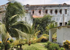
The People's Palace Museum, also known as Beit el-Sahel, is one of Zanzibar’s most significant cultural and historical attractions. Located in the heart of Stone Town, this museum once served as the official residence of the Sultan of Zanzibar. Today, it stands as a living monument to Zanzibar’s royal history, offering visitors an insightful glimpse into the lives of the Sultan’s family and the political changes that shaped the island. From royal artifacts to personal memorabilia and elegant architecture, the museum is a must-visit destination for history lovers and culture enthusiasts. How to Reach People's Palace Museum, Zanzibar The People's Palace Museum is centrally located in Stone Town, Zanzibar’s historic capital. If you're already in Stone Town, the museum is easily accessible on foot, as it is close to other notable attractions like the House of Wonders and the Old Fort. It lies along Mizingani Road, overlooking the Indian Ocean. For those arriving from outside Stone Town, you can take a taxi or private vehicle. The museum is about 7 km (roughly 20 minutes) from Abeid Amani Karume International Airport. Public transportation options, such as dala-dalas (local minibuses), are available but may be less convenient for tourists unfamiliar with the routes. Weather Around the People's Palace Museum Zanzibar has a tropical climate, meaning it's warm and humid most of the year. The best time to visit the People’s Palace Museum is during the dry seasons – from June to October and from late December to February. During these months, the weather is more pleasant, with average temperatures ranging between 25°C (77°F) and 30°C (86°F). The rainy seasons are typically from March to May and in November. While the rains can cool things down, they may also make walking around Stone Town less comfortable. However, as the museum is indoors, visiting during light showers can still be enjoyable. Timing for Visiting the People's Palace Museum The People's Palace Museum is open to the public every day except for public holidays. The usual opening hours are: Monday to Sunday: 9:00 AM – 6:00 PM It’s advisable to visit earlier in the day to avoid the afternoon heat, especially if you're walking through Stone Town. The museum isn’t usually overcrowded, so you can expect a relaxed, immersive experience without large crowds. Why is the People's Palace Museum Famous? The People’s Palace Museum is famous for being the former royal residence of the Sultan of Zanzibar and his family. It showcases a fascinating collection of personal items, photographs, furniture, and clothing from the Sultanate era, particularly focusing on the 19th and early 20th centuries. Visitors are especially intrigued by the stories of Princess Salme, a member of the royal family who famously fled Zanzibar and later wrote her memoir, “Memoirs of an Arabian Princess from Zanzibar.” The museum houses displays about her life, offering a personal perspective on Zanzibar’s royal past and its interaction with the wider world. Entry and Visit Details About People's Palace Museum There is a small entry fee to access the People’s Palace Museum. As of the most recent updates: International visitors: Around $3–$5 USD Local residents and East African citizens: Lower rates apply Guided tours are not mandatory, but some local guides offer services for an additional fee. They can provide deeper insights into the exhibits and the history of Zanzibar’s royal family. Most of the museum's exhibits have English explanations, making it easy for international visitors to understand the displays on their own. History of the People's Palace Museum The building that now houses the People's Palace Museum was originally constructed in the 19th century. It served as the Sultan’s palace up until the Zanzibar Revolution in 1964. After the revolution, the Sultanate was overthrown, and the palace was repurposed as a government building. Eventually, it was converted into a museum dedicated to the history of Zanzibar’s royal family and political transformation. The museum is especially important as it tells the story of Zanzibar before and after independence. It provides a human angle to historical events by focusing on personal belongings and narratives from royal family members, rather than just political milestones. Architecture of the People's Palace Museum The architecture of the People's Palace Museum reflects a blend of Arabic, Indian, and European influences – a hallmark of Stone Town's unique style. The structure features elegant arches, high ceilings, large wooden doors, and wide balconies that offer views of the ocean. While not overly extravagant, the palace has a quiet grandeur. The furniture and interior decorations reflect the Sultanate's affinity for luxury and comfort, with Persian rugs, carved furniture, and chandeliers adorning many of the rooms. Things to Do at the People's Palace Museum Explore Royal Artifacts: View a collection of royal family possessions, including clothing, letters, photographs, and household items. Learn about Princess Salme: Discover the life story of this remarkable woman who defied cultural expectations and became a published author in Europe. Take a Self-Guided Tour: Wander through the palace rooms and admire the historical decor and ocean-facing balconies. Photography: Capture beautiful images of the palace’s architecture and views of the harbor from the upper floors. Combine with Nearby Attractions: Visit the House of Wonders and the Old Fort, which are located just a few minutes' walk away. Facts and Tips About the People's Palace Museum Fact: The museum is named "People’s Palace" to reflect its post-revolution transformation from royal residence to public heritage site. Tip: Wear comfortable shoes as you’ll likely be walking through Stone Town’s narrow, cobbled streets before and after your visit. Fact: The museum includes detailed exhibits about Zanzibar’s cultural and religious heritage, not just its political history. Tip: Visit in the morning for better lighting if you plan to take photographs from the balconies or the front facade. Fact: The People's Palace played an important role during the final years of the Sultanate and is one of the few remaining royal buildings open to the public in Zanzibar. Conclusion The People's Palace Museum is more than just a building – it is a powerful reminder of Zanzibar's rich and complex history. With its unique combination of cultural, political, and personal stories, it offers visitors a deeper understanding of the island’s past and its journey through change. Whether you’re fascinated by royal history, architecture, or the human stories behind political change, a visit to the People’s Palace Museum is a rewarding experience that will add depth and meaning to your time in Zanzibar.
Explore More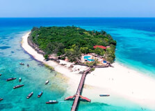
Prison Island, also known as Changuu Island, is one of the most popular day-trip destinations from Stone Town, Zanzibar. Despite its ominous name, the island is now a peaceful, tropical escape famous for its beautiful beach, clear waters, and its population of giant tortoises. Originally intended to be a prison, the island has a rich and complex history, which adds to its charm. Today, it is a must-visit spot for those looking to combine history, nature, and relaxation in one scenic location. How to Reach Prison Island, Zanzibar Prison Island is located about 5.6 kilometers (3.5 miles) northwest of Stone Town. The only way to reach the island is by boat. Most visitors take a traditional wooden dhow or speedboat from the Stone Town waterfront. The boat ride takes approximately 20 to 30 minutes, depending on the weather and the type of boat used. You can book a tour through a hotel, local guide, or travel agency, which usually includes transportation, entry fees, and sometimes snorkeling equipment. It is also possible to negotiate directly with local boatmen at the Forodhani Gardens or the harbor area in Stone Town. Weather on Prison Island Prison Island enjoys the same tropical climate as the rest of Zanzibar. The best time to visit is during the dry seasons – from June to October and from December to February. These months are perfect for beach activities, sunbathing, and snorkeling. Temperatures typically range between 25°C (77°F) and 32°C (90°F). The wet seasons – March to May and November – can bring heavy rains, but short tropical showers are also common throughout the year. Always check the weather forecast before planning your trip, especially if you're heading out by boat. Timing for Visiting Prison Island Prison Island is open to visitors daily. There are no strict opening or closing hours since most trips are privately arranged, but the best time to visit is during daylight hours, ideally between 9:00 AM and 4:00 PM. This allows enough time to explore the island, relax, and return safely before sunset. Early mornings and late afternoons are less crowded, especially during the high tourist season, and also offer better lighting for photography and cooler temperatures for exploring. Why is Prison Island Famous? Prison Island is famous for its giant Aldabra tortoises, some of which are over 100 years old. Originally gifted by the British governor of the Seychelles in the late 19th century, these tortoises are now protected and roam freely in a sanctuary on the island. Visitors can feed and interact with them under supervision. Aside from the tortoises, the island is also known for its crystal-clear waters, coral reefs, and historical ruins. The beach offers great opportunities for snorkeling, swimming, and relaxing in a peaceful setting just minutes from the busy streets of Stone Town. Entry and Visit Details About Prison Island To visit Prison Island, you need to pay for a boat ride and a small entry fee for access to the island. Here’s a general idea of the costs: Boat ride (round trip): $30–$60 USD (depending on group size and negotiation) Entry fee: Around $4–$5 USD per person Most tour operators bundle these costs into a package, which may also include a guide, snorkeling gear, and refreshments. It’s always best to confirm what’s included before booking. Remember to bring cash, as there are no ATMs or card facilities on the island. History and Architecture of Prison Island Prison Island was originally used as a coral mine and later intended to become a prison for rebellious slaves under the rule of Sultan Said Barghash in the late 1800s. However, the prison building was never used for this purpose. Instead, the British colonial government used the island as a quarantine station for yellow fever patients during the late 19th and early 20th centuries. The original prison buildings still stand and can be explored by visitors. The main prison structure, with its thick coral-stone walls and iron-barred windows, is a reminder of Zanzibar’s colonial past. The architecture is simple but strong, blending local materials with British colonial design influences. Things to Do at Prison Island Visit the Tortoise Sanctuary: Meet and feed the giant Aldabra tortoises, some of which are over 150 years old. Explore the Historic Ruins: Walk through the old prison buildings and learn about the island’s colonial and slave trade history. Snorkeling: Enjoy snorkeling around the coral reefs that surround the island. The waters are home to colorful fish and marine life. Relax on the Beach: Lounge on the soft white sand and swim in the calm, warm waters of the Indian Ocean. Photography: Capture incredible views of Stone Town from across the water and photograph the ancient tortoises and ruins. Facts and Tips About Prison Island Fact: The oldest tortoise on Prison Island is believed to be over 150 years old. Tip: Bring sunscreen, a hat, and plenty of drinking water – there is limited shade and few facilities on the island. Fact: Despite being named Prison Island, it was never used as an actual prison for criminals. Tip: Wear water shoes or sandals if you plan to snorkel or explore rocky areas. Fact: The Aldabra tortoise is a protected species, and efforts are ongoing to preserve their population on the island. Tip: Respect the animals – feeding is allowed, but climbing or sitting on tortoises is strictly prohibited. Conclusion Prison Island is a fascinating destination where history, wildlife, and nature come together. Just a short boat ride from Stone Town, the island offers a refreshing contrast to the bustling city streets, making it a perfect half-day or full-day getaway. Whether you're visiting to meet the giant tortoises, explore colonial ruins, or simply enjoy a quiet beach, Prison Island promises a memorable experience. Its mix of education, adventure, and relaxation makes it one of Zanzibar’s must-see attractions.
Explore More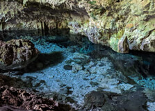
Kuza Caves is a hidden natural wonder located in the village of Jambiani on the southeastern coast of Zanzibar. This mystical limestone cave features a crystal-clear natural pool inside, surrounded by stunning rock formations and lush greenery. It is a sacred site for local communities and also a place of relaxation and exploration for visitors. Kuza Caves is not only a beautiful geological site, but it is also a cultural center offering insights into Swahili traditions, music, and history. How to Reach Kuza Caves, Zanzibar Kuza Caves is located in the Jambiani area, about 50 kilometers (31 miles) southeast of Stone Town. The most convenient way to reach the caves is by car or taxi. The drive from Stone Town takes around 1 to 1.5 hours depending on traffic. If you're staying in Jambiani, Paje, or other nearby beach areas, the caves are just a short drive or even a bike ride away. Many tourists visit Kuza Caves as part of a guided cultural or nature tour, which often includes transport. You can also rent a scooter if you prefer to explore on your own. Signboards and Google Maps can help you navigate easily to the entrance. Weather at Kuza Caves Zanzibar has a tropical climate, which means Kuza Caves can be visited all year round. Temperatures generally range between 25°C (77°F) and 32°C (90°F). The dry seasons—June to October and December to February—are the best times to visit, as the weather is sunny and more comfortable for exploring the cave and enjoying the natural pool. During the rainy seasons (March to May and November), the cave is still accessible, but the ground may be slippery, and swimming conditions could be less ideal. Always wear appropriate footwear and check the weather forecast before visiting. Timing for Visiting Kuza Caves Kuza Caves is open to visitors daily from around 8:00 AM to 6:00 PM. The best time to visit is in the morning or early afternoon when natural light reaches the pool, making the water look extra clear and blue. Visiting early also means you’ll have a more peaceful experience before larger groups arrive. It’s a good idea to spend about 1 to 2 hours here, giving yourself enough time to explore, swim, and enjoy the peaceful surroundings. Cultural activities may be offered at specific times, so it’s worth checking with the center in advance if you’re interested in music or traditional experiences. Why is Kuza Caves Famous? Kuza Caves is famous for its magical appearance, with a natural underground pool of clear freshwater in the middle of ancient coral rock. Many visitors are amazed by the beauty of the cave and the peaceful energy it holds. It’s a great place to cool off with a swim in the spring-fed waters. Beyond its natural beauty, Kuza Caves is also known as a cultural heritage site. The Kuza Cave Cultural Centre offers drumming lessons, Swahili cooking classes, and historical information about the early settlers in Zanzibar. This combination of nature and culture makes it one of the most unique attractions on the island. Entry and Visit Details About Kuza Caves, Zanzibar To visit Kuza Caves, there is a small entrance fee that supports the community and maintenance of the site. The fee is usually around $10 to $15 USD per adult. This includes access to the cave, use of the swimming area, and entry to the small cultural center on-site. You don’t need a guide to explore the cave, but staff are usually present to answer questions and help visitors. You can also join scheduled cultural programs or guided tours for an additional fee. It's recommended to wear swimwear if you plan to take a dip, and bring a towel, water shoes, and a change of clothes. History and Architecture of Kuza Caves Kuza Caves is a natural limestone cave that has formed over thousands of years. It sits within what was once an ancient coral reef, which has now turned into a limestone landscape due to geological changes. The cave was used by local communities for spiritual ceremonies, healing, and rituals long before it became a tourist site. While not man-made, the "architecture" of the cave is striking. The stalactites, rock walls, and naturally carved pool make it feel like a hidden underground temple. The surrounding area is filled with tropical vegetation, giving the place a secluded and serene atmosphere. Things to Do at Kuza Caves Swim in the Cave Pool: The freshwater pool is clean, cool, and perfect for a refreshing dip in a magical setting. Take Photos: The natural beauty and lighting of the cave make it a great place for photography. Join Cultural Activities: Learn about Swahili music, try drumming, or take part in a traditional cooking class. Explore the Grounds: Walk around the surrounding area to enjoy the gardens, art, and peaceful natural environment. Relax and Meditate: The tranquil setting is ideal for quiet reflection or meditation. Facts and Tips About Kuza Caves Fact: The cave is fed by a freshwater spring and is safe for swimming. Tip: Bring water shoes or sandals with grip, as the rocks around the pool can be slippery. Fact: Kuza means "to grow" in Swahili, reflecting the site's mission to grow community and cultural awareness. Tip: Wear your swimsuit under your clothes to make changing easier, as facilities are limited. Fact: The cave is still considered a sacred place by some locals, so treat it with respect. Tip: Don’t forget mosquito repellent, especially if you stay in the area during the evening. Conclusion Kuza Caves is one of Zanzibar’s most enchanting hidden gems. It offers a rare mix of natural beauty, peaceful ambiance, and cultural richness. Whether you’re looking to swim in a sacred cave, learn about Swahili traditions, or just escape into nature for a while, this spot offers a unique and memorable experience. It's a perfect half-day trip from the beaches of Jambiani or Paje, and well worth adding to your Zanzibar itinerary. Come for the water, stay for the culture, and leave feeling refreshed and inspired by this magical place.
Explore More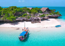
Pemba Island is one of the hidden gems of Zanzibar, located about 50 kilometers north of Unguja, the main island of the Zanzibar archipelago. Known for its lush landscapes, quiet beaches, and world-class diving spots, Pemba is far less touristy than Zanzibar’s main island, making it a perfect escape for travelers looking for a more natural and peaceful experience. Covered in clove plantations, dense mangroves, and untouched coral reefs, Pemba is a dream for nature lovers, divers, and those seeking authentic island life. How to Reach Pemba Island, Zanzibar You can reach Pemba Island by air or by sea. The quickest and most comfortable way is by flight. There are daily domestic flights from Zanzibar (Unguja), Dar es Salaam, and Tanga to Pemba's main airport — Karume Airport, located near Chake Chake, the island’s capital. Ferries are also available from Zanzibar and the mainland, but they are slower and can be affected by sea conditions. If you choose to travel by ferry, make sure to check schedules in advance and prepare for a longer journey. Once you arrive on the island, taxis and motorbike rentals are available to help you explore. Some resorts also offer private transfers from the airport or ferry terminal. Weather on Pemba Island Pemba Island has a tropical climate with warm temperatures throughout the year. Average temperatures range from 24°C to 31°C (75°F to 88°F). The best time to visit is during the dry seasons, from June to October and from late December to February. These months offer pleasant weather, calm seas, and clearer skies — ideal for diving, snorkeling, and exploring the island. The rainy seasons are from March to May and in November. While the island is still beautiful during this time, the heavy rains can make travel and outdoor activities more difficult. If you're visiting during the rainy season, pack appropriate footwear and rain gear. Timing for Visiting Pemba Island Pemba Island can be visited year-round, but for the best experience, plan your trip during the dry months mentioned above. The island does not have strict opening hours for beaches or natural attractions, but boat tours, diving trips, and cultural visits are best done during daylight hours. Sunrise and sunset are particularly beautiful on the island, so early mornings and late afternoons are perfect for photography, beach walks, or boat rides. Why is Pemba Island Famous? Pemba Island is famous for its untouched natural beauty and world-class diving spots. The coral reefs around the island are healthy and vibrant, home to a wide variety of marine life including turtles, rays, reef sharks, and colorful fish. The island is also known for its clove production. In fact, it is often called “The Green Island” because of its lush greenery and plantations. Pemba offers a more authentic and quieter experience compared to its sister island, Unguja (Zanzibar Island), making it popular among eco-travelers and those looking to escape tourist crowds. Entry and Visit Details About Pemba Island There are no specific entry fees to visit Pemba Island itself, but travelers arriving by air or sea should expect standard transport costs. If you are coming from outside Tanzania, you will need a Tanzanian visa, which also covers Zanzibar and Pemba. Most nationalities can get a visa on arrival or apply online. Once on the island, some natural reserves, marine parks, or private tours may require entrance or guide fees. Always carry some local currency (Tanzanian Shillings) as many places do not accept credit cards. History and Architecture of Pemba Island Pemba has a rich and complex history. It has been inhabited for over a thousand years and was once part of the ancient Swahili trading routes. Arab traders established settlements here centuries ago, and the island later became part of the Sultanate of Zanzibar. Architecturally, the island features a mix of Swahili, Arab, and colonial influences. In Chake Chake and other towns, you’ll find old ruins, mosques, and colonial-era buildings. The famous Mkama Ndume ruins near Pujini are the remnants of a 15th-century fort and palace built by a cruel ruler, offering a fascinating glimpse into the island’s past. Things to Do on Pemba Island Diving and Snorkeling: Explore the pristine reefs of Misali Island and Fundo Gap. Pemba is known for having some of the best diving spots in East Africa. Visit Misali Island: A protected marine conservation area with rich biodiversity, great beaches, and excellent snorkeling. Explore the Ngezi Forest: A lush rainforest home to rare species of birds and monkeys. Tour the Clove Plantations: Learn about the island’s spice trade and visit local farms. See the Mkama Ndume Ruins: Discover the island’s dark past at the ancient fort near Pujini. Relax on the Beach: Enjoy quiet beaches like Vumawimbi or Shamiani for sunbathing and swimming. Facts and Tips About Pemba Island Fact: Pemba produces over 70% of Zanzibar’s cloves and is one of the world’s top clove exporters. Tip: Bring cash, as there are few ATMs on the island and many places do not accept credit cards. Fact: Misali Island, just off the west coast of Pemba, is part of a marine conservation area protecting coral reefs and turtles. Tip: Hire a local guide for forest or historical tours — they provide valuable insight and help support the community. Fact: Pemba Island is less developed than Unguja, which means fewer tourists and a more peaceful atmosphere. Tip: Use eco-friendly products, especially sunscreen, to help protect the reefs and marine life. Conclusion Pemba Island is a peaceful paradise waiting to be explored. With its untouched nature, rich history, friendly locals, and outstanding marine life, Pemba is perfect for travelers seeking something beyond the typical tourist path. Whether you’re diving in crystal-clear waters, walking through spice farms, or simply enjoying the silence of a secluded beach, the island offers a truly special experience. If you want a deeper connection with nature and culture in Zanzibar, Pemba Island is a destination you won’t want to miss.
Explore More11 Day Tanzania Safari And Beach - Explore Zanzibar Island Tour
11 Days/ 10 Night
Zanzibar - Arusha - Ngorongoro
7D Tarangire - Serengeti - Ngorongoro Crater And Lake Manyara Mid-Range Lodge Tour
7 Days/ 6 Night
Arusha - Manyara - Ngorongoro
11 Days - 10 Nights Safari And Beach Relaxation Tour
11 Days/ 10 Night
Zanzibar - Arusha - Ngorongoro
Fazagah Tours and Adventure. Full Package Budgets and Destinations
8 Days/ 7 Night
Arusha - Moshi
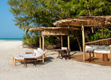
Mnemba Island is one of the most beautiful and exclusive destinations near Zanzibar. Located just off the northeast coast of Unguja (the main island of Zanzibar), Mnemba is a small, private island surrounded by vibrant coral reefs, white sandy beaches, and crystal-clear waters. This idyllic spot is known for its luxury resorts, diverse marine life, and pristine natural beauty, making it a perfect escape for those looking for tranquility, adventure, or simply a serene retreat in the Indian Ocean. How to Reach Mnemba Island, Zanzibar Mnemba Island is easily accessible by boat from the northeastern coast of Zanzibar, particularly from Matemwe beach, which is around 20-30 minutes away by boat. You can book a boat tour through hotels in the area, or you can arrange a guided excursion from places like Stone Town, Paje, or Nungwi. Since Mnemba is a private island, most visitors arrive through pre-arranged tours or resorts that offer exclusive access to the island. The boat ride to Mnemba Island offers scenic views of the ocean and surrounding coastline, adding to the excitement and beauty of the journey. If you're staying at a resort that offers access to Mnemba, they'll typically handle all transport arrangements. Weather on Mnemba Island Mnemba Island enjoys a tropical climate with warm temperatures throughout the year, making it a perfect destination any time of the year. Temperatures typically range from 25°C (77°F) to 31°C (88°F). The island experiences two main seasons — the dry season from June to October and the rainy season from March to May. The best time to visit is during the dry season, when the weather is sunny and ideal for swimming, snorkeling, and diving. The rainy season can be quite humid, and while it’s still possible to visit, outdoor activities might be restricted due to heavy showers. The calm and clear seas during the dry season are perfect for exploring the underwater world around the island. Timing for Visiting Mnemba Island Mnemba Island can be visited year-round, but it’s best to plan your trip during the dry season (June to October) to enjoy optimal weather conditions. Most tours to the island are day trips, although there are exclusive resorts on Mnemba that offer overnight stays for a more luxurious experience. Day trips typically start in the morning, with the boat ride taking about 30 minutes. It’s ideal to go early to avoid the midday heat and to have plenty of time to enjoy the activities. The island is usually visited between 9 AM and 4 PM, but if you’re staying overnight at the Mnemba Island Lodge, you’ll have the benefit of experiencing the island in a more tranquil and exclusive setting. Why is Mnemba Island Famous? Mnemba Island is famous for being a private, secluded getaway, attracting luxury travelers and honeymooners seeking a quiet escape in paradise. Its crystal-clear waters are home to rich coral reefs that offer incredible opportunities for snorkeling and diving. The island is also known for its incredible biodiversity, including the rare green sea turtles that nest on the beaches. The surrounding waters are a protected marine area, ensuring that the environment remains untouched and pristine. Mnemba Island is also famous for its luxury accommodation, specifically the Mnemba Island Lodge, a high-end resort known for offering an exclusive and intimate experience. The island has limited access to preserve its natural beauty and private atmosphere, making it a highly sought-after destination for those seeking a more intimate vacation in Zanzibar. Entry and Visit Details About Mnemba Island, Zanzibar Visiting Mnemba Island typically requires booking a tour or staying at one of the luxury resorts on the island, such as the Mnemba Island Lodge. Access to the island is limited, and entry is only granted to those with pre-arranged accommodation or official tours, ensuring the island remains exclusive and unspoiled. For day trips, visitors can book a snorkeling or diving tour, which includes a boat ride to the island, snorkeling equipment, and sometimes lunch. These tours are often operated by nearby resorts or operators from Matemwe. If you are staying at the Mnemba Island Lodge, all arrangements are taken care of by the resort, including transport, meals, and activities. History and Architecture of Mnemba Island Mnemba Island has a rich natural history but a relatively simple human history. It was historically used as a hunting and fishing ground, and over the years, it has become a protected marine reserve. Today, the island is known for its conservation efforts, particularly in preserving its coral reefs and marine life. In terms of architecture, Mnemba Island is known for the Mnemba Island Lodge, a luxury eco-lodge that blends seamlessly into its natural environment. The lodge is designed in traditional Swahili style, with thatched roofs and open-air structures that allow guests to enjoy the island’s natural beauty while staying in comfort. The lodge’s architecture focuses on sustainability, using local materials and eco-friendly practices to minimize its environmental impact. Things to Do on Mnemba Island Snorkeling: The waters around Mnemba Island are home to vibrant coral reefs and abundant marine life. Snorkeling here is a must-do activity, with the chance to see turtles, fish, and colorful corals. Diving: Mnemba is a world-renowned diving spot, offering some of the best diving experiences in East Africa. Dive into crystal-clear waters to explore rich coral gardens, reef sharks, and a variety of tropical fish. Relaxing on the Beach: The beaches on Mnemba Island are pristine and quiet, perfect for lounging, sunbathing, and enjoying the peace and beauty of the island. Marine Life Observation: The island is a sanctuary for green sea turtles, and with some luck, you may be able to witness these incredible creatures nesting on the shores. Bird Watching: Mnemba Island is home to a variety of birds, including migrant species that make it a great spot for birdwatching. Facts and Tips About Mnemba Island Fact: Mnemba Island is part of a marine conservation area, which helps protect its rich coral reefs and marine life. Tip: Since the island is private and access is limited, it’s important to book your tours and accommodations well in advance, especially during peak tourist seasons. Fact: The Mnemba Island Lodge is an eco-friendly resort, designed to minimize its impact on the environment while offering guests a luxurious and intimate experience. Tip: Pack appropriate beachwear and sunscreen, as you’ll likely spend most of your time outdoors. Also, bring a waterproof camera to capture the beautiful marine life. Fact: While the island is small and doesn’t have many facilities, the focus is on nature and seclusion, which makes it perfect for those looking to disconnect from the world. Conclusion Mnemba Island is one of Zanzibar’s most exclusive and stunning destinations, offering a unique combination of luxury, natural beauty, and privacy. Whether you're diving in crystal-clear waters, snorkeling among vibrant coral reefs, or simply enjoying the peace and quiet of the pristine beaches, Mnemba promises an unforgettable escape. Its rare combination of relaxation, adventure, and conservation efforts makes it an ideal destination for those looking to experience the best of Zanzibar’s marine life and exclusive island retreats.
Explore More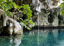
Maalum Cave is one of Zanzibar’s hidden gems, a fascinating natural attraction that draws visitors due to its unique beauty, historical significance, and serene ambiance. Located on the western side of the island, near the village of Bwejuu, Maalum Cave is renowned for its stalactites, stalagmites, and stunning natural formations. This cave is not only a place of natural beauty but also holds cultural and historical importance, making it a must-visit for travelers seeking to explore Zanzibar beyond its beaches. How to Reach Maalum Cave, Zanzibar Reaching Maalum Cave from Stone Town, the main city in Zanzibar, is relatively easy. The cave is located about 50 kilometers (31 miles) from Stone Town, which typically takes around 1.5 hours by car or taxi. The most convenient route is to take the main road heading south along the island’s eastern coast. Visitors can arrange transportation through hotels, local tour operators, or by hiring a taxi. For those who prefer a guided experience, various tour companies offer excursions to Maalum Cave, often combined with visits to nearby attractions like Jozani Forest or the village of Bwejuu. If you’re coming from the Zanzibar International Airport, the journey to Maalum Cave is roughly 1 hour by car. The road is relatively straightforward, but if you’re unfamiliar with the area, it’s recommended to hire a driver or use a local guide. Weather at Maalum Cave, Zanzibar Maalum Cave, like the rest of Zanzibar, enjoys a tropical climate. The island experiences two distinct seasons: a dry season from June to October and a rainy season from March to May. The dry season is the most popular time to visit, offering sunny days and warm temperatures, with average temperatures ranging between 25°C (77°F) and 30°C (86°F). During this time, the weather is perfect for exploring the cave and surrounding areas. The rainy season brings short bursts of heavy rainfall, usually in the afternoons, but it’s still warm. Though not as popular for outdoor excursions, the rainy season provides a quieter atmosphere and fewer crowds. If you’re planning to visit Maalum Cave during the rainy season, be prepared for occasional showers, but don’t let that discourage you from exploring. Timing for Visiting Maalum Cave The best time to visit Maalum Cave is during the dry season (June to October), when the weather is ideal for outdoor activities. Many visitors arrive early in the day to avoid the afternoon heat. The cave itself is open to visitors year-round, and tours are typically available from 9 AM to 5 PM, although this may vary depending on the season and local tour providers. It’s advisable to start your visit in the morning to take advantage of cooler temperatures and avoid crowds. Since the cave is relatively remote and not heavily trafficked, visiting early ensures a peaceful and undisturbed experience. Why is Maalum Cave Famous? Maalum Cave is famous for its unique natural formations and its historical significance. The cave is known for its impressive stalactites and stalagmites, which have formed over centuries. These geological formations create an awe-inspiring atmosphere and make the cave a fascinating spot for geology enthusiasts and nature lovers. The cave is also significant for its cultural and historical importance. It’s believed to have been used by local communities for centuries, and some believe it was once used as a place of refuge or a sacred site. While Maalum Cave is not as famous as some of Zanzibar’s other historical sites, its natural beauty and tranquil environment make it a peaceful and lesser-known attraction, perfect for visitors looking to escape the more crowded tourist spots. Entry and Visit Details About Maalum Cave, Zanzibar Entry to Maalum Cave is relatively straightforward. There is a small entrance fee, which typically ranges from $2 to $5 USD per person. The fee helps maintain the site and support local conservation efforts. The cave is not as commercialized as some of Zanzibar’s other attractions, which means it offers a more authentic and serene experience for visitors. Upon arrival, visitors are usually greeted by local guides who offer a brief tour of the cave, explaining its geological features, history, and significance. It’s recommended to bring comfortable footwear, as the path leading to the cave can be uneven and occasionally muddy. A guided tour is highly recommended to fully appreciate the cave’s history and geological formations. While the cave is open to the public, it’s important to note that it remains relatively uncrowded, allowing for a quiet and peaceful visit. The surrounding area is lush and green, with a tranquil atmosphere that invites reflection and relaxation. Visitors can spend around 30 minutes to 1 hour exploring the cave, depending on their interest in the formations and the surrounding environment. History and Architecture of Maalum Cave Maalum Cave is a natural wonder that has developed over centuries. Its limestone formations, including the stalactites and stalagmites, have been shaped by water filtering through the rock and depositing minerals over long periods of time. These formations create a stunning visual display inside the cave, and the cave's cool interior provides a welcome escape from the heat of the island’s tropical climate. While the cave itself is a natural formation, the area around Maalum Cave holds historical significance. The cave is believed to have been used by locals for various purposes over the years, such as shelter, refuge, or religious ceremonies. The surrounding area also features traditional Zanzibari architecture, with local houses and buildings reflecting the Swahili style that has influenced much of Zanzibar’s design. Things to Do at Maalum Cave Explore the Cave: The main activity at Maalum Cave is, of course, exploring the cave itself. Visitors can marvel at the impressive stalactites and stalagmites, which create a striking and mysterious atmosphere inside. Photography: The cave and its surroundings offer fantastic opportunities for photography. Be sure to bring a camera to capture the natural beauty of the cave’s formations and the lush greenery outside. Nature Walks: The area around the cave is ideal for nature walks. You can explore the tropical vegetation and enjoy the peaceful environment, which is home to various bird species and local flora. Learn About Local Culture: Local guides provide informative tours about the history and significance of the cave, as well as the culture and traditions of the nearby Bwejuu village. Visit Nearby Attractions: Maalum Cave is located near Jozani Forest, which is home to the famous Zanzibar red colobus monkeys. Visitors can combine a trip to the cave with a visit to this nearby nature reserve for a full day of exploration. Facts and Tips About Maalum Cave Fact: The cave’s natural formations are made from limestone and have been growing for millions of years, providing an incredible glimpse into the geological history of Zanzibar. Tip: Wear comfortable and sturdy footwear, as the path leading to the cave can be uneven and sometimes muddy. Fact: Maalum Cave is not overcrowded, making it a perfect spot for those seeking a quieter, more intimate experience away from the crowds of other tourist sites in Zanzibar. Tip: Bring a bottle of water and a hat, especially if visiting during the hot midday hours, as the sun can be intense in this tropical environment. Fact: The cave is home to a cool, dark interior, so it’s a great place to take a break from the heat and humidity of Zanzibar’s coastal climate. Conclusion Maalum Cave is one of Zanzibar’s lesser-known but highly rewarding attractions, offering visitors a unique opportunity to explore a beautiful natural wonder. Its serene environment, fascinating geological features, and historical significance make it a must-see destination for travelers interested in Zanzibar’s culture and nature. Whether you’re a geology enthusiast, nature lover, or simply looking for a peaceful escape, Maalum Cave is a spot you won’t want to miss.
Explore More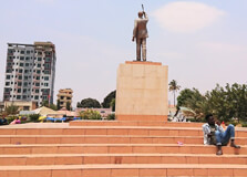
Nyerere Square, located in the heart of Dodoma, the capital city of Tanzania, is one of the most significant landmarks in the city. Named after Julius Kambarage Nyerere, the first president of Tanzania, the square stands as a tribute to his contributions to the nation. It is a central point for public gatherings, national events, and social activities in Dodoma. Visitors and locals alike gather here for various events, making it a lively and important spot in the city. How to Reach Nyerere Square, Dodoma Nyerere Square is centrally located within Dodoma, which makes it easily accessible from various parts of the city. Here are the best ways to reach the square: By Air: Dodoma is served by Dodoma Airport (DOM), located approximately 10 km from the city center. From the airport, you can take a taxi or a local bus to reach Nyerere Square. By Bus: If you're traveling by bus from other parts of Tanzania, Dodoma is connected to major cities like Dar es Salaam, Arusha, and Mwanza by regular bus services. After reaching the central bus station in Dodoma, you can take a short taxi ride to Nyerere Square. By Car: Dodoma is accessible by road through the Central Corridor Highway (A-104). Once in the city, Nyerere Square is located in a busy area, and signs can help direct you to it. Weather in Dodoma The weather in Dodoma is typically dry and semi-arid, with hot temperatures throughout most of the year. Here's what to expect: Dry Season (May to October): The weather during this time is hot and dry, with temperatures often exceeding 30°C (86°F) during the day. The nights are cooler, especially in the months of June and July. Rainy Season (November to April): The rainy season brings short, heavy showers, especially from November to March. While temperatures remain warm, the rains help to cool down the city, though humidity can increase. The best time to visit Nyerere Square is during the dry season, as the outdoor environment is more pleasant, and there are fewer chances of rain disrupting activities. Timing and Visiting Hours Nyerere Square is an open public space and does not have formal visiting hours. However, it is most active during the daytime and evenings when people gather for various events and social activities. Here's an overview of what to expect: Daytime: The square is bustling with activity, with locals and tourists walking around, attending events, or enjoying the outdoor space. It's also a popular spot for photos and relaxation. Evening: In the evening, the square often hosts public performances, speeches, or concerts. The surrounding area is well-lit, and the atmosphere is lively and welcoming. While there's no strict opening or closing time for the square, it’s best to visit during daylight hours or early evening to get the most out of the experience. Why is Nyerere Square Famous? Nyerere Square is famous for several key reasons: Historical Significance: Named after Julius Nyerere, the founding father of Tanzania, the square stands as a symbol of the country's independence and unity. Nyerere played a pivotal role in Tanzania's liberation and development, and the square reflects his enduring legacy. Central Gathering Place: Nyerere Square is a hub for public events such as national holidays, protests, social gatherings, and political rallies. It has been the site of countless important moments in Tanzanian history. Tourist Attraction: As one of the prominent landmarks in Dodoma, it draws tourists who are interested in Tanzanian history, culture, and architecture. The square provides a scenic backdrop for photos and exploration. Entry and Visit Details As a public space, Nyerere Square is free to visit. There are no formal entry requirements, and you can explore it at your leisure. However, here are some details to help you plan your visit: Accessibility: The square is easily accessible to people with disabilities. There are wide walkways, and it is well-maintained, making it comfortable for all visitors. Safety: The area around Nyerere Square is generally safe for visitors, but like any busy public space, it’s advisable to stay alert, especially in crowded situations. Things to Bring: Since the square is open and exposed, it's a good idea to bring sunscreen, a hat, and comfortable shoes, especially if you're planning to walk around or stay for extended periods. History of Nyerere Square Nyerere Square is named after Julius Nyerere, who served as the first president of Tanzania from 1964 to 1985. The square was established during his presidency to serve as a space for public gatherings, political speeches, and celebrations. It became an iconic symbol of Tanzania’s post-independence era. The square has witnessed numerous significant events, including independence celebrations, political rallies, and public addresses. It is a testament to Tanzania's journey as a nation and holds great national pride. Over the years, the square has undergone renovations to maintain its relevance as a center for public life in Dodoma. Architecture of Nyerere Square The architecture of Nyerere Square reflects a combination of modern and traditional Tanzanian elements. The square is surrounded by important government buildings, giving it a stately and formal atmosphere. The central area is paved with wide walkways and manicured lawns, making it a comfortable and pleasant place to spend time. The most striking feature of the square is the large statue of Julius Nyerere that stands in the middle. This monument serves as both a tribute to the late president and a focal point for the square. The surrounding buildings, including the Dodoma Regional Government offices, add to the official and historic vibe of the area. Things to Do at Nyerere Square Nyerere Square is not only a historical site but also a lively spot for various activities. Here are some things to do when you visit: Take Photos: The square, with its beautiful landscaping, statue of Julius Nyerere, and surrounding buildings, provides great photo opportunities. Attend Public Events: Depending on when you visit, you may be able to attend a public event, including political speeches, national celebrations, or concerts. Enjoy a Stroll: Walk around the square to take in the atmosphere, enjoy the greenery, and admire the surrounding architecture. Relax and People-Watch: The square is a popular gathering spot for locals. It’s a great place to sit, relax, and watch the busy life of Dodoma unfold. Facts and Tips about Nyerere Square Tip 1: Visit in the cooler months (from May to October) to avoid the intense heat of the rainy season. Fact 1: Nyerere Square is the site of major national celebrations like Independence Day on December 9th, which is celebrated with speeches and gatherings. Tip 2: Bring plenty of water, as the area can get quite hot, especially in the dry season. Fact 2: The square is an important political space, and it often hosts rallies and public meetings, especially during election periods.
Explore More
The Dodoma Museum, officially known as the Dodoma Regional Museum, is a cultural and historical institution located in Dodoma, the capital city of Tanzania. The museum offers insights into the region's rich heritage, showcasing artifacts and exhibits that reflect the diverse cultures and history of the area. How to Reach Dodoma Museum Dodoma is accessible by various means: By Air: The city is served by Dodoma Airport, with flights connecting from major cities like Dar es Salaam and Arusha. By Road: Dodoma is connected by road to other parts of Tanzania. Buses and private vehicles can be used to reach the city. By Rail: The Central Railway Line passes through Dodoma, offering train services from Dar es Salaam and other regions. Once in Dodoma, the museum is located centrally and can be reached by local transport options such as taxis, buses, or even on foot, depending on your location. Weather in Dodoma Dodoma experiences a semi-arid climate with distinct wet and dry seasons: Dry Season (May to October): Characterized by sunny days and cooler nights, making it an ideal time to visit. Wet Season (November to April): Features occasional rains, with the heaviest rainfall typically in March and April. Average temperatures range between 16°C (61°F) and 31°C (88°F) throughout the year. Timings of Dodoma Museum The Dodoma Museum is generally open to visitors during standard working hours: Monday to Friday: 8:00 AM to 5:00 PM Saturday: 9:00 AM to 1:00 PM Sunday and Public Holidays: Closed It's advisable to check ahead for any changes in operating hours or special closures. Why Dodoma Museum is Famous The Dodoma Museum is renowned for its comprehensive collection that highlights the cultural and historical aspects of the Dodoma region. It serves as an educational center, preserving and showcasing the traditions, artifacts, and history of the local communities, including the Gogo people. Entry and Visit Details Visitors are welcome to explore the museum's exhibits, which include traditional artifacts, historical documents, and cultural displays. Guided tours may be available upon request, providing in-depth information about the exhibits and the region's history. Photography policies may vary, so it's recommended to inquire at the entrance regarding any restrictions. History and Architecture of Dodoma Museum The Dodoma Museum was established to preserve and promote the rich cultural heritage of the Dodoma region. The architecture of the museum reflects traditional Tanzanian design elements, incorporating local materials and construction techniques. The building itself serves as an example of regional architectural styles, providing visitors with a tangible connection to the area's cultural identity. Things to Do at Dodoma Museum Visitors to the Dodoma Museum can engage in various activities: Explore Exhibits: View a wide range of artifacts, including traditional clothing, tools, musical instruments, and art pieces. Educational Programs: Participate in workshops and lectures that delve into the region's history and cultural practices. Research Opportunities: Access archives and resources for academic or personal research on Tanzanian culture and history. Community Events: Attend cultural events and exhibitions that showcase local traditions and contemporary artistic expressions. Facts and Tips about Dodoma Museum Inclusive Museum: The museum aims to be an inclusive space for knowledge, research, and heritage preservation, focusing on the material culture of archaeological sites and communities like the Gogo people. Special Exhibitions: Regularly hosts special exhibitions on various topics, including traditional arts and crafts, and contemporary art. Guided Tours: Available in both English and Swahili, offering deeper insights into the exhibits and regional history. Accessibility: The museum is centrally located, making it easily accessible for visitors exploring Dodoma. Visitor Engagement: Encourages interaction and learning, making it suitable for visitors of all ages and backgrounds.
Explore More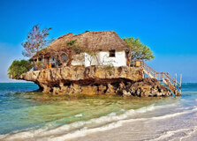
Chimala Hills, located in the Mbeya region of Tanzania, are a series of low hills, koppies, and ridges formed from variably resistant paragneiss sequences, including marbles, amphibolites, and quartzites. These hills are characterized by well-vegetated landscapes and are separated by flatter thorn bush and savannah country. :contentReference[oaicite:0]{index=0} How to Reach Chimala Hills Chimala Hills are situated in the Mbeya region, approximately 353.3 km (219.5 mi) from Dodoma. :contentReference[oaicite:1]{index=1} Travelers can reach the area by road from Dodoma or Mbeya. The nearest major town is Chimala, which serves as a gateway to the hills. Public transportation, such as buses and minibusses, are available from Dodoma to Chimala town. From there, local guides can assist in navigating the terrain. Weather in Chimala Hills The region experiences a tropical savannah climate with distinct wet and dry seasons. The dry season, from May to October, offers the best conditions for hiking and exploration, with daytime temperatures ranging from 20°C to 30°C (68°F to 86°F). The wet season, from November to April, brings heavier rainfall, making some trails slippery and challenging. Timings for Visiting Chimala Hills Chimala Hills are accessible year-round; however, the dry season is preferable for outdoor activities. It's advisable to start hikes early in the morning to avoid the midday heat. There are no official opening or closing times, but visitors should plan their trips during daylight hours for safety. Why Chimala Hills are Famous Chimala Hills are renowned for their unique geological formations and biodiversity. The area is characterized by well-vegetated low hills, koppies, and ridges, formed from variably resistant paragneiss sequences, including marbles, amphibolites, and quartzites. :contentReference[oaicite:2]{index=2} These geological features make the hills a point of interest for geologists and nature enthusiasts alike. Entry and Visit Details There are no formal entry fees for visiting Chimala Hills. However, hiring a local guide is recommended to navigate the terrain safely and to gain insights into the area's geology and ecology. Visitors should carry sufficient water, wear appropriate hiking gear, and inform someone about their travel plans before venturing into the hills. History and Geology of Chimala Hills The Chimala Hills are part of the Eastern Arc Mountains and have a complex geological history. The area is characterized by well-vegetated low hills, koppies, and ridges, formed from variably resistant paragneiss sequences, including marbles, amphibolites, and quartzites. :contentReference[oaicite:3]{index=3} These formations provide valuable insights into the Earth's geological past and are of significant interest to researchers and geologists. Things to Do at Chimala Hills Hiking and Trekking: Explore various trails that offer scenic views of the surrounding landscapes. Bird Watching: The area is home to diverse bird species, making it ideal for bird enthusiasts. Photography: Capture the unique geological formations and panoramic vistas. Geological Exploration: Study the diverse rock formations and learn about the area's geological history. Facts and Tips about Chimala Hills Location: Mbeya region, approximately 353.3 km from Dodoma. :contentReference[oaicite:4]{index=4} Best Time to Visit: Dry season (May to October) for optimal hiking conditions. Local Guides: Hiring a guide is recommended for safety and enhanced experience. Preparation: Carry sufficient water, wear sturdy hiking boots, and inform someone about your travel plans. Safety: Be cautious of wildlife and avoid hiking alone.
Explore More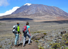
Mount Kilimanjaro, standing at 5,895 meters (19,341 feet), is Africa’s highest peak and the world’s tallest free-standing mountain. Located in Tanzania, it attracts adventurers from across the globe. Unlike technical climbs requiring advanced mountaineering skills, Kilimanjaro offers a trekking experience accessible to determined hikers, making it a bucket-list destination for many. How to Reach Mount Kilimanjaro The nearest major city to Kilimanjaro is Arusha, approximately 130 kilometers (81 miles) away. Arusha is well-connected by road and air, with Kilimanjaro International Airport (JRO) serving as the primary gateway for international travelers. From Arusha, visitors can arrange transportation to the mountain's various trailheads, such as Machame Gate, Marangu Gate, or Londorossi Gate, depending on the chosen route. Weather and Best Time to Climb Mount Kilimanjaro can be climbed year-round, but the best conditions are during the dry seasons: January to early March: Clear skies and dry conditions make this a favorable period for trekking. June to October: The main climbing season, offering stable weather and excellent visibility. It's advisable to avoid the rainy seasons: March to May: Long rains can make trails slippery and challenging. November: Short rains may cause afternoon showers, affecting trail conditions. For optimal conditions, consider planning your ascent during the dry months, keeping in mind that these periods may also coincide with higher numbers of climbers. Source: Ultimate Kilimanjaro Entry and Visit Details Climbing Mount Kilimanjaro requires a permit issued by the Kilimanjaro National Park Authority (KINAPA). All climbers must be accompanied by a licensed guide, and the use of porters and cooks is mandatory. It's essential to book your trek through a registered tour operator who will handle logistics, permits, and provide the necessary support staff. Entry fees vary depending on the route and duration of the climb. It's advisable to check with your tour operator for the most current fee structure. Why Kilimanjaro is Famous Mount Kilimanjaro is renowned for its unique ecological zones, ranging from tropical rainforests at the base to alpine deserts and glaciers near the summit. This diverse environment allows trekkers to experience multiple climates and ecosystems in a single journey. The mountain's accessibility, lack of technical climbing requirements, and the sense of achievement upon reaching the summit contribute to its popularity among trekkers worldwide. History and Architecture Mount Kilimanjaro is a dormant stratovolcano formed over 4 million years ago. It consists of three volcanic cones: Kibo, Mawenzi, and Shira. The first recorded ascent was in 1889 by German geographer Hans Meyer and Austrian mountaineer Ludwig Purtscheller. Since then, the mountain has become a symbol of Tanzania's natural heritage and a significant attraction for climbers. While Kilimanjaro is primarily a natural wonder, the infrastructure supporting climbers includes well-maintained trails, huts, and campsites along various routes, ensuring safety and comfort for trekkers. Things to Do on Mount Kilimanjaro Climb to Uhuru Peak: Reach the summit and enjoy breathtaking panoramic views. Explore Diverse Ecosystems: Traverse through rainforests, moorlands, and alpine deserts. Wildlife Spotting: Observe various species, including monkeys and diverse birdlife. Photography: Capture the stunning landscapes and unique flora and fauna. Cultural Interaction: Engage with local porters and guides to learn about their traditions and experiences. Interesting Facts About Mount Kilimanjaro It is the highest free-standing mountain in the world. The mountain's glaciers have been retreating rapidly due to climate change. It has five distinct ecological zones: Cultivation, Rainforest, Moorland, Alpine Desert, and Summit. Over 35,000 climbers attempt to summit Kilimanjaro annually. The mountain is home to diverse wildlife, including elephants, buffaloes, and various bird species. Tips for Climbing Mount Kilimanjaro Acclimatize Properly: Allow sufficient time for your body to adjust to higher altitudes. Stay Hydrated: Drink plenty of water to prevent dehydration. Dress in Layers: Weather conditions can change rapidly; layering helps manage temperature variations. Follow Your Guide's Instructions: Guides are experienced and knowledgeable; their guidance is crucial for safety. Prepare Physically: Engage in regular cardiovascular and strength training exercises before your climb. Climbing Mount Kilimanjaro is a rewarding adventure that offers unparalleled experiences and challenges. With proper preparation, respect for the environment, and adherence to safety guidelines, trekkers can achieve the remarkable feat of summiting Africa's highest peak.
Explore More
Mountain cycling on Mount Kilimanjaro offers an exhilarating adventure that combines the thrill of downhill biking with the breathtaking beauty of Africa's highest peak. This unique experience allows cyclists to traverse diverse landscapes, from alpine deserts to lush rainforests, all while descending from the summit of Mount Kilimanjaro. Whether you're an experienced mountain biker or an adventurous enthusiast, cycling on Kilimanjaro provides a once-in-a-lifetime opportunity to challenge yourself and witness the stunning vistas of Tanzania's iconic mountain. How to Reach Mount Kilimanjaro for Cycling To embark on a mountain cycling adventure on Kilimanjaro, the journey typically begins in the town of Moshi, located at the base of the mountain. Moshi is accessible via Kilimanjaro International Airport (JRO), which is approximately 45 kilometers (28 miles) away. From Moshi, cyclists can arrange transportation to the starting point of their chosen route. It's advisable to book a guided cycling tour through a reputable operator who can provide the necessary equipment, permits, and support staff for the journey. Weather and Best Time to Cycle The weather on Mount Kilimanjaro varies with altitude, and cyclists should be prepared for a range of conditions. At lower elevations, temperatures can be warm and humid, while higher altitudes experience cooler temperatures and potential snowfall. The best time to undertake a mountain cycling expedition is during the dry seasons: January to March: Warm temperatures with minimal rainfall. June to October: Cooler temperatures with dry conditions. It's important to note that the mountain's weather can be unpredictable, and conditions can change rapidly. Cyclists should be prepared for sudden temperature drops and potential storms, especially at higher elevations. Why Kilimanjaro is Famous for Mountain Cycling Mount Kilimanjaro is renowned for its unique combination of challenging terrain and stunning scenery, making it a sought-after destination for mountain cycling enthusiasts. The mountain's diverse ecosystems, ranging from tropical rainforests to alpine deserts, provide a dynamic and ever-changing backdrop for cyclists. Additionally, the opportunity to cycle from the summit, Uhuru Peak, at 5,895 meters (19,341 feet) down to the base of the mountain offers an unparalleled adventure that few other locations can match. Entry and Visit Details Embarking on a mountain cycling journey on Kilimanjaro requires proper permits and arrangements. All cyclists must obtain a permit from the Kilimanjaro National Park Authority (KINAPA). It's essential to book through a licensed tour operator who can handle the necessary logistics, including permits, equipment, and support staff. The cost of the expedition varies depending on the chosen route, duration, and services provided. It's advisable to inquire about the specifics with the tour operator during the booking process. History and Architecture Mount Kilimanjaro has a rich history that dates back millions of years. The mountain was formed through volcanic activity and is composed of three cones: Kibo, Mawenzi, and Shira. The first recorded ascent of the mountain was in 1889 by Hans Meyer and Ludwig Purtscheller. Since then, Kilimanjaro has become a symbol of Tanzania's natural heritage and a popular destination for adventurers worldwide. While Kilimanjaro is primarily a natural wonder, the infrastructure supporting mountain cycling includes well-maintained trails and designated routes that ensure safety and accessibility for cyclists. These trails are carefully managed to preserve the mountain's delicate ecosystems while providing an exciting experience for visitors. Things to Do During a Mountain Cycling Expedition Summit Ride: Cycle from the summit, Uhuru Peak, down to the base of the mountain, experiencing a dramatic change in scenery and climate. Wildlife Viewing: Encounter diverse wildlife, including elephants, giraffes, and various bird species, as you traverse the lower slopes of the mountain. Cultural Interaction: Engage with local communities, such as the Maasai and Chagga people, to learn about their traditions and way of life. Photography: Capture stunning photographs of the diverse landscapes, unique flora, and panoramic views of the mountain. Camping: Experience the thrill of camping at various altitudes, from the rainforest zones to the alpine deserts. Interesting Facts About Mountain Cycling on Kilimanjaro The descent from the summit to the base covers a distance of approximately 42 kilometers (26 miles). Cycling on Kilimanjaro is considered one of the longest downhill mountain bike rides in the world. The route traverses through five distinct ecological zones: rainforest, moorland, alpine desert, summit, and base. Mountain cycling on Kilimanjaro is a physically demanding activity that requires a high level of fitness and preparation. Only a limited number of cyclists undertake the summit-to-base ride each year, making it a unique and exclusive adventure. Tips for a Successful Mountain Cycling Expedition Physical Preparation: Engage in regular cardiovascular and strength training exercises to build endurance and strength. Acclimatization: Allow time for your body to adjust to the high altitudes to reduce the risk of altitude sickness. Proper Gear: Ensure you have appropriate cycling gear, including a mountain bike suitable for rugged terrain, protective equipment, and layered clothing to adapt to changing temperatures. Hydration and Nutrition: Stay hydrated and maintain a balanced diet to sustain energy levels throughout the expedition. Guided Tours: Consider booking a guided tour with experienced guides who are familiar with the terrain and can provide valuable insights and support. Mountain cycling on Mount Kilimanjaro is an extraordinary adventure that combines physical challenge with the opportunity to experience one of the world's most iconic landscapes. With proper preparation and respect for the mountain's environment, cyclists can enjoy a safe and memorable journey down Africa's highest peak.
Explore More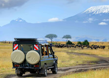
Game drives in Kilimanjaro National Park offer a unique opportunity to witness Tanzania's diverse wildlife against the backdrop of Africa's highest peak. Unlike traditional safaris in the Serengeti or Ngorongoro Crater, Kilimanjaro's game drives provide a more intimate and tranquil experience, allowing visitors to explore the lower slopes of the mountain and its surrounding forests. How to Reach Kilimanjaro National Park The nearest town to Kilimanjaro National Park is Moshi, which serves as the primary gateway for visitors. Moshi is accessible via Kilimanjaro International Airport (JRO), approximately 45 kilometers (28 miles) away. From Moshi, travelers can arrange transportation to the park's various entry points, such as Marangu Gate or Machame Gate, depending on their chosen route. It's advisable to book a guided tour through a reputable operator who can provide the necessary permits and support for the game drive. Weather and Best Time for a Game Drive The weather in Kilimanjaro National Park varies with altitude, ranging from tropical conditions at the base to alpine climates near the summit. The best time for a game drive is during the dry seasons: January to March: Warm temperatures with minimal rainfall. June to October: Cooler temperatures with dry conditions. It's advisable to avoid the rainy seasons: March to May: Long rains can make trails slippery and challenging. November: Short rains may cause afternoon showers, affecting trail conditions. For optimal conditions, consider planning your game drive during the dry months, keeping in mind that these periods may also coincide with higher numbers of visitors. Entry and Visit Details To embark on a game drive in Kilimanjaro National Park, visitors must obtain a permit from the Tanzania National Parks Authority (TANAPA). The standard entry fee for non-East African citizens is approximately $82.60 per person per day. Children between the ages of 5 and 15 are charged a reduced fee of $15 to $20, depending on the park. Children under 5 years old can enter free of charge. These fees are valid for a 24-hour period and can be paid upon arrival using a Visa or MasterCard; cash and debit cards are not accepted. It's essential to book your game drive through a licensed tour operator who can handle the necessary logistics, including permits, transportation, and guiding services. Self-drive options are not permitted within the park. Why Kilimanjaro is Famous for Game Drives While Mount Kilimanjaro is renowned for its trekking routes, its lower slopes and surrounding forests also offer exceptional wildlife viewing opportunities. The park is home to a variety of species, including: Elephants Cape buffaloes Blue monkeys Red duikers Leopards Numerous bird species The diverse ecosystems, ranging from montane forests to moorlands, provide a rich habitat for these animals. The proximity to the mountain's iconic glaciers and snow-capped peak adds to the allure of the game drive experience. History and Architecture Mount Kilimanjaro and its surrounding areas have a rich history. In the early 20th century, the German colonial government declared the region a game reserve. In 1921, it was designated as a forest reserve, and in 1973, the area above the tree line was reclassified as a national park. The park was declared a World Heritage Site by UNESCO in 1987 for its natural value. The infrastructure supporting game drives includes well-maintained roads and designated routes that ensure safety and accessibility for visitors. Things to Do on a Game Drive Wildlife Viewing: Spot a variety of animals in their natural habitats. Bird Watching: Observe numerous bird species, including endemic and migratory birds. Photography: Capture stunning images of wildlife and the majestic Mount Kilimanjaro. Cultural Interaction: Engage with local communities, such as the Chagga people, to learn about their traditions and way of life. Guided Tours: Participate in guided game drives to gain insights into the park's ecosystems and wildlife. Interesting Facts About Kilimanjaro National Park The park covers an area of 1,688 square kilometers (652 square miles). It is home to five distinct ecological zones: cultivation, rainforest, moorland, alpine desert, and summit. The park's glaciers have been retreating rapidly due to climate change. Over 35,000 climbers attempt to summit Mount Kilimanjaro annually. The mountain's glaciers are a significant source of water for surrounding communities. Tips for a Successful Game Drive Book in Advance: Secure your permits and accommodations early, especially during peak seasons. Dress Appropriately: Wear layered clothing to adapt to varying temperatures and conditions. Bring Essentials: Carry binoculars, a camera, sunscreen, and insect repellent. Stay Hydrated: Bring sufficient water to stay hydrated during the drive. Respect Wildlife: Maintain a safe distance from animals and follow your guide's instructions. Game drives in Kilimanjaro National Park offer a unique and enriching experience, combining wildlife viewing with the stunning backdrop of Mount Kilimanjaro. With proper planning and respect for the environment, visitors can enjoy a memorable adventure in one of Africa's most iconic landscapes.
Explore More
Nature walking safaris in Kilimanjaro National Park offer an immersive experience into the diverse ecosystems of Africa's highest peak. Unlike traditional game drives, these guided walks allow visitors to explore the mountain's lower slopes, montane forests, and moorlands on foot, providing a unique perspective of the flora, fauna, and cultural heritage of the region. How to Reach Kilimanjaro National Park The nearest town to Kilimanjaro National Park is Moshi, located approximately 45 kilometers (28 miles) from Kilimanjaro International Airport (JRO). From Moshi, visitors can arrange transportation to the park's various entry points, such as Marangu Gate or Machame Gate, depending on their chosen route. It's advisable to book a guided walking safari through a reputable tour operator who can provide the necessary permits, equipment, and experienced guides for the journey. Weather and Best Time for a Nature Walking Safari The weather in Kilimanjaro National Park varies with altitude, ranging from tropical conditions at the base to alpine climates near the summit. The best time for a nature walking safari is during the dry seasons: January to March: Cooler temperatures, clear skies, and fewer climbers. June to October: Dry conditions, stable weather, and optimal visibility. It's advisable to avoid the rainy seasons: March to May: Long rains can make trails slippery and challenging. November: Short rains may cause afternoon showers, affecting trail conditions. For optimal conditions, consider planning your nature walking safari during the dry months, keeping in mind that these periods may also coincide with higher numbers of visitors. Entry and Visit Details Embarking on a nature walking safari in Kilimanjaro National Park requires proper permits and arrangements. All visitors must obtain a permit from the Tanzania National Parks Authority (TANAPA). The standard entry fee for non-East African citizens is approximately $82.60 per person per day. Children between the ages of 5 and 15 are charged a reduced fee of $15 to $20, depending on the park. Children under 5 years old can enter free of charge. These fees are valid for a 24-hour period and can be paid upon arrival using a Visa or MasterCard; cash and debit cards are not accepted. It's essential to book your nature walking safari through a licensed tour operator who can handle the necessary logistics, including permits, equipment, and guiding services. Self-guided walks are not permitted within the park. Why Kilimanjaro is Famous for Nature Walking Safaris Mount Kilimanjaro is renowned for its unique combination of diverse ecosystems and stunning scenery, making it a sought-after destination for nature walking safaris. The mountain's lower slopes and surrounding forests provide a rich habitat for various species, including: Elephants Cape buffaloes Blue monkeys Red duikers Leopards Numerous bird species The opportunity to explore these habitats on foot allows visitors to experience the environment intimately and gain insights into the ecological dynamics of the region. History and Architecture Mount Kilimanjaro and its surrounding areas have a rich history. In the early 20th century, the German colonial government declared the region a game reserve. In 1921, it was designated a forest reserve, and in 1973, the area above the tree line was reclassified as a national park. The park was declared a World Heritage Site by UNESCO in 1987 for its natural value. The infrastructure supporting nature walking safaris includes well-maintained trails and designated routes that ensure safety and accessibility for visitors. These trails are carefully managed to preserve the mountain's delicate ecosystems while providing an exciting experience for visitors. Things to Do During a Nature Walking Safari Wildlife Viewing: Spot a variety of animals in their natural habitats. Bird Watching: Observe numerous bird species, including endemic and migratory birds. Photography: Capture stunning images of wildlife and the majestic Mount Kilimanjaro. Cultural Interaction: Engage with local communities, such as the Chagga people, to learn about their traditions and way of life. Guided Tours: Participate in guided nature walks to gain insights into the park's ecosystems and wildlife. Interesting Facts About Kilimanjaro National Park The park covers an area of 1,688 square kilometers (652 square miles). It is home to five distinct ecological zones: cultivation, rainforest, moorland, alpine desert, and summit. The park's glaciers have been retreating rapidly due to climate change. Over 35,000 climbers attempt to summit Mount Kilimanjaro annually. The mountain's glaciers are a significant source of water for surrounding communities. Tips for a Successful Nature Walking Safari Book in Advance: Secure your permits and accommodations early, especially during peak seasons. Dress Appropriately: Wear layered clothing to adapt to varying temperatures and conditions. Bring Essentials: Carry binoculars, a camera, sunscreen, and insect repellent. Stay Hydrated: Bring sufficient water to stay hydrated during the walk. Respect Wildlife: Maintain a safe distance from animals and follow your guide's instructions. Nature walking safaris in Kilimanjaro National Park offer a unique and enriching experience, combining wildlife viewing with the stunning backdrop of Mount Kilimanjaro. With proper planning and respect for the environment, visitors can enjoy a memorable adventure in one of Africa's most iconic landscapes.
Explore More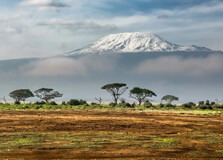
Long walking safaris in Kilimanjaro National Park offer an immersive experience into the diverse ecosystems of Africa's highest peak. Unlike traditional game drives, these guided walks allow visitors to explore the mountain's lower slopes, montane forests, and moorlands on foot, providing a unique perspective of the flora, fauna, and cultural heritage of the region. How to Reach Kilimanjaro National Park The nearest town to Kilimanjaro National Park is Moshi, located approximately 45 kilometers (28 miles) from Kilimanjaro International Airport (JRO). From Moshi, visitors can arrange transportation to the park's various entry points, such as Marangu Gate or Machame Gate, depending on their chosen route. It's advisable to book a guided walking safari through a reputable tour operator who can provide the necessary permits, equipment, and experienced guides for the journey. Weather and Best Time for a Long Walking Safari The weather in Kilimanjaro National Park varies with altitude, ranging from tropical conditions at the base to alpine climates near the summit. The best time for a long walking safari is during the dry seasons: January to March: Cooler temperatures, clear skies, and fewer climbers. June to October: Dry conditions, stable weather, and optimal visibility. It's advisable to avoid the rainy seasons: March to May: Long rains can make trails slippery and challenging. November: Short rains may cause afternoon showers, affecting trail conditions. For optimal conditions, consider planning your long walking safari during the dry months, keeping in mind that these periods may also coincide with higher numbers of visitors. Entry and Visit Details Embarking on a long walking safari in Kilimanjaro National Park requires proper permits and arrangements. All visitors must obtain a permit from the Tanzania National Parks Authority (TANAPA). The standard entry fee for non-East African citizens is approximately $82.60 per person per day. Children between the ages of 5 and 15 are charged a reduced fee of $15 to $20, depending on the park. Children under 5 years old can enter free of charge. These fees are valid for a 24-hour period and can be paid upon arrival using a Visa or MasterCard; cash and debit cards are not accepted. It's essential to book your long walking safari through a licensed tour operator who can handle the necessary logistics, including permits, equipment, and guiding services. Self-guided walks are not permitted within the park. Why Kilimanjaro is Famous for Long Walking Safaris Mount Kilimanjaro is renowned for its unique combination of diverse ecosystems and stunning scenery, making it a sought-after destination for long walking safaris. The mountain's lower slopes and surrounding forests provide a rich habitat for various species, including: Elephants Cape buffaloes Blue monkeys Red duikers Leopards Numerous bird species The opportunity to explore these habitats on foot allows visitors to experience the environment intimately and gain insights into the ecological dynamics of the region. History and Architecture Mount Kilimanjaro and its surrounding areas have a rich history. In the early 20th century, the German colonial government declared the region a game reserve. In 1921, it was designated a forest reserve, and in 1973, the area above the tree line was reclassified as a national park. The park was declared a World Heritage Site by UNESCO in 1987 for its natural value. The infrastructure supporting long walking safaris includes well-maintained trails and designated routes that ensure safety and accessibility for visitors. These trails are carefully managed to preserve the mountain's delicate ecosystems while providing an exciting experience for visitors. Things to Do During a Long Walking Safari Wildlife Viewing: Spot a variety of animals in their natural habitats. Bird Watching: Observe numerous bird species, including endemic and migratory birds. Photography: Capture stunning images of wildlife and the majestic Mount Kilimanjaro. Cultural Interaction: Engage with local communities, such as the Chagga people, to learn about their traditions and way of life. Guided Tours: Participate in guided long walks to gain insights into the park's ecosystems and wildlife. Interesting Facts About Kilimanjaro National Park The park covers an area of 1,688 square kilometers (652 square miles). It is home to five distinct ecological zones: cultivation, rainforest, moorland, alpine desert, and summit. The park's glaciers have been retreating rapidly due to climate change. Over 35,000 climbers attempt to summit Mount Kilimanjaro annually. The mountain's glaciers are a significant source of water for surrounding communities. Tips for a Successful Long Walking Safari Book in Advance: Secure your permits and accommodations early, especially during peak seasons. Dress Appropriately: Wear layered clothing to adapt to varying temperatures and conditions. Bring Essentials: Carry binoculars, a camera, sunscreen, and insect repellent. Stay Hydrated: Bring sufficient water to stay hydrated during the walk. Respect Wildlife: Maintain a safe distance from animals and follow your guide's instructions. Long walking safaris in Kilimanjaro National Park offer a unique and enriching experience, combining wildlife viewing with the stunning backdrop of Mount Kilimanjaro. With proper planning and respect for the environment, visitors can enjoy a memorable adventure in one of Africa's most iconic landscapes.
Explore More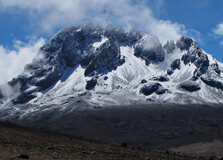
Mawenzi Peak, the second-highest summit on Mount Kilimanjaro, offers a challenging and exhilarating experience for seasoned mountaineers. Unlike the more frequented Kibo summit, Mawenzi presents a rugged terrain with jagged spires and steep cliffs, making it a sought-after destination for those seeking a technical climbing adventure. How to Reach Mawenzi Technical Climbing To embark on a technical climb of Mawenzi, climbers typically start from Moshi, Tanzania, which is approximately 45 kilometers from Kilimanjaro International Airport. From Moshi, the journey to Mawenzi begins at the Marangu Gate or Rongai Route entry points. The routes converge at Mawenzi Hut, situated at an elevation of 4,310 meters, serving as the base camp for Mawenzi climbs. Weather and Best Time for Climbing Mawenzi The optimal time to attempt a technical climb of Mawenzi is during the dry seasons: January to March: Clear skies and stable weather conditions. June to October: Dry conditions with minimal rainfall. Climbing is permitted only between 6:00 am and 6:00 pm. Night climbs are prohibited to ensure climbers' safety in the challenging terrain. Why Mawenzi is Famous for Technical Climbing Mawenzi is renowned for its challenging and technical climbing routes, attracting experienced mountaineers seeking a formidable ascent. The peak's rugged terrain, characterized by steep cliffs and jagged spires, presents a unique challenge compared to the smoother slopes of Kibo. The climb to Hans Meyer Peak, the highest point on Mawenzi at 5,149 meters, involves technical rock climbing and is considered a serious undertaking requiring advanced skills and equipment. Entry and Visit Details Climbing Mawenzi requires prior approval from the Tanzania National Parks Authority (TANAPA). Climbers must: Book through authorized tour operators with valid mountain TTLB licenses. Provide technical climbing CVs to TANAPA for approval. Ensure availability of reliable communication systems for emergencies. Carry a first aid kit during the climb. Only groups of two climbers are allowed to attempt Mawenzi at a time, and climbers must be at least 18 years old. All climbers are required to fill out indemnity forms provided by the park before the climb. History and Architecture Mawenzi Peak was first summited in 1912 by explorers Fritz Klute and Eduard Oehler. The peak was formed during a volcanic eruption within the Shira caldera after the Shira peak became extinct. Unlike the neighboring Kibo volcano, Mawenzi's terrain is characterized by jagged rocks and steep cliffs, offering a stark contrast to Kibo's smoother slopes. Things to Do on Mawenzi Technical Climbing: Attempt the challenging ascent to Hans Meyer Peak. Scenic Photography: Capture breathtaking views of the surrounding landscape. Wildlife Observation: Spot large bearded vultures nesting on the cliffs. Sunrise and Sunset Viewing: Experience stunning sunrises and sunsets over the rugged terrain. Interesting Facts About Mawenzi Mawenzi is the third-highest peak in Africa, after Mount Kenya's Batian and Nelion peaks. The peak's jagged appearance is the result of erosion and weathering over thousands of years. Large bearded vultures nest on Mawenzi's cliffs, feeding on dead animals and carrying bones high into the air to access the marrow inside. In 1955, a plane crash on Mawenzi Peak resulted in the deaths of 20 people, making it the deadliest aviation disaster in Tanzania to date. Tips for Climbing Mawenzi Preparation: Ensure you have the necessary technical climbing skills and experience. Equipment: Bring essential mountaineering gear, including crampons, ice axes, ropes, and helmets. Guides: Hire experienced guides familiar with Mawenzi's terrain. Health: Acclimatize properly to prevent altitude sickness. Safety: Follow all safety protocols and park regulations during the climb. Embarking on a technical climb of Mawenzi is a challenging yet rewarding endeavor for experienced mountaineers. With proper preparation and adherence to safety guidelines, climbers can experience the rugged beauty and unique challenges that Mawenzi Peak offers.
Explore More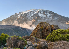
Kibo Peak, the highest point on Mount Kilimanjaro, stands as a formidable yet accessible destination for trekkers and mountaineers. Rising to 5,895 meters (19,341 feet) above sea level, it is the tallest mountain in Africa and one of the Seven Summits, making it a coveted goal for climbers worldwide. :contentReference[oaicite:0]{index=0}:contentReference[oaicite:1]{index=1} How to Reach Kibo Peak To embark on a journey to Kibo Peak, climbers typically start from Moshi, Tanzania, located approximately 45 kilometers from Kilimanjaro International Airport. From Moshi, the most common route to Kibo is via the Marangu Gate, also known as the "Coca-Cola" route, which is the only route with hut accommodations along the way. :contentReference[oaicite:2]{index=2} Other routes leading to Kibo include Machame, Lemosho, Rongai, and Umbwe. Each route offers a unique experience, with varying levels of difficulty and scenic views. It's advisable to choose a route that aligns with your fitness level and desired experience. All routes converge at Kibo Hut, situated at an elevation of 4,700 meters, serving as the base camp for the final ascent to the summit. :contentReference[oaicite:3]{index=3} Weather and Best Time to Climb The weather on Kibo Peak varies with altitude, ranging from tropical conditions at the base to alpine climates near the summit. The best times to climb are during the dry seasons: January to March: Clear skies and stable weather conditions. June to October: Dry conditions with minimal rainfall. Climbing is permitted only between 6:00 am and 6:00 pm. Night climbs are prohibited to ensure climbers' safety in the challenging terrain. :contentReference[oaicite:4]{index=4} Why Kibo Peak is Famous Kibo Peak is renowned for its challenging ascent and breathtaking views. Unlike Mawenzi and Shira, which are extinct, Kibo is a dormant volcano that could potentially erupt again. Scientists estimate that the last eruption occurred approximately 360,000 years ago. :contentReference[oaicite:5]{index=5} The mountain is also known for its snow-capped peak, which might disappear within the next 20 years due to climate change. :contentReference[oaicite:6]{index=6} The allure of reaching the summit, Uhuru Peak, attracts thousands of climbers each year, making it a significant achievement in the mountaineering community. Entry and Visit Details Climbing Kibo requires prior approval from the Tanzania National Parks Authority (TANAPA). Climbers must: Book through authorized tour operators with valid mountain TTLB licenses. Obtain necessary permits for park entry and camping. Ensure availability of reliable communication systems for emergencies. Carry a first aid kit during the climb. Only groups of two climbers are allowed to attempt Kibo at a time, and climbers must be at least 18 years old. All climbers are required to fill out indemnity forms provided by the park before the climb. :contentReference[oaicite:7]{index=7} History and Architecture Mount Kilimanjaro, including Kibo Peak, was formed from volcanic activity over 2 million years ago. Its slopes host montane forests and cloud forests. Multiple species are endemic to Mount Kilimanjaro, including the giant groundsel Dendrosenecio kilimanjari. :contentReference[oaicite:8]{index=8} The mountain possesses a large ice cap and the largest glaciers in Africa, including Credner Glacier, Furtwängler Glacier, and the Rebmann Glacier. This ice cap is rapidly shrinking, with over 80% lost in the 20th century. The cap is projected to disappear entirely by the mid-21st century. :contentReference[oaicite:9]{index=9} Things to Do on Kibo Summit Attempt: Reach Uhuru Peak, the highest point on Mount Kilimanjaro. Photography: Capture stunning views of glaciers, volcanic landscapes, and surrounding plains. Wildlife Observation: Spot various wildlife species along the lower slopes. Stargazing: Experience clear night skies and breathtaking sunrises and sunsets. Interesting Facts About Kibo Peak Kibo is the highest of Kilimanjaro's three volcanic cones, with Mawenzi and Shira being extinct. The mountain's glaciers are rapidly retreating due to climate change. Over 35,000 climbers attempt to summit Mount Kilimanjaro annually. :contentReference[oaicite:10]{index=10} The first successful ascent of Kibo was made by Hans Meyer and Ludwig Purtscheller in 1889. :contentReference[oaicite:11]{index=11} Tips for Climbing Kibo Acclimatization: Spend extra days on the mountain to adjust to higher altitudes. Physical Preparation: Engage in regular cardiovascular and strength training exercises before the climb. Proper Gear: Equip yourself with appropriate clothing, including layers to adapt to temperature changes. Hydration: Drink plenty of water to stay hydrated and help prevent altitude sickness. Guided Tours: Consider joining a guided trekking tour for a safer and more informative experience. :contentReference[oaicite:12]{index=12} Embarking on a climb to Kibo Peak is a challenging yet rewarding adventure. With proper preparation, respect for the mountain, and adherence to safety guidelines, climbers can experience the unique beauty and majesty of Africa's highest peak.
Explore More9D Tarangire - Serengeti - Ngorongoro Crater And Lake Manyara Mid-Range Lodge Safari
9 Days/ 8 Night
Arusha - Ngorongoro - Manyara
Day Trip To Ngorongoro Crater From Arusha
1 Day
Ngorongoro
9 Days Private Experience Tanzania Safari - Culture Tour
9 Days/ 8 Night
Arusha - Manyara - Ngorongoro
7 Days - 6 Nights Tanzania Safari Tour
7 Days/ 6 Night
Arusha - Ngorongoro - Manyara
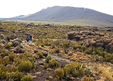
The Shira Plateau, located on the western side of Mount Kilimanjaro, is a remarkable high-altitude plateau that offers trekkers a unique perspective of Africa's tallest mountain. Situated at approximately 3,800 meters (12,500 feet) above sea level, it provides a less-trodden path for those seeking an alternative route to the summit. :contentReference[oaicite:0]{index=0} How to Reach the Shira Plateau Accessing the Shira Plateau typically involves starting from Moshi or Arusha, Tanzania. From there, climbers can reach the plateau via two primary routes: Lemosho Route: This route begins at the Londorossi Gate and ascends through the rainforest before reaching the plateau. It is known for its scenic beauty and gradual acclimatization profile. :contentReference[oaicite:1]{index=1} Shira Route: Starting at the Morum Barrier, this route begins directly on the plateau, bypassing the rainforest. While it offers a unique landscape, the higher starting altitude can increase the risk of altitude sickness. :contentReference[oaicite:2]{index=2} Both routes converge at Shira Camp 2, from where trekkers can continue their journey towards the summit via the Lemosho or Northern Circuit routes.:contentReference[oaicite:3]{index=3} Weather and Best Time to Visit The climate on the Shira Plateau is characterized by: Daytime temperatures: Typically around 10°C (50°F). Nighttime temperatures: Often dropping below 0°C (32°F). Precipitation: Annual rainfall ranges from 530 to 1,300 mm, with frequent cloud cover and mist. :contentReference[oaicite:4]{index=4} The optimal times to trek the Shira Plateau are during the dry seasons: January to March June to October These periods offer clearer skies and more stable weather conditions, enhancing the trekking experience.:contentReference[oaicite:5]{index=5} Why the Shira Plateau is Famous The Shira Plateau is renowned for several reasons: Unique Landscape: As a collapsed volcanic caldera, it offers a distinct terrain compared to other parts of Kilimanjaro. :contentReference[oaicite:6]{index=6} Scenic Beauty: The plateau provides panoramic views of Mount Kibo and diverse vegetation zones. Historical Significance: It is one of the oldest routes on Kilimanjaro, offering a glimpse into the mountain's geological history. :contentReference[oaicite:7]{index=7} Entry and Visit Details To trek the Shira Plateau, climbers must obtain permits from the Tanzania National Parks Authority (TANAPA). It's advisable to book through licensed tour operators who can arrange necessary permits, guides, and porters. The trek typically spans 6 to 8 days, depending on the chosen route and acclimatization schedule.:contentReference[oaicite:8]{index=8} History and Geology The Shira Plateau was formed approximately 500,000 years ago when an ancient volcanic caldera collapsed. Over time, lava and debris from subsequent eruptions filled the caldera, creating the plateau's current landscape. This geological history provides trekkers with a unique opportunity to walk through one of Kilimanjaro's earliest volcanic formations. :contentReference[oaicite:9]{index=9}:contentReference[oaicite:10]{index=10} Things to Do on the Shira Plateau While trekking the Shira Plateau, visitors can engage in various activities: Scenic Hiking: Explore the diverse landscapes, including heathlands, moorlands, and alpine meadows. Photography: Capture the breathtaking views of Mount Kibo and the surrounding terrain. Wildlife Observation: Though rare, sightings of wildlife such as monkeys and various bird species are possible. Stargazing: The high altitude and clear skies offer excellent opportunities for stargazing. Interesting Facts About the Shira Plateau It is one of the highest plateaus in the world, situated at an elevation of 3,800 meters (12,500 feet). The plateau's unique ecosystem supports various endemic plant species. Despite its proximity to Amboseli National Park in Kenya, wildlife sightings on the plateau are infrequent. :contentReference[oaicite:11]{index=11} Tips for Visiting the Shira Plateau Acclimatization: Given the high starting altitude, it's crucial to acclimatize properly to avoid altitude sickness. Proper Gear: Equip yourself with appropriate clothing and gear for cold temperatures and potential rain. Guides and Porters: Hiring experienced guides and porters enhances safety and enriches the trekking experience. Physical Preparation: Engage in regular physical training to prepare for the strenuous trek. Respect Nature: Follow Leave No Trace principles to preserve the pristine environment of the plateau. Embarking on a trek across the Shira Plateau offers a unique and rewarding experience for adventurers seeking to explore the diverse landscapes and rich history of Mount Kilimanjaro.
Explore More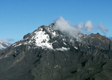
Mawenzi Peak, standing at 5,149 meters (16,893 feet), is the second-highest peak on Mount Kilimanjaro and one of the most striking features of the mountain. Unlike the more commonly trekked Kibo Peak, Mawenzi offers a challenging and scenic alternative for experienced climbers seeking adventure beyond the typical routes.:contentReference[oaicite:0]{index=0} How to Reach Mawenzi Peak Access to Mawenzi Peak is typically via the Machame or Umbwe routes, both of which approach the peak from the southern side of Kilimanjaro. These routes offer trekkers the opportunity to ascend through diverse ecosystems, from lush rainforests to alpine deserts. Climbers usually start their journey from Moshi or Arusha, Tanzania, and proceed to the respective trailheads.:contentReference[oaicite:1]{index=1} Weather and Best Time to Visit The weather on Mawenzi Peak can be unpredictable, with temperatures varying significantly based on altitude and time of year. During the dry season, from late June to October, climbers can expect clearer skies and more stable weather conditions, making it the most favorable time for trekking. In contrast, the wet season, from March to May, brings frequent rainfall, making trails slippery and conditions more challenging.:contentReference[oaicite:2]{index=2} Why Mawenzi Peak is Famous Mawenzi Peak is renowned for its rugged terrain and dramatic landscapes. The peak's jagged spires and volcanic rock formations create a striking contrast against the surrounding alpine desert. Climbing Mawenzi is considered more technical and demanding than ascending Kibo Peak, attracting experienced mountaineers seeking a more challenging and rewarding experience.:contentReference[oaicite:3]{index=3} Entry and Visit Details To trek Mawenzi Peak, climbers must obtain permits from the Tanzania National Parks Authority (TANAPA). It is advisable to book through licensed tour operators who can arrange necessary permits, guides, and porters. The trek typically spans 6 to 8 days, depending on the chosen route and acclimatization schedule.:contentReference[oaicite:4]{index=4} History and Architecture Mawenzi Peak is a remnant of Kilimanjaro's ancient volcanic activity. The peak was formed approximately 500,000 years ago when an ancient volcanic caldera collapsed. Over time, lava and debris from subsequent eruptions filled the caldera, creating the peak's current jagged appearance. This geological history provides trekkers with a unique opportunity to explore one of Kilimanjaro's earliest volcanic formations.:contentReference[oaicite:5]{index=5} Things to Do Around Mawenzi Peak Technical Climbing: For experienced mountaineers, Mawenzi offers challenging rock climbs and technical ascents. Scenic Hiking: Explore the diverse landscapes surrounding Mawenzi, including alpine deserts and volcanic terrains. Photography: Capture the dramatic landscapes and unique geological features of the area. Wildlife Observation: While wildlife sightings are rare at higher altitudes, trekkers may encounter various bird species and alpine flora. Interesting Facts About Mawenzi Peak Mawenzi is the third-highest peak in Africa, after Mount Kilimanjaro's Kibo Peak and Mount Kenya. The peak's jagged spires are a result of erosion and volcanic activity over millennia. Unlike Kibo, Mawenzi is not a dormant volcano and is considered technically challenging to ascend. Tips for Climbing Mawenzi Peak Acclimatization: Due to the high altitude, proper acclimatization is essential to prevent altitude sickness. Technical Gear: Climbers should be equipped with appropriate technical gear, including ropes, harnesses, and helmets. Guides and Porters: Hiring experienced guides and porters enhances safety and enriches the trekking experience. Physical Preparation: Engage in regular physical training to prepare for the strenuous trek. Weather Awareness: Be prepared for rapidly changing weather conditions, especially at higher altitudes. Embarking on a trek to Mawenzi Peak offers a unique and rewarding experience for adventurers seeking to explore the rugged beauty and geological history of Mount Kilimanjaro.:contentReference[oaicite:6]{index=6}
Explore More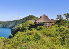
Chala Crater Lake, also known simply as Lake Chala, is a stunning volcanic crater lake located on the eastern edge of Mount Kilimanjaro, right on the border between Tanzania and Kenya. Known for its breathtaking turquoise-blue waters, steep crater walls, and peaceful surroundings, this lake offers a truly unique experience for travelers. It’s one of Tanzania’s lesser-known natural treasures, but it’s growing in popularity among eco-tourists, nature lovers, and photographers. How to Reach Chala Crater Lake, Kilimanjaro Lake Chala is located about 50 to 60 kilometers from Moshi town in northern Tanzania. The drive from Moshi takes around 1.5 to 2 hours and offers beautiful views of the countryside and, on clear days, Mount Kilimanjaro itself. To reach Lake Chala: From Moshi, take the road east toward Himo. At Himo Junction, turn right and continue toward Holili, which is close to the Tanzanian-Kenyan border. Look for signs pointing toward Lake Chala Safari Lodge and take the gravel road to the lake. Private vehicles, hired taxis, or tour operator services are the most reliable ways to get there. Public transportation doesn’t go all the way to the lake, so having your own transport or a pre-arranged guide is recommended. Weather at Chala Crater Lake The weather around Lake Chala is generally warm and pleasant year-round, although it can vary slightly due to its elevation (about 880 meters or 2,890 feet above sea level). The dry season runs from June to October and is the best time to visit. The rainy seasons are from March to May and November to December. Daytime temperatures range from 25°C to 30°C (77°F to 86°F), and evenings can be cooler, especially in the dry season. Visitors should bring light, breathable clothing and something warmer for the evenings. Timings for Visiting Lake Chala can be visited year-round. The lodge and surrounding area are open daily, usually from early morning (around 8:00 AM) until dusk. If you’re not staying overnight, it’s best to visit during daylight hours for safety and to enjoy all the activities. Why is Chala Crater Lake Famous? Lake Chala is famous for its striking natural beauty. The lake’s water changes color throughout the day, ranging from deep blue to turquoise to emerald green. This is due to mineral content and sunlight reflections. The lake is also known for its serene and untouched environment, making it ideal for peaceful getaways and nature photography. Another interesting feature is that the lake is fed by underground streams that originate from Mount Kilimanjaro’s glaciers. Despite being located in a volcanic crater, the water is fresh and incredibly clear. Entry and Visit Details Visitors must pay an entrance fee to access the Lake Chala area. This fee supports local conservation efforts and the maintenance of the area. Entrance Fee (as of latest information): Approx. $10 to $15 USD per person for day visitors. Accommodation: Lake Chala Safari Lodge offers a range of lodging options, including campsites, tents, and cottages. Meals and drinks are available at the lodge for an extra fee. History and Natural Formation Lake Chala was formed over three million years ago from a volcanic eruption and subsequent collapse of a magma chamber, which created the caldera. Over time, the crater filled with water from underground streams. The caldera walls surrounding the lake rise up to 100 meters high in some places, making it a natural amphitheater. Unlike other volcanic lakes, Lake Chala has no surface outlet, so its water level depends entirely on rainfall and underground inflow. Things to Do at Chala Crater Lake Swimming: The lake’s water is clean and refreshing, though it’s quite deep (up to 90 meters), so caution is advised. Kayaking: The lodge rents out kayaks for a peaceful paddle around the lake. Hiking: You can take guided hikes around the crater rim for stunning panoramic views. Birdwatching: Lake Chala is home to over 200 bird species, including African fish eagles and kingfishers. Camping: For the adventurous, overnight camping is a great way to experience the area’s tranquility. Interesting Facts About Lake Chala It is one of the deepest inland water bodies in East Africa. The lake is about 3 kilometers wide and 2.5 kilometers long. Although near the Kenya border, the lake is mainly accessed from the Tanzanian side. It is believed to be home to a rare species of freshwater fish found only in this lake. Tips for Visiting Chala Crater Lake Bring drinking water, sunscreen, and insect repellent. Wear sturdy shoes if planning to hike around the crater. Don’t swim alone, as the lake is deep and there are no lifeguards. If staying overnight, book your accommodation in advance, especially in high season. Respect the natural environment—do not litter or disturb wildlife. Chala Crater Lake offers a unique and peaceful escape, perfect for those who want to combine relaxation with a bit of adventure. Its natural beauty, biodiversity, and relative seclusion make it one of Kilimanjaro’s best-kept secrets.
Explore More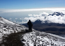
Uhuru Peak is the highest point on Mount Kilimanjaro and the tallest summit on the African continent, standing at an elevation of 5,895 meters (19,341 feet). Located on the Kibo cone of Kilimanjaro's three volcanic peaks, Uhuru Peak is not only a geographical landmark but also a symbolic one. The name "Uhuru" means "freedom" in Swahili, and the peak was named in honor of Tanzania's independence. Climbing to Uhuru Peak is a dream for many adventurers around the world, and it offers a once-in-a-lifetime experience that combines physical challenge, natural beauty, and cultural significance. How to Reach Uhuru Peak, Kilimanjaro Reaching Uhuru Peak requires a multi-day trek through Kilimanjaro National Park. You cannot simply drive to the summit—you must hike through one of several established routes. These include: Marangu Route: Known as the “Coca-Cola” route, it’s the only path with hut accommodations and is considered one of the easier options, though it has a lower summit success rate due to a shorter acclimatization period. Machame Route: Often called the “Whiskey” route, it’s more scenic and challenging than Marangu. It has a higher success rate due to better altitude acclimatization. Lemosho Route: This is one of the longest and most beautiful routes, offering great views and a high success rate. Rongai Route: Approaches from the northern side of the mountain, offering a quieter and drier path. Umbwe Route: Very steep and direct; recommended only for experienced climbers. Treks typically last from 5 to 9 days, depending on the route and pace. All climbs require a licensed guide and are usually arranged through certified tour operators. Weather at Uhuru Peak Mount Kilimanjaro’s climate varies dramatically due to its elevation. You’ll experience everything from tropical forests at the base to arctic conditions at the summit. At Uhuru Peak, temperatures can drop below -20°C (-4°F), especially during the night and early morning. Snow and strong winds are common. The best months for climbing are January to March and June to October, when the weather is drier and more stable. Timing and Best Season to Visit The best time to attempt the summit is during the dry seasons: January to March: Warmer with fewer climbers, though occasional snow at the summit is possible. June to October: Cooler and drier, and the most popular time for climbs due to clear skies and good trail conditions. Avoid climbing during the long rains (April and May) and short rains (November) when trails can be muddy and dangerous. Why Uhuru Peak is Famous Uhuru Peak is famous not just because it is the highest point in Africa, but also for its accessibility compared to other continental peaks. It is part of the Seven Summits—the highest peaks on each continent—making it a goal for climbers worldwide. What sets Kilimanjaro apart is that it is a non-technical climb, meaning no ropes or climbing gear are needed for the standard routes, making it achievable for many people with good fitness and determination. Entry and Visit Details To visit Uhuru Peak, you must enter through Kilimanjaro National Park, which has designated entry gates such as Marangu Gate and Machame Gate. Entry fees, conservation fees, and camping/hut fees are required. Most of these are bundled into your tour package. Independent climbing is not allowed; all climbers must be accompanied by a registered guide. Most trekking companies provide porters, guides, cooks, and all necessary equipment. History and Geography Mount Kilimanjaro was formed over a million years ago from volcanic activity and consists of three cones: Kibo (where Uhuru Peak is located), Mawenzi, and Shira. Kibo is a dormant volcano, with Uhuru Peak sitting on its crater rim. The first recorded ascent of Uhuru Peak was made by Hans Meyer and Ludwig Purtscheller in 1889. Things to Do at Uhuru Peak While the main goal is reaching the summit, the journey offers plenty of memorable experiences: Sunrise at the Summit: Most climbers reach Uhuru Peak at dawn to watch the sunrise over the African plains—an unforgettable sight. Photography: Take photos at the iconic signpost marking the highest point in Africa. Explore Glaciers: Witness the last remaining glaciers of Kilimanjaro, though they are receding due to climate change. Celebrate Your Achievement: Many climbers bring flags or special memorabilia to mark their accomplishment. Interesting Facts Uhuru Peak is part of the Kilimanjaro National Park, a UNESCO World Heritage Site. It is one of the only places in the world where you can walk from tropical forest to arctic conditions in just a few days. Over 30,000 people attempt the climb annually, with about two-thirds making it to the summit. The summit sign has become an iconic photo spot, reading: “Congratulations! You are now at Uhuru Peak, Tanzania, 5,895 M. AMSL. Africa's Highest Point. World’s Highest Free-Standing Mountain.” Tips for Climbing Uhuru Peak Train in advance. Cardio, hiking, and strength training will help prepare you. Acclimatize properly. Choose a longer route if possible to reduce the risk of altitude sickness. Pack wisely. Bring layers, waterproof gear, and good hiking boots. Stay hydrated and eat well during the trek. Listen to your guides and take rest days seriously. Mentally prepare for summit night—it’s the hardest part, but the most rewarding. Climbing to Uhuru Peak is more than just a hike—it's a personal challenge and a journey through some of the most stunning landscapes in the world. Whether you're chasing a bucket list goal or simply seeking adventure, Uhuru Peak delivers an unforgettable experience.
Explore More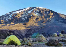
Mount Kilimanjaro is one of the most iconic and highest mountains in the world, standing tall at 5,895 meters (19,341 feet) above sea level. Located in Tanzania, near the town of Moshi, Kilimanjaro is the highest peak in Africa. This majestic mountain attracts adventurers, hikers, and nature enthusiasts from all corners of the globe. The mountain is renowned for its stunning beauty, diverse ecosystems, and as a symbol of the natural wonders of Africa. How to Reach Mount Kilimanjaro, Moshi To reach Mount Kilimanjaro, the nearest town is Moshi, located in the northeastern region of Tanzania. The easiest way to get to Moshi is by flying into Kilimanjaro International Airport (JRO), which is about a 45-minute drive from Moshi. Several international airlines operate flights to Kilimanjaro, and connecting flights are available from major cities like Dar es Salaam, Nairobi, and Addis Ababa. From Moshi, you can easily access the various starting points for climbing Mount Kilimanjaro, such as the Marangu, Machame, Lemosho, and Rongai routes. These routes begin from different points and offer unique experiences depending on the level of difficulty and the type of terrain you wish to explore. Weather on Mount Kilimanjaro, Moshi The weather on Mount Kilimanjaro can vary dramatically depending on the altitude. The climate at the base of the mountain, in Moshi, is tropical, with warm temperatures ranging from 20°C to 30°C (68°F to 86°F). However, as you ascend the mountain, the temperature drops significantly. The lower slopes are covered with lush forests, while the higher altitudes feature alpine desert and eventually the icy summit. The best time to visit is during the dry season, from late June to October and from late December to March. These months provide the clearest skies and the most favorable conditions for hiking and climbing. However, it is important to be prepared for sudden weather changes, especially if you are planning to summit the mountain. Timing to Visit Mount Kilimanjaro, Moshi Mount Kilimanjaro can be visited year-round, but the ideal time to climb depends on the weather and your preferences. As mentioned earlier, the dry seasons from June to October and December to March offer the best conditions for climbing. If you prefer fewer crowds and don't mind cooler temperatures, visiting during the shoulder seasons (April to May and November) might be ideal, though there may be occasional rainfall. Why is Mount Kilimanjaro Famous? Mount Kilimanjaro is famous for several reasons. It is the highest mountain in Africa, making it a bucket-list destination for adventurers and mountaineers. Kilimanjaro is a dormant volcano that is not only a physical challenge but also a cultural and natural wonder. It is the only place in the world where you can experience tropical forests, alpine deserts, and glaciers all on one mountain. The mountain's appeal goes beyond just its altitude. It is also home to a wide range of unique plant and animal species, some of which are found nowhere else on Earth. The famous "Kilimanjaro glaciers," although shrinking due to climate change, still remain a breathtaking sight. The views from the summit offer panoramic vistas that attract both climbers and photographers alike. Entry and Visit Details about Mount Kilimanjaro, Moshi To visit Mount Kilimanjaro, you need to obtain a climbing permit, which can be arranged through a registered tour operator. It is important to note that independent climbs are not permitted; all climbers must be accompanied by a licensed guide. The cost of the permit includes the park fees, guides, porters, and other necessary services, such as camping equipment if needed. Before beginning your climb, it is recommended to do physical preparation, as the hike can be strenuous, especially as you ascend to higher altitudes. There are different routes available, each with varying degrees of difficulty, duration, and scenic views. The most popular routes are Machame and Marangu, with Machame considered more scenic but also more challenging. History and Architecture of Mount Kilimanjaro The history of Mount Kilimanjaro is not just about its physical presence but also its cultural significance. The mountain is sacred to many of the local Tanzanian tribes, including the Chaga people, who live on its lower slopes. For centuries, Mount Kilimanjaro has been a symbol of strength and reverence. Early explorers like Hans Meyer and Ludwig Purtscheller were among the first to summit Kilimanjaro in the late 19th century, making the mountain an international landmark. Regarding architecture, while Kilimanjaro itself is a natural marvel, there are several facilities on the lower slopes, such as huts and camps, built to accommodate climbers. The Marangu route, for example, has several huts along the way, making it the only route on the mountain where climbers do not need to camp outdoors. Things to Do in Mount Kilimanjaro, Moshi While the primary activity on Mount Kilimanjaro is climbing, there are other things to do in and around Moshi. Here are a few highlights: Climbing Mount Kilimanjaro: The main attraction is, of course, climbing the mountain. There are multiple routes, catering to different levels of experience and fitness. Visit the Chagga Caves: Learn about the history and culture of the Chagga people who live at the foot of Kilimanjaro. These caves were used by the Chagga for protection against invaders. Waterfalls in Moshi: Visit the beautiful Materuni and Kikuletwa Hot Springs for a refreshing dip or a scenic hike. Cultural Tours: Explore the vibrant town of Moshi, visit local markets, and experience the daily life of Tanzanian people. Interesting Facts about Mount Kilimanjaro Mount Kilimanjaro is the tallest free-standing mountain in the world. It is made up of three volcanic cones: Kibo, Mawenzi, and Shira. Despite its proximity to the equator, the summit is covered with glaciers and snow. Over 30,000 people attempt to climb Kilimanjaro every year, with a success rate of around 66% for those who complete the climb. The mountain is home to over 1,000 plant species and around 140 different species of mammals. Tips for Climbing Mount Kilimanjaro Acclimatize: The altitude can be challenging, so take your time and make sure to acclimatize properly to avoid altitude sickness. Choose the Right Route: Choose a route that matches your fitness level and the kind of experience you want. Pack Smart: Bring warm clothes for the summit, as temperatures can drop below freezing. Don't forget sunscreen and sunglasses to protect against the sun. Stay Hydrated: It’s easy to become dehydrated while climbing, so drink plenty of water throughout your hike. Respect Local Culture: Learn a little about the traditions and customs of the Chagga people and show respect during your visit.
Explore More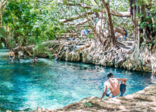
Chemka Hot Springs, also known as Kikuletwa Hot Springs, is one of the most beautiful and relaxing places to visit near Moshi, Tanzania. Despite the name "hot springs", the water here is actually more warm than hot, making it perfect for swimming and relaxing. Located in the middle of a dry landscape, the springs are like an oasis with clear turquoise water, big trees providing shade, and soft sand at the bottom of the pool. This hidden gem is popular with both locals and tourists who are looking for a peaceful getaway, a fun swimming spot, and a place to enjoy nature. It is an excellent stop for anyone visiting the Kilimanjaro region. How to Reach Chemka Hot Springs, Moshi Chemka Hot Springs is located about 35-40 kilometers (around 1.5 hours drive) from Moshi town. The springs are situated between Moshi and Arusha, near a village called Rundugai. The journey involves a mix of paved roads and bumpy dirt tracks, especially towards the end. You can reach the springs by hiring a taxi, joining a local tour, or driving yourself if you have a rental car. Many tour companies in Moshi offer day trips that include transportation, entrance fees, and sometimes a picnic lunch. If you’re adventurous, you can even rent a bicycle or motorbike, although the ride may be rough in some parts. Weather at Chemka Hot Springs, Moshi The weather at Chemka Hot Springs is generally warm and sunny throughout the year. Temperatures usually range from 25°C to 35°C (77°F to 95°F), making it ideal for swimming almost any time. The area is part of a semi-arid zone, so there’s a lot of sunshine and only occasional rain. The rainy seasons are from March to May and in November, but even during these times, the hot springs are still accessible and enjoyable. The surrounding area can get muddy during rains, so it’s best to check weather conditions if you're visiting during the wet months. Best Time to Visit Chemka Hot Springs, Moshi You can visit Chemka Hot Springs any time of the year, but the best time is during the dry season, from June to October and again from December to February. These months have the most sunshine and the easiest road access. Most people visit the springs during the day, between 10:00 AM and 4:00 PM. Weekdays are usually less crowded, while weekends and public holidays can be quite busy. If you prefer a quieter experience, go early in the morning or later in the afternoon. Why is Chemka Hot Springs, Moshi Famous? Chemka Hot Springs is famous for its crystal-clear water, relaxing atmosphere, and beautiful natural surroundings. The name “Chemka” means “boiling” in Swahili, because the water seems to bubble up from underground, although it's not actually hot. The springs are fed by underground geothermal activity, which keeps the water warm and clean. The place is also known for being one of the best natural swimming spots in northern Tanzania. Tourists love jumping from the trees into the water, swinging on ropes like Tarzan, and floating in the warm springs. It’s also a great place to take photos, have a picnic, or simply unwind in nature. Entry and Visit Details about Chemka Hot Springs, Moshi To enter Chemka Hot Springs, visitors usually pay an entrance fee of about $10 to $15 USD per person. This may vary slightly depending on whether you go with a tour group or on your own. Most tours include transportation, a guide, and sometimes lunch or snacks. There are basic facilities at the springs, including changing rooms, toilets, and local stalls where you can buy drinks or snacks. However, it’s a good idea to bring your own food, water, sunscreen, and swimwear. The area is safe, and local guides are friendly and helpful. History and Natural Formation of Chemka Hot Springs Unlike historical buildings or sites, Chemka Hot Springs is a natural attraction. The water comes from underground geothermal sources that are heated and pushed to the surface, creating a steady flow of clean, warm water. Geologists believe that the water starts its journey on the slopes of Mount Kilimanjaro and filters through layers of volcanic rock before rising again in the Chemka area. The filtering process through the earth’s rocks naturally purifies the water, making it clear and refreshing. The area around the springs has been used by local communities for generations. In recent years, it has become more popular with tourists, and local people have built simple facilities to accommodate visitors. Things to Do at Chemka Hot Springs, Moshi Swimming: Enjoy the warm, clean water in the natural pool. It’s deep in some areas, so you can even dive in. Rope Swing: Have fun using the rope swing to jump into the water—it's one of the most exciting parts of the visit. Picnic: Bring your own lunch and enjoy a picnic under the shade of the trees. Relaxing: Simply float in the calm waters and soak in the peaceful atmosphere. Photography: Take stunning photos of the turquoise water, the trees, and the scenic surroundings. Interesting Facts about Chemka Hot Springs Chemka is one of the only warm spring systems in Tanzania with crystal-clear water year-round. The water in the springs is so clean that you can see the bottom clearly, even in deep sections. Despite its remote location, Chemka Hot Springs attracts thousands of tourists each year. The pool is formed naturally and has not been changed or altered by construction. Local guides often tell stories and legends about the magical properties of the springs. Tips for Visiting Chemka Hot Springs, Moshi Bring swimwear and a towel: You’ll want to swim, so don’t forget to pack these items. Wear comfortable clothes: It can be hot and dusty on the journey, so dress accordingly. Bring cash: Some small vendors sell drinks and snacks, but they usually don't accept cards. Use sunscreen and insect repellent: There can be mosquitoes, and the sun can be strong. Go early: Avoid crowds by arriving early in the day, especially on weekends.
Explore More