
- Home
- Travel Packages
- Top Destination
-
Travel Attraction
By Category
Top Attraction

- Travel Agents
- Car Rentals
- Hotels
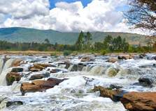
About the Ruaka Falls Ruaka Falls, situated near Nairobi, Kenya, is a hidden gem that offers a refreshing escape from the bustling city life. Nestled within the lush greenery of the Kiambu County, these falls present a serene and picturesque environment, making them a perfect spot for nature enthusiasts, hikers, and photographers. The falls are formed by the Ruaka River, which cascades down a rocky cliff, creating a beautiful and soothing spectacle. The surrounding area is rich with indigenous flora and fauna, enhancing the natural beauty and tranquility of the location. The Ruaka Falls are not just about the cascading waters but also the entire experience of being immersed in nature. The cool, misty air around the falls, the sound of the rushing water, and the scenic views make it a perfect place for a relaxing day trip. It’s a great spot for picnics, short hikes, and nature walks, providing an ideal setting for both adventure and relaxation. Despite being relatively lesser-known compared to other tourist attractions in Kenya, Ruaka Falls offers an authentic and unspoiled natural experience. History of Ruaka Falls The history of Ruaka Falls is intertwined with the local communities and their interaction with the natural landscape. Historically, the falls have been part of the cultural and social life of the local Kikuyu people, who have lived in the region for centuries. The name "Ruaka" itself is derived from the Kikuyu word "Rwaka," which means "place of ample water." The river and the falls have been crucial for the local agriculture and daily water needs of the surrounding villages. In colonial times, the area around Ruaka Falls was part of the broader coffee and tea plantations established by European settlers. The falls and the river played a significant role in the irrigation and maintenance of these plantations. Over time, as Nairobi expanded and urbanized, Ruaka Falls became more accessible to the city dwellers, evolving into a recreational spot. In recent years, efforts have been made to promote Ruaka Falls as a tourist destination. Local authorities and conservation groups have worked to preserve the natural environment around the falls while improving infrastructure to accommodate visitors. These efforts aim to balance ecological preservation with tourism, ensuring that the beauty and ecological significance of Ruaka Falls are maintained for future generations. Time to Visit The best time to visit Ruaka Falls is during the rainy seasons, which occur from March to May and from October to December. During these periods, the falls are at their most spectacular, with the river flowing robustly and the surrounding vegetation in full bloom. The lush greenery and the powerful cascade of water create an enchanting scene, perfect for photography and nature walks. However, visiting during the dry seasons, from June to September and January to February, also has its advantages. The weather is generally more predictable and conducive to outdoor activities such as hiking and picnicking. Regardless of the season, it is advisable to check the weather forecast before planning your trip to ensure the best experience. Entry Fee As of the latest updates, there is no formal entry fee to visit Ruaka Falls. The area is relatively undeveloped in terms of commercial tourism infrastructure, and access is generally free. However, visitors are encouraged to contribute to local conservation efforts or community initiatives that help maintain the site and support the local economy. It’s always a good idea to carry some cash in case there are any small fees or contributions required on-site. Time Required for Travel The time required to travel to Ruaka Falls largely depends on your starting point. From Nairobi, the falls are approximately 15 kilometers away, making it a short drive of about 30 to 45 minutes under normal traffic conditions. However, during peak hours or weekends, the travel time may extend slightly due to traffic congestion. For those relying on public transportation, matatus (shared minibuses) and boda-bodas (motorcycle taxis) are available from various points in Nairobi, offering an affordable and accessible means to reach the falls. The entire journey, including the time spent waiting for transportation, can take around one to one and a half hours. Traveling Tips 1.Wear Comfortable Clothing: Since the area around Ruaka Falls involves some walking and possibly hiking, it’s best to wear comfortable, weather-appropriate clothing and sturdy shoes. Waterproof shoes can be particularly useful if you plan to explore near the water. 2.Carry Essentials: Bring along essentials such as water, snacks, sunscreen, and insect repellent. While the falls are a great place for a picnic, there may not be any vendors or shops nearby. 3.Stay Safe: Be cautious around the waterfall area, especially if you plan to climb rocks or venture close to the water. The rocks can be slippery, and it’s important to prioritize safety. 4.Respect the Environment: Help preserve the natural beauty of Ruaka Falls by not littering and respecting the local flora and fauna. If there are designated paths, stick to them to minimize environmental impact. 5.Travel in Groups: If possible, travel with a group or a local guide. This not only enhances safety but also makes the experience more enjoyable and informative. 5.Check Local Conditions: Before heading out, check the current conditions and any advisories that might affect your visit. Local weather patterns and temporary closures can impact your plans. 6.Support Local Communities: Consider supporting local businesses and initiatives around the falls. This could include buying local crafts, donating to conservation efforts, or using local guides. This not only enhances your experience but also contributes to the sustainability of the area.
Explore More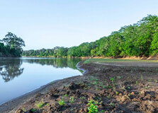
About The Tana River The Tana River is the longest river in Kenya, stretching approximately 1,014 kilometers (630 miles) from its source in the Aberdare Mountains to its mouth in the Indian Ocean. This river is a vital water source for the regions it traverses, providing irrigation for agriculture, supporting wildlife, and generating hydroelectric power. The Tana River basin is an ecological hotspot, home to diverse ecosystems, including forests, wetlands, and savannas. These ecosystems support a wide range of flora and fauna, making the Tana River a significant site for biodiversity. The river's journey begins in the central highlands of Kenya, flowing southeast towards the Indian Ocean. Along its path, it passes through several key regions, including the Tana River County, which is named after it. The Tana River is particularly known for its seasonal flooding, which replenishes the floodplains and supports traditional farming practices. This natural cycle of flooding and receding has shaped the livelihoods and cultures of the communities living along its banks for centuries. History of Tana River The Tana River has a rich history that is deeply intertwined with the development of Kenya. Archaeological evidence suggests that human settlements along the Tana River date back thousands of years. Early communities relied on the river for fishing, agriculture, and transportation. The fertile floodplains of the Tana River provided ideal conditions for the cultivation of crops, supporting the growth of ancient civilizations. During the colonial period, the Tana River played a crucial role in the economic development of Kenya. The British colonial administration recognized the potential of the river for irrigation and hydroelectric power generation. In the mid-20th century, several large-scale projects were initiated to harness the river's resources. The construction of dams, such as the Seven Forks Hydro Stations, significantly boosted Kenya's electricity production and irrigation capacity. In recent history, the Tana River has been the focus of various development and conservation efforts. The river basin faces challenges such as deforestation, pollution, and climate change, which threaten its ecological balance. Numerous initiatives have been launched to address these issues, including community-based conservation programs and sustainable development projects aimed at preserving the river's natural resources for future generations. Time To Visit The best time to visit the Tana River is during the dry seasons, which occur from January to March and July to October. During these periods, the weather is more favorable for outdoor activities, and the risk of flooding is minimal. The dry seasons offer the best opportunities for wildlife viewing, bird watching, and exploring the river's diverse landscapes. Entry Fee There is no standardized entry fee for visiting the Tana River itself, as it flows through various regions and is accessible at different points. However, specific attractions along the river, such as national parks, reserves, and private conservancies, may charge entry fees. For example, visiting the Tana River Primate Reserve or the Kora National Park, both of which are located along the river, would require paying an entry fee. These fees vary depending on the park or reserve and the visitor's residency status (local or international). Time Required For Travel The time required to explore the Tana River depends on the activities and destinations planned along its course. A typical visit to the Tana River could range from a one-day trip to several days. For instance, a day trip might include visiting a specific section of the river, engaging in activities like bird watching or boating, and enjoying a picnic along the riverbanks. For a more comprehensive experience, including visits to multiple sites such as the Seven Forks Hydro Stations, Tana River Primate Reserve, and various cultural sites, a multi-day itinerary would be necessary. This allows travelers to fully appreciate the river's natural beauty, historical significance, and the lifestyle of communities living along its banks. Traveling Tips Plan Ahead: Research and plan your itinerary in advance, including the specific sites you want to visit along the Tana River. This will help you make the most of your trip and ensure you don't miss any key attractions. Check Weather Conditions: Since the Tana River is prone to seasonal flooding, it's essential to check the weather forecast and river conditions before your visit. Avoid traveling during the rainy season to minimize the risk of encountering floods. Hire a Local Guide: Engaging a local guide can enhance your experience by providing valuable insights into the river's history, ecology, and cultural significance. Guides can also help navigate the best routes and ensure a safe journey. Respect Local Communities: The Tana River passes through areas inhabited by various ethnic communities. Show respect for their traditions and practices, and seek permission before taking photographs of people or their property. Stay Hydrated and Protected: Carry sufficient water, wear sunscreen, and dress appropriately for the weather. The sun can be intense, especially during the dry seasons, so take precautions to stay hydrated and protected from sunburn. Conservation Awareness: Be mindful of the environment and support conservation efforts by not littering and following the guidelines provided by parks and reserves. Sustainable tourism helps preserve the river's natural beauty and biodiversity. Safety Precautions: Ensure your safety by following local advice and regulations. If you plan to engage in water-based activities, such as boating or fishing, use appropriate safety gear and follow guidelines to avoid accidents.
Explore More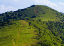
About The Ngong Hills The Ngong Hills are a range of mountains located southwest of Nairobi, the capital city of Kenya. These picturesque hills are part of the Great Rift Valley, which stretches across eastern Africa. The name "Ngong" is derived from the Maasai word "enkong'u," meaning "knuckles," aptly describing the knuckle-like peaks of the ridge. The hills stand at an elevation of about 2,460 meters (8,070 feet) at their highest point, offering breathtaking panoramic views of Nairobi and the Great Rift Valley. The Ngong Hills are not only known for their scenic beauty but also for their rich biodiversity. The hills are covered with a mix of grasslands and forests, providing a habitat for various wildlife species, including buffaloes, gazelles, and numerous bird species. The area is also popular among hikers, picnickers, and nature enthusiasts who are drawn to the serene environment and the opportunity to explore the trails that wind through the hills. The cool climate and the fresh mountain air make the Ngong Hills a perfect escape from the hustle and bustle of city life. History of Ngong Hills The Ngong Hills hold significant historical and cultural value. The hills were historically inhabited by the Maasai people, a semi-nomadic ethnic group known for their distinct culture and traditions. The Maasai used the area for grazing their cattle, and it remains an important cultural landscape for them. During the early 20th century, the Ngong Hills became famous as part of the backdrop for the film "Out of Africa," which was based on the autobiographical book by Karen Blixen. The film and the book highlighted the beauty of the hills and brought international attention to the region. The hills also have historical significance from the colonial period. During World War I, the British built a fort on one of the peaks to protect the railway from possible German attacks. The remains of the fort can still be seen today and serve as a reminder of the area's strategic importance during the war. Time to Visit The best time to visit the Ngong Hills is during the dry season, which typically runs from June to October and again from December to March. During these months, the weather is generally sunny and dry, making it ideal for hiking and outdoor activities. The trails are less likely to be muddy, and the visibility is excellent, offering clear views of the surrounding landscapes. The early morning and late afternoon are the best times of day to visit, as the temperatures are cooler and the lighting is perfect for photography. Additionally, visiting during these times allows you to avoid the midday heat, which can be quite intense even at higher altitudes. Entry Fee As of the latest updates, there is an entry fee to access the Ngong Hills. The fee is usually around 200 Kenyan Shillings (approximately 2 USD) for Kenyan citizens and residents, and 600 Kenyan Shillings (approximately 6 USD) for non-residents. These fees are subject to change, so it's advisable to check the latest rates before planning your visit. The entry fee contributes to the maintenance and conservation of the area, ensuring that the natural beauty and biodiversity of the Ngong Hills are preserved for future generations. Time Required for Travel The time required to explore the Ngong Hills largely depends on your itinerary and fitness level. A typical hike along the main ridge can take between 4 to 5 hours. This includes time for breaks and to enjoy the views. The main trail, known as the Ngong Hills Hiking Trail, covers approximately 11 kilometers (7 miles) and traverses the seven peaks of the ridge. If you plan to hike from the Ngong town side to Kona Baridi, it can take around 5 to 6 hours. This route is longer but offers a more comprehensive experience of the hills. For those not interested in hiking, a shorter visit to enjoy the views and a picnic can be completed in 2 to 3 hours. Traveling Tips 1.Wear Appropriate Gear: Comfortable hiking shoes with good grip are essential due to the rocky and uneven terrain. Dress in layers to accommodate the varying temperatures, and bring a hat and sunglasses to protect against the sun. 2.Stay Hydrated: Carry plenty of water, as there are no reliable water sources along the trails. It's also a good idea to bring some snacks or a packed lunch. 3.Safety First: The weather can change rapidly in the hills, so be prepared for sudden rain or cold. It's advisable to hike in groups and inform someone of your plans before heading out. A local guide can enhance your experience and ensure safety. 4.Respect The Environment: Keep the trails clean by carrying out all your trash. Avoid disturbing the wildlife and stick to designated paths to prevent erosion. 5.Entry Requirements: Bring a valid identification card or passport for entry verification. Check the current entry fees and any other requirements before your visit. 6.Start Early: Begin your hike early in the morning to take advantage of the cooler temperatures and avoid the afternoon heat. 7.Navigation: While the trails are well-marked, carrying a map or using a GPS-enabled device can be helpful.
Explore More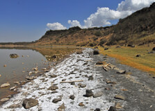
Lake Nakuru Lake Elementaita About The Lake Nakuru Lake Elementaita Lake Nakuru and Lake Elementaita, situated in the Great Rift Valley of Kenya, are two stunning freshwater lakes known for their scenic beauty, abundant wildlife, and diverse birdlife. Lake Nakuru, located within Nakuru County, is renowned for its vast flocks of flamingos that blanket the shoreline, creating a mesmerizing pink hue against the backdrop of the surrounding savannah and acacia woodlands. Lake Elementaita, located a short distance north of Lake Nakuru, offers a more tranquil setting, with its serene waters and picturesque landscapes providing a haven for birdwatchers, nature enthusiasts, and photographers alike. Together, these two lakes form part of the Lake Nakuru National Park and the Soysambu Conservancy, both of which are important conservation areas that protect and preserve Kenya's rich biodiversity and natural heritage. History of Lake Nakuru Lake Elementaita Lake Nakuru and Lake Elementaita have long been revered by the indigenous communities of the Rift Valley, who consider them sacred sites imbued with spiritual significance. Over the centuries, these lakes have provided sustenance and shelter to countless generations of people and wildlife, serving as vital sources of water, food, and livelihoods. In the early 20th century, British colonialists recognized the ecological importance of the lakes and designated them as protected areas, laying the foundation for their eventual establishment as national parks and conservation reserves. Today, Lake Nakuru and Lake Elementaita continue to attract visitors from around the world, drawn by their natural beauty, biodiversity, and cultural heritage. Time to Visit The best time to visit Lake Nakuru and Lake Elementaita is during the dry season, from June to September, when the weather is mild and the wildlife is most active. This is also the peak season for birdwatching, as thousands of flamingos flock to Lake Nakuru to feed on the algae-rich waters. However, the lakes are worth visiting year-round, each season offering its own unique attractions and experiences. Visitors should be aware that the rainy season, from March to May and from October to December, may result in muddy roads and limited wildlife sightings, but also brings lush vegetation and fewer crowds. Entry Fee Entry fees for Lake Nakuru National Park and Soysambu Conservancy vary depending on nationality, age, and type of vehicle. Visitors are advised to check the official websites or contact park authorities for up-to-date information on entry fees and any additional charges for activities such as guided tours, camping, or boat rides. It's also recommended to carry cash in local currency to pay for park fees, as credit card facilities may not be available at the entry gates. Time Required for Travel Traveling to Lake Nakuru and Lake Elementaita from Nairobi typically takes around 2 to 3 hours by road, depending on traffic conditions and the route taken. Visitors can choose to drive themselves or book guided tours that include transportation and park entry fees. Once at the lakes, plan to spend at least a full day exploring the area and enjoying activities such as game drives, birdwatching, nature walks, and picnics. Those with more time may opt to stay overnight at one of the lodges or campsites near the lakeshores, allowing for a more immersive experience amidst the natural beauty and tranquility of the Rift Valley. Traveling Tips Before embarking on a trip to Lake Nakuru and Lake Elementaita, it's advisable to check the weather forecast and pack accordingly, including sunscreen, hats, sunglasses, and lightweight clothing. Bring along plenty of drinking water and snacks for the journey, as well as binoculars and cameras to capture the breathtaking landscapes and wildlife sightings. Respect the rules and regulations of the national parks and conservancies, including speed limits, wildlife viewing etiquette, and waste disposal guidelines. Lastly, be prepared for bumpy roads and occasional wildlife crossings while driving within the parks, and exercise caution to ensure a safe and enjoyable experience for yourself and other visitors.
Explore More
Uhuru Park About The Uhuru Park Uhuru Park, nestled in the heart of Nairobi, Kenya, is a sprawling urban oasis that offers respite from the hustle and bustle of city life. Spanning over 120 acres, this lush green space serves as a sanctuary for relaxation, recreation, and cultural events, attracting visitors from all walks of life. From serene lakes and verdant lawns to scenic walking paths and iconic landmarks, Uhuru Park provides a tranquil escape where locals and tourists alike can unwind, connect with nature, and enjoy breathtaking views of the city skyline. History of Uhuru Park Established in 1969, Uhuru Park holds significant historical and cultural significance for the people of Kenya. Originally known as "Central Park," the park was renamed "Uhuru," meaning "freedom" in Swahili, to commemorate Kenya's independence from British colonial rule in 1963. Over the years, Uhuru Park has served as a venue for political rallies, public demonstrations, and cultural celebrations, playing a central role in the country's democratic struggles and social movements. Time to Visit Uhuru Park is open to visitors year-round, providing a welcome retreat from the urban hustle and bustle. The park's expansive grounds and diverse attractions make it an ideal destination for picnics, leisurely strolls, and outdoor activities. While the park is busiest on weekends and during public holidays, visitors can enjoy a quieter experience on weekdays, when the park is less crowded. The park's hours of operation typically vary depending on the season and any scheduled events, so it's advisable to check the park's official website or contact the authorities for updated information before planning your visit. Entry Fee Entry to Uhuru Park is free of charge, making it accessible to all visitors. Whether you're looking to relax by the lake, take a leisurely stroll through the gardens, or simply enjoy the scenic views, Uhuru Park welcomes everyone to enjoy its natural beauty and tranquil ambiance without any financial barrier. However, visitors may need to pay a nominal fee for certain activities or amenities within the park, such as boat rides on the lake or guided tours. Time Required for Travel Traveling to Uhuru Park is convenient, as it is centrally located in Nairobi's city center. The park is easily accessible by car, taxi, or public transportation, with designated parking areas available for those driving. The travel time may vary depending on your starting point within Nairobi, but most visitors can reach the park within 30 to 45 minutes. Once there, plan to spend at least a couple of hours exploring the park's various attractions and enjoying its serene surroundings, although you may choose to extend your visit for a full day of relaxation and recreation. Traveling Tips Before visiting Uhuru Park, it's advisable to pack sunscreen, a hat, and plenty of drinking water to stay hydrated, especially on hot and sunny days. Wear comfortable clothing and footwear suitable for walking, as the park's terrain may be uneven in some areas. Consider bringing along a picnic blanket and some snacks to enjoy a leisurely meal amidst the park's scenic beauty. Lastly, be mindful of the park's rules and regulations, such as avoiding littering and respecting the natural environment and wildlife, to ensure a pleasant experience for yourself and other visitors.
Explore More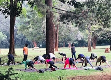
Nairobi Arboretum About The Nairobi Arboretum The Nairobi Arboretum, situated in the heart of Nairobi, Kenya, is a tranquil haven for nature lovers and outdoor enthusiasts. Spanning approximately 30 hectares, this botanical garden is home to a diverse collection of indigenous and exotic tree species, making it a valuable resource for conservation, education, and recreation. With its lush greenery, winding paths, and serene ambiance, the Nairobi Arboretum provides a peaceful retreat where visitors can escape the hustle and bustle of city life and immerse themselves in the beauty of nature. Nairobi Arboretum Established in 1907, the Nairobi Arboretum was originally intended for research and experimentation with tree species suitable for Kenya's climate and soil conditions. Over the years, it has evolved into a popular recreational destination and educational resource for both locals and tourists. Today, the arboretum features over 300 tree species, including indigenous varieties such as acacias, figs, and crotons, as well as exotic species from around the world. Time to Visit The Nairobi Arboretum is open to visitors daily from sunrise to sunset, providing ample opportunities to explore its natural wonders and scenic beauty. While the arboretum is accessible year-round, the best time to visit is during the dry season (from June to September and from January to February), when the weather is pleasant and conducive to outdoor activities such as picnics, nature walks, and birdwatching. However, visitors should be prepared for occasional rain showers during the wet season (from March to May and from October to December), as Nairobi experiences a tropical climate with two rainy seasons. Entry Fee Admission to the Nairobi Arboretum is free of charge, making it accessible to visitors of all ages and backgrounds. Whether you're a nature enthusiast, a birdwatcher, or simply looking for a peaceful spot to relax and unwind, the arboretum welcomes everyone to enjoy its natural beauty and tranquility without any financial barrier. Donations are always appreciated and help support the maintenance and conservation efforts of the arboretum's diverse plant life and ecosystems. Time Required for Travel Traveling to the Nairobi Arboretum is convenient, as it is centrally located in Nairobi's Kilimani area, just a short distance from the city center. The arboretum is easily accessible by car, taxi, or public transportation, with ample parking available for those driving. The travel time may vary depending on your starting point within Nairobi, but most visitors can reach the arboretum within 15 to 30 minutes. Once there, plan to spend at least an hour or two exploring the arboretum's trails, gardens, and botanical collections, although nature enthusiasts may choose to extend their visit for a more immersive experience. Traveling Tips Before visiting the Nairobi Arboretum, it's advisable to wear comfortable clothing and footwear suitable for walking, as the arboretum's trails may be uneven or muddy in some areas, especially during the rainy season. Bring along a hat, sunscreen, and insect repellent to protect yourself from the sun and mosquitoes, as well as a bottle of water to stay hydrated during your visit. Consider packing a picnic lunch or snacks to enjoy amidst the arboretum's scenic surroundings, but be sure to clean up after yourself and dispose of any trash responsibly. Lastly, respect the arboretum's rules and regulations, such as staying on designated trails and refraining from picking or damaging any plants or wildlife, to ensure a pleasant experience for yourself and other visitors.
Explore More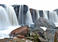
About The Fourteen Falls The Fourteen Falls, located near Thika in Nairobi, Kenya, is a breathtaking natural wonder that captivates visitors with its awe-inspiring beauty and raw power. Named after the 14 distinct cascades formed by the Athi River as it plunges over a series of rocky outcrops, these falls are a sight to behold. Surrounded by lush greenery and towering cliffs, the Fourteen Falls offer a mesmerizing spectacle that showcases the unbridled force of nature and provides a refreshing escape from the urban hustle and bustle. Fourteen Falls The Fourteen Falls have long been a popular destination for nature lovers, photographers, and adventure seekers seeking to marvel at the sheer magnificence of Kenya's natural landscapes. Whether you're drawn to the thundering roar of the cascading water, the serene beauty of the surrounding wilderness, or the opportunity to embark on exciting outdoor activities, the Fourteen Falls offer something for everyone to enjoy. Time to Visit The Fourteen Falls are accessible year-round, with each season offering its own unique charm and appeal. The best time to visit is during the rainy season, from March to May and October to December, when the falls are at their most spectacular and the surrounding landscape is lush and green. However, visitors should be prepared for occasional rain showers and muddy trails during this time. The dry season, from June to September and January to February, offers sunny weather and clearer views of the falls, making it ideal for photography and outdoor activities. Entry Fee There is an entry fee to access the Fourteen Falls, which helps support the maintenance and conservation efforts of the site. The fee may vary depending on the season and any additional amenities or services offered at the falls. Visitors are advised to check the official website or contact the authorities for updated information on entry fees and any discounts or promotions available. Time Required for Travel Traveling to the Fourteen Falls from Nairobi is relatively straightforward, as the falls are located approximately 65 kilometers northeast of the city. The journey by car typically takes around 1.5 to 2 hours, depending on traffic conditions and the route taken. Visitors can also opt to take a taxi or join a guided tour for a hassle-free travel experience. Once at the falls, plan to spend at least a couple of hours exploring the site, taking in the breathtaking views, and perhaps indulging in some outdoor activities such as hiking, picnicking, or birdwatching. Traveling Tips Before visiting the Fourteen Falls, it's advisable to check the weather forecast and plan your trip accordingly, especially during the rainy season when the falls are at their most impressive. Wear sturdy footwear and comfortable clothing suitable for walking and outdoor activities, as the terrain around the falls may be uneven or slippery. Bring along a camera or smartphone to capture the beauty of the falls and the surrounding scenery, but be sure to secure your belongings to prevent them from getting wet or damaged by the spray. Lastly, respect the natural environment and follow any rules or guidelines provided by the authorities to ensure a safe and enjoyable experience for yourself and other visitors.
Explore More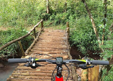
About The Nairobi Road Forest Sanctuary The Nairobi Road Forest Sanctuary, nestled on the outskirts of Nairobi, Kenya, is a serene haven for nature enthusiasts and outdoor adventurers alike. Spanning a vast expanse of lush greenery and diverse ecosystems, this sanctuary offers visitors a peaceful retreat from the urban hustle and bustle, where they can reconnect with nature, explore scenic trails, and observe a variety of flora and fauna in their natural habitat. From birdwatching and nature walks to picnicking and photography, the Nairobi Road Forest Sanctuary provides endless opportunities for relaxation, recreation, and discovery amidst the beauty of Kenya's wilderness. Nairobi Road Forest Sanctuary The Nairobi Road Forest Sanctuary is a hidden gem waiting to be explored by nature lovers and outdoor enthusiasts. Home to a rich diversity of plant and animal species, including indigenous trees, shrubs, and wildlife, the sanctuary offers a unique glimpse into Kenya's natural heritage and ecological importance. Visitors can wander along well-marked trails, breathe in the fresh air, and listen to the soothing sounds of birds chirping and leaves rustling in the breeze as they immerse themselves in the tranquility of the forest. Time to Visit The Nairobi Road Forest Sanctuary is open to visitors throughout the year, providing opportunities to experience its beauty and serenity in every season. The best time to visit is during the dry season, from June to September and from January to February, when the weather is mild and the trails are less muddy. However, the rainy season, from March to May and from October to December, brings the forest to life with lush vegetation and vibrant colors, making it an ideal time for photography and birdwatching. Entry Fee There is typically no entry fee to access the Nairobi Road Forest Sanctuary, making it accessible to visitors of all ages and backgrounds. Whether you're a local resident or a tourist exploring Nairobi, the sanctuary welcomes everyone to enjoy its natural beauty and tranquility without any financial barrier. However, visitors are encouraged to contribute to the conservation efforts of the sanctuary by making a donation or participating in volunteer activities to help preserve its ecosystems and protect its wildlife. Time Required for Travel Traveling to the Nairobi Road Forest Sanctuary is relatively easy, as it is located just a short distance from Nairobi's city center. The sanctuary is accessible by car, taxi, or public transportation, with designated parking areas available for those driving. The travel time may vary depending on your starting point within Nairobi, but most visitors can reach the sanctuary within 30 to 45 minutes. Once there, plan to spend at least a couple of hours exploring the sanctuary's trails and enjoying its natural beauty, although you may choose to extend your visit for a full day of outdoor adventure and relaxation. Traveling Tips Before visiting the Nairobi Road Forest Sanctuary, it's advisable to check the weather forecast and plan your trip accordingly, especially during the rainy season when the trails may be muddy and slippery. Wear sturdy footwear and comfortable clothing suitable for walking and outdoor activities, and consider bringing along a hat, sunscreen, and insect repellent to protect yourself from the sun and mosquitoes. Bring plenty of drinking water and snacks to stay hydrated and energized during your visit, and be sure to pack a camera or smartphone to capture the beauty of the sanctuary's landscapes and wildlife. Lastly, respect the natural environment and follow any rules or guidelines provided by the authorities to ensure a safe and enjoyable experience for yourself and other visitors.
Explore More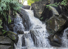
About The Oloolua Nature Trail The Oloolua Nature Trail, located in Nairobi, Kenya, is a hidden gem that offers visitors a unique opportunity to explore the beauty of Kenya's natural landscapes and biodiversity. Nestled within the Ngong Hills, this scenic trail winds its way through lush forests, tranquil streams, and rocky outcrops, providing a peaceful escape from the hustle and bustle of city life. With its well-maintained paths, diverse plant and animal life, and stunning views of the surrounding countryside, the Oloolua Nature Trail is a popular destination for nature lovers, hikers, and outdoor enthusiasts seeking adventure and tranquility in equal measure. Oloolua Nature Trail The Oloolua Nature Trail is a haven for nature enthusiasts and outdoor adventurers alike, offering a range of activities and experiences to suit every interest and skill level. Visitors can explore the trail on foot or by bike, following marked routes that lead through dense forests, open meadows, and rocky terrain. Along the way, you'll encounter a variety of plant and animal species, including indigenous trees, birds, butterflies, and small mammals, making each hike a unique and memorable experience. Time to Visit The Oloolua Nature Trail is open to visitors throughout the year, although the best time to visit is during the dry season, from June to September and from January to February, when the weather is mild and the trails are less muddy. However, the rainy season, from March to May and from October to December, brings the landscape to life with lush vegetation and flowing streams, creating a picturesque setting for hiking and nature photography. Entry Fee There is typically a nominal entry fee to access the Oloolua Nature Trail, which helps support the maintenance and conservation efforts of the trail and its surrounding ecosystems. The fee may vary depending on the season and any additional amenities or services offered at the trailhead. Visitors are encouraged to check the official website or contact the authorities for updated information on entry fees and any discounts or promotions available. Time Required for Travel Traveling to the Oloolua Nature Trail is relatively easy, as it is located just a short distance from Nairobi's city center. The trailhead is accessible by car, taxi, or public transportation, with designated parking areas available for those driving. The travel time may vary depending on your starting point within Nairobi, but most visitors can reach the trailhead within 30 to 45 minutes. Once there, plan to spend at least a couple of hours exploring the trail and enjoying its natural beauty, although you may choose to extend your visit for a full day of hiking and outdoor adventure. Traveling Tips Before visiting the Oloolua Nature Trail, it's advisable to check the weather forecast and plan your trip accordingly, especially during the rainy season when the trails may be muddy and slippery. Wear sturdy footwear and comfortable clothing suitable for hiking and outdoor activities, and consider bringing along a hat, sunscreen, and insect repellent to protect yourself from the sun and mosquitoes. Bring plenty of drinking water and snacks to stay hydrated and energized during your hike, and be sure to pack a camera or smartphone to capture the beauty of the trail's landscapes and wildlife. Lastly, respect the natural environment and follow any rules or guidelines provided by the authorities to ensure a safe and enjoyable experience for yourself and other visitors.
Explore More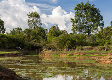
About The Karura Forest Karura Forest, located in Nairobi, Kenya, is a sprawling urban forest reserve that serves as a green lung for the city and a haven for nature lovers, outdoor enthusiasts, and wildlife enthusiasts alike. Spanning over 1,000 hectares, this majestic forest is home to a diverse array of plant and animal species, including towering indigenous trees, tranquil streams, and a variety of birdlife. With its well-maintained trails, scenic picnic spots, and educational facilities, Karura Forest offers visitors a peaceful retreat where they can reconnect with nature, explore the great outdoors, and learn about the importance of conservation and environmental stewardship. Karura Forest Karura Forest is more than just a natural oasis; it's also a symbol of community resilience and environmental activism. Originally threatened by land grabbers and deforestation, the forest was saved from destruction thanks to the efforts of local residents, environmentalists, and government officials who banded together to protect this precious green space. Today, Karura Forest stands as a shining example of successful conservation and sustainable land management, providing a sanctuary for both people and wildlife to enjoy for generations to come. Time to Visit Karura Forest is open to visitors daily from 6:00 AM to 6:00 PM, offering ample opportunities to explore its trails and enjoy its natural beauty. The best time to visit is during the early morning or late afternoon hours, when the weather is cooler and the forest is bathed in soft golden light. Weekdays tend to be less crowded than weekends, making it an ideal time for a peaceful nature walk or birdwatching expedition. Entry Fee There is a nominal entry fee to access Karura Forest, which helps support the maintenance and conservation efforts of the forest and its surrounding ecosystems. The fee may vary depending on age, nationality, and any additional amenities or services offered at the forest entrance. Visitors are encouraged to check the official website or contact the forest authorities for updated information on entry fees and any discounts or promotions available. Time Required for Travel Traveling to Karura Forest is relatively easy, as it is located just a short distance from Nairobi's city center. The forest is easily accessible by car, taxi, or public transportation, with designated parking areas available for those driving. The travel time may vary depending on your starting point within Nairobi, but most visitors can reach the forest within 15 to 30 minutes. Once there, plan to spend at least a couple of hours exploring the forest's trails and enjoying its natural beauty, although you may choose to extend your visit for a full day of outdoor adventure and relaxation. Traveling Tips Before visiting Karura Forest, it's advisable to check the weather forecast and plan your trip accordingly, especially during the rainy season when the trails may be muddy and slippery. Wear sturdy footwear and comfortable clothing suitable for walking and outdoor activities, and consider bringing along a hat, sunscreen, and insect repellent to protect yourself from the sun and mosquitoes. Bring plenty of drinking water and snacks to stay hydrated and energized during your hike, and be sure to pack a camera or smartphone to capture the beauty of the forest's landscapes and wildlife. Lastly, respect the natural environment and follow any rules or guidelines provided by the forest authorities to ensure a safe and enjoyable experience for yourself and other visitors.
Explore More
Lake Nakuru, a Rift Valley soda lake, lies in the southern region of Nakuru, Kenya. Large numbers of flamingoes come to the place because of the abundance of algae in the lake. Other beautiful birds, warthogs, black rhinos, white rhinos and baboons can also be seen near the lake. Large mammals also inhabit along the shore of Lake Nakuru. Lake Nakuru is under the protection of Lake Nakuru National Park. So well maintained, that it is a major tourist attraction of Kenya.
Explore More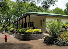
Hyrax Hill Prehistoric Site and Museum
Hyrax Hill Museum Located just outside Nakuru town in Kenya, Hyrax Hill Museum stands as a testament to Kenya's rich archaeological heritage and offers visitors a glimpse into the region's ancient past. Situated on a ridge overlooking Lake Nakuru, this archaeological site and museum provide valuable insights into the prehistoric cultures that once thrived in the Rift Valley. History of Hyrax Hill Museum The history of Hyrax Hill dates back over 3,000 years, with evidence of human habitation dating to the Neolithic period. Excavations conducted at the site have unearthed a wealth of artifacts, including stone tools, pottery, and human remains, shedding light on the lifestyles and technologies of ancient communities in the region. The museum itself was established in the 1930s following archaeological discoveries made by Louis and Mary Leakey, renowned paleoanthropologists. Initially serving as a research station, Hyrax Hill Museum was later developed into a public museum to showcase the archaeological finds and educate visitors about Kenya's prehistoric past. Exhibits and Attractions Hyrax Hill Museum features a range of exhibits that highlight the cultural and technological advancements of early inhabitants of the Rift Valley. Visitors can explore reconstructed dwellings, learn about ancient hunting and gathering techniques, and marvel at artifacts crafted by early artisans. One of the museum's most notable attractions is the Hyrax Hill archaeological site itself, where visitors can view the remains of ancient settlements and burial sites. Interpretive signage provides insights into the significance of the archaeological finds and the lifestyles of the people who once inhabited the area. Time to Visit Hyrax Hill Museum is open to visitors throughout the year, with the best time to visit being during the dry season, which typically runs from July to October and from December to March. During this time, the weather is favorable for outdoor exploration, and wildlife viewing opportunities abound in nearby parks such as Lake Nakuru National Park. Entry Fee Visitors to Hyrax Hill Museum are required to pay an entry fee, which helps support the maintenance and preservation of the archaeological site and museum exhibits. The fee varies depending on nationality, age, and whether visitors opt for guided tours or self-guided exploration. It's advisable to check the latest entry fees and operating hours before planning your visit. Time Required for Travel The amount of time required for travel to Hyrax Hill Museum depends on the mode of transportation and the starting point of your journey. If traveling from Nakuru town, the museum is easily accessible by road, with a travel time of approximately 15-20 minutes. Visitors can also reach the museum via taxi or organized tours from nearby accommodations. Traveling Tips Wear comfortable walking shoes and sun protection, as the museum grounds include outdoor exhibits and walking trails. Bring a camera to capture the scenic views of Lake Nakuru and the surrounding landscape from the museum's vantage point. Respect the archaeological site and museum exhibits by refraining from touching or removing artifacts. Take advantage of guided tours offered by knowledgeable museum staff to gain deeper insights into the history and significance of Hyrax Hill. Combine your visit to Hyrax Hill Museum with exploration of other nearby attractions, such as Lake Nakuru National Park or Menengai Crater, to make the most of your time in the region.
Explore MoreTeam Building In Naivasha With Activities In Hells Gate National Park Tour
2 Days/ 1 Night
Nairobi - Nakuru
2 Nights / 3 Days Luxury Masai Mara Road Safari
3 Days/ 2 Night
Masai Mara
Bush - Beach 9 Days Safari Tour
9 Days/ 8 Night
Mombasa - Nairobi - Masai Mara
Team Building Package - Sportsman’s Arms
2 Days/ 1 Night
Nanyuki
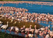
About Lake Nakuru and Lake Elementaita Lake Nakuru and Lake Elementaita are two stunning lakes located in the Rift Valley region of Kenya. Lake Nakuru, one of the most renowned lakes in the country, is situated within Lake Nakuru National Park, while Lake Elementaita lies nearby, creating a picturesque landscape that attracts visitors from all over the world. Lake Nakuru is famous for its vast population of flamingos, which create a breathtaking sight as they gather along the shores of the alkaline lake. The lake is also home to various other bird species, making it a haven for birdwatchers. In addition to its avian inhabitants, Lake Nakuru National Park is home to diverse wildlife, including endangered black rhinos, giraffes, zebras, and lions. The park offers visitors the opportunity to enjoy game drives, birdwatching tours, and nature walks amidst stunning scenery. Lake Elementaita, situated just a short distance from Lake Nakuru, is equally enchanting. This soda lake is known for its serene surroundings and is a designated UNESCO World Heritage Site. Visitors to Lake Elementaita can enjoy birdwatching, nature walks, and cultural experiences, as the area is rich in history and local traditions. **History of Lake Nakuru and Lake Elementaita** The history of Lake Nakuru and Lake Elementaita dates back thousands of years, with both lakes playing significant roles in the lives of the indigenous communities that have inhabited the region for generations. These lakes have provided water, food, and livelihoods for the local people, who have revered them as sacred sites. Lake Nakuru gained international recognition in the early 20th century when British colonial settlers declared it a bird sanctuary in 1960, later upgrading it to a national park in 1961. This designation was aimed at protecting the lake's abundant birdlife, particularly its iconic flamingos, and preserving the surrounding ecosystems. Similarly, Lake Elementaita has been a vital resource for the indigenous communities that have lived along its shores for centuries. The Maasai, for example, have relied on the lake's saline waters for their livestock and have incorporated it into their cultural traditions and rituals. **Time to Visit** The best time to visit Lake Nakuru and Lake Elementaita is during the dry season, which typically runs from July to October and from December to March. During this time, the weather is generally pleasant, and wildlife viewing is at its peak. Additionally, the dry season coincides with the annual migration of flamingos to Lake Nakuru, making it an ideal time for birdwatchers. **Entry Fee** Visitors to Lake Nakuru National Park are required to pay an entry fee, which varies depending on nationality and vehicle type. International tourists typically pay a higher fee than Kenyan citizens, while additional fees may apply for guided tours or camping. It's advisable to check the latest entry fees and park regulations before planning your visit. **Time Required for Travel** The amount of time required for travel to Lake Nakuru and Lake Elementaita depends on the mode of transportation and the starting point of your journey. If traveling from Nairobi, the journey by road typically takes around 2-3 hours, depending on traffic conditions. Alternatively, domestic flights are available from Nairobi to nearby airstrips, which offer a faster but more expensive option for reaching the lakes. **Traveling Tips** - Carry plenty of water and sunscreen, as the sun can be intense, especially during the dry season. - Binoculars and a camera are essential for birdwatching and capturing the stunning scenery. - Wear comfortable clothing and sturdy shoes for walking and outdoor activities. - Respect the wildlife and follow the park rules and regulations to minimize your impact on the environment. - Consider hiring a knowledgeable guide for a more enriching experience and to learn about the local flora, fauna, and cultural heritage. - Plan your visit in advance and check for any travel advisories or park closures before departing.
Explore More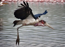
Lake Naivasha About The Lake Naivasha at Nakuru National Park Tour Lake Naivasha, situated near Nakuru National Park in Kenya's Great Rift Valley, is a stunning freshwater lake renowned for its scenic beauty and rich biodiversity. The lake is one of the largest in Kenya and serves as a vital habitat for a wide variety of bird species, including African fish eagles, pelicans, and flamingos, making it a paradise for birdwatchers and nature enthusiasts. In addition to birdlife, Lake Naivasha is also home to a diverse array of wildlife, including hippos, giraffes, zebras, and buffaloes, which can often be seen grazing along the lake's shores. Visitors to Lake Naivasha can enjoy a range of activities, including boat safaris, birdwatching tours, hiking, and biking, as well as visiting nearby attractions such as Hell's Gate National Park and Crescent Island Game Sanctuary. Lake Naivasha at Nakuru Lake Naivasha can be visited year-round, although the best time to visit for birdwatching is during the dry season from June to September when birdlife is most abundant. The lake's shores are also popular with tourists during the weekends and public holidays, so visitors may prefer to visit during the week for a quieter experience. Entry Fee There is no entry fee to access Lake Naivasha itself, although there may be charges for specific activities such as boat safaris or guided tours. However, visitors to Lake Naivasha may need to pay a conservation fee if they are visiting nearby protected areas such as Hell's Gate National Park or Crescent Island Game Sanctuary. The conservation fee helps support the management and conservation efforts of these protected areas. Time Required for Travel Traveling to Lake Naivasha from Nakuru Town typically takes around 1 to 1.5 hours by car, depending on traffic conditions and the route taken. The lake is easily accessible by road, with well-maintained highways leading directly to its shores. Visitors should plan to spend at least a half-day exploring Lake Naivasha and its surrounding attractions, although full-day excursions are also possible for those looking to experience more of the area's natural beauty and wildlife. Traveling Tips Before embarking on a tour of Lake Naivasha, it's essential to be prepared for the outdoor experience. Dress appropriately for the weather and wear comfortable clothing and footwear suitable for walking and outdoor activities. Bring along a hat, sunglasses, sunscreen, and insect repellent to protect yourself from the sun and insects. Don't forget to bring a camera or smartphone to capture photos of the stunning scenery and wildlife sightings. Lastly, listen to your guide's instructions and follow any safety guidelines provided to ensure a safe and enjoyable experience on Lake Naivasha.
Explore More
Lagdera Plains is a wide and remote landscape located in Garissa County, in the northeastern region of Kenya. The area is part of the arid and semi-arid lands (ASALs) that stretch across much of northern Kenya. Characterized by vast open plains, sparse vegetation, and a rugged terrain, the Lagdera Plains offer a raw, untouched environment that reflects the natural beauty and resilience of Kenya’s dryland ecosystems. Despite being less known on the tourist map, Lagdera Plains holds ecological significance and is home to several nomadic communities, rare wildlife species, and dryland vegetation. It presents an off-the-beaten-path experience for those who seek adventure and a glimpse into pastoralist lifestyles in one of Kenya’s most culturally rich and least disturbed environments. How to Reach Lagdera Plains, Garissa Lagdera Plains can be accessed from Garissa town, which is the main urban center in the region. Garissa is approximately 350 kilometers northeast of Nairobi. The journey from Nairobi to Garissa is mostly done by road, taking around 6 to 8 hours depending on traffic and road conditions. Public buses and private vehicles frequently travel the Nairobi–Garissa route. Once in Garissa, reaching Lagdera Plains requires a four-wheel-drive vehicle due to the rough and unpaved roads. Local guides or tour companies familiar with northeastern Kenya are highly recommended for safety and navigation. The nearest airstrip is in Garissa town, which is served by small charter planes from Nairobi and other major cities. Weather in Lagdera Plains, Garissa Lagdera Plains lies in an arid climate zone. The weather is predominantly hot and dry throughout the year, with temperatures frequently exceeding 35°C (95°F) during the daytime. Rainfall is scarce and erratic, mostly occurring between March to May and October to December. Due to its semi-desert conditions, visitors are advised to prepare for extreme heat, especially in the afternoon, and dust-laden winds. Early mornings and evenings are relatively cooler and more pleasant for exploration. Timings for Visit There are no official operating hours for Lagdera Plains since it is an open natural region rather than a fenced national park. However, the best time to visit is during the cooler months between June and September or immediately after the rainy seasons when the landscape is dotted with sparse greenery. It is highly advisable to travel during daylight hours for safety and visibility, as road infrastructure is limited and mobile network coverage can be unreliable in remote sections. Why Famous for Lagdera Plains, Garissa? Lagdera Plains is famous for its raw natural beauty, cultural richness, and importance in Kenya’s dryland ecology. It is a habitat for rare desert-adapted wildlife such as the gerenuk, lesser kudu, dik-dik, and various bird species. The region also holds cultural importance due to its Somali-influenced nomadic pastoralist communities who have preserved their traditions for generations. The area is also known for being part of the wider ecosystem that supports wildlife migration corridors and contributes to ecological balance in northeastern Kenya. For researchers and ecotourists, Lagdera Plains is a place of exploration and understanding of human-wildlife coexistence in arid zones. Entry and Visit Details There is no formal gate or entrance fee to visit Lagdera Plains as it is not a designated national park. However, due to its remote nature and potential security considerations, it is advisable to coordinate your visit with local authorities or community elders. Visitors are encouraged to hire a local guide or travel in groups. Carrying sufficient water, food, fuel, and spare vehicle parts is essential for a safe journey. Visitors should also inform someone of their travel plans before entering remote areas. History and Cultural Significance Lagdera region has a long history rooted in pastoralism and nomadic lifestyles. The Somali community, which predominantly inhabits this region, has for centuries moved with their livestock in search of pasture and water across the plains. The cultural practices, language, and attire reflect a strong Somali influence mixed with indigenous Kenyan traditions. While not much is documented about ancient architecture in Lagdera Plains, traditional huts (manyattas), livestock enclosures, and community gathering places serve as the primary forms of traditional rural architecture. These reflect the adaptability and ingenuity of communities living in arid climates. Things to Do in Lagdera Plains, Garissa While the area does not offer conventional tourism infrastructure, it is ideal for: Bird watching – Look out for arid-zone birds like the Somali ostrich, hornbills, and bustards. Wildlife spotting – Sightings of antelope species, jackals, and desert-adapted mammals. Cultural visits – Meet local communities and learn about nomadic life, camel herding, and traditional customs. Nature walks – With a guide, explore the semi-arid landscape, seasonal rivers (lugga), and desert flora. Photography – Capture vast horizons, sunrises, and the dramatic arid landscape. Interesting Facts about Lagdera Plains, Garissa Lagdera is one of the sub-counties of Garissa County and holds cultural and ecological value. The area is often used for camel caravans, a traditional mode of transport and trade in the region. Lagdera Plains support resilient acacia trees and desert shrubs, which are key for grazing animals. Nomadic communities in the area follow seasonal migration patterns that have remained unchanged for generations. Tips for Visiting Lagdera Plains, Garissa Travel with a local guide or through a tour operator experienced in northeastern Kenya. Carry enough water, snacks, fuel, and basic medical supplies. Wear light, breathable clothing, a hat, and sunglasses to protect from the sun. Be culturally respectful – dress modestly and seek permission before photographing locals. Ensure your vehicle is in excellent condition and preferably a 4x4. Check with local authorities regarding safety and security updates before your trip.
Explore More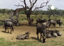
Boni National Reserve is a vast and remote protected area located in the eastern region of Garissa County, Kenya. It covers approximately 1,339 square kilometers and borders Lamu County to the southeast. The reserve is named after the Boni Forest, one of Kenya's last remaining coastal forests, and is part of a larger ecosystem that stretches into neighboring Somalia. The reserve is managed by the Kenya Wildlife Service (KWS) and is considered one of the most ecologically significant areas in the country. It is home to a diverse range of wildlife including elephants, lions, buffaloes, antelopes, wild dogs, and many rare bird species. Despite being less visited than other parks in Kenya, Boni offers an untouched wilderness experience ideal for nature lovers, researchers, and adventurous travelers seeking off-the-beaten-path destinations. How to Reach Boni National Reserve, Garissa Getting to Boni National Reserve requires careful planning due to its remote and rugged location. The nearest major town is Garissa, which is about 250 kilometers northwest of the reserve. Visitors can first travel from Nairobi to Garissa by road or domestic flight. From Garissa, a 4x4 vehicle is essential to reach the reserve, as the roads become less developed and often challenging. Another route is through Lamu, with chartered flights or boat services connecting to nearby towns such as Kiunga or Hindi. From there, travelers can access the eastern parts of the reserve. It is advisable to travel with experienced local guides or through a reputable tour operator, as certain areas may require security clearance and knowledge of local conditions. Weather in Boni National Reserve Boni National Reserve experiences a coastal tropical climate with hot and humid conditions for most of the year. Temperatures generally range between 24°C and 34°C (75°F to 93°F). The area has two rainy seasons: the long rains from March to May and the short rains from October to December. The dry seasons, from January to February and June to September, are the best times to visit as roads are more accessible and wildlife is easier to spot. Due to its dense forest and coastal proximity, the reserve can also be affected by occasional flooding during heavy rains. Visitors are advised to check weather updates and consult with local authorities before planning a trip. Timings and Visiting Hours Boni National Reserve is officially open year-round, but visits are generally recommended during daylight hours from 6:00 AM to 6:00 PM. Due to its remote nature and security considerations, it is essential to plan visits in coordination with the Kenya Wildlife Service (KWS) and local tour operators. Unaccompanied travel is not advised. The reserve has limited infrastructure, so pre-arranged guided visits are the most reliable and safe option. It is also common for visitors to combine Boni with nearby destinations like Kiunga Marine Reserve or Lamu Archipelago for a broader coastal wilderness experience. Why Famous for Boni National Reserve, Garissa? Boni National Reserve is famous for its unique ecosystem, which includes the rare Boni Forest — a tropical forest rich in biodiversity and considered a biodiversity hotspot by conservationists. The forest is home to several endangered species, including the African wild dog, the elephant shrew, and endemic birds not found elsewhere in Kenya. The reserve is also known for its quiet, untouched natural environment, providing a habitat for elephants, leopards, buffaloes, hippos, and hyenas. Its proximity to the Indian Ocean coastline adds to its ecological diversity, blending forest, savannah, and marine ecosystems. Boni's cultural significance is also noteworthy. The forest is traditionally inhabited by the Aweer (Boni) people, a small hunter-gatherer community who have coexisted with nature for generations. Their traditional knowledge and practices are vital to conservation in the area. Entry and Visit Details Entry to Boni National Reserve is regulated by the Kenya Wildlife Service. Visitors must obtain permits in advance, which can be arranged through KWS offices or authorized travel agencies. Given the area's sensitive nature and history of security concerns, visits are typically conducted with accompaniment from armed rangers or local guides. Accommodation options near the reserve are limited, with basic eco-lodges and tented camps available in nearby towns like Kiunga or Hindi. It is advisable to bring your own supplies including drinking water, food, and medical kits. History and Architecture Boni National Reserve was established in 1976 as part of Kenya’s efforts to protect coastal forest ecosystems and the wildlife within them. The reserve's name is derived from the Boni Forest, a historically and ecologically important region that has supported human life and wildlife for centuries. While there are no traditional architectural monuments within the reserve, the forest itself can be considered a living cultural and natural monument. The indigenous Boni (Aweer) people have lived in harmony with the forest, using traditional methods of hunting, gathering, and herbal medicine. Their shelters and tools, though temporary and sustainable, reflect a deep understanding of their environment. Things to Do at Boni National Reserve Although Boni is not a typical tourist destination, it offers unique and rewarding experiences for adventurous visitors: Guided forest walks to explore Boni Forest and learn about its medicinal plants and wildlife. Game viewing to spot elephants, bush pigs, monkeys, buffaloes, and occasionally big cats. Birdwatching – especially rewarding due to the presence of rare and endemic bird species. Community visits to learn about the Boni people's culture, language, and traditional practices. Nature photography, especially for forest landscapes and rare species. Camping experiences under the stars with the sound of forest wildlife. Facts about Boni National Reserve It covers over 1,339 square kilometers of forest, savannah, and coastal terrain. The reserve is part of the Northern Zanzibar-Inhambane coastal forest mosaic. Home to critically endangered African wild dogs and rare plant species. Traditionally inhabited by the Aweer (Boni) indigenous community. Less commercial and offers one of Kenya's most remote and authentic wilderness experiences. Used in the past as a cross-border habitat corridor between Kenya and Somalia. Tips for Visiting Boni National Reserve, Garissa Always plan your visit through a registered guide or tour operator familiar with the area. Travel in a 4x4 vehicle, especially during rainy seasons when roads can be impassable. Bring sufficient supplies including food, water, and medical kits as facilities are minimal. Respect local communities and follow ethical tourism practices. Check with Kenya Wildlife Service and local authorities for safety and access conditions before traveling. Be prepared for minimal connectivity – no mobile signal in some parts of the reserve. Ideal for bird watchers, researchers, and experienced nature travelers seeking isolation and biodiversity. Boni National Reserve remains one of Kenya’s most unexplored and ecologically important regions. It combines raw wilderness, indigenous culture, and rich biodiversity, making it an exceptional destination for those looking to go beyond the conventional safari routes. Whether you're a biologist, a nature lover, or simply in search of silence and untouched forest, Boni offers a rare and meaningful travel experience.
Explore More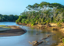
Tana River is the longest river in Kenya, flowing over 1,000 kilometers from the Aberdare Mountains through the central and eastern regions, including Garissa County, before emptying into the Indian Ocean. In Garissa, the Tana River becomes a lifeline for the dry and semi-arid landscapes of the northeastern region. It supports both wildlife and human settlements by providing water for agriculture, fishing, and domestic use. In Garissa, the river creates a unique contrast between the arid terrain and the lush riverbanks, lined with doum palms, reeds, and pockets of riverine forest. The presence of the Tana River has made Garissa an important area for biodiversity and rural development, attracting visitors for its natural beauty, birdlife, and local cultural experiences. How to Reach Tana River, Garissa Tana River in Garissa can be reached by road or air. Garissa town is the closest major settlement along the river and serves as the main access point. From Nairobi, you can drive approximately 370 kilometers to Garissa via Thika and Mwingi. The journey takes about 7 to 8 hours by car. A four-wheel-drive vehicle is recommended, especially if you plan to visit areas close to the riverbanks or during the rainy season when roads may become difficult. Alternatively, travelers can fly to Garissa Airport via chartered or scheduled flights from Nairobi’s Wilson Airport. From Garissa town, the river is easily accessible by local transport or private vehicles. Weather in Tana River, Garissa The weather around the Tana River in Garissa is typically hot and dry throughout most of the year. The area falls under the semi-arid to arid climate zones, with temperatures often reaching 35°C to 40°C (95°F to 104°F) during the day. There are two main rainy seasons: the long rains from March to May and the short rains from October to December. Rainfall, although occasional, can significantly affect road conditions. The best time to visit the river is during the dry months (June to September and January to February), when travel is easier and the riverbanks are more accessible. Timings and Best Time to Visit There is no fixed visiting schedule or entry time for the Tana River in Garissa since it is a natural feature accessible from various points. However, visiting during daylight hours—between 6:00 AM and 6:00 PM—is recommended for safety and better visibility. Early mornings and late afternoons are ideal for photography, birdwatching, and river tours, as the light is softer and wildlife is more active. Avoid visiting during the peak midday heat. Why Famous for Tana River, Garissa? The Tana River is famous in Garissa for being the main source of life in the otherwise dry landscape. It supports agriculture, livestock rearing, and fishing among the local communities. The riverbanks are fertile and home to numerous bird species and aquatic life, making it a hotspot for birdwatchers and nature lovers. The Tana River also contributes to regional hydroelectric power generation and is essential for floodplain farming. In Garissa, it plays a key role in the cultural practices and traditions of the Somali and other communities who rely on it for their daily needs. Entry and Visit Details about Tana River, Garissa There is no formal entry point to the Tana River in Garissa, as the river flows naturally through the region and is accessible from various public or rural areas. However, it is best to visit through guided tours or with local contacts who know the safe access points and can assist with transportation. Visitors can arrange riverbank picnics, fishing trips, or birdwatching outings through local operators in Garissa town. While there are no entry fees, travelers may incur charges for boat rides, guides, or organized activities. It’s also advisable to notify local authorities or accommodation providers about your plans, especially if heading to remote areas. History and Significance The Tana River has long been a source of livelihood for the people of eastern Kenya. Historically, it supported pastoral communities, including the Pokomo and Somali tribes, with its waters allowing for irrigation and grazing lands even in drought periods. Over time, the river has also become important for national development, with hydroelectric power stations like Kindaruma, Kamburu, and Gitaru built upstream. In Garissa, the river continues to play a vital ecological role, supporting diverse wildlife and plant species along its banks. Unlike architectural monuments, the "structure" of the Tana River lies in its winding channels, oxbow lakes, and natural riverine systems that shape the region's landscape and ecology. Things to Do at Tana River, Garissa Birdwatching: Spot a variety of bird species, especially near the water and forest patches along the riverbanks. Fishing: Engage in traditional fishing with local communities, using simple nets and handlines. Photography: Capture scenic views of the river, riverine forests, and local life along the banks. Boat Rides: In some parts, visitors may be able to organize small canoe or boat rides, especially near calmer sections of the river. Cultural Tours: Visit nearby villages to experience traditional Somali and Pokomo cultures that depend on the river. Nature Walks: Walk along the riverbanks to see lush vegetation, wildlife tracks, and perhaps even hippos or crocodiles in the water. Interesting Facts about Tana River, Garissa The Tana River is Kenya’s longest river, stretching over 1,000 kilometers. It originates from the Aberdare Mountains and flows into the Indian Ocean near Kipini. The river is a major source of hydroelectric power for Kenya. It supports several endangered and endemic bird species. Garissa is one of the key towns along the Tana River's path in northern Kenya. The river plays a crucial role in the ecosystem and economy of northeastern Kenya. Tips for Visiting Tana River, Garissa Visit during the dry season for easier access and pleasant weather. Wear light clothing, a hat, and sunscreen due to high temperatures. Travel with a local guide for safety and better experience. Carry water, snacks, and first aid, as amenities may be limited near the river. Respect local customs and avoid littering along the riverbanks. Use insect repellent to protect against mosquitoes near water sources. Always inform someone of your travel plans if heading into remote areas. The Tana River in Garissa is a place of natural beauty, cultural heritage, and ecological importance. It may not offer traditional tourist attractions, but it promises a unique and authentic experience for visitors looking to connect with nature and local communities. Whether you're interested in birds, local culture, or simply the peaceful flow of water through an arid land, the Tana River is a must-visit destination in northeastern Kenya.
Explore More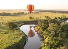
The Mara River is one of the most iconic and important rivers in Africa, flowing through the stunning Masai Mara National Reserve in Kenya. Known for its role in the great wildebeest migration, this river is synonymous with the breathtaking scenes of thousands of wildebeests, zebras, and gazelles crossing its waters in their perilous journey to new grazing grounds. Aside from the migration, the Mara River is home to a rich variety of wildlife, making it a prime spot for safaris and a must-see destination for nature lovers. How to Reach Mara River, Masai Mara The Mara River is easily accessible as it runs through the Masai Mara National Reserve. To reach the river, visitors must first enter the Masai Mara Reserve, which can be done by both road and air. The river itself meanders through the reserve, and game drives are the best way to get close to its banks for the best wildlife viewing experiences. By Road: If you are traveling from Nairobi, the most common way to get to Masai Mara is by road. The journey usually takes between 5 and 6 hours, passing through the Nairobi-Narok-Masai Mara highway. Once within the reserve, you can reach various sections of the Mara River with a guided safari. The roads to the river may be rough, so a 4x4 vehicle is recommended for comfort and accessibility. By Air: For those who prefer a quicker and more convenient route, there are regular flights from Nairobi's Wilson Airport to various airstrips near the Masai Mara. Several airlines, including Safarilink and Air Kenya, operate daily flights. The closest airstrips to the Mara River include those at Ol Kiombo and Keekorok. Once you land, a short drive will take you to the riverbanks. From Muscat: If you're traveling from Muscat, Oman, you would need to take a flight to Nairobi’s Jomo Kenyatta International Airport (NBO). Several international airlines, including Oman Air, offer direct flights from Muscat to Nairobi. Once in Nairobi, you can either take a flight directly to the Masai Mara or travel by road, as mentioned above, to reach the Mara River. Weather and Timing The climate at the Mara River and Masai Mara region is moderate, with temperatures varying between 20°C (68°F) and 30°C (86°F). The area experiences two main seasons: the dry season and the wet season. Dry Season: The dry season lasts from June to October, which coincides with the Great Migration. This is the most popular time to visit the Mara River because it is during this period that the famous river crossings take place. The dry weather also makes it easier to access the riverbanks and spot animals congregating near water sources. Wet Season: From November to May, the region experiences rainfall. The wet season results in lush green vegetation and is ideal for birdwatching. While the wildlife viewing may not be as abundant during this time, the landscape around the Mara River becomes stunningly beautiful, offering a completely different experience for visitors. Why Famous for Mara River, Masai Mara? The Mara River is famous worldwide for several reasons, with its role in the Great Migration being the most prominent. The river provides a dramatic and often perilous crossing for the millions of wildebeests, zebras, and other herbivores that undertake the journey every year. Additionally, the river is known for its crocodile population, which preys on the animals attempting to cross, adding a thrilling element to the migration. The Great Migration: One of the most awe-inspiring wildlife events on Earth is the Great Wildebeest Migration. Every year, over 1.5 million wildebeests, along with thousands of zebras and gazelles, migrate from the Serengeti in Tanzania to the Masai Mara in Kenya. The crossing of the Mara River is often the most dangerous part of the migration, as the animals have to navigate strong currents, steep banks, and the lurking crocodiles that inhabit the river. Crocodiles and Hippos: The Mara River is home to large populations of Nile crocodiles, which are famous for their role in hunting the migrating animals. Hippos are also abundant in the river, with large pods spending most of the day submerged in the water. Watching the crocodiles and hippos interact with the migrating wildlife is a fascinating experience for any visitor. Entry and Visit Details About Mara River, Masai Mara To visit the Mara River, travelers must first enter the Masai Mara National Reserve, which is managed by the Kenya Wildlife Service (KWS). The main entrance to the park is through the Sekenani Gate, but visitors can also use the Talek Gate and others depending on where they are staying in the reserve. Entry Fees: The entry fees for the Masai Mara National Reserve vary depending on the time of year. International visitors typically pay $70 to $80 per day, while residents of Kenya pay a reduced fee. The park fees are used to support wildlife conservation efforts in the reserve. Best Time to Visit the Mara River: The best time to visit the Mara River is during the dry season, especially between July and October, when the Great Migration reaches its peak. However, if you prefer a more peaceful experience with fewer crowds, visiting in the wet season is also an option, as the river's lush surroundings offer a different beauty. History and Architecture of Mara River While the Mara River is not known for human-built architecture, it holds great historical and cultural significance. The river has been a central part of the Masai Mara ecosystem for centuries, with the Maasai people traditionally living alongside its banks. The Maasai, known for their rich cultural heritage, have had a deep connection with the land, and the river holds spiritual significance for them. The river’s importance as a lifeline for wildlife and the Maasai community is immense, especially during the migration season. Today, conservation efforts aim to protect the Mara River and its surrounding ecosystems to ensure that both the animals and local communities continue to benefit from this natural resource. Things to Do at Mara River, Masai Mara Visiting the Mara River offers many unique and thrilling activities, from wildlife viewing to photography. Here are some of the most popular things to do when visiting the Mara River: Game Drives: The most common activity at the Mara River is a game drive. Visitors can embark on guided safaris to explore the reserve and get close to the riverbanks, where wildlife congregates. The river is often a prime spot for seeing crocodiles, hippos, and other animals. Wildebeest Migration Viewing: During the Great Migration (typically July to October), the Mara River is the main stage for the river crossings. Witnessing the dramatic river crossing is one of the most unforgettable experiences in the world. Photography: The Mara River offers fantastic opportunities for photography, particularly during the migration or when the crocodiles are hunting. Photographers often flock to the river to capture the stunning action shots. Guided Nature Walks: Some lodges offer walking safaris around the river to learn about the flora and fauna that depend on the water. Walking with an expert guide allows you to connect with nature on a deeper level. Interesting Facts About Mara River The Mara River flows from the Mau Escarpment, traveling through the Masai Mara before entering Tanzania, where it eventually feeds into the Serengeti ecosystem. During the Great Migration, over 1.5 million wildebeests, along with tens of thousands of zebras, attempt to cross the Mara River. The river is home to one of Africa's largest populations of Nile crocodiles, with some individuals growing up to 5 meters (16 feet) long. Tips for Visiting Mara River, Masai Mara Book a Guided Safari: To make the most of your visit to the Mara River, it’s advisable to book a guided safari with an experienced guide who can help you spot wildlife and understand the river’s ecosystem. Bring Binoculars and a Camera: The Mara River is full of wildlife, including crocodiles, hippos, and migratory animals. Be sure to pack binoculars and a camera to capture the stunning scenery. Wear Comfortable Clothing: As game drives can last several hours, wearing comfortable, neutral-colored clothing and sturdy shoes is important for a comfortable experience.
Explore More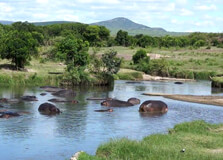
Hippo Pools is one of the most fascinating natural attractions within the Masai Mara ecosystem in Kenya. Located along the Mara River, Hippo Pools is renowned for its large congregation of hippopotamuses and crocodiles, providing visitors with a spectacular opportunity to witness these powerful creatures in their natural habitat. This site is a must-visit for wildlife enthusiasts, photographers, and anyone seeking to experience the raw beauty of Kenya’s wilderness. How to Reach Hippo Pools, Masai Mara Hippo Pools is situated inside the Masai Mara National Reserve, near the Mara River, making it accessible during a game drive within the reserve. From Nairobi By Road: It takes approximately 5 to 6 hours to drive from Nairobi to the Masai Mara, passing through Narok town. Visitors typically drive on a combination of tarmac and dirt roads. A 4x4 vehicle is highly recommended due to the rough terrain within the reserve. By Air: Daily flights from Nairobi’s Wilson Airport to several airstrips near the Masai Mara, such as Keekorok, Mara Serena, or Ol Kiombo, reduce travel time significantly. From the airstrip, lodges arrange transfers to Hippo Pools and other key spots in the reserve. From Muscat Travelers flying from Muscat usually transit through Nairobi’s Jomo Kenyatta International Airport (NBO). From Nairobi, the routes above can be taken to reach Hippo Pools in the Masai Mara. Weather and Timing The Masai Mara, including Hippo Pools, experiences two main seasons: Dry Season (June to October): This is the peak safari season when animals gather around water sources like Hippo Pools, offering excellent wildlife viewing. The weather is generally sunny and dry, with cooler mornings and evenings. Wet Season (November to May): The rainy season brings lush green landscapes and a different kind of beauty. While some roads may become muddy and challenging, birdwatching is superb, and many animals give birth during this time. The best time to visit Hippo Pools for viewing hippos and crocodiles is during the dry season when water sources become focal points for wildlife. Why Famous for Hippo Pools, Masai Mara? Hippo Pools is famous for several reasons: Large Concentration of Hippos: The pools provide a natural habitat where large pods of hippos spend much of their time submerged to stay cool, offering visitors an up-close glimpse of these impressive mammals. Crocodile Sightings: The Mara River is also home to Nile crocodiles, often seen basking near the pools or lurking beneath the water surface, adding excitement to the wildlife experience. Part of the Great Migration Route: Hippo Pools lies along the Mara River, a key crossing point during the annual wildebeest migration, making it a hotspot for dramatic river crossing events. Scenic Natural Setting: The combination of river, rocky pools, and surrounding savannah creates a picturesque environment favored by nature photographers. Entry and Visit Details About Hippo Pools, Masai Mara Hippo Pools is accessible to visitors who enter the Masai Mara National Reserve. Entry requires paying the Masai Mara park fees, which are collected at the reserve gates. Entry Fees: Park entry fees for foreign tourists currently range around $70 to $80 per day, with varying fees for residents and children. These fees help support wildlife conservation and reserve management. Visiting Hours: The reserve is open from 6:00 AM to 6:00 PM daily. Most visitors opt for early morning or late afternoon game drives when animal activity is highest and temperatures are cooler. Visitors can enjoy guided game drives arranged by lodges or tour operators, which often include Hippo Pools as a key stop on their safari itinerary. History and Architecture of Hippo Pools Hippo Pools is a natural feature formed by a series of rocky pools and channels along the Mara River. Unlike man-made structures, there is no architecture here, but the site’s significance lies in its ecological and cultural history. The Mara River ecosystem has long supported wildlife populations and Maasai communities living in the region. Hippo Pools has served as a critical watering and resting site for hippos and crocodiles for centuries. Conservation efforts in the Masai Mara ensure that such habitats remain protected, balancing wildlife preservation with tourism and community interests. Things to Do at Hippo Pools Game Drives: Experience thrilling game drives to spot hippos lounging in the pools, crocodiles, and other wildlife such as elephants, lions, and antelopes. Wildlife Photography: Capture stunning images of hippos, crocodiles, and the scenic river environment—especially during golden hours of sunrise and sunset. Bird Watching: The area around Hippo Pools attracts many bird species, including kingfishers, herons, and fish eagles, making it a birdwatcher’s delight. River Crossing Observation: If visiting during the Great Migration, witness the dramatic crossing of thousands of wildebeest and zebras braving the river's currents and predators. Facts About Hippo Pools Hippos spend up to 16 hours a day submerged in water to keep their skin moist and regulate body temperature. The Mara River is one of the most famous rivers in Africa for its wildlife diversity and migration crossings. Hippo Pools provides a vital refuge for hippos during the dry season when other water sources dry up. Despite their calm appearance in water, hippos are one of Africa’s most dangerous animals due to their aggressive nature on land. Tips for Visiting Hippo Pools Bring Binoculars and Camera: To get a closer view and capture amazing shots of hippos and other wildlife. Wear Neutral Clothing: Earth tones like khaki, brown, and green help blend into the environment and avoid disturbing animals. Stay Quiet and Patient: Hippos can be shy; staying still and quiet increases chances of good sightings. Follow Guide Instructions: Safety is paramount; always listen to your guide when near water or wildlife. Carry Water and Snacks: Game drives can be long; staying hydrated and energized is important. Protect Against Sun and Insects: Use sunscreen, hats, and insect repellent to ensure comfort during your visit.
Explore More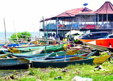
Lake Victoria, the largest freshwater lake in Africa, is located in the western part of Kenya and borders Uganda and Tanzania. The lake is a significant part of the East African ecosystem and a key feature of Kisumu, the third-largest city in Kenya. Known for its vastness, rich biodiversity, and cultural importance, Lake Victoria offers both locals and tourists a unique experience of natural beauty, wildlife, and recreation. Kisumu, a vibrant lakeside city, serves as the perfect gateway for exploring the wonders of Lake Victoria. How to Reach Lake Victoria, Kisumu Getting to Kisumu and Lake Victoria is straightforward, as Kisumu has good transport connections by air, road, and rail. Visitors can fly directly to Kisumu International Airport from Nairobi’s Jomo Kenyatta International Airport or Wilson Airport. The flight takes around 45 minutes, and several airlines, including Kenya Airways and Jambojet, operate daily flights to Kisumu. For those traveling by road, Kisumu is approximately 340 kilometers from Nairobi, and the journey takes around 5 to 6 hours via the Kisumu-Nairobi highway. The road is well-maintained, with scenic views along the way, passing through towns such as Nakuru and Eldoret. Alternatively, you can take a train from Nairobi to Kisumu, which is a scenic and comfortable option that takes about 8 hours. Weather and Timing The climate around Lake Victoria is typically tropical, characterized by hot temperatures and significant rainfall throughout the year. Kisumu experiences two main seasons: the rainy season (from March to May and October to December) and the dry season (from June to September). During the rainy season, temperatures range from 20°C (68°F) at night to 30°C (86°F) during the day, with occasional afternoon showers. In the dry season, temperatures can climb higher, and the days are sunnier, making it ideal for outdoor activities like boat rides, fishing, and bird watching. For the best experience, it is recommended to visit Lake Victoria during the dry months, from June to September, when the weather is more predictable, and the conditions for sightseeing and recreation are optimal. Why Lake Victoria, Kisumu is Famous Lake Victoria is famous not only for its size but also for its rich biodiversity. It is the world’s second-largest freshwater lake by surface area and serves as a crucial water source for millions of people living in the three countries surrounding it: Kenya, Uganda, and Tanzania. The lake is home to over 500 species of fish, including the popular Nile perch, which has become a vital part of the local fishing industry. Besides its significance as a water source and an economic hub, Lake Victoria is also known for its cultural and historical importance. The lake has been home to the Luo people for centuries, who have a deep cultural connection to the water. Kisumu, located on the shores of the lake, is a historic city with colonial-era buildings and is often referred to as the "City of Friendship." The city also serves as a major transport and trade center for the region. Entry and Visit Details About Lake Victoria, Kisumu Visiting Lake Victoria is relatively easy, and there are no specific entry fees for accessing the lake itself. However, activities such as boat rides, fishing, and guided tours around Kisumu or nearby islands may incur additional costs. There are various accommodation options around the lake, ranging from budget guesthouses to luxury resorts that offer lake views and access to various activities. Popular accommodations include the Sovereign Hotel, Kisumu Impala Sanctuary, and the Kiboko Bay Resort, all offering unique experiences for guests. For a more organized experience, visitors can book guided tours, which often include boat trips to the nearby islands, visits to local fishing villages, and cultural experiences with the Luo community. It's recommended to plan activities in advance, particularly during the peak tourist season (July to October), as the area can get busy with both local and international tourists. History and Architecture of Lake Victoria, Kisumu Lake Victoria has a rich history that dates back to pre-colonial times. The Luo people, one of Kenya’s prominent ethnic groups, have lived along its shores for centuries, relying on the lake for fishing, transportation, and trade. The name “Kisumu” is derived from the Luo word for “a place of barter trade,” reflecting the city’s historical role as a trading hub for the local communities. During the colonial period, Kisumu became an important port for the British colonial administration. The colonial influence can still be seen in some of the architecture around the city, such as the Kisumu Railway Station, built during the British era. The station and its surroundings are historic landmarks that tell the story of the city’s growth as an administrative and transport center in the western part of Kenya. Modern-day Kisumu has evolved into a vibrant city, blending colonial architecture with contemporary structures. The lakeside promenade, located along the shores of Lake Victoria, features modern buildings, parks, and recreational spaces, offering visitors a beautiful view of the lake while enjoying various leisure activities. Things to Do at Lake Victoria, Kisumu Lake Victoria offers a wide range of activities for visitors to enjoy. Whether you’re an adventure seeker, nature lover, or cultural enthusiast, there is something for everyone: Boat Tours: A boat ride on Lake Victoria is a must-do activity. You can explore the lake’s numerous islands, including the famous Rusinga Island, where you can visit historical sites and engage with local communities. Fishing: Lake Victoria is known for its vibrant fishing industry, and visitors can enjoy sport fishing or hire local fishermen for a unique fishing experience on the lake. Visit Kisumu Impala Sanctuary: Located on the shores of Lake Victoria, this sanctuary is home to a variety of wildlife, including impalas, zebras, and giraffes. It’s a great spot for nature walks and birdwatching. Cultural Tours: Learn about the rich history of Kisumu and the Luo people by visiting local museums, such as the Kisumu Museum. You can also visit nearby villages to experience traditional Luo dances, songs, and cuisine. Bird Watching: Lake Victoria is an excellent location for birdwatching, especially during the migratory season. The lake is home to hundreds of bird species, including pelicans, cormorants, and kingfishers. Lakeside Walks: Take a leisurely stroll along the lakeside promenade in Kisumu, where you can enjoy beautiful views of the lake and surrounding scenery. The promenade is lined with cafes and restaurants offering fresh fish and local delicacies. Interesting Facts About Lake Victoria, Kisumu Lake Victoria is the largest lake in Africa by area, covering about 68,800 square kilometers (26,600 square miles). The lake is home to more than 500 species of fish, many of which are endemic to the lake, including the famous Nile perch. Lake Victoria is shared by three countries: Kenya, Uganda, and Tanzania. Approximately 6 million people live around the lake, relying on its resources for their livelihoods. The lake is facing significant ecological challenges, including pollution, invasive species like the water hyacinth, and overfishing, which threaten the biodiversity of the lake. The city of Kisumu was originally known as Port Florence during the colonial period. The name was changed after Kenya gained independence in 1963. Travel Tips for Visiting Lake Victoria, Kisumu Pack for the Weather: Kisumu can get hot, especially during the dry season, so pack light, breathable clothing, sunscreen, and a hat. Stay Hydrated: The tropical climate can be quite warm, so make sure to carry plenty of water with you when exploring the city or going on boat trips. Respect Local Culture: Kisumu is home to the Luo people, so be respectful of their traditions and customs, especially when visiting local villages or attending cultural events. Health Precautions: Kisumu is located in a malaria zone, so it’s advisable to take anti-malaria medication and use insect repellent during your visit. Book in Advance: During peak tourist seasons (July to October), it’s a good idea to book your accommodation and activities in advance to secure your spot.
Explore More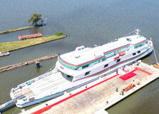
Kisumu Port is located on the shores of Lake Victoria in Kisumu City, Kenya. As the largest freshwater lake in Africa, Lake Victoria has always played a central role in the cultural, economic, and historical life of the East African region. Kisumu Port, which serves as a vital transportation hub, is also a major tourist attraction, providing both locals and visitors with beautiful views and a glimpse into the region's maritime heritage. Originally known as Port Florence during the colonial period, the port continues to play an essential role in the trade and transport of goods between Kenya, Uganda, and Tanzania. How to Reach Kisumu Port, Kisumu Getting to Kisumu Port is simple and convenient, with a variety of transport options available for visitors coming from different regions. Visitors flying into Kisumu can take a direct flight from Nairobi's Jomo Kenyatta International Airport (JKIA) to Kisumu International Airport, which is just about 15 kilometers from the port. The flight duration is approximately 45 minutes. Several airlines, including Kenya Airways and Jambojet, operate daily flights between Nairobi and Kisumu. If you're traveling by road, Kisumu is about 340 kilometers from Nairobi, and the drive takes roughly 5-6 hours, depending on traffic and road conditions. The Kisumu-Nairobi highway is well-maintained, offering picturesque views of the Rift Valley and the Kenyan countryside along the way. For those looking to explore Kenya by train, Kisumu is connected to Nairobi via the Kenya Railways system. While this option takes a bit longer (roughly 8 hours), the scenic route offers a unique way to see the Kenyan landscape and is a relaxing alternative to road travel. Weather and Timing Kisumu experiences a tropical climate, which is characterized by two major seasons: the rainy season and the dry season. The rainy season spans from March to May and from October to December, while the dry season typically runs from June to September. During the rainy season, Kisumu experiences moderate to heavy rainfall, with temperatures averaging between 20°C (68°F) at night and 30°C (86°F) during the day. The dry season, from June to September, is the most popular time to visit Kisumu Port. During these months, the weather is warm and sunny, with temperatures ranging from 22°C (72°F) to 30°C (86°F). This is the best time for outdoor activities, such as boat rides on Lake Victoria, walking around the port, or enjoying the scenic views of the lake. Why Kisumu Port, Kisumu is Famous Kisumu Port is renowned for its historical and economic importance, as it was one of the first major transport hubs on Lake Victoria. Originally established as Port Florence during the colonial period, the port played a critical role in the transportation of goods, including coffee, cotton, and other agricultural products, to international markets. The port was also vital for the trade between Kenya, Uganda, and Tanzania, making Kisumu an important point for the East African trade network. In recent years, Kisumu Port has been revitalized to accommodate both cargo shipping and tourism. The port is strategically located on the shores of Lake Victoria, providing a stunning backdrop and offering opportunities for recreational activities like boat tours and birdwatching. It has become one of the key attractions for visitors to Kisumu, with its cultural significance and the opportunity to experience life on the lake firsthand. Entry and Visit Details About Kisumu Port, Kisumu Visiting Kisumu Port is free, but there may be costs associated with specific activities or tours around the port. While the port itself does not charge an entry fee, visitors are encouraged to engage in activities like boat rides on Lake Victoria or guided tours around the port and nearby attractions. If you’re interested in taking a boat tour, there are numerous operators around the port offering both private and group tours. These boat rides typically cost between $20 to $50 per person, depending on the duration of the trip and the tour operator. Visitors can also explore nearby islands, such as Rusinga Island, or enjoy birdwatching in the area surrounding the port. The port is located near various restaurants, cafes, and hotels, allowing visitors to relax and enjoy the view of the lake after a tour. Many of these establishments offer fresh fish from Lake Victoria, a local delicacy. If you’re looking to spend a whole day around the port, consider staying at one of the hotels nearby, such as the Sovereign Hotel Kisumu or the Kisumu Hotel, both of which are within walking distance of the port. History and Architecture of Kisumu Port The history of Kisumu Port dates back to the colonial period when it was established as Port Florence in 1901. The British colonialists built the port to facilitate the transportation of goods from the interior of Kenya to international markets through Lake Victoria. The port's strategic location allowed it to become a hub for trade between the countries surrounding the lake—Kenya, Uganda, and Tanzania—during the colonial era. Today, the port is an important symbol of Kisumu's history, with its colonial-era architecture still visible in several of the old buildings and structures around the area. The Kisumu Railway Station, located near the port, is another landmark from the colonial era, serving as a vital part of the region's transport network. While the port area has been modernized over time to accommodate new shipping technology, much of its original charm remains, and the port continues to serve as a link between Kisumu and the broader East African region. The port is surrounded by a lakeside promenade, where visitors can enjoy a scenic walk or relax at one of the cafes that overlook the water. The architectural blend of modern and colonial-era buildings adds to the appeal of the port area and offers a unique atmosphere for visitors. Things to Do at Kisumu Port, Kisumu There are plenty of activities to enjoy around Kisumu Port, making it a great destination for tourists. Some of the top things to do include: Boat Tours: Explore Lake Victoria by boat. Visitors can hire a boat and take guided tours that offer stunning views of the lake, the surrounding islands, and the wildlife in the area. Rusinga Island and the nearby Kisumu Impala Sanctuary are popular destinations during these tours. Birdwatching: Kisumu Port is located in a prime spot for birdwatching. The area is home to a variety of bird species, including migratory birds that stop by Lake Victoria. Birdwatching enthusiasts will enjoy the chance to spot pelicans, cormorants, and kingfishers. Visit Kisumu Museum: Located near the port, Kisumu Museum is a great place to learn about the history and culture of the region. The museum features exhibits on local wildlife, the Luo people, and the area’s colonial history. Relax at the Lakeside Promenade: Take a leisurely stroll along the lakeside promenade near the port. Enjoy the scenic views of Lake Victoria, and stop for a meal at one of the many cafes and restaurants that line the water. Fishing: Lake Victoria is known for its fishing industry, and visitors can enjoy fishing trips from Kisumu Port, either independently or with local fishermen. This is a great way to experience the local way of life and learn about the fishing culture that is so central to the region. Interesting Facts About Kisumu Port, Kisumu Kisumu Port is one of the few active ports on Lake Victoria, linking Kenya to Uganda and Tanzania. The port was originally called Port Florence and was a crucial trading center during the colonial period. The Kisumu Railway Station, which is near the port, played a central role in transporting goods to and from Kisumu in the early 20th century. The port area has undergone several upgrades and improvements in recent years, making it more accessible to tourists and enhancing its role in regional trade. Lake Victoria, where Kisumu Port is located, is the largest freshwater lake in Africa and the second-largest in the world by surface area. Travel Tips for Visiting Kisumu Port, Kisumu Bring Sunscreen: The sun can be quite intense around Kisumu, so make sure to apply sunscreen and wear a hat to protect yourself from sunburn. Wear Comfortable Shoes: The port area is a great place to walk, so wear comfortable shoes if you plan to explore on foot. Stay Hydrated: Keep hydrated, especially if you're visiting during the dry season, as temperatures can rise above 30°C (86°F). Respect Local Culture: Kisumu is home to the Luo people, and it’s important to be respectful of their traditions and cultural practices when visiting the region. Book Tours in Advance: If you plan to take a boat tour or visit nearby islands, consider booking in advance to secure your spot.
Explore More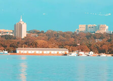
The Kisumu Waterfront Park is a scenic and serene recreational space located along the shores of Lake Victoria, in Kisumu, Kenya. This urban park offers stunning views of the lake and is one of the top tourist attractions in Kisumu. The park is popular among both locals and tourists due to its peaceful atmosphere, beautiful landscapes, and opportunities for various outdoor activities. It is a perfect destination for relaxation, family outings, and appreciating the natural beauty of Lake Victoria. How to Reach Kisumu Waterfront Park, Kisumu Getting to the Kisumu Waterfront Park is easy, thanks to its central location in Kisumu city. The park is situated near Kisumu Port, making it accessible to visitors coming from various directions. If you are flying into Kisumu, you can take a direct flight from Nairobi's Jomo Kenyatta International Airport (JKIA) to Kisumu International Airport. The flight takes approximately 45 minutes. From the airport, you can take a taxi or a public minibus (matatu) to reach the park in about 30 minutes. If you prefer traveling by road, Kisumu is about 340 kilometers from Nairobi. The drive takes roughly 5 to 6 hours, and the road is well-maintained, offering scenic views of the Rift Valley and the Kenyan countryside. Upon arrival in Kisumu, the park is located near the city center, making it easy to access by foot, taxi, or local transport. Public transport options, including buses and matatus, are also available and will take you to the central bus station in Kisumu. From there, you can easily find a taxi or walk to the Kisumu Waterfront Park. Weather and Timing Kisumu experiences a tropical climate with a warm and moderate temperature throughout the year. The city enjoys two major seasons: the rainy season and the dry season. The rainy season typically occurs from March to May and October to December, with temperatures ranging from 20°C (68°F) in the morning to 30°C (86°F) in the afternoon. During this period, occasional rains provide a refreshing coolness to the air. The dry season, lasting from June to September, is the best time to visit the Kisumu Waterfront Park. The weather is sunny and warm, with temperatures averaging between 22°C (72°F) and 30°C (86°F). This is the ideal time for outdoor activities like walking, picnicking, and sightseeing. The dry season is particularly popular for tourists, as the lake offers stunning views, and the park’s greenery is at its best. Why Kisumu Waterfront Park is Famous Kisumu Waterfront Park is famous for its picturesque setting and recreational opportunities. The park is located along the shores of Lake Victoria, Africa's largest freshwater lake, offering panoramic views of the water and surrounding landscapes. The park’s location makes it a perfect place to relax, take a walk, or enjoy a peaceful moment by the lake. The park is also well known for its diverse range of activities and facilities that cater to both locals and visitors. From its beautifully landscaped gardens to the peaceful lakefront walking trails, the Kisumu Waterfront Park is an urban oasis that provides a perfect retreat from the bustle of city life. The park is also a popular spot for locals to gather, host events, and enjoy picnics in the open-air spaces. Additionally, the Kisumu Waterfront Park is a symbol of Kisumu's efforts to promote tourism and urban development. The park has been developed as part of a broader initiative to enhance the lakeside area and provide locals and visitors with accessible green spaces in the city. Entry and Visit Details About Kisumu Waterfront Park, Kisumu Entry to Kisumu Waterfront Park is free, making it an accessible destination for everyone. The park is open to the public every day, from early morning until late evening, allowing visitors to explore the park during the day or at sunset. It is recommended to visit the park during daylight hours for safety and to fully enjoy the park’s scenic beauty. The park is well-maintained, and there are no specific visiting hours. However, to avoid the large crowds that can gather on weekends or during public holidays, it’s best to visit during weekdays or early mornings. Visitors can walk around the park, enjoy the views, or sit on one of the many benches scattered around the park for a peaceful experience. History and Architecture of Kisumu Waterfront Park The history of Kisumu Waterfront Park is closely tied to the development of Kisumu as a city and the revitalization of the lakeside area. Kisumu has a long history as an important port and trading hub on Lake Victoria, dating back to the colonial period. The park was developed in recent years as part of a city beautification project aimed at improving the lakeside area and creating a modern public space for both locals and tourists. The architecture of Kisumu Waterfront Park is simple yet stunning, with a focus on natural beauty and sustainability. The park features open green spaces, flower gardens, and large trees that provide shade for visitors. The park’s design incorporates elements that celebrate Kisumu’s cultural heritage and its connection to Lake Victoria. There are several well-maintained walkways, resting areas, and picnic spots where visitors can sit and enjoy the view of the lake. Things to Do at Kisumu Waterfront Park, Kisumu There are numerous activities and experiences to enjoy while visiting Kisumu Waterfront Park. Whether you're looking to relax or be active, there’s something for everyone: Walking and Jogging: The park offers a wide range of walking paths along the lake, making it a great spot for a leisurely stroll or jog. The fresh air and beautiful views of the lake provide an excellent environment for exercise. Picnics: Kisumu Waterfront Park is an ideal place to have a picnic. Visitors can enjoy the fresh air, have a meal by the lakeside, and spend time with family or friends. There are several open spaces where you can set up a picnic. Boat Rides on Lake Victoria: The park is located near Kisumu Port, and visitors can easily take a boat ride on Lake Victoria. These boat tours offer a unique way to see the lake and the surrounding islands. Birdwatching: Lake Victoria and the park are home to a variety of bird species, including pelicans, herons, and kingfishers. Birdwatchers will enjoy spotting these birds along the lakefront and in the surrounding areas. Relaxing by the Lake: For those who prefer to unwind, sitting by the lake or on one of the many benches in the park provides a peaceful retreat. The calming sounds of the water and the scenic views of the lake are perfect for relaxation. Photography: The park offers great opportunities for photography, especially during the golden hours of sunrise and sunset. The views of Lake Victoria and the lush greenery of the park make for fantastic photo backdrops. Interesting Facts About Kisumu Waterfront Park, Kisumu The Kisumu Waterfront Park is part of the city’s larger development project to enhance the lakeside area and attract more tourists to Kisumu. The park provides a habitat for various bird species, making it a popular spot for birdwatching. Kisumu Waterfront Park is located near several other tourist attractions, including the Kisumu Museum, Kisumu Impala Sanctuary, and Kisumu Port. The park has become a social hub for local residents who gather for picnics, events, and leisure activities. The park’s well-maintained gardens and clean environment make it a favorite destination for families, couples, and solo visitors alike. Travel Tips for Visiting Kisumu Waterfront Park, Kisumu Bring Comfortable Shoes: Since the park has walking paths and open spaces, it’s a good idea to wear comfortable shoes for walking or jogging. Carry Water and Snacks: If you plan to picnic or spend time at the park, make sure to bring water, snacks, and sunscreen to stay hydrated and protected from the sun. Respect the Environment: Keep the park clean by disposing of trash in the designated bins and being mindful of your surroundings. Visit Early for Quiet: To enjoy the park without large crowds, visit in the morning or during weekdays. Engage with Locals: Kisumu is known for its friendly locals, so take the time to talk with them and learn about the city’s culture and history.
Explore More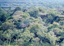
Kakamega Forest is a renowned tropical rainforest located in western Kenya, near the town of Kakamega and around 40 kilometers from Kitale. It is one of the last remnants of the vast tropical rainforest that once covered much of East Africa. The forest is a prime destination for nature lovers, birdwatchers, and those seeking a peaceful escape into the heart of Kenya's natural beauty. It offers an incredible diversity of flora and fauna, making it an ecological treasure for conservation and tourism. How to Reach Kakamega Forest, Kitale Kakamega Forest is easily accessible from Kitale, which is about 40 kilometers to the southeast of the forest. Visitors can reach Kakamega by road from Kitale, which typically takes around an hour by car. You can hire a taxi or rent a car for the journey, or use local buses and matatus that operate between Kitale and Kakamega. The roads are generally good, though some parts may be a bit bumpy, especially during the rainy season. If you're coming from Nairobi, you can take a direct bus or flight to Kakamega. From Nairobi, it’s approximately a 5-6 hour drive to Kakamega, or a one-hour flight to Kakamega Airport followed by a short drive to the forest. Weather and Timing Kakamega Forest has a mild climate throughout the year, with temperatures averaging between 18°C (64°F) and 30°C (86°F). It is located in a tropical zone, which means that the forest experiences two rainy seasons: the long rains between March and May and the short rains between October and November. The best time to visit Kakamega Forest is during the dry season, from June to September and December to February, when the trails are more accessible, and wildlife is more visible. Visitors should be prepared for occasional rainfall, especially during the rainy season. The weather can be unpredictable, so it’s wise to bring a raincoat or jacket. Even during dry months, the forest can feel humid, so comfortable clothing and sturdy footwear are highly recommended for walks and hikes. Why Kakamega Forest is Famous Kakamega Forest is famous for being Kenya’s only tropical rainforest and one of the most biologically diverse regions in the country. The forest is home to more than 400 species of trees, over 300 species of birds, and numerous animal species, including primates like the colobus monkeys. The forest is also famous for its rich plant life, including medicinal plants used by the local communities. Aside from its biological importance, Kakamega Forest is a historical site that has attracted researchers and conservationists due to its unique ecosystem. It is a critical area for the conservation of Kenya’s biodiversity, and it also serves as an educational resource for students and scientists alike. The forest’s rich cultural heritage and natural beauty have made it an increasingly popular destination for eco-tourism. Entry and Visit Details About Kakamega Forest, Kitale Entry into Kakamega Forest is available through several designated entrances, including the main Kakamega Forest Station. There are various entry points depending on the activities you plan to do, such as hiking, birdwatching, or cultural tours. Entry fees vary, and it is advisable to check the current rates ahead of your visit. The forest is open to visitors year-round, but the best time to visit is during the dry season when activities like hiking and birdwatching are more enjoyable. In terms of accommodation, visitors can stay in Kakamega Town, where there are several hotels and guesthouses ranging from budget to mid-range. Additionally, the forest area offers camping facilities for those looking to immerse themselves in nature. The Kakamega Forest Station also provides basic lodging options for visitors. For a more immersive experience, guided tours are available and can be booked in advance. History and Architecture of Kakamega Forest The history of Kakamega Forest dates back several centuries, with evidence suggesting that it was once part of a vast forest that covered much of East Africa. Over time, the forest was reduced in size due to human settlement and agricultural activities, but it remains an important ecological landmark. Kakamega Forest is part of the larger Mount Elgon ecosystem and was declared a forest reserve in the 1930s. The forest’s biodiversity has attracted international conservation organizations, and it has been designated as a critical conservation area in Kenya. Although the forest is not known for large architectural structures, there are several historical sites within and around the forest. The forest is dotted with ancient trees and sacred groves that hold cultural significance for the local Luhya community, who have lived in the area for generations. Things to Do at Kakamega Forest, Kitale There are plenty of activities to enjoy while visiting Kakamega Forest, including: Birdwatching: Kakamega Forest is a birdwatcher’s paradise, with over 300 species of birds, including the rare Great Blue Turaco. Early morning walks through the forest provide opportunities to spot colorful birds like sunbirds, hornbills, and turacos. Hiking and Nature Walks: There are several nature trails that wind through the forest, allowing visitors to explore the diverse flora and fauna. The trails vary in difficulty, from short walks to longer, more challenging hikes. The paths are well-marked, and visitors can enjoy the sounds of birds and wildlife along the way. Cultural Tours: The Luhya community surrounding Kakamega Forest has a deep cultural connection to the forest. Visitors can take part in cultural tours to learn about the indigenous plants, medicinal herbs, and the role the forest plays in the lives of the local people. Wildlife Viewing: While the forest is primarily known for its birdlife, it is also home to various animals, including monkeys, bush pigs, and forest antelopes. Wildlife viewing is a great way to experience the forest's biodiversity up close. Photography: With its stunning landscapes, vibrant birdlife, and lush greenery, Kakamega Forest offers excellent opportunities for photography, especially for those interested in capturing nature’s beauty. Interesting Facts About Kakamega Forest, Kitale Kakamega Forest is the only tropical rainforest left in Kenya, making it a unique ecological site. The forest is home to the endangered African Golden Cat, a rarely seen species of wild cat. There are over 400 species of trees in Kakamega Forest, some of which are endemic to the region. The forest is a haven for rare bird species, including the Great Blue Turaco, which is a symbol of the forest. In addition to its biodiversity, Kakamega Forest is culturally significant to the local Luhya community, who regard it as a sacred place. Travel Tips for Visiting Kakamega Forest, Kitale Pack for the Climate: The weather in Kakamega Forest can be humid and rainy, so pack light and breathable clothing. Don’t forget a rain jacket and sturdy hiking shoes. Guided Tours: Hiring a local guide is highly recommended. They can provide in-depth knowledge about the forest’s flora, fauna, and cultural significance. Be Mindful of Wildlife: While exploring the forest, be respectful of the wildlife. Avoid disturbing animals and follow the guide’s instructions for safety. Respect Local Culture: Kakamega Forest is of cultural importance to the Luhya community. Take time to learn about the local customs and traditions, especially when participating in cultural tours. Bring Water and Snacks: There are limited facilities inside the forest, so bring enough water and snacks, especially if you plan to hike for several hours.
Explore More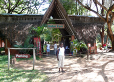
Haller Park, located in the coastal town of Malindi, Kenya, is one of the most scenic and ecological treasures in the region. Initially a barren limestone quarry, the park has been transformed into a thriving nature reserve that supports a wide range of wildlife and plant species. The park is managed by the Haller Park Foundation and offers visitors the chance to explore lush landscapes, encounter wildlife, and learn about sustainable environmental practices. It is an ideal destination for nature lovers, families, and anyone looking to escape the hustle and bustle of daily life while enjoying the beauty of the Kenyan coastline. How to Reach Haller Park, Malindi Haller Park is located just a few kilometers outside the town of Malindi, along the Mombasa-Malindi Road. The park is easily accessible by road, and visitors can use local transport or hire taxis to reach the entrance. From Malindi Town, it takes about 10 to 15 minutes to drive to the park, depending on traffic conditions. If you are traveling from Nairobi, the easiest way to reach Haller Park is by taking a flight to Malindi Airport, which is approximately 2 kilometers away from the park. Flights from Nairobi’s Wilson Airport to Malindi Airport are available, and the flight duration is approximately 1 hour. Alternatively, you can drive from Nairobi to Malindi, which takes around 7 to 8 hours, passing through Mombasa on the way. For those coming from Mombasa, Haller Park is approximately 120 kilometers away, and the drive typically takes around 2.5 to 3 hours. Visitors staying in Mombasa or the surrounding areas can also take a bus or arrange a guided tour to visit Haller Park. Weather and Timing The weather at Haller Park is typical of the coastal region, with warm and humid conditions year-round. The park enjoys a tropical climate with average temperatures ranging between 25°C (77°F) and 32°C (90°F). The best time to visit Haller Park is during the dry season, which lasts from December to March and from July to October, as the weather is sunny and pleasant for outdoor activities. The rainy season, from April to June, may bring occasional showers, making some areas of the park a bit slippery. Haller Park is open daily from 8:00 AM to 6:00 PM, giving visitors ample time to explore the park’s trails, view wildlife, and enjoy the scenic surroundings. It is advisable to visit in the early morning or late afternoon to avoid the midday heat. Why Famous for Haller Park, Malindi? Haller Park is renowned for its remarkable transformation from a desolate quarry to a lush and biodiverse nature reserve. What was once a barren limestone mine has been rehabilitated into a thriving ecosystem, thanks to the efforts of Dr. René Haller, a Swiss agricultural engineer. Over the years, he introduced innovative techniques to restore the land and create a sustainable environment for both flora and fauna. The park is famous for its diverse wildlife, including giraffes, hippos, waterbucks, buffaloes, and various species of birds. It also boasts a large number of plant species, including tropical trees, shrubs, and flowers that attract butterflies and other insects. The park’s commitment to conservation, environmental education, and wildlife protection makes it a popular attraction for eco-tourists and nature enthusiasts. One of the park’s most unique features is the successful breeding program of its animal species, such as the impala, buffaloes, and giraffes. Haller Park is a testament to how human intervention can help restore damaged ecosystems and provide a safe haven for wildlife. Entry and Visit Details About Haller Park, Malindi Visitors to Haller Park are required to pay an entry fee, which helps fund the park’s conservation efforts. The entrance fees are usually affordable, and there are different rates for locals, residents, and international tourists. The park offers guided tours for visitors who wish to learn more about the park’s history, the restoration efforts, and the diverse species inhabiting the area. The park is open from 8:00 AM to 6:00 PM, seven days a week. To make the most of your visit, it is recommended to arrive early in the morning or later in the afternoon when the temperatures are cooler. Guided tours are available upon request, and they typically last around 1.5 to 2 hours. Visitors can also explore the park on their own by following the clearly marked trails. For a more immersive experience, visitors can enjoy a picnic at designated spots within the park or relax at the park’s restaurant, which offers local and international dishes. It’s important to carry essentials such as water, sunscreen, and a hat, as the park can get quite warm, especially in the midday heat. History and Architecture of Haller Park The history of Haller Park dates back to the 1970s when Dr. René Haller, along with his team, began the process of rehabilitating the barren land. Originally a limestone quarry, the area had been left unusable after the mining operations ceased. Dr. Haller’s vision was to restore the area into a thriving ecosystem, using sustainable agricultural and ecological techniques. Through his efforts, Dr. Haller transformed the quarry into a green haven, planting thousands of trees and introducing various plant species. The restoration process also included building water systems, creating animal enclosures, and constructing paths for visitors to explore the park’s beauty. The architecture of Haller Park is minimalist and functional, designed to blend harmoniously with the surrounding environment. The park’s trails are well-maintained, and there are strategically placed observation points for visitors to enjoy views of the park’s wildlife and landscapes. The park also features a large pond where hippos and waterfowl can be observed in their natural habitat. Things to Do at Haller Park, Malindi There are plenty of activities to enjoy during your visit to Haller Park. Here are some top things to do: Wildlife Viewing: The park is home to various animals, including giraffes, buffaloes, zebras, and hippos. Visitors can view these animals in their natural habitat and learn about their behavior and conservation efforts. Bird Watching: Haller Park is a birdwatcher’s paradise, with over 100 species of birds. Visitors can spot species such as the African fish eagle, herons, and ibises. Guided Tours: Take a guided tour to explore the park’s history, learn about the rehabilitation efforts, and spot animals and plants of interest. Picnicking: Enjoy a relaxing picnic in the park’s designated picnic spots. The park offers a peaceful setting surrounded by lush greenery, perfect for a family outing or a quiet retreat. Photography: Capture the beauty of the park, its wildlife, and landscapes. The diverse flora and fauna provide excellent opportunities for nature photography. Interesting Facts About Haller Park, Malindi Haller Park was formerly known as Bamburi Nature Trail and was rehabilitated from a limestone quarry. The park was named after Dr. René Haller, whose innovative restoration methods turned the barren land into a thriving ecosystem. Haller Park is home to over 160 species of plants and more than 100 species of birds. Haller Park is a successful example of how human intervention can restore damaged ecosystems and provide a safe haven for wildlife. The park’s giraffes, impalas, and waterbucks have been part of a successful breeding program, contributing to the conservation of these species. Tips for Visiting Haller Park, Malindi Wear Comfortable Shoes: Since the park involves walking on dirt trails, comfortable footwear is recommended. Bring Essentials: Don’t forget to carry sunscreen, a hat, water, and a camera for wildlife photography. Take a Guided Tour: To get the most out of your visit, consider booking a guided tour to learn more about the park’s history and wildlife. Visit During Cooler Hours: It’s best to visit early in the morning or later in the afternoon to avoid the midday heat. Respect the Wildlife: Keep a safe distance from the animals, and avoid disturbing their natural habitat.
Explore More6 Days Mount Kenya Climbing - Sirimon Route Tour
6 Days/ 5 Night
Nanyuki
10 Days Kenya Family Expedition Tour
10 Days/ 9 Night
Nairobi - Nakuru - Masai Mara - Nanyuki
3 Days 2 Nights Masai Mara Safari
3 Days/ 2 Night
Narok
Amazing Kenya 7 Days Safari Tour
7 Days/ 6 Night
Nairobi - Nakuru - Masai Mara
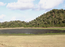
Lake Paradise is a stunning crater lake nestled within the Marsabit National Park in northern Kenya. Surrounded by thick montane forest, this serene and scenic lake sits inside an extinct volcanic crater on the slopes of Mount Marsabit. The lake is one of the most beautiful and tranquil destinations in Kenya, often referred to as a “hidden gem in the desert.” It has attracted naturalists, explorers, and wildlife lovers for decades and remains one of the top attractions in Marsabit County. How to Reach Lake Paradise, Marsabit Lake Paradise is located within the boundaries of Marsabit National Park. The lake can be accessed via the following options: By Road: From Nairobi, it’s about 560 kilometers to Marsabit town via the A2 highway. The route passes through Isiolo and Archers Post. A 4WD vehicle is highly recommended due to uneven terrain within the park. From Marsabit Town: Lake Paradise is approximately 6 km from Marsabit town and can be reached by local taxi or tour vehicle. A short drive and hike through the forest will bring you to the lake viewpoint. By Air: There’s an airstrip in Marsabit town for private and chartered flights from Nairobi’s Wilson Airport. Weather at Lake Paradise, Marsabit The climate around Lake Paradise is cooler and wetter than the surrounding arid regions due to its high elevation and forest cover: Temperature: Daytime temperatures range between 20°C to 28°C; nights can be cool with temperatures dropping to 12°C or lower. Rainfall: The area experiences short rains in November and longer rains from March to May. Best Time to Visit: June to October and December to February offer the best weather for exploration and wildlife sightings. Timing and Operating Hours Lake Paradise is accessible during Marsabit National Park’s standard operating hours: Opening Hours: 6:00 AM to 6:00 PM daily, including weekends and public holidays. Recommended Visit Time: Morning and late afternoon are best for bird watching and game viewing. Why Famous for Lake Paradise, Marsabit? Lake Paradise holds a legendary status due to its unmatched beauty, rich biodiversity, and historical significance: It served as a favorite retreat for early 20th-century explorers such as Martin and Osa Johnson who documented wildlife and local culture here. The lake is surrounded by a dense, misty forest that contrasts with the surrounding desert plains, creating a magical visual effect. It is a haven for birdwatchers and wildlife enthusiasts, offering a peaceful escape into nature. Entry and Visit Details about Lake Paradise, Marsabit Lake Paradise is part of Marsabit National Park, and entry is regulated by the Kenya Wildlife Service (KWS). Here are the key visitor details: Entry Fees: Citizens: KES 300 (adult), KES 215 (child) Residents: KES 1,030 (adult), KES 515 (child) Non-Residents: USD 52 (adult), USD 35 (child) Payment: Entry fees are payable via M-PESA or eCitizen at the gate. Guides and Tours: Local guides and KWS rangers are available to lead walking safaris and game drives around the lake. Accommodation: Options include the historic Marsabit Lodge overlooking the lake, local guesthouses in Marsabit town, and designated campsites inside the park. History and Architecture Lake Paradise has a rich legacy associated with exploration, conservation, and natural science: It gained global fame through the works of Martin and Osa Johnson, pioneering American wildlife filmmakers who visited in the 1920s and 1930s. Their book “I Married Adventure” and wildlife documentaries introduced Lake Paradise to a global audience. Ahmed the Elephant, Kenya’s most famous elephant, roamed near Lake Paradise and became a symbol of elephant conservation. The Marsabit Lodge, built during colonial times, is one of Kenya’s oldest park lodges and offers a panoramic view of the lake from its location above the crater rim. Things to Do at Lake Paradise, Marsabit There are several exciting and tranquil activities for visitors to enjoy at Lake Paradise: Bird Watching: Over 500 bird species including the crowned eagle, red-knobbed coot, and masked lark can be spotted around the lake. Wildlife Viewing: Spot elephants, buffaloes, warthogs, baboons, and bushbucks that come to drink at the lake or roam nearby forest paths. Hiking and Nature Walks: Short guided hikes through the forest offer a chance to observe flora, birds, and insects up close. Photography: The lake’s mirror-like reflection, mist-covered trees, and morning light make it perfect for landscape and wildlife photography. Relaxation: Enjoy a quiet picnic near the lake or at one of the designated rest points. Facts about Lake Paradise, Marsabit Lake Paradise is an extinct crater lake formed from volcanic activity millions of years ago. It is fed by underground springs and seasonal rainfall, maintaining water even during dry spells. The surrounding Marsabit forest is classified as a cloud forest – a rare feature in arid northern Kenya. The lake served as a filming location for early wildlife documentaries in the 20th century. It was a favorite destination for Kenya’s first president, Jomo Kenyatta, who recognized its ecological value. Tips about Lake Paradise, Marsabit Bring a good pair of binoculars and a camera with zoom lenses for optimal wildlife and bird viewing. Wear comfortable hiking shoes and layered clothing to adapt to the shifting temperatures. Use local guides to enhance your understanding of the area’s ecology and history. Travel in a 4x4 vehicle, especially during the rainy season when paths can be slippery. Respect the wildlife and environment – do not litter or disturb animals near the lake. Carry enough drinking water and snacks as there are limited commercial facilities inside the park.
Explore More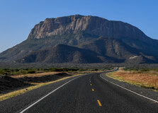
Mount Marsabit is a majestic extinct volcano located in the arid northern region of Kenya, in Marsabit County. Rising to an elevation of approximately 1,700 meters above sea level, this lush, green mountain is a dramatic contrast to the surrounding dry lowlands. Covered by dense cloud forest, Mount Marsabit is the heart of Marsabit National Park and home to a wide range of wildlife, crater lakes, and historical legends. It serves as a vital water catchment area and offers a peaceful natural retreat filled with stunning landscapes and rich biodiversity. How to Reach Mount Marsabit, Marsabit Mount Marsabit is easily accessible via several travel options: By Road: From Nairobi, the mountain can be reached via the A2 Highway that runs through Isiolo and Archers Post, covering a distance of about 560 km. The journey takes approximately 10–12 hours by vehicle. A 4WD vehicle is recommended due to the rough roads in and around Marsabit. By Air: Marsabit town has a small airstrip that accommodates chartered and scheduled flights from Nairobi’s Wilson Airport. From Marsabit town, the base of Mount Marsabit is just a short drive away. Local Transport: Visitors can take local taxis or hire guides from Marsabit town to reach hiking trails and scenic spots around the mountain. Weather at Mount Marsabit Despite being located in an otherwise dry region, Mount Marsabit’s weather is cool and often misty due to its forested nature: Temperature: Daytime temperatures range between 18°C to 26°C, while nights are cooler at around 10°C to 15°C. Rainfall: The area receives significant rainfall during the long rains (March–May) and short rains (October–December). Best Time to Visit: The dry months from June to September and January to February are ideal for hiking, wildlife viewing, and photography. Timing and Operating Hours Mount Marsabit is part of the Marsabit National Park ecosystem and follows the standard timing of the Kenya Wildlife Service (KWS): Opening Hours: 6:00 AM to 6:00 PM daily, including weekends and holidays. Hiking Hours: Early morning hikes (6:30 AM to 10:30 AM) and late afternoon (3:30 PM to 5:30 PM) are recommended due to cooler temperatures and better wildlife activity. Why Famous for Mount Marsabit, Marsabit? Mount Marsabit is famous for several unique reasons: Its stunning cloud forest provides a green oasis in the otherwise barren north of Kenya. It is home to Lake Paradise, a crater lake surrounded by thick vegetation and frequented by elephants and birds. The mountain is historically linked to famous wildlife conservation stories, including Ahmed the Elephant, one of Kenya’s most protected animals. It has attracted explorers and documentarians like Martin and Osa Johnson who filmed African wildlife here in the early 20th century. Entry and Visit Details about Mount Marsabit, Marsabit Since Mount Marsabit lies within the boundaries of Marsabit National Park, entry is governed by KWS regulations: Entry Fees: Kenyan Citizens: KES 300 (adults), KES 215 (children) Residents: KES 1,030 (adults), KES 515 (children) Non-Residents: USD 52 (adults), USD 35 (children) Payment: Visitors must pay via M-PESA or online through the eCitizen platform. Accommodation: Marsabit Lodge is the primary accommodation within the park. Camping sites and lodges are also available in the town. Guides: Guided tours and nature walks are available from local guides and KWS rangers stationed in the park. History and Architecture Mount Marsabit has historical and ecological importance: The mountain was formed millions of years ago through volcanic activity and has multiple craters, including those housing lakes such as Lake Paradise and Lake Sokorte Guda. The Marsabit Lodge, established during colonial times, is a rustic accommodation facility located near the edge of Lake Paradise. Ahmed the Elephant, known for his huge tusks, roamed Mount Marsabit’s forests and was declared a national treasure under President Jomo Kenyatta’s protection. The mountain's forests were a vital source of water for the local communities and still serve as a catchment for Marsabit town today. Things to Do at Mount Marsabit Visitors can enjoy several activities around Mount Marsabit, including: Hiking and Nature Walks: Explore trails through the misty forest, climb to viewpoints, and experience the unique highland ecosystem. Bird Watching: The forest is home to over 500 bird species such as hornbills, turacos, and raptors. Wildlife Viewing: Spot elephants, buffaloes, warthogs, leopards, bushbucks, and hyenas. Photography: Ideal for landscape, wildlife, and cultural photography due to dramatic scenery and vibrant biodiversity. Crater Lake Exploration: Visit Lake Paradise and other smaller crater lakes for their tranquility and wildlife. Facts about Mount Marsabit Mount Marsabit rises to approximately 1,707 meters above sea level. The mountain contains three major crater lakes and several seasonal water bodies. It’s one of the few cloud forests in Kenya’s northern frontier, offering a rare ecosystem. Ahmed the Elephant, once protected by armed guards, lived on this mountain. The Marsabit forest is home to both tropical and savannah flora and fauna species. Tips about Mount Marsabit, Marsabit Start hikes early in the day to avoid midday heat and increase chances of seeing animals. Always carry drinking water, sunscreen, and insect repellent. Hire a local guide for safer navigation and to learn about local culture and ecology. Respect wildlife and do not feed or approach wild animals. Carry a rain jacket as the weather can shift quickly due to the mountain’s microclimate. Ensure your vehicle is well-fueled and in good condition before traveling into the park.
Explore More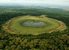
The Dub Goba Crater is a hidden geological gem located in Marsabit County, northern Kenya. Nestled in the Marsabit Forest Reserve, the crater is part of the ancient volcanic landscape that dominates this region. Though less popular than the nearby Gof Sokorte Guda or Lake Paradise, Dub Goba Crater offers equally breathtaking views, lush vegetation, and a sense of mystery and solitude. Surrounded by dense forest and steep walls, this volcanic caldera remains a quiet retreat for adventurous travelers, nature lovers, and researchers interested in geology and biodiversity. How to Reach Dub Goba Crater, Marsabit Dub Goba Crater is located within the Marsabit National Reserve, approximately 6–10 kilometers from Marsabit town center. While not signposted like more popular attractions, it is accessible by foot or 4x4 vehicle with guidance from locals or park authorities. By Road: From Nairobi, the main route to Marsabit is via Isiolo and Merille, covering around 540 km. The road is paved up to Marsabit town, taking about 8–10 hours by car or bus. Once in Marsabit, you can access the crater through the Marsabit Forest area with a guide and suitable off-road vehicle. By Air: Marsabit has a small airstrip with charter flights available from Wilson Airport in Nairobi. From the airstrip, you can hire a local vehicle or arrange a tour. On Foot or Bike: For those staying nearby, guided hiking or biking to the crater is possible through forest trails. Ensure you go with someone who knows the area well due to the thick vegetation and wildlife. Weather at Dub Goba Crater The crater lies within the highland forest area of Marsabit, which gives it a unique microclimate compared to the arid surroundings. Temperature: Average daytime temperatures range between 18°C to 28°C. Nights can be cool, especially due to forest cover. Rainfall: The area receives rainfall twice a year—between March to May and October to December. These rains keep the crater and forest lush and green. Best Time to Visit: June to September and January to early March are the driest and most accessible months. Timings for Visiting As part of the Marsabit Forest Reserve, the Dub Goba Crater can be visited during daylight hours. Most visitors go between 7:00 AM and 5:00 PM. Opening Hours: Daily, 6:00 AM to 6:00 PM (recommended timing for safe exploration) Tour Duration: A visit can take between 2 to 4 hours, including hiking and sightseeing. Why Famous for Dub Goba Crater, Marsabit? Dub Goba Crater is known for its scenic beauty, geological importance, and biodiversity. Its steep sides, lush green floor, and tranquil atmosphere make it ideal for nature photography and eco-tourism. The crater is part of the extinct volcanic system that shaped Marsabit Mountain. Surrounding forest areas are home to elephants, buffaloes, leopards, baboons, and numerous bird species. The crater floor often holds a small seasonal lake or wetland during the rainy season, attracting animals and birds. It is a peaceful, off-the-beaten-path destination for explorers looking to avoid crowds. Entry and Visit Details Since Dub Goba lies within the protected Marsabit Forest, visitors are advised to enter through official routes and inform Kenya Wildlife Service (KWS) personnel before exploring. Entry Fee: Entry to Marsabit National Reserve is typically KES 300 for citizens, KES 600 for residents, and USD 25 for non-residents. This fee covers the general forest and crater areas. Permits: No special permit is needed for Dub Goba, but check with KWS at Marsabit gate for local access rules. Guides: Hiring a local guide is highly recommended for safe navigation and to learn about the flora, fauna, and culture. Facilities: There are no facilities at the crater. Carry water, food, and safety gear. Basic accommodation is available in Marsabit town. History and Architecture Dub Goba Crater is an ancient volcanic feature formed thousands of years ago during Marsabit Mountain’s last eruptions. While it doesn't have man-made architecture, the natural structure of the crater is a geological marvel. The name "Dub Goba" is derived from local Cushitic or Rendille language and refers to the circular nature of the crater. The walls of the crater are steep and densely forested, making it a rare combination of geological and ecological diversity in northern Kenya. Things to Do in Dub Goba Crater Hiking: Trek through forest trails to reach the rim and descend safely to the crater floor. Bird Watching: Spot hornbills, eagles, sunbirds, and other rare forest birds. Photography: Capture the stunning greenery, crater walls, and wildlife in their natural habitat. Nature Observation: Observe elephants, baboons, and other animals during early mornings or evenings. Eco-tourism: Learn about forest conservation and local indigenous practices from guides or researchers. Facts about Dub Goba Crater It is one of several volcanic craters on Marsabit Mountain, including the better-known Lake Paradise. Dub Goba Crater lies at an altitude of over 1,300 meters above sea level. The crater is rarely visited, making it ideal for travelers seeking solitude and untouched nature. The ecosystem includes montane forest species and endemic plants not found in the surrounding arid areas. Dub Goba is a potential site for eco-research and sustainable tourism development. Tips about Dub Goba Crater, Marsabit Wear sturdy hiking shoes and lightweight long clothing to protect against thorns and insects. Bring your own drinking water, snacks, binoculars, and first-aid kit. Hire a guide or join a group to avoid getting lost in the forest. Respect wildlife and avoid making loud noises or feeding animals. Visit during dry seasons for easier access and better visibility of the crater floor. Check in at the KWS gate for safety information and maps before entering the forest.
Explore More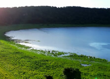
Lake Marsabit is a picturesque and serene lake located in Marsabit County, northern Kenya. It is an integral part of the Marsabit National Reserve, surrounded by lush forests and located in the Marsabit Mountain, an extinct volcano. The lake, sitting at an elevation of about 1,400 meters above sea level, is a haven for wildlife and offers an escape for nature lovers, photographers, and tourists looking for an off-the-beaten-path destination. How to Reach Lake Marsabit Lake Marsabit is located approximately 550 kilometers north of Nairobi, the capital city of Kenya. There are several ways to reach the lake: By Road: The most common way to reach the lake is by road. From Nairobi, it takes about 9 to 10 hours by car, depending on road conditions. The route goes through Nanyuki, Isiolo, and Moyale, passing through rugged terrains and scenic landscapes. By Air: If you prefer a quicker route, you can fly to Marsabit from Nairobi. There are regular flights available from Nairobi’s Wilson Airport to Marsabit’s local airport. Once in Marsabit town, the lake is just a short drive away. Weather at Lake Marsabit The weather around Lake Marsabit is characterized by its cool and moderate climate due to its high altitude. The temperatures generally range between 20°C to 30°C, making it a pleasant escape from the scorching heat found in other parts of northern Kenya. However, it’s important to note that the area can experience sudden weather changes, so it’s advisable to carry light clothing for the day and warm clothes for the evening. Rainfall is frequent between March and May, and during this period, the region becomes even more vibrant and green. Timing to Visit Lake Marsabit Lake Marsabit can be visited throughout the year, but the ideal time to visit is during the dry seasons from June to September, as this is when the weather is most predictable. The wet seasons, especially in April and May, can make travel to and around the lake difficult due to heavy rains and muddy roads. Why Lake Marsabit is Famous Lake Marsabit is famous for its stunning beauty, serene atmosphere, and the surrounding lush forests and wildlife. It is known for being an oasis in an otherwise dry region, thanks to the cool volcanic crater lake nestled within the Marsabit Mountain. Some of the most unique features that make the lake famous include: Natural Habitat: The lake is a vital water source for both wildlife and local communities. It is surrounded by dense forests, which are home to various species of flora and fauna, including monkeys, buffaloes, and various bird species. Unique Ecosystem: Due to its location on a volcanic mountain, the lake’s ecosystem is unique, offering a contrast between the dry, harsh surrounding landscape and the lush greenery surrounding the lake. Historical Significance: The lake has cultural significance to the indigenous people of the region, especially the Borana community. It is also important historically for being a water source during times of drought. Entry and Visit Details The lake is part of the Marsabit National Reserve, so visitors are required to pay an entry fee. It’s best to contact the reserve authorities for up-to-date pricing on entry fees and other charges. Visitors typically enter the reserve via the main gate near Marsabit town. If you are planning to camp near the lake or spend more time exploring the area, you should arrange for permits and accommodations in advance. History and Architecture The history of Lake Marsabit is deeply connected to the local community and the region’s geology. The lake is situated inside a volcanic crater, and it’s believed that it formed thousands of years ago. The Marsabit Mountain, from which the lake was created, is an extinct volcano that played a significant role in shaping the landscape of northern Kenya. Although there are no major human-made architectural structures directly associated with the lake itself, the surrounding forest and nearby mountains offer a fascinating natural architecture, with cliffs, volcanic formations, and diverse ecosystems that make it a striking place to visit. Things to Do Around Lake Marsabit Lake Marsabit is not only a beautiful place to visit but also offers a variety of activities for nature lovers, adventure enthusiasts, and wildlife photographers. Some of the things to do include: Wildlife Watching: The surrounding Marsabit National Reserve is home to a variety of wildlife, including elephants, giraffes, buffaloes, and a diverse range of bird species. The forests around the lake are particularly attractive to birdwatchers. Hiking: The surrounding mountain offers several hiking trails, where you can enjoy panoramic views of the lake, forest, and the surrounding terrain. Photography: Whether it’s capturing the misty mornings by the lake or the wildlife, this location is perfect for photographers looking to capture the untouched beauty of nature. Cultural Exploration: Learn about the local communities, especially the Borana people, and their connection to the land and water. Visitors can often engage in local cultural activities or visit nearby villages. Camping: Camping near the lake offers a unique experience. The tranquil environment allows for a peaceful night under the stars, and early mornings provide beautiful views of the lake and surrounding forest. Interesting Facts about Lake Marsabit The lake is located within the Marsabit National Reserve, a protected area that helps preserve the local wildlife and ecosystem. Lake Marsabit is a crater lake, formed by volcanic activity thousands of years ago. The lake is surrounded by dense forests, making it a biodiversity hotspot, home to unique flora and fauna. During the dry seasons, the lake provides water to wildlife and local communities, making it a vital source of survival for many species. Tips for Visiting Lake Marsabit Prepare for the Weather: While the weather is generally cool, temperatures can drop at night, so bring warm clothing. Travel with a Guide: Given the remoteness of the area, it’s advisable to travel with a local guide who knows the terrain and wildlife. Respect Local Customs: Be respectful of the indigenous cultures and traditions of the local communities. Carry Enough Supplies: Due to the remote location, services are limited, so carry sufficient food, water, and other essentials. Be Mindful of Conservation: The area is a natural reserve, so avoid littering and respect the wildlife and plant life.
Explore More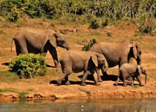
The Marsabit Forest, located in the northern region of Kenya, is one of the country's hidden gems, offering an oasis of cool, dense forest amidst the arid landscapes of Marsabit County. This forest is part of the Marsabit National Park and is an important ecological zone, home to a rich diversity of flora and fauna. As a crucial water catchment area for the surrounding communities, Marsabit Forest is not only a natural treasure but also a key resource for the people living in the region. Surrounded by the stunning landscapes of volcanic hills, the forest offers a serene escape for nature lovers and adventure seekers alike. How to Reach The Marsabit Forest The Marsabit Forest is located near the town of Marsabit in northern Kenya. Getting there requires some preparation due to its remote location, but it is accessible for those willing to embark on a journey through this captivating region. By Road: From Nairobi, the drive to Marsabit takes approximately 12-14 hours, covering a distance of about 700 kilometers. The most common route is through Isiolo and then heading northwards towards Marsabit. The roads are mostly tarmacked up to Isiolo, but the final stretch towards Marsabit can be rugged and dusty, so a 4x4 vehicle is highly recommended. By Air: You can also fly from Nairobi to Marsabit Airport, which is the nearest airstrip to the forest. Flights from Nairobi’s Wilson Airport to Marsabit are operated by local airlines, and the journey takes about 1.5 hours. From Marsabit town, you can hire a vehicle to take you to the forest. Weather in The Marsabit Forest The climate in Marsabit Forest is a marked contrast to the surrounding arid regions. Due to its high elevation, the forest experiences cooler temperatures compared to the rest of Marsabit County. The average temperature in the forest is around 18°C (64°F), making it a refreshing getaway from the intense heat of the lowlands. Unlike the surrounding desert areas, the Marsabit Forest receives regular rainfall, especially during the wet season from April to October. This rainfall supports the lush vegetation that covers the forest, creating a vibrant green environment. The dry season from November to March is warmer but still cooler than the surrounding desert areas, with temperatures rarely exceeding 30°C (86°F). Timing to Visit The Marsabit Forest The best time to visit Marsabit Forest is during the cool, dry months from December to March. During this period, the weather is ideal for exploring the forest and engaging in outdoor activities, such as hiking and bird watching. However, visiting during the rainy season (April to October) offers a different experience, with the forest in full bloom, and the surrounding environment more vibrant and lush. Keep in mind that some roads can become impassable during heavy rains, so it's essential to check the weather conditions before traveling. Why The Marsabit Forest is Famous The Marsabit Forest is famous for several key reasons: Ecological Importance: The forest is one of the few remaining rainforests in the northern part of Kenya. It plays a vital role in the region’s ecosystem by acting as a water catchment area for the surrounding communities and wildlife. The forest is home to numerous streams and natural springs that provide water to Marsabit town and its neighboring areas. Rich Biodiversity: Marsabit Forest is home to a wide variety of plant and animal species, some of which are rare or endemic to the region. It houses many bird species, including the endangered African green pigeon and various species of eagles, making it a prime spot for bird watching. Scenic Beauty: The forest is located on the slopes of the extinct Marsabit Volcano, providing visitors with spectacular views of the surrounding landscapes. The mixture of lush greenery, volcanic hills, and the clear sky creates an incredibly scenic backdrop. Cultural Significance: The forest is not only important ecologically but also culturally. The local communities, such as the Borana and Gabra people, rely on the forest’s resources for their livelihoods, making it an essential part of their culture and way of life. Entry and Visit Details About The Marsabit Forest Entry to Marsabit Forest is generally open to the public, and there are no specific entry fees. However, if you're planning to explore the area, it is advisable to check in with the Kenya Wildlife Service (KWS) or local authorities for any updates on access restrictions or permits, especially if you plan to visit during a period of increased tourism activity. For those wishing to explore the forest, it is highly recommended to travel with a local guide. Guides can help you navigate the forest’s many trails and ensure that you experience the best of the forest, including its hidden gems, like the various viewpoints and the natural springs. Guides also provide valuable information about the area's flora and fauna, making the visit more informative. History and Architecture The Marsabit Forest has a long history, both ecologically and culturally. The forest has been part of the natural landscape of northern Kenya for centuries, and it holds significant importance for the local communities who have lived in the region for generations. The forest is believed to have originated from the volcanic activity that formed the Marsabit Volcano, which is the source of the forest’s rich soil and diverse vegetation. While there are no significant man-made architectural structures within the forest itself, the surrounding Marsabit area is home to traditional huts and structures built by the indigenous communities, including the Borana and Gabra peoples. These communities rely on the forest’s resources, including water from its springs, for their traditional way of life. Things to Do Around The Marsabit Forest While the Marsabit Forest is primarily a place to enjoy nature and tranquility, there are several activities that visitors can engage in during their visit: Hiking and Nature Walks: Explore the forest on foot, following the many trails that wind through the lush environment. The hikes range from easy walks to more challenging treks that take you to the top of the volcano, offering breathtaking views of the surrounding landscape. Bird Watching: The forest is a bird watcher’s paradise, home to over 200 bird species. With species like the African green pigeon and various types of eagles, bird enthusiasts will have plenty to admire and photograph. Camping: For those who wish to immerse themselves in nature, camping is a great option. The forest provides several camping sites, where you can spend the night under the stars, surrounded by the sights and sounds of the forest. Visit the Marsabit Volcano: The forest is located on the slopes of the Marsabit Volcano, an extinct volcanic mountain. A visit to the summit offers a panoramic view of the surrounding desert landscape and the forest itself. Visit the Local Communities: The local Borana and Gabra communities offer an opportunity to learn about their cultures and traditional lifestyles. A visit to their villages can provide insights into how they have lived in harmony with the forest and its resources for generations. Interesting Facts About The Marsabit Forest The Marsabit Forest covers approximately 1,500 square kilometers, making it one of the largest forests in northern Kenya. The forest is a crucial water catchment area, providing vital water supplies to the town of Marsabit and surrounding communities. It is home to the Marsabit Volcano, which is an extinct volcano that provides the forest with fertile soil and a unique landscape. The forest is one of the few places in northern Kenya where you can find cool temperatures, as it is located at an altitude of over 1,500 meters (5,000 feet) above sea level. Tips for Visiting The Marsabit Forest Pack for the Climate: While the forest is cooler than the surrounding desert, temperatures can still be warm during the day. Wear lightweight clothing, but bring a jacket or sweater for the evenings. Stay Hydrated: Even though the forest is cooler, the dry conditions of Marsabit County require that you drink plenty of water, especially if you are hiking or engaging in outdoor activities. Respect the Environment: The forest is a delicate ecosystem, so ensure you leave no trace by disposing of waste properly and avoiding damage to plants and wildlife. Travel with a Guide: A local guide will enhance your experience, helping you navigate the forest and providing valuable information about its history, biodiversity, and cultural significance. Check Road Conditions: The roads leading to the forest can be rough, especially during the rainy season. It’s a good idea to check road conditions and ensure that your vehicle is suitable for the terrain.
Explore More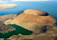
Lake Turkana, also known as the "Jade Sea" due to its beautiful turquoise-colored waters, is one of the most remarkable natural landmarks in Kenya. Located in the northern part of the country, in Marsabit County, this vast desert lake is the largest in Kenya and one of the most remote destinations in East Africa. It holds a significant place in both ecological and cultural contexts, being an essential water source for the local communities and wildlife. The lake, along with its surrounding area, has been declared a UNESCO World Heritage Site due to its rich biodiversity and archaeological significance. How to Reach Lake Turkana, Marsabit Reaching Lake Turkana can be an adventurous journey, as it is located in a remote region of northern Kenya. The lake is approximately 500 kilometers north of Nairobi, which means it’s a long-distance trip that requires careful planning. By Road: The most common way to reach Lake Turkana is by road. Travelers usually take the highway from Nairobi through Isiolo and Marsabit towns. From Marsabit, a 4x4 vehicle is needed to reach the lake’s shores, as the roads can be quite rough and challenging, especially during the rainy season. The trip from Nairobi to Lake Turkana typically takes about 12 to 14 hours, depending on road conditions. By Air: There are small chartered flights from Nairobi’s Wilson Airport to Lodwar Airport, which is the nearest airport to Lake Turkana. From Lodwar, it takes about 3-4 hours by road to reach the lake. Flights are more expensive but offer a quicker and more comfortable journey. From Muscat: If you’re traveling from Muscat, you’ll first need to fly to Nairobi, Kenya. From Nairobi, you can either take a flight to Lodwar or drive to Marsabit, and then continue by road to Lake Turkana. Weather at Lake Turkana The climate around Lake Turkana is typically hot and arid. The temperatures are high throughout the year, with daytime temperatures often reaching between 30°C and 40°C (86°F to 104°F). Due to its location in the Great Rift Valley, the region experiences a semi-desert climate. Nights, however, are cooler, with temperatures dropping to around 20°C (68°F). The area is characterized by minimal rainfall, although it does experience some precipitation during the short rains from October to December and the long rains from March to May. Timing to Visit Lake Turkana The best time to visit Lake Turkana is during the dry season, from June to October. This is when the roads are in the best condition, making it easier to navigate the sometimes challenging terrain. The dry weather also provides the best opportunity to experience the lake and surrounding areas without the risks of heavy rains that can make travel difficult. However, the lake is beautiful year-round, with the rainy season bringing temporary lushness to the desert and offering a different kind of beauty. Why Lake Turkana is Famous Lake Turkana is renowned for several reasons, making it a unique and fascinating destination for both local and international visitors: Geological Significance: Lake Turkana is located in the heart of the Great Rift Valley, making it an important geological feature. It is the largest desert lake in the world and serves as an important body of water in one of the driest parts of Kenya. Ecological Richness: The lake is home to a variety of wildlife, including crocodiles, hippos, and numerous bird species, particularly around the surrounding wetlands. The area around the lake is an essential habitat for both migratory and resident birds, making it a birdwatching haven. Archaeological Significance: The Lake Turkana Basin has been a major source of fossil discoveries, including some of the oldest evidence of early hominid life. The region is often called the "Cradle of Humankind," and numerous archaeological sites have been uncovered, shedding light on the evolution of humanity. Cultural Importance: The communities around Lake Turkana, such as the Turkana people, rely on the lake for fishing and livestock watering. Their way of life, rich with traditions, rituals, and customs, is closely tied to the lake and its environment. Entry and Visit Details About Lake Turkana Lake Turkana is a remote location, and access to the area is subject to some regulations. While there are no specific entrance fees for the lake itself, travelers must obtain permits for certain activities or access to specific regions within the Turkana Basin. It’s recommended to obtain permission and guidance from the local authorities or the Kenya Wildlife Service (KWS) before embarking on a trip. Visiting Lake Turkana typically requires traveling with a local guide or joining an organized tour, as the area can be difficult to navigate due to its remote location and rugged terrain. There are some basic accommodation options available near the lake, ranging from tented camps to lodges. It's advisable to book accommodation in advance, especially during peak travel seasons. History and Architecture of Lake Turkana The history of Lake Turkana is both natural and cultural. Geologically, the lake has existed for millions of years and has played a key role in the shaping of the Great Rift Valley. The lake is thought to have formed through volcanic activity and tectonic shifts, creating a unique environment for both plants and animals to thrive. Evidence suggests that the lake has undergone significant changes in size over the centuries, influenced by climate and geological shifts. Culturally, Lake Turkana has been the cradle of the Turkana people for centuries. They have a rich cultural heritage that revolves around the lake, which provides them with water, food (mainly fish), and a means for transport. The Turkana people are known for their unique architecture, which includes their traditional homes, called "akakas," made from branches, grass, and cow dung. Things to Do at Lake Turkana Lake Turkana offers a variety of activities that allow visitors to fully experience the lake’s beauty and surrounding landscape. Some of the key things to do around the lake include: Birdwatching: Lake Turkana is a popular spot for birdwatching, with over 350 bird species, including flamingos, pelicans, and migratory species. The wetlands surrounding the lake attract a wide variety of birds. Boat Tours: You can take a boat ride on Lake Turkana to explore its shores and islands. These tours offer a great opportunity to spot wildlife, including hippos and crocodiles. Fishing: Fishing is a major activity for the local communities around the lake. Visitors can also engage in fishing trips, with the chance to catch Nile perch, tilapia, and other species. Camping: For those looking to immerse themselves in the environment, camping near the lake or in designated campsites provides a chance to enjoy the peace and serenity of the area. Visit Archaeological Sites: Lake Turkana is surrounded by several important archaeological sites, including those that have uncovered evidence of early hominids. Visiting these sites offers a unique chance to learn about the origins of humanity. Interesting Facts About Lake Turkana Lake Turkana is often referred to as the "Jade Sea" because of its stunning turquoise color. The lake is the largest desert lake in the world and covers an area of approximately 6,405 square kilometers. It is home to the world’s largest population of Nile crocodiles, making it a critical habitat for this species. Lake Turkana is part of the larger Turkana Basin, which is rich in fossils and archaeological sites that date back millions of years. The lake’s waters feed the Omo River, which originates in Ethiopia and flows into the lake, bringing in nutrients and helping to sustain local fish populations. Tips for Visiting Lake Turkana Travel with a Guide: The area is remote, so it’s highly recommended to visit with a local guide who knows the terrain and can provide valuable insights. Pack Essentials: Carry sufficient water, sunscreen, a hat, and sturdy shoes, as the region can be hot and dusty. Respect Local Culture: The Turkana people have a rich cultural heritage. Always ask for permission before taking photographs, especially of people and traditional ceremonies. Prepare for Rough Roads: Many roads in the area are rough and unpaved. A 4x4 vehicle is necessary for traveling to the lake and its surrounding areas.
Explore More