
- Home
- Travel Packages
- Top Destination
-
Travel Attraction
By Category
Top Attraction
- Travel Agents
- Car Rentals
- Hotels
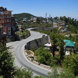
About 16 kms. from Shimla is the this hill famous for its trekking and hiking trails. It is also known for nature parks and picnic spots. It also has a Potato Research Station. It is famous for winter sports. This place is also full of lush green hills. The region around Shimla including Kufri was once a part of the Kingdom of Nepal. This region remained obscure from the rest of the world until the British discovered it in 1819.The British made Shimla their summer capital in 1864 and it remained so until 1939. As Shimla gained importance, Kufri also began to be recognized as an important place to visit. An annual winter sports festival is organized every year in the month of February in Kufri, when skiing enthusiasts and adventure seekers participate in this festival.There are plans to suspend tourist operations. If there is snow, the slopes are suitable for beginners and anyone with a decent plastic bag and a thick pair of trousers.
Explore More
Victoria Peak, often referred to simply as "The Peak," is the highest point on Hong Kong Island, offering one of the most spectacular views of the city. It is an iconic destination for tourists and locals alike, known for its stunning vistas of Hong Kong's skyline, harbor, and surrounding islands. This landmark is an essential part of the Hong Kong experience, providing breathtaking views, historical significance, and a variety of activities for visitors to enjoy. How to Reach Victoria Peak, Hong Kong Getting to Victoria Peak is straightforward, with several transport options available. The most popular way to reach The Peak is by taking the famous Peak Tram, a historical and scenic tram ride that has been in operation since 1888. Peak Tram: The Peak Tram departs from the Peak Tram Lower Terminus in Central, Hong Kong. The tram ride takes about 7-8 minutes and ascends a steep incline, providing stunning views of the city as you make your way up. Once at the top, visitors are rewarded with incredible panoramic views. Tickets for the tram can be purchased at the tram station, and it is advisable to purchase tickets in advance, especially during peak seasons. Bus: For those looking for an alternative to the tram, several bus routes (such as Bus No. 15) run from Central to the Peak. The bus journey takes around 30 minutes and offers scenic views along the way. Taxi: Taxis are another convenient option. Although more expensive than public transport, taking a taxi directly to the top is comfortable and quick. Taxis can drop you off right near the Peak Galleria, where the main attractions are located. Walking: For the more adventurous, there are walking trails that lead to the Peak, offering a more immersive experience in the natural surroundings. The Hong Kong Trail is a popular choice for those who enjoy hiking. Weather at Victoria Peak, Hong Kong Victoria Peak enjoys a subtropical climate, with mild temperatures throughout the year. However, due to its elevation, the weather at The Peak is often cooler than in the city below, making it a refreshing escape, especially during the summer months. Here’s what you can expect throughout the year: Spring (March to May): Spring brings pleasant weather, with temperatures ranging from 18°C to 24°C (64°F to 75°F). The weather is mild, making it a great time for sightseeing and outdoor activities at The Peak. Summer (June to August): Summer in Hong Kong can be hot and humid, with temperatures reaching up to 31°C (88°F). However, the cooler temperatures at The Peak provide a comfortable break from the heat of the city. It’s also the season for occasional showers and thunderstorms, so it’s best to carry an umbrella. Autumn (September to November): Autumn is another excellent time to visit, with temperatures ranging from 23°C to 28°C (73°F to 82°F). The weather is sunny and dry, and the views from the Peak are at their best. Winter (December to February): Winter at The Peak is cool, with temperatures dropping to between 12°C and 17°C (54°F to 63°F). It rarely gets below 10°C (50°F), but it’s advisable to wear layers, especially in the evenings when temperatures can drop. Why Famous for Victoria Peak, Hong Kong? Victoria Peak is famous for several reasons, making it a must-visit landmark in Hong Kong. Here are the key factors that contribute to its popularity: Stunning Views: Victoria Peak offers the best panoramic views of Hong Kong’s iconic skyline, Victoria Harbour, and surrounding islands. The vista includes breathtaking cityscapes, the vibrant skyline, and the lush green hills surrounding the city. Visitors often come for the “Million Dollar View” — a view that’s considered one of the most spectacular in the world. Historical Significance: The Peak has been a prominent part of Hong Kong’s history, being the site of the British colonial governor's residence in the 19th century. It has since developed into a popular spot for both tourists and locals seeking respite from the hustle and bustle of the city below. Peak Tram: The Peak Tram, which has been in operation since 1888, is an iconic part of the Hong Kong experience. The tram provides a thrilling ride up the steep incline and offers unparalleled views along the way. The tram itself is a historical relic, adding a touch of nostalgia to the visit. Entry and Visit Details about Victoria Peak, Hong Kong Victoria Peak is open to visitors year-round, and there are no entry fees for the area itself. However, there are fees for certain attractions within the area, such as the Sky Terrace 428, which offers a 360-degree view from the top of the Peak Tower. Here are some important details to keep in mind when planning your visit: Opening Hours: The Peak is open to visitors at all times, though specific attractions such as the Peak Tram and Sky Terrace have set operating hours. The Peak Tram operates from 7:00 AM to 12:00 AM, and the Sky Terrace 428 is open from 10:00 AM to 10:00 PM daily. Sky Terrace 428: The Sky Terrace 428 is a must-visit for panoramic views. The entry fee for adults is around HKD 52 (USD 7), and children under 3 can visit for free. It’s recommended to buy tickets in advance, especially during peak tourist seasons. Peak Galleria: The Peak Galleria is a shopping and dining complex at the summit. It offers a range of shops, restaurants, and cafes with great views. Entry to the Galleria is free, though dining options can be expensive depending on the restaurant. Hiking Trails: There are several scenic hiking trails around The Peak, such as the Hong Kong Trail and Green Trail, which are free to access and ideal for nature lovers. These trails provide a peaceful alternative to the bustling city and offer incredible views of the surroundings. History and Architecture of Victoria Peak, Hong Kong Victoria Peak has been a prominent part of Hong Kong's history for over a century. During British colonial rule, the area was developed as a residential area for the British elite, with the Peak serving as the official residence for the colonial governor. Over time, the area became more accessible to the public, especially with the introduction of the Peak Tram in 1888, which connected the city below to the summit. The architecture around Victoria Peak is a mixture of modern and colonial styles. The Peak Tower, with its distinctive and futuristic design, is one of the most recognizable buildings at The Peak. It houses the Sky Terrace 428 and several shopping, dining, and entertainment facilities. The Peak Galleria, a more traditional-style building, offers additional retail and dining options. Things to Do at Victoria Peak, Hong Kong There are plenty of things to do when visiting Victoria Peak, making it a full day experience for tourists. Here are some of the most popular activities: Take a Peak Tram Ride: The Peak Tram ride itself is a thrilling and historic experience. The tram provides unique views of the steep slope and is an essential part of any visit to The Peak. Visit Sky Terrace 428: For panoramic views of Hong Kong, head to the Sky Terrace 428. The views are especially breathtaking at sunset or at night when the city lights up. Explore Hiking Trails: For nature enthusiasts, The Peak offers several walking and hiking trails that allow you to explore the lush greenery around Hong Kong Island. Shopping and Dining: At the Peak Galleria and Peak Tower, there are plenty of dining options and souvenir shops where you can enjoy local and international cuisine while enjoying the stunning views. Facts and Tips about Victoria Peak, Hong Kong Best Time to Visit: The best time to visit is during the cooler months of spring and autumn, when the weather is mild and the views are at their clearest. Wear Comfortable Shoes: If you plan to explore the hiking trails, wear comfortable shoes as the terrain can be uneven. Sunset Views: If possible, try to visit in the late afternoon for the stunning sunset views. The city’s skyline looks especially magical as the sun sets. Plan Ahead: The Peak is a popular tourist destination, so expect large crowds during weekends and holidays. Try to visit early in the morning or later in the evening to avoid the rush.
Explore More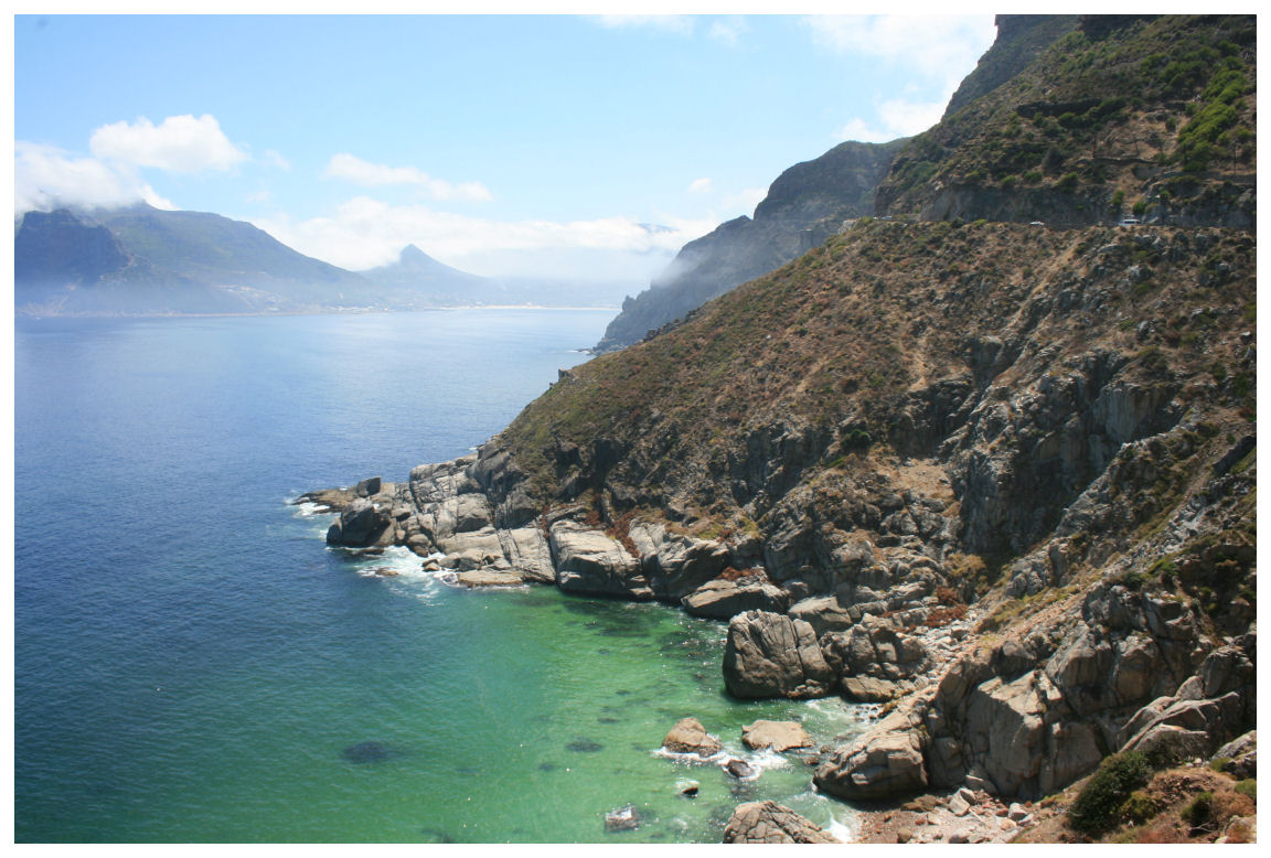
Chapman’s Peak Drive, one of the most scenic coastal drives in the world, is a popular road located along the Cape Peninsula in Cape Town, South Africa. Known for its breathtaking views of the Atlantic Ocean, dramatic cliffs, and surrounding mountain landscapes, this 9-kilometer stretch of road offers a one-of-a-kind experience for drivers and passengers alike. The drive is renowned for its jaw-dropping beauty, making it a must-see for anyone visiting Cape Town. Why Chapman's Peak Drive is Famous Chapman’s Peak Drive is famous for its spectacular scenery and unique construction. The road was carved into the mountainside and offers visitors panoramic views of the ocean, the rugged coastline, and the charming towns below. Opened in 1922, it has since become a popular route for both locals and tourists. The drive is often used for road trips, sightseeing tours, and as a scenic route between Cape Town and the Cape of Good Hope. It also serves as a filming location for many documentaries, advertisements, and travel videos, thanks to its striking natural beauty. How to Reach Chapman's Peak Drive Chapman’s Peak Drive is easily accessible from Cape Town and the surrounding areas. The drive is located just outside of the city, and there are various ways to get there: By Car The most common way to reach Chapman’s Peak Drive is by car. If you're in Cape Town, head south on the M3 highway, and then follow signs to the M64 (the road leading to the start of Chapman’s Peak Drive). The drive offers an excellent opportunity to explore the beautiful coastal scenery as you head toward the charming towns of Hout Bay and Noordhoek. It takes about 30 minutes from Cape Town to reach the start of Chapman’s Peak Drive. By Public Transport Public transport options are limited directly to Chapman's Peak Drive, but you can take a train or bus to Hout Bay, which is a short drive from the start of the drive. From Hout Bay, you can either walk or take a taxi to Chapman’s Peak Drive. However, driving yourself or taking a guided tour is the most convenient way to explore this scenic route. Weather at Chapman's Peak Drive The weather at Chapman’s Peak Drive is largely influenced by the Mediterranean climate of the Cape Peninsula. Summers, which run from November to February, are warm and dry, with average temperatures ranging from 18°C to 25°C (64°F to 77°F). This is the ideal time to visit, as the skies are usually clear and the weather is perfect for enjoying the stunning coastal views. Winter, from June to August, brings cooler temperatures, with averages between 10°C and 18°C (50°F to 64°F). While it’s still relatively mild, this season can be windy and rainy, especially in the later months. Even during winter, Chapman’s Peak Drive remains open, but it's best to check the weather forecast before setting out to ensure a smooth drive. Timing and Opening Hours Chapman’s Peak Drive is open daily, although the road may occasionally close during heavy storms or strong winds. It's essential to check road conditions before you go, as safety is a priority. The best time to visit is during the day when the views are most striking. The drive offers stunning vistas that are best appreciated with good visibility. Since it is a toll road, there is an entrance fee to access the drive, and the toll is collected at the entrance in Hout Bay. Entry and Visit Details The entrance to Chapman’s Peak Drive is located near Hout Bay. The toll fee is typically around R50 to R70 for cars, though the price can vary. The fee helps maintain the road and supports the surrounding environment. Payment is collected at a toll booth near the entrance. If you are traveling with a larger group or on a bus, the fees may vary based on the size of the vehicle. Once you're on the drive, you can stop at various designated viewpoints along the route to take photos, enjoy the view, or simply take in the fresh air. There are also several spots along the way where you can park and explore the natural beauty of the area. For those looking to extend their visit, there are hiking trails near the area, including the famous “Chapman’s Peak Trail” which leads to the top of the mountain. History and Architecture Chapman’s Peak Drive was constructed in the early 20th century and officially opened in 1922. It was built by the government to improve access between Hout Bay and Noordhoek, but it also served as a strategic military route during times of conflict. The road is a feat of engineering, carved into the side of the mountain with winding turns and curves that provide breathtaking views of the ocean below. The road itself is a testament to early civil engineering, with the construction making use of dynamite to clear rock and create the winding route. The project was challenging and risky, but the end result is one of the most beautiful coastal drives in the world. The views from Chapman’s Peak Drive are simply stunning, with dramatic cliffs on one side and sweeping views of the Atlantic Ocean on the other. Things to Do at Chapman’s Peak Drive There are several things to do along Chapman’s Peak Drive, making it more than just a scenic drive: 1. Scenic Viewing Chapman’s Peak Drive is renowned for its stunning vistas. The best way to experience this is by stopping at the various viewpoints along the way. Some of the most popular stops include the overlook at the top of the drive, which offers panoramic views of Hout Bay, Noordhoek Beach, and the Atlantic Ocean. 2. Hiking For those looking for an active adventure, there are numerous hiking trails in and around the area. One of the most popular trails is the Chapman’s Peak Trail, which leads up the side of the mountain and provides spectacular views of the surrounding landscape. It’s a great way to explore the natural beauty of the region up close. 3. Photography Chapman’s Peak Drive is a photographer’s paradise. Whether you're capturing the stunning landscapes, the wildlife, or the architecture of the road itself, you'll find plenty of opportunities for incredible photos. The road offers golden hour light in the early mornings and late afternoons, which makes for some truly magical shots. 4. Relax at Noordhoek Beach At the end of Chapman’s Peak Drive, you’ll find the idyllic Noordhoek Beach, a long stretch of sand that’s perfect for walking, picnicking, or simply relaxing. The beach is a great spot to unwind after your drive and enjoy the beauty of the Cape Peninsula. Facts About Chapman's Peak Drive Chapman’s Peak Drive is 9 kilometers long and connects the towns of Hout Bay and Noordhoek. The road is often referred to as “Chappies” by locals. It’s one of the most photographed roads in the world due to its stunning beauty. The road was constructed in the early 1920s, with significant work done to carve it into the cliffs. It’s considered a dangerous route in certain weather conditions, with strong winds and rockfalls occasionally causing road closures. Tips for Visiting Chapman's Peak Drive Check road conditions: Before setting off, ensure the road is open, especially in winter or during storms. It's best to visit on clear days for the best views. Bring your camera: The views are spectacular and deserve to be captured. Don’t forget to stop at various viewpoints for the perfect photos. Drive safely: The road can be winding and narrow. Make sure to drive carefully, particularly on the sharp bends, and be cautious of cyclists and pedestrians. Wear comfortable shoes: If you plan to hike or walk along the trails, bring comfortable footwear for the terrain. Conclusion Chapman’s Peak Drive is more than just a road – it’s an experience. With its breathtaking views, rich history, and many activities to enjoy, it is one of the highlights of any trip to Cape Town. Whether you're looking to take a scenic drive, go hiking, or simply relax at the beach, Chapman’s Peak offers something for everyone. Don’t miss the opportunity to explore one of the world’s most beautiful coastal routes on your visit to Cape Town.
Explore More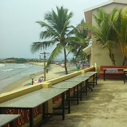
Kerala has always remained one of the top attractions among global tourists due to its heaven-like ambience. The beauty of Kerala compels the visitors to visit its spectacular beaches one after another. When you have already finalised your next holiday destination in Kerala, you need to plan your trip properly .If all the aspects are concerned, you can choose the Lighthouse Beach here, as it includes a plethora of options available for the foodies. And, The German Bakery Kovalam is one such major attraction here known to offer mellowing meals for the food critics and tourists. It is an ancient restaurant cum café known to entertain the tourists for about a century. In the surrounding region of Kovalam, The German Bakery is well-known for its mellowing food and beverages. So, you should definitely give it a try! Visitor Information about the German Bakery: • Popular for – its heritage and food • No entry fee • Visiting time: 7.30 in the morning – 11.30 at night • Duration for visit: 1-2 hours Traveler Tips: The German Bakery remains crowded every month of the year. So, whenever you pay a visit here, you need to wait for your turn! As the place is crowded all throughout the day, the best dishes including the delicious pastries and buns get consumed by the evening. Visiting the bakery in the evening or at night may delight you with some mind-blowing baked goods. Although, it is always advised to visit The German Bakery in the morning, evenings here are lively enough to recharge your mind and taste buds. Things to do: • As its a cafe at its core, you will get a range of delicacies to satisfy your craving. • After having your meal, you may lie down on the beach, holding a can of beer and shaded under an umbrella. • The remnants of the lighthouse are not too far from the German Bakery. Trust me, its worth a visit! • Take a long beach walk with your loved one and relish the serene aura of the place. You can even make a sandcastle and click some memorable shots with it. • You can get indulged in some beach sports there such as beach volley. It a true delight to play a sport on a sand beach with bustling waves appeasing your senses. Dont worry about the atmosphere down there on the beach, as previous tourists have always praised this place for its warm atmosphere on the sparkling sand. • You can hire guides too for your travel help. The best time to visit The German Bakery: As previously mentioned, The German Bakery is thronged throughout the year, it is recommended to reach the bakery in the morning time as it offers a limited number of bakery food items in the evening. How to reach The German Bakery Kovalam The German Bakery is situated in the middle of Kovalam. You can hire an auto-rickshaw in Kovalam to reach any place in the city. It is at a walking distance from Lighthouse Beach. Interesting Facts to Know about German Bakery: • It is famous for making baked goods with European flavors and style. • It is a heritage bakery that holds some legendary delicacies. • The tourists relish the pancakes and pastries available here, as the taste lures them from every nook of the world. • You will be able to have your meal whilst enjoying the scenic beauty here and the courteous staff is competent to impress you in every aspect. • While munching those yummy baked goods, you can enjoy the free Wi-Fi available. Nearby locations of The German Bakery: • Kovalam beach • The lighthouse beach • Neyyar Dam • Samudra beach • Day classes of Soji Yoga • Sellayani Lake • Kovalam Surf Club • Karamana River • Panchakarma Ayurveda center So, next time you throng to Kovalam, Kerala, remember, The German Bakery Kovalam deserves a visit from you!.
Explore More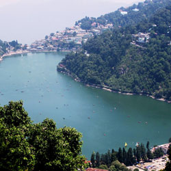
(2610 mtrs) : Naina Peak, also called, as China Peak is the tallest of all in Nainital, at a height of 2611 metres commanding the finest views of the Himalayas and an intriguing bird's-eye. On a clear day, a wide range of the snow-clad Himalayas is visible. Naini Peak is a challenging hike. One can see the Himalayan ranges, especially, East Trishul, Nanda Devi and Nandak Kot from its top.
Explore More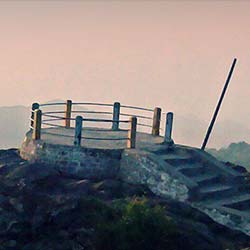
Tiffin Top aka Dorothy's Seat is a remarkable tourist attraction in Nainital. It is an appealing viewpoint and a picnic spot that a person cannot miss-out during a visit to Nainital. Tiffin Top is located in the Kumaon Himalayan foothills and is blessed with a serene environment. It draws a large number of tourists each year due to its enchanting beauty. It Is Known For:-1) Tiffin Top is known for its arresting surroundings. One can see the breathtaking view of the whole landscape of Kumaon and its hills2) It is truly an amazing place where one can succumb to nature and calm down the tired senses3) The whole area of Tiffin Top is a photographer's delight. People are often seen capturing the photographs 4) It is a place where one can experience the thrill of rock climbing and trekking. The pony rides are also available for the kids Best Time To Visit:-Tiffin Top is an arresting tourist destination in Nainital. Tourists often visit this place for spending their vacations. Excluding the monsoons, the rest of the year is regarded as the best time for spending some hours at this spot. If a person is visiting Tiffin Top during winters, it is recommended that extra woolens should be carried. Similarly, in summers, one should step-out to visit the place during the pleasant hours of the day. Reaching There:-Tiffin Top is a spectacular destination. It can be easily reached by hiring the service of the local transit like the bus or cab. Nearest Railway Station- Kathgodam Railway StationNearest Airport- Pantnagar Airport
Explore More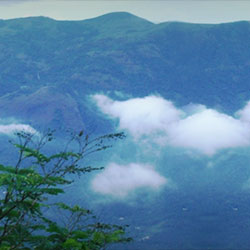
With an elevation of more than 3000 feet, Nadukani is a place that will surely tranquilize you. Hemmed in the serene hills, Nadukani is a hilly region in Kottayam. It is a renowned picnic destination in Kerala that is blest with quietude in the ambiance. Anyone who visits this beguiling place cannot resist himself from succumbing to Mother Nature. You can see the lush green hillocks everywhere as far as your sight can see. It Is Known For:- The hillocks that serve as the ideal trekking spot for the adventure lovers.The nearby forest that is a home to a variety of avifauna. Best Time To Visit:- Nadukani is a region that welcomes the vacationers throughout the calendar year. Each day, hundreds of tourists update their WhatsApp status as "Touchdown At Nadukani". There's no hassle in spending a holiday at Nadukani during the Winter, Summer, Autumn, Spring, and Monsoon. Reaching There:- Nadukani is a famous picnic and trekking destination in Kottayam (Kerala). To reach these hills, you can hire the service of the local transports. You have to pay a minimal amount for the service to reach the hills of Nadukani. Nearest Railway Station - Aluva Railway StationNearest Airport - Cochin International Airport
Explore More
Vellarimala is a famous mountain range that lies in the Western Ghats near Kozhikode. This mountain range extends till the enchanting Nilgiris and is divided by the valley of Chaliyar. Vellarimala is renowned for its breathtaking beauty and never fails to lure tourists, especially the trek aficionados. It Is Known For:-1) Vellarimala is known for its beauty. The soul-calming beauty and an ethereal ambiance are just perfect to spend some time in the laps of Mother Nature 2) It is regarded as an astounding destination for the venture buffs that wish to conquer the peaks3) Some mountainous herbs are also found here that possess medicinal qualities Best Time To Visit:-Since it is a mountain range in Kozhikode, tourists can visit it throughout the year. To admire the pristine beauty of these peaks, one should plan the trip post monsoons. The rainfall polishes each stone and leaf that makes this region more charming. The only drawback is that it is hard to find an appropriate accommodation during the peak holiday season. Reaching There:-Vellarimala is not hard to access. After the arrival in Kerala, an individual can hire the service of the local cab or bus to reach Kozhikode. From Kozhikode, regular jeeps are available to reach Vellarimala. Nearest Railway Station- Kozhikode JunctionNearest Airport- Calicut International Airport
Explore More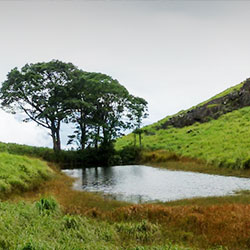
Chembra Peak doesn't need a formal introduction. This peak is a popular tourist attraction located in Wayanad (Kerala). Standing at a monstrous height of 6,890 feet above the sea level, Chembra Peak is a mountain that belongs to the majestic Western Ghats that join the exquisite Nilgiris. This peak is simply tantalizing and draws a large number of tourists on a large scale. Whilst you're in Kerala, missing a visit to Chembra Peak is not less than a sin in the Bible of travelers. It Is Known For:-1. The heavenly beauty where people can succumb to nature2. The apt location for relishing the venture of trekking in the Western Ghats Best Time To Visit:-If you want to visit Chembra Peak, any time of the year would be comfortable. People flock to Chembra Peak for the one-day itinerary, overnight camping etc. as well. The onset of winters adds charm to this peak as the blanket of mist shrouds it, making it a romantic place for the lovebirds seeking some romantic time. Reaching There:-The local transit is available to reach the nearby village from where the trekking commences. You can reach the peak of Chembra by crossing the rocky pathways. Nearest Railway Station- Kozhikode Railway StationNearest Airport- Calicut International Airport
Explore More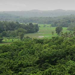
Dhoni Village is a village located on the outskirts of the main town of Palakkad. Surrounded by the green vegetation in four directions, this village is a great place to spend a day away from the bustling cities and reinvigorate the senses. This village is the place from where the trekking begins. The trekkers visit Dhoni Village on a large scale. It Is Known For:-1) This village is known for as famous landmarks in the region. The notable places of interest include the names like Dhoni Waterfalls, Dhoni Shiva Temple, Krishna Temple, and many other places2) The hill of Dhoni is another place that catches the sight of the visitors. One can spot the locals, as well as tourists, having a nice time at Dhoni Hill Best Time To Visit:-The best time to visit the village of Dhoni is throughout the year. This village is one among the places where visitors can learn about the rural life from the turf. During monsoons, the footfall in this village increases because of the presence of the alluring Dhoni Waterfall. This time also becomes the period when the locals can earn some amount of money by serving as a guide for the visitors. Reaching There:-Though Dhoni is a rural area, it has a well-established network of roadways and railways. The frequent service of the local buses is available to reach the village of Dhoni. The visitors have to de-board the bus on the village outskirts and hire the local carts and tempos to commute to and fro. Nearest Railway Station- Palakkad JunctionNearest Airport- Coimbatore Airport
Explore More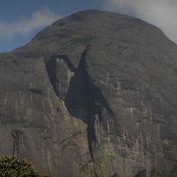
Located in the mesmerizing surroundings, Agastya Mala Peak is a beauteous hillock situated in the Western Ghats. Also known by the name of Agasthyarkoodam, this hillock with a monstrous height of 6,129 feet, lies in the vicinity of Neyyar Wildlife Sanctuary. The soul-calming ambiance of this region is enough to lure the visitors and nature enthusiasts that seek some private time with nature. It is a major pilgrimage site for the followers of the sage Agastya and houses a full-size statue of him. It Is Known For:-1) The medicinal herbs (more than 2000 in number) that are found here2) The harsh trekking routes3) Kalakkad Mundanthurai Tiger Reserve (located nearby)4) Manjolai Hills Best Time To Visit:-The mesmerizing Agastya Mala Peak can be visited throughout the year except for monsoons. During rainfall, the access to the peak becomes slippery and it can lead to unwanted accidents. If you want to explore the flora-fauna here, January-March and October-December is the time to pay a visit here. Reaching There:-It has a well-established network of roadways, so visitors can reach here after a drive of an hour or so. To reach the top of the hillock, one has to wake the sleeping trekker inside. Nearest Railway Station- Ambasamudram Railway StationNearest Airport- Trivandrum International Airport
Explore More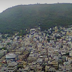
Standing at a height of 500 feet, Gandhi Hill is a hillock that is named after the 'Father of the Nation', Mahatma Gandhi. Naming this hill after Gandhi is a noble gesture to show respect for Mahatma Gandhi and his selfless efforts for the freedom of the country. Gandhi Hill is a major tourist attraction in Vijayawada. It Is Known For:-1) Gandhi Hill houses 7 pillars that are carved beautifully2) A memorial atop the hillock is the place that showcases the early life and freedom movements led by M.K. Gandhi3) A stone slab is present on the hillock that contains the quotations of M.K. Gandhi4) There's also a planetarium on the hillock for those having a special interest in the solar system Best Time To Visit:-The best time to visit Gandhi Hill is throughout the year, excluding monsoons. During monsoons, the hillock becomes unsuitable for spending a good quality time. Rest of the year is considered as apt for relishing a jovial time at the hillock and learning about the untouched facts of the life of Mahatma Gandhi. To enter the memorial, one has to pay the fee of 10 INR per head. Reaching There:-Being a renowned attraction in Vijayawada, Gandhi Hill is frequented by a sizable population of the city. It can be reached easily by hiring the services of the local transit like the buses, auto rickshaws, cabs etc. They charge a minimal amount for the services provided. Nearest Railway Station- Vijayawada Railway StationNearest Airport- Vijayawada Airport
Explore More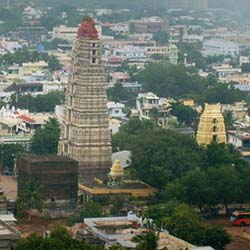
Mangalagiri is a township in the district of Guntur in Andhra Pradesh. Its name 'Mangalagiri' translates into 'Auspicious Hill'. This place used to be the part of the empire of Vijayanagar in the bygone times. Mangalagiri used to be a rich township and was invaded many times but no foreign power was able to conquer it. Presently, it is known for housing the temple of Lord Vishnu and many other attractions that make it a frequented tourist destination in Andhra Pradesh. It Is Known For:-1) Mangalagiri is known for Lakshmi Narasimha Temple. It is an intricately carved temple dedicated to Lord Vishnu and he is worshiped as Thodatri in this temple2) The saris of Mangalagiri are also famous in the major states of India 3) The other attractions of the township include the names like Undavalli Caves, Hinkar Thirtha Jain Temple etc. are places that can be visited Best Time To Visit:-Mangalagiri is a famous tourist attraction in Guntur. Known for the shrines, saris, and other places of interest, Mangalagiri is visited across the year as it serves as a tourist attraction and a pilgrimage site. There is no specific season for paying a visit to this enchanting place. Reaching There:-Mangalagiri is well-connected via network of the roadways and railways. Visitors can avail the service of the local transit like the bus, taxi, and auto to commute within the city. Nearest Railway Station- Mangalagiri Railway StationNearest Airport- Vijayawada Airport
Explore More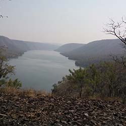
The Nallamala Hills is a remarkable hill range of the Eastern Ghats. These attractive hills stretch over the regions of Kurnool, Nellore, Prakasam, Kadapa, and Chittoor. Nallamala Hills attract tourists, especially the trekkers from the different regions of the country. People, on a large scale, visit Nallamala Hills due to its picturesque surroundings. It Is Known For:- 1) The rocks of these hillocks are said to be the formation of the volcanic activities that took place at this place hundreds of years ago 2) Nallamala Hills are known for their beauty. This place is a delight for nature photographers 3) The lush green surroundings of these hills provide shelter to a variety of the avifauna 4) The elevation of the hills of the Eastern Ghats ranges between 2000-4000 feet above the sea level that serves as an ideal place for the trekkers Best Time To Visit:- Throughout the year, the climate of this particular region remains warm. However, the months between October-January are considered as apt for paying a visit. These months, as compared to the rest of the months, are comparatively less warm that makes them the right time for visiting the hills. Watch Out! Do not forget to carry the first-aid kit and extra cash while visiting Nallamala Hills. There are no ATMs in the nearby villages. Thus, carrying cash is a wise choice to avoid any problems. Nearest Railway Station - Vijayawada Railway StationNearest Airport - Vijayawada Airport
Explore More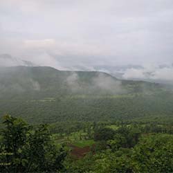
Jamboti Hills aka Jambooti Hills is a renowned travel attraction on the outskirts of Belgaum. It is a magnificent hill range that is an extension of the Western Ghats. Jamboti Hills is a marvelous place where visitors, especially nature enthusiasts and venture aficionados visit frequently to this place and spend a good quality time. These hills are a picture-perfect destination for spending some good quality time in the laps of nature. It Is Known For:- 1) Jamboti Hills is an apt location for spending a good quality time away from the polluted cities2) This hill range is seen as an ideal place for enjoying the activities like camping, trekking, and hiking. Trekking can be enjoyed only after obtaining a written permission from the forest department3) Even the locals are often seen enjoying a family picnic/outing at the site of Jamboti Hills4) Climbing atop the hill provides a panoramic view of Belgaum city5) Monkeys can be spotted in profusion on these hills Best Time To Visit:- Jamboti Hills magnetize the tourists as well as locals alike. This travel destination is a place that no one would like to miss and thus, it is visited throughout the year. But, witnessing the beauty of this hill range when it wears the thin blanket of mist is indescribable. Try visiting this destination during winters. Watch Out! Jamboti Hills are a residence of monkeys. Therefore, an individual should be cautious about their belongings, especially the food items. Reaching There:- Belgaum is well-connected via roadways, airways, and railways all over Karnataka and it makes it easier for travelers to reach the city. Commuting within the city can be done by the local transit like the buses, taxis, and autos. Nearest Railway Station - Belgaum Railway Station Nearest Airport - Belgaum Airport
Explore More
Famous for its enchanting beauty, Tiger Hill is an amazing tourist attraction in Ooty. It is located 6 km away from the main town of Ooty and serves as a great escape for holidaymakers, enjoying a picnic, and a perfect hangout spot for youngsters. It never fails to attract tourists from nearby cities. It Is Known For:-1) At present, Tiger Hill is a beautiful hill resort. It is blessed with the captivating environment and a calm ambiance2) It is known for its jagged trekking pathways that challenge the valiant trekkers. Experiencing the thrill of trekking at Tiger Hill is an experience in itself3) Due to its location away from the concrete jungle, it is seen as an appropriate place for relaxing in the laps of Mother Nature4) A reservoir is located atop Tiger Hill that serves as the chief source of water for the sizable local populace Best Time To Visit:-Tiger Hill is a great place for a person who is looking for some mental calmness. It is a place that welcomes everyone throughout the year. During any season, travelers can pay a visit to Tiger Hill for rejuvenating the senses. An excursion to the same should be avoided during rainfalls. Reaching There:-Tiger Hill is situated 6 km from the main town of Ooty. To reach the place comfortably, one can hire the service of the local transit like the bus or cab. To reach the top, one can enjoy a short trek as well. Nearest Railway Station- Ooty Railway StationNearest Airport- Coimbatore Airport
Explore More
Jampui Hills is a beautiful hill range located in Northern Tripura. It has eye-catchy surroundings that can tranquilize the onlooker. The ambiance of Jampui Hills is simply enthralling and has an elevation of 3,050 feet above the sea level. Since the ancient times, these hills have been serving as the residence of the Mizo people. They have resided here since the 16th century. Jampui Hills are popular for their surroundings and never fail to draw tourists from the different directions of the country. It Is Known For:-1) Being a hilly region, Jampui Hills is known for its mountainous beauty. The lofty terrains covered under the green carpet of grass and having a serene ambiance is truly enchanting2) It is also popular as a remarkable destination for enjoying the thrill of trekking3) Due to an impressive height, one can also relish the fun of rock climbing4) Jampui Hills also offers a scenic view of the sunset and sunrise. To capture the view in the lens, these hills are usually visited by the foreign tourists on a large scale Best Time To Visit:-Jampui Hills is a picturesque destination in Agartala and has a misty backdrop of the mighty Himalayas. Since it is located at a higher altitude, the weather of this place remains pleasantly cool throughout the year. Thus, Jampui Hills can be visited around the year without any hassle. Reaching There:-Jampui Hills is a famous tourist place. To reach this place comfortably, it is connected through all the major roads in the region. Local buses, rickshaws, and carts are available for the visitors to reach the Jampui Hill. Nearest Railway Station- Kumarghat Railway StationNearest Airport- Guwahati Airport
Explore More
Superga Hill, located just outside the city of Turin (Torino), Italy, is one of the most scenic and historically significant sites in the region. Standing at approximately 672 meters (2,205 feet) above sea level, Superga Hill offers panoramic views of Turin and the surrounding Alps. At its summit sits the magnificent Basilica of Superga, a baroque-style church built in the early 18th century. The hill is also known for its tragic connection to the 1949 Superga air disaster, which claimed the lives of the entire Torino football team. Today, Superga Hill is a place of peace, reflection, and natural beauty, attracting tourists, pilgrims, hikers, and history lovers. How to Reach Superga Hill, Italy Superga Hill is located about 10 kilometers (6 miles) east of Turin city center and can be reached by various means of transport. By Train and Funicular: The most scenic way to reach Superga Hill is by taking the historic Sassi-Superga rack railway (Tram a Dentiera). This funicular train departs from the Sassi Station in Turin and climbs up the hill through forests and charming landscapes. The ride takes about 20 minutes. By Car: You can drive to Superga via the SP1 provincial road. There is parking available near the basilica at the top of the hill. By Public Transport: From central Turin, take a bus or tram to the Sassi area, then transfer to the rack railway. Alternatively, some buses may go near the base of the hill, from where you can hike or take a taxi. Weather in Superga The weather on Superga Hill is similar to that of Turin, though it may be slightly cooler due to the elevation. Summer (June–August): Warm and sunny, with temperatures between 20°C and 30°C (68°F to 86°F). A great time for walking and enjoying the views. Autumn (September–November): Mild temperatures and beautiful fall foliage. Expect cooler mornings and evenings. Winter (December–February): Cold and occasionally snowy, with temperatures often below 5°C (41°F). The air is crisp and clear on sunny days. Spring (March–May): Fresh and pleasant, with blooming flowers and mild weather. Timing Superga Hill is accessible at all times, but specific sites such as the Basilica of Superga have fixed visiting hours. Basilica Opening Hours: - Summer: 9:00 AM to 7:00 PM - Winter: 9:00 AM to 5:00 PM Closed on major holidays and during bad weather. The rack railway generally operates between 10:00 AM and 6:00 PM, depending on the season. Always check schedules before your visit. Why is Superga Hill Famous? Superga Hill is famous for several reasons: The stunning Basilica of Superga, built by architect Filippo Juvarra for King Victor Amadeus II of Savoy. The panoramic views of the city of Turin and the surrounding Alps, making it a favorite spot for photographers and hikers. The tragic Superga air disaster of 1949, in which an airplane carrying the entire Torino football team crashed into the hill during heavy fog. A memorial now stands at the crash site near the basilica. Entry and Visit Details Visiting Superga Hill is free, though some attractions have a small entry fee. Entry to the Hill: Free of charge. Basilica Entry: Free to enter the main church area. Tours of the royal tombs and dome viewing require tickets (€3–€5). Superga Rack Railway: Ticket costs around €6–€8 for a round trip. Memorial Site: Free and open to the public. History and Architecture The Basilica of Superga was commissioned by Victor Amadeus II in the early 1700s after he vowed to build a church if his army won a key battle against the French. After victory, he kept his promise, and the church was designed by the famous Sicilian architect Filippo Juvarra. Completed in 1731, the basilica is a masterpiece of baroque architecture, with its large dome, twin bell towers, and symmetrical colonnades. The basilica also serves as a royal mausoleum for members of the House of Savoy. The tombs are located in the crypt beneath the church and are open to visitors on guided tours. Things to Do Visit the Basilica: Admire the interior architecture, marble columns, and religious artworks. Climb to the Dome: Take the narrow staircase to the top for incredible 360-degree views of the Alps and Turin. Explore the Royal Tombs: Discover the final resting place of many members of the Savoy royal family. Hike or Bike: Trails around Superga are popular for walking, jogging, or mountain biking. Visit the Memorial: Pay respects at the monument to the fallen football players of the Grande Torino team. Photography: Bring your camera to capture breathtaking views, sunrises, or snowy winter scenes. Interesting Facts - The Basilica of Superga was inspired by St. Peter’s Basilica in Rome. - The 1949 air disaster is remembered every year on May 4 with a ceremony attended by Torino F.C. fans and officials. - Superga Hill offers one of the best spots in Turin for watching the sunset. - The rack railway has been operating since 1884 and is one of the oldest in Italy. - The dome of the basilica rises to 75 meters and provides views all the way to the snow-capped Alps. Tips for Visiting Superga Hill Visit early in the morning or late afternoon for the best light and fewer crowds. Bring water and snacks if you plan to hike around the hill. Wear comfortable shoes as there are stairs and paths to explore. Dress in layers, as the weather can change quickly at higher elevations. Use public transport if you don’t want to drive, as parking can be limited on weekends. Respect the memorial site and the quiet, reflective atmosphere of the basilica. Conclusion Superga Hill is a place where history, nature, and culture meet. Whether you are looking for panoramic views, a peaceful walk, or a deep dive into Italian history, this site has it all. From the stunning Basilica of Superga to the emotional memorial of the 1949 air disaster, every visitor leaves with a sense of wonder and respect. A visit to Superga is more than a sightseeing trip—it’s an experience of Italy’s rich heritage and natural beauty.
Explore More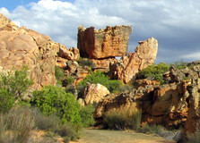
The Cederberg is a rugged and remote mountain range located about 300 kilometers north of Cape Town in the Western Cape province of South Africa. Known for its striking rock formations, ancient San rock art, breathtaking mountain landscapes, and star-filled skies, the Cederberg is a haven for adventurers, nature lovers, and those seeking an escape from city life. This region forms part of the Cederberg Wilderness Area, offering a blend of natural beauty, history, and cultural richness. How to Reach Cederberg, Western Cape Cederberg is not connected by public transport, so the best way to reach it is by road: By Car: From Cape Town, take the N7 highway towards Citrusdal. Depending on your destination in Cederberg (such as Clanwilliam or Algeria Forest Station), the drive takes approximately 3.5 to 4.5 hours. Most lodges or campsites are accessible via gravel roads, so a vehicle with good clearance is recommended. By Tour: Several travel companies offer guided tours from Cape Town to the Cederberg region, including transport, meals, and accommodations. Make sure to refuel and stock up on supplies before entering the wilderness area, as amenities are limited once you’re in the mountains. Weather in Cederberg, Western Cape Cederberg has a semi-arid climate with hot, dry summers and cool winters. Rain is sparse but mostly occurs during the winter months. Summer (Nov–Mar): Hot and dry with daytime temperatures often exceeding 30°C. Best for stargazing and rock climbing but can be intense for hiking during midday. Winter (Jun–Aug): Cooler with temperatures ranging from 5°C to 18°C. Occasional frost at night; ideal for hiking if you prefer mild weather. Best Time to Visit: Spring (Sept–Nov) and autumn (Mar–May) are perfect with moderate temperatures, fewer bugs, and blooming wildflowers in spring. Timings The Cederberg Wilderness Area is open year-round. There are no official entry hours since it's a natural area, but it’s advisable to travel and hike during daylight. Hiking and Trail Access: Recommended between 6:00 AM and 6:00 PM. Accommodation Check-in: Varies by lodge or campsite, usually 2:00 PM to 6:00 PM. Why Famous for Cederberg, Western Cape? Cederberg is famous for several compelling reasons: Rock Formations: Iconic sandstone formations like the Maltese Cross and Wolfberg Arch draw climbers and photographers alike. San Rock Art: Thousands of years old, these paintings provide insight into the spiritual life of the indigenous San people. Rooibos Tea: The region is the exclusive home of the Rooibos plant, used to make South Africa’s famous herbal tea. Stargazing: With almost no light pollution, Cederberg skies are among the clearest in the country, ideal for stargazers and astrophotographers. Biodiversity: The area is home to rare plants, including endangered Clanwilliam Cedar trees and unique fynbos species. Entry and Visit Details about Cederberg, Western Cape Entry Fee: No fee to enter the general area, but certain parts like Algeria Forest Station and CapeNature hiking routes may require a small conservation fee (typically around R50–R70 per adult). Permits: Required for overnight hikes and for access to restricted heritage sites like Truitjieskraal Rock Art. Facilities: Campsites, mountain huts, self-catering lodges, picnic areas, and some basic shops in Clanwilliam and Algeria. Safety: Mobile signal is limited in the region. Always carry a physical map or GPS, and inform someone of your itinerary. History and Architecture The name “Cederberg” comes from the endangered Clanwilliam Cedar tree, once found in abundance in the area. The Cederberg region has a long history, with the oldest known inhabitants being the San people, who left behind an extraordinary legacy of rock art. Some artworks date back over 6,000 years. European settlers arrived in the 18th century, using the land primarily for grazing and farming. Today, remnants of old mission stations, stone houses, and farm buildings reflect colonial-era architecture, often blending stone, thatch, and whitewashed walls. Things to Do in Cederberg, Western Cape Hiking: Popular trails include: Maltese Cross Trail – a short hike to an impressive rock column. Wolfberg Cracks & Arch – challenging but extremely rewarding for fit hikers. Stadsaal Caves – short walk to rock art and sandstone chambers. Rock Climbing: Cederberg is a world-class bouldering and sport-climbing destination. Swimming: Cool off in natural rock pools and clear mountain streams during summer. Visit Wupperthal: A historic Moravian mission village known for handmade leather shoes and cultural heritage. Stargazing: Bring a telescope or enjoy naked-eye views of the Milky Way. Tea Tasting: Visit Rooibos farms in Clanwilliam to learn about tea cultivation and enjoy tastings. Facts about Cederberg, Western Cape The Cederberg Wilderness Area covers over 71,000 hectares of mountainous terrain. There are more than 2,500 known San rock art sites in the region. The Wolfberg Arch is over 15 meters tall and one of the largest natural arches in South Africa. The area has its own unique microclimate supporting rare endemic species. The Cederberg is part of the Cape Floral Kingdom, a UNESCO World Heritage site. Tips about Cederberg, Western Cape Bring all essentials including food, water, sunscreen, and medical supplies, especially for remote trails. Wear good hiking shoes and sun protection at all times. Book accommodation and permits in advance, especially during holidays and spring wildflower season. Respect cultural heritage sites—do not touch or deface rock art. Carry a flashlight or headlamp if hiking close to dusk or camping overnight. Always follow conservation rules to protect this fragile and pristine ecosystem. The Cederberg offers a rare mix of wilderness, culture, and spiritual solitude. Whether you’re chasing a challenging summit, exploring ancient artwork, or simply gazing at the stars in silence, this unique region of the Western Cape provides an unforgettable journey into South Africa’s natural soul.
Explore More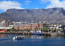
Table Mountain National Park is one of South Africa’s most iconic and scenic protected areas, stretching from Signal Hill in Cape Town to Cape Point at the tip of the Cape Peninsula. It was established to protect the unique biodiversity of the Cape Floral Kingdom and to preserve the rich cultural and natural heritage of the Western Cape. Dominated by the flat-topped Table Mountain, one of the New 7 Wonders of Nature, this park draws millions of visitors every year with its stunning views, rich biodiversity, historic sites, and thrilling outdoor adventures. How to Reach Table Mountain National Park, Western Cape Table Mountain National Park is easily accessible as it lies within and around the city of Cape Town in the Western Cape province. By Air: The nearest airport is Cape Town International Airport (about 20 km from Table Mountain). Flights operate daily from major cities in South Africa and internationally. By Car: Visitors can drive from anywhere in Cape Town using signs for Table Mountain or the Cableway. Parking is available at various points like the Lower Cableway Station and Cape Point. By Public Transport: Taxis, tour buses, and ride-sharing services like Uber are readily available in Cape Town. The MyCiTi bus also services some areas close to the park. Weather at Table Mountain National Park The climate at Table Mountain National Park is Mediterranean, with mild, wet winters and warm, dry summers. However, the weather on the mountain can change rapidly, so visitors are advised to dress in layers and check conditions before visiting. Summer (Nov–Mar): Warm and dry, temperatures range from 20°C to 30°C. Ideal for hiking and sightseeing. Winter (Jun–Aug): Cooler and rainy, temperatures drop to around 10°C to 18°C, with occasional fog or strong winds. The top of the mountain is usually cooler and windier than the city below. Always carry sun protection, a windbreaker, and water regardless of the season. Timings Table Mountain National Park is open year-round, but different sections of the park have their own operating hours. Below are general timings: Table Mountain Aerial Cableway: 08:00 AM to 06:00 PM (last car up at 5:00 PM, down at 6:00 PM; varies seasonally) Cape Point: 06:00 AM to 06:00 PM (Oct to Mar), 07:00 AM to 05:00 PM (Apr to Sept) Silvermine and Boulders Beach: 08:00 AM to 06:00 PM Note: The cableway may close due to adverse weather conditions, especially strong winds or fog. Why Famous for Table Mountain National Park, Western Cape? Table Mountain National Park is world-famous for several reasons: Home to Table Mountain, one of the most recognizable natural landmarks globally and a UNESCO World Heritage Site. Rich in plant biodiversity, including over 2,200 species of flora, many of which are endemic to the region. Offers spectacular panoramic views over Cape Town, the Atlantic Ocean, and the Cape Peninsula. Popular for hiking, paragliding, rock climbing, and bird watching. Includes unique attractions like Cape Point, Boulders Beach with its penguin colony, and Lion’s Head. Entry and Visit Details There are no entry fees for Table Mountain itself unless using the cableway. However, certain sections of the park like Cape Point and Boulders Beach have separate conservation fees: Cableway Round Trip: Approx. R420 for adults, R200 for children Cape Point: R360 for international adults, R90 for South African citizens (discounted with ID) Boulders Beach: R190 for international adults, R45 for South African citizens Visitors can explore several areas without fees, including hiking trails around Devil’s Peak, Signal Hill, and Lion’s Head. Guided tours and adventure activities can be booked via local operators. History and Architecture Table Mountain has been a significant landmark for centuries, first noted by indigenous Khoisan tribes and later by European explorers. The park area holds remnants of Stone Age tools and ancient rock art. The name "Table Mountain" comes from its distinctive flat top. While there are no grand architectural structures in the traditional sense, the Table Mountain Cableway, opened in 1929, is a marvel of engineering. It has been modernized to offer rotating cabins that give visitors a 360° view as they ascend. Cape Point also has a historic lighthouse built in 1859. Things to Do at Table Mountain National Park Visitors can enjoy a wide variety of activities: Ride the Cable Car: Enjoy breathtaking views as you ascend Table Mountain in a rotating cable car. Hiking: Choose from over 350 trails, including Platteklip Gorge, Skeleton Gorge, and Pipe Track. Cape Point: Visit the dramatic cliffs and historic lighthouse at the southern end of the peninsula. Boulders Beach: See the endangered African penguins up close. Picnicking: Silvermine and Kirstenbosch offer great spots for relaxation amidst nature. Photography: Capture sunsets, panoramic views, flora, and wildlife. Adventure Activities: Rock climbing, abseiling, mountain biking, and paragliding. Facts about Table Mountain National Park Table Mountain is over 260 million years old—older than the Himalayas and the Alps. It is part of the Cape Floral Region, the smallest yet richest floral kingdom in the world. The park is home to over 8,000 plant species, including fynbos, proteas, and ericas. It attracts over 4 million visitors annually, making it one of South Africa’s top tourist destinations. The Table Mountain cableway has carried more than 30 million visitors since it opened. Tips for Visiting Table Mountain National Park Check weather forecasts and cableway status before visiting. Arrive early to avoid long queues at the cableway, especially during holidays. Carry water, sunscreen, a hat, and a light jacket. Wear comfortable shoes for hiking or walking. Book tickets for the cable car online to skip the ticket queue. Respect wildlife—do not feed baboons or penguins. Keep a map or GPS handy when hiking as some trails are rugged and remote. Table Mountain National Park is a gem that beautifully combines natural splendor, adventure, biodiversity, and cultural significance. Whether you want to hike up rugged paths, glide up in a cable car, take pictures of penguins, or simply soak in some of the world’s most spectacular views, the park offers something for every type of traveler. It is a must-visit destination when exploring South Africa’s Western Cape.
Explore More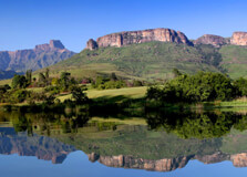
Champagne Castle is a majestic mountain peak located in the Central Drakensberg region of KwaZulu-Natal, South Africa. Standing tall at 3,377 meters (11,079 feet), it is the second-highest peak in the Drakensberg range, after Mafadi. The peak is not just a mountaineering destination but also a scenic and serene escape that attracts nature lovers, hikers, and adventurers from around the world. With its dramatic cliffs, sweeping vistas, and rich flora and fauna, Champagne Castle offers an unforgettable experience for visitors. How to Reach Champagne Castle, KwaZulu-Natal Champagne Castle is located within the uKhahlamba Drakensberg Park, a UNESCO World Heritage Site, near the town of Winterton in KwaZulu-Natal. Here’s how you can get there: By Car from Durban: Drive northwest along the N3 towards Johannesburg. Exit at the Estcourt North or Winterton off-ramp, and follow signs towards the Champagne Valley. The drive takes around 2.5 to 3 hours. By Car from Johannesburg: Take the N3 south towards Durban. Exit at Harrismith, take the R74 via Bergville, and continue to the Champagne Valley. The journey takes about 4.5 to 5 hours. By Air: The closest airport is King Shaka International Airport in Durban. From there, renting a car is the most convenient option to reach the mountain region. Weather at Champagne Castle Champagne Castle has a mountain climate, which varies throughout the year: Summer (November to March): Warm with daytime temperatures between 20°C and 30°C. Afternoon thunderstorms are common, and the landscape is lush and green. Winter (May to August): Cold and dry, especially at higher altitudes. Temperatures range from 5°C to 20°C during the day but can drop below freezing at night. Spring and autumn (April and September-October) offer the best weather for hiking, with mild temperatures and clear skies. Timings to Visit Champagne Castle is accessible year-round, though it is best visited during the drier months from April to September. There are no fixed operating hours for hiking the mountain, but it is advisable to begin early in the morning for safety and to enjoy a full day outdoors. If you’re visiting resorts or using hiking trails within the Champagne Valley, check with local lodges or Ezemvelo KZN Wildlife for specific timings and access rules. Why Famous for Champagne Castle, KwaZulu-Natal? Champagne Castle is renowned for its towering peaks, dramatic natural beauty, and challenging hiking trails. It is a sought-after destination for experienced hikers and climbers, as well as those seeking tranquility in nature. Scenic Beauty: The mountain offers breathtaking views of the Drakensberg escarpment, valleys, and rivers. Biodiversity: Home to unique plant species, birds like the bearded vulture, and mountain wildlife. Adventure: Popular for hiking, rock climbing, and even horse riding in the nearby valleys. Cultural Significance: The surrounding area features San rock art, reflecting the region’s ancient heritage. Entry and Visit Details Access to Champagne Castle is usually through the Monk’s Cowl entrance of the uKhahlamba Drakensberg Park. Entry requires a conservation fee payable at the gate. Adults: Approximately R50 per person Children: Reduced rates available Opening Hours: Typically from 6:00 AM to 6:00 PM Visitors can opt for guided hikes, or self-guided trails. Overnight hikes require prior booking and registration with Ezemvelo KZN Wildlife. Several lodges and campsites are available in the Champagne Valley region. History and Architecture Champagne Castle’s name dates back to a climbing expedition in the early 20th century. Legend has it that two mountaineers carried a bottle of champagne to celebrate summiting Cathkin Peak. Upon reaching the summit, the bottle was accidentally broken, and they named the area "Champagne Castle" in honor of the mishap. While there are no man-made architectural structures on the mountain itself, the surrounding region has charming mountain lodges, rustic chalets, and farmhouses that reflect local Drakensberg architectural styles. Things to Do at Champagne Castle Hiking: Trails range from easy walks to challenging climbs. Notable trails include the hike to Blind Man’s Corner and longer treks up the Champagne Castle massif. Bird Watching: Look out for rare species like the Cape vulture and the Drakensberg rockjumper. Photography: Capture panoramic views of valleys, ridges, and changing cloudscapes. Camping: Designated sites are available for overnight hikers who want to explore the summit. Rock Art Viewing: Nearby caves feature ancient San rock paintings. Horse Riding: Some lodges offer horseback rides through the mountain meadows. Facts about Champagne Castle Champagne Castle is the second-highest peak in South Africa after Mafadi (3,450 m). The mountain is part of the Drakensberg range, a UNESCO World Heritage Site. It is named after an incident involving a broken champagne bottle. The area supports rare flora and is a designated biodiversity hotspot. The peak can only be reached via multi-day hikes and is suitable for experienced hikers. Tips about Champagne Castle, KwaZulu-Natal Check the weather forecast before planning your hike—weather conditions change rapidly at high altitudes. Wear proper hiking boots and layered clothing to adapt to cold or rainy conditions. Carry plenty of water, food, sunscreen, and a basic first aid kit. If camping, book in advance and inform park authorities of your itinerary. Travel with a guide if you are unfamiliar with mountain trekking routes. Start hikes early in the day to ensure a safe return before dusk. Respect wildlife and do not disturb the natural environment.
Explore More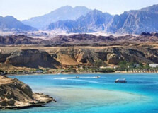
Anfish Mountain is a scenic hilltop located in Hurghada, a well-known resort town on Egypt’s Red Sea coast. Though not a very high mountain, Anfish offers breathtaking panoramic views of the Red Sea, Hurghada city, and its surrounding desert. It is especially famous for sunrise and sunset views and has become a popular destination for both locals and tourists looking for a peaceful and natural experience. The mountain is ideal for photography, hiking, or simply enjoying a quiet escape from the hustle of the city below. How to Reach Anfish Mountain, Hurghada Anfish Mountain is easily accessible from the city of Hurghada and is usually visited via guided tours, taxi rides, or on foot if you are staying nearby. By Car or Taxi: The mountain is located near the marina area and Hurghada port. Taxis are the most convenient way to get there. Just ask for “Anfish Mountain View” or show a map on your phone. Walking: If you are staying in central Hurghada near the marina, the base of the mountain is about a 10–15-minute walk. Tour Groups: Many city tours include Anfish Mountain as part of their itinerary, especially evening or sunset tours. Weather at Anfish Mountain, Hurghada Hurghada has a desert climate, and Anfish Mountain experiences the same weather patterns as the city below. Summer (May to September): Hot and dry, with temperatures often exceeding 35°C (95°F). Winter (November to February): Mild and pleasant, with temperatures ranging from 18°C to 25°C (64°F – 77°F). Best Time to Visit: Early morning or late afternoon to avoid peak sun and enjoy the beautiful sky colors. Timings and Entry Details Anfish Mountain is not a ticketed tourist site but a natural hill, open to the public. You can visit it any time, but it’s most popular during sunrise and sunset. Opening Hours: Open 24 hours (natural open area) Best Visit Time: 5:30 AM – 7:00 AM (sunrise) or 5:00 PM – 6:30 PM (sunset) Entry Fee: Free Accessibility: Wear walking shoes, as you’ll need to climb a bit to reach the top Why Famous for Anfish Mountain, Hurghada? Anfish Mountain is famous for its unique viewpoint over Hurghada’s skyline and coastline. Visitors come here to enjoy one of the best sunset and sunrise experiences in the region. It's also known for its tranquility, away from the busy beaches and resorts. The view from the top includes luxury boats in the marina, the shimmering Red Sea, desert landscapes, and the distant outlines of city buildings. History and Architecture Anfish Mountain does not have historical ruins or built architecture, but it has cultural and scenic value. Over the years, it has become a place where people gather for moments of reflection, to take memorable photos, or simply to breathe in the fresh air above the city. Occasionally, locals and visitors place small stones or symbols at the top as markers of their visit. The summit is natural and undeveloped, adding to its raw and authentic beauty. Things to Do at Anfish Mountain, Hurghada Watch the Sunrise or Sunset: The most recommended activity. The view of the sun rising or setting over the sea is breathtaking. Photography: Capture beautiful panoramic shots of Hurghada, the Red Sea, and the desert horizon. Picnic or Quiet Relaxation: Bring a bottle of water and sit peacefully enjoying the cool breeze and scenic environment. Star Gazing: At night, the mountain becomes a quiet and dark spot for viewing stars, away from city lights. Meditation and Yoga: The peaceful environment is perfect for practicing mindfulness or yoga. Facts about Anfish Mountain, Hurghada Anfish Mountain is one of the highest points in the central Hurghada region, though it is still a low hill by elevation. It is known by locals as a romantic spot and is often visited by couples at sunset. The area is occasionally used for local film shoots or photo sessions due to its scenic backdrop. It’s a completely free natural attraction—no commercial development, just pure landscape. Close to the marina and shopping areas, making it convenient to combine with a city outing. Tips for Visiting Anfish Mountain, Hurghada Wear comfortable walking or hiking shoes—parts of the climb can be rocky or uneven. Bring water, especially if visiting during warmer hours. Visit early morning or around sunset for the best views and cooler temperatures. Use sunscreen and wear a hat; there’s no shade at the top. Be careful when climbing down—loose stones can make the descent slippery. If going at night for star-gazing, bring a flashlight and go with a group for safety. Respect the natural environment; do not litter or damage the area. Anfish Mountain may not be the most well-known landmark in Egypt, but it offers something unique—a natural viewpoint that allows you to see Hurghada from a whole new perspective. It’s a perfect spot for nature lovers, photographers, or anyone seeking a moment of peace above the city’s excitement. Free to visit and close to major attractions, Anfish Mountain is a hidden gem worth exploring when in Hurghada.
Explore More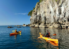
Moutohorā, commonly known as Whale Island, is a small, pest‑free volcanic island sanctuary located about 9 km off the coast of Whakatāne in the Bay of Plenty, New Zealand. The 1.43 km² island, with twin peaks rising to 353 m, is a remnant of a Pleistocene volcanic cone and still hosts geothermal features like hot springs and fumaroles :contentReference[oaicite:1]{index=1}. How to Reach Moutohorā, Bay Of Plenty Access is strictly via guided tours offered by DOC‑approved operators. Tours depart from Whakatāne’s Strand East waterfront (e.g. Awa Motel pickup) and include a 10–15 minute boat crossing :contentReference[oaicite:2]{index=2}. Before boarding, visitors undergo biosecurity clearance—boots and bags are checked, disinfected, and sealed to prevent introducing pests :contentReference[oaicite:3]{index=3}. Weather at Moutohorā The island’s climate mirrors Whakatāne’s maritime weather. Summers (20–28 °C) are warm, winters are mild (10–16 °C), and rainfall is moderate. Tours may be canceled in rough seas, high winds, or fire‑risk conditions :contentReference[oaicite:4]{index=4}. Timings of Visits Tours are seasonal: Dec–Feb: Daily departures Oct–Nov & Mar–Apr: 4 days/week May–Sep: 2 days/week (typically Wed & Sat) Departure is around 10 AM, lasting approximately 4 hours. You’ll be notified the evening before if canceled due to weather :contentReference[oaicite:5]{index=5}. Why Famous for Moutohorā, Bay Of Plenty? This island is known for its: – Unique status as one of NZ’s few pest‑free wildlife sanctuaries, home to tuatara, tieke (North Island saddleback), kākāriki, little blue penguins, grey‑faced petrels, kiwi, and fur seals :contentReference[oaicite:6]{index=6}. – Geothermal activity: Hot springs at Onepū Bay and Sulphur Valley where you can dig your own pool :contentReference[oaicite:7]{index=7}. – Cultural and archaeological significance—from Māori pa sites to early European whaling, sulphur mining, and quarrying history :contentReference[oaicite:8]{index=8}. Entry and Visit Details – Permit required: Only landings via DOC‑licensed operators, not independently :contentReference[oaicite:9]{index=9}. – Pricing: Adult NZD 149–169, Child NZD 64–85, includes boat fare and DOC landing fees :contentReference[oaicite:10]{index=10}. – Check‑in: 9:30–9:45 AM at Awa Motel or waterfront kiosk :contentReference[oaicite:11]{index=11}. – Biosecurity: No fresh food, sealed bags, footwear dip—strict rules in place :contentReference[oaicite:12]{index=12}. – Minimum age: 6 (recommended 8+) :contentReference[oaicite:13]{index=13}. – Facilities: Basic DOC shelter, emergency radio; tours provide guides and meals :contentReference[oaicite:14]{index=14}. History & Archaeology Māori presence dates to the Mataatua waka era, with Pa Hill fortifications and seasonal harvesting noted by Ngāti Awa and Tūhoe :contentReference[oaicite:15]{index=15}. European activity included an 1830s whaling station, 1880s sulphur mining, and WWI rock quarrying :contentReference[oaicite:16]{index=16}. Conservation began in 1965 when the island became a wildlife refuge, purchased by the Crown in 1984. Goat eradication and replanting led to a thriving native forest. In 1999, 40 saddlebacks were reintroduced, marking conservation success :contentReference[oaicite:17]{index=17}. Things to Do Guided walks through regenerating bush to spot wildlife—tuatara, tieke, kākāriki, kiwi transmitters :contentReference[oaicite:18]{index=18}. Visit fur seal colony at Boulder Bay :contentReference[oaicite:19]{index=19}. Dig your own hot pool at Onepū Bay’s geothermal beach :contentReference[oaicite:20]{index=20}. Bird watching—look for grey‑faced petrels, dotterels, penguins, kaka, falcon :contentReference[oaicite:21]{index=21}. Snorkeling/diving around reefs and wrecks; dolphin and whale watching :contentReference[oaicite:22]{index=22}. Photography—capture wildlife, volcanic cliffs, thermal vents. Facts about Moutohorā Island area: ~1.43 km², peaks at 353 m :contentReference[oaicite:23]{index=23}. Hosts 190 native and 110 introduced plant species, now pest‑free :contentReference[oaicite:24]{index=24}. Declared wildlife refuge in 1965, purchased in 1984 :contentReference[oaicite:25]{index=25}. Featured in “Quidditch Through the Ages” as home of Moutohora Macaws :contentReference[oaicite:26]{index=26}. Part of a joint management fund—Te Tapatoru a Toi—by Ngāti Awa and DOC :contentReference[oaicite:27]{index=27}. Tips for Visiting Book early—capacity limited and weather‑dependent :contentReference[oaicite:28]{index=28}. Wear sturdy footwear, swimwear, sun protection, and bring snacks in sealed bags :contentReference[oaicite:29]{index=29}. Check weather updates and confirm tour the night before :contentReference[oaicite:30]{index=30}. Adhere to biosecurity—do not carry fresh fruit or open bags. Respect wahi tapu—avoid sacred sites like Te Pari Kawau and stay on trails :contentReference[oaicite:31]{index=31}. Support conservation by removing rubbish and following guide instructions. Bring a camera and extra battery for wildlife and landscapes.
Explore More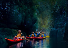
Glow Worm Kayaking in Bay of Plenty is a captivating evening activity that combines serene paddling with rare sightings of bioluminescent larvae (Arachnocampa luminosa) clinging to canyon walls and caves. It's one of the most magical nocturnal experiences in New Zealand :contentReference[oaicite:1]{index=1}. How to Reach Glow Worm Kayaking, Bay Of Plenty Tours depart from Waimarino Adventure Park at Lake McLaren, located about 10 minutes from central Tauranga. The address is 36 Taniwha Place, Bethlehem. Booked participants are often provided shuttle transfers from Tauranga or Mount Maunganui accommodations for an additional fee (~NZD 40–25pp) :contentReference[oaicite:2]{index=2}. After check-in at Waimarino, you'll drive (or be driven) through rural roads (~15 minutes) to the launch site near McLaren Falls Park. Adequate parking is available if you arrive by car :contentReference[oaicite:3]{index=3}. Weather Conditions for Glow Worm Kayaking Tours run year-round in all but storm conditions, as calm water is key to spotting glow worms. Rain may still be okay, but guides will cancel or reschedule if winds or heavy storms are forecast :contentReference[oaicite:4]{index=4}. Summer evenings are warm (15–20 °C), while winter nights require warm layers—guides provide waterproof jackets and thermal gear. Conditions near sunset and dusk offer beautiful skies and comfortable paddling :contentReference[oaicite:5]{index=5}. Timing of Glow Worm Kayaking Tours Typical tour duration is 3 to 3.5 hours, with about 1–1.5 hours on the water :contentReference[oaicite:6]{index=6}. • Departures begin 30–60 minutes before sunset (times vary seasonally). • Recommended arrival time is 10 minutes before, to enjoy pre-tour refreshments, gear-up, and safety briefing :contentReference[oaicite:7]{index=7}. Tours run daily year-round, except Christmas Day :contentReference[oaicite:8]{index=8}. Why Famous is Glow Worm Kayaking, Bay Of Plenty? Glow Worm Kayaking is iconic because it fuses adventure, nature, and glow‑worm magic: Enchanting Visuals: Thousands of glow worms illuminate canyon walls, like a starlit sky reflected on water :contentReference[oaicite:9]{index=9}. Unique Location: McLaren Falls Park’s narrow canyon provides optimal conditions for glow worms—dense dwellings and minimal artificial light :contentReference[oaicite:10]{index=10}. All-in-One Experience: Sunset paddling, gourmet snacks, Māori storytelling, and wildlife glimpses combine for a memorable trip :contentReference[oaicite:11]{index=11}. Year-Round Operation: Unlike many seasonal offerings, glow worm kayaking runs through all seasons :contentReference[oaicite:12]{index=12}. Entry and Visit Details • Cost: NZD 225–250 per adult; under-8s usually can’t go; hotel transfers extra (~NZD 25–40pp) :contentReference[oaicite:13]{index=13}. • Booking: Essential—tours are limited and sell out in summer. Free cancellation up to 24 hours prior :contentReference[oaicite:14]{index=14}. • Pickup: Typically from Tauranga/Mount Maunganui hotels with prior arrangement :contentReference[oaicite:15]{index=15}. • Minimum age: 8+, fitness level low–moderate per operator :contentReference[oaicite:16]{index=16}. • Equipment included: Kayak, paddles, buoyancy aids, waterproof jacket, spray skirt; insect repellent also provided :contentReference[oaicite:17]{index=17}. • Guides: Qualified, provide safety briefings, paddle effort support, wildlife education, and Māori cultural insights :contentReference[oaicite:18]{index=18}. History and Natural Setting Waimarino Kayak Tours started offering glow‑worm tours in 2004 from Lake McLaren, within McLaren Falls Park :contentReference[oaicite:19]{index=19}. Guided by local Māori knowledge, the tours share stories and star lore during paddling. The canyon—carved into ignimbrite rock—hosts healthy glow‑worm colonies thanks to dark, damp microclimate and stable water flow. McLaren Falls Park itself is rooted in conservation, with diverse native trees planted since the 1970s :contentReference[oaicite:20]{index=20}. Things to Do on a Glow Worm Kayaking Tour Enjoy sunset views over McLaren Falls Lake with gourmet snacks and locally sourced beverages :contentReference[oaicite:21]{index=21}. Paddle along routes to the glow‑worm canyon, led by your guide—kayaks are rafted together for quiet immersion. Experience total darkness and fall quiet as glow‑worms illuminate the canyon ceiling and walls :contentReference[oaicite:22]{index=22}. Learn glow‑worm biology (they’re fungus‑gnat larvae) and Māori names like “titiwai” during your journey :contentReference[oaicite:23]{index=23}. Stargaze atop the water if skies are clear—guides often point out constellations like the Southern Cross :contentReference[oaicite:24]{index=24}. Photographs are taken by guides during the paddling and supplied afterwards :contentReference[oaicite:25]{index=25}. Facts about Glow Worm Kayaking Glow‑worms (Arachnocampa luminosa) produce light via bioluminescence to attract prey :contentReference[oaicite:26]{index=26}. Lake McLaren canyon hosts one of the densest glow‑worm populations in NZ :contentReference[oaicite:27]{index=27}. Tours operate as long as conditions allow—daily, all year :contentReference[oaicite:28]{index=28}. Waimarino Kayak Tours is QUALWORX‑accredited and has run the tours since 1975 (family-owned) :contentReference[oaicite:29]{index=29}. Environmental care: Tours light minimised, boats rafted to limit wake and preserve glow‑worm habitat :contentReference[oaicite:30]{index=30}. Tips for Glow Worm Kayaking Book early: Popular year‑round, especially summer and holiday periods :contentReference[oaicite:31]{index=31}. Dress layers: Thermal mid‑layers, waterproof jacket, light fleece; avoid jeans or cotton :contentReference[oaicite:32]{index=32}. Bring essentials: Water bottle, insect repellent, towel, fitted water-safe shoes—guides also provide these in winter :contentReference[oaicite:33]{index=33}. Camera advice: Don’t use flash; low‑light photos work best later or with tripod from shore :contentReference[oaicite:34]{index=34}. Arrive on time: Pre-kayak snacks start evening atmosphere; late arrivals delay group :contentReference[oaicite:35]{index=35}. Be quiet in canyon: Glow‑worms are sensitive to disturbance—silence enhances the experience :contentReference[oaicite:36]{index=36}.
Explore More
Monteagudo Castle (Castillo de Monteagudo) is an impressive fortress located on a hilltop overlooking the city of Murcia, Spain. This ancient castle dates back to the 10th century and is renowned for its strategic location and panoramic views of the surrounding landscapes. The castle stands as a testament to the region's rich history, having been built by the Moors during their rule in Spain. Today, it is a popular tourist attraction, offering a unique blend of history, architecture, and breathtaking scenery. How to Reach Monteagudo Castle, Murcia Monteagudo Castle is situated about 7 kilometers north of the city center of Murcia. The castle’s elevated location means visitors must either hike or drive to reach it. Here’s how you can get there: By Car: The easiest way to reach Monteagudo Castle is by car. From the city center, take the Carretera de Monteagudo and follow the signs toward the castle. The drive takes about 15 minutes. There is parking available near the base of the hill where the castle is located. By Public Transport: There is no direct public transport to the castle, but you can take a bus to the nearby town of Monteagudo and then walk to the castle. The bus routes include Bus No. 25 from the city center to the town, followed by a 30-minute walk uphill. By Walking: For those who love hiking, it is possible to walk to the castle from the city. The hike can be challenging, taking approximately 1 to 1.5 hours to ascend, depending on your fitness level. The route offers beautiful views of the countryside along the way. Weather in Murcia Murcia enjoys a Mediterranean climate, characterized by hot summers and mild winters. This makes Monteagudo Castle a year-round destination, although the best time to visit is during the spring and autumn months when the weather is more temperate. Here’s what you can expect: Summer (June to August): The summer months can be extremely hot, with temperatures often soaring above 35°C (95°F). If you plan to visit during the summer, it is advisable to go early in the morning or late in the evening to avoid the heat. Autumn (September to November): Autumn brings cooler temperatures, ranging from 20°C to 25°C (68°F to 77°F), making it one of the most pleasant times to explore the castle and its surroundings. Winter (December to February): Winters in Murcia are mild, with temperatures between 10°C to 15°C (50°F to 59°F). This season offers a peaceful experience with fewer tourists. Spring (March to May): Spring is an excellent time to visit Monteagudo Castle, with temperatures ranging from 15°C to 20°C (59°F to 68°F). The lush greenery around the castle is also a highlight during this time. Timing of Visit to Monteagudo Castle The Monteagudo Castle is an outdoor monument and does not have specific opening or closing hours. Visitors are free to explore the area at any time of the day. However, it is recommended to visit during daylight hours for the best experience. The views from the castle are most spectacular at sunrise and sunset, so early morning or late afternoon visits are ideal. During the summer months, it’s better to avoid midday visits due to the intense heat. Why Famous for Murcia? Monteagudo Castle is famous for its rich history and its spectacular location. The castle's most notable feature is the large statue of Christ that sits atop a tower, known as Christ of Monteagudo. This statue has become a symbol of the region and offers a dramatic focal point for the castle. The strategic position of the castle, with panoramic views over the region, makes it a key historical landmark. Additionally, the castle's architectural remains offer valuable insight into the region's Islamic past and the subsequent Christian reconquest. Entry and Visit Details about Monteagudo Castle Monteagudo Castle is open to the public year-round, and entry is free of charge. The castle’s open-air nature makes it accessible at any time, though visitors should be prepared for a hike or drive to reach it. While there are no formal guides available at the castle, informative plaques are posted throughout the site to help visitors understand its history and significance. History and Architecture of Monteagudo Castle Monteagudo Castle was initially built by the Moors in the 10th century, during the Muslim rule of Spain. The castle was constructed as part of a larger defense system to protect the region from invaders. The structure was expanded over the centuries, particularly during the Christian reconquest in the 13th century, when the castle was used as a military stronghold. The castle is strategically located on top of a hill, offering a commanding view of the surrounding area, including the fertile valley of the Segura River. One of the most distinctive features of the castle is the tower, which houses the famous Christ of Monteagudo statue. This statue was erected in the 20th century and stands at a height of over 12 meters (39 feet), visible from miles around. Architecturally, the castle reflects both Islamic and Christian influences, with defensive walls, towers, and a large courtyard. The castle’s strategic position made it a critical military site throughout history, and it played a role in both the Islamic and Christian periods of Spain. Things to Do at Monteagudo Castle Monteagudo Castle offers more than just historical exploration. There are a number of activities that visitors can enjoy while at the site: Photography: The panoramic views from the castle are a photographer’s dream. Whether you are capturing the castle itself or the surrounding countryside, there are plenty of opportunities for memorable photos. Hiking: For those who enjoy outdoor activities, hiking to the top of the hill is a popular activity. The hike may be challenging for some, but it is rewarded with stunning views and the chance to explore the historic site. Explore the Castle Ruins: Walk around the ruins of the castle, including the walls, towers, and the central courtyard. The castle remains offer a glimpse into the architectural grandeur of its past. Visit the Christ of Monteagudo: Don’t miss the chance to see the towering statue of Christ at the top of the castle. It is a remarkable sight, especially when viewed from a distance. Picnic: The castle area provides plenty of open space where visitors can relax and enjoy a picnic while taking in the views. Facts and Tips about Monteagudo Castle The Christ of Monteagudo statue is one of the largest religious statues in Spain and is a notable landmark in the region. The castle has been declared a national historical monument and is protected by Spanish heritage laws. Wear comfortable shoes if you plan to hike up to the castle, as the path can be steep and uneven. Bring water, especially if visiting in the summer, as there are no facilities for refreshments at the top. Visit early in the morning or late in the afternoon to avoid the midday heat, especially in the summer months. Conclusion Monteagudo Castle is a remarkable historical site that offers a fascinating glimpse into Spain's past, from the Muslim rule to the Christian reconquest. Its stunning location, combined with the famous Christ of Monteagudo statue, makes it a must-visit destination in Murcia. Whether you are a history enthusiast, a nature lover, or simply looking for an outdoor adventure, Monteagudo Castle has something to offer. Its panoramic views, historical significance, and architectural beauty make it one of the most impressive landmarks in the region.
Explore More
Mount Titlis is one of the most spectacular and popular mountain destinations in Switzerland. Located near the charming village of Engelberg in Central Switzerland, Mount Titlis rises to an altitude of 3,238 meters (10,623 feet) above sea level. Known for its eternal snow, breathtaking views, and thrilling attractions, Mount Titlis offers a unique combination of adventure, natural beauty, and modern alpine infrastructure. It is the only publicly accessible glacier in the region and is open throughout the year. A visit to Mount Titlis promises an unforgettable experience, whether you're traveling in summer or winter. Tourists from around the world come to enjoy the panoramic views of the Swiss Alps, ride the world’s first revolving cable car, and explore the glacier cave and suspension bridge. It's a must-visit destination for nature lovers, adventure seekers, and families. How to Reach Mount Titlis, Engelberg Reaching Mount Titlis is easy and convenient from major Swiss cities such as Lucerne and Zurich. By Train: From Lucerne, take a direct train to Engelberg (about 45 minutes to 1 hour). Swiss Federal Railways (SBB) operates regular connections. From Engelberg train station, it’s a short walk or bus ride to the Titlis Valley Station. By Car: Engelberg is about 35 km from Lucerne and can be reached via the A2 motorway. There are ample parking facilities near the base station. By Cable Car: From the base station in Engelberg, you will take the Titlis Xpress gondola to Trübsee, and then the Rotair cable car to the summit. The journey is scenic and takes about 30 minutes. Weather at Mount Titlis Due to its high elevation, Mount Titlis experiences cold weather year-round. Temperatures at the summit can remain below freezing even in summer. Visitors should dress in layers and be prepared for snow and wind. Summer (June to August): Temperatures range from -5°C to 5°C at the summit. Snow remains on the glacier, and all attractions are open. Winter (December to February): Ideal for skiing and snowboarding. Temperatures can drop below -15°C. Spring/Autumn: Mild in Engelberg but still snowy and cold on the mountain. Fewer crowds during these shoulder seasons. Timings of Mount Titlis Mount Titlis is open year-round, but cable car timings may vary slightly depending on the season. Cable Car Operating Hours: Generally from 8:30 AM to 5:00 PM. Last Ride Down: Around 4:45 PM from the summit. It is advised to check the official website for real-time updates, weather conditions, and maintenance schedules before planning your trip. Why Famous for Mount Titlis, Engelberg? Mount Titlis is globally recognized for several unique reasons. It is home to the first rotating cable car in the world — the TITLIS Rotair — which provides stunning 360° views of the mountains during the ascent. The glacier park, suspension bridge (Titlis Cliff Walk), and Ice Flyer chairlift make the visit truly special. Mount Titlis is also the only glacier accessible year-round in the central part of Switzerland, making it a top destination in both summer and winter. The mountain combines natural alpine beauty with modern attractions, making it ideal for families, honeymooners, solo travelers, and tour groups alike. Entry and Visit Details about Mount Titlis, Engelberg Tickets for Mount Titlis include access to the gondola, revolving cable car, and all the main attractions at the top. Adult Ticket: Approx. CHF 96 (round trip from Engelberg) Child Ticket (6–15 years): Approx. CHF 48 Swiss Travel Pass Holders: 50% discount available Group rates and family packages: Available upon request Tickets can be purchased online, at the base station, or through travel agencies. Guided tours and combo packages with Lucerne are also available. History and Architecture The first cableway to Mount Titlis was built in the 1960s, and since then, the infrastructure has been continually modernized. The Rotair, introduced in 1992, remains an engineering marvel as the world's first rotating gondola. The architecture of the summit station is designed to withstand extreme weather and provides visitors with restaurants, viewing platforms, and access to the glacier cave and other attractions. The integration of modern technology with natural surroundings is a remarkable feature of Mount Titlis. Things to Do at Mount Titlis Ride the TITLIS Rotair: Experience the rotating cable car that offers a 360° view of the Alps. Walk the Titlis Cliff Walk: Europe’s highest suspension bridge – a thrilling and scenic experience. Explore the Glacier Cave: A magical ice tunnel located 20 meters beneath the glacier surface. Ride the Ice Flyer: A chairlift over crevasses and snowy fields – perfect for thrill seekers. Snow tubing and skiing: Available at the Glacier Park during summer and winter months. Dine at Panorama Restaurant: Enjoy traditional Swiss cuisine with a view of the Alps. Photography: Stunning views from observation decks and the cable car journey. Facts and Tips about Mount Titlis, Engelberg Mount Titlis is 3,238 meters (10,623 ft) above sea level. It is the highest peak in Central Switzerland accessible to tourists. Dress warmly — even in summer, temperatures at the top can be below freezing. Carry sunglasses and sunscreen — the snow glare can be intense. Start early in the day to avoid crowds and enjoy all activities at leisure. Check the weather before your visit; visibility can vary greatly. The area is wheelchair-accessible, and elevators are available at the summit station. It is a very popular location for Indian tourists; several Bollywood movies have been filmed here. Mount Titlis is more than just a mountain — it’s a complete alpine adventure. Whether you're climbing the sky on a cable car, walking across a suspension bridge, or playing in the snow, the experience is magical. Don’t miss this Swiss gem on your journey through Europe!
Explore More
Fürenalp is a stunning alpine destination located in Engelberg, Switzerland. Nestled in the heart of the Swiss Alps at an altitude of about 1,850 meters above sea level, Fürenalp is known for its breathtaking panoramic views, serene natural beauty, and traditional alpine charm. The area is less commercialized compared to other tourist destinations, making it a peaceful retreat for nature lovers, hikers, and adventure seekers. Whether you’re visiting in summer or winter, Fürenalp offers a refreshing escape with its tranquil landscapes, dramatic cliffs, and rich alpine flora and fauna. How to Reach Fürenalp, Engelberg Getting to Fürenalp is an adventure in itself. The journey starts from the village of Engelberg and includes a scenic cable car ride. By Train: From Lucerne, take a direct train to Engelberg (approximately 45–50 minutes). Trains run frequently throughout the day. By Car: Engelberg is accessible by road from major Swiss cities. From Lucerne, the drive takes about 40–50 minutes. Free and paid parking options are available in Engelberg. From Engelberg to Fürenalp: Take the free village shuttle or walk to the Fürenalpbahn valley station. From there, a small cable car takes you to the mountain station in about 5 minutes, offering incredible views along the way. Weather at Fürenalp, Engelberg The weather at Fürenalp varies greatly depending on the season. Due to its high elevation, temperatures are generally cooler than in the village below. Summer (June to September): Temperatures range from 10°C to 18°C. Ideal for hiking and outdoor activities. Autumn (October to November): Cooler temperatures (5°C to 10°C) with vibrant foliage and fewer crowds. Winter (December to February): Snow-covered trails and temperatures often below freezing, making it a great location for snowshoeing. Spring (March to May): Melting snow and blooming alpine flowers make this a picturesque time to visit, with temps from 5°C to 12°C. Always check weather conditions before heading up, as conditions can change quickly in the mountains. Timing to Visit Fürenalp, Engelberg Cable Car Operating Hours: Typically from 8:00 AM to 6:00 PM in summer and reduced hours in winter. It’s advisable to check the official Fürenalp website for seasonal updates. Best Time to Visit: Summer and autumn for hiking and nature photography; winter for snowshoeing and tranquility. Why Famous for Fürenalp, Engelberg? Fürenalp is famous for its unspoiled alpine beauty and panoramic views of the surrounding peaks, including Gross Spannort and the Hahnen. It’s a lesser-known gem compared to Mount Titlis, offering visitors an authentic Swiss mountain experience. Fürenalp is particularly popular with hikers due to its variety of trails, such as the challenging Surenenpass route and more relaxing scenic paths. Its peaceful environment, traditional alpine restaurant, and dramatic rock faces make it a favorite spot for photographers and outdoor enthusiasts. Entry and Visit Details about Fürenalp, Engelberg Entry Fee: There’s no entry fee to visit Fürenalp itself, but the cable car ride is ticketed. Fürenalpbahn Ticket Prices: Around CHF 14 for a one-way and CHF 19 for a round trip for adults. Discounts are available for children, seniors, and groups. Facilities: Includes a traditional mountain restaurant, well-marked hiking trails, viewing platforms, and resting benches. Accessibility: The cable car and restaurant are wheelchair-friendly. History and Architecture Fürenalp's charm lies in its simplicity and natural integration into the alpine environment. The area has a long tradition of alpine farming and seasonal migration. The architecture is rustic, with wooden chalets and the charming Fürenalp mountain restaurant, built in a classic Swiss style using local timber and stone. The cable car system, originally installed in the mid-20th century, has been modernized but retains a quaint, nostalgic feel. Fürenalp has been a known destination for locals and alpine trekkers for many decades, and it continues to be preserved as a quiet alternative to the more commercial tourist spots. Things to Do at Fürenalp, Engelberg Hiking: Multiple trails for all fitness levels, including the Surenenpass trail to Uri and the panoramic trail with views of Engelberg Valley. Snowshoeing: Available in winter with clearly marked trails through snow-blanketed meadows and forests. Paragliding: Fürenalp is a launch point for paragliders. Flights can be arranged with local guides. Photography: Perfect for alpine photography, especially during sunrise and sunset. Dining: Enjoy traditional Swiss meals at the mountain restaurant with panoramic terrace seating. Relaxation: Simply relax and enjoy the fresh mountain air and scenery. Many visitors enjoy a peaceful picnic or rest on the provided benches. Facts and Tips about Fürenalp, Engelberg Fürenalp means “pasture near the fir trees” in Swiss German. It’s part of the larger Engelberg Valley hiking network, making it ideal for multi-day hikes. The area is less crowded, making it perfect for a peaceful escape even during the peak tourist season. There are cows grazing on the alpine meadows during summer, adding to the traditional Swiss mountain charm. Carry cash as not all vendors or the cable car station accept cards. Wear appropriate footwear for mountain trails, even if you’re not hiking far. Binoculars are helpful for wildlife and bird spotting. Start early in the day to make the most of the hiking trails and views. In conclusion, Fürenalp is a true hidden gem in the Engelberg region, offering breathtaking views, peaceful hiking trails, and a taste of authentic alpine life. Whether you’re an adventure lover or someone who simply wants to unwind in nature, Fürenalp provides a perfect escape from the noise of modern life. Its accessibility, affordability, and serene charm make it one of the best off-the-beaten-path destinations in Switzerland.
Explore More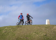
Climbing Garth Mountain, located just a few miles outside of Cardiff, offers an incredible escape into nature while providing stunning panoramic views of the Welsh countryside. At 307 meters (1,007 feet) high, Garth Mountain is a relatively easy yet rewarding climb suitable for walkers of various abilities. Whether you're a seasoned hiker or a beginner looking for a leisurely adventure, climbing Garth Mountain is an ideal outdoor activity that allows you to experience the natural beauty of Cardiff and its surrounding areas. How to Reach Garth Mountain, Cardiff Garth Mountain is situated to the north of Cardiff, in the area known as Garth Hill, near the village of Pentyrch. The mountain is easily accessible by car, public transport, and even by foot for those who enjoy a longer walk from the city center. If you are traveling by car, the best way to reach the base of Garth Mountain is by heading out of Cardiff on the A470 road, which takes you through the village of Pentyrch. From there, you can park near the base of the mountain. There are free parking spaces available near the trailheads, but they can fill up during peak times, particularly on weekends or holidays. For those using public transport, Cardiff Bus provides several services that can take you to the nearby village of Pentyrch. Once you reach Pentyrch, it’s a short walk to the foot of the mountain. Alternatively, if you enjoy cycling, the mountain is within cycling distance from Cardiff, and you can follow scenic routes through the countryside. Weather in Cardiff The weather in Cardiff is typically maritime, meaning it’s mild but can be unpredictable, with regular rainfall throughout the year. The best times to climb Garth Mountain are in the spring and summer months, when temperatures are mild and the weather is generally drier. During these months, temperatures range between 12°C (54°F) and 20°C (68°F), making it a perfect time for outdoor activities. However, since the weather in Cardiff can change quickly, it’s important to check the forecast before you set out. The winter months can be cold, with temperatures dropping to around 3°C (37°F), and there's a higher chance of rain. If you’re climbing during the colder months, be prepared with appropriate clothing and equipment, as conditions on the mountain can become slippery or muddy after rain. Opening Hours and Timing Garth Mountain is a natural site, so it doesn’t have fixed opening hours. You can visit at any time of the day. However, if you're planning to complete the climb, it’s recommended to start early in the morning or in the late afternoon, especially if you want to enjoy the views and avoid the crowds. The duration of the hike can range from 1.5 to 3 hours, depending on the chosen route and pace, so plan accordingly to ensure you return before sunset. Why Garth Mountain is Famous Garth Mountain is famous for its outstanding views, its accessibility, and its historical significance. The mountain provides one of the best views of Cardiff and the surrounding Vale of Glamorgan, offering a clear view of the city’s skyline, Cardiff Bay, the Bristol Channel, and the distant Brecon Beacons. Another reason why Garth Mountain is well-known is because it’s a relatively easy climb compared to some of the other hills and mountains in the region. This makes it a popular spot for family hikes, dog walkers, and casual walkers. Despite being easily accessible, it still offers the tranquility and beauty that draws nature lovers and photographers. Additionally, Garth Mountain has an ancient past, with its top being the site of a prehistoric hillfort, which adds an extra layer of historical intrigue for visitors interested in the past. Its prominent position and rich history have made it a favorite among locals and tourists alike. Entry and Visit Details about Garth Mountain Accessing Garth Mountain is free of charge. The mountain and surrounding area are open to the public throughout the year, and there are no entry fees. The trail to the summit is well-marked, and you can start your hike from the village of Pentyrch, following one of several designated paths that lead to the top of the mountain. It is important to wear appropriate footwear and carry some water, especially during warmer months. The mountain’s terrain can vary, with some rocky sections, muddy patches, and steep inclines. While the climb is not overly strenuous, it is still advisable to wear sturdy walking boots or shoes with good grip. History and Architecture of Garth Mountain Garth Mountain has been an important landmark for centuries. Archaeological evidence suggests that the mountain has been a site of human activity for thousands of years. At the summit of Garth Mountain, there is the remains of a prehistoric hillfort, which dates back to the Iron Age. The site is thought to have been used for defensive purposes, as it provides an excellent vantage point over the surrounding landscape. While there is no modern architecture on Garth Mountain itself, the village of Pentyrch nearby has several historic buildings that are worth visiting. The natural landscape, combined with the mountain’s ancient history, adds a rich layer of heritage to the hike, making the climb more than just a physical challenge. Things to Do at Garth Mountain Climbing Garth Mountain is the main activity, but there are other ways to enjoy this beautiful area. Here are some things to do during your visit: Hiking: The primary activity at Garth Mountain is hiking. The mountain offers a variety of paths and trails, suitable for walkers of all abilities. The main route to the summit is relatively short, but there are longer routes for those who want to explore the surrounding area more. Birdwatching: Garth Mountain is home to various bird species. The summit provides an excellent vantage point for birdwatching, particularly for species such as kestrels, buzzards, and other raptors. Photography: The panoramic views from the top of Garth Mountain are stunning. Photographers will appreciate the wide-open vistas, especially at sunrise or sunset. Picnicking: After reaching the summit, many visitors enjoy a relaxing picnic while taking in the breathtaking views. There are several quiet spots where you can rest and enjoy the surroundings. Exploring the History: At the summit, take some time to explore the remains of the Iron Age hillfort. It's an interesting spot for history enthusiasts, offering insight into the mountain's historical significance. Interesting Facts and Tips about Garth Mountain The summit of Garth Mountain offers some of the best views of Cardiff and its surrounding areas, including the Brecon Beacons and the Bristol Channel. Garth Mountain is a relatively easy climb, but it can still be challenging in wet or slippery conditions, so be cautious after rain. The mountain is part of the Garth Hill Area of Special Scientific Interest (ASSI), so it is important to respect local wildlife and natural habitats during your visit. If you are looking for a longer walk, you can combine your climb of Garth Mountain with a stroll around the nearby Taff Trail, which runs through Cardiff and beyond. The climb can take around 1 to 2 hours depending on your pace, so it’s a great activity for a half-day excursion. Always bring water and snacks, especially if you plan to hike for a longer period, and don’t forget sun protection in summer months, as the summit can get quite exposed.
Explore More
Gun Hill is the second highest peak of Mussoorie that is beckoned by the mighty Himalayas. This hill is named the Gun Hill because it is said that to help the natives know the right time, the British army used to fire cannons. The number of cannons fired signified the time. It is an amazing tourist site and after reaching atop the hill, one can see the panoramic view of the Himalayas and the whole town of Mussoorie. It Is Known For:-1) Gun Hill is known for its scenic surroundings. Throughout the year, this hill remains shrouded in the thin blanket of mist2) It offers a panoramic view of the whole town of Mussoorie3) The other side of the hill is known for trekking. The enthusiastic trekkers can be spotted challenging their potentials there4) During the extreme winters, the entire Gun Hill gets decorated with the shining white snow and becomes a temporary skiing slope Best Time To Visit:-Being a popular travel attraction in Mussoorie, Gun Hill can be visited throughout the year. But, the best time for enjoying a good quality time is during the winters. When this hill covers itself with the white snow, it looks even appealing to the tourists. People can enjoy the cable car ride and skiing. Reaching There:-To reach Gun hill, one has to hire a taxi or a coach that reduces the time of climbing uphill. If a person wishes to see the landscape, the service of the cable car can be hired as well to reach the top. Nearest Railway Station- Dehradun Railway StationNearest Airport- Jolly Grant Airport
Explore More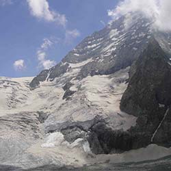
Kolahoi Glacier is valley glacier that perches in the snow-capped Himalayas. This glacier has a monstrous height of 15, 400 feet above the sea level and is named after the peak of Kolahoi. It is the highest peak in the region and the well-known Lidder River originates from this glacier. Kolahoi Glacier offers the spectacular views of the Himalayas and is an amazing destination to explore.It Is Known For:-1) Kolahoi Glacier is a mesmerizing glacier in the Himalayan belt and has a humongous height.2) This glacier is the source of the famous freshwater river known by the name of Lidder. It provides the water to the nearby areas.3) Throughout the year, this place witnesses a cold climate. The temperatures usually stay below 0°C during winters.4) Kolahoi Glacier is a perfect place for relishing the venture of trekking and hiking. Camping can also be relished in the meadows around the glacier.Best Time To Visit:-Kolahoi Glacier catches the attention of the visitors throughout the year but it remains inaccessible during winters. Thus, the best time for embarking a memorable journey to this spot is between April-August.Watch Out!Kolahoi Glacier is an amazing site for trekking. But, it is recommended that novice trekkers and hikers should not begin the journey without the experts. Moreover, camping should also be avoided during the snowfall.Reaching There:-The nearest township to Kolahoi Glacier is Pahalgam. It has a well-established network with the roadways, railways, and airways in Kashmir. One can reach Pahalgam from any of the above-listed means from any part of J&K.Nearest Railway Station:- Jammu Railway StationNearest Airport:- Srinagar Airport
Explore More